The Inn Way to the Peak District, England – Part 4

Day 6 – Castleton to Hayfield – 11.5 miles (18.5 km) – 5 hours

The last day of the hike has the shortest distance but is the hardest with the most climbing. Unlike yesterday, the forecast today was for rain. But it’s England, and the Peak District, so I left my accommodation expecting the worst.

peakdistrictday6-2018-06-8-17-33.jpg

Castleton is known for the remains of Peveril Castle on the hill, not to mention an extensive cave system in the peaks around it. I could see the castle high on the hill from the Main Street.

dscf8887-2018-06-8-17-33.jpg

I headed up the hill beside the castle on a rocky path and began a long slow climb with sheep and lambs bleating at me as I passed. As I came around behind the castle, I could see its back above me as I climbed. It was built to keep the townsfolk in check but was abandoned as it proved to be unnecessary.

dscf8893-2018-06-8-17-33.jpg

On either side of the trail are small caves, but I didn’t stop to investigate. The path continued to the top of the hill between stone walls and eventually emerged onto a plateau, sectioned off for farming. I passed through a gate and it began to spit. I pulled out my pack cover but didn’t bother with a jacket, no point sweating even more than I currently do. Thankfully, the rain did not come, and the spitting subsided.

img_4962-2018-06-8-17-33.jpg

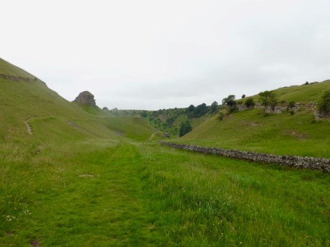
After a fair walk, I came to a junction where a thin road headed off to the north. My trail followed this road for about a mile, past a farmhouse, to a major road. On the far side, I could see where the trail was leading me, to the top of a Tor. It would be a fair climb, and by the number of people climbing it, a popular tourist spot.

dscf8896-2018-06-8-17-33.jpg

The climb to the tourist carpark looked to be steeper than the actual climb up the Tor, but hiking is not about doing things the easy way. I climbed to the carpark and then on up the side of the Tor, which had been paved for ‘easy’ walking. When walking for distance, I find it easier to walk on the soft ground beside the steps as it uses less energy. At the top of Mam Tor there are great views down both sides, but because of the cloudy haze about, it is difficult to get a clear shot.

dscf8901-2018-06-8-17-33.jpg

On the far side of the Tor the trail continued up to another pair of peaks, but I wasn’t to climb either of these. Partway up the first was Hatton Cross, which is more of a knob, marking where I would begin my descent from the peak on a rocky trail.

dscf8902-2018-06-8-17-33.jpg

The trail eventually passed alongside a farm, crossing grazing paddocks with sheep and lambs, until it came to a major road. A few fields after and I arrived at the village of Grindsbrook Booth where I stopped for lunch: a bacon and egg butty, and a coffee. This was when it decided to start raining.

img_4967-2018-06-8-17-33.jpg

After my lunch, I struck out in the rain, which wasn’t too heavy and didn’t last long. Grindsbrook Booth, also known as Edale, is the official beginning point of the 286 mile Pennine Trail, of which I would only be doing a tiny section.

I climbed a hill at pace, the caffeine from lunch pushing my on with vigour. I soon overtook several other walkers, with others coming the other way, to eventually arrive at a tiny village called Upper Booth, and continuing quickly on.

dscf8904-2018-06-8-17-33.jpg

From the village, the trail climbed steadily up the hill towards Jacob’s Ladder, a set of steps that have been built to ensure a quick climb to the top of the pass. I shot up the steps, passing other walkers, but stopping a couple of time to regain my breath before pushing on.

dscf8908-2018-06-8-17-33.jpg

I soon crossed the pass, and with the understanding that it was only a handful of miles before the end of the hike, I raced downhill on a stone covered trail.

When the moors ended, and the farm fields began, the trail became less rocky and eventually became a road. I continued to race down the hill to the bottom and climbed the final small hill, a mile from Hayfield, the end of the hike. I then raced along the trail, my legs aching, until I hit the roads of Hayfield.

With the end of the hike nigh, I crossed through the streets of Hayfield to my beginning point, The Kinder Lodge and finally took off my boots for the final time on the hike. I celebrated with a meal at the local Italian restaurant, and several ciders.

The next day I was off and back to London, returning to normal life after my time in the Midlands.

Overall Thoughts

I enjoyed my time in the Peak District National Park. I expected the weather to be changeable but got a couple of lovely days and very little rain. I did have a small expectation that things would be a little more difficult and that it would feel a little wilder. There were periods during a couple of the days where I felt like I was away from other people and in the wilds. But this is England, and you have to take what you can get. Perhaps the further north I push for hikes, the wilder it will feel.

Next, I am off to Northern Wales into Snowdonia to do several days of walking, this time not in a circuit. During that time I will be summiting Mt Snowdon.

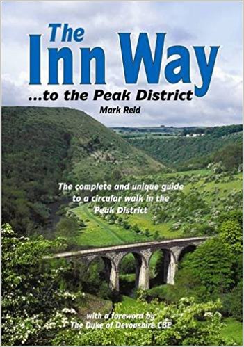
The Inn Way was a well-prepared hike, and I am glad I found it. While there were plenty of pubs along the way, that wasn’t the point of the walk. I would recommend checking out the website www.innway.co.uk for this and other books in the Inn Way series.

Until next time,

The Lone Trail Wanderer

The Inn Way to the Peak District, England – Part 3

Day 4 – Youlgrave to Tideswell – 16 miles (25.5 km) – 8 hours

I had worried during the night about an infection in one particular blister and went to see a nurse to check it out. If it was indeed infected, I might have to cancel the rest of the hike, but it turned out to be just a painful, annoyingly located, blister nothing more. So, I packed my gear and set out from the hostel, ignoring the pain.

peakdistrictday4-2018-06-7-18-46.jpg

I headed down the very steep roads of Youlgrave to the river, and followed it on a dirt path, past a small footbridge and several fields.

dscf8828-2018-06-7-18-46.jpg

I eventually came to a vehicle bridge across to Alport but did not cross. I continued alongside the River Lathkill crossing fields, for about a mile before coming to the Conksbury Bridge. I stopped and looked down the river where masses of flies buzzed about. In the water, a single fish preyed on those that got too close.

dscf8832-2018-06-7-18-46.jpg

I crossed the bridge and entered Lathkill Dale, a three-mile stretch of trail along the river. I passed many other walkers, most who had come only to walk the dale. I walked with the thin river to my left, with views of weirs along the way.

dscf8833-2018-06-7-18-46.jpg

To my right side for much of the dale was a rocky bank often covered with bush, but from time to time a small path would lead to a cave entrance in the rock. While I had a head torch with me, there were too many to investigate and my day was set to be long enough. About halfway along the dale, a wooden bridge crossed the river to a ruined house.

img_4867-2018-06-7-18-46.jpg

I decided to investigate and found a large hole behind the building with a ladder leading down. So, I climbed down for a look and found a short tunnel leading to a five-metre deep rocky hole beneath the house itself. Beside it a small hand generator to turn on the lights.

Back up along the river, I continued my walk along a mixture of concrete paths, dirt trail and rocky path. Towards the end of the dale, it forked, with the trail heading along the other fork from the river. The trail led up between two ridges, crossing rough rocky ground until it emerged near a road.

img_4873-2018-06-7-18-46.jpg

I stopped for lunch before continuing around into Monyash, a small village. Then my trail led up a road and across grazing fields before coming to the Magpie lead mine, which has not been used for many decades.

img_4882-2018-06-7-18-46.jpg

After a brief look around, I continued on to the small town of Sheldon. I then crossed more fields for more than half a mile before heading downhill in Great Shacklow Wood.

img_4886-2018-06-7-18-46.jpg

I rarely use my hiking poles, but I pulled one out to help my stability on the steepest descent so far of the hike.

img_4887-2018-06-7-18-46.jpg

At the base, I forded a river and followed a dirt trail through the forest for near a mile around a right bend to a weir, which I crossed at a metal bridge. The path then ran up the side of the hill, while not steep, it was a constant climb to emerge at Monsal Head and great views along the valley.

dscf8848-2018-06-7-18-46.jpg

The trail headed down steeply again on the other side, to the old Monsal rail line, where the railway has now been all but removed.

dscf8856-2018-06-7-18-46.jpg

The trail followed a hard road for a couple of miles, and through two old train tunnels, the Cressbrook and Litton tunnels.

img_4904-2018-06-7-18-46.jpg

After the second tunnel, I crossed the river at Litton Mill.

img_4907-2018-06-7-18-46.jpg

I made my way around and up Tideswell Dale for a mile and a half before coming to a road. The trail crossed and pushed me up a hill. With only a few hundred metres to go on a long day’s hike, who’s idea was it to climb a steep hill behind a farm? I eventually came into the Tideswell, exhausted, and began looking for my Airbnb.

Footsore and with the painful blisters, I did not feel like wandering too far for food, so I found a local chippy around the corner and a Co-op to get some cider, before settling in for a long sleep.

Day 5 – Tideswell to Castleton – 14 miles (22.5 km) – 6.5 hours

After a 10 hour sleep, and an excellent breakfast at my Airbnb, I headed out of Tideswell along Church Lane which headed over a hill. It was nothing too extreme and got my blood going as the wind was a little chilly.

peakdistrictday5-2018-06-7-18-46.jpg

I made it into Litton, just another tiny village dotted on the landscape. I found the trail on the far side and cut across a field with a group of seven people stopped ahead of me. They were all teenage girls; I wished them a good morning and continued walking. A few minutes later, I came upon a group of seven teenage boys and wished them the same. I headed quickly downhill into a gully called Tansley Dale, following a dirt path.

dscf8860-2018-06-7-18-46.jpg

With the boys following behind, I walked on quickly towards the bottom. The gully was part of Cressbrook Dale I had walked beside yesterday. At the bottom, I turned left and headed along the base of the dale between two ridges. I followed it around to the right and began to rise. The lads likely went the other direction, but I could hear the girls, who were walking at the top of the left-hand ridge.

dscf8861-2018-06-7-18-46.jpg

The gully eventually rose out of the dale to a road near a village, Wardlow Mires. I walked through and found the path headed between farm buildings, the smell was just foul, I don’t know how farmers do it. I then headed up the hill across grazing fields towards a Manor House.

dscf8878-2018-06-7-18-46.jpg

I passed the manor and walked along a lane for a couple of hundred metres before crossing a grazing field with sheep and lambs. I crossed many more fields until I came to Foolow, apparently the Peak District’s prettiest village, where I stopped outside the pub for a five-minute sit-down.

dscf8869-2018-06-7-18-46.jpg

After crossing a further 17 fields, mostly empty, but some with the obligatory sheep and lambs, I came to Eyam. This village has a sombre story behind it. It was struck by the plague in the 17th century but quarantined itself so as not to spread the disease. 260 died, but the plague did not get out.

img_4933-2018-06-7-18-46.jpg

After Eyam, the trail climbed a very steep road, through a less steep field and into a small wood where the even steeper path finally levelled out. As I emerged from the wood, I discovered the sun had come out, and it would stay out for the rest of the day.

dscf8872-2018-06-7-18-46.jpg

I crossed several more fields before the landscape changed from grassy paddocks to scraggy moors. I climbed to the summit of a short hill and then down the other side following a winding trail that cut around the edge of a steep hill following a stone wall. It eventually dove down into a gully, across a stream and into a clough – a small gorge – where I followed a trail to the end, climbing out of it to the village of Abney.

dscf8879-2018-06-7-18-46.jpg

From Abney, I followed a thin concrete road for half a mile to a sandy, gravel road for a further two miles to the village of Brough.

dscf8882-2018-06-7-18-46.jpg

From here I followed the trail across many grazing fields, containing cows and their calves, sheep and their lambs, a goat and even llama! I passed the village of Hope before arriving at Castleton, the end point of the day.

The Inn Way to the Peak District, England – Part 2

Day 2 – Hathersage to Baslow – 13 miles (21 km) – 6 hours

Hathersage is a great little village on the eastern side of the Peak District. It’s a popular destination for all manner of outdoor activities – hiking, climbing, and cycling, and has three outdoor activity stores.

peakdistrictday2-2018-06-4-19-21.jpg

After a hot night in the Hathersage YHA with little air flow in the dorm room, I wandered into town for breakfast to find that much of the village doesn’t open until nine, if at all on a Monday or Tuesday. I did, however, find a bakery and bought breakfast, along with a sandwich for lunch.

I headed out of town, past the Scottish Pack pub and the parish church, onto a grass paddock and down some steps, my knees reminding me of the long descent from the day before.

img_47221-2018-06-4-19-21.jpg

I crossed a paddock following a fence line passing the Cowclose Farm. I crossed the road and headed up a long steep driveway towards the somewhat restored ruins of a Chapel.

img_4728-2018-06-4-19-21.jpg

Past the chapel, I headed into a small wood, again on a steep trail. When I emerged, I could see the Stanage Edge above me, slightly obscured by clouds. I passed through another small wood before emerging at an open field with a path leading towards the Edge.

img_47351-2018-06-4-19-21.jpg

The climb to the top felt easy, and before long I was amidst the low clouds. The views were not the greatest because of the low visibility.

img_4736-2018-06-4-19-21.jpg

I then walked along the top of the Edge on a trail alternating between natural stone, sand and cut stone. The visibility grew shorter as I walked, with small groups of people appearing out of the mist, either walking towards me or preparing to rock climb down the rock wall.

img_4744-2018-06-4-19-21.jpg

Eventually, I followed a pair of guys and their dog to the highest point, 457 metres, before descending down to the valley below. It was an easy descent but led me off the trail into the bog, which I spent some time crossing back to the path. Thankful for my waterproof boots, I followed this to a carpark. The trail then led me along the top of a gorge, towards the mist covered Higger Tor, a flat-topped ridge with cloud filled views in most directions.

img_4758-2018-06-4-19-21.jpg

With little to see, I quickly climbed down the other side towards Carl Wark Tor, an Iron Age fort, before descending a boggy field between the two towards the Burbage Bridge.

img_4762-2018-06-4-19-21.jpg

After a quick lunch, I passed the Longshaw Lodge in the Longshaw Estate and headed up across more sheep-filled paddocks to a junction of several roads. I walked along a driveway towards White Edge Lodge and around the edge of White Edge Moor before heading down into Hay Wood.

dscf8777-2018-06-4-19-21.jpg

I crossed a major road and headed up towards Stoke Flat across the top of Froggatt Edge and passed stone circle and a large cairn, both overgrown. I then followed the top of Curbur Edge for more than a mile, looking at the views of surrounding hills and villages dotted across them.

dscf8781-2018-06-4-19-21.jpg

I crossed a road and continued along Baslow Edge towards the Eagle Stone, a large oddly shaped stone sticking up out of Eaglestone Flat.

img_4795-2018-06-4-19-21.jpg

The trail then led down a thin stone road down into Baslow, the official end of the hike. But as I had not been able to find cheap accommodation in the village, I waited at a bus stop and messaged the Airbnb owner that I was on my way. She offered to pick me up as it was going to be an hour before the bus arrived. This continued my experience with the people of the Peak District being very friendly.

Day 3 – Baslow to Youlgrave – 12 miles (19.5 km) – 6 hours

Today’s walk is set to be one of the easiest of the six days of this circuit. This is great as my feet are still recovering from the blisters I gained on day one. The weather looks to be cool with no rain, a perfect day for a hike.

peakdistrictday3-2018-06-4-19-21.jpg

The host of the Airbnb put on an excellent breakfast and offered to drop me off in Baslow. Who was I to refuse kindness? From my drop off point, I walked along the main road, down a side street and into Chatsworth Park.

dscf8784-2018-06-4-19-21.jpg

Little did I know that for the next couple of hours I would be walking in this park, a massive estate set aside for both animals and humans to wander through. At the centre is the extensive Chatsworth House and to one side the annual Chatsworth Flower Show.

dscf8791-2018-06-4-19-21.jpg

I continued along the road through the park for some time seeing various birds and plenty of lambs. I passed the flower show and headed to a small village inside the park called Edensor with a large church.

dscf8792-2018-06-4-19-21.jpg

Then I headed south through grassy fields along thin walking tracks to the river, which I followed south.

dscf8797-2018-06-4-19-21.jpg

I finally crossed the river at a bridge and again continued south to another village, Beeley, on the main road. I walked through it and along a steep lane for a hundred metres before crossing grazing fields on my way up to Burnt Wood.

img_4811-2018-06-4-19-21.jpg

After a brief walk in the forest, the trail crossed a bridge across Smeltingmill Brook and into Rowsley Wood.

img_4814-2018-06-4-19-21.jpg

Part of the trail through Rowsley Wood was a mess of leaves and cut branches, as some lumber work had been done in the area.

I then dropped down out of the woods via a nettle flanked thin path between two buildings, across a road and into another nettle flanked path to the edge of Rowsley, where I stopped for lunch. I then got back on the trail and walked along the road out of town to another set of farm paddocks, this time with cattle, before following the steadily climbing lane up towards Stanton in Peak.

I walked through town climbing another road and through the forest to Stanton Park. As I entered the park, my GPS deciding to take some time off. I followed a trail and came to the main attraction in the park, The Nine Ladies, a stone circle with a legend, nine ladies caught dancing on the Sabbath and turned to stone.

dscf8819-2018-06-4-19-21.jpg

Based on my map I took a guess at the right trail and when my GPS woke up again I was still in the park, but nowhere near where I hoped to be. I found my way out of the park onto a road and headed along it until I picked up the trail again. This lead me down a path to the village of Birchover. The sun decided to make an appearance as I followed a thin lane out of town for half a mile, and down a steep bank to a major road. On the other side, I found a long driveway climbing a hill with more sheep. I followed and came to an area with some rock formations, one known as Robin Hood’s Stride, and along another with a cave where a hermit once lived.

img_4840-2018-06-4-19-21.jpg

I crossed the fields beyond the formations and passed circle of four large stones before coming to a quiet road. I walked around a farmyard and up a hill to a location called the Castle Ring, an old Iron Age hill fort. Then it was all downhill and across a pair of sheep paddocks to Youlgrave, where I climbed a steep road up to my hostel.

The Inn Way to the Peak District, England – Part 1

The Peak District National Park is a region of England’s Midlands just to the East of Greater Manchester. The district is named after a series of tall rolling hills strewn with walking/cycling trails and dotted with villages.

peakdistrictandinset-2018-06-2-19-11.jpg

It’s pre-summer in the United Kingdom, so I have come out of my winter hibernation for hiking season. My first, this year, will be my longest UK hike, although not the longest of the season. The Inn Way of the Peak District is one of several ‘Ultimate Pub Walks’ created in northern England. It is a six-day hike, covering 85 miles (135 km) and passes 51 pubs. While it’s not a pub crawl as such, it does allow for many places to stay, dine, and of course, grab a couple of well-deserved ciders after a long day’s walk.

Find out more about this hike and to buy the book go to http://www.innway.co.uk

The Peak District is a diverse area with much to see, from the wild moors in the north to the limestone valleys to the south. There are Roman roads, plentiful villages, areas known for its history of Robin Hood, with Nottingham to the South East, and a lot more I hope to discover on my walk.

Day 0 – London to the Peak District

My train to Manchester was in the early afternoon, so it gave me plenty of time to pack and repack in preparation. On the Virgin Trains, Manchester is only 2 hours north of London, then it was an hour-long bus ride to Hayfield, the Trailhead of the Inn Walk.

Hayfield is a quaint larger village to the west of the Peak District. After arriving at my accommodation, I went for a walk around town and followed a short trail to a local reservoir.

Then it was off for last-minute preparations.

Day 1 – Hayfield to Hathersage – 17.5 miles (28 km) – 9 hours

Today will be the hardest day of the hike, both in distance and difficulty and with the sun is out, the heat will make it more difficult. It’s going to be a long day.

peakdistrictday1-2018-06-2-19-11.jpg

I set out from the Kinder Lodge, across Hayfield, then stopped to have a sandwich made for me and to repack my pack. I climbed the steep village roads to the trailhead only to discover I had left my hat on the seat where I had been repacking. Just what I needed, more length to the hike.

With my hat firmly on my head, I climbed along a rocky dirt path with three off-road cyclists, into open paddocks high above Hayfield and the other villages in the valley.

img_4663-2018-06-2-19-11.jpg

I followed a trail, called the Snake Path, as it slowly ascended across the grazing fields on a slightly rocky dirt path. After about a mile I crossed into the moors, the difference in vegetation obvious.

img_4664-2018-06-2-19-11.jpg

The trail continued climbing for some time before flattening out near the Kinder Reservoir. But the view was only a distraction for the climb that was to come.

dscf8710-2018-06-2-19-11.jpg

The trail follows the curve of the reservoir and up into the William Clough, a long gully.

img_4672-2018-06-2-19-11.jpg

The rocky trail crossed the stream flowing down the Clough several times.  I climbed slowly until it levelled out at Ashop Head between Mill Hill and the Kinder Scout Tor.

img_4673-2018-06-2-19-11.jpg

I continued past Ashop Head and followed the trail around hard to the right where it followed Ashop Clough for three miles. I rested in the sun, part way along, before continuing towards the end of the Clough where there is a fair-sized wood.

dscf8728-2018-06-2-19-11.jpg

In the woods, alongside the river, the trail climbed sharply up to a major road, one I had been hearing for some time. I walked along it for a short distance to the Snake Inn where I stopped for lunch. I headed back to where the trail was supposed to take but found the access was no longer available. I returned to where I had come out of the woods, crossed the road and headed up a steep path.

img_4684-2018-06-2-19-11.jpg

I followed it to an old Roman road on the edge of the Cowms Moor, with a rocky shelf to my left, and then onto grazing fields with a rock fence.

img_4689-2018-06-2-19-11.jpg

After a mile, I came back down to the major road where I crossed and headed up into the moors once more. The trail climbed steadily, following the old Roman road for a couple of miles with woods to the side. It then ran flat across several grazing fields as I approached Hope Cross.

dscf8739-2018-06-2-19-11.jpg

Ahead I could see a tor and figured that I would be climbing it, but the trail seemed to veer around it. Five hundred metres along and I discovered my map showed another path up the tor that wasn’t there, only a steep ridge. I chose not to walk back, so out came my hiking poles for the first time and I set off up the hill. After five minutes of climbing, I discovered the end of one of my brand new poles had come off. I pushed on upwards anyway to the trail and then up the Tor.

dscf8752-2018-06-2-19-11.jpg

As I came over Thornhill Brink, I got my first sight of the Ladybower Reservoir below. But the climbing was not done, ahead was the Winhill Pike, which gave me a better view of the reservoir.

img_4695-2018-06-2-19-11.jpg

Then, after a long day in the sun, the worst thing is a long steep descent. Steep descents can be painful on the knees, and 300 metres steeply down on a rocky, root laden trail is just hell. It was slow going, but with the help of my remaining hiking pole, I got to the bottom, my knees aching.

img_46981-2018-06-2-19-11.jpg

Then, with four miles still to go, I discovered I’d run out of water. I rested before crossing a major road and climbing another, then across several grazing fields to Bamford. But when I got there, I discovered everything was closed, as it has a tendency to be after 5pm on a Sunday. I could have stopped at a house and asked for water, everyone in the region seemed very friendly, but I pushed on. Three miles to Hathersage.

img_4706-2018-06-2-19-11.jpg

I headed out of Bamford and into a wood, past a water processing plant, over a short hill to a village called Nether Hurst then over one final small hill until I could see Hathersage below. I crossed several grazing fields and followed a road into the village. The hostel I was staying it was at the other end and, of course, up a hill. I made my way up there on sore feet and checked in for the night.