San Juan del Sur, Nicaragua – Impressions

Thirty kilometres north of the Costa Rican border on the Pacific Coast is the beach town of San Juan del Sur (San Juan of the South). The town is known to tourists as San Juan del Surf because of its proximity to several good surf beaches.

wpid-dscf3226-2014-01-28-14-37.jpg

The oddity of the name is apparent when you realise that San Juan del Norte (San Juan of the North) – situated on the Caribbean Sea, is actually further south.

wpid-costanicaoverview-2014-01-28-14-37.jpg

For over 130 years San Juan del Sur was a little backwater town in southern Nicaragua, then in 1992 a tsunami destroyed a large portion of the town. Its recovery was helped greatly by the ‘gringo’ invasion, with many migrants arriving from the US, Britain and Canada. Scattered throughout the surrounding hills are many mansions and resorts…

wpid-dscf3218-2014-01-28-14-37.jpg

At the northern end of the cove is the statue of Jesus de la Misericordia – Christ of Mercy.

wpid-dscf3225-2014-01-28-14-37.jpg

It’s one of 17 giant statues of Christ throughout the world. The most famous being Christ the Redeemer in Rio de Janeiro, Brazil. La Paz, Bolivia has the tallest at 34m, while San Juan del Sur’s Jesus de la Misericordia is the 9th tallest at 26 metres tall.

wpid-dscf3209-2014-01-28-14-37.jpg

Climbing the hill to the statue is fairly easy, a cobbled road weaves it’s way to the top. While it’s steep at points, it’s not too strenuous and gives great views of the cove and township.

wpid-dscf3210-2014-01-28-14-37.jpg

Beyond surfing and swimming, the nightlife is the other main focus of the town as there are many beachfront restaurants and bars. As a large portion of the tourists visiting are in their 20’s, there are plenty of party hostels with raucous parties raging on until the wee hours most nights. But don’t let that put off the older traveller…

wpid-img_1674-2014-01-28-14-37.jpg

Overall, the beach town of San Juan del Sur is a great way to spend a couple of days, the surf town vibe is relaxing and fun.

Next, I head to Isla Ometepe, an island made up of twin volcanos in on Lake Nicaragua.

The World Wanderer

Costa Rica – Adventures

With an official end date to my Latin American adventures quickly approaching I’ve had to make some hard decisions. One of these was to only spend a week in Costa Rica, this being on the basis that it’s the most expensive country in Central America.

wpid-political-map-of-costa-rica-2014-01-24-16-48.jpg

From David in Panama, I caught a bus to Costa Rica’s capital, San Jose. The bus ride was around eight hours including the border crossing, which wasn’t as stressful as I was led to believe. Like Panama, when entering the country ‘proof of exit’ is required. This time I had a fake booking set up but was not asked for it.

San Jose isn’t as influenced by the US as Panama City is, and since my plan was to stay in the city only two nights I didn’t spend a lot of time exploring the city beyond finding a restaurant and a supermarket. This still took me past a municipal building.

wpid-img_1648-2014-01-24-16-48.jpg

Soon after arriving, I arranged for a full day tour to see as much as I could in the short time I was here. I confirmed the time of pick up and was prepared for the early start. The next morning the tour operator arrived 30 minutes early and when I wasn’t ready, left without me. This led me to wonder if I’d heard the wrong time. When the staff member at the hostel arrived for the morning, he confirmed that I had been correct and set about getting my money back. He booked me on another tour for the following day, a cheaper one, with the difference in price covering the cost of another night in the hostel.

The next morning the tour operator arrived at the correct time and we were off. First stop was the ruins of the Temple of the Santiago Apostle Parish. The building of the temple began in 1870 but stalled after an earthquake destroyed part of it. Building again began several years later but again stalled because of another earthquake. This happened several times over the course of 40 years until in 1910 when it was decreed that God didn’t wish the temple built and construction was abandoned.

wpid-dscf3147-2014-01-24-16-48.jpg

Our next stop was Volcán Irazú, the tallest active volcano in Costa Rica. As we drove to the top, the cone was shrouded in clouds so it was unclear if we’d be able to see much. At the top the crater was barely visible through the mist and we put on rain jackets to save getting wet. Like Volcán Barú in Panama, Volcán Irazú can sometimes give views of both the Pacific Ocean and the Caribbean Sea, but today was not one of those rare days. The clouds cleared enough after 10 minutes and we finally got to see the crater.

wpid-dscf3159-2014-01-24-16-48.jpg

After the volcano visit, the tour headed to a restaurant for breakfast then north across the continental divide to the Caribbean side of the country. After a couple of hours in the bus we stopped at Rio Puerto Veijo and got on a river boat for a 90 minute cruise along the river.

wpid-dscf3170-2014-01-24-16-48.jpg

On the trip we spied plentiful birds, including the rare Red Macaw – which are often poached and sold on the black market for US$30,000 each. We then encountered a lone Iguana sitting in the bushes on the side of the river…

wpid-dscf3177-2014-01-24-16-48.jpg

There were also sightings of a Sloth and its baby asleep in high boughs…

wpid-dscf3182-2014-01-24-16-48.jpg

Then a lone Caiman about the length of my arm. Caimans have no ridges along their backs and are much smaller than their larger cousins…

wpid-dscf3195-2014-01-24-16-48.jpg

We heard several Howler Monkeys, although only caught glimpses in the trees. Then small camouflaged micro-bats on the trunk of a tree and lastly, Crocodiles. This one is about three metres long.

wpid-dscf3198-2014-01-24-16-48.jpg

We then stopped at an animal sanctuary that houses poisonous frogs, an Asper snake and a butterfly conservatory. The poisonous frogs were the most interesting. There were two varieties, one black with luminous green spots about the size of your big toenail, and the other tiny and red about the size of your little fingernail. Their poison was used in blow guns by natives of Latin America. Lunch was a traditional Costa Rican meal but included Iguana, which like crocodile, tastes very like chicken. Then it was a 2 hour bus ride back to the hostel.

The following day, I caught a bus to the northern city of Liberia, a hub of tourism in Costa Rica. Like many Costa Rican cities, it has a more modern church…

wpid-img_1655-2014-01-24-16-48.jpg

During the couple of days I stayed, I made my way to Playa del Coco – Coco Beach, which is a touristy beach town set on the Pacific Ocean. As much of Costa Rica is tropical, even in winter, I enjoyed a swim in the cool waters of the ocean.

wpid-img_1657-2014-01-24-16-48.jpg

For my last day in the country, I visited Llanos de Cortez waterfall where myself and three women from the hostel enjoyed swimming. This is just one of the many waterfalls in the area…

wpid-img_1661-2014-01-24-16-48.jpg

Next I head to the beach town of San Juan del Sur in southern Nicaragua.

The World Wanderer

Volcán Barú, Panama

Barely 37km from the border of Costa Rica is Panama’s tallest mountain, Volcán Barú. At just under 3,500m, it’s still considered high altitude but is really just a molehill compared to 6,000m tall mountains of Andes. Volcán Barú is commonly climbed for the rare possibility of seeing both the Pacific Ocean to the south and the Caribbean sea to the north. It’s rare because the view to the Caribbean is often blocked by a layer of clouds.

wpid-101405669-idpllmbm-panama-2014-01-17-22-32.jpg

There’s two ways to the top of Volcán Barú, either taking a 4×4 vehicle tour or to hike. The hike is difficult and long at 13km from the trailhead to the peak (with a 1,750 climb in altitude) before 13km back again. What makes it a challenge is most people begin climbing at midnight, aiming to see the sunrise from the summit after walking 6 hours in the dark. Hiking 26km makes for a long day at the best of times, but beginning at midnight makes it just nasty. I even tried to nap in the afternoon, but only managed an hour, which was nowhere near enough.

wpid-dscf3124-2014-01-17-22-32.jpg

Getting to the trail head is fairly easy, with one of the hostels offering transport for US$5. Then after a very short briefing, we were pointed off along a wide track and told to just keep climbing no matter what forks in the trail we see. Except for 3 short descents, the 13km was a steady climb along the wide rocky trail. When you’re hiking at night all you have is your head torch and the ground directly ahead of you to look at.

wpid-dscf3128-2014-01-17-22-32.jpg

We were lucky to be walking under the full moon, so it wasn’t always necessary to use the head lamps. But even in daylight there would be little to see, as there are trees along both sides of the trail. We did come to several locations where we looked down upon the township of Boquete. The lights were beautiful but fleeting and too distant for good photos.

Getting to the summit for sunrise was not my aim, so I took is more slowly. When sunrise did hit, I was still half a kilometre from the summit but was able to watch it, seeing the same view as I would have from the top.

Unfortunately it was around this point where altitude sickness struck. It felt like someone had split my head in half and prodded at the insides with their fingers. As I climbed the last of the trail to the radio tower buildings at the top it grew worse and I started to feel ill.

wpid-dscf3132-2014-01-17-22-32.jpg

The last 500 metres was steeper than the rest and when I made it to the top I found the howling wind rough. I found a secluded spot and put on some warm clothing. When dressed, I looked around the buildings and took photos of the surrounds.

To the south was the city of David and the islands in the Gulf of Chiriqui beyond.

wpid-dscf3137-2014-01-17-22-32.jpg

To the west, Costa Rica.

wpid-dscf3138-2014-01-17-22-32.jpg

On the other side, I discovered the buildings were not at the absolute summit, as there was a rocky outcrop that climbed perhaps 30m higher. To get to the top was a rocky scramble, but with the state of my head and stomach I decided against it. The cross on top is the highest point in the country.

wpid-dscf3140-2014-01-17-22-32.jpg

From the northern side of the summit I was out of luck with seeing the Caribbean sea but instead clouds fading away into the distance.

wpid-dscf3136-2014-01-17-22-32.jpg

While I sat huddled out of the wind, one of the girls from my hostel found me and sat with me while I brewed a cup of tea using my hiking stove.

The walk down was very long but straightforward. The trail descends for most of its length except for three points where it climbs. Half way up the first and longest of the three climbs, my tiredness gave out and I lay down on a large rock for a power nap, letting my friend walk on alone. I woke forty minutes later slightly refreshed and no longer feeling the altitude.

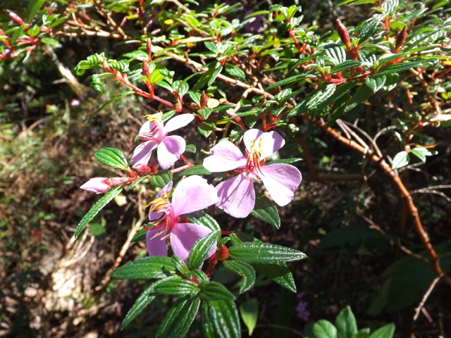
The rest of the walk was more of a stagger although I did manage to catch my friend again. We discovered there were many wild flowers growing along the trail but was too exhausted to take photos beyond this one…

wpid-dscf3141-2014-01-17-22-32.jpg

We passed some of the lookouts and caught daylight glimpse of Boquete…

wpid-dscf3143-2014-01-17-22-32.jpg

We eventually made it to the end of the trail and exhausted, booked a taxi through the ranger before being whisked away back to the hostel for a shower and a well deserved sleep.

Overall, the hike up Volcán Barú was okay. I would have enjoyed it more if I hadn’t suffered altitude sickness at the end and if we’d started at a more reasonable time. While walking at night was fine – it’s cooler out of the sun and there isn’t much to see anyway – the main difficulty is the length. To make the hike more enjoyable, I would make it a two-day hike, camping just below the summit, climbing to see the sunrise early on morning two before the long walk back again.

The Lone Trail Wanderer.

Boquete, Panama – Impressions.

Nestled in the mountain plains 60km from the border of Costa Rica is the mountain town of Boquete (‘Boc-ket-e’). At 1,200 metres above sea level, the township is cooler than the rest of Panama and this makes it a popular holiday destination for both locals and travellers alike. It’s also one of the leading retirement locations for US citizens outside of the United States.

wpid-101405669-idpllmbm-panama-2014-01-18-16-43.jpg

Boquete is next to Parque Nacional Volcán Barú and is the primary starting point for those who wish to climb the volcano, the tallest mountain in Panama. The mountains around Boquete contain many short trails but the only real hike is the volcano climb, although it’s not the best of hikes as there’s little to see along its 26km length.

wpid-dscf3117-2014-01-18-16-43.jpg

Every year in mid-January Boquete hosts a flower and coffee festival that runs for ten days. It’s a very popular occasion with people coming from all over the country to party late into the night at the dance hall. Feriado Las Flores y del Cafe – literal translation: Holiday Flowers and Coffee.

wpid-dscf3119-2014-01-18-16-43.jpg

The fiesta is less crowded during the day, which allows better access to see the impressive flower displays.

wpid-dscf3118-2014-01-18-16-43.jpg

There are plenty of things to do in Boquete besides hiking and the festival, these include horse riding, visiting coffee plantations and farms, and the Aguas Calientes – hot springs.

For $2 you can spend all day on the property where several pools have been crudely set up. The crudeness gives it character, and if you get too hot there’s a river nearby to cool off in.

wpid-img_1631-2014-01-18-16-43.jpg

Overall, Boquete has a vibrant energy about it and is a great place to hide away from Panama’s year round heat.

Next, I cross the border into Costa Rica to the capital of San José.

The World Wanderer

Bocas del Toro, Panama – Impressions

Not far from the Costa Rican border on the north-west Caribbean coast of Panama is Bocas del Toro. Meaning ‘Mouths of the Bull’ in spanish Bocas del Toro is one of Panama’s primary holiday destinations for both locals and travellers alike.

Bocas del Toro refers to many places: first the province, then the archipelago within the province and the provincial capital on Islá Colón, which is also known as Bocas Town. The island is named after Cristóbal Colón, the spanish name for Christopher Colombus, who visited the islands in 1502 looking for a way through to the Pacific.

wpid-700px-bocas_del_toro_archipelago_map-2014-01-9-17-48.jpg

Getting to Islá Colón is easy, either catch a 30-minute water taxi across the bay from the town of Almirante or fly in from the Costa Rican capital, San Jose. You can’t miss Bocas Town when crossing the bay as most of the shoreline around the town is utilised by hostels, bars and tour operators.

wpid-dscf3112-2014-01-9-17-48.jpg

The town itself feels very much like you’re in a surfing town. January being high season, the town is bloated with tourists, most of them early to mid-twenties, surfboard clad and heavily tanned.

wpid-dscf3091-2014-01-9-17-48.jpg

I call Panama the 51st state of the US, not only because there are so many americans here or that the US dollar is the currency, but because most people speak english, in a U.S. accent. Bocas del Toro is no different, with its upmarket hostels, shops and eating places, including a fantastic indian restaurant that I just had to visit twice.

While on Islá Colón, one of the easiest way to see the islands is via a sailing tour. They take a group out on a pair of catamarans to several choice spots around the islands.

wpid-p1000073-2014-01-9-17-48.jpg

This included two different snorkelling spots, which would give me the opportunity to test out my new underwater camera. The first part of our mini cruise was to a bay they have nicknamed Dolphin Bay because of the dolphins that come to play around the boats.

wpid-dscf3106-2014-01-9-17-48.jpg

Then it’s off to the first snorkelling spot. Flippers aren’t really needed as the water is not deep and you float around a coral reef surrounding a mangrove island in a place they call Starfish Bay.

wpid-p1000047-2014-01-9-17-48.jpg

While there I swam with a pair of jellyfish. Cool to look at under the water, but I wasn’t letting them get too close.

wpid-p1000058-2014-01-9-17-48.jpg

The water was not the clearest, but at our second spot, there were more coloured fish and I got some shots of the brightly coloured coral.

wpid-p1000063-2014-01-9-17-48.jpg

There are several beaches on the islands that are well visited by tourists, but at an expensive US$5 to get to the sand, I decided against going.

For the three days I spent on the island, I managed to stay in three different hostels. On arrival, I discovered the hostel I wanted to stay at was full (you can’t prebook online), so I booked in for the next two days and went searching for another hostel. The following day I discovered my booking was no longer there. This time they located another hostel for me and ensured I would get a bed the following night. On the third day I finally got the bed I wanted and spent the day just relaxing on the side of the channel.

wpid-p1000110-2014-01-9-17-48.jpg

During the midday hours it gets rather hot in Bocas del Toro, even in winter, but all you need do is roll out of the hammock and into the sea to cool down. Then in the evening they set up a band and we rocked out to the sounds of Sublime, Blink 182 and the Red Hot Chili Peppers.

Next, I head back to David for the night, then up to the town of Boquete, a tourist town in the mountains.

The World Wanderer