Gibraltar – Impressions

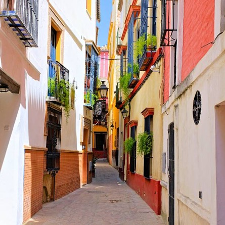
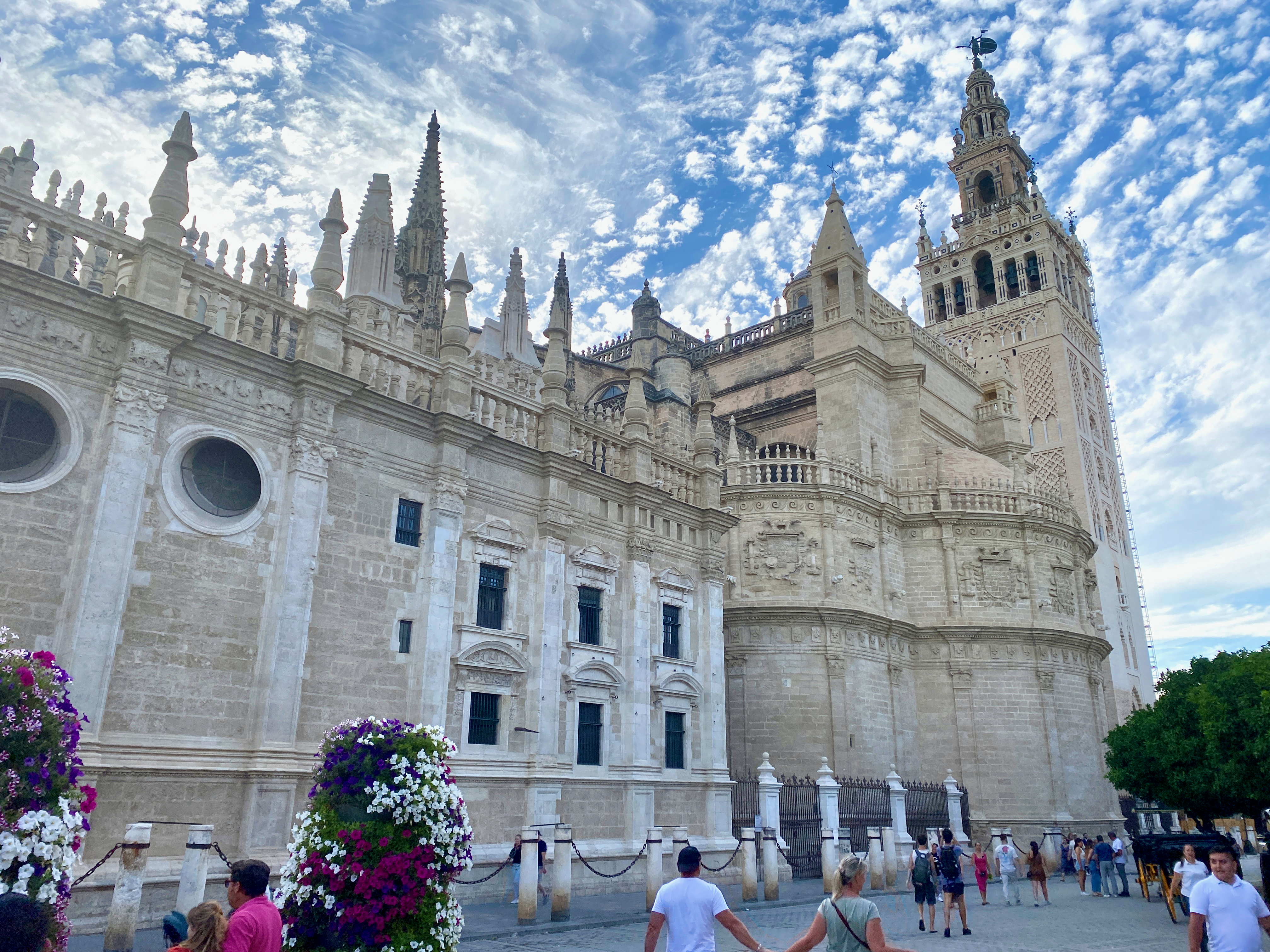
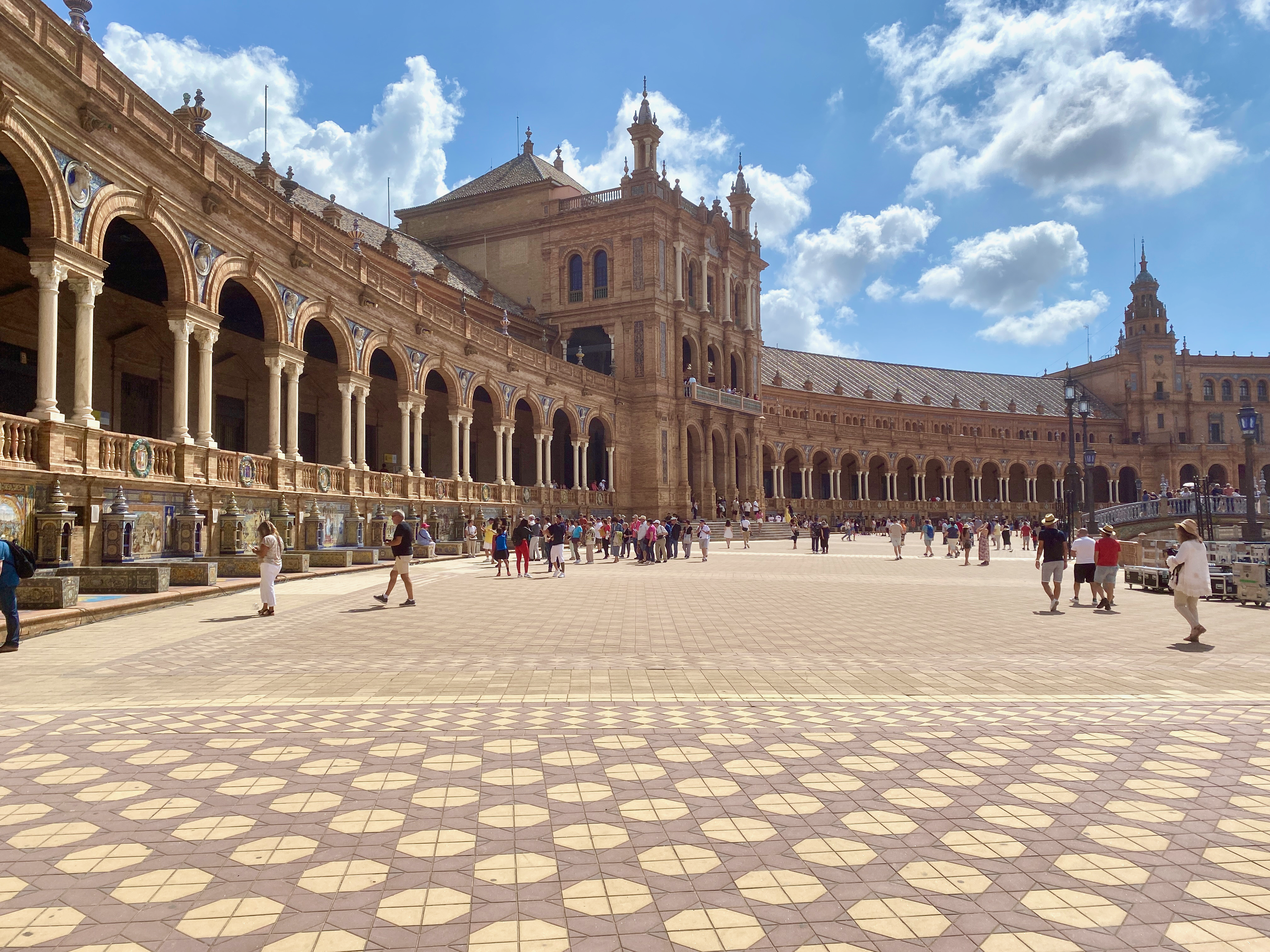
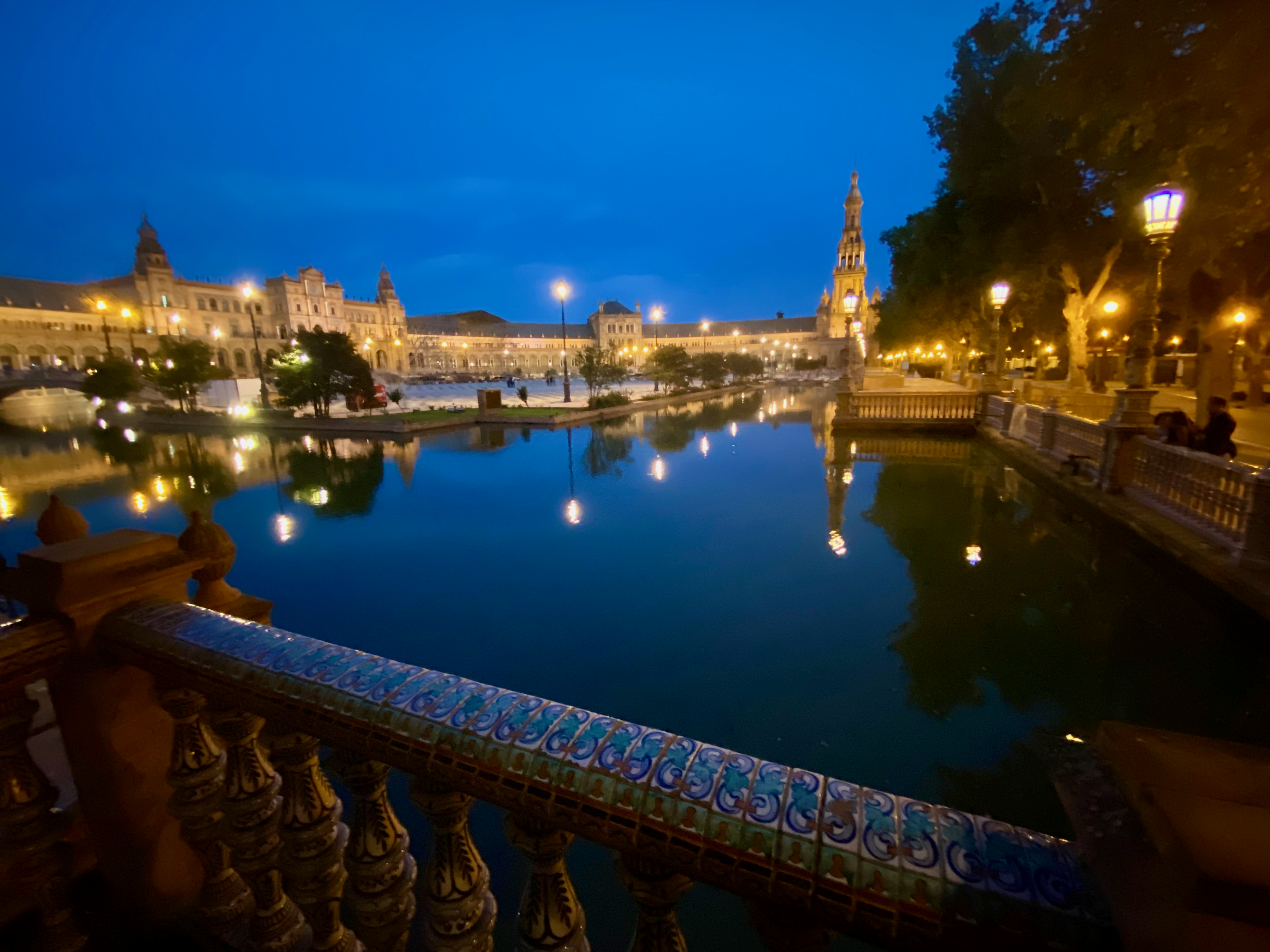
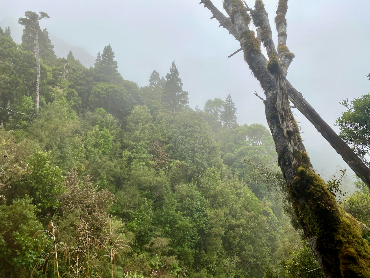
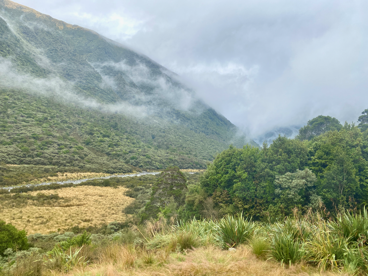
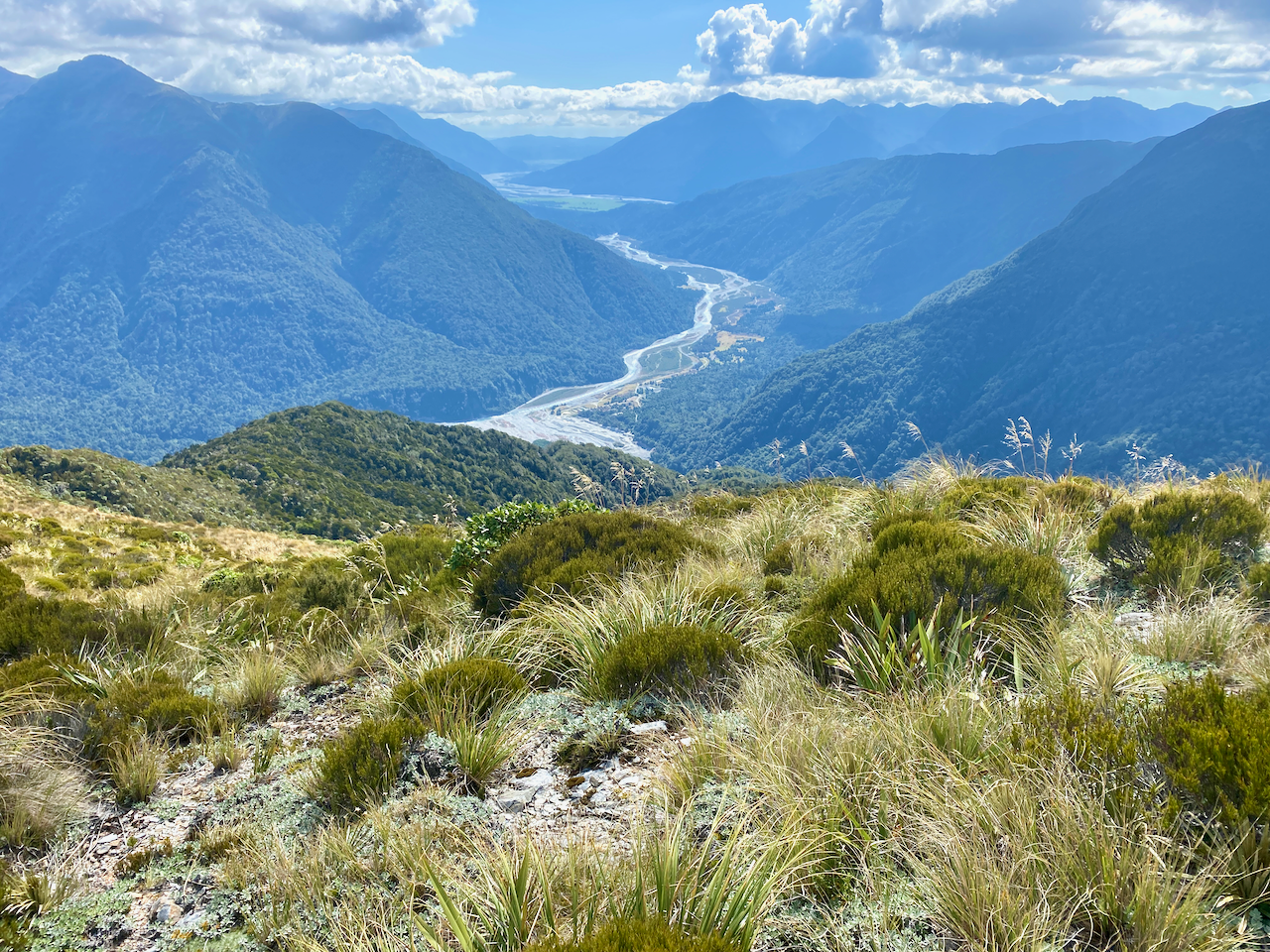
After my Camino and a week in Seville, I went south to visit Gibraltar before I headed across the straits to Morocco. Gibraltar is a British Overseas Territory and a city in the south of the Iberian Peninsula, bordering Spain. While it was a habitation site of Neanderthals dating back to 50,000 years ago, it was used only as a religious location by the Phoenicians around 950BC and not officially settled until the 1100s. It became part of Britain in 1713.

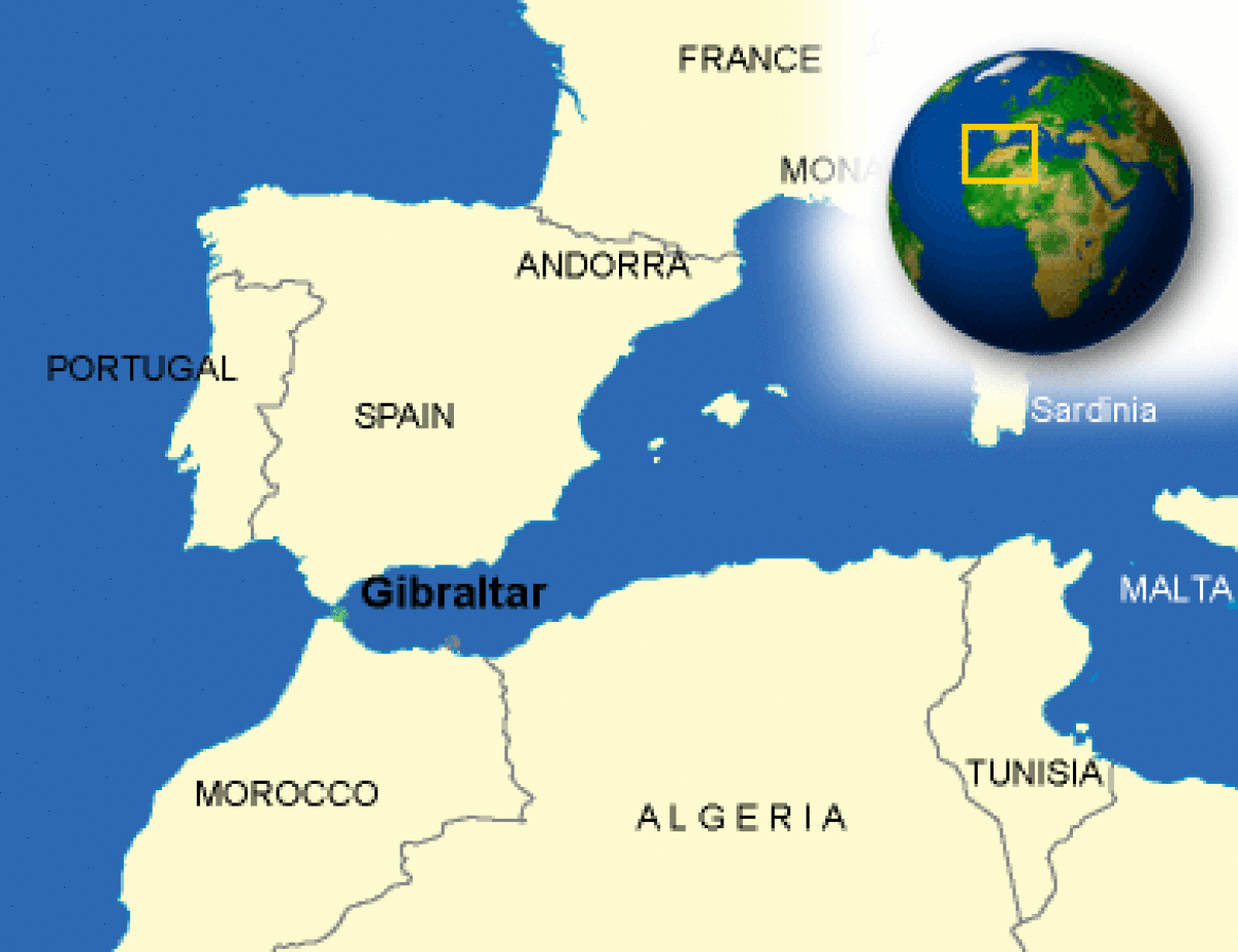
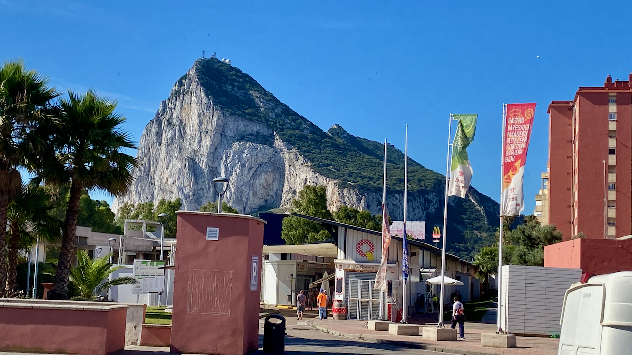
Much of Gibraltar is a ridge line known as The Rock, which at 426m high, runs the length of the city, leaving only a thin swathe of land where the city actually is. I stayed in the city of La Linea de la Concepción, just over the border in Spain. The crossing was fairly easy, I walked through passport control, they saw I had a non-EU passport, scanned and stamped it, then I was through in a matter of 30 seconds. It was the same process coming back the other way, although due to the line of people, it took about 15 minutes.
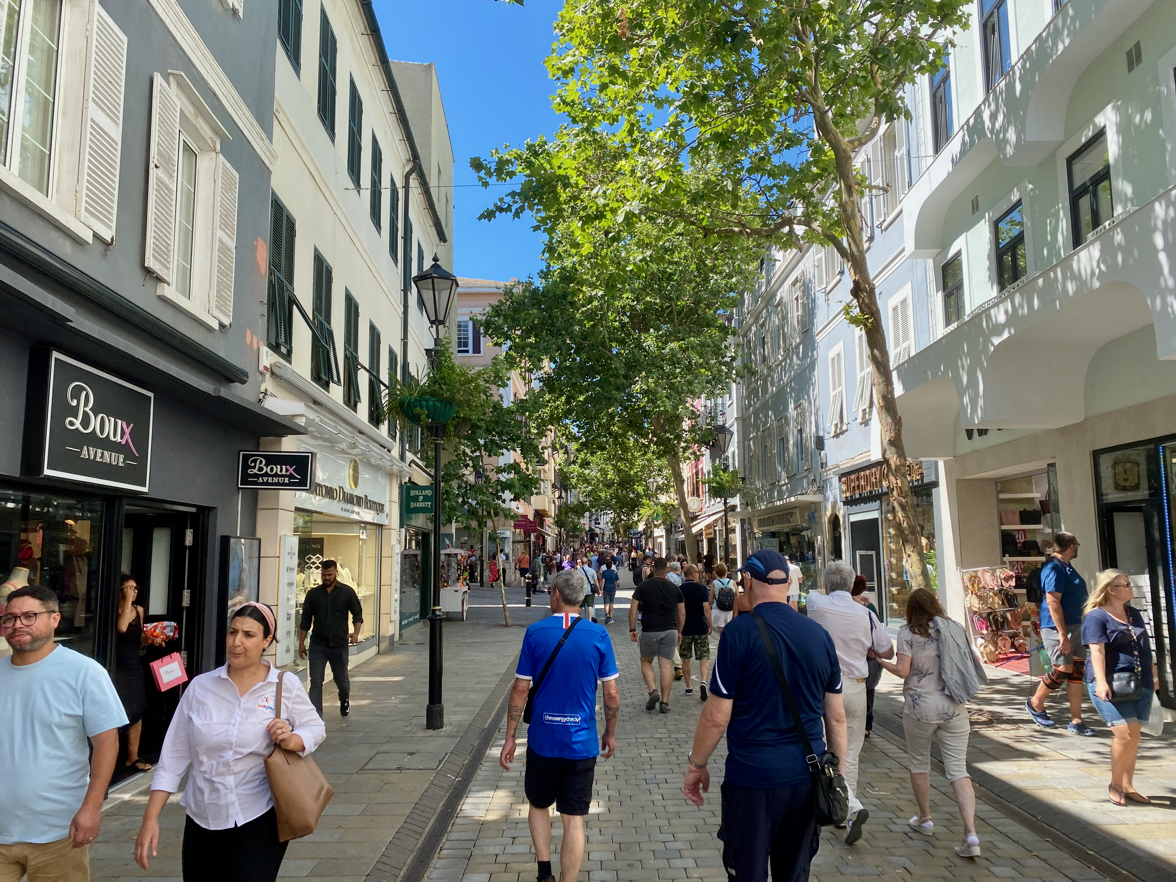
2d65fc99-28b6-4b44-9553-e1bfd2f18962-2023-06-19-16-22.png

The Mall
Most of the accommodations on Gibraltar are apartment buildings and hotels, although some single houses run up the side of the rock. Through the middle of these accommodations is a long street mall running from one end of Gibraltar to the other. The most annoying thing about the shops and cafes is that they take the British Pound. It’s annoying as I’ve been using Euros in Spain for some time but thankfully I have a British bank account. The good thing about shopping in Gibraltar is that you don’t pay UK VAT on products.

img_3708-2023-06-19-16-22.png

Pillars of Hercules
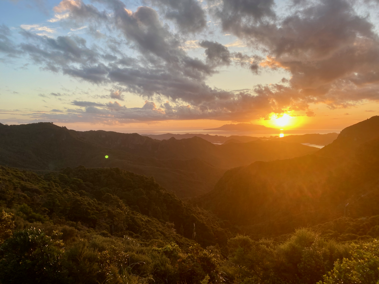
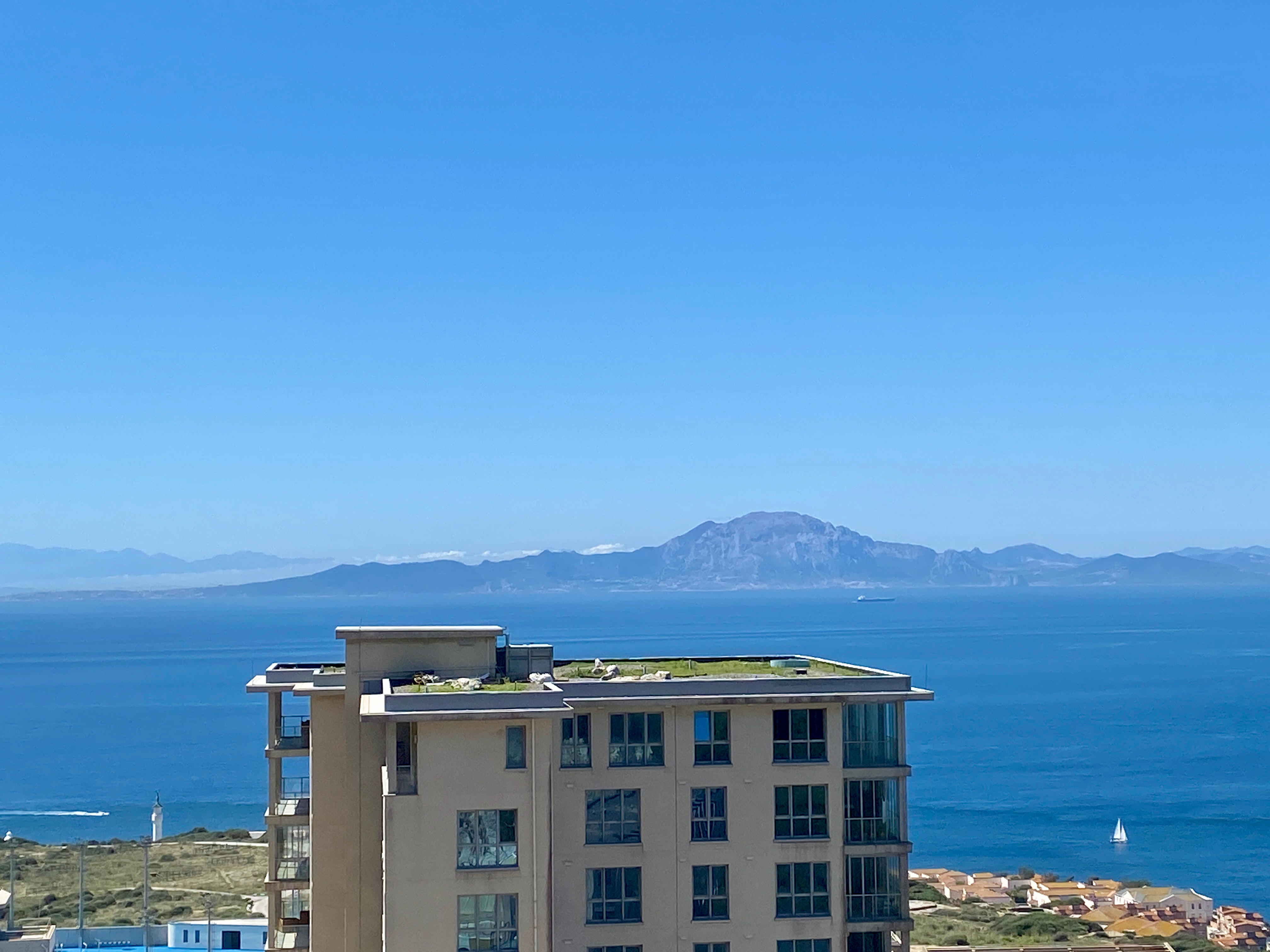
The Rock of Gibraltar is one of the fabled pillars Hercules created, when legend had him smashing through a mountain and creating the Gibraltar straits. This is one of the many differing stories told of what Hercules apparently did. The Rock of Gibraltar was known as Calpe Mons, while the mountain on the African side, is disputed between two different peaks, Monte Hacho and Jebel Musa. This one seen across the straits…
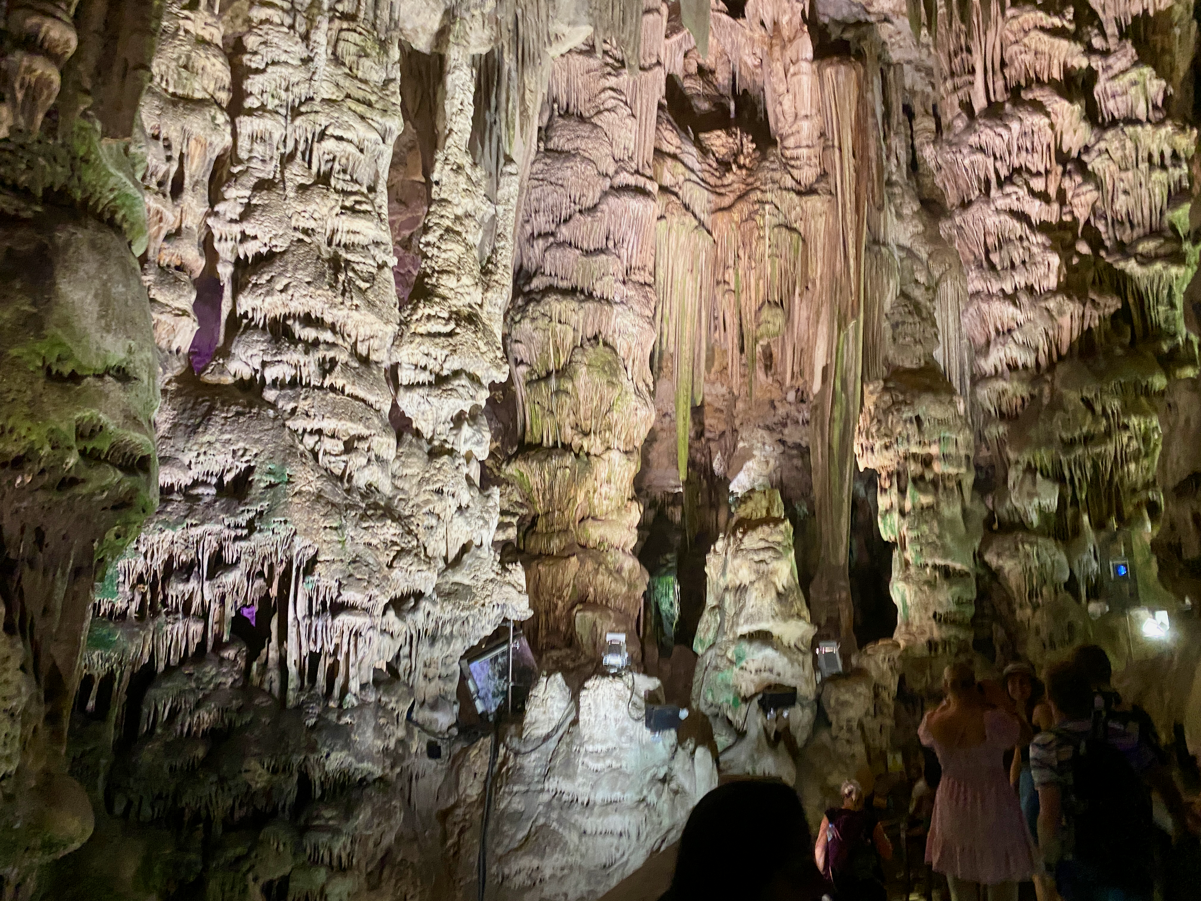
img_3715-2023-06-19-16-22.png

St Michaels Cave
Near the south end of the Rock of Gibraltar and 300m above sea level is St Michael’s Cave, one of the 150 cave systems in the area. This one has been set up as a tourist destination with nearly 1 million visitors a year. Rainwater seeping in from above has created many features in the rock. For purposes of tourism, a new entry was created to ensure adequate air flow, while a lighting system was installed, along with an auditorium with 100 seats and a music show.
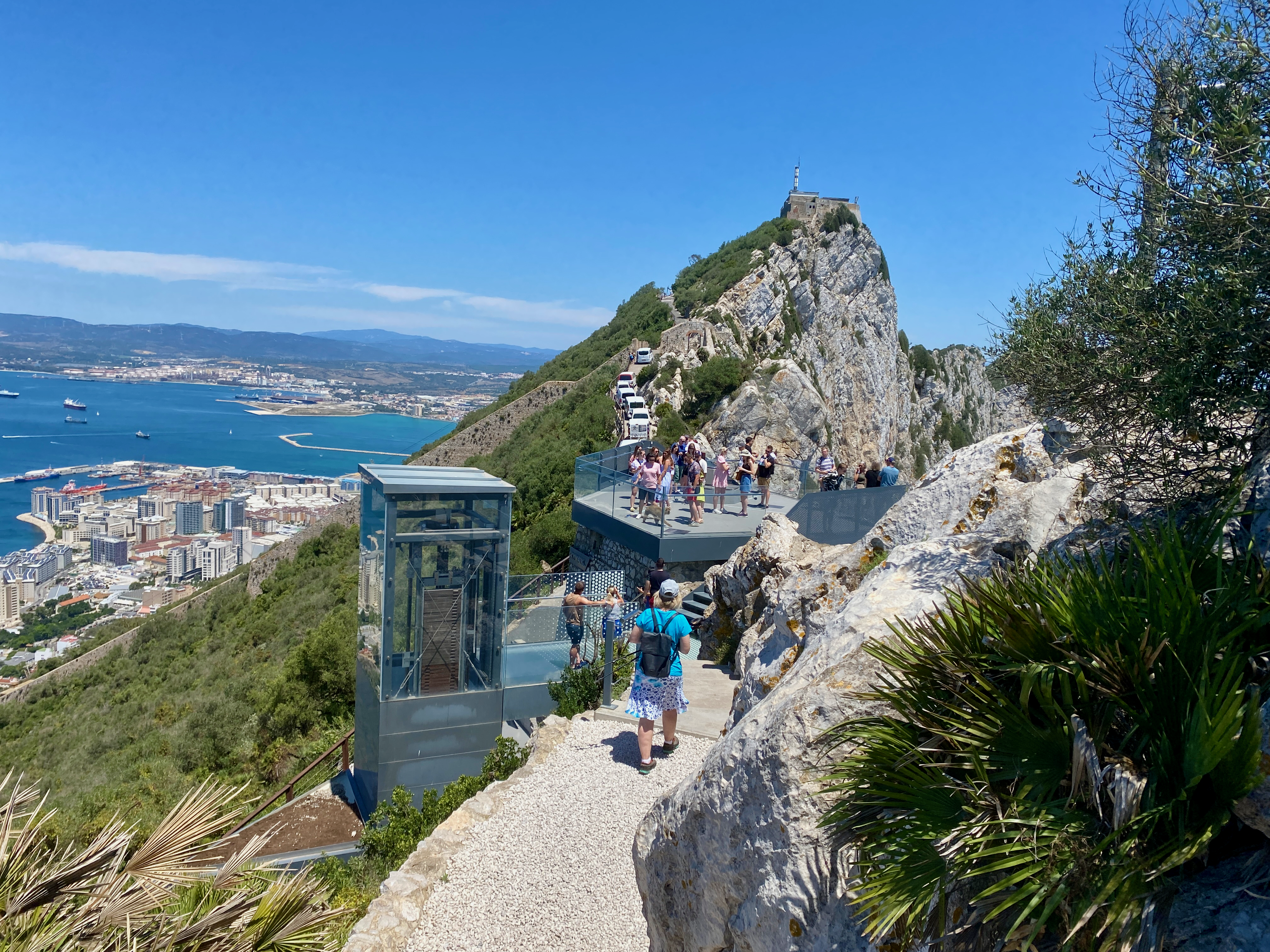
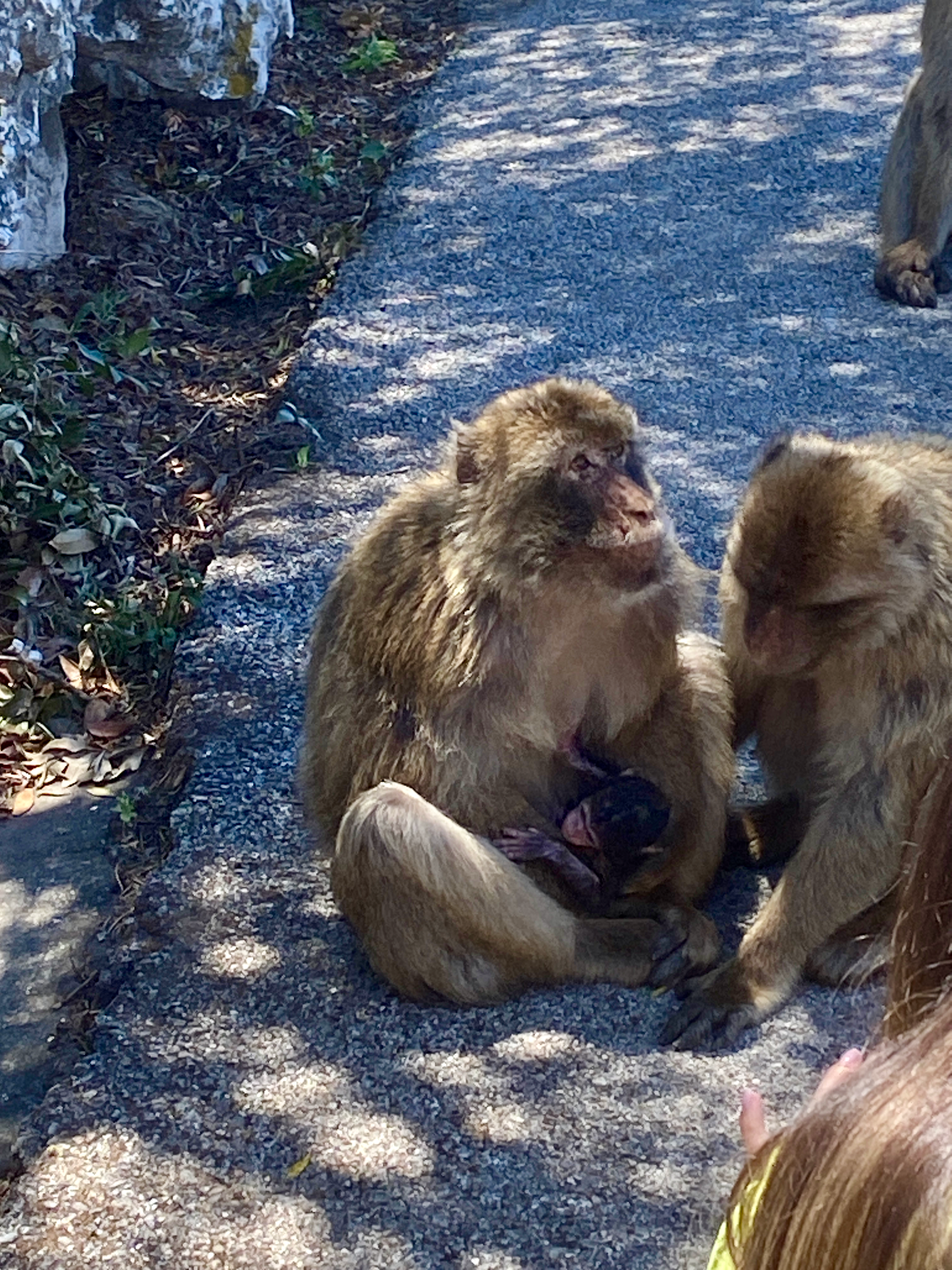
img_3718-2023-06-19-16-22.png

Skywalk and Monkeys
Two of the highest points reached during the tour was the skywalk, high on the rock where you can walk out over the edge; and the Monkey feeding zone.

img_3742-2023-06-19-16-22.png

There are around 300 Barbary Macaque Monkeys. Some of them can be cheeky, looking in windows and getting into cars to rifle through belongings looking for food.

img_3746-2023-06-19-16-22.png

Great Siege Tunnels
Started in mid 1782, these tunnels were to access cannons pointing north during the 14th and last siege on Gibraltar by the Spanish and French. By 1790 there were 1.2km of tunnels dug in the north end of the rock housing cannons focused mostly to the north.

img_3754-2023-06-19-16-22.png

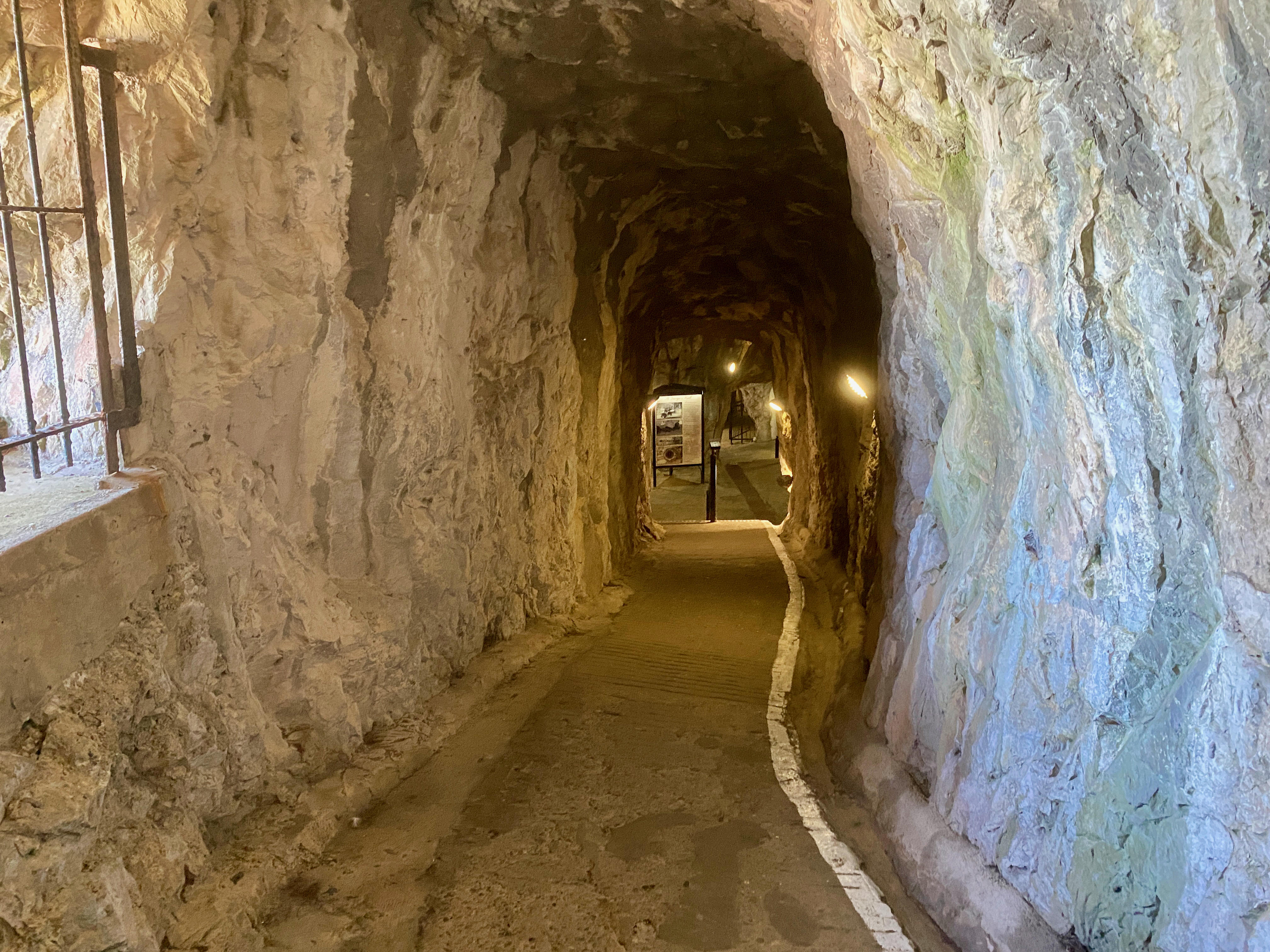
The tunnels now house a museum of sorts in the different rooms along the tunnels and exploring them can take an hour or more.

img_3756-2023-06-19-16-22.png

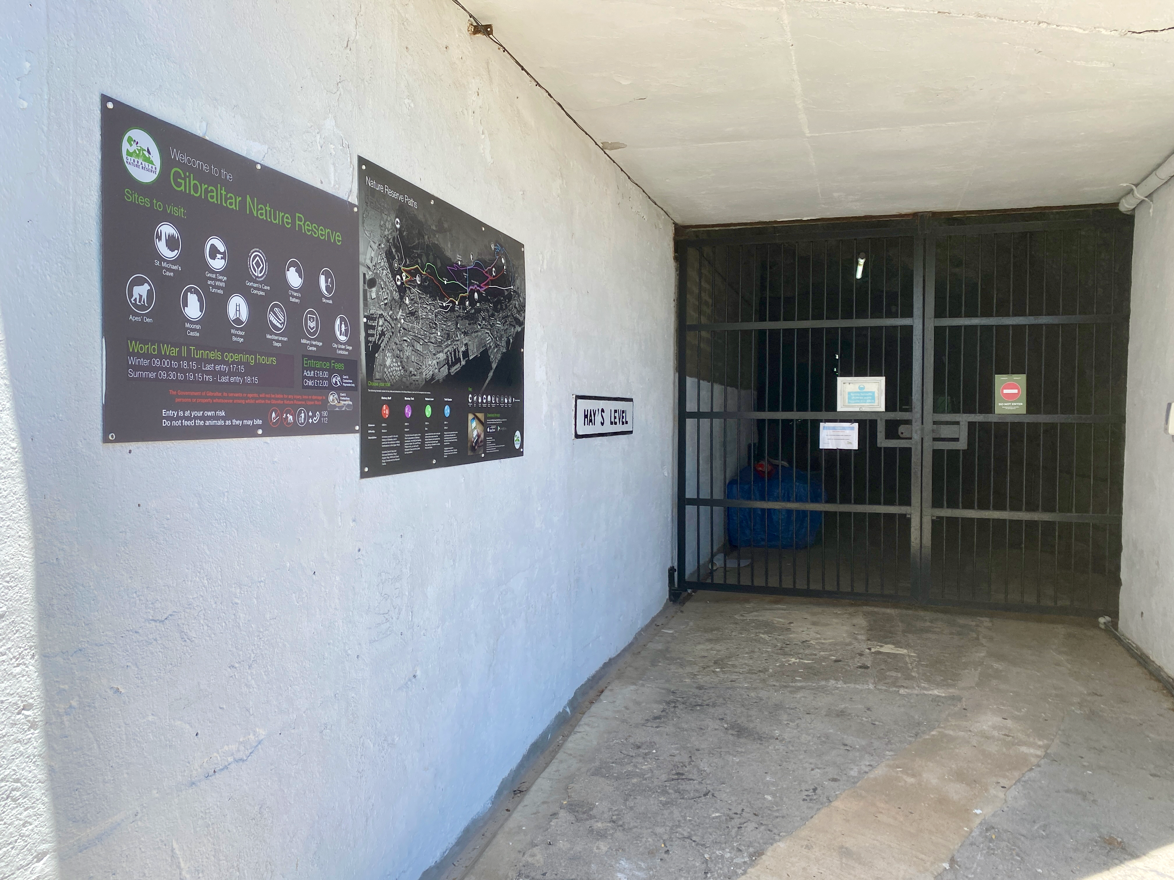
World War II Tunnels
During WWII Gibraltar was evacuated so the military could use it as a base. There was estimated 30,000 British Soldiers, sailors and airmen on the rock during the war. But the British also had a special operation to build tunnels to hide men, should the German invade. They were never used as the German did not come to Gibraltar. The tunnels have been closed ever since due to the means they were cut.
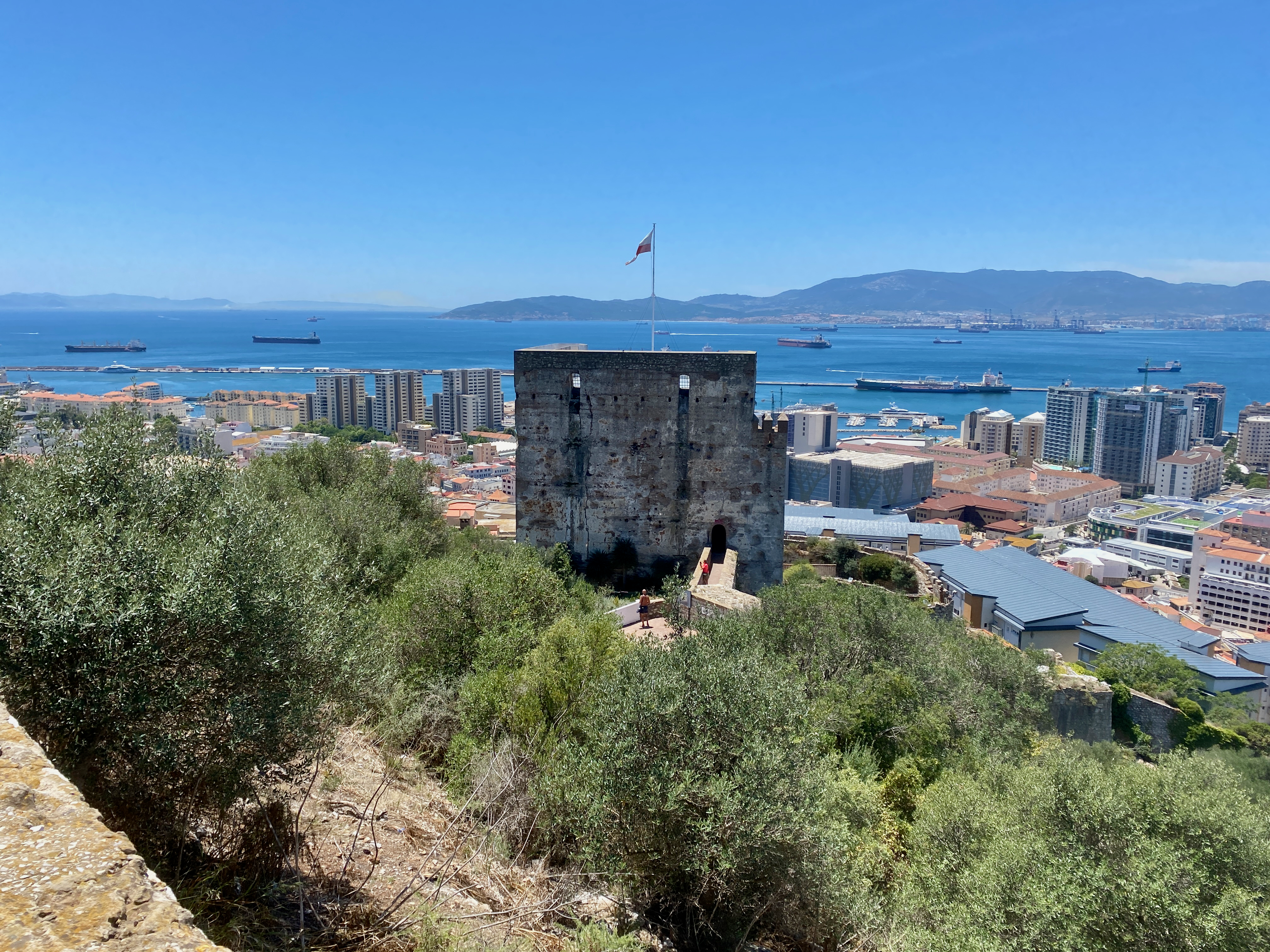
img_3759-2023-06-19-16-22.png

Moorish Castle
The Tower of Homage is the sole remaining tower of the Castle built by the Moors in the 1100s. The Castle played a prominent role in the Muslim capture of much of Western Europe for 700 years. It gives great views over Gibraltar, The Rock and the coastline across from the city.

img_3761-2023-06-19-16-22.png

Impressions,
Due to its small size, there’s not that much to do in Gibraltar. But as I only had half a day, the tour, and a good wander of the streets, was enough. It was nice to visit and to see Africa from a distance.

Next, I head to Tarifa, the southernmost tip of continental Europe in preparation for my ferry to Morocco.
The World Wanderer

Seville, Spain – Impressions

After the constant moving of the Camino de Santiago over 34 days, followed by three days in both Madrid and Lisbon, a friend and I decided to spend 6 days exploring the city of Seville in Southern Spain.

Physical Map Of Spain

Seville is the fourth largest city in Spain, and the capital of the large Andalusian province covering much of the country’s southern Mediterranean Coast. The city was said to have been founded by mythical Hercules in the 9th century BC as a centre of trade.

Streets of Seville
Staying in the centre of the city can be crazy. Like many old cities, the thin streets are like crazy spiderwebs with small entrances and exits, twisting turns, restaurants and cafes sprinkled throughout the maze. It took me several days to get used to it. We stayed in two separate locations, one in the centre and one just outside. The maze continues beyond the thin streets, but throws roads and vehicles into the mix with the slow walking locals. Seville has a large shopping areas right next to the maze.

url-2023-04-29-18-55.jpg

Seville Cathedral
The Cathedral of Saint Mary of the See was originally built as a grand mosque in 1172, it was christianised then torn down and rebuilt in 1401 as the grand gothic structure it currently is.

On its completion in the early 16th century, it became the largest Cathedral in the world, replacing the Byzantine church which had held the title for a thousand years. It has since been surpassed by three other structures: St Peter’s Basilica, Cathedral Basilica of our lady Aparecida and Milan Cathedral. Having spent time exploring several other Cathedrals in recent weeks we decided not to explore the interior.


Alcazar de Seville
Situated beside the Seville Cathedral, the Seville Alcazar is a royal palace which was begun in 913 under Muslim rule and took 500 years to complete, during which changes in architectural styles took place.

img_3525-2023-04-29-18-55.png

These can be seen throughout with different areas in the palace looking decidedly different. We took a day tour of the building, listening to an audio guide as we went. The gardens surrounding the back of the palace are immense.

img_3512-2023-04-29-18-55.png

Plaza de Espana

This semi-circular square was built in 1929 and is the most famous square in Seville. It was designed in the renaissance style with a stream running through it crossed by bridges. It’s surrounded by the large Parque de Maria Luisa.

The semicircular building is fringed by tiled seated areas each detailing a province in detail. We spent some time here in both the day and the night. During the day there are performances by dancers and musicians at various places along the plaza. At night, the lights gave it a little more magical feel.

img_3577-2023-04-29-18-55.png

Torre the Oro
This 12th century tower is 36m tall and is known as the Tower of Gold. It was built to control maritime transport along the Guadalquivir river beside which is was built. A heavy chain just under the water helped to stop invading boats coming into the city. Today it hosts a naval museum.

img_3554-2023-04-29-18-55.png

Plaza de toros de la Real Maestranza de Caballería de Sevilla

A visit to Seville is not complete without a tour of one of the most famous bull rings in Spain, which could hold 12,000 people including a box for royalty.

The audio guide going along with the tour detailed the different parts of the ring, and included access to the small museum. Much of the guide went into the feelings of the various members of the crew including the bullfighter himself.

Flamenco
Again, one cannot come to Seville without seeing a Flamenco show. Flamenco is a type of dance developed on this region in the 18th century, and includes twirling and foot stamping along to the sound of flamenco guitar. We attended a Flamenco show, sitting in the front row, and it was exhilarating. The effort of all involved, the skill of the guitarist, dancers and singer were well worth the effort. Unfortunately, photos were not allowed to be taken inside, so this is one kindly provided by the web.

Day trip – The City of Cadiz
Staying in Seville a week, a road trip to the surrounding towns is a must. Renting a car is easy and the best way to get around at your own pace. Cadiz is a port city with great sandy beaches and is known to be one of the oldest continually inhabited cities in Western Europe. In the mid 1800s it took over from Seville as the major port in Southern Spain.

Day trip to Ronda
The small town of Ronda situated atop a mantle of rock is a location that must be seen to believed. It feels like a magical location with grand views across the olive groves.

img_3616-2023-04-29-18-55.png

A new bridge between the two ends of the town was built with great arches crossing the river valley. And after walking from one end of town to the other to find the best view, we drove to the bottom of the valley to look up at it.

Impressions
Seville is well worth a week, and we enjoyed our time both in and out of the city. There’s plenty to see, along with the expansive culture and food. A definite locations for a revisit should I ever return to southern Spain.

img_3626-2023-04-29-18-55.png

Next, I head down to Gibraltar to explore the rock.
The World Wanderer

Hiking Statistics

The following is a list of all Multiday Hikes I’ve completed since I began walking long hikes in August 2011. All but the first has links to the relevant write up I did on each hike.

HikeCountryRegionDaysDistance (km)
1Rainbow Beach Training WalkAustraliaQueensland240
2Larapinta TrailAustraliaNorthern Territory17230
3Conondale Great! WalkAustraliaQueensland356
4Gold Coast Hinterland Great! WalkAustraliaQueensland354
5Yurrebilla TrailAustraliaSouth Australia354
6Major Mitchell Plateau – The GrampiansAustraliaVictoria226
7The Overland TrackAustraliaTasmania765
8Wilsons PromontoryAustraliaVictoria350
9Mt Bogong Big River Circuit – Alpine National ParkAustraliaVictoria350
10Burchell Trail – Brisbane Ranges National ParkAustraliaVictoria338
11Bogong Wilderness – North Koscioscko National ParkAustraliaVictoria242
12Paso de la OvejaArgentinaPatagonia228
13Parque Nacional Torres del PaineChilePatagonia9110
14Mt Fitz Roy TriangleArgentinaPatagonia334
15Cerro Catedral, Parque Nacional Nahuel HuapiArgentinaPatagonia220
16El ChoroBoliviaBolivia349
17Colca CanyonPeruPeru320
18Santa Cruz Trek, Cordillera BlancaPeruPeru350
19El Altar, Sanjay National Park,EcuadorEcuador325
20Ciudad Perdida – Sierra Nevada National ParkColombiaColombia444
21Kalaw to Inle LakeMyanmarMyanmar357
22Land’s End – St Ives to PenzanceEnglandCornwall466
23Boudicca WayEnglandNorfolk358
24Sandstone TrailEnglandCheshire355
25Inn Way of the Lake DistrictEnglandLake District7145
26The Inn Way to the Peak DistrictEnglandPeak District6135
27Great Glen WayScotlandScotland6126
28Arran Coastal WayScotlandScotland6105
29Camino Portugúes de CostaPortugal and SpainPortugal and Spain12280
30Tour du Mont Blanc (TMB)France, Italy and SwitzerlandFrance, Italy and Switzerland10165
31Pinnacles Loop TrackNew ZealandCoromandel217
32Routeburn TrackNew ZealandFiordland332
33Abel Tasman Coastal TrailNew ZealandNelson460
34Travers Sabine Angelus CircuitNew ZealandNelson Lakes680
35Rangitoto Motutapu CircuitNew ZelandAuckland226
36Alpha and Omega, Tararua RangesNew ZealandWairarapa439
37Pouakai Circuit, Mt TaranakiNew ZealandTaranaki323
38Cape Brett TrackNew ZealandNorthland231
39Tongariro Northern CircuitNew ZealandManawatu/Waikato445
40Southern Alps CrossingNew ZealandWest Coast13171
41Aotea TrackNew ZealandGreat Barrier Island342
Total  1862843

Aotea Track, Great Barrier Island, New Zealand

Great Barrier Island is 100km North East of Auckland Central, and sits between the Hauraki Gulf and the Pacific Ocean just to the north of the Coromandel Penninsula. More than half of the island is a nature reserve, and the 1000+ residents live off the grid.

aoteatracklocation-2023-04-5-17-27.png

I first visited Great Barrier 25 years ago, and have been trying to get back to do a hike for months now. I’ ha’d planned it as a warm up hike before my Southern Alps crossing, but it wasn’t to be. First, a downpour flooded Auckland, including the airport, so I couldn’t fly out, then the Island was closed down due to the Cyclone Gabrielle. Now, a month after completing my Southern Alps crossing, and I finally made it.

Day 1: Whangaparapara Road to Mt Heale Hut – 8.2 km – 3.5 hours – Red Track

I’d tossed around catching the car ferry over, but with the extra costs associated with it, flying was only a little more expensive. So, after a quick 30 minute flight in a 12 seater Cessna aircraft, I arrived on the island.

img_1445-2023-04-5-17-27.png

I’d arranged to be collected from the airport and delivered to the trailhead by a local transport. I arrived at 2:10 pm, and with an estimated 4 hours walk, I set out along a wide track beside a stream. As daylight savings ended last night, sunset was going to be just after 6, so I was going to be close.

img_1308-2023-04-5-17-27.png

Along the trail I got my first look across the grasslands, with views of the short mountains beyond.

img_1312-2023-04-5-17-27.png

The trail was flat and the smell of sulphur in the air heralded in my arrival at the ‘hot springs’. The springs themselves were more of a luck warm stream with pools along it. I might have gone in if I hadn’t been pressed for time, although as they weren’t quite hot, they lost their appeal.

img_1318-2023-04-5-17-27.png

Not long after the hot springs, I arrived at the Tramline trail where Kauri Trees were logged more than 100 years ago. A view out over the grasslands to Kaitoke and Medlands Beaches.

img_1319-2023-04-5-17-27.png

The Tramline track was also flat until it headed up Peach Tree Trail, which began a crazy amount of steps. This would be a reccuring theme on the island.

img_1334-2023-04-5-17-27.png

Starting near sea level, I climbed towards the the hut at 412m. The lack of breeze ensured that my climb felt more like I was swimming up the mountains in my own sweat. But the views were worth the energy.

img_1341-2023-04-5-17-27.png

And I got a better look back to Kaitoke and Medlands Beaches as I got higher. The trees gave way to low scrub giving an almost alpine feel on a mix of dirt path and stairs.

img_1352-2023-04-5-17-27.png

At the 400m altitude mark, I saw the sign to the Hut stating 5 min and 200 m. I arrived soon after and found a family group of 4 already there. I went in, claimed a bunk, had a quick hiker’s shower before going out to watch the sunset. Then while chatting to the family members, I cooked a Chef Corso Trail Meal, Macaroni with Bacon and Blue Cheese.

img_1357-2023-04-5-17-27.png

Day 2: Mt Heale Hut to Kaiaraara Hut via Mt Hobson Lookout and Port Fitzroy – 16.9km – 4.75 hours – Pink Track

After a fitful night’s sleep, I arose and got ready for today’s walk. First, I climbed past Mt Heale to the summit of Mt Hobson, the tallest mountain on the island, at 627m. I was to have climbed past Mt Hobson and along the ridgeline to the next hut, but due to a slip the trail that was was closed. So I’d left my pack at the hut.

img_1363-2023-04-5-17-27.png

I knew there was going to be a lot of steps, as others in the hut had complained about the sheer number. I didn’t bother counting on the way up, concentrating on the climbing until I reached the summit platform with almost 360 degree views. This over Whangapoua Bay…

img_1373-2023-04-5-17-27.png

and this over Port Fitzroy with Kaikoura Island, in the centre, and Little Barrier Island, in the distance.

img_1374-2023-04-5-17-27.png

I counted 1016 stairs on the way back to the hut where I picked up my pack and headed straight off again. A sign at the top of the South Fork Track said an hour to the Forest Road, not far from the hut. So it was going to be a short day. The trail headed down slowly, crossing a wire bridge as it went.

img_1379-2023-04-5-17-27.png

The trail was wide and an easy descent. Along the way I passed a pair of woman, the only two people I’d see on the track today.

img_1386-2023-04-5-17-27.png

The trail crossed a stream several times, and was easy to avoid getting my boots wet, although the trail was a little muddy and slippery at times. I finally came out at the Forest Road after an hour and a half. Not sure where they got an hour from as I wasn’t walking slowly. The Forest Road is rocky road though the nature reserve, and the sign said 30 minutes to the hut, but it only took 10 minutes.

img_1390-2023-04-5-17-27.png

At the hut I ran into one of the ladies from the hut last night. It was early, so we decided to walk the 5km into Port Fitzroy. I’d heard there was a burger place, which turned out to be closed, so we continued walking to the Boat Club, hoping for a burger, but that was also closed. We did manage to persuade the owner to sell us a beer though. Afterwards, we stopped at the shop on the way back. That evening we discovered there were mice under the hut, as my hutmate had left a bag outside with a chocolate bar in it. The mice enjoyed that. Thankfully they couldn’t get inside.

Day 3: Kaiaraara Hut to Green Campsite via Mt Maungapiko – 17km – 4 hours – Green Track

Today would be the longest day, although most of it would be spent walking along the Forest Road. Unfortunately, there wasn’t much of a view most of the time, so I took whatever photos I could.

img_1406-2023-04-5-17-27.png

Then a short side trail with a bunch of stairs led down 50m to a pair of large Kauri Trees. After the logging a century ago, there were few of the ancient giants left, and with Kauri Dieback Disease, there are likely to be few others living to such greatness.

img_1418-2023-04-5-17-27.png

30 minutes later, I came to the turn off to Mt Maungapiko, a 280m peak with good views. It was the only climb off the Forest Road, and in time for lunch, so I took the opportunity, and climbed the rough rock to the top where there’s a wooden bench.

img_1426-2023-04-5-17-27.png

I stopped for lunch, taking photos of the near 360 degree views.

img_1421-2023-04-5-17-27.png

And back the way I’d come.

img_1425-2023-04-5-17-27.png

Back on the Forest Road, I headed down to a stream, the climbed for the final time before finally reaching the South Tramline Track. The actual metal tramline had been removed many years ago, leaving just a steep descent. About halfway down I came to the turnoff to the Kauri Falls, and stopped to have a look.

img_1432-2023-04-5-17-27.png

Then it was a fairly easy walk, crossing numerous streams via wooden bridges, before I came out near Whangaparapara, then a 7 minute walk to the Green Campsite, opposite the village. I set up my tent, then went for a short walk along the main road of Whangaparapara hoping to find a beer at the lodge, but it was closed. So, I just chilled, reading in the sun.

img_1437-2023-04-5-17-27.png

The next morning, I packed and had breakfast, before I met the trail transport guy who dropped me off at the airport for my 30 minute flight home.

Overall

The hike was a fairly easy walk over three days, and would have made the perfect warmup hike had it not been for the weather events. I enjoyed my time there in relative quiet.

The Lone Trail Wanderer

Savai’i Island, Samoa – Impressions

In March 2023 I headed out to Samoa for a weeklong family gathering in Upolu, the country’s main island. Then once much of the family returned home, myself and my parents visited Samoa’s other main island, Savai’i. For me it was to explore a place I’d not been before, and for my parents it was to trace back some of our family heritage by finding a family cemetery.

Savai’i is the largest island in the Samoan Islands chain, both in size and height, and is the sixth largest Polynesian island after the 3 New Zealand Islands and two of the Hawaiian islands. Savai’i is more traditional than Upolu with a more relaxed feel. There is also no airport on the island, so arrival must be via boat, usually the car ferry.

Ferry to Savai’i

There are two ferrys to Savai’i, a small one and a larger one. On our trip over from Upolu Island, was in the small ferry. It’s the first car ferry I’ve ever had to reverse onto it, but I was guided on by helpful workers. This ferry had no sitting area, so we stayed in the car without aircon. We did find a spot at the edge of the deck where we could feel the wind. On the way back, we were on the larger ferry and locked up the car and went to sit in the airconditioned passenger seating area.

img_1147-2023-03-25-18-43.png

On the slow chug of the ferry, we passed the small islands of Manono and Apolima. The trip over on the small ferry took 90 minutes, while the larger one took about an hour.

img_1140-2023-03-25-18-43.png

Beach Fale

Fale in Samoan means ‘building’, and they are very common on the islands. The original fales were simple structures made from posts and a thatched roof. These days they’ve been modernised with concrete floors and corrugated iron roofs. Beach Fales are common ways for families to make extra money by renting them out to visitors. Mine had woven shields on the back half and tarpaulin sheets on the ocean facing half. While these provide some privacy, they can block the elements, especially during heavy winds or storms. The woven panels when partially drawn are good for allowing air flow on the usually steamy island nights.

img_1148-2023-03-25-18-43.png

Inside mine were two beds, one with a mattress to sleep on, the other to put my bags on, plus a small table, a chair and most importantly, a mosquito net. For convenience, mine also had a light and a power plug. While not for some – my parents stayed in a resort up the road – I like trying new things, and on most days the views out the front at high tide were amazing. From time to time, I’d even see a turtle popping it’s head out of the water.

img_1150-2023-03-25-18-43.png

Breakfast and dinner are both included in accommodation, all traditional fare, and on the last night, there were lobster tails, local BBQ, a cooked salad with fried taro and potato.

Saleaula Lava Fields

On the 3rd of August, 1905, molten lava began blowing from the ground from Mt Matavanu. It spilled over the crater’s rim filling a deep river valley leading to the flat Saleaula coastal plain, overwhelming part of Saleaula Village. A year later and much of the coastal plain had been covered, the lagoon had been filled, a vertical basalt cliff had built up over the coral reef, and five villages with their adjacent farming land had been buried. The eruption continued for a total of 6 years.

img_1155-2023-03-25-18-43.png

One of the buildings that was hit by the lava was the London Missionary Church, the remains still standing.

img_1154-2023-03-25-18-43.png

Some things didn’t succumb to the lava, like the Virgin’s Grave. Some say it belonged to a virgin daughter of a high chieftain, while others say it belonged to a virgin nun. In either case, the reasoning why the lava went around the grave instead of over was because the girl was so pure.

img_1156-2023-03-25-18-43.png

Safotu Congregational Christian Church of Samoa

This church, in the north western corner of Savai’i, is known for being the last church built from crushed coral. Coral was used to build many things in Samoa, from roads to buildings. Crushed to a fine sand, it was mixed with limestone to make a concrete. It’s been painted within the last few years to look almost new.

img_1159-2023-03-25-18-43.png

Flying Foxes

There is a species of flying fox in Samoa known as the Pe’a, which can also be found on Fiji and American Samoa. They are a hunted species, often eaten on special occasions by the locals.

img_1163-2023-03-25-18-43.png

Pe’a Pe’a Cave

The cave is a lava tube from around the time of the First World War, when lava rushed through the area burning through whatever was here then hardening into a long tunnel. Steps lead down into the cave which then widens, running for 50m or so before the roof drops to low to walk under. I stopped there, but apparently the cave goes for a kilometre to the ocean, but can be too narrow to get through in places. The name of the cave is from the Pe’a Pe’a bird which nests in and around the cave. We saw one flying circles around the end of the cave.

img_1171-2023-03-25-18-43.png

Alofa’aga Blowholes

These are also known as the Taga Blowholes you must pass Taga villageto get to the blowholes and pay WST5 to use the land. Here, lava flows have created a series of tubes connecting a flat clifftop of lava rock with the ocean below. Waves breaking against the lower end of the lava tubes push water at high pressure up through the tubes, sending spray followed by fountains into the air every few seconds. There are many of these along this area near the ancient village of Fagaloa.

img_1179-2023-03-25-18-43.png

Afu Aau Waterfall

The waterfall was WST10 to go into as it is on Palauli land. There are three parts to the falls, the two minor falls along the track, and the main one at the end. There is a legend that a giant named Mafane lived near the Palauli village. Over time he turned into a mountain that erupted forming a crater for water. Twenty-five streams run from the crater – the 25 warriors of Mafane’s battalion – feeding 7 rivers, one of which runs down the Afu Aau waterfalls. The pool was large and two of us from the tour swam in it, climbing up the rocks behind the waterfall and jumping in the pool. Note, there are rocks in the pool, so it’s suggested to be careful when jumping. The pool was cool and crisp, great in the heat of the day, although the steps to get out were slippery. Some girls in the next fale from me went a few days after we did, and the waterfall wasn’t flowing. The could still swim in the pool though.

img_1201-2023-03-25-18-43.png

John Williams Memorial

Samoa is a christian society with over 100 churches on the islands and strict holy day views with church services important. John Williams was a British missionary who visited many of the island chains throughout the Pacific bringing the word of christianity. The first was one of the islands of French Polynesia, before he moved on to the Cook Islands and many others. He arrived in Samoa in 1830 to meet with the then high chief who accepted christianity immediately. Then, with the aid of local translators he created the first bibles for the Pacific Islands. Unfortunately, on arriving in the New Hebrides, now known as Vanuatu, he was killed and eaten by cannibals. This monument was built in his honour and stands on the eastern shore of Savai’i.

img_1202-2023-03-25-18-43.png

Matautu Bay Snorkelling

I’d brought my own snorkelling gear so I wanted to get in amongst the coral at some point on my Samoan explorations. I found the only Dive company on the island – Dive Savai’i Samoa – and booked a trip. Because of the small numbers, there were three separate groups on the boat, snorkelers, divers training for their accreditation and an accredited diver. Each of the three groups had a guide/instructor. They took us out to three separate locations around Matautu Bay. The one thing I was missing was an underwater camera, as mine had died in Rarotonga and new ones were quite expensive.

img_1206-2023-03-25-18-43.png

At our first stop, we swum behind the guide along the length of a coral reef with many fish, and to my surprise many turtles, some sleeping around the coral, others just out for an afternoon swim. The second spot was near an old ship wreak, the John Williams 5 apparently, but I was unable to find any information online about it. And while we were there, a turtle came to visit, eating little squares of Papaya skin we threw to it. Last stop was the coral garden, but we had to be careful, as some areas were quite shallow. Overall, a great day out on and in the water.

img_1211-2023-03-25-18-43.png

Cemetery of Distant Relatives

One of the main reasons to come to Savai’i was to track down our family’s burial ground so dad could continue his work crafting the family history. We were shown the family houses in the Manase village close to where we were staying, and found that the cemetery was up on the hill. Unfortunately, with dad’s health he’s unable to climb a hill in the heat, but I was able to talk to the woman who owns my fale and tell her our story. In true Samoan style, she was off next door to organise a 4 x 4 vehicle to take us up there. An hour later we were being driven up a crazy 4 x 4 track, bobbing madly back and forth as it went. Before long we came out at the cemetery where they were preparing a grave for a funeral at the end of our stay. There were only headstones there, but they dated back more than 100 years to Dad’s adopted father’s parents and kin. Later, I was come to learn that the owner of my fale is also a distant relative.

img_1219-2023-03-25-18-43.png

Impressions

Savai’i Island is less built up than Upolu Island and there is less there to do and see. But we still managed to fill out time and enjoyed the more relaxing week of our stay.

Then after the week, we were back to Apia on Upolu Island for a few more days.

The World Wanderer

Upolu Island, Samoa, Impressions

In March 2023, myself and 14 members of my extended family flew out to the Island of Upolu in Samoa for a family gathering and to bring the ashes of my grandfather home. We all set up our base in Apia, the capital of Samoa and the largest city on Upolu.

Upolu is the main island of the Samoa, previously known as Western Samoa to differentiate it from American Samoa which separated in 1899. While not the largest island of the chain, Upolu has the highest population.

Apia

Apia is a mad mash of worlds. On one hand, there are wondrous resorts, restaurants and churches. On the other there are hovel markets, lines of shops, reminisant of south east Asia selling all manner of trinkets and knicknacks, sidewalk stalls, and so many taxis. Near the heart of the Apia is the clocktower.

img_1027-2023-03-16-13-09.png

Around the bay from the resorts is the marina, with many ships and small boats docked. There’s also a more upmarket bar and restaurant area called The Edge and has views over the marina, the bay and Apia.

img_1042-2023-03-16-13-09.png

After a couple of choice cocktails during happy hour, we walked five minutes down the road to one of the best restuarants on the island, Paddles, stopping to admire the lights of Apia across the bay.

img_1048-2023-03-16-13-09.png

Garden Fale

While the other 14 members of my extended family stayed at a large and somewhat expensive resort, I went for the more local style at another resort a couple of kilometres away. And instead of an air conditioned room with TV, bar fridge, toilet and shower etc, I chose a garden fale. The fale is literally just a room with a roof and woven shades on each side pulled down for privacy and protection from the elements. It’s hot inside, but by partially pulling up some of the shades, a draft can pass through. Inside there is just a pair of mattresses on the floor, mosquito netting on each, a lockable safety box, a light and a pair of power outlets. This was my first experience with a fale of the kind, but not my last. It was a fun and sweaty experience, that I enjoyed, although in this case I only stayed two nights instead of the nine I’d booked due to bed bugs.

img_1021-2023-03-16-13-09.png

Fiafia Night

The resort where my extended family were staying hosts a Fiafia every Wednesday, so we decided to take part in this cultural event. There is much dancing and singing by our hosts, and a large buffet dinner with suckling pork on the menu. Someone even leaked to the crew that there was a birthday and they dragged my sister up to present her with a cake.

Then once the singing and dancing inside was done, we were herded outside for the fire show. An enjoyable experience.

Sua Ocean Trench

Fifteen people is a lot to transport around the island, especially if the only people mover we could rent was a 12 seater. We decided to split the group and five of us headed on a road trip across and around the island to the To-Sua, which in samoan means ‘giant swimming hole’. It has salt water flowing in from one side, and at high tide, you can climb down the crazy lader and swim in it. A great day out for the WST20 entry fee.

img_1064-2023-03-16-13-09.png

Waterfalls

On the way to and from the Sua Ocean Trench, we passed five waterfalls:

Papapapai Falls
In the centre of Upolu are the tallest falls in Samoa dropping 100m into a volcanic crater. There is a carpark on the side of the road and a short 10m trail through the the grass to the best views . There was no charge for this waterfall.

img_1053-2023-03-16-13-09.png

Togitogiga Waterfall
On the south side of Upolu is O le Pupu-Pue National Park, we followed a short road to a carpark. Then a short fairly flat 200m walk along a rocky track leads to a park with fales, a bbq, toilets and two pools, one above and one below the falls. The falls aren’t large, but gush down into the lower pool. It’s known to have been a place where great warriors of Samoa’s past swam. Four days later, we drove out to have another look with a different group, only to find that the falls were dry. How quickly things change. These falls are also free to visit.

img_1061-2023-03-16-13-09.png

Sopoaga Falls
Near the Sua Ocean Trench, a well manicured garden surrounds a viewing platform looking across a river basin to the falls. Cost to enter this area is WST10, so only I checked it out, my family members deciding to sit this one out. While not as impressive as Papapapai Falls, the garden area is a place you could spend an hour chilling over a picnic lunch or similar. The river valley flowing away from the waterfall is also rather impressive, with great green walls disappearing into the distance.

img_1070-2023-03-16-13-09.png

Fuipisia Falls
These 55m tall jungle falls are apparently spectacular, but at WST20 it was too rich for us to look at for a few minute viewing. This was however, the only waterfalls our other contingent stopped at, talking the land owner into dropping the price to WST10. Photo courtesy of them.

Falefa Falls
Near the north side of the island again, the final waterfall we visited was right by the road, and we stopped quickly to check it out. It’s only a short falls, with a river continuing to run out to sea, but apparently you can swim in it. We didn’t stop at the official garden entrance, but at the side looking down at it. But as we looked, a man came out of a fale 20m behind us and charged us WST5 to view it.

img_1084-2023-03-16-13-09.png

Parase’ea Sliding Rocks

Not far out of Apia are the Parase’ea Sliding Rocks. It’s one of those redundant double names like East Timor, which in East Timorese is literally East East. Parase’ea means ‘sliding rocks’ in Samoan. There are a trio of small waterfalls, all with somewhat smooth rocks that can be slid down into a pool at the bottom. Entry fee is WST5 each.

The top falls were the shortest and easiest to slide down (photo not included). The second and main slide is more dramatic and when you come down the 100 or so steps to the sliding rocks it’s the first you come to. The far side is the correct side, due to there being a deep enough pool. It’s nerve-racking sitting at the top and pushing yourself over, but it ends quickly enough with a splash at the bottom.

img_1102-2023-03-16-13-09.png

The bottom one has two parts. I called the first part the devil’s throat as it reminded me of the Iguazu Falls in South America. Sliding down into the pool surrounded by water from three sides.

img_1104-2023-03-16-13-09.png

Then pushing up onto a lip and sliding down the next on the left side, gaining air at the end before dropping into a pool.

img_1105-2023-03-16-13-09.png

Then, once we were done, we climbed back to the carpark where there are great views down over Apia.

Robert Louis Stevenson Museum

Robert Louis Stevenson was a British writer born in 1850 who wrote such classics as Treasure Island and Strange Case of Dr Jekyll and Mr Hyde. Suffering from health problems for most of his life, he decided to move to the Samoa in 1889 where the climate greatly helped his condition. In 1890 he purchased land and had a large 2-story house built, the first in the country. He would die here four years later, but not before becoming a beloved advocate of the Samoan people.

img_1224-2023-03-16-13-09.png

During the last days of my stay, I caught a taxi to his house, which has since been converted into a museum. I took the tour and heard tales of him, his wife, her 2 children from her previous marriage, and his mother.

img_1274-2023-03-16-13-09.png

On his sudden death in 1893, Samoans stood a vigil over his body for the night, before clearing a way to the top of the hill nearby where they carried his body, and laid it to rest. After the tour, I set off up a trail to the top of that hill. There are two paths, the short steep one, and the long, not so steep one. I climbed the short one, and dripping heavily with sweat in the 32º heat, stopped several times to catch my breath and check out the view.

img_1279-2023-03-16-13-09.png

I finally reached the top where I found his resting place and a cool breeze.

img_1281-2023-03-16-13-09.png

There were excellent views back down to his house and the surrounding area. When I was done, I decided to take the longer route back down again, which was certainly a lot longer and less step, along with being fairly muddy.

img_1282-2023-03-16-13-09.png

Impressions

Upolu wasn’t what I was expecting, especially after my month in Rarotonga a year ago. The number of cars racing everywhere, dozens of taxis taking people back and forth for next to nothing, the mass of people in Apia, then the quieter areas all over the rest of the island. The sheer number of Fales and villages was all an experience, especially in the 32 degree heat. The people are generally friendly wherever you go and the atmosphere is very laid back. It was a good time to see a new country, and spend time with the extended family while we scattered the ashes in the sea outside where my grandfather grew up.

The World Wanderer

Southern Alps Crossing – New Zealand – Days 11 – 13

In late February 2023 I embarked on my longest walk in New Zealand, 13 days across the Southern Alps of the South Island. Go back to Days 9 – 10 or the beginning Days 1 – 3.

Day 11 – Mudflats Hut to Mid Styx Hut – 12.38 km – 6 hours – Yellow

My German hut mate for the night left in the dark to walk out along the trail I’d come in on yesterday, so when I awoke, I did my usual breakfast and pack up routine before heading out. The rain had stopped early this morning, but the grasses would no doubt be wet. The sky in the direction I was heading looked promising.

img_0922-2023-03-10-14-49.png

I crossed the river via the wire bridge and followed the trail along the grassland alongside the river. Not far along, it began to climb, but not high, perhaps 100m in elevation before levelling out in a wide flat trail similar to the one coming around the mountain yesterday. The trail continued for several kilometres, crossing many small streams, creeks and rock slides, but staying wide and flat, although edging higher as it went. The views along the river continued with Harman Hut, where the German girl had come from yesterday, somewhere down that way.

img_0931-2023-03-10-14-49.png

But I wasn’t going that far as my trail came to a T junction, the third trail heading over the Styx saddle, a low pass compared to many in the area. It wasn’t a difficult climb, more annoying as it was through tall grasses with little streams running across it, not to mention bogs here and there. I got wet as I crossed it, both boots and body due to the still wet grass, some of which were taller than me. I followed the trail markers towards the edge of the saddle hidden in mist. I passed a memorial of several people who’d died in a plane crash in the area in 1979.

img_0933-2023-03-10-14-49.png

The way down was more thick grasses and thin trees along small streams but the mist cleared and I could see the descent ahead.

img_0936-2023-03-10-14-49.png

It was fairly gentle for the most part, dropping more than 100m to the grassy river plains below.

img_0938-2023-03-10-14-49.png

It didn’t take me long, crossing the occasional wide creek before popping out on the grassy plains.

img_0943-2023-03-10-14-49.png

One more creek and I arrived at the Grassy Flat Hut. This is where I’d intended to walk to yesterday if it hadn’t been for the rain. I stopped, boots off and went inside to make a coffee and have lunch. I also checked the routes to the next hut. Over the wet winter, the heavy rains had washed away a section of the trail meaning that all walkers had to follow the trail to the Mid Styx Hut instead of just following the trail along the Styx River to the carpark. This meant I’d have to do a major river crossing at some point.

img_0945-2023-03-10-14-49.png

I headed out again after lunch, crossing some river flats, through grasses taller than myself, finding a way across a deep stream and then across the river to the far bank. From here I’d walk for an hour looking for the sign telling me where to cross the river, all the while watching the river grow deeper and wider.

img_0950-2023-03-10-14-49.png

I almost missed the sign, but headed down the bank to the river. There was no hope I was going to keep my boots dry here, so I ensured nothing was in my pockets and waded on it, using my poles to help stabilise me against the flow of the river. The water at its highest didn’t quite reach my crotch thankfully, and I made it without much of an issue. I then headed up a thin trail into the woods that climbed somewhat steeply at points, but eventually levelled out through the thin trees. I passed the point on my GPS map and kept walking to eventually come out at a little hut. This one had an old style fireplace and no toilet. So I set about getting ready for the evening, getting wood in ready for a fire. There were plenty of tools in the hut, so I got a spade and found a nice place to dig a hole away from the trail, for tomorrow morning’s business. Then I settled in, got the fire going and chilled out for the evening.

img_0952-2023-03-10-14-49.png

Day 12 – Mid Styx Hut to Hans Bay Campsite – 17.7 km – 6 hours – Pink

I awoke the next morning feeling good and ready for my final day in the wilderness, as tomorrow will be mostly a road walk from the DOC campsite to Hokitika. I was lying in bed thinking about getting up when it began to rain, so I got moving. I’d seen warnings that after heavy rain the Tyndall Creek and Styx River are dangerous to cross, and the first part of my day would be walking along Tyndall Creek. Halfway though getting ready it began to pour which disheartened me and I lay back in my bed considering staying in the hut for the day. Then I heard footsteps outside and opened the door to find two guys wet from the rain. They were just passing through and headed on along the trail. This pushed me to get moving and I packed, did my morning ablutions and headed out 30 minutes later. I weaved quickly through the forest along the trail for a kilometre until it began descending steeply, eventually coming out at Tyndall Creek.

img_0962-2023-03-10-14-49.png

After the warnings, I was nervous about following the creek as I was expecting to spend a lot of time climbing over the rocks in the raging creek as I’d done down Newton Creek. But I found much of the trail was on either side, through the trees and bushes, crossing it several times.

img_0963-2023-03-10-14-49.png

After 45 minutes, I emerged at the Styx River, crossed Tyndall Creek one last time before heading along the top of the bank on the true left side of the river – the left side in the direction it is flowing. I wandered through the forest at the top of the bank for 500m before climbing down a small creek to grassy plains.

img_0965-2023-03-10-14-49.png

I followed the plains for a kilometre and a half, occasionally diving into the forest. At the last hut there had been a map telling me where I was to cross the Styx river safely and it was near where I’d planned to begin climbing to Brown Hut. But due to the on-the-fly changes I’d made to my walk, along with the weather, I decided to skip this final climb and walk to the car park instead. I found the location the map had said and crossed the river without difficulty, again using my poles to stabilise me. On the other side I found the original trail and walked for less than 100m before the trail ended at a massive rock slide. This forced me to cross the river again. And again, it wasn’t difficult. Then another kilometre along, I saw a marker on the far side of the river so crossed a third time and found a 4 x 4 track.

img_0966-2023-03-10-14-49.png

I followed this for nearly a kilometre before finally emerging at the carpark. I knew if I stopped for any length of time the sand flies would feed, so I began the walk to my campsite hopeful that I might be randomly picked up like I had been on my road walk on day 6. The walk along Dorothy Falls Road to the campsite was about 6 km.

img_0968-2023-03-10-14-49.png

The road tracked through the forest for a bit, climbing here and there before passing the falls.

img_0976-2023-03-10-14-49.png

It rained on and off but not heavily as I passed some grazing fields with views of the mountains. I was passed by about a dozen vehicles from cars to large RVs, but no-one offered me a ride. Note, I wasn’t trying to hitch, just wondering if anyone would kindly offer me one.

img_0969-2023-03-10-14-49.png

My first sighting of the lake was half way along, a narrow gap of water with mountains on the far side.

img_0972-2023-03-10-14-49.png

The road the road weaved through more forest to emerge beside the lake. I walked the final couple kilometres as the road turned from the stones to tar seal and I knew the campsite was near when I rounded a corner to see a large cell tower.
I found the camp and walked around looking for a spot away from the RVs, of which there were plenty, and pitched my tent. This was the first I’d used it in the 12 days I’d spent walking. While it’s only light, the items I’d carried only to use on this particular night would come to 2.5 kilos more than 10% of my pack weight. When set up, I relaxed in the sun, drying clothes and boots while reading and catching up on everything I’d missed online over the past 6 days.

img_0977-2023-03-10-14-49.png

Day 13 – Hans Bay Campsite to Hokitika Central – 21 km – 1 hours – Red

I shouldn’t really include this day in my walk, as I decided not to walk the three hour trail along the ridge, instead trying to hitch a lift into Hokitika. It was a little cold over night in my tent as I’d gotten used to sleeping in huts with a fire. After having breakfast and packing, I set out along the road, putting my thumb out for the first time. I worked out it would take me 5 hours to walk the 21 km to Hokitika and was more than happy to walk if no-one picked me up. A handful of cars passed me before the end of the lake.

img_0992-2023-03-10-14-49.png

I then headed along Lake Kaniere Road – which sounds like you are saying Lake Canary – and had walked a total of 3 kilometres before a van pulled over to pick me up. A tour operator had just dropped a host of people off near the lake to ride bicycles back to Hokitika. We chatted the 20 minutes to the town, but as it was too early to book into my accommodation, he took me on a tour of the town.

img_0996-2023-03-10-14-49.png

Afterwards he dropping me off at a laundrette that he owned where I did all my washing and lay me tent out to dry in the glorious sun. When all was dry, I headed into town for lunch and then to my accommodation.

Overall

The thirteen day walk was different than I expected. I didn’t expect the first 6 days to be so flat along the Harper Pass, or that there would be so many TA walkers, but it was a good build up to being on a long term hike. In turn, I was expecting the second part to be more rugged and peaceful with big climbs and long descents, but it was more brutal than I expected. I’m glad I chose to take an emergency beacon this time just in case although thankfully I didn’t need it. I enjoyed my walk, but the overall most exhausting part was the rain, which overall made the trek less fun.

I do chalk it up as an achievement, crossing the large set of mountains in the country I grew up in, and marks the end of a year of walking in New Zealand.

Until next time,

The Lone Trail Wanderer

Southern Alps Crossing – New Zealand – Days 9 – 10

In late February 2023 I embarked on my longest walk in New Zealand, 13 days across the Southern Alps of the South Island. Go back to Days 7 – 8 or to the beginning Days 1 – 3.

Day 9 – Mid Taipo Hut to Newton Creek Hut – 6.9 km – 11 hours – Red

It had rained a little overnight and as today would be a long difficult day, I wasn’t pleased that everything would be wet. Clouds hung atop the ridges, and I hoped they’d blow over. In the hut were instructions to get to the beginning of today’s climb, so I followed them back to the turn off and easily found the trail leading up the mountain.

img_0885-2023-03-10-14-49.png

While I’d been told the trail would be steep, it wasn’t as bad as expected. I’d imagined the climb from yesterday after the three war cableway, just much longer. But it turned out to be a moderate climb, fairly constant up rocks and roots only damp from the overnight rain.

img_0888-2023-03-10-14-49.png

And, after 90 minutes I popped out at the top amidst the mist.

img_0891-2023-03-10-14-49.png

The sign at the bottom had said 2 hours to the Dunn Creek Hut, but it took another hour to make my way through wet flax and vegetation.

img_0893-2023-03-10-14-49.png

A couple of wet stream crossings and I crossed a marshy, grassy mud patch leading up to hut. It was in better shape than I’d expected, but the heating had been removed and I’m glad I’d decided not to stay there. I took my boots off, brewed a coffee and ate some lunch.

img_0894-2023-03-10-14-49.png

Half an hour later, I headed out again across the boggy grasslands following the trail markers.

img_0897-2023-03-10-14-49.png

Much of the climb to Newton Saddle was up Dunn Creek, and it was pretty lively as I went. The trail pushed up the centre of the creek over wet rocks and wasn’t very pleasant as it was slippery and slow as I tried to ensure each step was stable. Thankfully over the hours I climbed, the creek grew thinner. At one point I must have climbed up the wrong rocky gully as lost sight of the regular orange markers. My GPS confirmed I was off track and I was forced to bush whack my way across the grassy mountain slope until I saw the correct creek with the markers. Going down would have cost me extra time.

img_0899-2023-03-10-14-49.png

I was mostly dry as I walked, but the occasional gust of cold wind from across the saddle was pretty miserable. I saw the markers go up the very steep side of the grassy bank away from the creek, and I knew this was the final climb to the saddle. It was hard going. I couldn’t use my poles, so let them dangle from my wrists with the straps. Each step was finding a footing and dragging myself up by the grass, bit by bit until I got 30 metres from the top when I could again use my poles. I finally got over the top and looked down to regard where I came from…

img_0903-2023-03-10-14-49.png

The hundred or so metres across the saddle was fairly flat and it felt good to not have to climb. I stopped at the top of the descent and looked down.

img_0906-2023-03-10-14-49.png

The climb down was the opposite of the ascent. It was easy going at the top, trickles of water in the rocks, but as I went it got thicker and heavier the trail going down the centre of the Newton Creek. I descended into the mist which grew bright from the occasional ray of the sun, only to fade again. With several other water flows joining the creek it got heavier and the rocks larger. I slipped several times, catching myself on my poles, bending them slightly under the strain. Sometimes I had to let go of them and catch myself on my arms in the water. I don’t remember bashing my ribs, but perhaps coming down hard on my arms caused bruising on my left side. It didn’t affect my walking, or carrying, only turning over at night. I had scratches and bruises down much of my legs and again wished I’d brought the full length gators.

img_0907-2023-03-10-14-49.png

The day was getting on and I realised I wasn’t going to make it to the hut I’d originally planned to stay in. There was another, closer one, so I decided to walk there. But again, because I hadn’t preplanned it on my digital map, I had to guess where it was. And at 7:30 pm, I was also starting to worry that I was losing daylight. Based on where I thought the hut was, I’d likely be walking in the semi dark with my head lamp. Thankfully I train for endurance, so even though I’d been going for more than 10 hours, I still had more in me. Another large creek joined the Newton Creek, making it just too wild to be rock hoping in a raging river. Thankfully the trail finally cut along the side for the first time during this descent. Then, as I followed the trail, I came out onto a grassy patch and looked over to see a hut. I wondered about there being another hut not shown on the map, but went over to it and it turned out to be the hut I was looking for and hour earlier than I predicted. The sense of relief was unimaginable. I set about getting out of my wet gear, having a wet wipe ‘hikers’ shower and getting into warm clothing. I topped up my water for the next day from the river, set out all my gear before getting the fire going. I cooked some dinner and just stared into the fire for what felt like hours.

img_0910-2023-03-10-14-49.png

Day 10 – Newton Creek Hut to Mudflats Hut – 5.1 km – 3.5 hours – Green

After belting myself around yesterday, I woke somewhat refreshed and ready to continue my trek. I packed up and headed out into the wet morning grass. The trail continued through the woods beside the raging river and it wasn’t long before I arrived at the 200m descent I’d been expecting last night. I’m glad I didn’t have to do it in the twilight or the dark, the slippery roots and steep trail was slow going as I had to be careful of every step. Half way down there was a grove of thin trees giving me something to hang onto as I descended.

img_0911-2023-03-10-14-49.png

I finally got to the bottom after an hour and came out at the Arahura River, which I stood little chance of crossing. But, according to the map, around the corner was a triple wire crossing, so I began rock hoping along, careful on the slippery boulders. Then, it began to spit, heralding in the rain.

img_0912-2023-03-10-14-49.png

There was a small climb up to the wire bridge, but according to the map the other side was going to be a bit of a bush whack as I climbed to a trail. But, I found that the trail had changed, and straight from the end of the bridge it began to climb. It wasn’t as steep as the earlier descent, and got my blood pumping. At the top of the climb the trail went both ways and was quite wide.

img_0914-2023-03-10-14-49.png

I figured this would be a brief patch of wide trail, but was pleasantly surprised. For several kilometres, the trail stayed wide and flat. Perhaps this was part of an old settlers trail and had been around for many decades, maybe even from the 1800s, with only the occasional stream crossing that was a little rocky. It continued to rain, but there was a fair covering, so I wasn’t affected too much. I also got views of the grassy river plains below.

img_0916-2023-03-10-14-49.png

Then came the descent along a small stream heading towards the hut, and while I’d planned to walk further today, the constant rain was bugging me, so I decided after the extreme day yesterday, I’d get to the Mudflats Hut and call it a day.

img_0917-2023-03-10-14-49.png

The trail down wasn’t hard and I emerged at the base of the mountain on the wet grassy plains in the rain. I crossed a long wire bridge and crossed more grassy lands before I was forced up a steep climb where I came out at the hut. The rain was still coming down, so I ducked inside and got prepared for the night, a hiker’s shower, a change of clothes, collecting for firewood etc. I’d been there two hours in the ongoing rain when I heard footsteps outside and a slight German girl appeared at the door. She’d come along the river I was heading up tomorrow. We chatted for a couple of hours as I lit the fire before I got on with my evening.

img_0919-2023-03-10-14-49.png

Next, the final part, Days 11 – 13 of my Southern Alps Crossing.

The Lone Trail Wanderer

Southern Alps Crossing – New Zealand – Days 7 – 8

In late February 2023 I embarked on my longest walk in New Zealand, 13 days across the Southern Alps of the South Island. Go back to Days 4 – 6 or the beginning Days 1 – 3.

Day 7 – Rata Lodge Backpackers Otira to Dillon Hut – 14 km – 8 hours – Yellow

After a breakfast down at the local cafe, I packed and was delivered to the start point by the owner of the Backpackers. I’d originally planned to stop at Carroll Hut at the top of today’s climb, but after finding there was no heating there I decided to walk further. In the carpark I took my obligatory selfies to prove I was on the walk, then set off up the trail into the forest. I was barely 10 metres when a man emerged with pack on. He would be the last person I’d see for more than 24 hours.

img_0799-2023-03-10-14-49.png

The climb was by no means difficult but no easy fair either. I pushed on step by step and was rewarded by the occasional view out across the mountains. For the first steep climb of the walk, I finally got a good sweat on.

img_0805-2023-03-10-14-49.png

The good weather continued as I climbed out of the forest, passing the short stubby trees towards the top as I always seem to. I stopped and got another good shot along the range with Otira and Authur’s Pass in the distance.

img_0806-2023-03-10-14-49.png

The top two hundred metres the trail grew more rocky, feeling more exposed and dangerous.

img_0807-2023-03-10-14-49.png

But I finally crossed onto the tussock covered top and Carroll Hut came into view. At the hut I stopped for 30 minutes for lunch and to dry my sweaty clothes.

img_0811-2023-03-10-14-49.png

From here the trail was marked with posts, but the trail was not as well defined as before. This was fine atop the range which felt more like rolling hilltops than craggy mountain peaks.

img_0813-2023-03-10-14-49.png

As long as I could see the next pole, it didn’t matter that there were a meander of little trails leading to it. I go my first views down the other side where I’d eventually be descending to the river valley below.

img_0827-2023-03-10-14-49.png

The poles continued as did the suggested routes, which were fairly obvious due to the short vegetation. However, the mapping software I’d used to plot my course only listed the huts I’d planned to stay at, but as I’d decided to stay at a different one, I was forced to guess exactly where it was. Today was fairly easy, but later in my walk it would be more of an issue.

img_0832-2023-03-10-14-49.png

As the trail disappeared beneath the longer vegetation I was forced to bush bash from post to post. This was the beginning of my scratched legs woes, and my regret at not bringing full length gators.

img_0837-2023-03-10-14-49.png

The trail grew more prominent as I crossed into the tree line, with the usual orange triangles marking the route. At the top I easily descended 200m quickly before the trail got a little more precarious, but nothing too dangerous.

img_0844-2023-03-10-14-49.png

I came out atop a slip giving good views down. Then, near the base the trail lead through a rocky passage with a lone tree in the centre then popped out onto a rocky creek.

img_0845-2023-03-10-14-49.png

The creek was raging in places, and after a long day, I wanted to find the huts less than a kilometre away and rest. I skirted along the lower bank beside the creek, but couldn’t get past. So, trying to ensure my boots remained dry, I skirted back again looking for a place to cross. I found one, and jumped over, but I think my sunglasses came off my pack here, as I didn’t see them again. I walked along the other side, and found a place to cross.

img_0848-2023-03-10-14-49.png

Then it was up the bank and along a 4 x 4 track. I quickly saw the Dillon Homestead Hut and stopped to check it out. The homestead hut has been around since 1945 and has a lot of character in it. I could have stayed here and I’m not sure why I didn’t, but I chose to push on to the nearby Dillon hut, a far newer Department of Conservation hut. I wasn’t disappointed and as I had it to myself I got set up for my first night alone on this trek. And as it had been a warm day, I didn’t bother with a fire.

img_0854-2023-03-10-14-49.png

Day 8 – Dillon Hut to Mid Taipo Hut – 8.9km – 3 hours – Pink

Because yesterday was long day, and tomorrow will be too, I chose a more chilled walk today along the Taipo River. I’d planned to climb to the Dunn Creek Hut at the end of the day, but had read that it wasn’t in the best of shape and being rebuilt. Again my map didn’t have the alternative huts marked, so I was guessing by the end of the day. I headed out from Dillon Hut in an overcast sky.

img_0861-2023-03-10-14-49.png

As the river was wide and deep in places, I stayed on the left bank waiting for a three cable crossing I knew was further along.

img_0863-2023-03-10-14-49.png

To get to the crossing, I had to climb the side of a high rocky outcrop, then follow the path and a super steep descent where a ladder had been installed to help.

img_0867-2023-03-10-14-49.png

I crossed the bridge over a raging river, and on the other side, had a hard climb almost straight up the dirt bank that seemed endlessly.

img_0868-2023-03-10-14-49.png

It eventually flattened out before an easier descent down the side to pop out near the river, which had split in two.

img_0870-2023-03-10-14-49.png

I then followed vague trails along the river bank and grassy flats.

img_0872-2023-03-10-14-49.png

…before running into two guys who’d come from a hut further up the river. From a few minute chat, one suggested that if I was going up to Dunn Creek Hut to go up the creek instead of the trail further around as it was less steep. I’d originally planned to do that, but as I was no longer going to that hut tonight, I might have to be satisfied with the more difficult route up.

img_0874-2023-03-10-14-49.png

The river gully became quite tight with no way to walk along the side, so I was forced to push up the side of the bank on a forest trail. It was by no means a easy walk, and cemented in my mind that I wouldn’t be coming back to climb Dunn Creek.

img_0875-2023-03-10-14-49.png

I finally popped out at the Mid Taipo Hut having passed the less than obvious junction to tomorrow’s climb. There were bits of sun and it was warm. I decided to wash my sweaty clothes, so I stripped down tossed my clothes in a waterproof bag with some special organic cleaner and headed out to the river to do the washing. In my naked state, I kept an eye out should someone pop out of the wilderness, but no-one did. I took my washing back to the hut and hung it up outside, then went back to the river and bathed. The water was pretty icy, but I got it done and returned to the hut to chill out as it began to rain. I lit the fire to help dry the clothes and got on with my afternoon.

img_0883-2023-03-10-14-49.png

Next, Days 9 – 10 of my Southern Alps Crossing.

The Lone Trail Wanderer

Southern Alps Crossing – New Zealand – Days 4 – 6

In late February 2023 I embarked on my longest walk in New Zealand, 13 days across the Southern Alps of the South Island. Go back to Days 1 – 3.

Day 4 – Hurunui No. 3 Hut to Locke Stream Hut – 15 km – 6 hours – Pink

Thankfully the sun came out today as it will be the hardest day so far, taking me over Harpers Pass at 967m. I headed out along thee grassy plains feeling pleased that the rain had passed for the time being, although that didn’t mean the grass wasn’t wet from dew.

img_0660-2023-03-10-14-49.png

The trail headed into the forest for a while, with laid out tree stumps covering the muddy patches. Good, but still slippery.

img_0661-2023-03-10-14-49.png

I soon came to the three wire bridge and crossed, pushing uphill a little in the woods.

img_0668-2023-03-10-14-49.png

Until once more coming out onto the flat via a rocky landscape before arriving at a small hut called Cameron’s Hut, which has only one workable bunk. I’d planned to stay here last night, but a walker the night before had persuaded me not to.

img_0669-2023-03-10-14-49.png

I marched on up the trail as it steadily began to climb, planning to stop at the Harper Pass Bivvy for lunch near the top.

img_0689-2023-03-10-14-49.png

I got to the bivvy an hour later, and stopped for lunch with two people there. And as they left, the three that had been following me since day 2 arrived. I ate my lunch in the sun with them, then letting them go first, I headed up the final climb to the top of the pass.

img_0694-2023-03-10-14-49.png

The trail down the other side was steep and rocky, and I’d been warned I’d be getting wet feet. I finally got a good view down onto the valley I’d be walking into and continued down the very steep trail, slipping a handful of times, but nothing serious.

img_0698-2023-03-10-14-49.png

I eventually came to another three wire bridge and crossed into a rocky riverbed where I rock hopped all the way down, scrambling up the bank in a couple of cases to get away from the water.

img_0703-2023-03-10-14-49.png

The rocky river continued, as I climbed one of the banks and walked in the woods for a bit, then back to rock hopping.

img_0705-2023-03-10-14-49.png

I came around the corner to spy people in the river. I climbed the bank to find the Lock Stream Hut where I’d be staying for the night. It was warm enough that there was no need for a fire, which was good as we couldn’t find any. With the only water that from the river, I topped up from there trying to avoid the sandflies that were eagerly waiting for me. I also did some washing in the river and laid it out to dry, then sat reading my book in the sun, or at least trying to, as again the sandflies swarmed us all, even covered in repellant.

img_0707-2023-03-10-14-49.png

Day 5 – Locke Stream Hut to Kiwi Hut – 8.4 km – 2.25 hours – Red

Again, my preplanning had stated a fairly long day today, but in revision, it turned out to be little more than 2 hours. But as my following day was a firm booking at a backpackers, I didn’t want to turn up a day early. I headed out from the hut and across some rugged landscape.

img_0710-2023-03-10-14-49.png

The trail lead me across the river, and I spent some time walking back and forth trying to find the best location to ensure I wouldn’t get my boots wet. I eventually found it and headed across into the grassy plains.

img_0711-2023-03-10-14-49.png

The trail rambled through the red rocks fairly common along this route, but staying on the true right of the river.

img_0712-2023-03-10-14-49.png

Most of it was along a grassy plain beside the river, with forest on the right.

img_0714-2023-03-10-14-49.png

I followed the trail on, seeing no-one else as I walked, the weather becoming better.

img_0724-2023-03-10-14-49.png

After a while I came to a sign to Kiwi Hut, pointing into the forest. I headed in, following the trail through to a large grassy paddock and up a bank. It was warm and before lunch when I arrived. I scouted for some wood and dragged it back to the wood shed, but felt there would be no need to start a fire, so didn’t bother cutting it up. A couple arrived and stopped for lunch. I brewed coffee and chatted with them before they left.

img_0736-2023-03-10-14-49.png

I then changed, cleaned the hut, checked the water and just chilled for a few hours until a large group of TA walkers arrived. More people would arrive during the day until all 7 beds were full and there were three tents out on the grassy patch.

img_0738-2023-03-10-14-49.png

Day 6 – Kiwi Hut to Rata Lodge Backpackers Otira – 21.45 km – 6 hours – Green

I headed out the next day looking forward to having a hot shower and staying in a real bed. Soon after heading out, I crossed the river which had split in two on the river plain. The first I found a way to rock hop across, but the second was not so easy. I finally had to remove my boots and wade over without them.

img_0746-2023-03-10-14-49.png

Then over the course of the next handful of hours, I walked along the grassy field slowly making my way towards where I guessed the road would be. I came to a large gorse forest and was forced along an old river bed to avoid it. This cut me through some forest, back to the river bed, through a small portion of gorse, before I finally exited down a bank to the grassy plains.

img_0748-2023-03-10-14-49.png

The plains widened and I followed a 4 x 4 trail across it. As I walked I began to hear the occasional vehicle in the distance. My hopes of keeping my boots dry, however, died quickly as the trail crossed many brooks with few other means to cross than to wade through or remove them. After the first couple I gave up and just let me boots get wet.

img_0756-2023-03-10-14-49.png

I trailed across the grassy plains, finally making it to the rivers, of which there were again two. By that stage, I’d all but given up trying to stay dry and just waded straight in. Then with soggy boots, I was up a bank and crossing a farm paddock toward the road.

img_0760-2023-03-10-14-49.png

I stopped briefly for lunch, but sandflies… So I picked up my pack and headed off along the road towards Otira and the backpackers. I thought it was only 6 or 7 km, but I have since learned it was closer to 11. I also decided to not thumb a lift, but should someone offer a ride I’d take them up on it. Several km along the road I came to the Morrison Foot Bridge spanning the river and railway tracks. TA walkers commonly camp on the other side of the bridge, or arrive here and hitch a lift to Otira or Arthur’s Pass Village. This is the last location I’d be encountering walkers from the Te Araroa. From here it was going to be much quieter.

img_0767-2023-03-10-14-49.png

I walked a further 3km, and next to the location where I’d be beginning my walk tomorrow, a car stopped and a pair of women picked me up. They’d been hiking in the mountains in the area too. They drove me the remaining 3km to the the backpackers where I checked in, had a hot shower, then headed along the road to the cafe for a hot meal. Unfortunately, as I was not staying at his establishment, the owner wouldn’t sell me a beer. I’d just have to wait another week until I arrived in Hokitika.

img_0771-2023-03-10-14-49.png

Next, Days 7 – 8 of my Southern Alps Crossing.

The Lone Trail Wanderer