Bogong Wilderness – North Kosciusko National Park – NSW

Kosciusko National Park in New South Wales is part of the Great Dividing Range that starts in North Queensland and ends at the Grampians in western Victoria. Kosciusko National Park gets its name from Mt Kosciusko the tallest mountain in Australia, which is situated at the southern end of the park. I’ve climbed that mountain twice now, so for my final hike of my South East Australian adventure tour, I’ll be walking around the north end of the park, an area called the Bogong Wilderness.

wpid-dscn1433-2013-01-17-08-38.jpg

The Bogong Wilderness is a small region of the park around Bogong Mountain. Not Mt Bogong, which is a different mountain – the tallest in Victoria. The Bogong, from which both mountains get their name, is a dark coloured Australian moth, which was apparently used as a food by the aborigines.

The Bogong Wilderness walk is an overnight hike stretching 42km through forest. It’s a linear hike, so I’m hoping someone will give me a lift back to The Pointy Brick tomorrow afternoon.

Day 1 – Prosser Fire Trail to Ring Creek
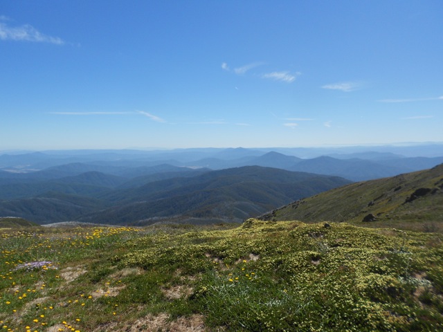
On the way to the start point, I passed a lookout and stopped for a photo. A sign at the lookout pointed out some features of the wilderness that I’d be passing in my travels. It was like looking at my hiking route from the side.

wpid-dscn1431-2013-01-17-08-38.jpg

I arrived at the beginning of Prosser Fire Trail and donning my pack, headed off into the wilderness.

There’s actually not a lot I can say about the trail. It’s fairly wide and like all fire trails, is designed to allow access for 4WD vehicles into the wilderness in event of a fire. On that note, there are plentiful fires going on throughout New South Wales at the moment, but just not here – I did make sure to check before coming.

wpid-dscn1437-2013-01-17-08-38.jpg

A lot of the 20.5km of today’s walk is climbing and I’m well used to that. The trail meanders – a word I have tried to put in every post so far – through the wilderness, ascending and descending, and crossing the occasional creek.

wpid-dscn1438-2013-01-17-08-38.jpg

The entire day I’m surrounded by forest, so there’s not much to see. I’m constantly hounded by horse flies that try to bite when I stop for breaks. There are now plentiful dead March Flies littered around the area no doubt providing a food source for the ant populations.

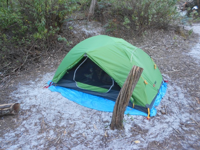
At the end of the day, I arrive at a large grassy patch beside Ring Creek and set up for the night.

Day 2 – Ring Creek to Humes Crossing
Unlike yesterday, most of today is down hill. I have the option to climb Bogong Mountain, but it would mean an hour of bush bashing and with 21km ahead of me, I decided not to. While this may have led to some good views of the surrounding forests, it was also forecast to be hot today, and after the last time, I didn’t want to push it.

Again, as per yesterday, there’s not much to be said about the trail. While I was no longer on the Prosser Fire Trail, I was on another fire trail and it looked pretty much the same.

wpid-dscn1440-2013-01-17-08-38.jpg

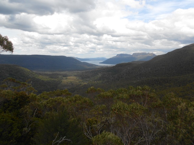
It wasn’t until the final five kilometres that the views began and they were the reason I’d decided on this hike. Looking down off the mountains you see Blowering Reservoir, a beautiful stretch of lake, that while fairly thin, stretches off to either side. The views are minimal at first, the reservoir seen through the trees, but as I descended they got better.

wpid-dscn1444-2013-01-17-08-38.jpg

There’s a catch though… the trail descends very steeply for several kilometres. Normally this wouldn’t be an issue but the surface is light scree over hard dirt. This meant every step had to be carefully made else an uncontrolled slip down the steep trail. This is definitely a place where hiking poles come in handy. The descent took me down 800m steeply, so it was a slow process but with growing views.

wpid-dscn1445-2013-01-17-08-38.jpg

As I broke the tree line I headed out onto dry grassy plains for the last couple of kilometres. But without the shelter of the trees, I began to feel the heat of the day. As I came down, I crossed paths with several groups of kangaroos. After a rest, I made it to the road and began walking towards my van, which was only 27km away. The heat of the bitumen added to that of the day, plus the one thing you don’t notice when driving…roadkilled kangaroo stinks, and there are plenty of them. I did see an Emu crossing the road, though. First time I’ve seen one in the wild. Of course, then I came to an ‘Emu Crossing’ road sign…

wpid-dscn1448-2013-01-17-08-38.jpg

After about 2km – walking on bitumen is fairly speedy – I was picked up and dropped off at The Pointy Brick.

So, here ends my South East Australian adventure. Next, I’m taking a well deserved rest while I wrap up things here in Australia and sell the Pointy Brick. Then it’s off to New Zealand for a couple of weeks before delving into South America, to begin the next leg of my adventure.

Until then,

The Lone Trail Wanderer

Mt Bogong Big River Circuit – Alpine National Park – Central Victoria

Alpine National Park is in the Central Victorian Highlands and is a well known Victorian skiing area. Mt Bogong is the tallest mountain in Victoria at just under 2000m above sea level.

Day 1 – Watchbed Creek Trailhead to Cole Cleve Memorial Hut
This morning I drove, from where I’d been resting for a few days at Mt Beauty (a township not a mountain), up to the Bogong High Plains and Watchbed Creek Trailhead. The Trailhead is about 1500m from the locked gate that is the beginning of the hike. I parked down the bottom as I didn’t deem the road suitable of the Pointy Brick.

wpid-dscn1380-2013-01-12-14-161.jpg

I was preparing to walk up the track and add the 1.5km to the already 20.5km for the day when an old lady drove up. She asked about the condition of the road and telling me how she used to come here years ago. She decided to drive it and offered to give me a lift.

From the gate, the trail walks out across the grassy high plains gently climbing to a point where it meets the Australian Alps Walking Trail. The AAWT, as it’s known, is a 650km long trail starting in lower Victoria and crossing all of the country’s highest areas to its end point near Canberra. I might do that another time. Maybe.

wpid-dscn1382-2013-01-12-14-161.jpg

Since the highland is above the tree line, the knolls and knobs are the mountains. Sadly, this makes them not as impressive as the rocky Tasmanian mountains. The trail climbed gently through the mountains with the distant sets of rolling mountains coming into view from time to time in all directions. The track is fairly easy to follow as it’s a 4WD track cut across the grass. The side tracks, of which there are plenty, are harder to see. Along the side of the track are snow posts each 3 metres tall.

wpid-dscn1387-2013-01-12-14-161.jpg

At a junction the track separates and I follow the less defined one. The other is my return track in a couple of days. After a couple of kilometres the trail heads below the tree line and shortly after I arrive at Roper Hut. The hut is surrounded in the white Snow Gum trees, their high branches standing white against the surrounding greenery. The hut itself was burnt down in the 2003 fires, and has been rebuilt. It looks new on the inside.

wpid-dscn1388-2013-01-12-14-161.jpg

The trail from here climbs steeply down 800 metres…

wpid-dscn1392-2013-01-12-14-16.jpg

…to Big River, which is probably a lot bigger during wetter seasons, where I stopped for lunch in preparation for the 800 metre climb on the other side back up the mountain.

wpid-dscn1393-2013-01-12-14-16.jpg

While the climbing was hard, it wasn’t too torturous but did seem to go on until 90 minutes later I arrived at the top and a junction. The AAWT went one way and I went the other to Cole Cleve Memorial Hut, another well set up hut, this one even had running water, a shower and a connecter to enhance your cellphone reception. This far up, I was expecting to be alone, but there were 3 other groups here.

Day 2 – Cole Cleve Memorial Hut to Big River Ford
While it was slightly cold on the highlands overnight, nothing a pair of socks couldn’t fix.

Today’s walk begins with a steep climb up to Mt Bogong, but as it’s above the tree line the time goes past quickly because you can see how much further you have to go.

Following the line of snow poles, I made my way up the mountain. Climbing in the highlands doesn’t have the same grandeur as some other places.

wpid-dscn1398-2013-01-12-14-16.jpg

Yes, I was climbing the tallest mountain in Victoria, but it felt more like I’d just strolled to the top of the neighbourhood grassy hill. There are no rocky fingers or parapets, just a grassy knoll high above everything else. Yup, that’s the high point…

wpid-dscn1406-2013-01-12-14-16.jpg

At the top of Mt Bogong is a giant cairn and 360 degree views.

wpid-dscn1410-2013-01-12-14-16.jpg

The views are awesome, lines and lines of mountains in all directions…

wpid-dscn1411-2013-01-12-14-16.jpg

and one large valley where sits the township of Mt Beauty.

wpid-dscn1408-2013-01-12-14-16.jpg

I crossed Hooker Plateau and found a spot for lunch looking along the valley. Then I was off again. The only way down is along Quartz Ridge, and awesome rocky spine. This was the fun part of the day with a deep gully on either side. I climbed along it cautiously.

wpid-dscn1419-2013-01-12-14-16.jpg

A few hundred metres later I broke the tree line and followed the trail down through the Snow Gums at times feeling like I was walking in a tree graveyard, the white fingers sticking up with growth around the base.

wpid-dscn1423-2013-01-12-14-16.jpg

A couple of tree covered knolls later I came to a junction and followed it for a kilometre to the Big River Fire Trail I’d left yesterday (when I headed to Roper Hut). Another kilometre downhill I came to the Big River at a ford about 8km along from yesterday’s crossing. The fire trail continued on the other side, but there was an open patch of ground that I used as a camping spot. Unlike Cole Cleve Memorial hut, there’s nothing here other than a flattened area of ground and a fire pit. Not even a toilet. I set up the tent and then went down for a dip in the icy river.

Day 3 – Big River Ford to Watchbed Creek Trailhead.
From the ford, the fire trail heads up at a constant slope up to the junction where I left it two days ago. Most of the walk was along the side of the mountains, meandering their way slowly up towards the tree line.

wpid-dscn1426-2013-01-12-14-16.jpg

Once at the junction, it was another 2 and a half hours retracing my steps back across the highlands until I arrived at the locked gate. This time there was no old lady to drive me, so I walked down to The Pointy Brick.

While the hike wasn’t as grand as others I’ve done, I still felt like I achieved a feat. Next, after a couple of days off, I go to the Kosciusko National Park, home of the tallest mountain in Australia, in the highlands of New South Wales. Mt Kosciusko is actually at the southern end of the National Park, but as I’ve already climbed it twice, I’m walking an area called the Bogong Wilderness at the northern end. This is the last hike of my South East Australian adventure, then after a short break, I head to Argentina to continue my travels.

The Lone Trail Wanderer.

Bachan Caves – Snowy River National Park

As a planned rest stop after Wilsons Promontory I stopped off at Bachan to check out the caves. I hadn’t organised adventure caving, so was going to just do a standard tour.

There are two cave tours at Buchan. They were discovered in the late 1800s when looking for cave systems to match the tourism of New South Wales.

Both tours had a full compliment of 25 on them, so were rather busy and noisy.

The Fairy Cave

Roof formations:
wpid-dscn1272-2013-01-12-14-09.jpg

Columns forming:
wpid-dscn1286-2013-01-12-14-09.jpg

Stalactite garden:
wpid-dscn1290-2013-01-12-14-09.jpg

Stone ribbons… With a light on the other side they can be seen through. Also called bacon strips.
wpid-dscn1303-2013-01-12-14-09.jpg

A frisky floor:
wpid-dscn1305-2013-01-12-14-09.jpg

The Royal Cave

Rock ears:
wpid-dscn1332-2013-01-12-14-09.jpg

Rock straws forming:
wpid-dscn1341-2013-01-12-14-09.jpg

Pure calcium carbonate – ancient fossils – form the wax coloured formations:
wpid-dscn1342-2013-01-12-14-09.jpg

Crystal structures:
wpid-dscn1356-2013-01-12-14-09.jpg

Redness means iron deposits:
wpid-dscn1374-2013-01-12-14-09.jpg

Next, I’m off to Mt Beauty for a couple of days of rest before climbing Mt Bogong – tallest mountain in Victoria – on the Bogong high plains.

The Cave Wanderer

Wilsons Promontory – Victoria

Wilsons Promontory is the southern most tip of mainland Australia and is also known as the South-East Cape. Located about 200km south east of Melbourne, it’s a common holiday destination. In fact, it’s so popular, each year there’s a ballot for the many camping spots at Tidal River, the township on The Prom.

wpid-dscn1209-2013-01-12-12-50.jpg

There are several walking tracks around The Prom on both the north and south sides. I’ll be walking the south side, merging two 2-day hikes into a 3-day one.

Day 1 – Telegraph Saddle to Little Waterloo Bay
I parked The Pointy Brick in the Overnight Hiker’s car park just outside Tidal River and prepared for the walk. A shuttle bus leaves Tidal River via the car park every 15 minutes, so when I was ready, I waited and was transported up the hill to Oberon car park at Telegraph Saddle.

Originally, I was going to walk across The Prom to Sealer’s Cove and around the bay working my way to Little Waterloo Bay, but since the floods of May 2011 – 19 months ago – the track has been closed. I discovered this during the week before and planned accordingly although this meant my first day was shorter and easier.

I headed down the centre of the southern end of The Prom via a gravel road. The road continues all the way to the Lighthouse, which is tomorrow’s lunch destination. I walked along the road gently downhill for about 6km through the mountains.

wpid-dscn1213-2013-01-12-12-50.jpg

The mountains here are different to those of Tasmania, they’re mainly tree covered and those that aren’t are large smooth boulder covered mounds. In fact, one of the mountains is called Boulder Mountain.

The turn off to Waterloo Bay is a sandy track that meanders gently through a gap in the mountains and past a tree covered rocky outcrop called The Mussolini Rocks, but I don’t see the likeness.

wpid-dscn1216-2013-01-12-12-50.jpg

Eventually the track arrived at Waterloo Bay – a beach of pristine white sands and azure blue water.

wpid-dscn1219-2013-01-12-12-50.jpg

Little Waterloo Bay is a kilometre away on the other side of a jutting rocky outcrop. When I arrived, I discovered many people were already here. I found a spot, set up my tent and went to the beach where I sat reading on a set of boulders.

wpid-dscn1226-2013-01-12-12-50.jpg

Day 2 – Little Waterloo Bay to Roaring Meg
Many people had departed before me this morning, most heading around the coast towards Sealer’s Cove (the cove isn’t closed, only the trail to it from Telegraph Saddle).

I walked back to the junction and then along the beach for a kilometre. Sand is perhaps one of the hardest surfaces to walk on and it’s slow going. At the end of the beach the trail headed up the mountain on a sandy path. The constant climbing was a change from none at all yesterday. There were a couple of good vantage points as I walked.

wpid-dscn1227-2013-01-12-12-50.jpg

At the top of the mountain the trail flattened out giving some good views out to the south and the small rocky islands in the distance.

wpid-dscn1232-2013-01-12-12-50.jpg

I rested on a large smooth boulder before heading off again, with my aim to be at the lighthouse by lunchtime. The trail began slowly downhill before climbing again around the sides of two other mountains. It cut through the forest and along a steep cliff line before arriving at the junction to the lighthouse.

I hid my pack and with day pack I made my way downhill towards a set of Remarkable Rocks similar to those I’d seen on Kangaroo Island.

wpid-dscn1237-2013-01-12-12-50.jpg

To get to the lighthouse, there’s a very steep concrete road which was used to transport supplies from the beach below. You can book to stay at the lighthouse, but I hadn’t so was just visiting. While I was there, I ran into the ranger who offered me a jug of ice water! Real treated water and ice, it’s almost like having a pub on the trail, just without beer.

wpid-dscn1250-2013-01-12-12-50.jpg

After lunch, I returned to my pack and continued on. For the first hour, I climbed around the mountains at the southern edge of The Prom working my way up to the plateau. After a couple of flat kilometres, there was a series of steep ups and downs before finally crossing a stream via a wooden bridge and into Roaring Meg, a two level camping area.

I set up my tent at the bottom near the stream before being invited for a mug of tea with a couple of older gents who were already camping.

Day 3 – Roaring Meg to Tidal River
Today was forecast to be a hot one, so I was glad my route took me via Oberon Bay beach. The trail headed me briefly uphill before it met the road and then wound its way back to the junction I’d left to get to Waterloo Bay.

On the way down from the mountains, I came across a foot long grass snake in the middle of the road. I stopped for a brief chat as it slithered across.

wpid-dscn1256-2013-01-12-12-50.jpg

The heat was already in the air as I arrived at Halfway Hut and decided to stop for morning tea. I was sitting on a log at the side of an empty campsite when I looked up to see a metre long Tiger Snake slithering not a metre away. I, of course, followed it but it went into the brush before I could get a photo. Snakes aren’t scary and they generally only bite as a defensive measure, usually when you stand on them. There’s a trick to snakes, don’t stand on them.

wpid-dscn1259-2013-01-12-12-50.jpg

Twenty minutes later I came to the turn off and headed west towards Oberon Bay. The road turned to sand and became hard going. Thankfully there were plentiful tree covered areas for me to stop in the 5km to the beach as it was starting to become very hot.

wpid-dscn1264-2013-01-12-12-50.jpg

At the end of the trail was the beach, not as picturesque as Waterloo Bay, but it was water. I walked 500m to the end before stripping off and getting in. The water was beautiful but by the time I got back to my clothes and dressed I was sweating again. I ate a quick lunch before setting off on the final 7km around the bays to town.

By now, the heat was draining as I reached Little Oberon Bay and crossed it. On the far end, there’s a dune to climb to get back to the trail. The effort took it from me and I had to rest at the end, almost throwing up from the over exertion in the heat. It was only 4km to go and I discovered my water was hot. I sat in some shade at the top of the dune for about 30 minutes trying to dry off and recover. When I was ready, I headed on again. There was more climbing to be done before the end and I dragged myself 500m at a time before having to stop for a rest and cool off.

wpid-dscn1267-2013-01-12-12-50.jpg

I came around the point and could see Norman Beach in front of Tidal River which gave me hope, so I staggered on. I stopped once before the beach, once at the beach and once on the way to the car park. I was relieved when I finally got to the Pointy Brick. After changing, I headed to Tidal River for a cold drink, and ice block and then a swim in the sea.

It turned out to be 44 degrees that day. I decided to take a few days off before my next hike – Mt Bogong and Big River in the Central Victorian Highlands.

The Lone Trail Wanderer.

Overland Track Afterword – The Huts of the Overland Track

While I was planning for the Overland Track I had trouble finding collective information about the huts and camping grounds on the trail. Some I didn’t go to so don’t have any information on. Most other huts are for emergency only.

Overall, All Main Huts:

  • Sleep at least 24
  • Have untreated tank water
  • Have one composting toilet (usually two)
  • NO TOILETS HAVE TOILET PAPER (bring your own)
  • NO RUBBISH BINS PROVIDED (Take your rubbish with you)
  • Have plentiful camping spots for tents
  • Have gas/coal heaters for cooler times (some only work at temps below 10 degrees)
  • Have cooking tables inside the hut
  • Have bookable group camping platforms
  • Have a no open fire policy

Camp 1: Waterfall Valley
There are two huts at Waterfall valley:

Old Hut

  • Is 100m from New Hut.
  • Sleeps 8: two double bunks each sleeping two
  • Has a separate toilet 50m further away
  • No tank water
  • Has Group camping platforms above the waterfall
  • Most camping is on the grass around the hut

New Hut

  • Sleeps 24: 2 platform bunks, each platform sleeps 6
  • There are two tables and 2 cooking benches
  • Plenty of room for sleepers on the floor in wet weather
  • Water tanks
  • Twin externally located composting toilets
  • Bed platforms are in same room as cooking area
  • Gas heater
  • Separate room for wet weather gear

Camp 2: Lake Windemere

  • There is only one hut
  • Sleeps 24. 4 double bunks and 1 quad bunk
  • Sleeping room is separate from cooking room
  • Gas heater
  • 4 cooking tables
  • Water tanks
  • Has Group camping platforms
  • Twin externally located composting toilets
  • Camping is on platforms only
  • Small amount of room for sleeping on floor where necessary

Camp 3: Pelion Plains

  • Sleeps 60 (theoretically 72)
  • 6 separate sleeping rooms
  • 3 double bunks in each room (theoretically 12 people per room)
  • Bedrooms are separated from each other and cooking area by doors
  • 6 cooking tables in massive room
  • Cooking room can be separated in half by roller door
  • 2 gas heaters
  • Water Tanks
  • Has Group camping platforms
  • Twin externally located composting toilets
  • Camping is on platforms only
  • Huge amount of room for sleeping on floor where necessary

Camp 4: Kia Ora hut

  • Sleeps 24: Has 2 platform bunks, each platform sleeps 6
  • Bed platforms are in same room as cooking area
  • Coal heater
  • 2 cooking tables
  • Water tanks
  • Has Group camping platforms
  • Twin externally located composting toilets
  • Camping is on platforms only
  • Very small amount of room for sleeping on floor where necessary

Emergency Hut: Du Cane Hut

  • Sleeps 12: Has platform bunks, each platform sleeps 6
  • Bed platforms are in same room as cooking area
  • Single externally located composting toilets
  • Very small amount of room for sleeping on floor where necessary

Camp 5: Bert Nichols hut

  • Sleeps 36: 3 rooms each with platform bunk. Platforms sleep 6
  • Bedrooms closed by doors
  • Cooking room has 5 cooking tables and two cooking benches
  • Separate room for wet weather gears
  • 2 water tanks
  • Has Group camping platforms
  • Twin externally located composting toilets
  • Camping is on platforms only
  • Coal heater
  • Huge amount of room for sleeping on floor where necessary

Side Camp: Pine Valley

  • Sleeps 24: 2 platform bunks, each platform sleeps 6
  • Bed platforms are in same room as cooking area
  • Coal heater
  • 2 cooking tables
  • Water tanks
  • Single externally located composting toilet
  • Camping is on grass only
  • Very small amount of room for sleeping on floor where necessary

Camp 6: Kia Ora hut

  • Sleeps 24: 2 platform bunks, each platform sleeps 6
  • Bed platforms are in same room as cooking area
  • Coal heater
  • 1 cooking table
  • Water tanks
  • Externally located composting toilets
  • Camping is on platforms only
  • Very small amount of room for sleeping on floor where necessary
  • Radio to communicate with Lake St Clair Information Centre ferry
  • Has resident rats

Camp 6.5: Echo Point Hut

  • Sleeps 8: Has two double bunks each sleeping two
  • Unsure if toilet
  • Unsure if tank water
  • Camping is on sand at side of lake
  • Has resident rats

I hope this is of some use to someone out there

Overland Track Day 7 – Pine Valley to Cynthia Bay

I’d planned to climb the Acropolis this morning – one of the last climbable mountain on the trail – but rain had fallen all night. My plans also had me staying on the trail one more day, but with the rain, I decided to walk out. So, packing the wet tent, I headed off across the pair of suspension bridges to the junction, then across a river…

wpid-dscn1199-2013-01-8-17-27.jpg

It did not take long to get to Narsassus Hut, where I’d planned to stay the night. I stopped for a bite of lunch then pushed on.

wpid-dscn1201-2013-01-8-17-27.jpg

The lake quickly came into view as I walked through the forest along its side, walking around large muddy patches as I went.

wpid-dscn1202-2013-01-8-17-27.jpg

Two hours on from Narsassus hut I came to Echo Point Hut, and called for the ferry. Half an hour later I stood on the wharf at the end of the Overland Track.

wpid-dscn1203-2013-01-8-17-27.jpg

It wasn’t how I’d intended to finish, but with the changeable nature of Tasmanian weather, it was for the best.

Afterwards, I enjoyed a hot shower and a steak dinner with the Brits as we chatted about our experiences.

Overall, I enjoyed the hike in all of its different parts, and while I’d have preferred more open spaces and less forests, I’d still recommend this hike to anyone wanting to get into the sport. It has something for everyone, beginners and experienced walkers, allowing you to chose the difficulty of most days as you go.

Next, I drive back across Tasmania, catch the ferry back to Melbourne and head to Wilsons Promontory, also know as the South-east Cape, the southernmost tip of Mainland Australia. There I’m back into my boots and hitting a three day trail.

The Lone Trail Wanderer.

Overland Track Day 6 – Windy Ridge to Pine Valley

Pine Valley isn’t officially part of the Overland Track but most people on the trail choose to walk there. It’s also a popular destination for one night visits, as it’s close to Cynthia Bay at the end of trail.

The walk to the junction was fairly flat and encased in forest. I walked with a british couple – Greg and Kim – to start with but after the junction that headed off the main trail, I went on alone making better time to the hut, and crossing a pair of suspension bridges on the way.

wpid-dscn1176-2013-01-8-17-12.jpg

On arrival I found the hut was very busy so, for the first time on the hike, I decided to pitch my tent. It was a nice day…why not. Once set up, I stopped for lunch as Annie from NT arrived. She pitched her tent next to mine and together, we decided to climb to a plateau known as the Labyrinth.

wpid-dscn1178-2013-01-8-17-12.jpg

The pair of us followed a vague trail through the tall gloomy rainforest until we came to the hill and began slowly climbing. We climbed up a steep and sometimes slippery rocky stream and across to the other side. The markers then ceased and we climbed through a thin but fairly obvious section of trail that seemed to climb forever. It’s easy to lose your sense of scale on a climb when you’re shrouded in trees. It’s far easier when you can see the top as you go.

We eventually arrive at the plateau and stopped for a break. Behind us, our first views of Lake Saint Clair, the end point of the adventure.

wpid-dscn1184-2013-01-8-17-12.jpg

Fifteen minutes later it began to rain. Yup, the first time I pitch a tent it decides to rain. We donned our rain jackets – which also serve as wind breakers – and continue on across the plateau following the plentiful cairns. The cairns led us deeper into the plateau where there are tales of a lady having gone missing some years earlier. They found her tent and pack, but no sign of her body. The cairns walked us past tarns…

wpid-dscn1185-2013-01-8-17-12.jpg

…and rocky outcrops alongside a ridge line known as the Parthenon. Beyond the ridge a mountain known as The Acropolis which I plan to climb tomorrow if the rain eases overnight.

wpid-dscn1197-2013-01-8-17-12.jpg

We picked our way along and then down into a small valley where the trail split and a sign pointed us either towards Lake Elysia or The Labyrinth Lookout. We headed along the trail towards the lookout and as it began to rain, we climbed the knoll following the cairns, some of them quite elaborately constructed.

wpid-dscn1189-2013-01-8-17-12.jpg

We followed the trail until we came to a giant cairn.

wpid-dscn1198-2013-01-8-17-12.jpg

Which gave good views of the lake and labyrinth.

wpid-1____dscn1194-2013-01-8-17-12.jpg

The Labyrinth gets its name from the many forested paths running through rocky areas of the plateau where tarns and lakes are scattered. I’m not sure how you could get lost, as simply climbing one of the many smooth rock mounds would give you a good view of the area, although perhaps in low cloud…

And with our own set of low clouds coming in, we decided to head back, although we were both keen to be covered and to pick our way in the gloom, but the clouds were not low enough.

We descended from the plateau slowly on the more slippery track and eventually made it to the bottom.

Tomorrow, as I mentioned, I plan to climb the Acropolis and then walk on to Narsussus hut on the shores of Lake St Clair.

The Lone Trail Wanderer

Overland Track Day 5 – Kia Ora to Windy Ridge

From this part of the hike onwards, much of the trail is through different types of forest: Rain forest, Myrtle forest and dry Euclypt Forests. I’ve hiked through plentiful forests in my travels and when compared to my preferred wide open spaces and mountain vistas, being constantly surrounded by trees instills a sense of being closed in. So, I wasn’t looking forward to this half of the trail as much as the first half.

wpid-dscn1154-2013-01-8-14-451.jpg

Then again, this stage of the hike is known as the waterfall walk, as there are several large waterfalls on side tracks. This part of the track also seemed to be the busiest. The first stop on the trail is Du Cane hut, an old hut on the trail belonging to an aged trapper that worked in this areas many decades ago.

wpid-dscn1156-2013-01-8-14-451.jpg

After a pause at the hut I continued along the trail. 30 minutes later I arrived at the junction to the first of the falls. There were already plentiful packs left at the junction, so I added mine to the group and headed down the long side trail to another junction.

wpid-dscn1158-2013-01-8-14-45.jpg

Then an easy walk to D’alton Falls…

wpid-dscn1159-2013-01-8-14-45.jpg

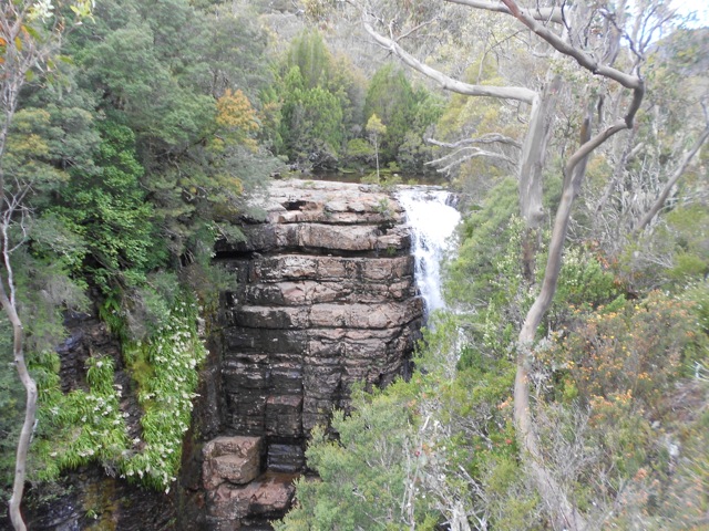
…and Fergusson Falls, where I had to climb down a rocky bank to get a better look.

wpid-dscn1171-2013-01-8-14-45.jpg

A further 30 minutes down the track, I came to the junction of Hartnell Falls – the largest` set of falls in the area. Unfortunately, there wasn’t a very easy view of the falls from the side, so I headed back to my pack and headed on.

wpid-dscn1174-2013-01-8-14-45.jpg

The rest of the day consisted of a climb through the forest up to Du Cane Gap past Falling Mountain, which you cannot see through the trees, then down again to Windy Ridge and the Bert Nichols hut. At the hut we discussed the reasoning behind the name Windy Ridge, but came to no firm conclusion since it’s not really a ridge and being immersed in forest, not really windy either.

I settled in for the evening, played a couple of games with my travelling companions and prepared for the walk tomorrow. I’m taking a side trail for the night to Pine Valley hut – a hut that is not actually on The Overland Track, but most people go there anyway.

The Lone Trail Wanderer

Overland Track Day 4 – Pelion to Kia Ora

Merry Christmas!

As I left the hut I stopped to have a chat with a Pademelon (like Wallabies only shorter and fatter) and its joey. You can almost hear them, ‘Ma, what’s that thing?’ ‘It’s a human, junior, just ignore it and it’ll go away.’

wpid-dscn1124-2013-01-8-14-001.jpg

While it started off a little cool and cloudy, it looks to burn of during the day. The walk to Kia Ora Hut today is only a short one. Kia Ora being a maori greeting, and the name was given because of a New Zealand member of one of the early expedition group across the plateau. The first two hours is through rainforest and climbs 300 metres over the course of 4km to Pelion Gap.

wpid-dscn1126-2013-01-8-14-001.jpg

Pelion Gap is the highest point of today’s hike and as you come out of the forest, you come to a large wooden platform. Climbing up to the east is the rocky topped Pelion East, a smaller version of Barn Bluff.

wpid-dscn1134-2013-01-8-14-001.jpg

But on the other side is Mt Doris, which is a short rocky mountain on the way to the real attraction, Mt Ossa, Tasmania’s Tallest mountain.

wpid-dscn1137-2013-01-8-14-001.jpg

I rested on the platform and had a snack in preparation for the climb. As I waited, several other groups arrived, including the Brits, the Victorians, Annie from NT and a Private hiking group. The Brits and Annie were ready to go when I was, so together we headed off up the side of Mt Dorris. The climb wasn’t hard, skirting around the summit to the saddle between the two mountains. As we crossed the area, the clouds started to clear from the mountain.

Climbing Mt Ossa is similar to climbing The Barn, although the rocky bouldering began a lot higher on Mt Ossa. We were barely a third of the way up when I saw someone running down, showin it’s not a difficult climb higher up. We continued climbing and stopped to chat to the guy. He told us that the views were disappointing and better on the way to the top.

wpid-dscn1140-2013-01-8-14-001.jpg

We reached the initial summit and realised that like Cradle Mountain, we had to climb down to climb up to the summit. When we finally crested the summit we were all pleasantly surprised. The clouds had cleared completely, and the top was a long flat area with a tarn on one side and a small area of snow on the other. After some photos in the snow I decided to phone my family to wish them a Merry Christmas. I hadn’t planned to be on the mountain on Christmas, it just kinda worked out that way.

wpid-dscn1141-2013-01-8-14-001.jpg

Unlike what the guy had said, the views from the top were the best I’ve seen on the walk. It was a 360 degree view…
wpid-img_1519-2013-01-8-14-00.jpg

…and the rows of mountains to the south were just amazing.

wpid-dscn1143-2013-01-8-14-00.jpg

Half an hour later, we all climbed down again. At the bottom we stopped for lunch before I again donned my pack and headed on alone. The short, hour long trip to Kia Ora was across the open valley surrounded by many mountains.

wpid-dscn1147-2013-01-8-14-00.jpg

Tomorrow I’m told is waterfall day…

The Lone Trail Wanderer

Overland Track Day 3 – Windermere Lake to Pelion

Today is the longest day of the hike at 17.5km. I set out early and began crossing some open moors on the now fairly standard boardwalk. Thankfully from time to time I got to walk on real ground – it makes you feel like you’re actually hiking!

Today is cold and the moors are surrounded by mountains, which gives it an awe inspiring feeling.
wpid-dscn1110-2013-01-7-14-121.jpg

I love great open areas with mountains near and close. it gives you the sense of size and just how small you are. The low cloud hanging around the mountains give that mysterious and powerful feeling. With the gentle drizzle I walked on, Mt Pelion West standing out ahead of me in its rocky glory.

wpid-dscn1109-2013-01-7-14-121.jpg

The moors roll on to a forest covered knoll. I picked my way through on rocky steps.

wpid-dscn1106-2013-01-7-14-121.jpg

On the other side the boardwalk continued again to the
Forth Valley lookout, down a glacial valley.

wpid-dscn1101-2013-01-7-14-121.jpg

The trail then heads downhill towards Frog Flats for some time crossing some areas of mud, including one extreme mud patch. Hikers here are instructed not to walk around these as it widens the patches and destroys the vegetation. Tree branches are often thrown into the mud to walk along and for the most part ensure you don’t get too muddy. The extreme patch however was just crazy. You couldn’t walk around as the mud stretched off to the sides as well. A branch lay half way across, but when I walked to the end of it my boot sunk in ankle deep. Thankfully for my boot cuffs, no mud went inside. I did eventually find a path around the mud and continued, with mud caked boots.

wpid-dscn1116-2013-01-7-14-121.jpg

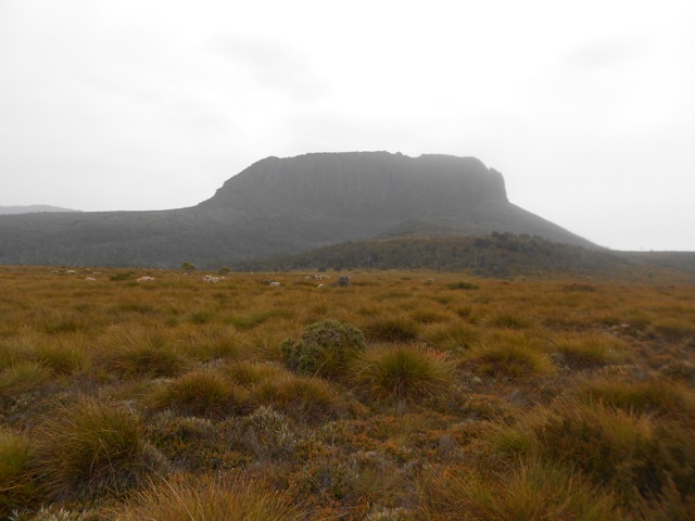
The trail descended and finally came to Frog flats for a few hundred metres of plains before the trees cover over again and the trail heads uphill along the muddy path. After a couple of kilometres I reached the Pelion plains under the awesome flat topped Mount Oakleigh. If it hadn’t been wet, I’d have climbed it, but alas I have to miss this one.

wpid-dscn1120-2013-01-7-14-121.jpg

Pelion Hut is a large one, sleeping 60. There is a side route onto the track for non-Overland Track hiking – you can be on the track for a single night without requiring a permit. With a hut so large, I managed to get a room to myself.

wpid-dscn1121-2013-01-7-14-121.jpg

Tomorrow, I’m off to Kia Ora.

The Lone Trail Wanderer