Snowdon and the Ranger Trail – Snowdonia National Park, Wales

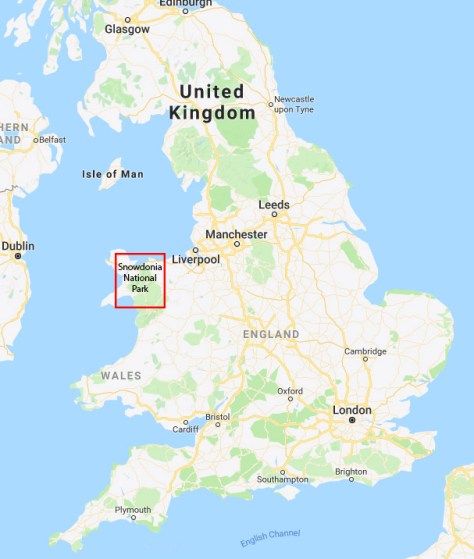
Snowdon is the tallest mountain in Wales and of all the British Isles south of Scotland. At 1085m above sea level, it’s not really that tall, but with the sharp ridges leading to it having claimed many deaths over the years, its height is nothing to be scoffed at. However, while there are dangerous routes up it, there is also a tourist route directly from Llanberis, which is why it is a popular climb. So, today I will be climbing it with 35+ people from my Meetup.com group, plus, no doubt many others thinking of doing the same.

When I woke this morning it was raining, Murphy’s Law considering the UK has had pristine weather for the past two months.

snowdon-2018-07-28-17-39.jpg

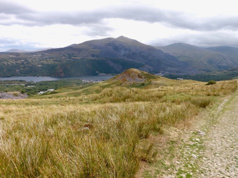
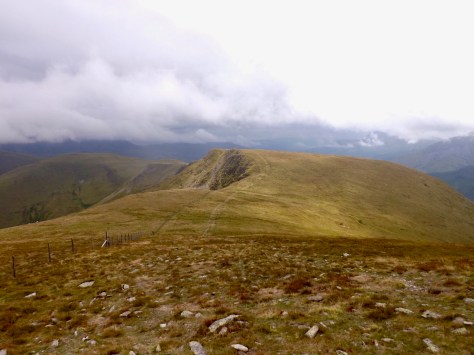
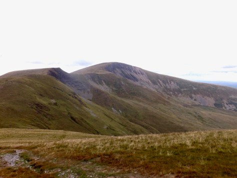
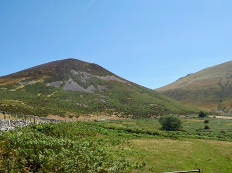
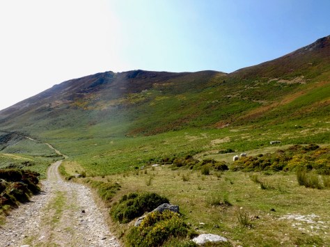
After breakfast, we all congregated outside in the cold preparing mentally for the climb ahead. And once we were ready, we began up the road I had come down the day before. This allowed me to get a morning shot of Moel Eilio, the main peak from yesterday’s hike.

dscf8983-2018-07-28-17-39.jpg

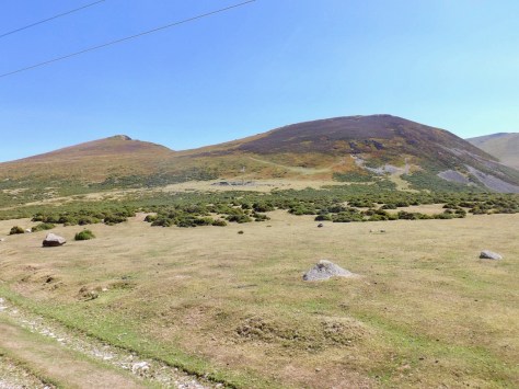
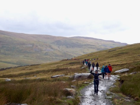
With a group this size, hiking becomes more of a social event, but I knew that would be the case before I signed up. With the wind buffeting us already, we continued to a gate on the side of the road and headed out across the slightly soggy grassy fields heading towards where the Snowdon train line meets its first stop. Ahead of us, Snowdon was ominously obscured by clouds.

dscf8986-2018-07-28-17-39.jpg

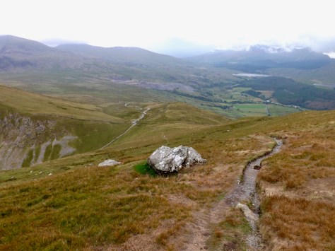
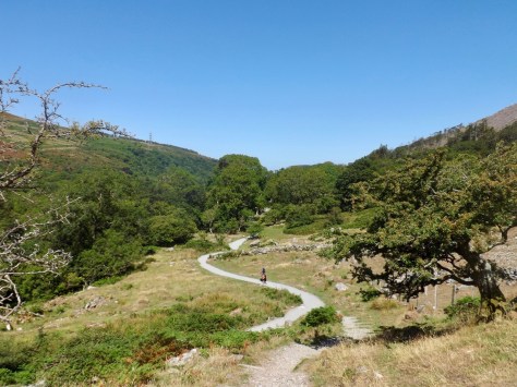
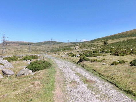
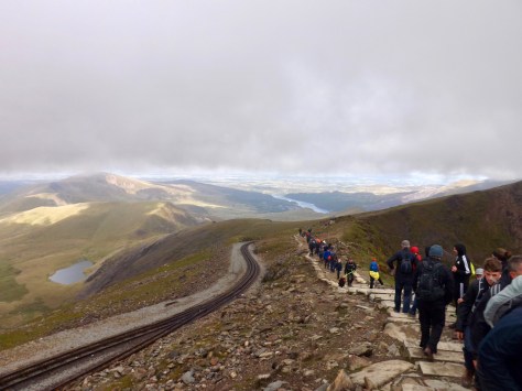
Once across the tracks, we climbed up the Llanberis Trail, the tourist route mentioned earlier. This trail is wide and is mainly laid with large flat stones or shale rock. And, it is what I call ‘Disneyland’ when looking up (or down) the trail lines of people can be seen climbing as if they were waiting in line for a ride. Here, looking back along the trail after a brief rain, with the Czech girl who would become my hiking partner for the day.

dscf8987-2018-07-28-17-39.jpg

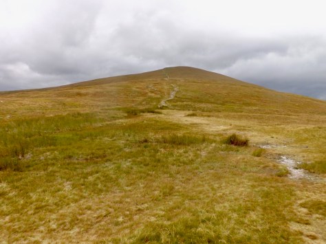
The climb was not difficult, with a steady climb from the beginning which can be progressed with a plodding walk. We fought the elements the entire time, with the wind gusting into our faces. We plugged away in our little groups along the trail, passing people both climbing and returning, including three walkers ‘driving’ RC 4x4s along the trail. We stopped briefly at Halfway House, a cafe at the midpoint of the walk, but it quickly grew cold, so we pushed on.

dscf8992-2018-07-28-17-39.jpg

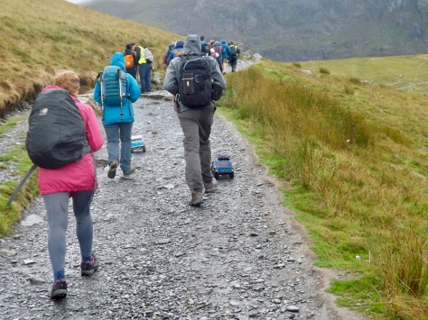
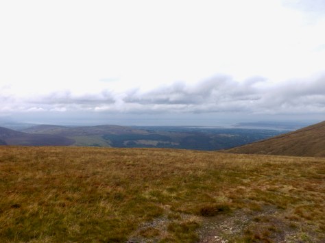
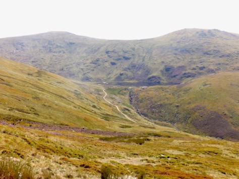
The next stage of the climb was more difficult, it began to rain briefly but thankfully not for long. The wind, however, seemed to pick up, tearing at our clothing, but we plodded on. People came and went from my small group, but my Czech walking partner and I kept pace. The climb grew steeper and colder as we went, but we pushed on at speed, the cold and howling wind winning over our slowly tiring legs. We pushed up past Clogwyn Station, the last train station before Summit Station, and looked out along a flat area with the small lake of Llyn Du r Arddu just hidden from our view.

dscf8994-2018-07-28-17-39.jpg

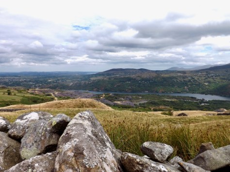
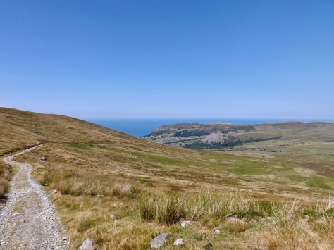
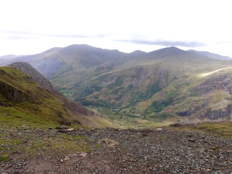
The wind picked up again as did the steepness, and at one point, the Czech girl, another girl and I formed a human chain so as not to be torn from the mountain. We pushed on and finally gained the top of the steep section, and under a thin train bridge. On the other side, there was some respite from the wind and good views along a valley called Cwm Glas Bach before the cold pushed us to continue. 1800m to go.

dscf8998-2018-07-28-17-39.jpg

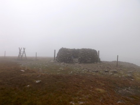
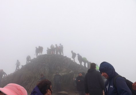
The grade became the steepest it had been, clouds began flowing over us giving everything a foggy look. We pushed on, with great gusts of wind flowing over us and we were forced to stop each time we felt the large blast coming. The steepness gave up a little, and the trail flattened out, but the wind seemed to grow stronger. We trudged on as we reached 1000m above sea level and the trail continued between a set of ragged rocks and the train tracks. The wind was at torturous levels, and deep in the cloud, with no idea how much further the trail went, it felt like we were walking forever. We struggled on for the last few hundred metres and finally arrived at the summit. The last couple of metres of a climb to the very top, we virtually crawled these last couple of steps, I hung onto my Czech companion to ensure she did not fly away.

dscf9001-2018-07-28-17-39.jpg

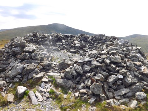
Near the top is the Summit Station with a cafe and gift store. When we entered, we found nearly a hundred people crammed inside the large area with an enormous window looking out to one side of the summit. We found a place to stand and ate the lunch the hostel had provided us. But as it was freezing even in the crowded room, we did not stay long and decided to head down again.

dscf9002-2018-07-28-17-39.jpg

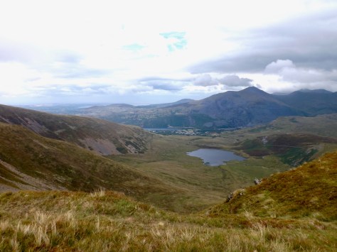
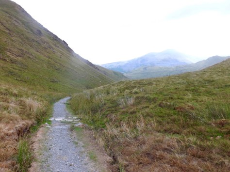
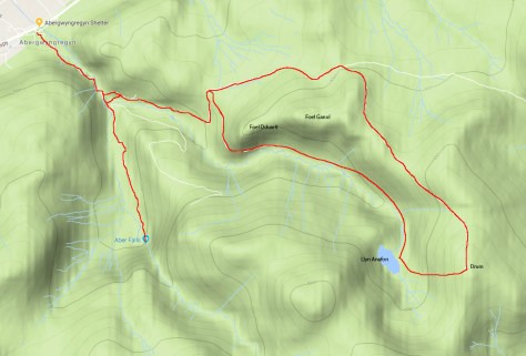
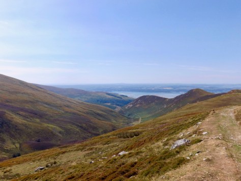
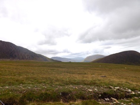
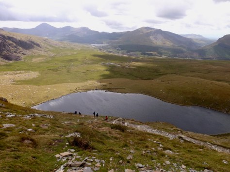
There are several ways down the mountain, and my walking partner and I decided to split from the group and follow the Ranger’s Trail. This cut beneath a range called the Clogwyn Coch and above the Lyyn Fyynnon-y-gwas reservoir. The trail led us down a rocky trail with the wind dragging us sideways, zig-zagging down towards this reservoir. There were fewer people on the path, so it felt more like being in the wilderness, and as we got to the bottom of the valley, the wind subsided, and we stopped for a rest.

dscf9003-2018-07-28-17-39.jpg

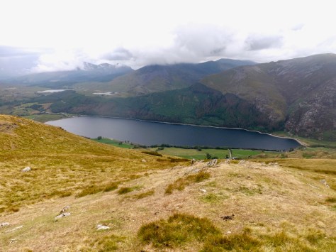
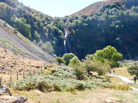
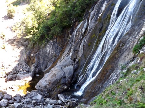
For the next 2km, we walked along a flat trail in this beautiful setting, with few people, until we came to the trail I had walked along at the end of my hike yesterday. Then for the final 4km back to the hostel, we saw no-one. This allowed us to have a long chat about things while enjoying the remainder of the walk, and to top it off, the sun finally emerged from the clouds.

dscf9008-2018-07-28-17-39.jpg

Overall, while it felt like a ‘Disneyland’ of a walk, it was still a hard slog all the way to the top, battling against the wind and occasional icy rain. Descending was easier and with good company, friendly conversation and amazing scenery, we arrived back at the hostel ready for showers and a relax.

Tomorrow, it’s back to London on the train.

Moel Eilio – Snowdonia National Park, Wales

This morning I packed up the little room I’d been staying in at Bangor University and headed for the bus stop for the  45 minutes ride to Llanberis (pronounced Clanberis). But I was late for the direct bus, so ended up finding an alternative route via Caernarfon. I arrived in Llanberis to find a classic adventure town with many adventure stores, pubs and cafes. I stopped off for lunch and read up on the today’s hike – Moel Eilio.

moeleilio-2018-07-28-17-39.jpg

After a coffee, I headed out and up a road near the hostel I’d be staying at later that evening. I followed a road up to the left and after a short climb stopped to take a photo of Snowdon, covered in clouds on the centre right of the below photo.

dscf8946-2018-07-28-17-39.jpg

The road ended at a series of ruined stone houses. I climbed a ladder-stile and heading up into grassy fields with small groups of sheep. I walked along a vehicle track, called Bwlch y Groes, as it rose towards some disused quarries. From here there are great views down on Lyn Padarn (the lake beside Llanberis), the adventure town hidden by the small mound of Ty n y Mynydd. You have to love these Welsh names.

dscf8947-2018-07-28-17-39.jpg

Near here there was once an old Iron Age settlement and a hill fort, but little remained of either. The other end of Lyn Padarn.

dscf8951-2018-07-28-17-39.jpg

I then peered at the peak of Moel Eilio up ahead, still a decent climb away and plodded on.

dscf8954-2018-07-28-17-39.jpg

From a distance, Moel Eilio does not look very steep, but as I grew closer, the main peak pushed up ahead. I stopped at the base for a brief rest and saw the only other walker I had seen so far. I began the steep climb, pausing here and there for a quick breather before continuing. About halfway up the steep climb, it started to rain. This pushed me to get to the top as quickly as I could, which was now covered in low clouds. When I got to the top, the rain was coming harder, and I found a stone shelter similar to that which I had seen at the top of the Drum the day before, although the walls of this one were taller. As the rain seemed to be blown across the top of Moel Eilio, when I ducked into the roofless shelter, I was fairly well protected from it.

dscf8959-2018-07-28-17-39.jpg

I sat for a while to wait out the rain and to rest. But when it didn’t seem ready to stop anytime soon, I decided to push on and hope at lower altitudes it would clear up. In the mist, I followed the trail to the edge of the peak and down the other side. It did not take long to come out of the cloud and to see the path crossing more hills ahead, one unnamed and two others, Foel Gron and Foel Goch, in the distance.

dscf8967-2018-07-28-17-39.jpg

As I climbed down, off to my right, I could see the Menai Straight splitting the island of Anglesea from the Welsh mainland, its mouth opening into the Irish Sea.

dscf8971-2018-07-28-17-39.jpg

Then from the top of the unnamed hill, I got a better look along the valley to Llanberis and Llyn Padarn, with the smaller Llyn Dwythwch at the base of the hills. I continued on up Foel Gron, a fair climb but nothing too strenuous.

dscf8973-2018-07-28-17-39.jpg

At the top, I could see down the other side of the range to Llyn Cwellyn reservoir and the small mountains on the other side.

dscf8978-2018-07-28-17-39.jpg

The final climb up Foel Goch gave great retrospective views across at Moel Eilio, now no longer covered in cloud.

dscf8979-2018-07-28-17-39.jpg

The trail then cut steeply down a trail to the fairly pronounced Ranger Trail. I made my way deftly down the steep hill to eventually arrive at the Ranger Trail where I passed a French man who was heading to Llanberis.

dscf8980-2018-07-28-17-39.jpg

I followed the trail for four kilometres along the side of the valley. But after ten minutes or so, it began to rain. So, on went, the pack cover and I marched on to finally arrive soaked and ready for a shower.

dscf8981-2018-07-28-17-39.jpg

Other than the two spots of rain during the walk, the Moel Eilio could be described as a hidden gem. It is not as high as many of the mountain walks around it, but still had plenty of excellent views, began and finished at Llanberis, and was mostly empty, with tourists opting for the larger Snowdon nearby.

After a shower, I drank a refreshing cider. Then once more of my group arrived, we headed down into Llanberis for dinner and a few more drinks.

Tomorrow, we hit up the big one. Snowdon.

Aber Falls and Drum – Snowdonia National Park, Wales

This week I am in Snowdonia National Park, Northern Wales. But, instead of doing a grand circuit, as I usually do, I have three separate day-walks at the northern end of the national park.

snowdonia-2018-07-28-17-39.jpg

Today, I merged two smaller walks into one longer one to give me a full day of walking.

Aber Falls – 3 miles / 4.8 km

The first walk of the day, to the Aber Falls, is probably one of the easier walks in Snowdonia. It is also a popular tourist walk, so I was expecting plenty of families.

aberfallsanddrum-2018-07-28-17-39.jpg

I headed out from the cafe in the brilliant midday sun, along a short path to a road and on the small village roads for about a kilometre to the Aber Falls carpark. As I had expected, the carpark was full, and from what I could tell, there was another carpark nearby which was the same. As my goal is to get away from people and get into the wilderness, I quick marched along the wide shingle and dirt trail, passing picnic benches and groups of families hanging out in the sun.

With temperatures in the high 30s back in London, I was glad it was cooler up here, although it was still set to be a scorcher of a day in the mid-20s. I marched quickly along the trail passing through small clumps of trees on a path that rose gently yet remained flat enough for wheelchairs.

dscf8912-2018-07-28-17-39.jpg

After another kilometre and a half, I finally climbed a rise and saw the thin ribbon waterfall. It has been hot and dry for many weeks here in the UK, so the waterfall was less than it should be.

dscf8911-2018-07-28-17-39.jpg

I walked on for several minutes until I came to the base of the falls. Groups of people sat along the stream leading away from the falls, enjoying the weather and cool water. When I got to the base, I climbed to the far side for a closer look. Unfortunately, because the sun was right above the cliffs, it was impossible to get a good photo of the entire waterfall.

dscf8915-2018-07-28-17-39.jpg

Then after a few minutes rest in the shade, I quick marched my way back along the trail, stopping to chat briefly to an older gentleman in a mobility scooter before arriving back at the car park.

Drum and Llyn Anafon – 6.75 miles / 10.7km

From the Aber Falls car park, I walked along a sometimes steep thin road for 2 km until I came to another carpark, this one empty. An empty car park is a good sign, there will be few people on the trail. I rested for lunch on a large rock in the sun as there was no shelter. Above me was the colourful peak of Foel Dduartl, my return trail obvious across its front.

dscf8919-2018-07-28-17-39.jpg

I climbed a rocky trail for several hundred metres towards a set of power lines and a rock fence. I cut right at the North Wales Path and followed the power lines steadily uphill. The peaks of Foel Dduartl and Foel Ganol to my right were emblazoned with autumn colours even though it felt most decidedly summer.

dscf8921-2018-07-28-17-39.jpg

The path continued steadily uphill for more than a kilometre under the power lines. If it were not for those power lines, it would feel decidedly wilderness. Close enough for me.

dscf8923-2018-07-28-17-39.jpg

Off to my left, as I climbed, the Irish Sea in all its blueness.

dscf8925-2018-07-28-17-39.jpg

After 2km, I turned right onto a wide and easy trail that again continued the long climb this time fairly directly to Drum (pronounced Drim) in the distance. Here I passed the only other walker I would see on this trail. I headed further on the trail as it grew steeper but nothing too strenuous, the sun beating down on me as I walked. To my right, the Llyn Anafon reservoir.

dscf8926-2018-07-28-17-39.jpg

While an open sky is excellent for views, the sun is not your friend on a summer hike. The direct sunlight can be draining, and today was no exception. As I neared the summit of Drum, the trail grew steeper, and I had to push myself step after step to climb higher. Eventually, I made it to the top and stared back at the valley below, the Irish Sea beyond.

dscf8927-2018-07-28-17-39.jpg

I crossed a ladder stile and took in the view from the other side of Drum down to the sea.

dscf8932-2018-07-28-17-39.jpg

At the top is a round cairn shelter, although it didn’t look like a pleasant place to sit in the heat. So I found a soft grassy patch on the far side and lay down for a ten-minute nap.

dscf8929-2018-07-28-17-39.jpg

When I got up again, I was besieged by a horde of flies which seemed to buzz around behind me. I flapped them away as best I could, but they kept returning. So, I donned my pack and hat, crossed the ladder stile and headed off.

The initial part of my return hike did not actually follow a trail down the hill, but simply struck off down towards Llyn Anafon reservoir, aiming for the broad service track. Thankfully from the dry weather, the ground was not soggy. I edged my way down the side of the hill for several hundred metres, zigzagging back and forth to avoid sheep until I eventually arrived at the lake.

dscf8937-2018-07-28-17-39.jpg

My descent from there was fairly steady, following the outlet of the reservoir – Afon Anafon – beneath the peaks I had climbed on the way up. The colours still stood out as I went, almost fading from deep green to the autumn colours as I headed towards the base of Foel Dduartl.

dscf8942-2018-07-28-17-39.jpg

And then it was onto the blue of the Irish Sea again as I rounded the base of the peak and returned to the empty carpark. I stopped for a brief rest before marching the 3km back to the bus stop at Abergwyngregyn. Then it was back to Bangor, where I made my way to the local Wetherspoons for a well-deserved cider.

img_5052-2018-07-28-17-39.jpg

Overall, the Aber Falls and Drum were a good pair of walks to add together on a sun-drenched day. Tomorrow, I head by bus to Llanberis and do a smaller local circuit before my group arrives to climb Snowdon.