Boudicca Way, Norfolk, England – Part 1

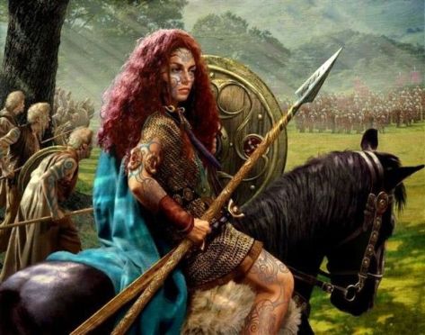
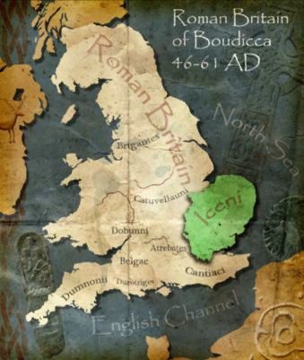
In 60AD, Boudicca (bow-de-see-ya) was a warrior queen of an ancient Celtic tribe in the region now known as East Anglia. After her husband’s death, her lands were usurped by the Roman emperor Nero, she was flogged, and her daughters raped. From this, she was chosen to lead an uprising against the Roman army, which left 80 thousand Roman soldiers dead and laid waste to three cities including Londinium, which would eventually become London.

b5d9950fe8635eb3396e543cf1732480-warrior-queen-woman-warrior-2017-07-27-14-35.jpg

The Boudicca Way is a three day, 58km/36-mile hike that crosses the area where Boudicca lived, Iceni. It starts in the city of Norwich, England’s second largest city until the Industrial Revolution, to the market town of Diss.

celtmap-2017-07-27-14-35.jpg

Day 1 – Norwich to Saxlingham Green – 22.75km (14.1miles)

It was an early start in London to get ready. I’d packed the night before, so I just needed to have breakfast and get to Liverpool Street Station for my train to Norwich.

After three hours I arrived and spent some time getting water and repacking. Then I headed out along the path following the app I’d downloaded, which would prove invaluable during my trip.

pastedgraphic-2017-07-27-14-35.png

The first hour of the hike was spent getting out of the city, crossing rivers and walking streets with endless cars everywhere. Finally, I passed through Trouse Newton and along a street that grew steadily thinner as I went. Towards the end of that road, I crossed a paddock where a henge had been. It’s now empty but for a circle of cleared ground.

dscf8465-2017-07-27-14-35.jpg

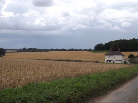
I followed another road and after crossing the A47 highway the trail went rural. I followed it through cropland freshly sprinkled with rain from earlier that morning.

dscf8466-2017-07-27-14-35.jpg

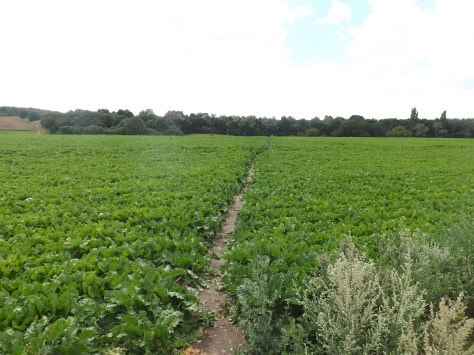
On the far side of the field, my feet were soaked from the wet plants. The worst was yet to come, as the trail lead alongside wheat fields it was thickly scattered with nettles, prickles and thorn bushes. Perhaps I should rethink always wearing shorts and would recommend anyone doing this walk to wear long pants. The sting of nettles goes away fairly quickly, but the scratches from the thorn bushes don’t. Trophies of hiking I guess.

dscf8471-2017-07-27-14-35.jpg

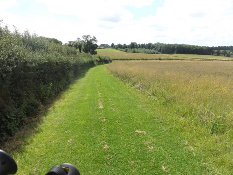
At Armishall I headed back onto a road and then along the wide stretch of grass between fields.

dscf8474-2017-07-27-14-35.jpg

I came to a T-intersection after being on the road for a mile and followed a side path to the site of the ancient Roman town of Venta Icenorum. The site is now just an empty field that had been dug up by archaeologists. I spent some time walking around it and reading the boards explaining how the Romans of 200-300AD lived.

dscf8486-2017-07-27-14-35.jpg

I then headed back along the roads to the crossing and went the other way for four miles, passing small wooded areas and more crops.

I stopped at Shotesham for a Cider at the local pub only to find out I was too early for dinner. This was a stroke of bad luck as there had been no other food places along the way. This was also the closest food place to my accommodation, which was still three miles away. After a long day on the trail, I did not relish the idea of walking 3 miles each way to get dinner, so I resigned myself to simply dining on my trail mix in my tent.

dscf8494-2017-07-27-14-35.jpg

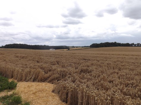
I walked on through fields of corn and wheat, past more woods to finally come out at my accommodation, the wild camp site. It turns out it was actually a B&B that was trialling wild camping in their extensive back field. I would get the use of a cottage’s bathroom and kitchen while only sleeping in my tent. Sheer luxury for a campsite. When my hosts discovered I’d missed dinner at the pub, they insisted on cooking me some scrambled eggs. A touch of the East Anglian hospitality I was to see more of during the walk.

dscf8495-2017-07-27-14-35.jpg

I chatted with my hosts and drank a glass of wine. They were lovely and interesting people. But after my long day walking I was looking forward to a shower, to get my tent pitched, and head to bed.

Boudicca Way, Norfolk, England – Part 2

The Lone Trail Wanderer

Lands End, England – St. Ives to Penzance, Part 2

A four-day hike around the toe of England – Land’s End, Cornwall. See the first two days – St. Ives to St. Just.

Day 3 – St. Just to Treen – 18.5km (11.5 miles)
Stage 3 overall was moderate with only a couple of difficult climbs.

As we had walked a mile past St. Just the night before to the YHA, we were already a mile ahead of schedule for the day. After breakfast, we checked out and headed along the gully to Gribba Point with a view back along the coast to Cape Cornwall. Ahead of us, the coastline stretched away as the trail cut across the cliff tops and only descended into a river gully once.

dscf8419-2017-07-10-14-35.jpg

We climbed our way back up the cliff and around to the rocky Aire Point with White Sand Bay growing ever closer.

dscf8423-2017-07-10-14-35.jpg

Beyond Aire Point, the trail grew more sandy as we came down into Whitesand Bay with Sennon Cove settlement on the far side where we aimed to find lunch. We watched surfers in the bay as you crossed a small amount of sand before climbing around the cliffs towards the town. On arrival, I found a fish and chip shop and a pub to enjoy a relax and an ice cold cider.

dscf8432-2017-07-10-14-35.jpg

After lunch, we headed up the cliff and the final kilometre to Land’s End, the westernmost point of England’s mainland. We walked briefly through Legendary Land’s End, a tourist mall, before pushing on in the heat.

The way around the coast was mainly across the tops of the cliffs with only one climb down into Mill Bay and back up the other side. From here it was rolling hills all the way around to Gwennap Head, the southernmost point of the Land’s End peninsula.

dscf8439-2017-07-10-14-35.jpg

We stopped for a break at the lookout at Hella Point before climbing down into Porthgwarra, a small village with a beach nestled in the rocks.

dscf8444-2017-07-10-14-35.jpg

Further on we were warned of a cliff slide near St. Levan, so walked cautiously but found nothing of concern. We could soon see Logan Rock ahead, our end point for day 3.

dscf8447-2017-07-10-14-35.jpg

We came to the top of the cliff over looking Porthcurno beach where there is a natural Open Air Theatre, but after a long day in the sun, neither of us felt like paying the money and lugging out bags up and down the cliff to see it.

At the top of the cliff on the other side of the beach, it was only a fifteen-minute walk to our accommodation, Treen House B&B and its host, the lovely Claire.

dscf8448-2017-07-10-14-35.jpg

Treen House B&B is only 50 metres from the local pub, but up a hill. After the day’s walk, it was perhaps the hardest walk we had to make.

Day 4 – Treen to Penzance
The initial part is ‘difficult’, going quickly to moderate, before ending on an easy walk along roads.

We left the lush comfort of the Treen B&B and walked along the road down to Penberth. As it had for the previous three days, the sun beat down with only a soft breeze to cool us as we climbed one of the few cliffs left on this coastal adventure. We descended into a gully, ascended the other side to walk along the cliff and then down towards the community of St. Loy Farm, where we finally had some shelter from the sun through a small tree reserve.

Past the community, we had to for the first time rock hop along a beach for about fifty metres before heading up Boscawen cliff on the other side.

dscf8451-2017-07-10-14-35.jpg

For the rest of the morning, we walked along the tops of the cliffs on a fairly easy route towards Lamorna where we came around the cliff to find a cosy little village nestled into an inlet. The heat was pretty sweltering, so we stopped off for lunch and a cold drink. We then continued around a rocky cliff, up Kemyel Cliff and passed alongside the Kenyel Crease Nature Reserve where we started to see more civilisation.

dscf8455-2017-07-10-14-35.jpg

We hit roads not long after at the township of Mousehole only a handful of miles around the coast from Penzance. The remainder of the walk had us following the main highway along the coast. We stopped for an ice-block to cool us down before pushing on. Many people catch a taxi or bus from Mousehole as it is all road walking, but we decided to finish on foot. The concrete under our feet was hot, and you could feel it through your boots as we pounded the pavement.

dscf8459-2017-07-10-14-35.jpg

After an hour on the road, we finally made it back to our accommodation in Penzance and dropping out bags off at the car, we headed to the local pub for a well-deserved cider.

Overall
The four-day hike from St. Ives to Penzance is an excellent and moderately difficult walk, made harder by the beating sun at this time of the year. It’s an experience and finding the little hidden away golden beaches and peacefulness of the trail, it was overall a good time. At no point would I have considered it severe difficulty as I have seen mentioned online, and only barely strenuous because of the constant heat.

The Trail Wanderer