In June 2019, I decided to walk the 6-day Great Glen Way, a 79 mile / 126 km walk from one side of Scotland to the other along The Great Glen fault which separates Scotland roughly in two.

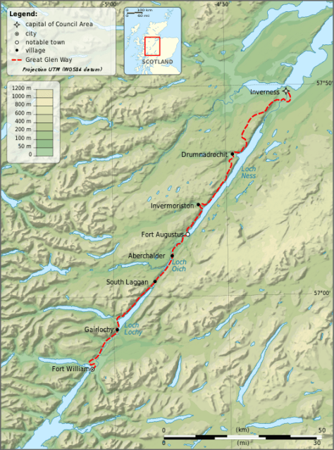
By Ayack – fr:Ayack – Own work :Topography: NASA Shuttle Radar Topography Mission (SRTM3 v.2) data (public domain);Reference used for confirmation for the additional data: ViaMichelin;Locator map: File:Saint Kilda archipelago topographic map-fr.SVG (modified) created by Sting., CC BY-SA 4.0, https://commons.wikimedia.org/w/index.php?curid=8860318
Day 5 – Invermoriston to Drumnadrochit – 13.5 miles / 23.5 km
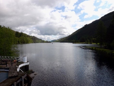
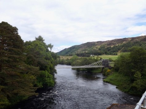
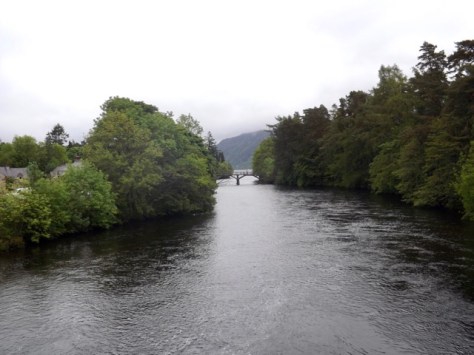
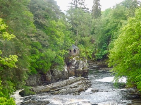
This morning I left behind the father and son walkers I’d run into on most days so far. The father’s foot had packed it in, and they were finishing the walk there. It had rained overnight, again, and I packed a wet tent as I had several times before. I walked out of the camping ground back up to the low route. I walked the mile back to the junction I’d come down off the moors on yesterday. I continued walking, the rain taking a break and I came down to the bridge across to Invermoriston. I took a quick photo down the river…
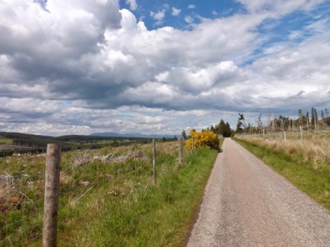
I walked 100m down the road to the cafe and a full Scottish Breakfast and coffee. After breakfast, I headed out and up several hairpins on an old country road to the top of the ridge and then higher along a trail beside a fence.
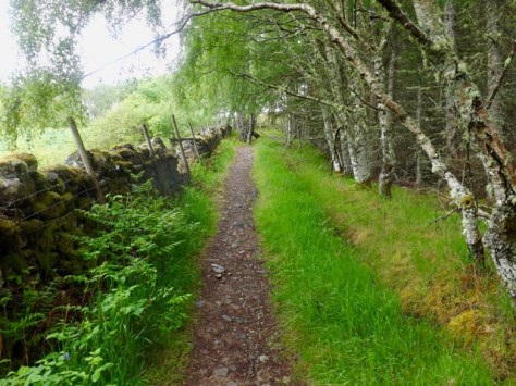
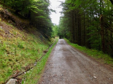
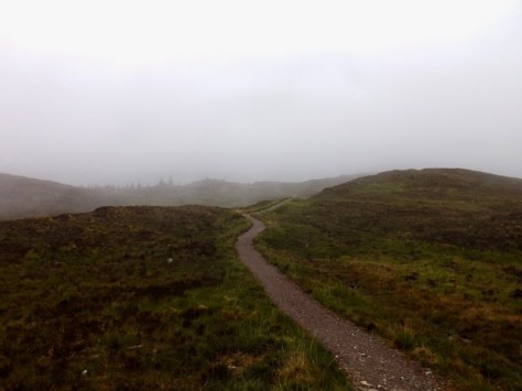
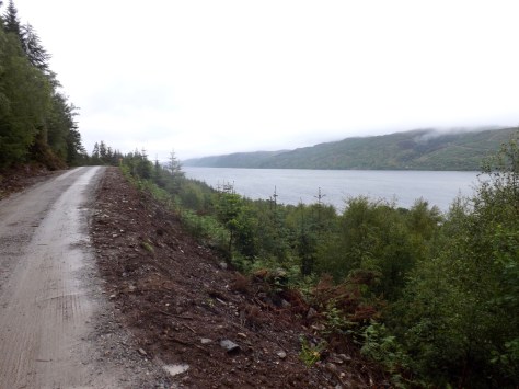
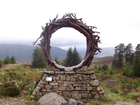
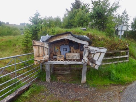
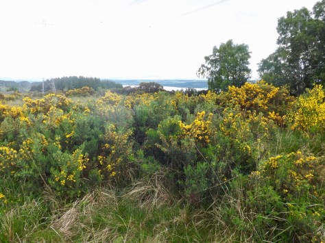
For the next few kilometres, the trail followed the fence or dipped down into the forest only to return again. The rain came and went, but it was not heavy. During the hours I spend atop the ridge line, I saw no one else. I was hidden away from Loch Ness for much of it but came past the ViewRanger, a piece of art built on the side of the hill.
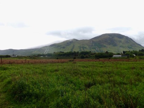
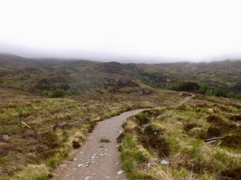
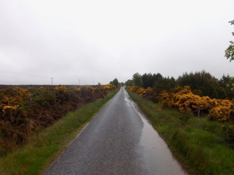
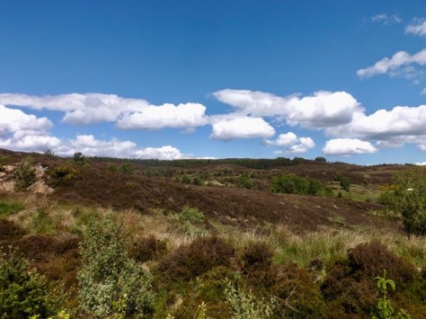
I continued across the moors for several more kilometres, clouds hanging low at times.
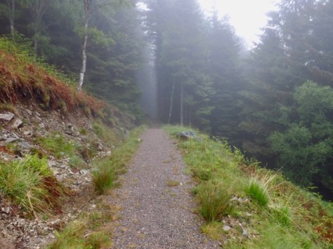
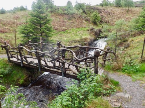
Then I came to the Troll Bridge and crossed it furtively but without assault, into the forest again where I continued.
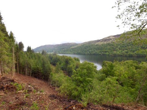
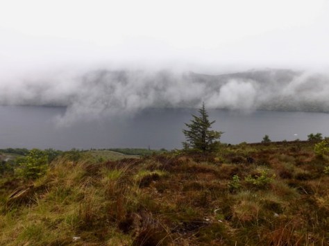
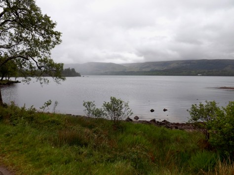
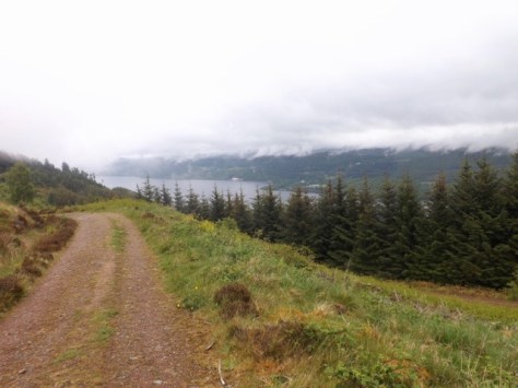
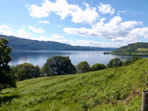
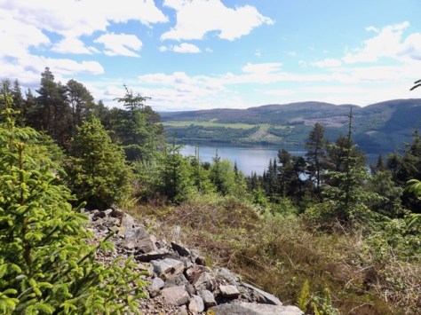
On several occasions, I came to parts where there should have been a view, but the clouds were too low over Loch Ness. Then, as if it knew I wanted to see the loch, the clouds lifted slightly and finally…
At the end of the 11km, I headed across some fields on a trail to a farm road as it again began to pour with rain. I found a little shelter someone had put out with things for sale for walkers.
I put on the pace along the sealed road averaging about a km every 10 min along the 4km stretch of road.
The road dove steeply downhill, and Drumnadrochit came into view. The trail them cut through a forest as it headed down towards the river before coming out onto the camping ground I’d be staying in for that night.
After pitching my tent, showering and washing my clothes, the sun came out, and I headed across to the local pub for dinner and a well-deserved cider.
Day 6 – Drumnadrochit to Inverness – 18 miles / 28.8 km
It didn’t rain overnight and when I woke there was s thin mist over the camping ground. And, by the time I had packed the sky was blue and the sun was out. After 5 days in the rain, the final longest day was to be spent in the sun. But I was not so lucky that my tent wasn’t wet, the dew and mist had ensured I would still be packing a wet tent.
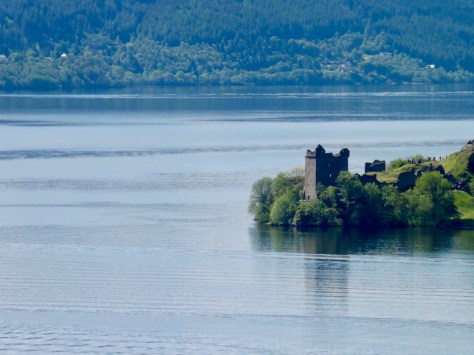
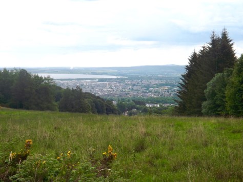
Once packed, I headed to a cafe for a big Scottish breakfast but was disappointed there was no haggis, I’ve become quite fond of it on this trip. After breakfast, I headed out through Drumnadrochit along the main highway past Drambuie farm and up a hill that gave good views back across Loch Ness…
…and the ruins of Urquhart castle.
I continued on along the trail and into the forest with continuing good views.
The trail climbed for the next 2km, sometimes steeply until it eventually came out into the moors only to cut into the forest again shortly after. After the hard climb up the ridge, the trail flattened out and remained that way for much the rest of the day.
I passed a farm and stopped to tend to blister forming when I noted the farmer struggling to get a trolley onto a trailer. So I put my boot back on and gave him a hand. After my good deed for the day, I set out again along the farm road, across a highway and onto a thin track. Along the side of the track, I started to see signs of an eco cafe, so stopped off for an expensive coffee and cake in the middle of nowhere. After the break, I arrived at another road…
…and quick marched the 4 km until it merged with a dirt trail. Dark clouds seemed to come, but no rain eventuated.

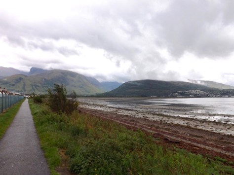
The dirt trail ran for a mile before diving into a forest and on a slow descent over 5km until I saw Beauty Firth, a stretch of sea off the coast of Inverness.
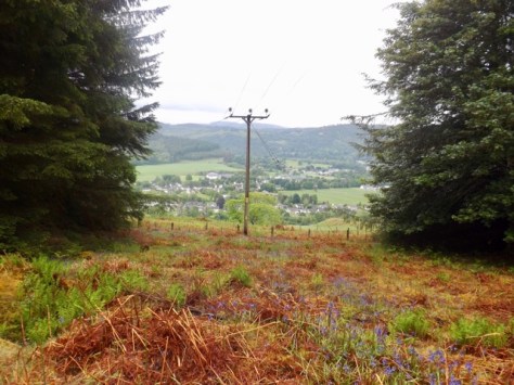
Then I rounded a hill and Inverness itself came into view. I followed a fairly steep hill down towards it.
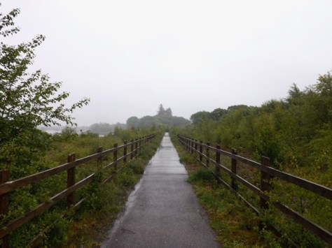
I crossed near a golf course to the canal where I walked for 3 km, crossing the Ness Islands and eventually ending the trail at Inverness Castle, near the centre of the city.
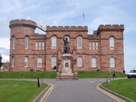
I discovered my hostel 50 metres from the castle and checked in for a well-deserved shower. Once clean and in fresh clothes I located a Wetherspoons for dinner and, of course, a cider or three.
Day A – Inverness
I found it cheaper to stay in Inverness the night on Saturday before flying out on Sunday. I wandered around the town a little but decided against doing the tourist thing. Instead, I rested my feet and body after the hike. Saturday night, however, there was a music festival in town, so all of the pubs and restaurants were very busy. I hung out about the hostel and read a lot relaxing and watching a movie with a few people in the common room.
Overall
The Great Glen Way is a good hike, but not a great hike. The first three days a spent on the flat walking beside the canal or lake. But it is the last three days where the real hiking begins. While the climbs were not high, it gave plenty of views when they were available.
The major issue with the hike was the amount of rain, but it is Scotland in June, so you just have to go with it. It was nice to have the sun on the final day. The other issue is the general lack of food options along the way, which is likely something I should have planned better for. I survived and enjoyed my time.
In a couple of weeks, I head back up to Scotland for another six-day hike, The Isle of Arran.
The Lone Trail Wanderer