Tongariro Northern Circuit Great Walk! Days 3 and 4 – The Easy Aftermath

In mid February 2023, I found a gap in the rainy summer and headed to the central North Island of New Zealand to walk the four day Tongariro Northern Circuit. See Day 2 here.

Day 3 – Oturere Hut to Waihuhuno Hut – 3 hours 45 min – 8.1 km (Green trail)

While the hut was full overnight, I’m thankful for being in one of the quieter smaller rooms, especially when people started moving around in the morning. Day three is the shortest of the hike, with a stated 3.75 hours of walking before arriving at the next hut. With Day 4 also being a shorter day some people merge the two and walk out on Day 3. I’m taking the more chilled approach and walking two short days.

I headed out from the hut in the sun and back into the sandy hellscape of the final hour of yesterday’s walk. Clouds hung quietly around Ngauruhoe as I walked.

img_0434-2023-02-12-15-59.png

I soon headed down the descent of the day, a steady but short rocky downhill towards a babbling brook running down from the mountains. In the distance I could see the Australian family.

img_0435-2023-02-12-15-59.png

On an easy path, I quick marched up the next small climb, nothing too taxing.

img_0438-2023-02-12-15-59.png

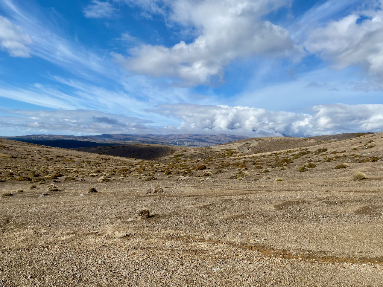
For the next hour, the trail undulated up and down rocky and sandy short hills. I flew past the Aussie family who were, in their own words, just ambling today.
img_0439-2023-02-12-15-59.png

Heading ever towards a tree covered ridge line in the distance, I spied the Italian newlyweds ahead.

img_0440-2023-02-12-15-59.png

With the tree covered ridge to one side, I sped along a sandy ridge to eventually pass the Italians on the downward climb at the end.

img_0446-2023-02-12-15-59.png

Halfway down, the trail dove into the trees.

img_0449-2023-02-12-15-59.png

At the bottom, beside a large stream the mud puddles began. Nothing too seriously thankfully.
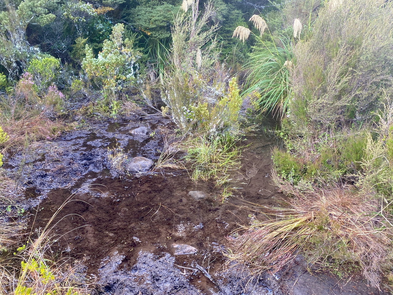
img_0451-2023-02-12-15-59.png

Then the steepest climb of the day, up to the top of the tree-covered ridge, passing a trail runner and two groups of hikers heading the other way. I came out of the woods at the top, climbed a small hillock off the trail and sat for 10 minutes in the sun. Then heading down the other side I got the first views of the tonight’s hut.

img_0455-2023-02-12-15-59.png

Compared to the previous two huts, this one was a veritable mansion with large bedrooms and a massive indoor and outdoor seating area. Inside the main windows gave great views of the Mt Ngauruhoe. In the afternoon, the rain came in spits and spurts. Up behind the hut, to one side of tomorrow’s path, in the tussock was what I described as the 4G zone, although spottier than previous huts. At one point there were a bunch of us in the tussock 4G zone, hunting the service in what became known as 4G yoga as we stretched this way and that with our phones.

img_0459-2023-02-12-15-59.png

Overall, the walking time was supposed to be 3 hours 45 minues, but I managed it in 2 hours 20 minutes including the 10 minute sit down at the stop of the last ridge.

Day 4 – Waihuhuno Hut to Whakapapa Village – 5 hours 45 minutes – 15.4km (Pink trail)

The hut was fine overnight, with the usual issues revolving around those who want to get away early waking everyone while trying to be quiet. With a day estimated at 5 hours and 45 minutes, I planned to leave at 8am so that I’d finish at 1:45 and then arrive at my accommodation at the 2pm check in time. But as today is fairly flat, I’ll likely finish early. I set out into the overcast day, headed past the 4G tussock patch and up some stairs. After ten minutes I came past the turnoff to the old Waihuhuno historic hut. I stopped to check it out.

img_0471-2023-02-12-15-59.png

I set out again across the tussock covered plains, ever so slightly undulating, the low cloud covering the top of Mt Ngauhuhoe. As this hike circumnavigates the volcanic cone, and because it was Mt Doom in the Lord of the Rings, I think this hike should be renamed to The Mordor Circuit.

img_0480-2023-02-12-15-59.png

Today’s section has no large ascents or descents, but a very slow, almost unnoticeable, climb to the mid point, a dip down to one of the many streams on the trail, then a climb to the day’s highpoint.

img_0487-2023-02-12-15-59.png

At that highpoint, there is a T-junction, one way leading to the Tama Lakes, and the other continuing on to the the end of the trail. I stopped for a break at the junction, near the toilet that cannot be seen as it is camouflaged to look like the tussock plains. This is not the only toilet of its kind in the National Park, wherever tourists can walk, there are toilets, and as they walk out to the Tama Lakes, there’s one here.

img_0495-2023-02-12-15-59.png

There are two Tama Lakes, the Upper being 45 minutes walk from this junction and the Lower being only 10 minutes walk. I wasn’t keen to walk all the way too the Upper Tama Lake, so leaving my pack at the invisible toilet, I made my way to the Lower Tama Lake.

img_0494-2023-02-12-15-59.png

After a quick photo, I trotted back, had a snack, donned my pack and headed off again. From here on I would begin to cross paths with more and more day walkers. The trail began to undulate more but nothing overly difficult. And after an hour, I came to a rather busy location. I dropped my pack amidst many tourists, and climbed down some steep steps to view the Taranaki Falls.

img_0502-2023-02-12-15-59.png

I then climbed back to my pack, and stood at the top of the falls looking down.

img_0504-2023-02-12-15-59.png

A sign near the waterfall said 1 hour to the Whakapapa Village, twenty minutes longer than I had estimated, so I got my skates on. After 10 minutes, I saw the recently closed Tongariro Chateau in the distance, I kept my march on. I cut through some woods, and when I emerged, ten minutes before the end of the track, I stopped to take my final shot of Mt Doom.

img_0509-2023-02-12-15-59.png

When I reached the end of the trail, I walked past the chateau to the place where I had left my vehicle. It was 12:15, the time I’d estimated mid today’s walk, and even with the short side track to the Lower Tama Lake, I still came in an hour and a half early.

Overall

The Mordor Circuit, officially known as the Tongariro Northern Circuit, was a good walk although, to be honest, days 1, 3 and 4 just felt like alternative ways to get to and from the main attraction, the Tongariro Alpine Crossing. In comparison, these three days put together don’t come close to the sheer exhilaration of the Alpine Crossing in effort, beauty, and reward. In saying that, I still enjoyed my four days on the trail.

The Lone Trail Wanderer.

Tongariro Northern Circuit Great Walk! Day 2 – The Alpine Crossing

In mid February 2023, I found a gap in the rainy summer and headed to the central North Island of New Zealand to walk the four day Tongariro Northern Circuit. See Day 1 here.

Day 2 – Mangatepopo Hut to Oturere Hut via the Tongariro Alpine Crossing – 5 hours 10 minutes – 12 km (Red trail)

Morning came and the rain had stopped but it was still cool. With the carpark for the Alpine Crossing only 20 min from the hut, the first waves of people began filtering by fairly early. I got ready and headed out onto the wide gravelly trail, the ridge I’d climbed the day before up to the left.

img_0335-2023-02-12-15-58.png

The beginning of the trail is a fairly slow climb through the lower portions of Tongariro heading towards the South Crater, which is just over the lowest point of the ridge straight ahead.

img_0339-2023-02-12-15-58.png

There are boardwalks in many places along this route to protect the ground from so many marching feet on their daily attempt up the mountain. I got into a good rhythm passing many of the walkers with their tiny packs while carrying near 20kg in mine.

img_0342-2023-02-12-15-58.png

The lead up to the first climb is stony but also well worn. When I did the Alpine Crossing previously, I was already immersed in the cloud which stayed with us for most of that walk. I was hoping today would be different.

img_0347-2023-02-12-15-58.png

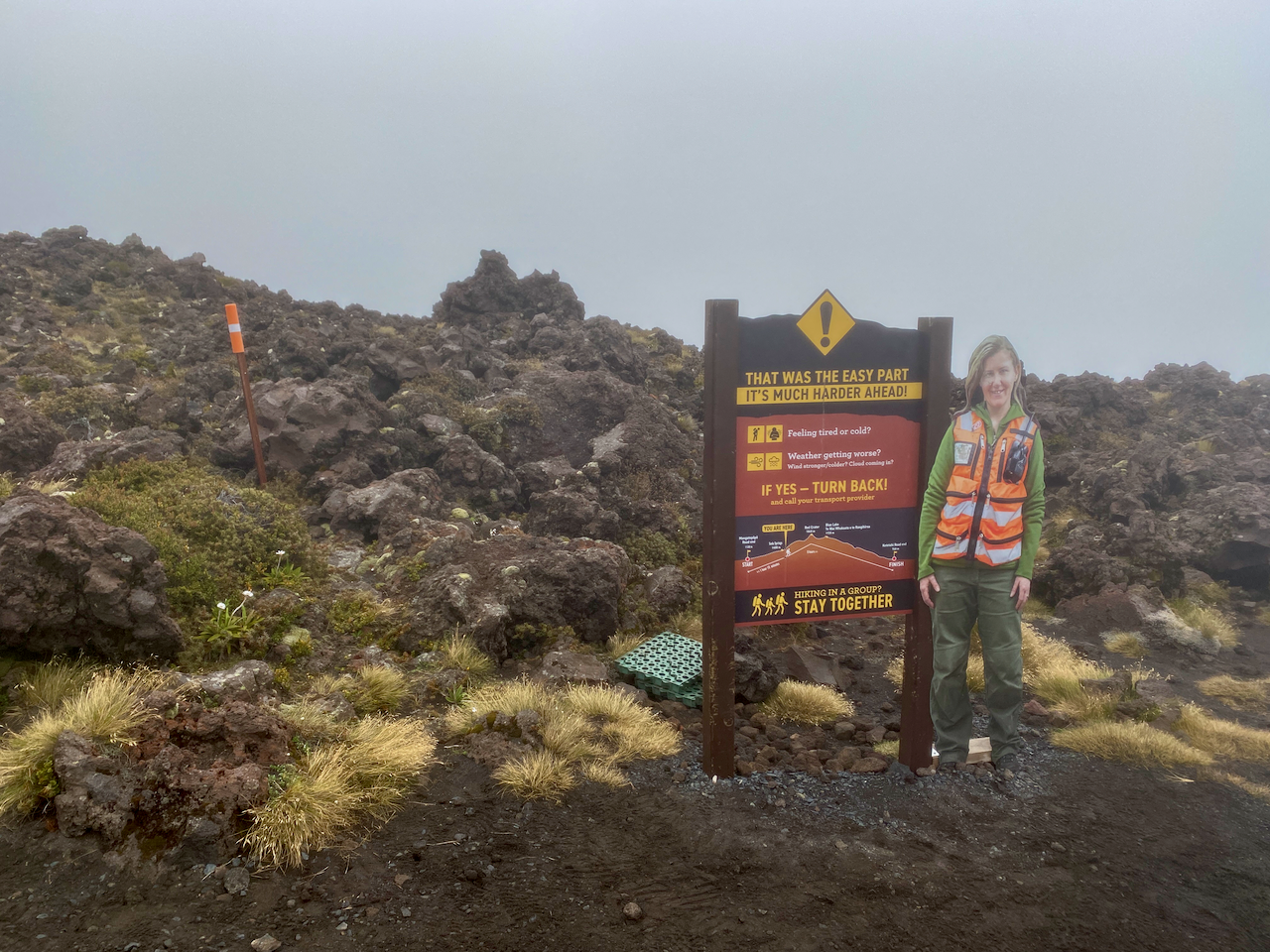
I began the initial climb to the toilets, some of the many emplacements along the crossing. I was approached by the two French girls I’d picked up hitch hiking to National Park village 2 days ago. I wished them well before proceeding. I was already in the low clouds at this stage, and had my thin waterproof jacket on backwards. I sweat heavy down my back, no point adding an extra layer where I don’t need it. And, when I no longer need it, I can remove it without having to take my pack off. At the toilets is the first warning sign:

img_0349-2023-02-12-15-58.png

The climb from the sign to the southern crater is only 250m in altitude gain, but in the light rain and wind it felt longer. It was here I first started hearing people coming back down warning how bad it was up top. When I got to the plateau of the Southern Crater, the wind had died down but the clouds still hung heavy.

img_0351-2023-02-12-15-58.png

The wall of the crater came into view after a five hundred metre walk across the plateau, and the wind began again tugging at my jacket and pack cover. I’ve heard some nightmare stories of people’s pack covers being torn off in the wind. Thankfully, mine has a cross strap, so was stable just a little noisy.

img_0352-2023-02-12-15-58.png

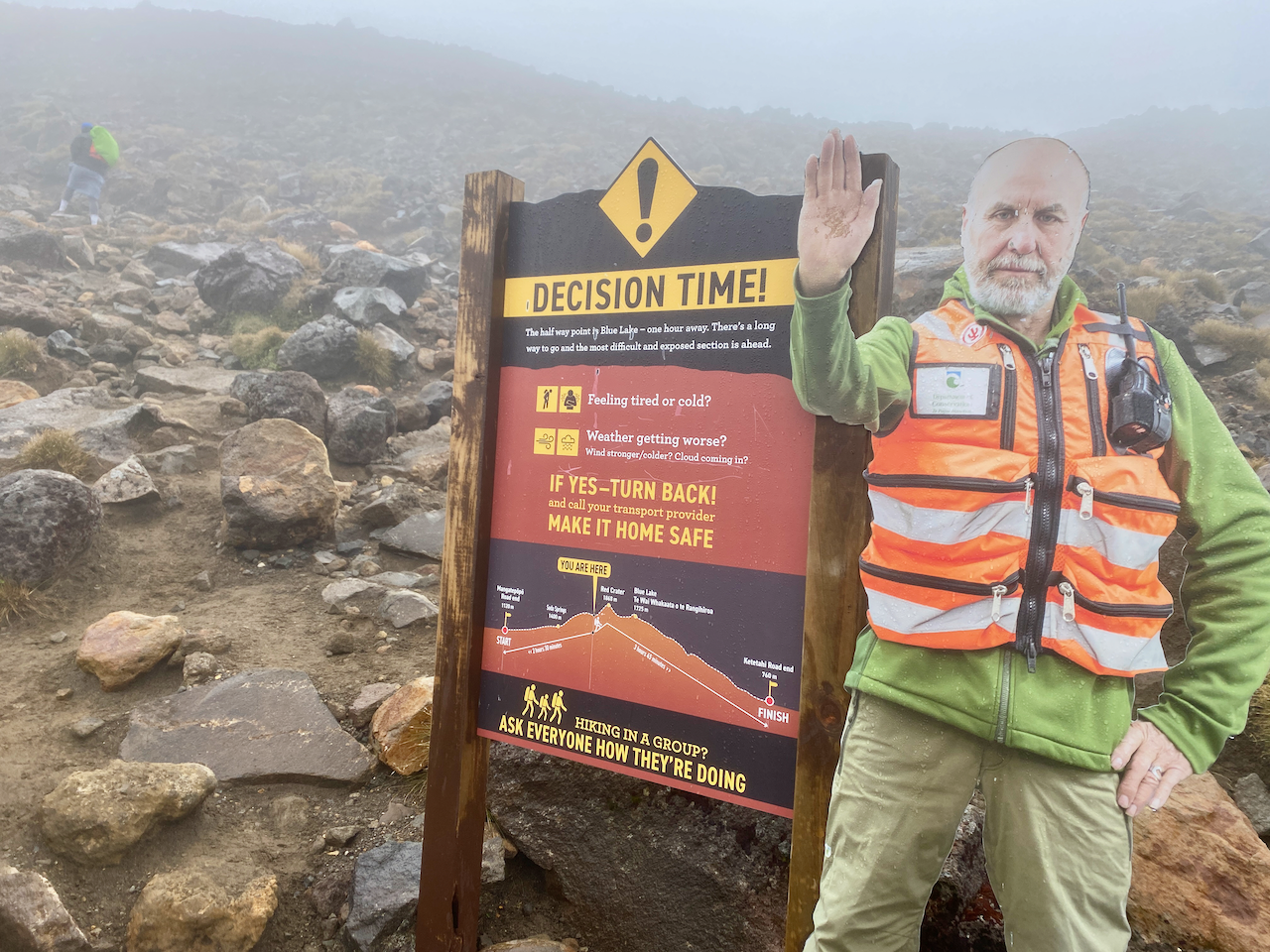
The Decision Time sign appeared out of the gloom, no doubt causing more people to head back. I marched on, my fingers starting to get cold but I was thankful for the long sleeves of my backward jacket giving a little protection. Some groups around me continued the climb, bit by bit, resting briefly where they could. My fingers got so cold they went numb and I couldn’t feel the buttons on my phone.

img_0353-2023-02-12-15-58.png

Like the first time I did the crossing, the most exposed section near the Red Crater had wind blasting visibly across it, and as per last time, I pushed on. This time I’m thankful for my hiking poles to give me a little more stability as I climbed. I marched on scurrying from rocky outcrop to outcrop across the exposed areas.

img_0355-2023-02-12-15-58.png

Then out of the mist, the final climb to the highest point at 1868m. Wind tearing at me, fingers numb and hands red, I pushed on.

img_0358-2023-02-12-15-58.png

Then in what seemed like a handful of moments, the mist swept away and looking back I got a better view of the South Crater from above.

img_0362-2023-02-12-15-58.png

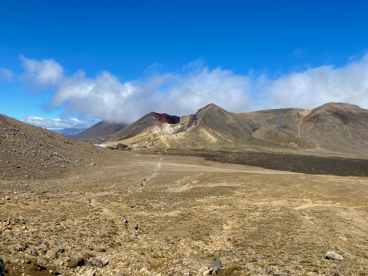
And to my right, the Red Crater.

img_0367-2023-02-12-15-58.png

The wind was still cold, so I pushed on, but as I began my descent, it ceased and the sun began its warming effect. I could feel my fingers again. Below me was the Central Crater and across it, the Blue Lake. The crossing continues past the Blue Lake and down the side of the mountain for several more hours to the collection point. Last time, none of this was visible, the cloud only clearing when we were half way down, past all the main sights.

img_0374-2023-02-12-15-58.png

The Northern Circuit doesn’t go past the Blue Lake, instead cutting right after the Emerald Lakes.

img_0377-2023-02-12-15-58.png

The trail down is not rocky like the ascent, instead it’s a light dirt/ash mix where you can slide if you aren’t careful. I slithered down in my boots and took a shot back up the peak. Afterwards, it was estimated more than a third of the climbers today had turned back.

img_0381-2023-02-12-15-58.png

I dropped my pack on the trail and stopped for lunch in the sun, then left it beside a rock and walked to the Blue Lake and its fairly easy climb. I looked back across the Central Crater to the Red Crater which looked like a gaping maw of the mountain.

img_0392-2023-02-12-15-58.png

I didn’t stay long at the Blue Lake before heading back.

img_0394-2023-02-12-15-58.png

Donning my pack again, I headed down the quieter trail towards what I describe as a hellscape, the Italian couple are ahead of me.

img_0404-2023-02-12-15-58.png

The trail to the hut has a long slow rocky descent onto the hell plains, then a hot 3-4 km march across rocky landscape.

img_0417-2023-02-12-15-58.png

Oh, and did I mention the never ending sand?

img_0423-2023-02-12-15-58.png

Eventually, I came over the a rocky outcrop and saw the hut up ahead. Perhaps it was my lack of sleep the night before, but the final hour across the hellscape just seemed to drag. I was grateful to arrive. At the hut, I unpacked my tent and ground sheet, lying them out to dry in the sun and warm wind.

img_0426-2023-02-12-15-58.png

I headed inside to get myself a prime bed in one of the smaller rooms, before heading out to the ridge where I found the campsites, a good 4G zone and a waterfall.

img_0429-2023-02-12-15-58.png

The crossing was everything I remember from my previous effort, except I got to see some sights this time. It’s definitely the high point of the trail (pun not intended but accepted). Tonight I relax and prepare for the shortest day of the trail tomorrow.

Next, Days 3 and 4 of the Tongariro Northern Circuit Great Walk!

The Lone Trail Wanderer.

Tongariro Northern Circuit Great Walk! Day 1 – The Beginning

Great walks are manicured hikes for everyone, but especially tourists and locals just starting out hiking. They’re not necessarily easier, just more accessible, and often also quite busy. The Tongariro Northern Circuit was something I wanted to revisit since my Tongariro Alpine Crossing several years ago – New Zealand’s most popular tourist walk – was mired in low cloud. Lots of walking/climbing and no view. The Tongariro Northern Circuit includes the Alpine Crossing on its second day, leaving the other three days quieter. So, with wet weather prevalent throughout the beginning of the New Zealand’s summer, I’ve been dying to get out on the tracks.

The Tongariro National Park in the centre of New Zealand’s North Island, contains four massifs, the two most famous being the Ruapehu Massif and the Tongariro Massif. There are two main circuits in the National Park also, the Tongariro Northern Circuit, which circumnavigates Mt Ngauruhoe, the cone shaped volcano used as Mt Doom in the Lord of the Rings trilogy. The southern circuit is The Round the Mountain, and circumnavigates Ruapehu, the North Island’s tallest mountain.

In early February, I slowly made my way down to the village aptly named National Park, where I stayed in preparation for the hike.

Day 1 – Whakapapa Village to Mangatepopo Hut – 4 hours – 9.4 km (Yellow trail)

Today’s walk is quite short, so I left the accommodation at check out and drove the 15 minute drive to the trailhead at the Whakapapa Village. I stopped in at the village i-Site to check on parking and got an overnight permit. Locking up my vehicle, I headed past the now closed Tongariro Chateau, then along the short road behind it. From the official trailhead of the clockwise circuit, I headed along the wide gravel path created to give tourists easy access to the Taranaki Falls. I passed several such couples with day packs as I went.

img_0298-2023-02-12-13-37.png

After passing the trail to the Taranaki Falls, my trail lost its tourist appeal, becoming a thin dirt track through the tussock covered plains. I headed along the track with the cloud covered Tongariro massif ahead of me.

img_0309-2023-02-12-13-37.png

Behind me, the Mt Ruapehu massif.

img_0314-2023-02-12-13-37.png

The trail is well marked with the typical orange triangle seen all over New Zealand. The trail is also fairly mundane, undulating gently from the circuits lowest point at 1,065m above sea level to 1,165m. Occasionally there is a bit of mud which added a bit of spice to the trail.

img_0315-2023-02-12-13-37.png

After a good three hours, I came over a short ridge to see the Mangatepopo hut in the distance tucked under ridgeline. I picked my way across the plains until I came over a small hillock to see the hut and its associated campsites.

img_0320-2023-02-12-13-37.png

I pitched my tent in a suitable spot, getting my gear inside as it began to spit. I went to the hut and hung out with an older Australian woman, her two adult daughters and the boyfriend of the youngest. The rain came down briefly as more hikers came in, some walking the circuit in reverse and having done the Alpine Crossing. After my brief and rather easy walk to the hut, I needed more, so I decided to climb the ridge beside the hut, which gave me great views back along the way I’d walked.

img_0327-2023-02-12-13-37.png

And off the other side to the north…

img_0329-2023-02-12-13-37.png

Later that evening, those of us gathered at the hut came out to watch the sunset. There were a fair mix of nationalities: the aforementioned Aussies, a large group of Kiwis, a pair of Italians, a Frenchman and his daughter, a Brit girl and her Canadian friend.

img_0333-2023-02-12-13-37.png

When it got dark, I retired to my tent. There was 4G in the camping area, so I watched YouTube on my phone for a while before heading to sleep. It rained on and off during the night and was quite cold. I didn’t sleep well, tossing and turning whenever I awoke shivering.

Next, Day 2 of the Tongariro Northern Circuit, the day we go over the top on the Alpine Crossing in the rain and tearing wind.

The Lone Trail Wanderer.