La Paz, Bolivia – Impressions

Nuestra Señora de La Paz (Our Lady of Peace) is Bolivia’s second largest city – after Santa Cruz de la Sierra – and is set high in the Andes mountains on the Altiplano (high plains in spanish). The city is built in a bowl, almost like a crater, with the rich and middle class living towards the lower areas in the centre. When the city began to expand the only way it could go was up, so in all directions the houses were built up the sides of the bowl. The poorer people of La Paz live in the brick buildings that span all visible walls. At night, the lights of the city are a marvel to see, both from the centre looking up and from the rim looking down.

wpid-dscn2896-2013-07-26-15-23.jpg

On the southern horizon of La Paz is Bolivia’s 2nd tallest mountain, Illimani, at just over 6,400m. Illimani is only the 18th tallest mountain in the Andes.

wpid-dscn3042-2013-07-26-15-23.jpg

As you arrive in La Paz by bus, you will no doubt travel around the top of the bowl and be amazed when you look down at the sprawling city below. However, for the first couple of days, the central city – no doubt where you’ll be staying – seems a little dirty and run down, with the calls of Bolivians trying to sell you whatever they can or the beggars silently holding their hands out to you. As you slowly explore the city over the first couple of days, it grows on you very quickly. There’s a certain charm about La Paz.

wpid-dscn3048-2013-07-26-15-23.jpg

La Paz has plentiful markets and shopping areas, but there’s a strange thing that I’ve found about Bolivia in general is that they don’t have just one store selling something, they have an entire block of small stores selling the same thing. As an example, I spent 2 days in the city of Santa Cruz before coming to La Paz and found a three story mall with about 100 shops in it, 95 of them selling mobile phones. Most of the stores were selling exactly the same models too. This is the same in La Paz, I walked through the hardware sales section of the central city and there were shop after shop selling exactly the same thing, with even smaller booth shops set up in front of the other shops selling the same thing also. It did make it easier when I was looking for a new sleeping bag, all the adventure stores were grouped together as well.

wpid-dscn3049-2013-07-26-15-23.jpg

The location of La Paz enables it to be a hub for many different activities, with plentiful hikes across the altiplano, the Death Road, and busses leaving for the jungle to the north or the salt flats to the south. In the city there are a couple of parks and miradors, but most things are just outside the city. When walking around the city, you will note a plentiful small plazas and the occasional piece of architecture. On one day, I caught a taxi to The Megacentre, a multi level mall with large movie theatre. When you enter the centre, you wander if you’ve left Bolivia.

wpid-dscn3051-2013-07-26-15-23.jpg

Lastly, unless you have come from the high areas of Peru or the salt flats, you are going to have to deal with the altitude. The lowest point of La Paz is 3,500m while the highest is 4,200m. So, for the first day in the city, you might have a serious headache and it will be hard work climbing the numerous hills or stairs, as the lack of air will have you gasping like crazy. There are plentiful ways to deal with altitude sickness, pre dosing with altitude pills, chewing on coca leaves, buying special coca powder (no, not cocaine, although that is derived from the leaves) or similar. After a few days it gets easier, although you may still have issues climbing steps.

My time in La Paz has been most enjoyable and I would recommend a visit if you are in the region.

The Lone Trail Wanderer

El Choro, Bolivia

The El Choro Trek is a three day trek that’s easily accessible from La Paz in Bolivia. I wanted to do different trek here in Bolivia, but without my own transport, many of the treks are difficult to get to. And while I tend to like hiking alone, the easiest means to do this trek is via a tour. This means I wouldn’t be carrying any food or a tent, as there will be a porter along with us to do that. This is the first time not having to carry all of my own equipment and it doesn’t feel quite right.

DAY 1 – La Paz to  Challapampa

The agency I booked through picked me up at 9.30 and I met the two other people I’d be hiking with, a french guy who spoke spanish well and some english, and an argentinian born girl who had been living in New Zealand most of her life. She spoke english and spanish perfectly. The guide with us only spoke spanish and his porter english and spanish. So, spanish became the spoken language of the trek and with my meagre understanding I decided hike alone for the most part.

The trek begins very near the start of the Death Road in a snowy mountainous area at a altitude of 4,800m. It was freezing that high up with an icy wind, so we couldn’t wait get started.

wpid-dscn2904-2013-07-26-15-23.jpg

The first 100 metres of the trek climbed to the highest point of the trail, 4,900 metres. This was the hardest 100m I’ve ever climbed in my life. With such thin air, I barely got 10 steps before having to stop and get my breath back, and I was only carrying half my usual weight! Eventually, we crossed over the ridge and the cold winds ceased. Ahead of us along the valley we could see the trail through the valley and a set of ancient Incan ruins at the base of the slope. The ruins were once a rest stop for travellers on the trail. Food and shelter was always offered for free.

wpid-dscn2910-2013-07-26-15-23.jpg

The trail weaved down the side of the mountain towards the ruins and it began to slowly get warmer, so we started shedding some of our warm weather clothes. At the ruins we stopped for a rest and watched as a Llama train came by. The Llamas and their master were returning from a delivery earlier in the day.

wpid-dscn2916-2013-07-26-15-23.jpg

We pushed on along the trail that from time to time was obscured by low cloud, through fields that housed other ancient ruined buildings and walls.

wpid-dscn2925-2013-07-26-15-23.jpg

Eventually, we came to a pair of newer buildings that were being used as farms raising Llama’s and drying several different kinds of small potatoes… We stopped for 30 minutes before pushing on.

wpid-dscn2932-2013-07-26-15-23.jpg

Much of the rest of the day was spent walking through the low cloud, so visibility was only several metres, meaning the focus went on the ‘road’ we were trekking along. We were told that it was originally built by the Tiwanaku, a race of people who would eventually become the Incans, and had been repaired by the Incans, so it was difficult to tell which was which. In the clouds, the stones get very slippery.

wpid-dscn2946-2013-07-26-15-23.jpg

Our day ended upon reached the very small settlement of Challapampa, where our guide and porter set up the tents and cooked our dinner. From the high point of 4900m, we had descended to 2400m. And while it rained during the night, it was a lot warmer.

DAY 2 – Challapampa to San Francisco
wpid-dscn2953-2013-07-26-15-23.jpg

Today we hit the Cloud Forest, a fairly untouched area of the valley which is usually covered in cloud. For only short periods of the day the clouds parted, but for most of the time, we could see the cliff edge, but beyond it only cloud.

wpid-dscn2955-2013-07-26-15-23.jpg

The trail meandered along the side of the valley for much of the day, climbing and descending small hills as we trekked along the thinner ‘Incan road.’

wpid-dscn2959-2013-07-26-15-23.jpg

The valley disappearing in cloud…

wpid-dscn2967-2013-07-26-15-23.jpg

…and opening up again.

wpid-dscn2976-2013-07-26-15-23.jpg

One wonderful part of the day was the plentiful different species of wild flowers that were growing along the sides of the trail. My super zoom camera getting great close up shots of most of them.

wpid-dscn2981-2013-07-26-15-23.jpg

We stopped for lunch at a small set of huts and rested for a while. Most importantly they served cerveza! Beer, in spanish.

wpid-dscn2998-2013-07-26-15-23.jpg

The rest of the trail was fairly straight forward, again with plentiful wild flowers. We eventually reached San Francisco, a tiny collection of huts, where the guide and porter erected our tents and cooked our dinner.

wpid-dscn3008-2013-07-26-15-23.jpg

DAY 3 – San Francisco to Chairo
We left San Francisco just after day break and headed away down the hill towards a river.
wpid-dscn3015-2013-07-26-15-23.jpg

As we slowly worked our way lower through the forest, we met a couple of wild donkeys who, after being initially fearful of us, just stood there and let us go past as if we weren’t there.

wpid-dscn3017-2013-07-26-15-23.jpg

We arrived at the river and crossed on a fairly new wooden suspension bridge. We were alerted to the carcass of a horse in the river under the bridge. We stopped on the other side and prepared ourselves for the climb to come, known as Subida del Diablo – the devil’s ascent.

The Subida del Diablo gets its name because it’s a very difficult climb up slippery Incan paving stones at a fairly steep incline that just keeps climbing.

wpid-dscn3023-2013-07-26-15-23.jpg

Once at the top, we stopped for a break at a place owned by an old Japanese man. Stories say he is a war criminal fled to South America after World War 2, but who knows. There is a camping spot at the back of his property next to the cliff line giving wondrous views along the valleys until the clouds again came rushing in.

wpid-dscn3027-2013-07-26-15-23.jpg

The trek continued for some time along the trail high up in the mountains. From time to time we could see the river below us, but clouds would race in to cover it quickly. Eventually, we started our decent until we could see the village of Chairo below us. It didn’t take us long to get down to the village where the guide ordered us lunch from the local cook house and we sat eating until our van arrived to take us to Choico, where death road finishes.

wpid-dscn3033-2013-07-26-15-23.jpg

We waited in Choico for an hour before catching a minibus back to La Paz. 3 hours later I was delivered to my hostel for a well deserved shower.

Overall, El Choro was a good hike where we spent much of our time climbing down. By the end, our calves were sore from the constant descending. While the low clouds meant that much of the view was hidden from us for parts of the hike, it was still good to get out into the wilderness and away from the city for a while.

Next, I head down to southern Bolivia to the Salar de Uyuni, one of the largest salt flats in the world.

The Lone Trail Wanderer

Death Road, Bolivia

Leading 69km across Bolivia from La Paz to the small town of Coroico is a road called North Yungas Road. North Yungas Road has another name, Death Road, and in1995 it was christened the world’s most dangerous road because of an estimated 200-300 deaths each year. Death Road runs along the side of a precarious cliff for most of its length. If you tip over the edge, it is 600 metres straight down and there aren’t any guard rails to stop you.

Because of the danger, a new road has been built over the course of 20 years ending in 2006, although there are parts that are still under construction and some impatient Bolivian drivers still tempt fate on Death Road. Since the mid 90’s when most of the traffic started using the new road, the road became a tourist attraction. People suit up and ride mountain bikes along most of the length of the rocky and dusty road. Since the road starts at about 4700m above sea level and finishes at 1200m, very little pedalling is required, you just steer, brake and try not to fall off. Since 1998 there have been at least 18 cyclists die on the road from about 25,000 cyclists who have ridden it…

So, with all that, one must be tempted by the attraction, so a small group of us from a couple of hostels decided to join the masses and ride the Death Road… We were one of about five adventure groups doing it this particular day, with a total of about 40. With 69km there was plenty of room for us.

The day started out slowly, it had rained overnight, which meant that higher up, it had snowed. We were picked up at 9.30 and waited at the bus station for about 2.5 hours before the police opened the road. Then with everyone going at once, it took us nearly 90 more minutes to get through the check point out of town. For a ride that was supposed to begin at 10.30, we finally got started at 2pm.

wpid-dsc01623-2013-07-26-15-23.jpg

At 4,650m it’s icy and we all shivered while getting into our clothing for the ride. Then after safety instructions we were off along the first 9km of road which is fully sealed. Being sealed means an easier run and for some a faster one.

wpid-dsc01645-2013-07-26-15-23.jpg

The first part on the sealed road was amidst amazing views of the snowy peaks. The sealed road can be made out on the left of the photo below… We made good time overtaking slower trucks and buses as we raced along.

wpid-dsc01629-2013-07-26-15-23.jpg

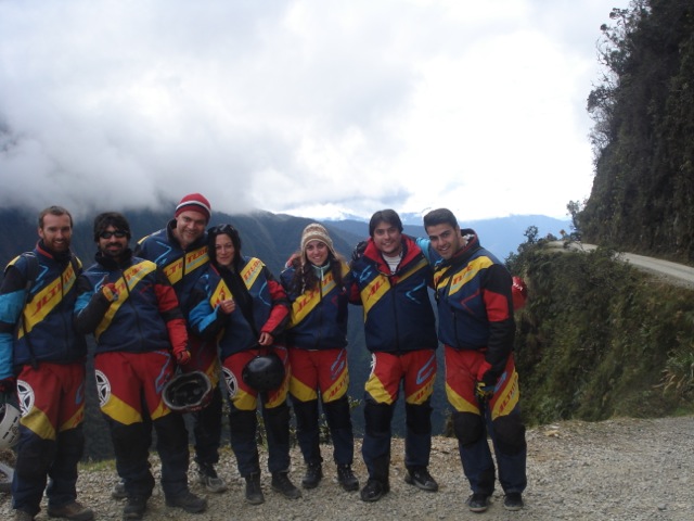
Then, we were back in the van and driven to the official main entrance to Death Road, where it actually becomes a rocky, dirt road. We had a late lunch then headed off, still dressed in out full kit as it was icy, and those without sun glasses had tears streaming down their faces. After a time we stopped to pose for photos – something we did regularly along the road.

wpid-dsc01689-2013-07-26-15-23.jpg

A couple of times during the ride, we were tailed by a truck and had to pull off to the side to let it past.

wpid-dsc01709-2013-07-26-15-23.jpg

As we got further along the road, it began to get warmer and thankfully the van we came in was following us down so from time to time we could strip off some of the layers. On one of the more famous corners of the road, we took photos on the edge of cliff. Some of the group were more cautious about being close to the edge while others of us were less worried. That’s me on one leg…

wpid-dsc01714-2013-07-26-15-23.jpg

Again as we got lower, the temperature grew warmer, and even passing under the occasional waterfall sprinkling the road was not enough to cool us down. Then we were forced to pull to the side as a series of trucks went past…

wpid-dsc01723-2013-07-26-15-23.jpg

About three quarters of the way down, some of the locals were having a celebration on the side of the road and we stopped for photos.

wpid-dsc01730-2013-07-26-15-23.jpg

By the bottom of the road, some of us had stripped down to singlets in the heat.

wpid-dsc01734-2013-07-26-15-23.jpg

At the end of the road, we were back in the van and taken to a resort where we spent only an hour (if it hadn’t been for the wait earlier in the day, we would have stayed longer). We did get to have a dip in the pool, some food and a couple of beers before getting back into the van and the 3 hour trip back to La Paz.

wpid-dsc01736-2013-07-26-15-23.jpg

Overall, it was a very fun day with a fun group of people. The road was nowhere as dangerous as imagined and was exhilarating enough that I have considered doing it again.

Next, I’m off for a three day hike through the Bolivian mountains.

The Lone Trail Maniac Cyclist.

Campo Grande and The Pantanal, Brazil

The Pantanal is one of the world’s largest wetlands. It’s situated in Western Brazil with a very small portion stretching over the border into both Bolivia and Paraguay. I decided to visit The Pantanal for a couple of reasons, firstly it’s known for its animal species and secondly, it was a stop off on the way to Bolivia. The bus ride from Rio de Janeiro to Campo Grande is just under 22 hours. To continue on to Santa Cruz in Boliviawould mean at least another 16 hours. 38 hours on a bus isn’t my idea of fun.

Campo Grande is a city of nearly 800,000 people, but it looks fresh and not run down like Rio. I stayed in the creatively named Hostel Campo Grande, although in all fairness there aren’t many hostels in the city. The hostel looked to be a rather large and nicely set up place, with many rooms and a swimming pool – it gets fairly warm out here in the middle of South America. I did have one major issue with the hostel, though, when I went to cook in the kitchen, I found a single pot, no pans, and nothing else but an old wooden spoon. Thankfully breakfast was absolutely amazing, with fresh rolls, many types of fresh fruit and good coffee.

The thing about Campo Grande is its access to The Pantanel. I was planning a 3 night stay in the hostel, then to make my way into The Pantanal on a tour and hope to get dropped off at the Bolivian border afterwards. At breakfast on the day after I’d arrived the owner told me of a group of English university students who were coming from Foz do Iguaçu and were planning an overnight stay in the Pantanal before being delivered to the border of Bolivia. If I went with them my night’s stay in the hostel would be free. With 90 minutes before they arrived, I raced around packing, buying strong insect repellant and cooking the last of my food.

When the English group arrived we were packed in a van with a bunch of others and driven several hours into the country with a single stop off at a Brazilian per kg buffet restaurant. We were dropped at a road crossing where we boarded an off road truck and driven along a bumpy dirt road. As we drove we could start to see the wetlands beginning around us…

wpid-dscn2832-2013-07-18-14-29.jpg

We continued on, driving over wooden bridges that creaked under our weight, until we came to this large metal bridge across the river with riverboats anchored along its side…

wpid-dscn2834-2013-07-18-14-29.jpg

A little while later the truck had a flat tire and we hung out watching chickens and dogs until it was fixed. About a kilometre later we sighted the first set of Caimans – members of the Alligator family. There are apparently more than 40 million of them in the Pantanal.

wpid-dscn2838-2013-07-18-14-29.jpg

As we travelled along the road the sun went down and the 15 of us on the back of the truck reapplied insect repellant and hunkered down as it went from hot to cool in the space of 30 minutes. In the dark we eventually arrived at a river where we could see houses lit up on the other side. We waited as several boats were sent to collect us and our luggage.

Once we arrived and were assigned rooms, we were taken to the food hall where dinner was waiting: several different salads and Piranha stew. It’s quite strange seeing the mean looking heads looking back at you from the stew… It tasted pretty good though, although it does have quite long bones.

After dinner, we were taken out on a boat in the darkness to see some of the wildlife. We saw several types of birds sleeping in the trees, many bats flying around the river and on the way back, many brief sightings of shiny Caiman eyes.

After a night’s sleep in the heat, I woke to the these views outside my room.

wpid-dscn2840-2013-07-18-14-29.jpg

Then back to the main building for breakfast…

wpid-dscn2841-2013-07-18-14-29.jpg

After breakfast we were taken back out on the water…

wpid-dscn2845-2013-07-18-14-29.jpg

To look at some of the wildlife again… I put some of the features of the camera I’d bought in Pucón, Chile to good use – the 21x zoom and close up mode. This Caiman’s head is only as long as my hand.

wpid-dscn2861-2013-07-18-14-29.jpg

We then settled in for a spot of Piranha fishing and between the six of us managed to catch four. Not as awesome as I’d hoped but some is better than none.

wpid-dscn2873-2013-07-18-14-29.jpg

We then headed back for lunch and as we’d just come ashore, we were alerted to a Yellow Anaconda that had been spotted near the shore. We were gathered around to look at it when one of the locals walked up in his bare feet and in one swift movement grabbed the snake just behind the head and dragged it onto the land. The Anaconda wasn’t happy and tried to slither back to the river but the local held it by the tail pulling it back so we could get photos.

wpid-dscn2874-2013-07-18-14-29.jpg

After a while it was released and slithered back to the water where it just sat there showing off. This snake is only 4 metres long and is as thick as my arm at its thickest. The largest Yellow Anaconda to ever be measured was just over 5 metres and just under 100kg.

wpid-dscn2876-2013-07-18-14-29.jpg

After lunch, they deep fried our mornings catch. Very tasty. The English group and I were then driven on the back of a truck further along the rocky dirt road towards the Bolivian border. Along the way we spotted a Capybara, the worlds largest rodent. For perspective this one is almost a metre in length. I’d say nose to tail but they have no tail.

wpid-dscn2887-2013-07-18-14-29.jpg

Towards the end of the journey, we drove up into the hills and I could see back towards the Pantanal.

wpid-dscn2889-2013-07-18-14-29.jpg

Overall, while my Pantanal experience was rather short, there isn’t really that much out there in the world’s largest swamp. It turned out to be rather cheap, including 2 nights accommodation, saving the cost of another bus from Campo Grande to the border and several meals. However, for every extra night the price would have skyrocketed. I was yet another adventure in my travels.

Next I’m off into the lower plains of Bolivia, to the city of Santa Cruz.

The Lone Trail Wanderer

Rio de Janeiro, Brazil – Adventures

Rio de Janeiro is Brazil’s second largest city. There’s so much going on in Rio that it’s one of the more interesting and entertaining cities I’ve been to in South America. Rio is nestled among some monolithic hills on the edge of the bay similar to the Glasshouse Mountains on the Sunshine Coast in Queensland, Australia.

wpid-dscn2820-2013-07-8-15-35.jpg

The city is rather spread out with a pair of small national parks nestled within the city. And, unlike elsewhere in South America, there’s a decided lack of dogs in Rio. Which means there’s a lot less dog crap on the streets and that cats reign supreme in the city.

My 24 hour trip to Rio was my longest bus ride to date. Most buses I’ve travelled in have been semi-cama (half bed) – similar to many air line seats – while there have been a handful of full-cama – almost full bed. The bus to Rio was all full-cama and quite comfortable but it didn’t have a food service. This turned out well though as for al meals the bus stopped at buffet restaurants that charge by the kilogram .

When I arrived in Rio, I found it to be the dirtiest city that I’ve been in so far, with graffiti covering the majority of the buildings. It didn’t give me the safest feeling. I quickly caught a taxi to my hostel, which turned out to be a very small place with people jammed into 3 small rooms and very little else. One bathroom for 18 people is just not enough. The hostel was also in a central area of town and not in the more famous beach areas. It was very cheap, so I guess you get what you pay for.

A couple of days later, I did a walking tour around the city to some of the more prominent sites in the central city and Lapa, the famous samba party suburb next to it. The city has many well designed buildings, churches, museums and municipal theatres.

wpid-dscn2709-2013-07-8-15-35.jpg

The cathedral is like no other cathedral I’ve seen.

wpid-dscn2705-2013-07-8-15-35.jpg

It holds 10 thousand and has amazing acoustics. Looking up from the inside…

wpid-dscn2708-2013-07-8-15-35.jpg

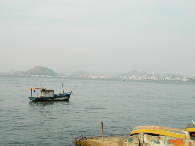
Then, from the central city you can look out across the bay to the suburbs on the eastern shore.

wpid-dscn2713-2013-07-8-15-35.jpg

Next, I booked a full city tour, to do some more of the touristy things. It took me to the Lapa Steps built by a Chilean artist…

wpid-dscn2758-2013-07-8-15-35.jpg

… to the Lapa arches, Maracanã stadium before up the mountain to see the most famous of attractions in Rio, Cristo Redentor – Christ the Redeemer.

wpid-dscn2736-2013-07-8-15-35.jpg

The hill it stands on gives great views over one part of the city and the peninsula that ends with Sugarloaf Mountain.

wpid-dscn2746-2013-07-8-15-35.jpg

Lasty, we were delivered to the end of the peninsula and took cable cars up to Sugar Loaf mountain. The views from both mountains are amazing.

wpid-dscn2767-2013-07-8-15-35.jpg

Getting to the top of the monolithic Sugar Loaf is a two step journey, the first up to Morro da RCA then up via the cable car another 1500m to Pão de Açúcar (Sugar Loaf Mountain).

wpid-dscn2784-2013-07-8-15-35.jpg

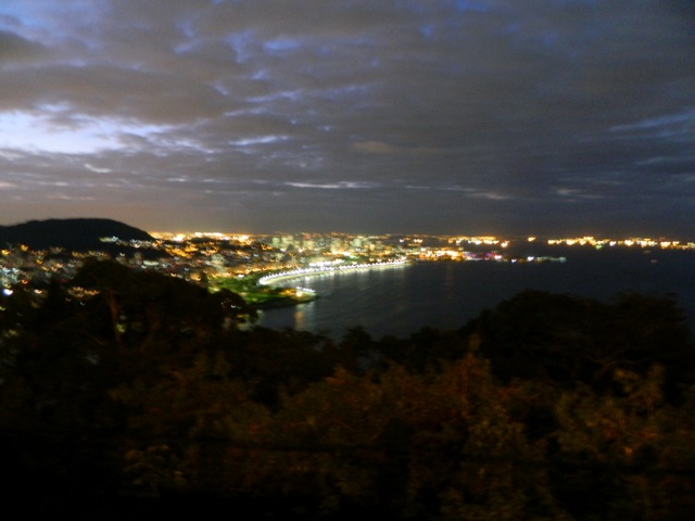
We stayed up there until sunset and watched the lights of the city appear below us. Definitely a spectacle to be seen.

wpid-dscn2807-2013-07-8-15-35.jpg

After a week in a tiny hostel in the city, it was time to move to the beach, so I booked three nights at a Copacabana beach hostel. On the second day, I hired a bike and rode the length of the busy Copacabana and Ipanema beachs.

wpid-dscn2809-2013-07-8-15-35.jpg

While it’s the middle of winter, it’s a beautiful 27ºC here and the beach has plentiful sun bakers, kite surfers and beach sports. The classic brazilian bikini is everywhere…

Rio de Janeiro has been an awesome experience. It feels more like a group of very different cities all merged in together.

Next I head towards Bolivia, stopping off in the Pantanal, the worlds largest wetlands…

The Lone Trail Wanderer