
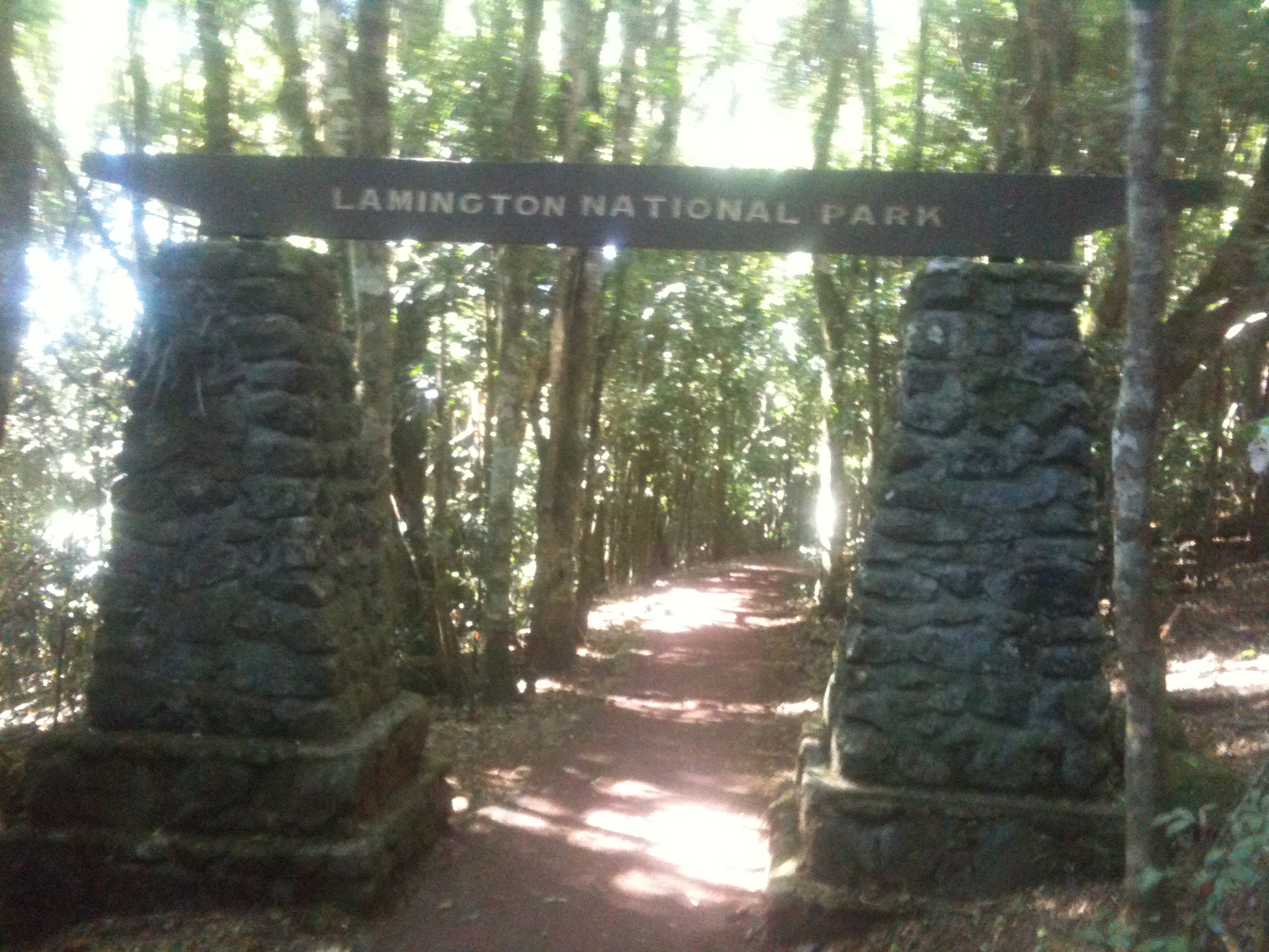
The Gold Coast Hinterland Great! Walk is a 54km, 3-day hike across both the Lamington and Springbrook National Parks with a 5km road walk in between.
Day 1 – 21.4km: Green Mountain O’Reilly’s retreat to Binna Burra
The day began in Brisbane at 5.30am. After much driving I dropped my car off at the Settlement Campground, the endpoint of my hike. I was delivered to the beginning by my good friend and her lovely but exceedingly strange adult daughter – at least the long drive wasn’t boring!
I headed out from the Green Mountains O’Reilly’s Retreat at 10:30. I’d estimated the walk at about 6 hours plus breaks with an ETA to Binna Burra at 5pm. I started later than I intended, but that’s the price you pay for a ‘car shuffle’ on a linear hike (where the start and end are not the same place).
Thirty minutes into the walk and I came across my first snake – a young red bellied black – which slithered quickly away. It was the last I was to see for the day and only one of two this adventure. The track overall was fairly easy-going with no steep climbs or descents and the initial 300m climb was not terribly apparent as it was a slow climb over several kilometres. The hardest part of the day was that much of the track was a muddy mess, meaning traction wasn’t good.
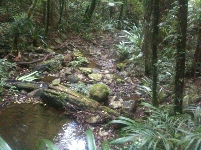
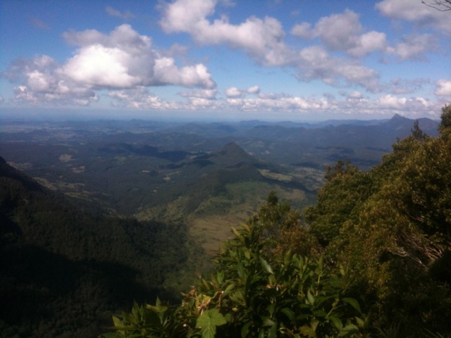
The waterfalls of Conondale National Park are not repeated here, with only small creeks and run-throughs. The lookouts over the border of New South Wales were pretty fantastic though with Mt Warning standing out among the hills. The track continued and after a while, more lookouts, this time out towards sea and the Gold Coast skyline. Unfortunately, not so clear in the photos.
As it was the Saturday of a long weekend, the track was very busy. I saw at least 40 other walkers on trail doing one of the numerous side tracks or day walks. Then, as I headed downhill towards Binna Burra, my first campground, I saw wallabies! It was a wonderful surprise but unfortunately I wasn’t quick enough with my camera.

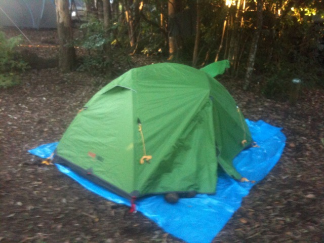
Binna Burra isn’t a walkers camp, but it’s the only legal camping location in the area. Just make sure you book a spot in advance. It’s a full camping park with washing machines, hot showers, fantastic pizza on Saturday night and happy hour! It’s not really wilderness but a couple of quiet beers after a hard day’s walk never hurt anyone!
Day 2 – 24km: Binna Burra to Woonoongoora Walker’s Camp
I left Binna Burra along the Lower Bellbird circuit trail and headed quickly back into the forest along a gentle downhill.

I passed a couple of lookouts which gave great views of Egg Mountain protruding out from the forest in the distance. As I walked I passed several small waterfalls and a series of awesome cliffs. At some points along the trail things became a little precarious as I literally had to hang on to a tree to get around one corner. But that’s what I was there for… adventure!

To get to Egg Mountain, I had a massive downhill slog. Steep downhills are the worst as they put a lot of pressure on the knees, ankles and feet. Weaving down the trail can make things easier, although dry dirt trails can make things slow going, as care must be taken with placing feet to avoid sliding. I passed Egg Mountain and followed the fence line of Numbimbah correctional centre for a couple of kilometres before arriving at Nerang-Murwillumbuh Rd where I stopped for lunch at the river.

The trail followed the road for about 5km before coming to the Numinbah café where I stopped for an ice-block and coke. After walking 18km with a 22kg pack, the last 5km in the open sun, who could resist? As there is no water at the next camp, I took supplies here for both my cooking requirements and for tomorrow’s walk.
After the cafe, the trail cut back into the forest up a steep hill towards the walker’s camp. The climb was tough, made tougher as it was at the end of a long hot day and because I was carrying extra water. I finally arrived at the walker’s camp, a field set out for camping with only a camp toilet and nothing more. The grass was knee height, which made pitching my tent a little more difficult, but it did make for a softer sleeping spot. After setting up camp, I settled in for a cool evening.
Day 3 – 9km – Woonoongoora Walker’s Camp to Settlers Camping Ground
Nine kilometres doesn’t sound far, but this part of the walk has multiple steep climbs and descents. The first climb apparently has 900 steps, about 82 floors of a building, or so the sign said. I only counted 829, but after climbing with a heavy pack I’m surprised I could still count by the end, so I could be wrong.
A quick stop at a park for a snack after the climb and I was off again into the forest. The trail follows the Nerang River for a fair distance, crossing it on several occasions and has many small waterfalls. I knew I was getting close to the end of my walk when I started to see people on the trail again. Lots of people. But then it was the Monday of a long weekend. I must have passed 100 people as I headed towards Purlingbrook Falls. The falls are spectacular from both the pool at the bottom…
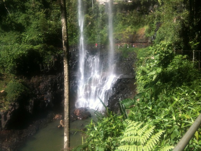
…to the top, and is the major reason so many people were visiting, although the climb was long even though it only had only 290 stairs and was all concreted.

Settlers Camp Ground was not far from the top of the falls. I arrived at midday and drive the 100km home. Overall a Great! Walk indeed!
The Lone Trail Wanderer

Tx for your post and photos. I’m planning to do the walk and appreciated your report.