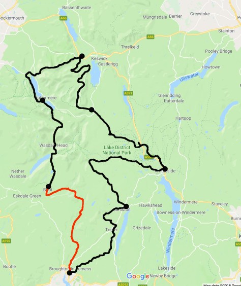
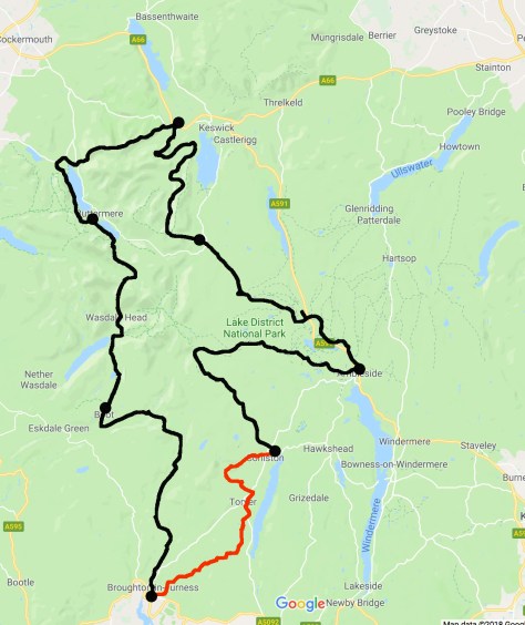
Day 5 – Boot to Broughton-in-Furness – 14 miles (22.5km) – 6.25 Hours
After the hard climbs of yesterday, today is longer but with less climbing. With the sun out, today should be an easy and glorious day.
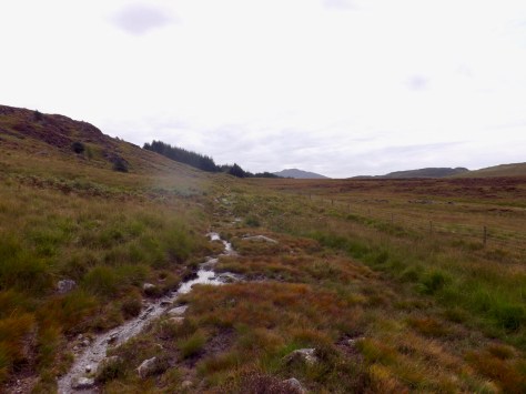
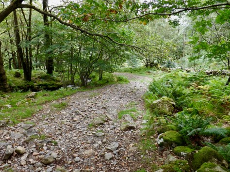
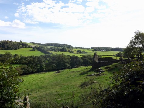
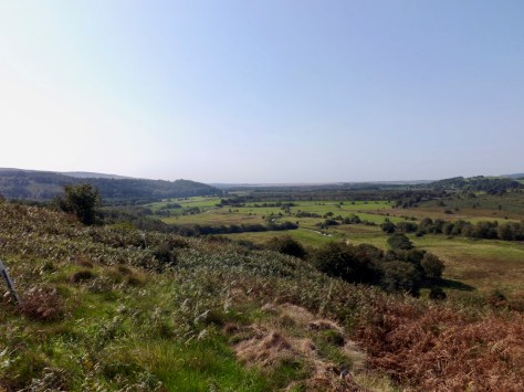
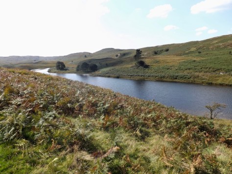
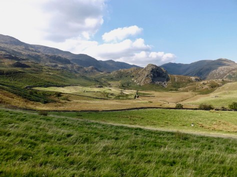
From the hostel, a mile out of Boot, the trail quickly crossed to the other side of the river cutting more than a mile off the trail should I have stayed in Boot. From across the river, I could see the rocky ridge I had come down the day before. The little building in the middle is the hostel.
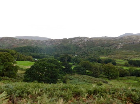
I crossed farmland for a short distance before the trail cut up onto Harter Fell. There was plenty of sheep, so I spent much time avoiding their droppings as I walked through the paddocks. As I climbed higher, I got a better look along the valley I had stayed in overnight.
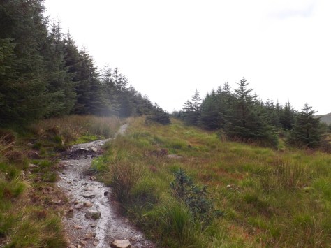
At only 350m above sea level, the climb quickly came to an end, and I got my first look beyond and into Ulpha Fell, a crag dotted area. It was here that the bogginess began again and I spent much time stepping around the flows of water hoping not to sink ankle-deep in the slush. I failed several times, thankfully my boots are mostly waterproof, so I did not suffer the wet feet of earlier days. Ahead I could see the beginning of Dunner Forest, one of the few real wooded areas on this hike.
Unfortunately, the trail through the forest was also boggy in many places.
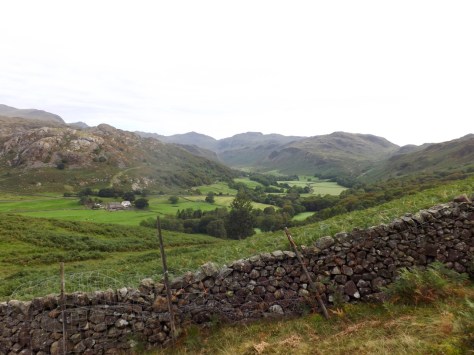
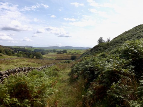
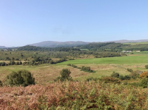
But, it still gave good views across the Dunnerdale-with-Seathwaite range. You have to love these English place names.
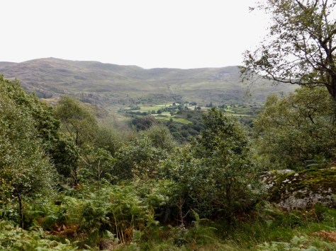
As I came out of the forest, I came out at a farmstead where I found a nice place to sit and have lunch. A family with two young boys came past laden with full camping gear. They stopped for a brief chat, and I discovered the wife had grown up in the town I would be staying at overnight – Broughton-in-Furness. After my early lunch, I followed them along a grassy road, through several sets of gates before I got my first look down on the valley of High Wallowbarrow.
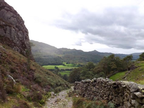
I passed the family as they ambled, and headed steeply down a curving rocky trail that just seemed to go on forever.
The curved trail ended at a farm where I turned left and headed into a wood where I crossed a river on stepping-stones before eventually coming to the Newfield Inn, where I stopped for a well-deserved cider.

After my break at the Inn, I walked on quickly and headed back up into the fells. With a mountain called Caw on my left, I worked my way up to 355m above sea-level.
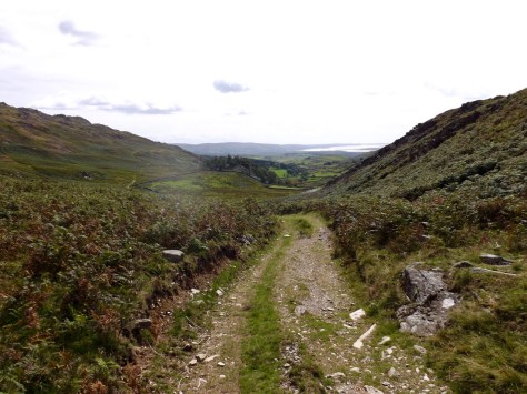
As I followed the Park Head Road path I quickly came to the top and a view out over the Irish Sea in the distance.

From here the trail led me downhill towards the Broughton West Flats, and again a view of the Irish Sea.
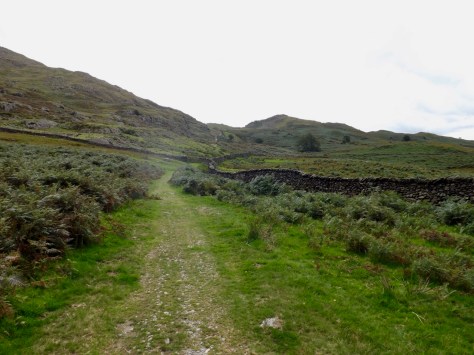
The trail came down to a road for a couple of hundred metres before coming to a farmstead called Hoses. The path then cut back up the hill sharply and steeply, along the fence line. It cut through fields of ferns scratching at my legs as I walked, with the occasional nettle hidden beneath it.
Eventually, I came down into the flat farmland where I crossed paddocks for several kilometres until I was forced to walk through a thin trail covered in bramble and nettle. As much as I tried, there was no avoiding it. Hours later, and my legs are still tingling from the nettle stings.
I finally came out onto a major road and was forced to climb a steep hill on a footpath. But on the other side was Broughton-in-Furness, the first place I could get a signal for my phone in days. I located my BnB, my first of this trip, where the owner was away, and I would have the place to myself.
Day 6 – Broughton-in-Furness to Coniston – 13 miles (21km) – 6 hours
When I woke this morning, there was brilliant sunlight coming in through the B&B’s sky-light. When I went downstairs to confirm, I found a perfect blue sky. According to the maps, today is to be a fairly average length day with few climbs, an easy one in the sun.
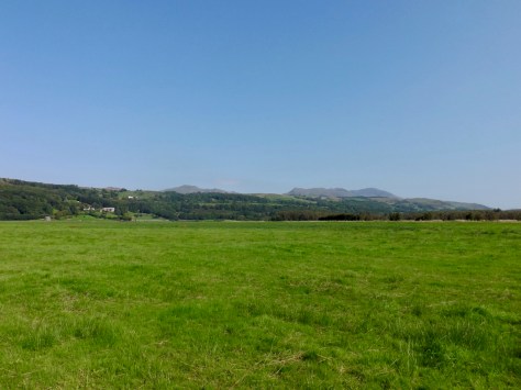
As Broughton-in-Furness is just outside the mountainous region of the Lake District, there is plenty of farmland around. For the first two miles or so I crossed paddocks, some that were once public walkways, but have been blocked off. This did not stop me crossing, I just had to be quick.
I crossed a small Moss called Middlescough which was still not much of a climb, but had a fair amount of ferns covering it, both living and dried out.
I then pushed up into Thornthwaite Latter Rigg, a small rolling hillock that was an easy climb which barely got the heart pumping. The only annoyance was the number of brambles hidden within the ferns, so climbing up the thin trail caused me to come away with many scratches up both arms. Battle scars of hiking.
I followed the trail up Woodland Fell. I’m not sure where this name came from as there is no woodlands, trees or similar, just boggy tall grass. This led me to my first proper climb of the day, but only to 150m.

The path then joined the Greater Cumbria Way Trail and headed north towards the Beacon Tarn, but before I reached it, I found a spot to rest and eat the lunch I had prepared.
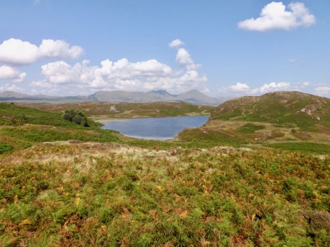
My next stage would be to walk around the Tarn, but when I got to it, it was very boggy, so I took the option to climb Beacon – the hill beside the tarn. At 255m it was not particularly strenuous but the view of the surrounding land and nearby reservoir was well worth the minimal effort.
And off to the right from the top of Beacon, the five-mile long Coniston Water. When I eventually arrived at the hostel, it was filling with people who would be swimming the length of the lake for a charity event.
I walked quickly down the hill along the trail and quickly came to the tarn that simply had the name ‘reservoir’. Before I crossed the farmland for about a kilometre to arrive at Torver, a small township which looked to have had mass-produced housing, all in grey.
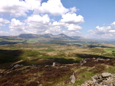
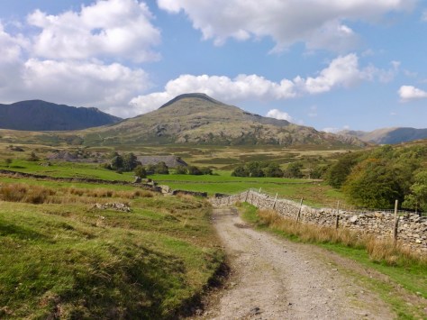
From Torver, I began climbing a stony road as I ascended slowly towards the mountain known as the Old Man of Coniston.
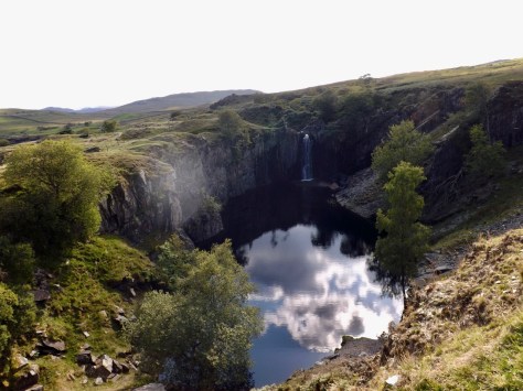
As I followed the trail steadily towards the base of The Old Man, I came to a hidden pool sunken into the rock fed by a waterfall.
At the base of the mountain, the trail turned to a road and lead towards the town of Coniston.
Behind The Old Man is a horseshoe valley called the Coniston Fells. This would be a great place to come back and hike around.
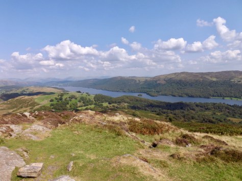
I took the advice of a guy I met at the Buttermere YHA and modified my route to climb around to Miners Bridge which gave me a good view across the valley to Coniston town and lake.

While it was an easy day, my last day looks to be the hardest and longest yet. I will start the day with the highest climb of the circuit and with the hike coming to an end late tomorrow.
The Lone Trail Wanderer
