
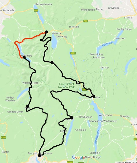
Day 3 – Braithwaite to Buttermere – 11 miles (17.7km) – 5 hours
The good news today is that it didn’t rain. It did think about it a couple of times, but the waterworks never eventuated. I was thankful, as my boots had struggled to fully dry during both of the previous nights, even in the hostel’s dry rooms. And, on another positive note, today will be the shortest and easiest day of this hike.
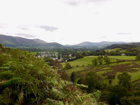
My overnight hotel had a late check-out, but I still managed to get away at 10. I walked though the village and found a place to buy a sandwich for lunch. Then, 100m out of the town I found the trail and headed out along it. At a suitable point, not far along the path, I stopped and looked back to Braithwaite.
The trail was thin with brambles and thorn bushes on either side, but I came away unscratched. After some time the thin path met a road that followed the valley around to the right following Coledale Beck.
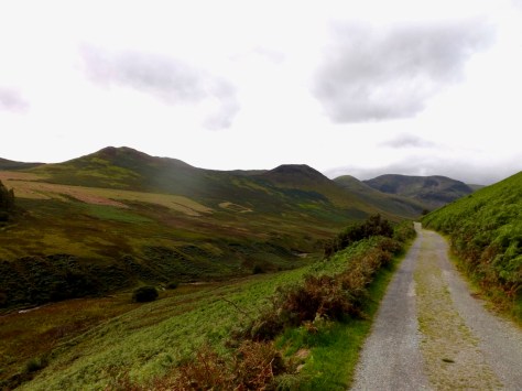
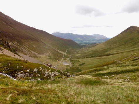
One part of hiking I enjoy is the mystery of what I find along the way and as I followed the road around I was met with Force Crag at the end of the valley. The thought that crossed my mind was, ‘I have to climb that?’
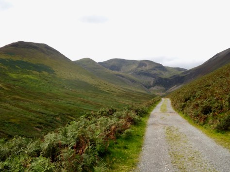
Things at a distance always look worse than they really are and as I got closer to the valley’s end, I could see the trail leading up the hill beside it. It still looked rather thin and precarious, but again, things appear worse from a distance.

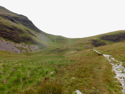
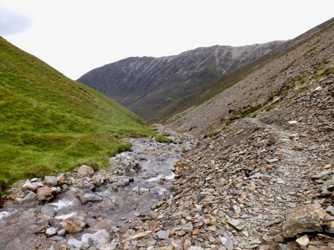
To follow the trail, I had to cross the river on stepping-stones, before climbing the hill, which I found easier than I had expected. While it had looked thin from a distance, you could have driven a 4×4 vehicle up the rocky trail. At the top, I looked back along the valley.
And once at the top, the trail continues up the hill beyond, zigzagging to the top of the pass between Sand Hill and Crag Hill.
A series of people came over the top as I climbed, and one guy told me it was very windy at the top. I took heed and near the top put my jacket on. I wear my coat backwards unless it’s raining heavily. This is to mainly protect against the wind and keep me warm, while not adding to the sweat running down my back. And, should I get too warm, I can pull my arms out without losing the wind protection at the front.
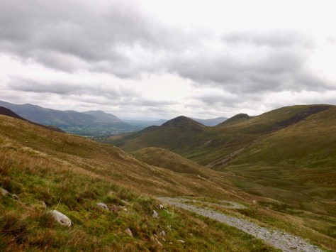
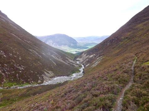
When I got to the top, it was indeed very windy. I looked down the other side and could see Liza Beck as it made its way along Gasgale Gill. I followed the trail down, fighting against the wind as I went.
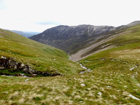
The trail was not an easy walk, at many places was covered in slate, and with parts that had slipped away. While I was not very high above the stream, at many places I was still forced to hang on to whatever I could just to get past.
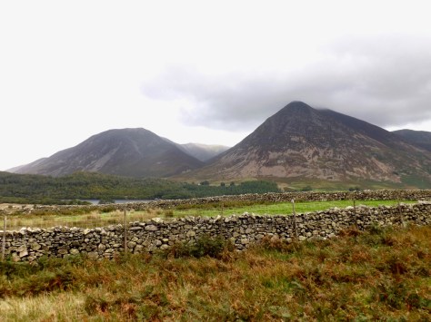
Two-thirds of the way down Loweswater and the peak beyond came into view. Finally, I exited the valley and came out on green paddocks. I crossed a major road and followed a trail through a small wood. I came out at a carpark at the other end and followed the road for a short distance to Loweswater village, where there’s an inn.
The sky decided it might be a good time to rain, so I stopped for a break and a cider. By the time I’d finished, the sun was out again, so I wasted little time heading off again. Across the valley, I could see the Gill I had come from beginning to look menaced by clouds.
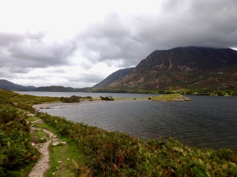
Ahead of me, Crummock Water came into view as I came over a small hill. The trail cut along the base of a ridge line, although the path itself was straightforward to follow and not particularly difficult.
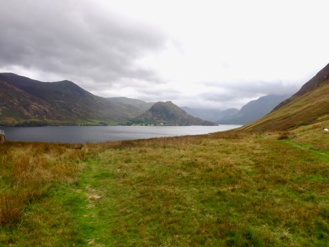
Towards the end, I passed the Low Long Crag that jutted out into the lake, a mini peninsula with a beach on each side.
Not long after I arrived at Buttermere village and spent some time wandering around trying to find the YHA. When I got there, I found I could not check in until 5, so I headed back down into the village for a cider.
The Lone Trail Wanderer
