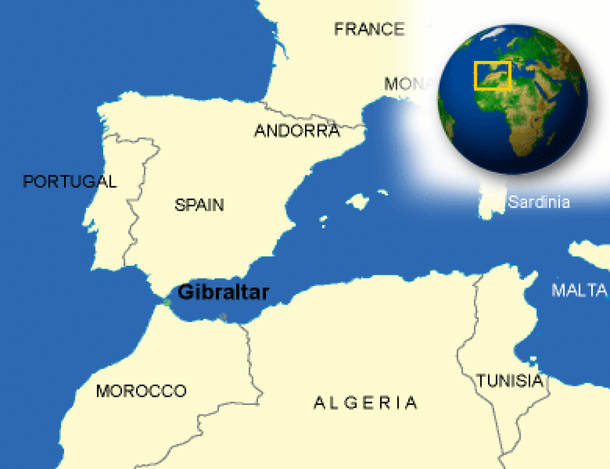
After my Camino and a week in Seville, I went south to visit Gibraltar before I headed across the straits to Morocco. Gibraltar is a British Overseas Territory and a city in the south of the Iberian Peninsula, bordering Spain. While it was a habitation site of Neanderthals dating back to 50,000 years ago, it was used only as a religious location by the Phoenicians around 950BC and not officially settled until the 1100s. It became part of Britain in 1713.
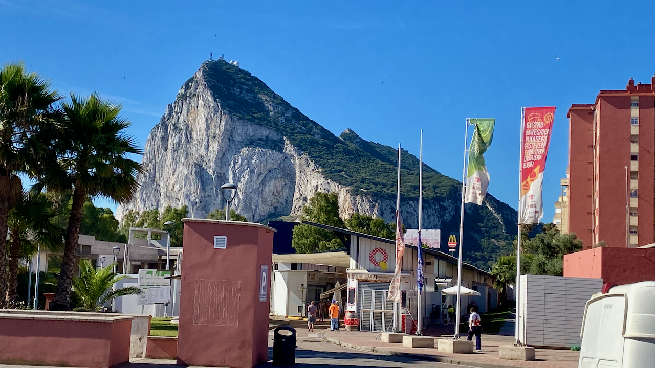
Much of Gibraltar is a ridge line known as The Rock, which at 426m high, runs the length of the city, leaving only a thin swathe of land where the city actually is. I stayed in the city of La Linea de la Concepción, just over the border in Spain. The crossing was fairly easy, I walked through passport control, they saw I had a non-EU passport, scanned and stamped it, then I was through in a matter of 30 seconds. It was the same process coming back the other way, although due to the line of people, it took about 15 minutes.
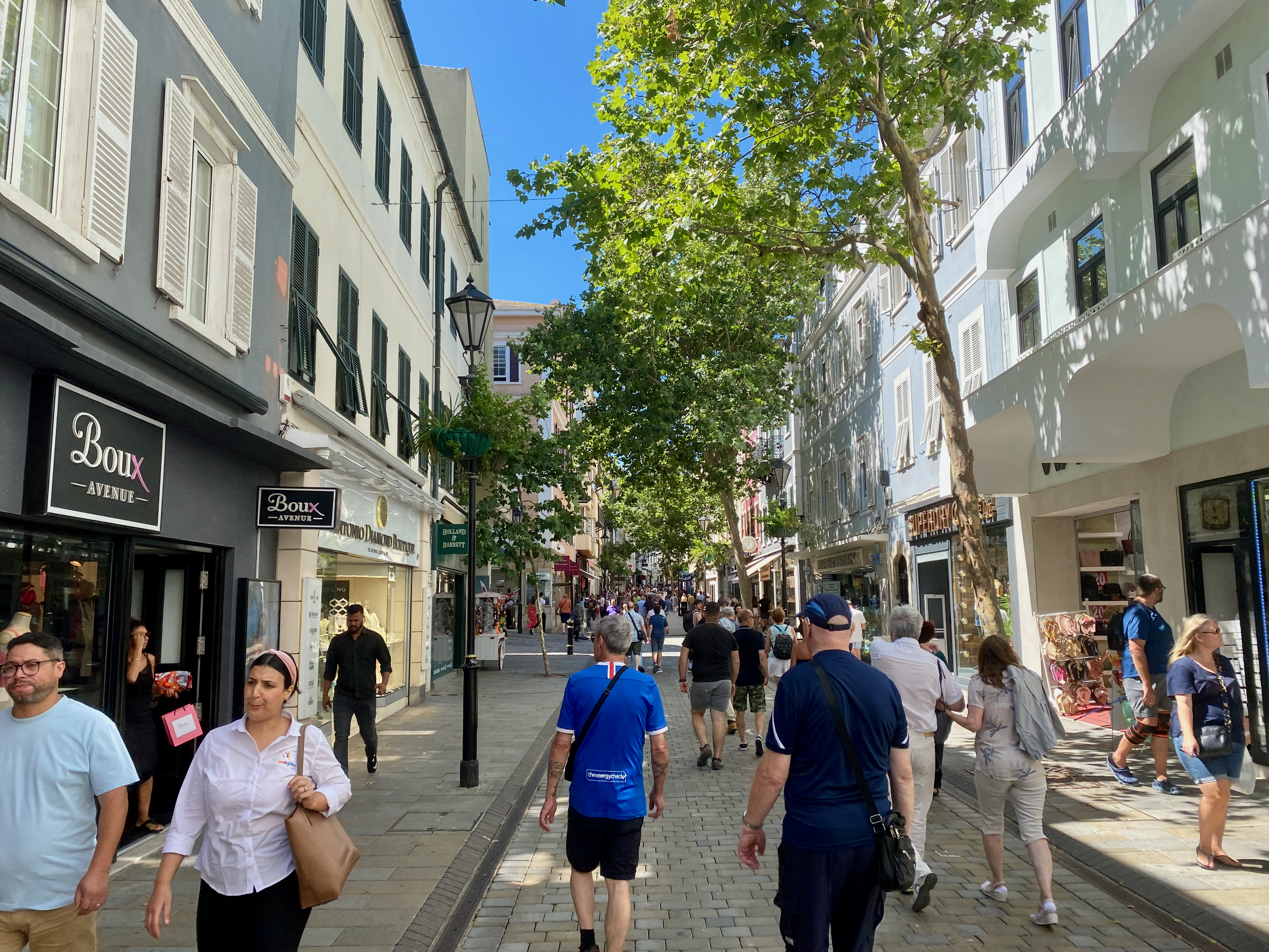
The Mall Most of the accommodations on Gibraltar are apartment buildings and hotels, although some single houses run up the side of the rock. Through the middle of these accommodations is a long street mall running from one end of Gibraltar to the other. The most annoying thing about the shops and cafes is that they take the British Pound. It’s annoying as I’ve been using Euros in Spain for some time but thankfully I have a British bank account. The good thing about shopping in Gibraltar is that you don’t pay UK VAT on products.
Pillars of Hercules The Rock of Gibraltar is one of the fabled pillars Hercules created, when legend had him smashing through a mountain and creating the Gibraltar straits. This is one of the many differing stories told of what Hercules apparently did. The Rock of Gibraltar was known as Calpe Mons, while the mountain on the African side, is disputed between two different peaks, Monte Hacho and Jebel Musa. This one seen across the straits…
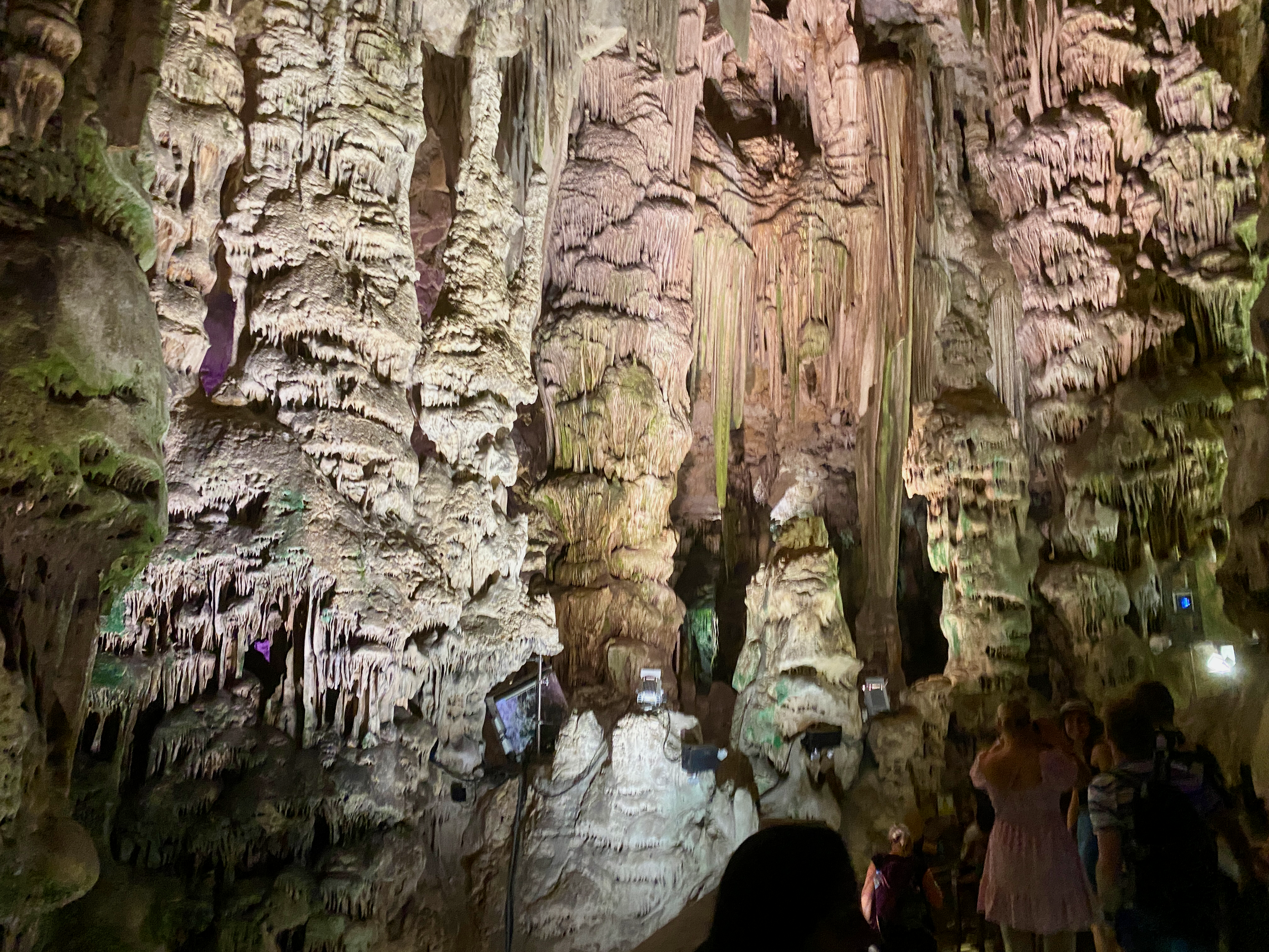
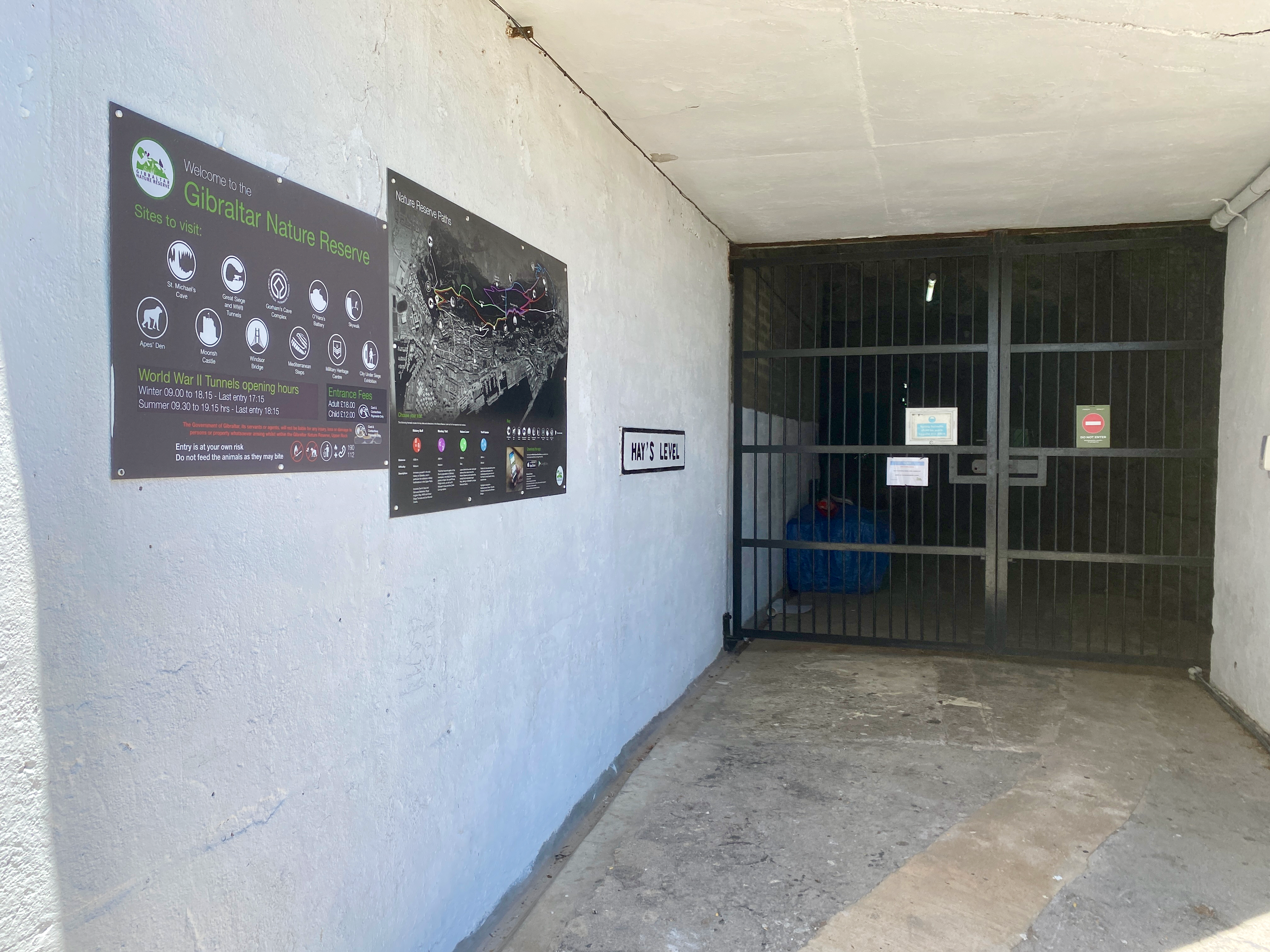
St Michaels Cave Near the south end of the Rock of Gibraltar and 300m above sea level is St Michael’s Cave, one of the 150 cave systems in the area. This one has been set up as a tourist destination with nearly 1 million visitors a year. Rainwater seeping in from above has created many features in the rock. For purposes of tourism, a new entry was created to ensure adequate air flow, while a lighting system was installed, along with an auditorium with 100 seats and a music show.
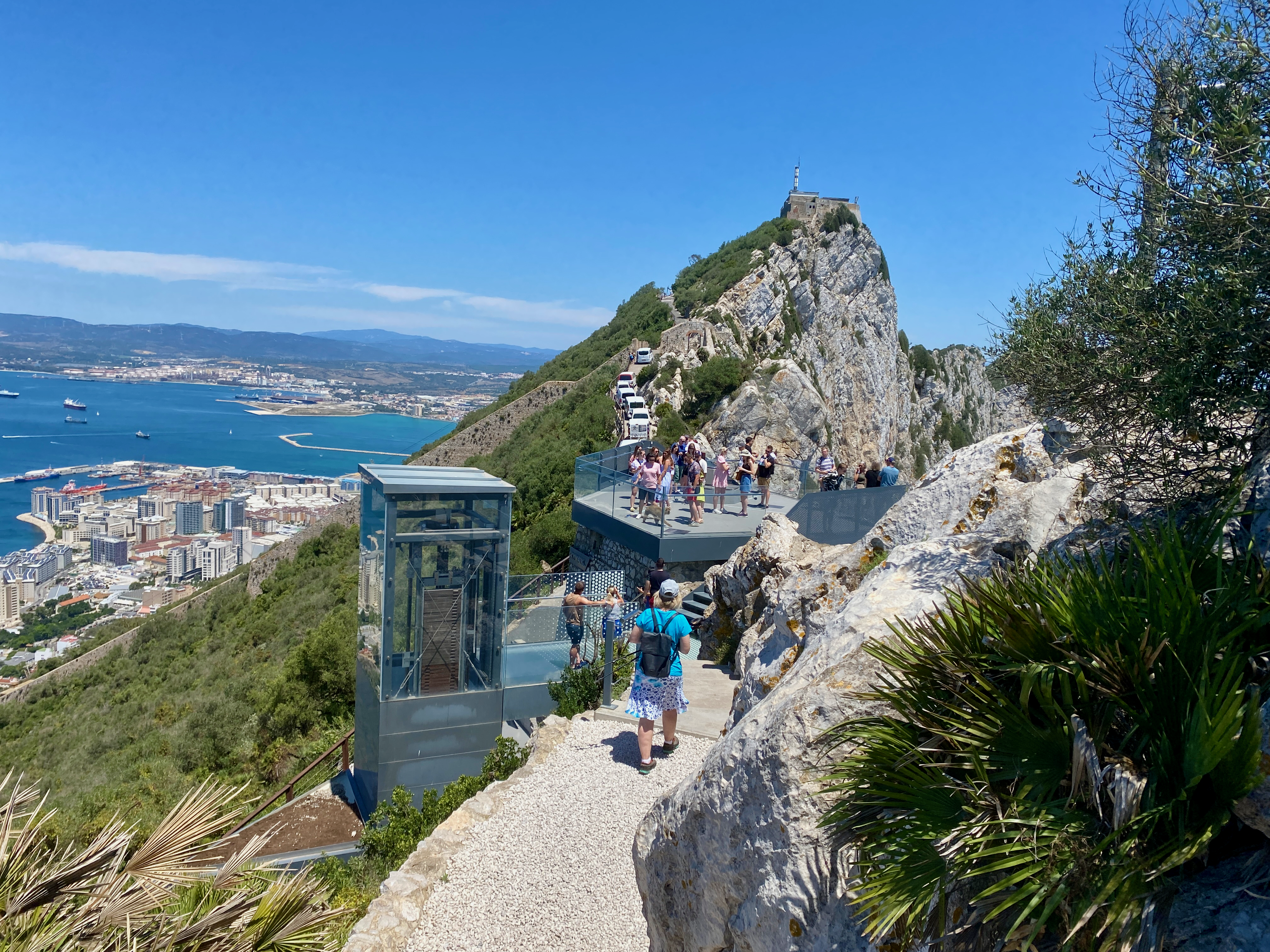
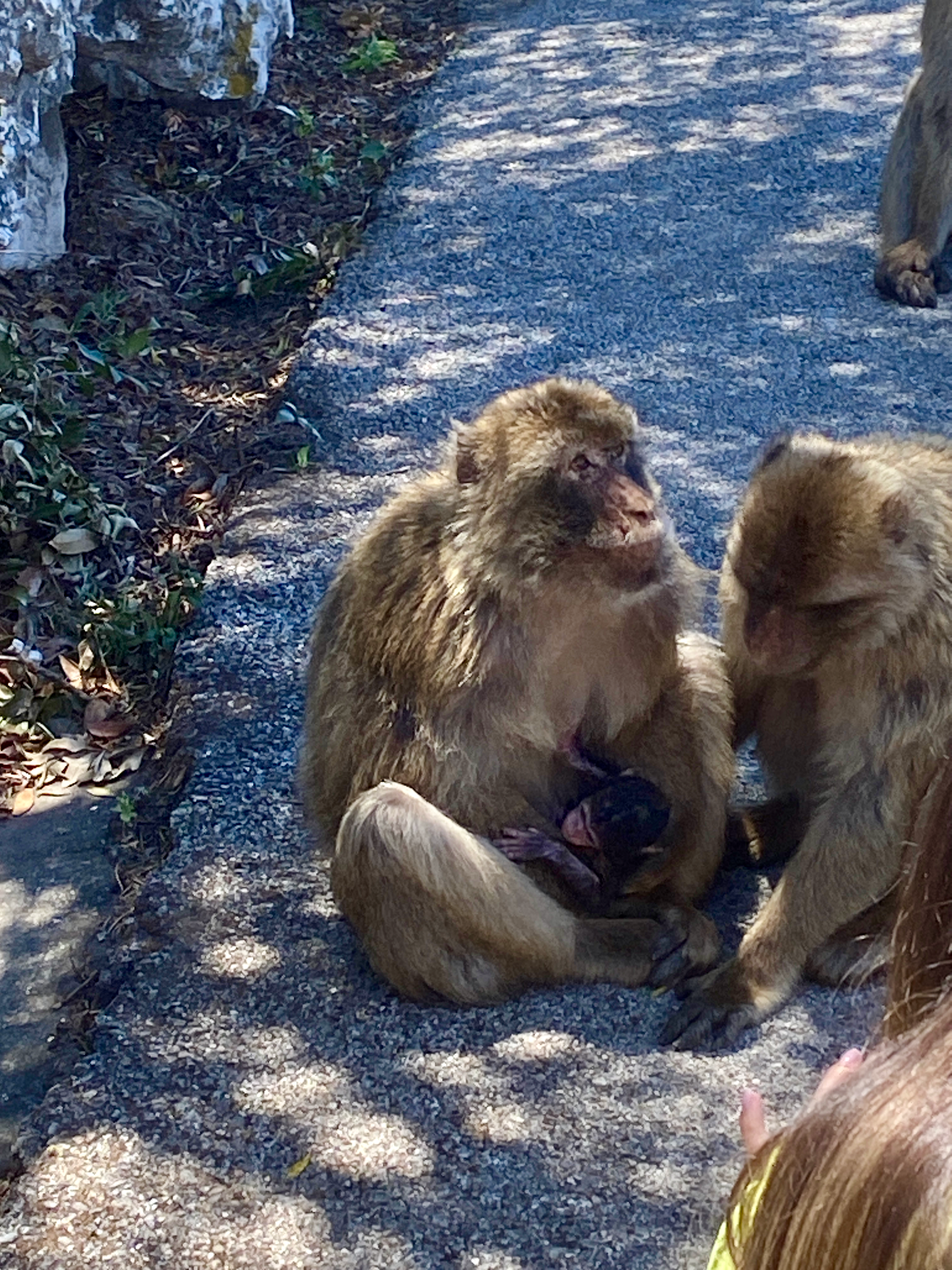
Skywalk and Monkeys Two of the highest points reached during the tour was the skywalk, high on the rock where you can walk out over the edge; and the Monkey feeding zone.
There are around 300 Barbary Macaque Monkeys. Some of them can be cheeky, looking in windows and getting into cars to rifle through belongings looking for food.
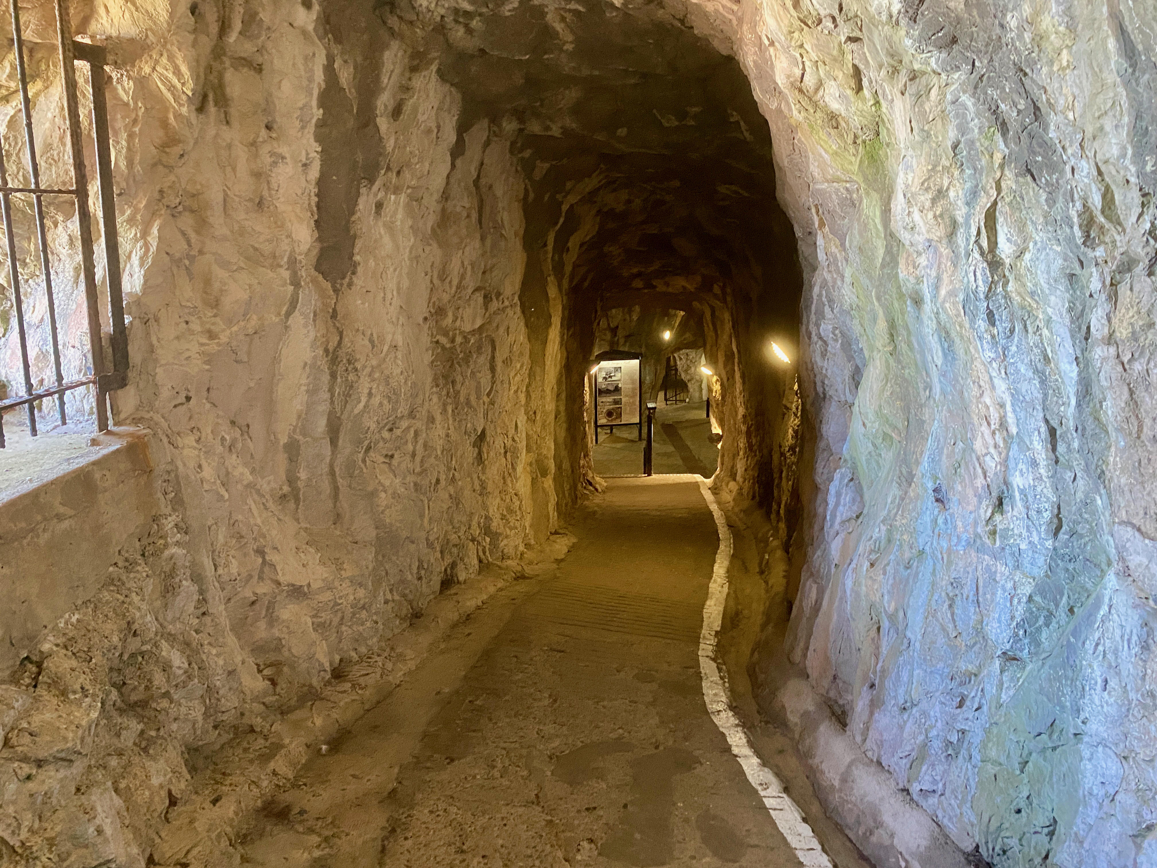
Great Siege Tunnels Started in mid 1782, these tunnels were to access cannons pointing north during the 14th and last siege on Gibraltar by the Spanish and French. By 1790 there were 1.2km of tunnels dug in the north end of the rock housing cannons focused mostly to the north.
The tunnels now house a museum of sorts in the different rooms along the tunnels and exploring them can take an hour or more.
World War II Tunnels During WWII Gibraltar was evacuated so the military could use it as a base. There was estimated 30,000 British Soldiers, sailors and airmen on the rock during the war. But the British also had a special operation to build tunnels to hide men, should the German invade. They were never used as the German did not come to Gibraltar. The tunnels have been closed ever since due to the means they were cut.
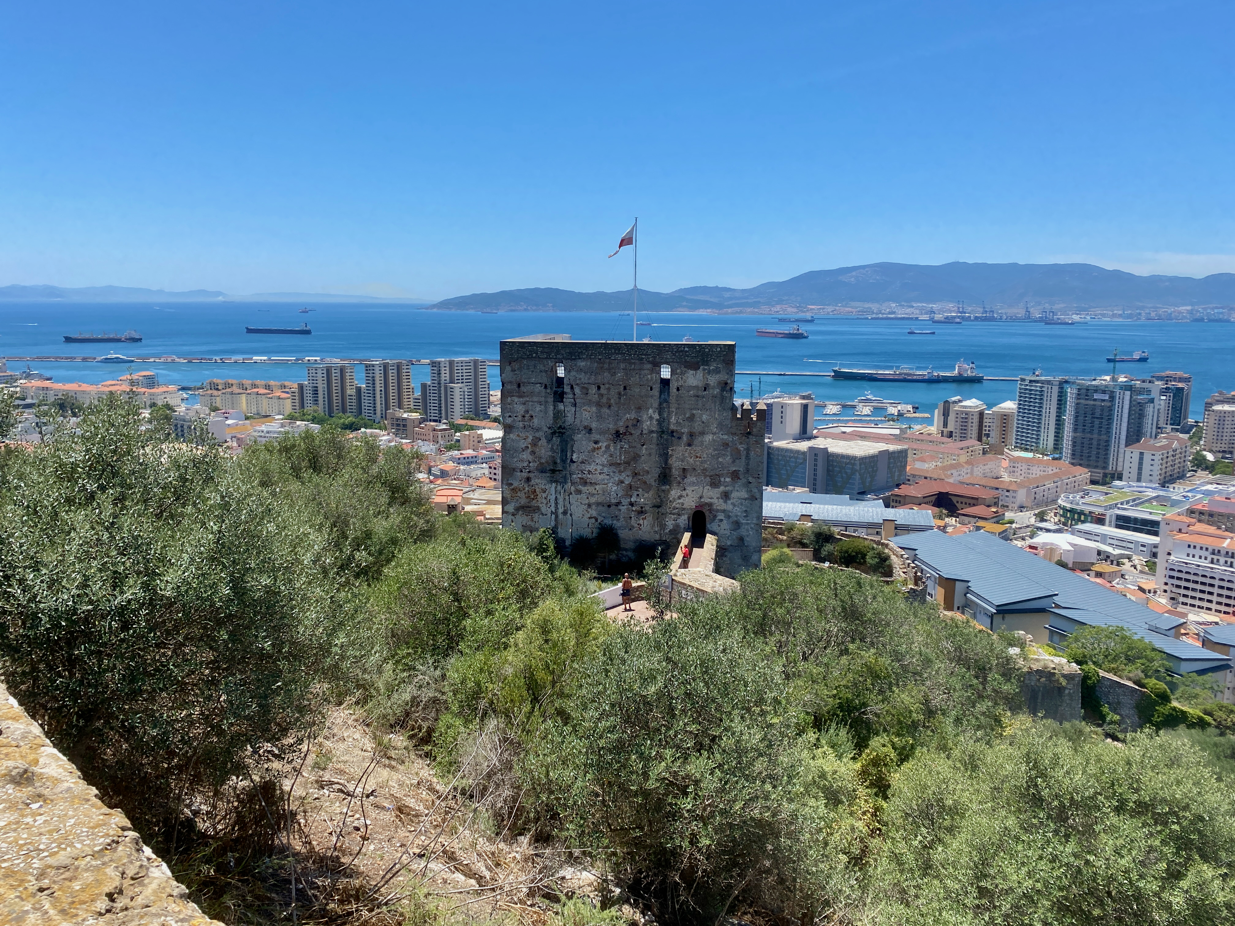
Moorish Castle The Tower of Homage is the sole remaining tower of the Castle built by the Moors in the 1100s. The Castle played a prominent role in the Muslim capture of much of Western Europe for 700 years. It gives great views over Gibraltar, The Rock and the coastline across from the city.
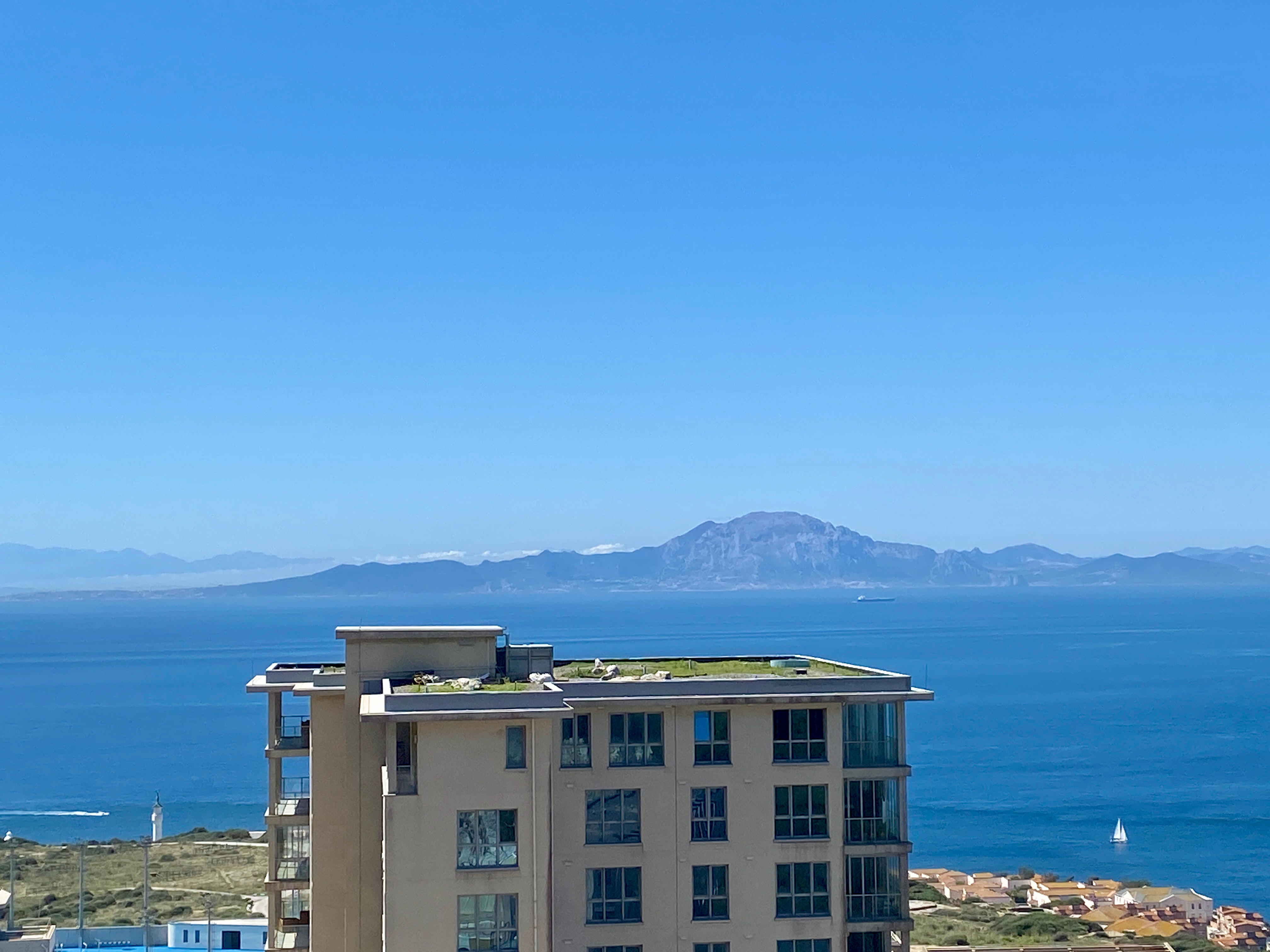
Impressions, Due to its small size, there’s not that much to do in Gibraltar. But as I only had half a day, the tour, and a good wander of the streets, was enough. It was nice to visit and to see Africa from a distance.
Next, I head to Tarifa, the southernmost tip of continental Europe in preparation for my ferry to Morocco. The World Wanderer
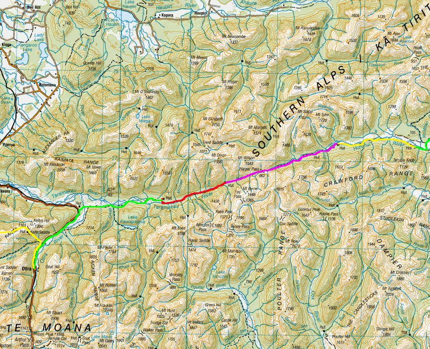
In late February 2023 I embarked on my longest walk in New Zealand, 13 days across the Southern Alps of the South Island. Go back to Days 1 – 3.
Day 4 – Hurunui No. 3 Hut to Locke Stream Hut – 15 km – 6 hours– Pink
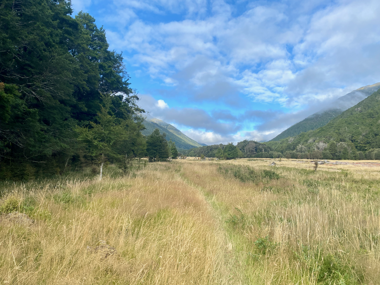
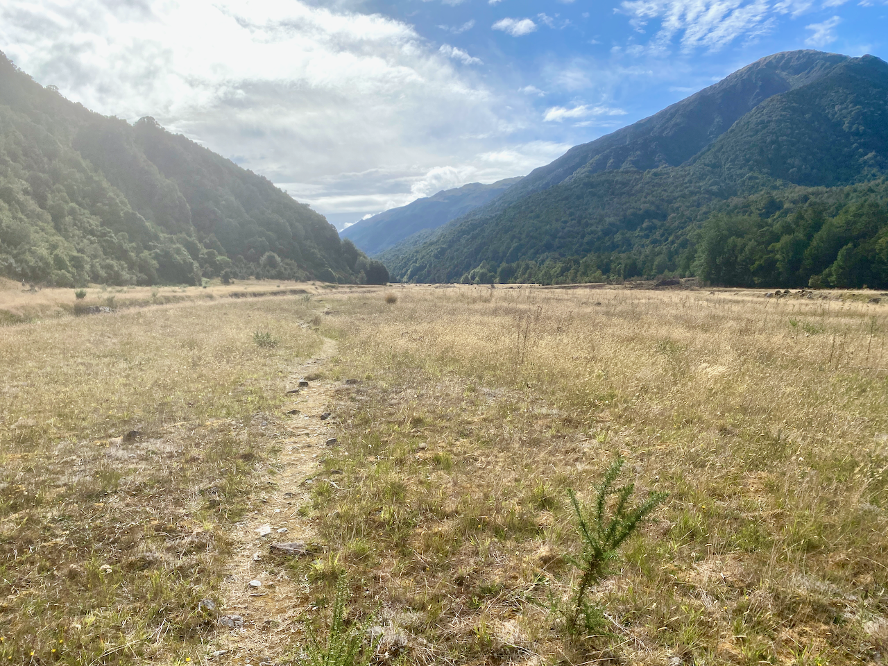
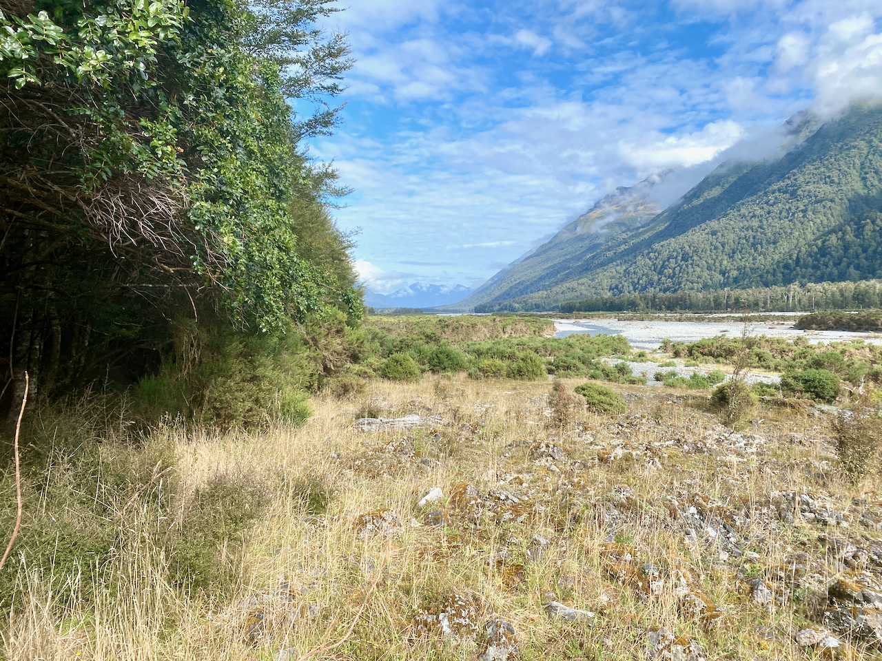
Thankfully the sun came out today as it will be the hardest day so far, taking me over Harpers Pass at 967m. I headed out along thee grassy plains feeling pleased that the rain had passed for the time being, although that didn’t mean the grass wasn’t wet from dew.
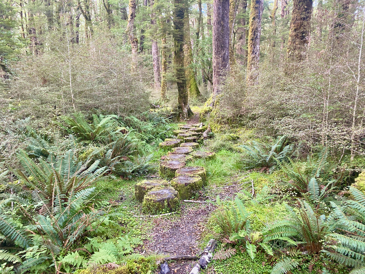
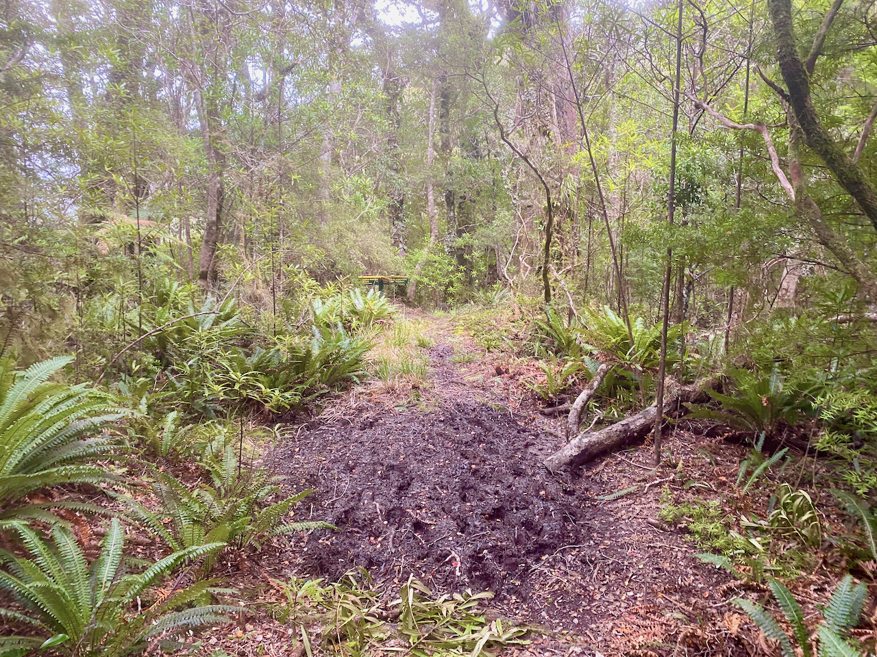
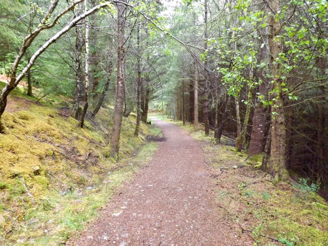
The trail headed into the forest for a while, with laid out tree stumps covering the muddy patches. Good, but still slippery.
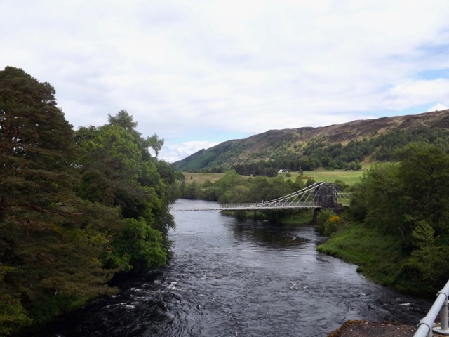
I soon came to the three wire bridge and crossed, pushing uphill a little in the woods.
Until once more coming out onto the flat via a rocky landscape before arriving at a small hut called Cameron’s Hut, which has only one workable bunk. I’d planned to stay here last night, but a walker the night before had persuaded me not to.
I marched on up the trail as it steadily began to climb, planning to stop at the Harper Pass Bivvy for lunch near the top.
I got to the bivvy an hour later, and stopped for lunch with two people there. And as they left, the three that had been following me since day 2 arrived. I ate my lunch in the sun with them, then letting them go first, I headed up the final climb to the top of the pass.
The trail down the other side was steep and rocky, and I’d been warned I’d be getting wet feet. I finally got a good view down onto the valley I’d be walking into and continued down the very steep trail, slipping a handful of times, but nothing serious.
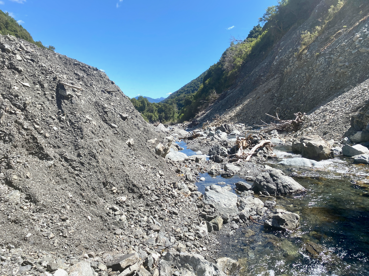
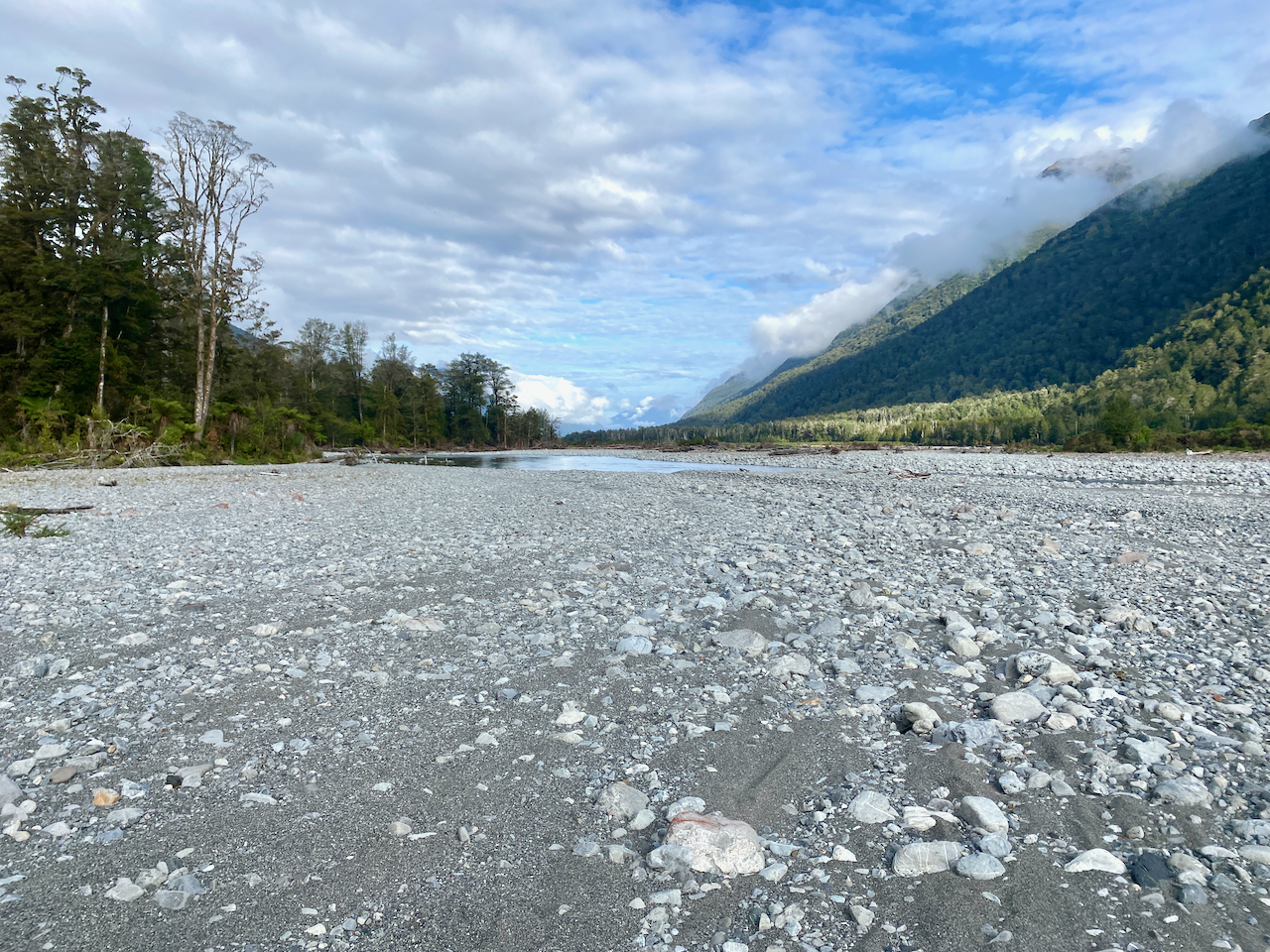
I eventually came to another three wire bridge and crossed into a rocky riverbed where I rock hopped all the way down, scrambling up the bank in a couple of cases to get away from the water.
The rocky river continued, as I climbed one of the banks and walked in the woods for a bit, then back to rock hopping.
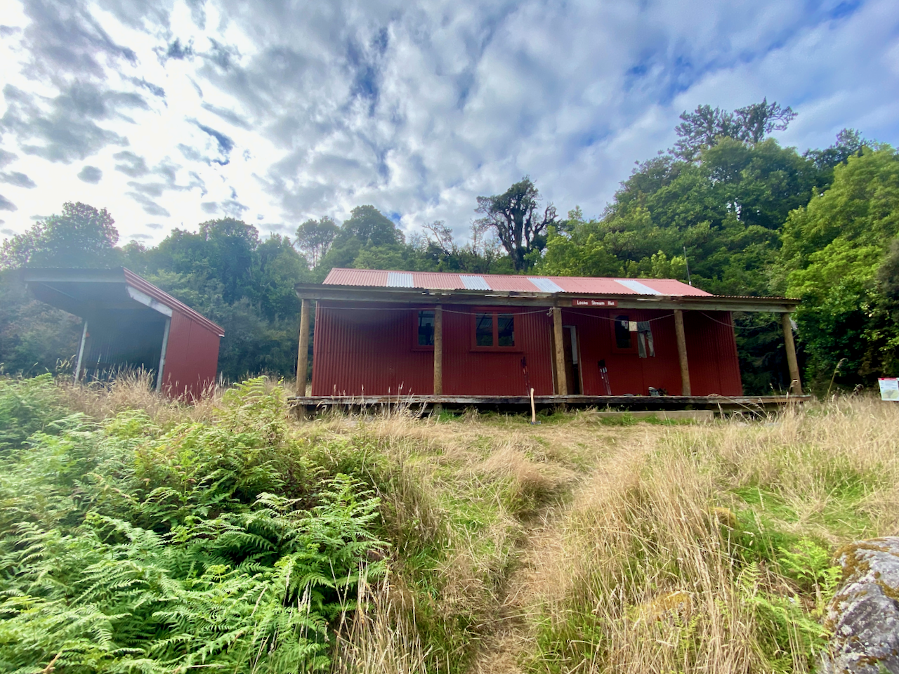
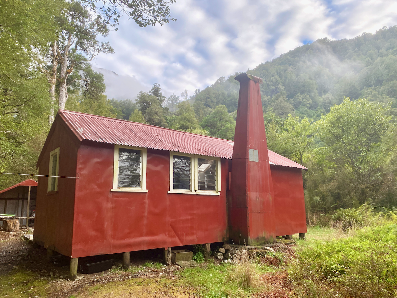
I came around the corner to spy people in the river. I climbed the bank to find the Lock Stream Hut where I’d be staying for the night. It was warm enough that there was no need for a fire, which was good as we couldn’t find any. With the only water that from the river, I topped up from there trying to avoid the sandflies that were eagerly waiting for me. I also did some washing in the river and laid it out to dry, then sat reading my book in the sun, or at least trying to, as again the sandflies swarmed us all, even covered in repellant.
Day 5 – Locke Stream Hut to Kiwi Hut – 8.4 km – 2.25 hours – Red
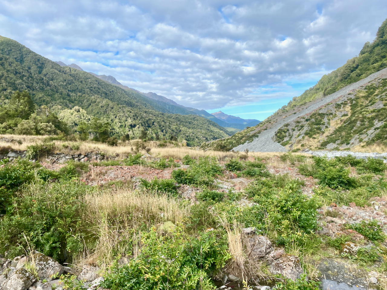
Again, my preplanning had stated a fairly long day today, but in revision, it turned out to be little more than 2 hours. But as my following day was a firm booking at a backpackers, I didn’t want to turn up a day early. I headed out from the hut and across some rugged landscape.
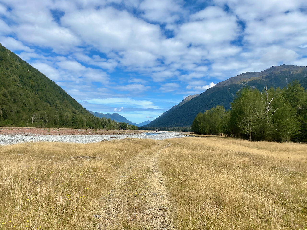
The trail lead me across the river, and I spent some time walking back and forth trying to find the best location to ensure I wouldn’t get my boots wet. I eventually found it and headed across into the grassy plains.
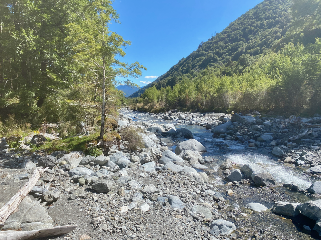
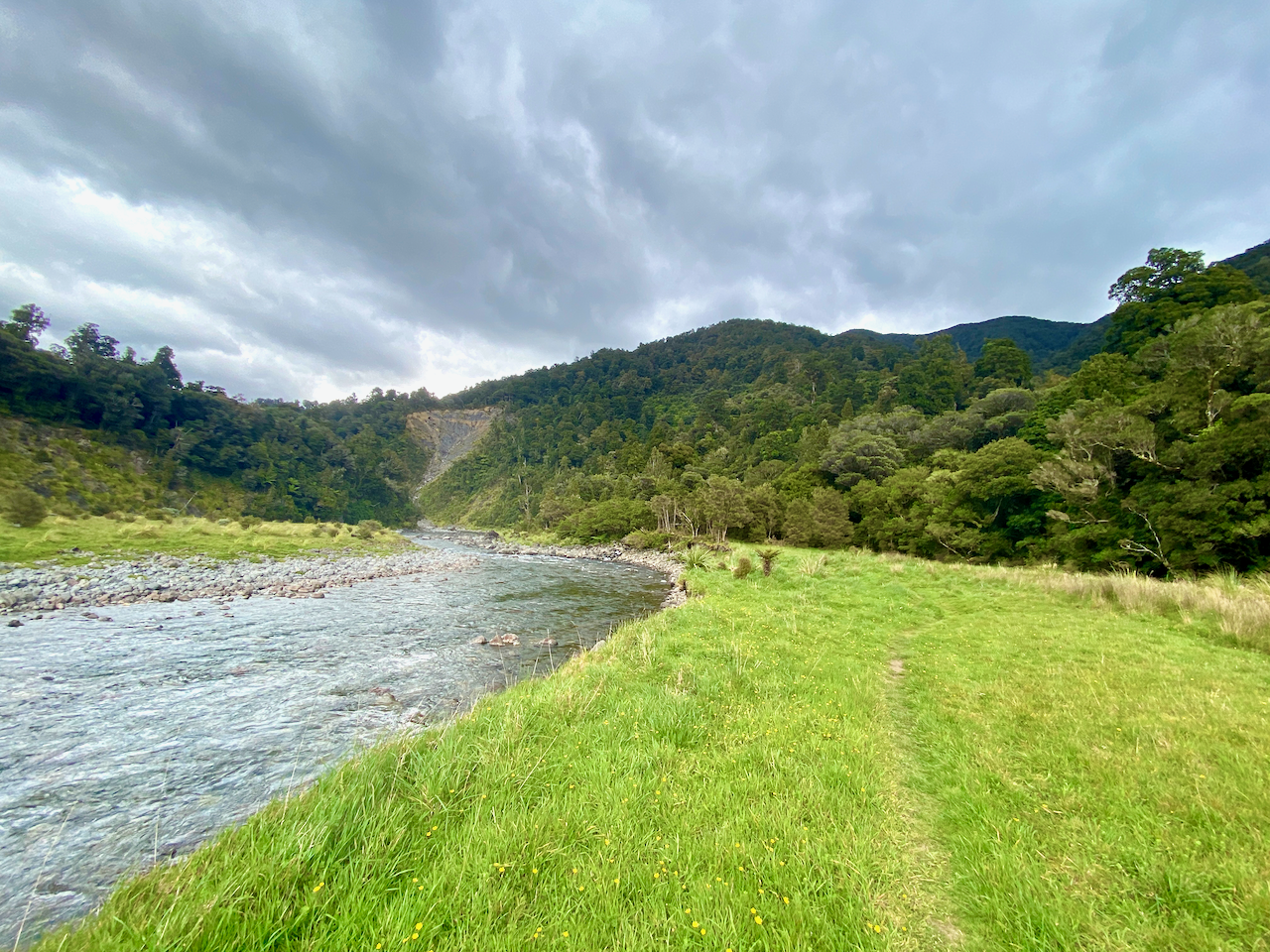
The trail rambled through the red rocks fairly common along this route, but staying on the true right of the river.
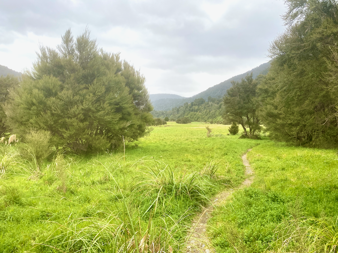
Most of it was along a grassy plain beside the river, with forest on the right.
I followed the trail on, seeing no-one else as I walked, the weather becoming better.
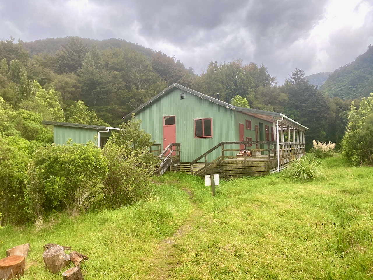
After a while I came to a sign to Kiwi Hut, pointing into the forest. I headed in, following the trail through to a large grassy paddock and up a bank. It was warm and before lunch when I arrived. I scouted for some wood and dragged it back to the wood shed, but felt there would be no need to start a fire, so didn’t bother cutting it up. A couple arrived and stopped for lunch. I brewed coffee and chatted with them before they left.
I then changed, cleaned the hut, checked the water and just chilled for a few hours until a large group of TA walkers arrived. More people would arrive during the day until all 7 beds were full and there were three tents out on the grassy patch.
Day 6 – Kiwi Hut to Rata Lodge Backpackers Otira – 21.45 km – 6 hours– Green
I headed out the next day looking forward to having a hot shower and staying in a real bed. Soon after heading out, I crossed the river which had split in two on the river plain. The first I found a way to rock hop across, but the second was not so easy. I finally had to remove my boots and wade over without them.
Then over the course of the next handful of hours, I walked along the grassy field slowly making my way towards where I guessed the road would be. I came to a large gorse forest and was forced along an old river bed to avoid it. This cut me through some forest, back to the river bed, through a small portion of gorse, before I finally exited down a bank to the grassy plains.
The plains widened and I followed a 4 x 4 trail across it. As I walked I began to hear the occasional vehicle in the distance. My hopes of keeping my boots dry, however, died quickly as the trail crossed many brooks with few other means to cross than to wade through or remove them. After the first couple I gave up and just let me boots get wet.
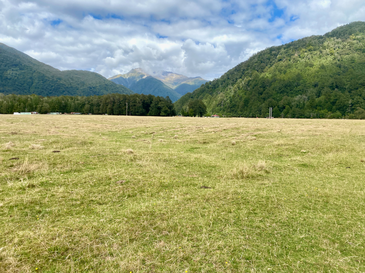
I trailed across the grassy plains, finally making it to the rivers, of which there were again two. By that stage, I’d all but given up trying to stay dry and just waded straight in. Then with soggy boots, I was up a bank and crossing a farm paddock toward the road.
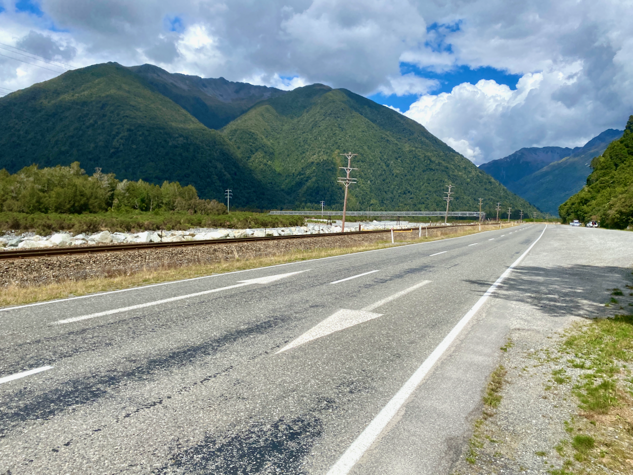
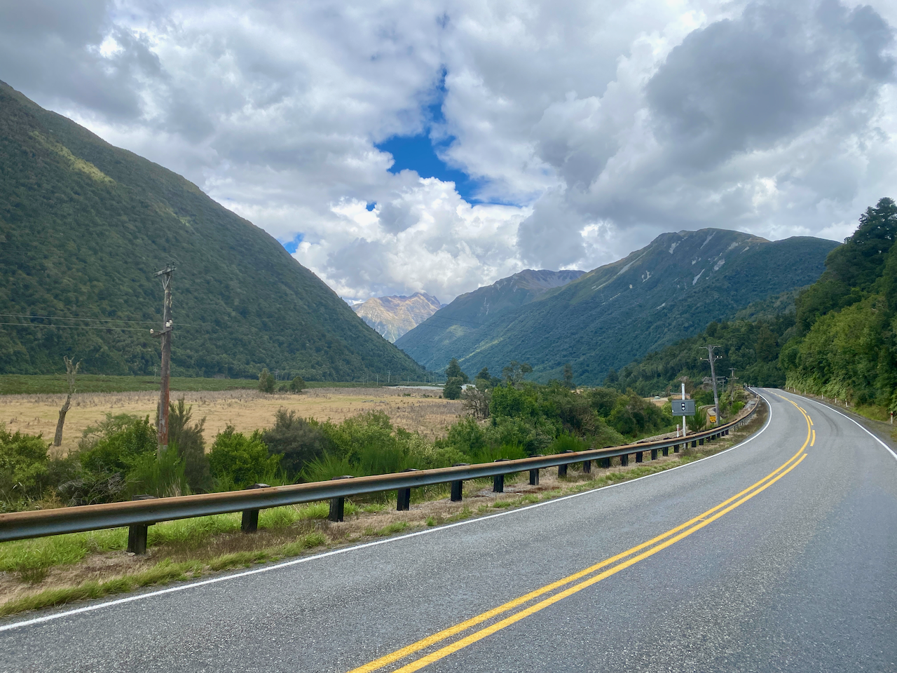
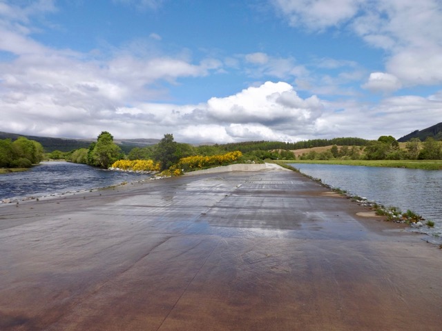
I stopped briefly for lunch, but sandflies… So I picked up my pack and headed off along the road towards Otira and the backpackers. I thought it was only 6 or 7 km, but I have since learned it was closer to 11. I also decided to not thumb a lift, but should someone offer a ride I’d take them up on it. Several km along the road I came to the Morrison Foot Bridge spanning the river and railway tracks. TA walkers commonly camp on the other side of the bridge, or arrive here and hitch a lift to Otira or Arthur’s Pass Village. This is the last location I’d be encountering walkers from the Te Araroa. From here it was going to be much quieter.
I walked a further 3km, and next to the location where I’d be beginning my walk tomorrow, a car stopped and a pair of women picked me up. They’d been hiking in the mountains in the area too. They drove me the remaining 3km to the the backpackers where I checked in, had a hot shower, then headed along the road to the cafe for a hot meal. Unfortunately, as I was not staying at his establishment, the owner wouldn’t sell me a beer. I’d just have to wait another week until I arrived in Hokitika.
In mid February 2023, I found a gap in the rainy summer and headed to the central North Island of New Zealand to walk the four day Tongariro Northern Circuit. See Day 2 here.
Day 3 – Oturere Hut to Waihuhuno Hut – 3 hours 45 min – 8.1 km (Green trail)
While the hut was full overnight, I’m thankful for being in one of the quieter smaller rooms, especially when people started moving around in the morning. Day three is the shortest of the hike, with a stated 3.75 hours of walking before arriving at the next hut. With Day 4 also being a shorter day some people merge the two and walk out on Day 3. I’m taking the more chilled approach and walking two short days.
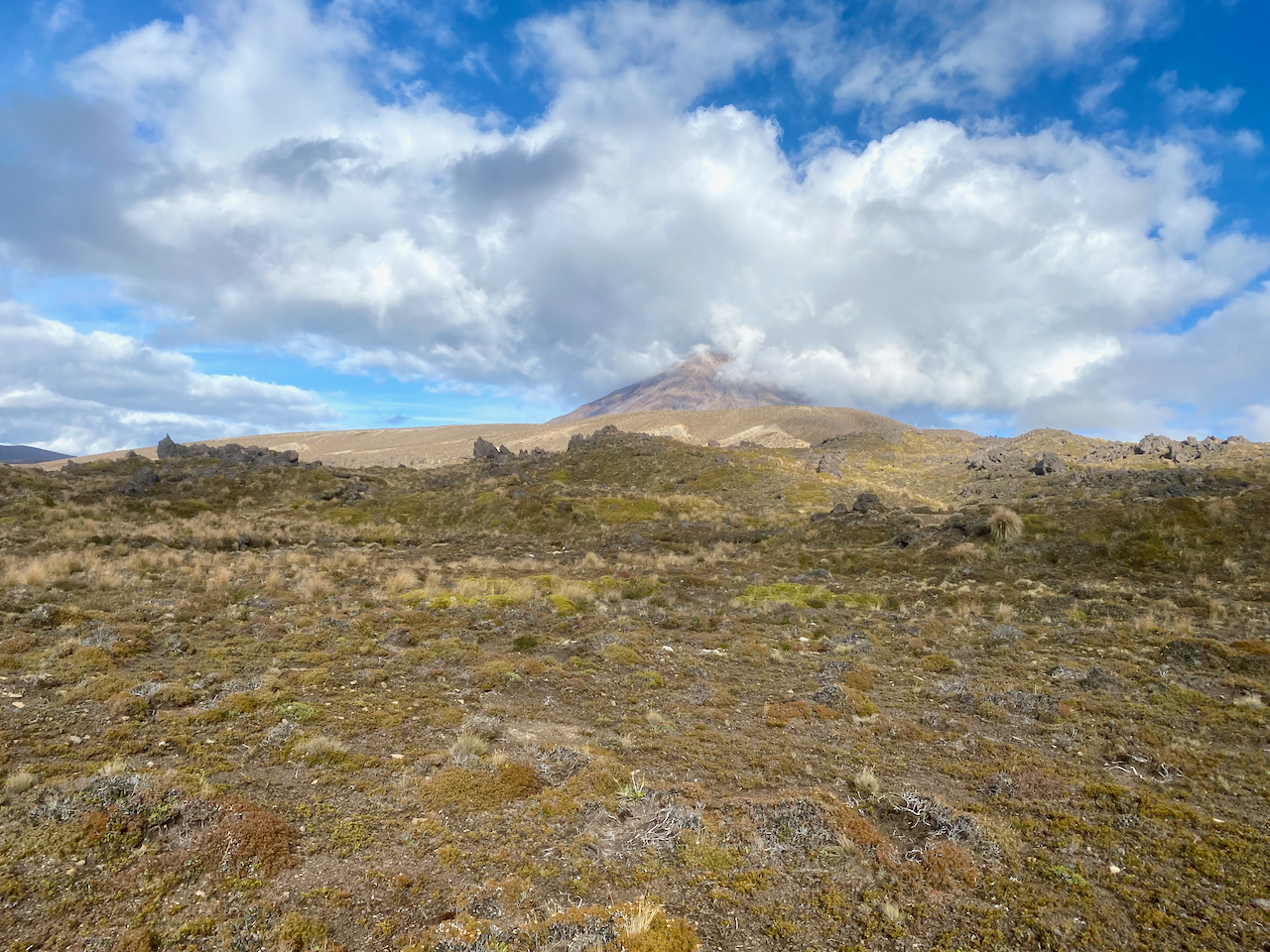
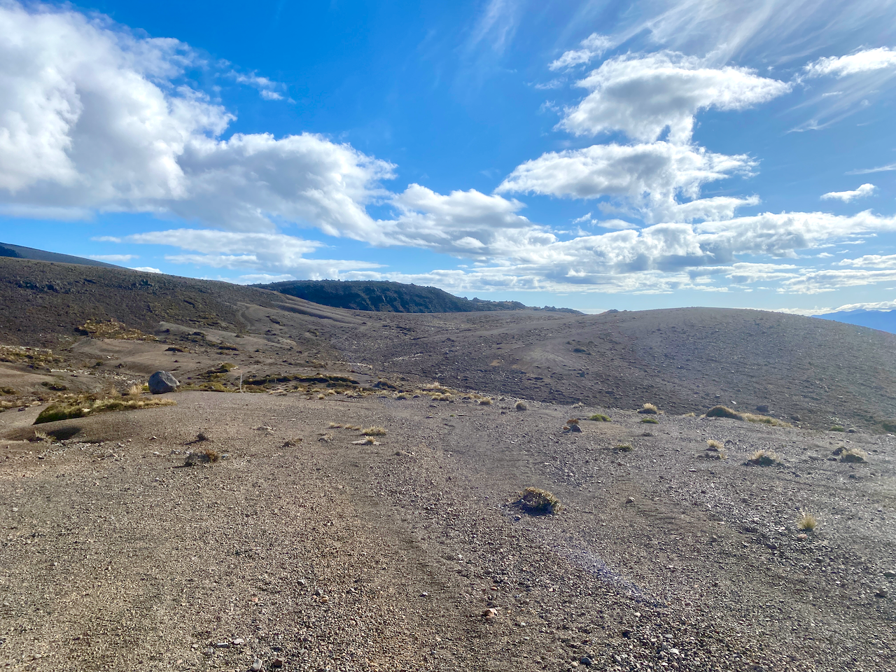
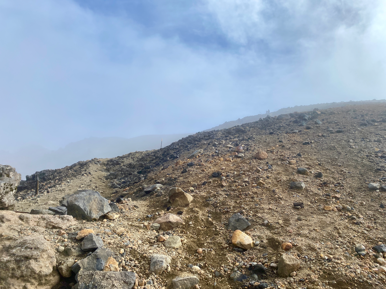
I headed out from the hut in the sun and back into the sandy hellscape of the final hour of yesterday’s walk. Clouds hung quietly around Ngauruhoe as I walked.
I soon headed down the descent of the day, a steady but short rocky downhill towards a babbling brook running down from the mountains. In the distance I could see the Australian family.
On an easy path, I quick marched up the next small climb, nothing too taxing.
For the next hour, the trail undulated up and down rocky and sandy short hills. I flew past the Aussie family who were, in their own words, just ambling today.
Heading ever towards a tree covered ridge line in the distance, I spied the Italian newlyweds ahead.
With the tree covered ridge to one side, I sped along a sandy ridge to eventually pass the Italians on the downward climb at the end.
Halfway down, the trail dove into the trees.
At the bottom, beside a large stream the mud puddles began. Nothing too seriously thankfully.
Then the steepest climb of the day, up to the top of the tree-covered ridge, passing a trail runner and two groups of hikers heading the other way. I came out of the woods at the top, climbed a small hillock off the trail and sat for 10 minutes in the sun. Then heading down the other side I got the first views of the tonight’s hut.
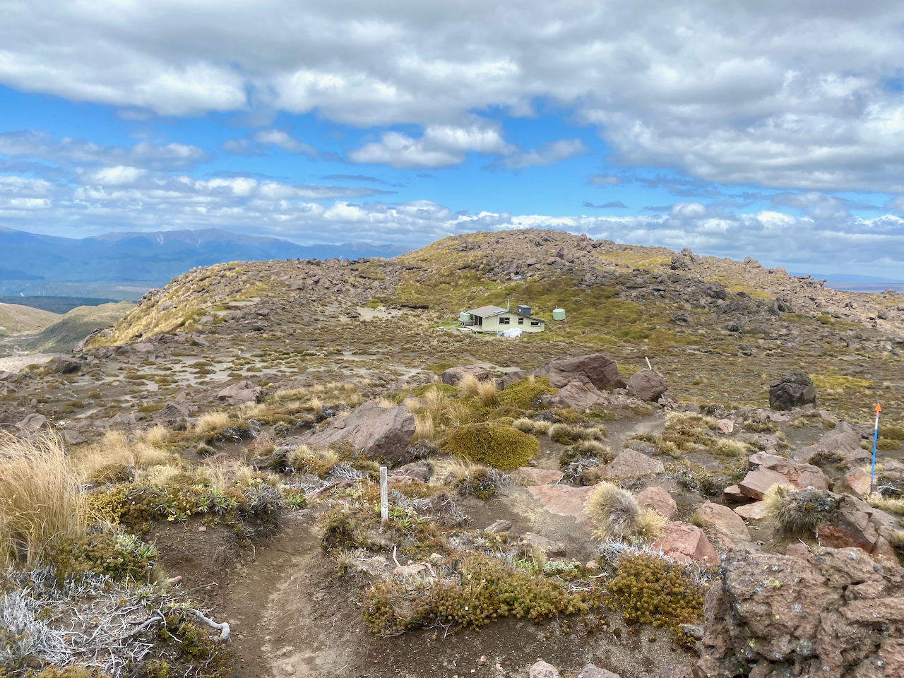
Compared to the previous two huts, this one was a veritable mansion with large bedrooms and a massive indoor and outdoor seating area. Inside the main windows gave great views of the Mt Ngauruhoe. In the afternoon, the rain came in spits and spurts. Up behind the hut, to one side of tomorrow’s path, in the tussock was what I described as the 4G zone, although spottier than previous huts. At one point there were a bunch of us in the tussock 4G zone, hunting the service in what became known as 4G yoga as we stretched this way and that with our phones.
Overall, the walking time was supposed to be 3 hours 45 minues, but I managed it in 2 hours 20 minutes including the 10 minute sit down at the stop of the last ridge.
Day 4 – Waihuhuno Hut to Whakapapa Village– 5 hours 45 minutes – 15.4km (Pink trail)
The hut was fine overnight, with the usual issues revolving around those who want to get away early waking everyone while trying to be quiet. With a day estimated at 5 hours and 45 minutes, I planned to leave at 8am so that I’d finish at 1:45 and then arrive at my accommodation at the 2pm check in time. But as today is fairly flat, I’ll likely finish early. I set out into the overcast day, headed past the 4G tussock patch and up some stairs. After ten minutes I came past the turnoff to the old Waihuhuno historic hut. I stopped to check it out.
I set out again across the tussock covered plains, ever so slightly undulating, the low cloud covering the top of Mt Ngauhuhoe. As this hike circumnavigates the volcanic cone, and because it was Mt Doom in the Lord of the Rings, I think this hike should be renamed to The Mordor Circuit.
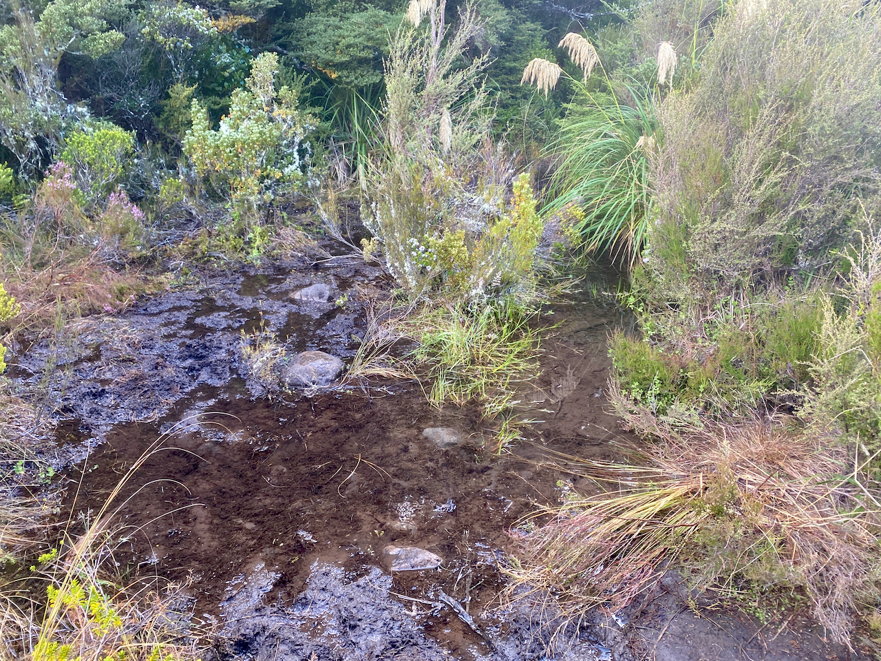
Today’s section has no large ascents or descents, but a very slow, almost unnoticeable, climb to the mid point, a dip down to one of the many streams on the trail, then a climb to the day’s highpoint.
At that highpoint, there is a T-junction, one way leading to the Tama Lakes, and the other continuing on to the the end of the trail. I stopped for a break at the junction, near the toilet that cannot be seen as it is camouflaged to look like the tussock plains. This is not the only toilet of its kind in the National Park, wherever tourists can walk, there are toilets, and as they walk out to the Tama Lakes, there’s one here.
There are two Tama Lakes, the Upper being 45 minutes walk from this junction and the Lower being only 10 minutes walk. I wasn’t keen to walk all the way too the Upper Tama Lake, so leaving my pack at the invisible toilet, I made my way to the Lower Tama Lake.
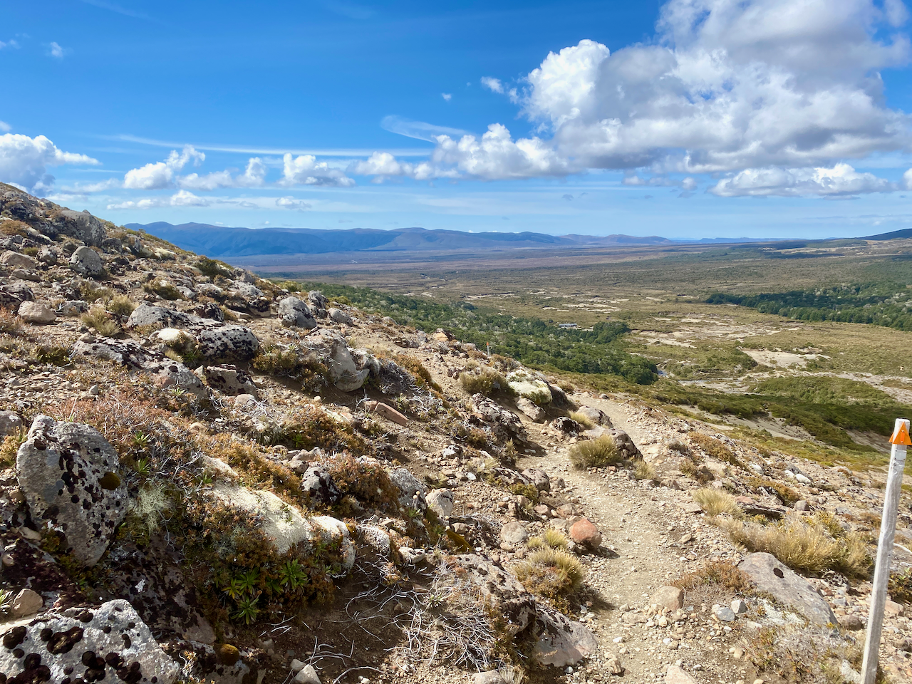
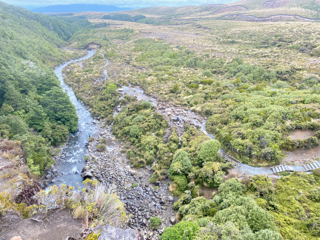
After a quick photo, I trotted back, had a snack, donned my pack and headed off again. From here on I would begin to cross paths with more and more day walkers. The trail began to undulate more but nothing overly difficult. And after an hour, I came to a rather busy location. I dropped my pack amidst many tourists, and climbed down some steep steps to view the Taranaki Falls.
I then climbed back to my pack, and stood at the top of the falls looking down.
A sign near the waterfall said 1 hour to the Whakapapa Village, twenty minutes longer than I had estimated, so I got my skates on. After 10 minutes, I saw the recently closed Tongariro Chateau in the distance, I kept my march on. I cut through some woods, and when I emerged, ten minutes before the end of the track, I stopped to take my final shot of Mt Doom.
When I reached the end of the trail, I walked past the chateau to the place where I had left my vehicle. It was 12:15, the time I’d estimated mid today’s walk, and even with the short side track to the Lower Tama Lake, I still came in an hour and a half early.
Overall
The Mordor Circuit, officially known as the Tongariro Northern Circuit, was a good walk although, to be honest, days 1, 3 and 4 just felt like alternative ways to get to and from the main attraction, the Tongariro Alpine Crossing. In comparison, these three days put together don’t come close to the sheer exhilaration of the Alpine Crossing in effort, beauty, and reward. In saying that, I still enjoyed my four days on the trail.
In mid February 2023, I found a gap in the rainy summer and headed to the central North Island of New Zealand to walk the four day Tongariro Northern Circuit. See Day 1 here.
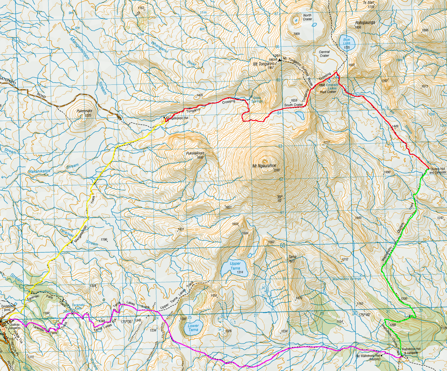
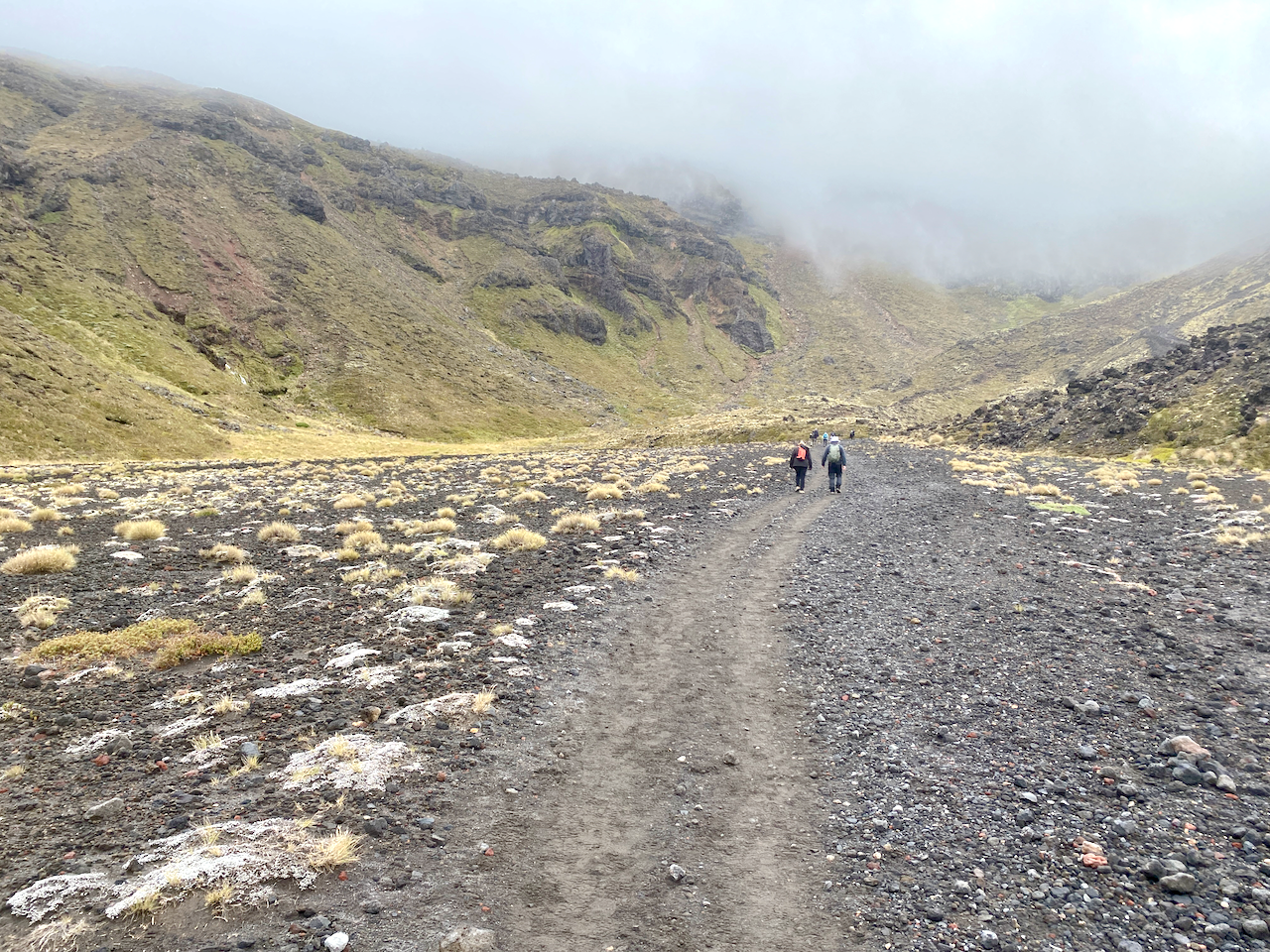
Day 2 – Mangatepopo Hut to Oturere Hut via the Tongariro Alpine Crossing– 5 hours 10 minutes – 12 km(Red trail)
Morning came and the rain had stopped but it was still cool. With the carpark for the Alpine Crossing only 20 min from the hut, the first waves of people began filtering by fairly early. I got ready and headed out onto the wide gravelly trail, the ridge I’d climbed the day before up to the left.
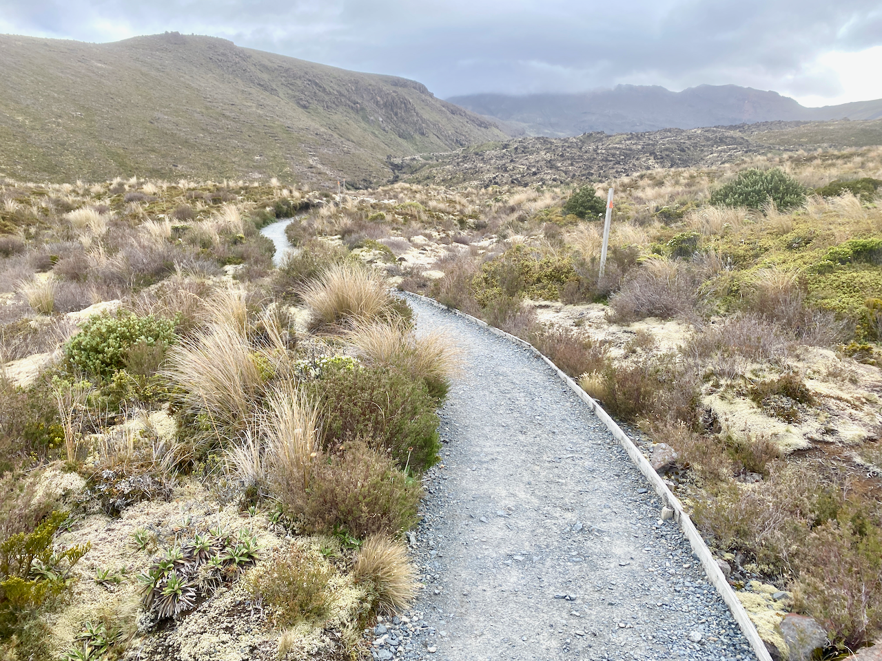
The beginning of the trail is a fairly slow climb through the lower portions of Tongariro heading towards the South Crater, which is just over the lowest point of the ridge straight ahead.
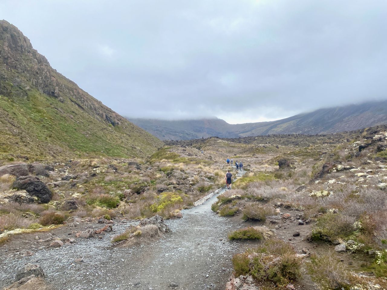
There are boardwalks in many places along this route to protect the ground from so many marching feet on their daily attempt up the mountain. I got into a good rhythm passing many of the walkers with their tiny packs while carrying near 20kg in mine.
The lead up to the first climb is stony but also well worn. When I did the Alpine Crossing previously, I was already immersed in the cloud which stayed with us for most of that walk. I was hoping today would be different.
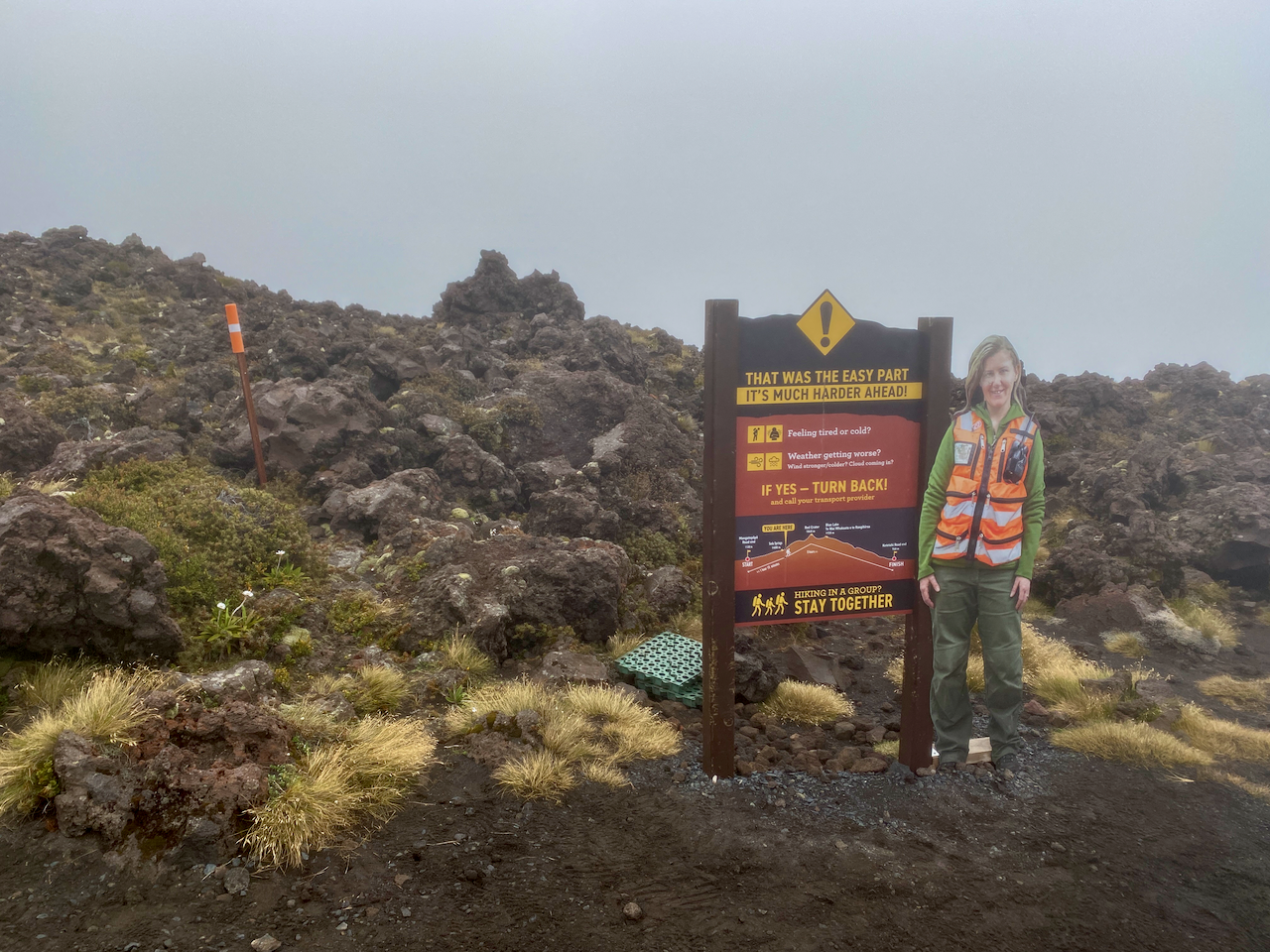
I began the initial climb to the toilets, some of the many emplacements along the crossing. I was approached by the two French girls I’d picked up hitch hiking to National Park village 2 days ago. I wished them well before proceeding. I was already in the low clouds at this stage, and had my thin waterproof jacket on backwards. I sweat heavy down my back, no point adding an extra layer where I don’t need it. And, when I no longer need it, I can remove it without having to take my pack off. At the toilets is the first warning sign:
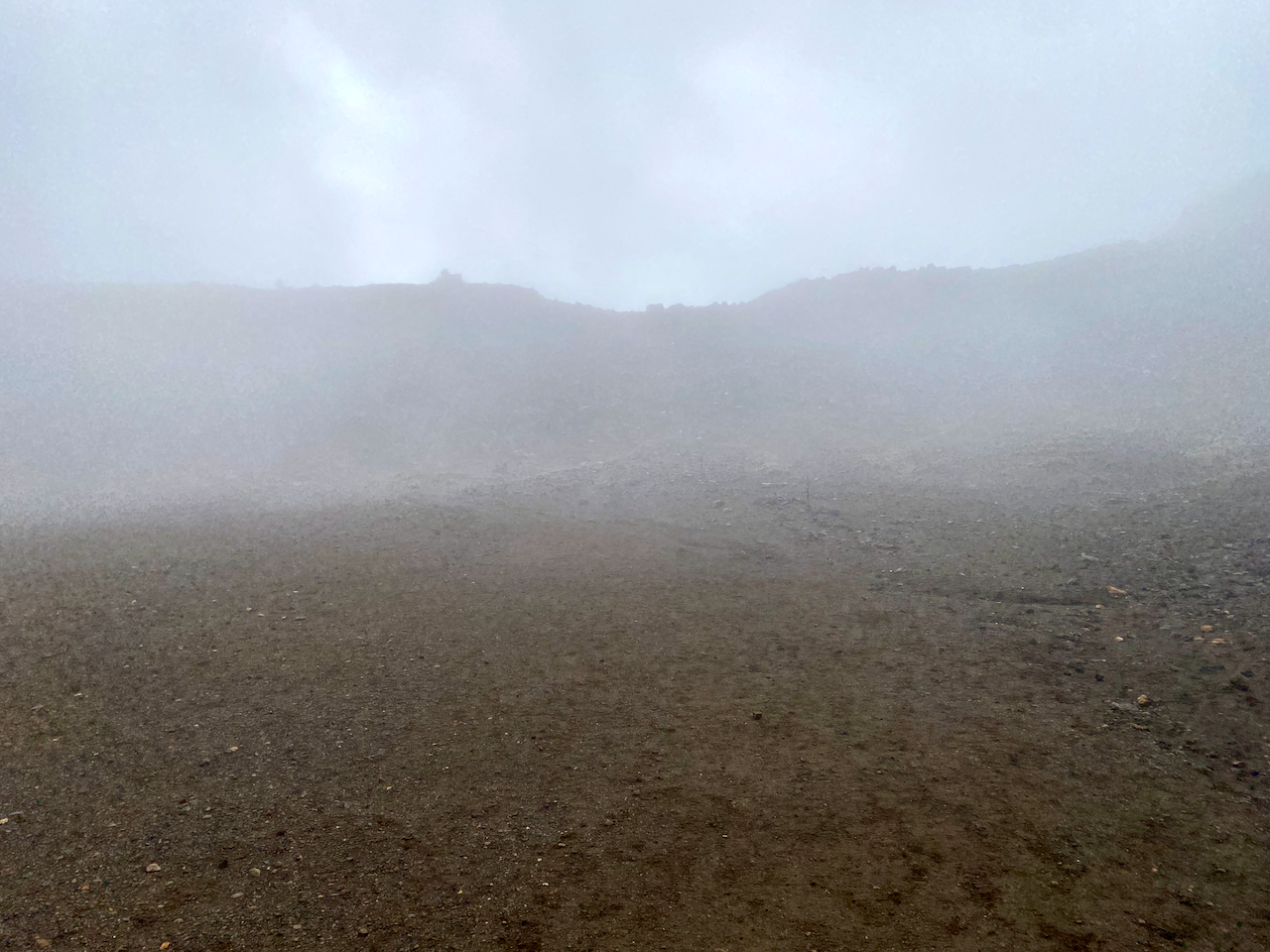
The climb from the sign to the southern crater is only 250m in altitude gain, but in the light rain and wind it felt longer. It was here I first started hearing people coming back down warning how bad it was up top. When I got to the plateau of the Southern Crater, the wind had died down but the clouds still hung heavy.
The wall of the crater came into view after a five hundred metre walk across the plateau, and the wind began again tugging at my jacket and pack cover. I’ve heard some nightmare stories of people’s pack covers being torn off in the wind. Thankfully, mine has a cross strap, so was stable just a little noisy.
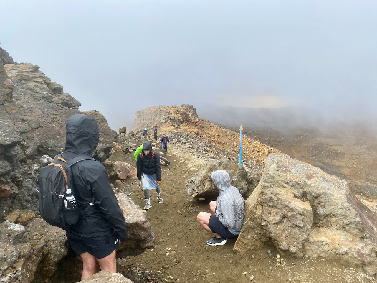
The Decision Time sign appeared out of the gloom, no doubt causing more people to head back. I marched on, my fingers starting to get cold but I was thankful for the long sleeves of my backward jacket giving a little protection. Some groups around me continued the climb, bit by bit, resting briefly where they could. My fingers got so cold they went numb and I couldn’t feel the buttons on my phone.
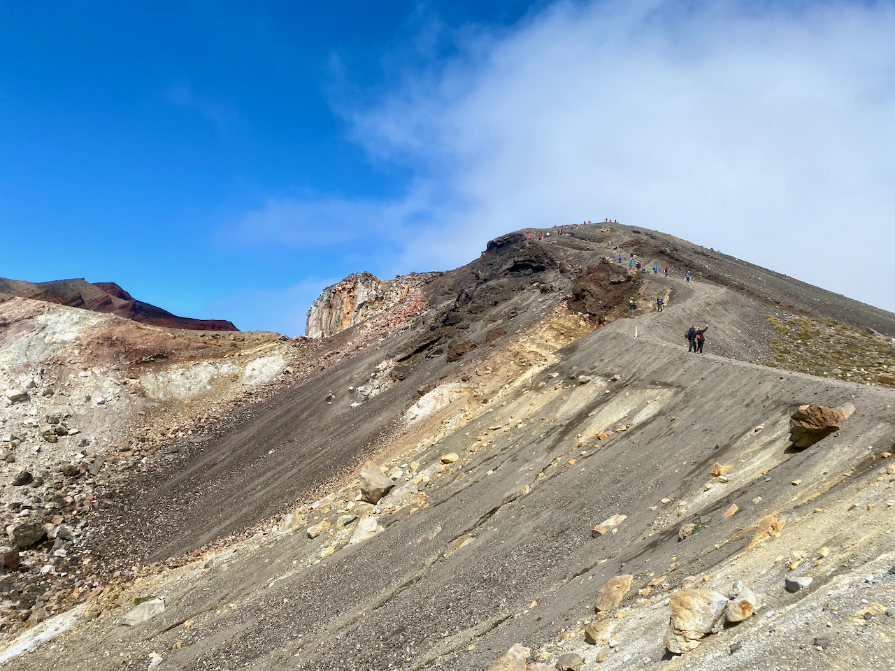
Like the first time I did the crossing, the most exposed section near the Red Crater had wind blasting visibly across it, and as per last time, I pushed on. This time I’m thankful for my hiking poles to give me a little more stability as I climbed. I marched on scurrying from rocky outcrop to outcrop across the exposed areas.
Then out of the mist, the final climb to the highest point at 1868m. Wind tearing at me, fingers numb and hands red, I pushed on.
Then in what seemed like a handful of moments, the mist swept away and looking back I got a better view of the South Crater from above.
And to my right, the Red Crater.
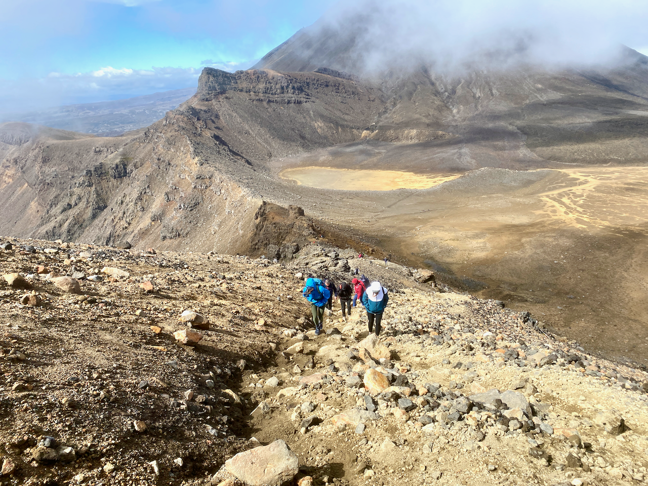
The wind was still cold, so I pushed on, but as I began my descent, it ceased and the sun began its warming effect. I could feel my fingers again. Below me was the Central Crater and across it, the Blue Lake. The crossing continues past the Blue Lake and down the side of the mountain for several more hours to the collection point. Last time, none of this was visible, the cloud only clearing when we were half way down, past all the main sights.
The Northern Circuit doesn’t go past the Blue Lake, instead cutting right after the Emerald Lakes.
The trail down is not rocky like the ascent, instead it’s a light dirt/ash mix where you can slide if you aren’t careful. I slithered down in my boots and took a shot back up the peak. Afterwards, it was estimated more than a third of the climbers today had turned back.
I dropped my pack on the trail and stopped for lunch in the sun, then left it beside a rock and walked to the Blue Lake and its fairly easy climb. I looked back across the Central Crater to the Red Crater which looked like a gaping maw of the mountain.
I didn’t stay long at the Blue Lake before heading back.
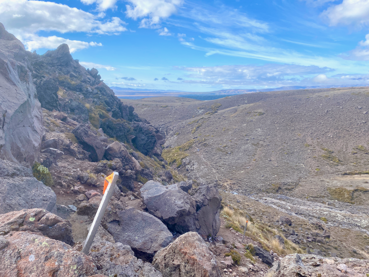
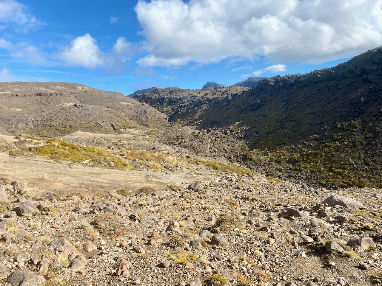
Donning my pack again, I headed down the quieter trail towards what I describe as a hellscape, the Italian couple are ahead of me.
The trail to the hut has a long slow rocky descent onto the hell plains, then a hot 3-4 km march across rocky landscape.
Oh, and did I mention the never ending sand?
Eventually, I came over the a rocky outcrop and saw the hut up ahead. Perhaps it was my lack of sleep the night before, but the final hour across the hellscape just seemed to drag. I was grateful to arrive. At the hut, I unpacked my tent and ground sheet, lying them out to dry in the sun and warm wind.
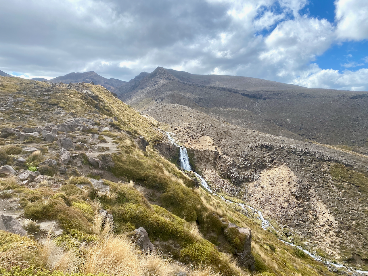
I headed inside to get myself a prime bed in one of the smaller rooms, before heading out to the ridge where I found the campsites, a good 4G zone and a waterfall.
The crossing was everything I remember from my previous effort, except I got to see some sights this time. It’s definitely the high point of the trail (pun not intended but accepted). Tonight I relax and prepare for the shortest day of the trail tomorrow.
Great walks are manicured hikes for everyone, but especially tourists and locals just starting out hiking. They’re not necessarily easier, just more accessible, and often also quite busy. The Tongariro Northern Circuit was something I wanted to revisit since my Tongariro Alpine Crossing several years ago – New Zealand’s most popular tourist walk – was mired in low cloud. Lots of walking/climbing and no view. The Tongariro Northern Circuit includes the Alpine Crossing on its second day, leaving the other three days quieter. So, with wet weather prevalent throughout the beginning of the New Zealand’s summer, I’ve been dying to get out on the tracks.
The Tongariro National Park in the centre of New Zealand’s North Island, contains four massifs, the two most famous being the Ruapehu Massif and the Tongariro Massif. There are two main circuits in the National Park also, the Tongariro Northern Circuit, which circumnavigates Mt Ngauruhoe, the cone shaped volcano used as Mt Doom in the Lord of the Rings trilogy. The southern circuit is The Round the Mountain, and circumnavigates Ruapehu, the North Island’s tallest mountain.
In early February, I slowly made my way down to the village aptly named National Park, where I stayed in preparation for the hike.
Day 1 – Whakapapa Village to Mangatepopo Hut – 4 hours – 9.4 km (Yellow trail)
Today’s walk is quite short, so I left the accommodation at check out and drove the 15 minute drive to the trailhead at the Whakapapa Village. I stopped in at the village i-Site to check on parking and got an overnight permit. Locking up my vehicle, I headed past the now closed Tongariro Chateau, then along the short road behind it. From the official trailhead of the clockwise circuit, I headed along the wide gravel path created to give tourists easy access to the Taranaki Falls. I passed several such couples with day packs as I went.
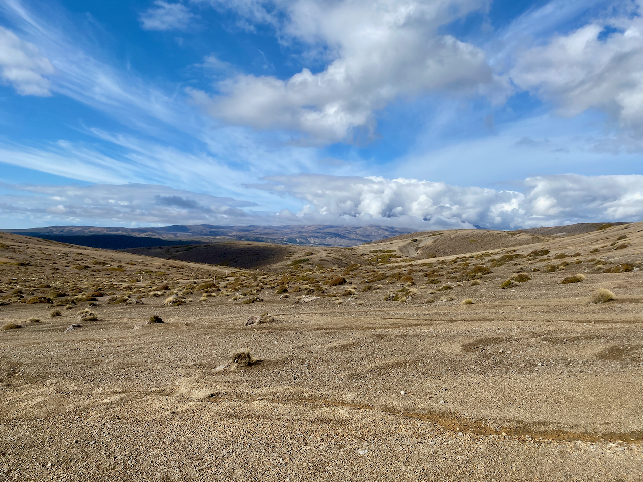
After passing the trail to the Taranaki Falls, my trail lost its tourist appeal, becoming a thin dirt track through the tussock covered plains. I headed along the track with the cloud covered Tongariro massif ahead of me.
Behind me, the Mt Ruapehu massif.
The trail is well marked with the typical orange triangle seen all over New Zealand. The trail is also fairly mundane, undulating gently from the circuits lowest point at 1,065m above sea level to 1,165m. Occasionally there is a bit of mud which added a bit of spice to the trail.
After a good three hours, I came over a short ridge to see the Mangatepopo hut in the distance tucked under ridgeline. I picked my way across the plains until I came over a small hillock to see the hut and its associated campsites.
I pitched my tent in a suitable spot, getting my gear inside as it began to spit. I went to the hut and hung out with an older Australian woman, her two adult daughters and the boyfriend of the youngest. The rain came down briefly as more hikers came in, some walking the circuit in reverse and having done the Alpine Crossing. After my brief and rather easy walk to the hut, I needed more, so I decided to climb the ridge beside the hut, which gave me great views back along the way I’d walked.
And off the other side to the north…
Later that evening, those of us gathered at the hut came out to watch the sunset. There were a fair mix of nationalities: the aforementioned Aussies, a large group of Kiwis, a pair of Italians, a Frenchman and his daughter, a Brit girl and her Canadian friend.
When it got dark, I retired to my tent. There was 4G in the camping area, so I watched YouTube on my phone for a while before heading to sleep. It rained on and off during the night and was quite cold. I didn’t sleep well, tossing and turning whenever I awoke shivering.
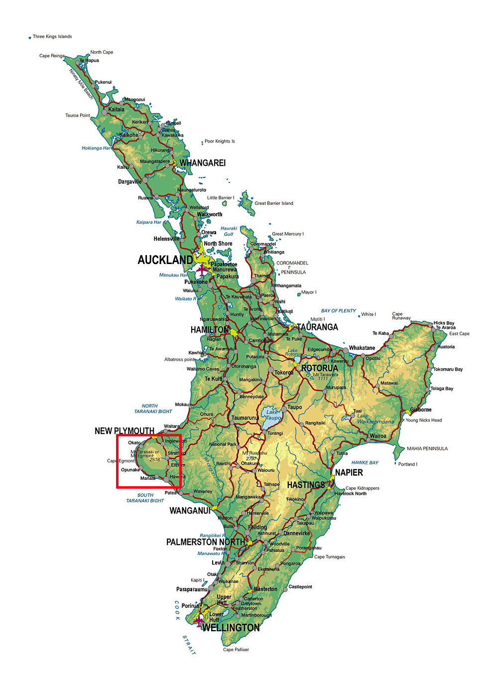
A couple of days after my hike in the Tararua Ranges, I drove to Taranaki for another hike. Like that earlier hike, the weather got in the way, but I still got to walk on Mt Taranaki after trying several times this year.
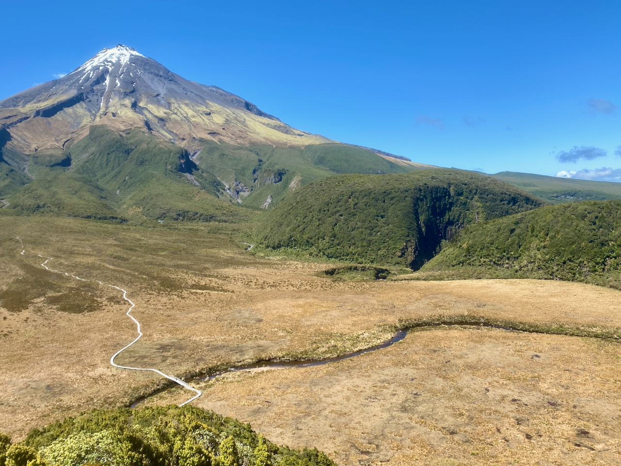
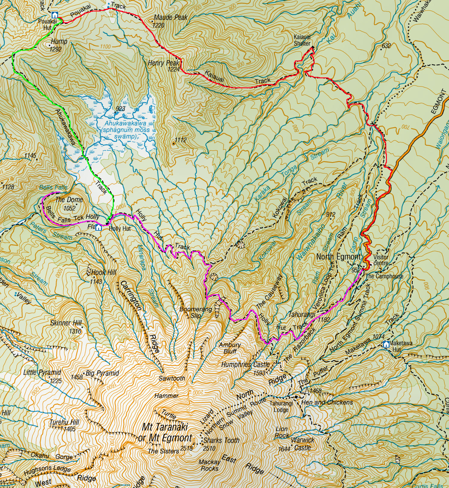
Since being back in New Zealand, I’ve been planning the Around the Mountain hike in Taranaki. But in February, a wave of heavy rain came over the North Island on the week I was to do it, so I flew to Queenstown and did The Routeburn trek instead. In March, another wave of heavy rain took the entirety of NZ, so again I cancelled it. As the cooler months were upon us, I left it until the end of the year. The Around the Mountain track has high and low trails along most of its length to allow for people wanting different grades of difficulty. However, there are three parts where there is only one option, and during the winter of heavy rain, a slip wiped out the largest of the three, closing the hike indefinitely. So I was left with its baby sister hike, The Pouakai Circuit, which can be done over 2 days, but I decided to split it over 3.
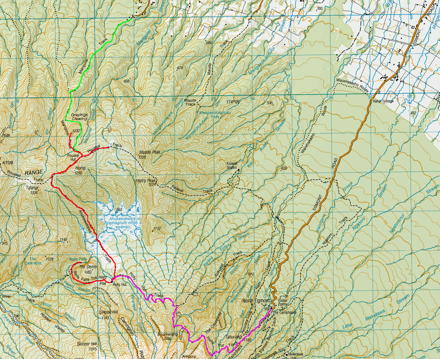
Day 1 – North Egmont Information Centre to Holly Hut
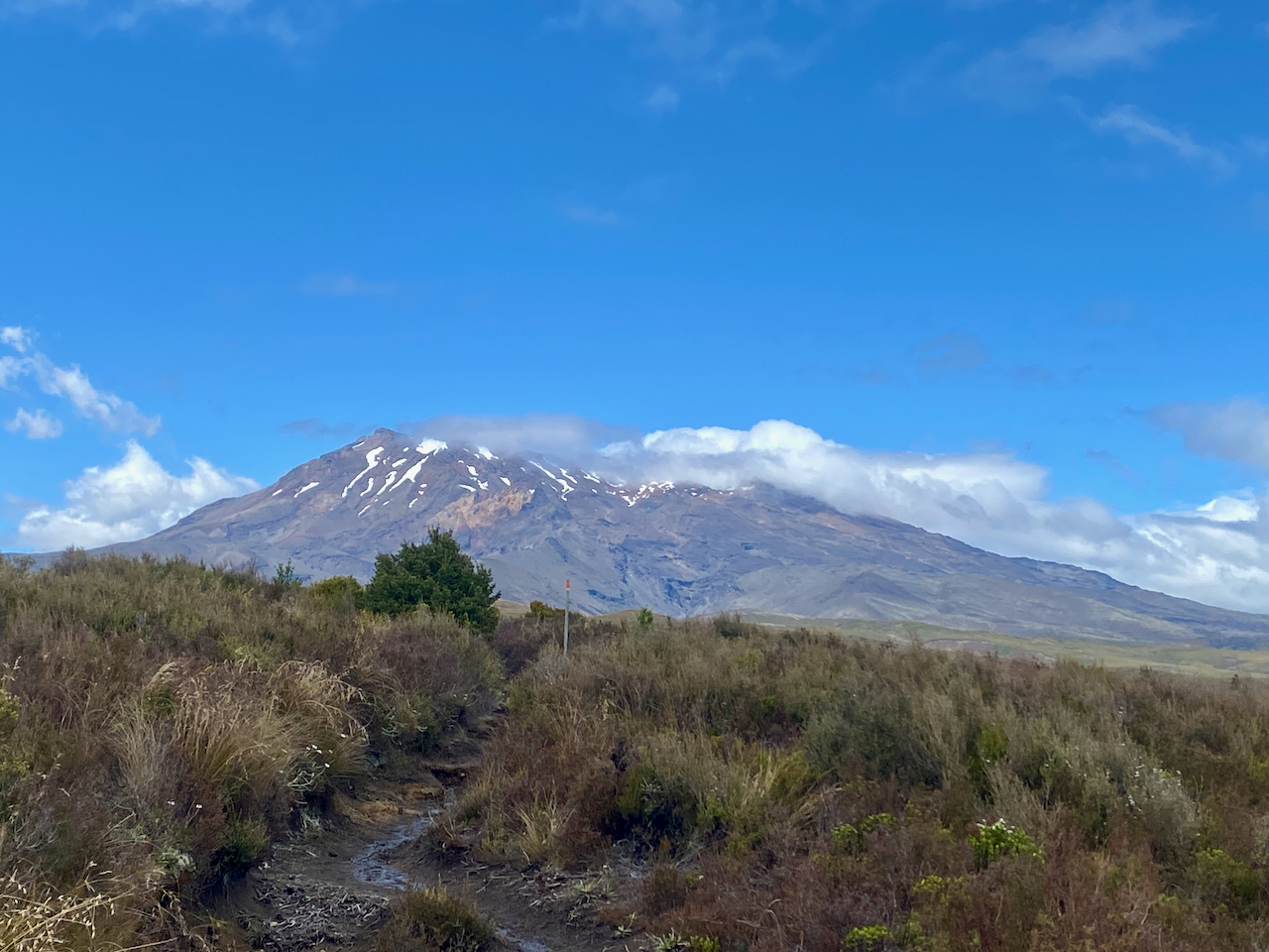
I stayed in a hostel in New Plymouth and on the morning of the hike, watched cloud cover the entire region. I couldn’t see the mountain from the city, but the weather was due to clear up. So, in the afternoon I headed out to the North Egmont Information Centre. Even as I approached the mountain, it was enveloped in clouds. I spoke to the lady at the information centre and watched the repeating weather forecast on their TV.
At 1pm I finally set out up the manicured wooden steps following the sign that said I should be walking that way.
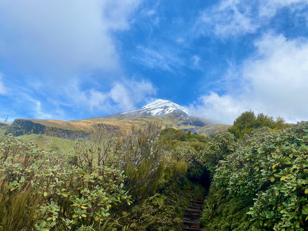
According to the topographic map on my phone, I had about 90 minutes climbing before I met the trail that would take me around the mountain and then another 2 and a half hours until I arrived at Holly Hut. After 30 minutes, the clouds blew off and I finally got a good look at the mountain.
The climb wasn’t difficult and the steps made it easier. After a while, as I pushed on, the steps turned into a stony trail.
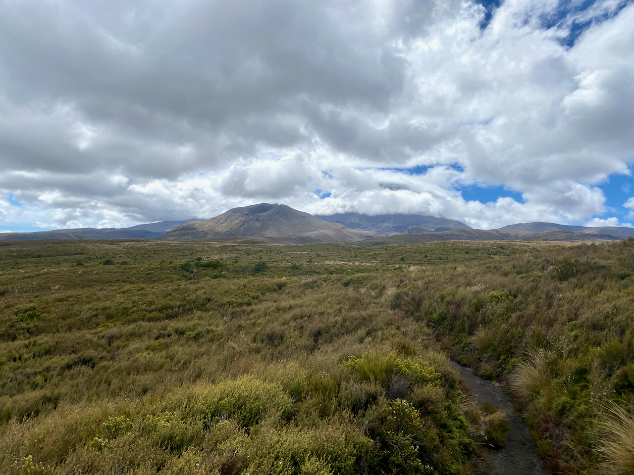
The main Holly Hut Trail was muddier with fewer of the wooden steps and more raw rock to climb over. However, beside the trail were pallet sized stacks of wrapped wood dropped off by chopper. It looked like they intend to lay a kind of boardwalk along the track, which would stop the mud and would also make it easier, not to mention more accommodating for tourists. I walked on and eventually came over a ridge to see the Ahukawakawa – the Sphagnum Moss Swamp – nestled in the crown of several lesser peaks.
The muddy trail continued joining a boardwalk for the last hundred metres to the Holly Hut. In the hut were two other walkers, an American girl and a local guy. We chatted and drank Korean alcohol she’d brought with her from the Pouakai Hut the night before. Then when the hut lights came on – solar powered with a darkness sensor – we all retired to our separate sleeping rooms, of which there were three in the Hut.
Day 2 – Holly Hut to Pouakai Hut
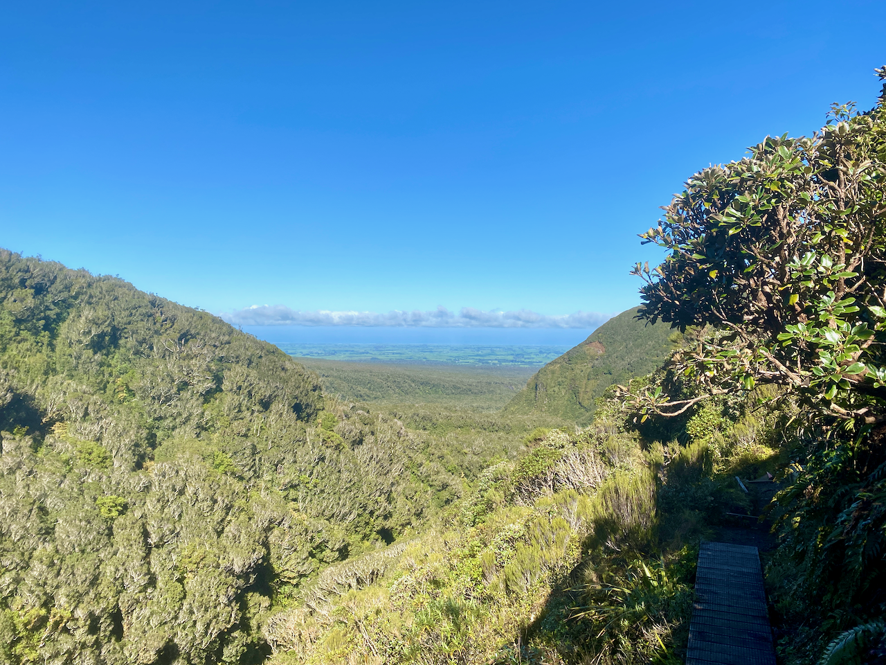
The sky was clear overnight and plentiful stars were out and it stayed that way into the morning. The local guy had left early, and the American girl and I ate breakfast and chatted. Then after she headed off, I walked the side trek down to Bells Falls behind the hut. As today’s walk is short – 2 hours – adding an extra hour would give me something to do. I headed out down a less defined track avoiding large puddles and pushing grasses aside to get through. I even got a good view out to the sea in the west.
I followed the trail attached to the side of a large mound The Dome, dropping some two hundred metres in height until I came to the junction with the closed Around the Mountain trail. Five minutes later and I was rock hopping across the side of the river to see Bells Falls.
I climbed back along the trail back towards the hut. I had almost arrived when I heard a chopper overhead. When I came out at the hut, there were workmen there and the chopper that had delivered bags of firewood. They were also swapping out the shit crates – the large plastic crates the long drop toilets sit on that fill up with… well, shit, and toilet paper. I had to wait until they’d finished and flown away before I could continue.
I donned my pack and headed off just as two ladies with day packs arrived. I walked the 10 minutes back to the junction and took the route downhill towards the Ahukawakawa swamp. The trail is a wooden boardwalk all the way, and half way down I met a girl sitting in an information booth. We chatted before I continued on.
When I got down to the swamp itself, it was mostly tussock grass. I continued across it and over the Stony River on a footbridge – the river flows to the west where it cascades down Bells Falls. I climbed the hill on the far side on manicured wooden steps and a fair way up looked back to see the Ahukawakawa, the river, the mountain and the little green dot that was the Holly Hut at it’s base.
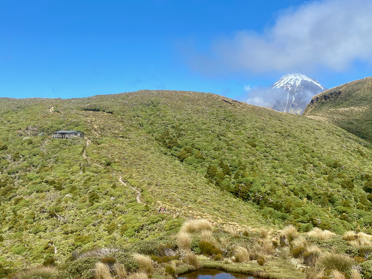
I pushed on, getting to the top of the ridge and around to a nice rocky outcrop beside the trail where I stopped for lunch. After eating, I continued on behind a large mound poetically named Hump. On the other side, I came to a rocky area with the trail heading down. I followed it for several minutes before arriving at the hut. I chose a bed and dropped my pack. Many groups of day walkers were coming up from the Mangorei Track. They would come across the deck to use the toilets, or go inside and have lunch on the tables. Across from the hut is another mound, this one unnamed. I chose to climb it to get away from the daywalkers and sat looking back at the Pouakai Hut.
Later, an older gentleman arrived, and we chatted for the afternoon. He’d come up from the Mangorei road end just for the night to relive his youth where he’d climbed Taranaki six times. Later an older couple arrived for the night, they’d walked the same route I had, but instead of stopping at Holly Hut had crossed the Ahukawakawa. They would be finishing the circuit the next day with me.
That afternoon I got several shots of New Plymouth when the clouds weren’t hanging low over it.
And even one in the dead of the night.
Day 3 – Pouakai Hut to Mangorei Rd
In the middle of the night, the wind picked up and the clouds swallowed us. When we awoke, visibility was at 20m or so. To finish the circuit, the three of us would have to climb over Henry Peak with the heavy wind gusts. I climbed up to the junction without my pack to check out the situation and found the winds rather strong.
We decided that climbing a mountain without any cover would be dangerous. The lone older guy offered to drive us around to the information centre when we got down, which sealed the deal for the three of us. We headed down the manicured wooden steps for the next two hours.
At the bottom, the lone man’s wife met us with their camper van and were driven to the end. This is the route we should have taken it.
Overall Without completing the last part of The Pouakai Circuit, I would rate the walk as fairly easy due to much of it being manicured. I do like how they are making it more accessible for tourists and day walkers and I hope they fix the trail for Around the Mountain so that one day I can come back and complete.
At the beginning of Spring, I set out on a road trip around New Zealand’s North Island to see some friends and walk a couple of hikes. After several days I found my way to Masterton preparing to head into the Tararua Ranges.
As I didn’t wish to spend the entire walk in the forest, I planned a walk across the open ridges, staying in huts as I went. The weather can change quickly in the ranges, and being a cautious walker I was prepared to change plans if needed, and indeed, I did. So, this hike is different to my original plan, which is described later.
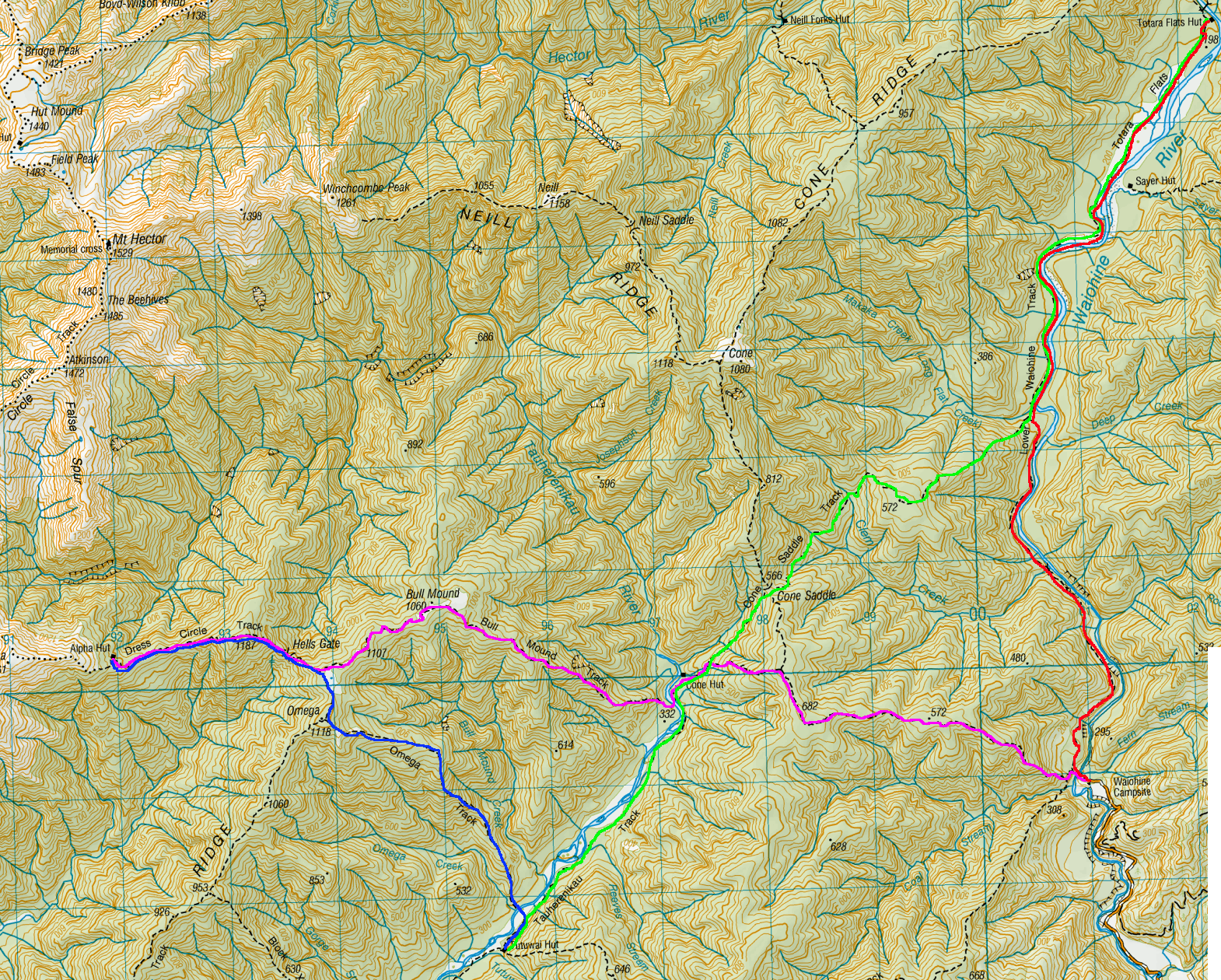
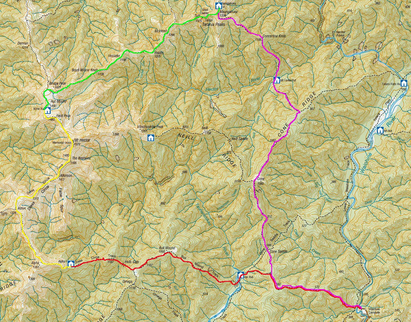
Day 1 – Waiohine Gorge Carpark to Alpha Hut
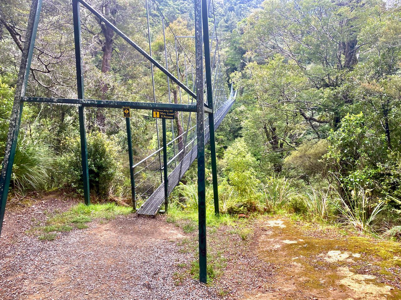
I set out from my accommodation in Masterton and drove into the Tararua ranges on a dirt road, parking at the Waiohine Gorge Carpark. I then headed out from the carpark laden with pack and across the swing bridge over the Waiohine River.
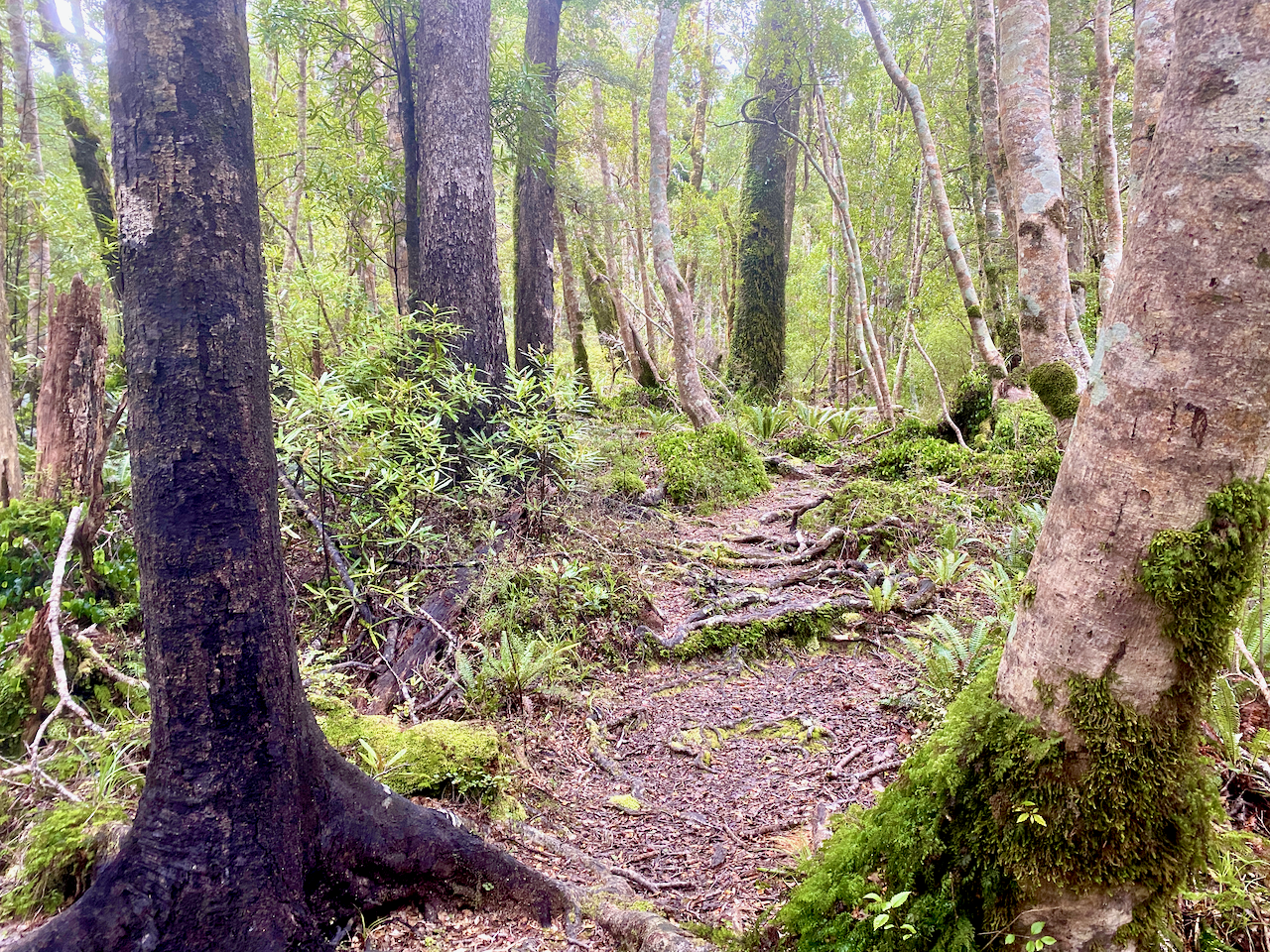
On the other side, the trail began climbing steeply immediately. The track was thin and knotted with roots, moist and slippery underfoot, with puddles of mud along the way. I began at around 170m above sea level and climbed to around 570m before it flattened out a little.
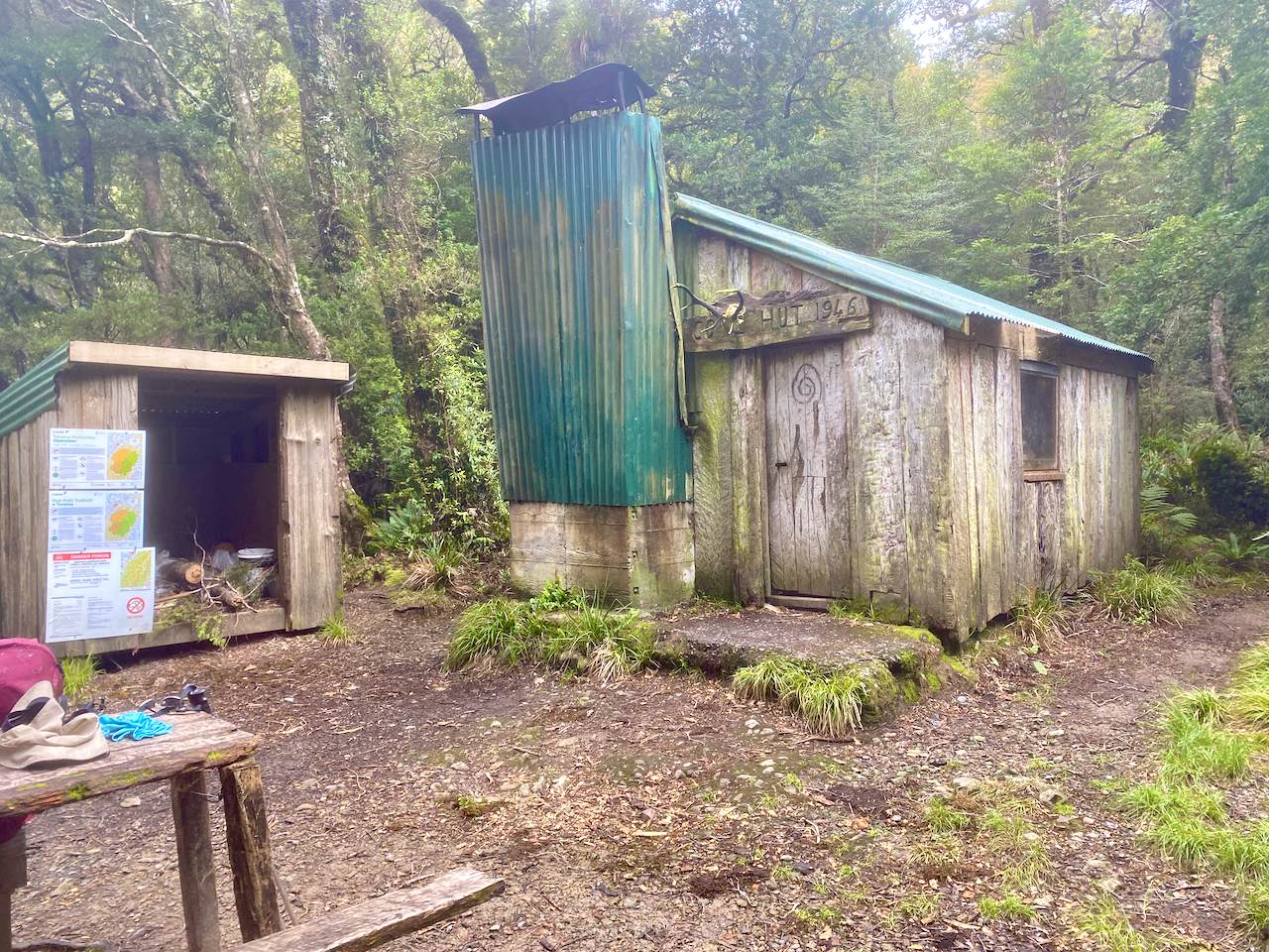
I continued on, climbing another 100m over a longer distance before the trail headed down, to come out at Cone Hut built in 1946. I stopped here for lunch. I also noted that a previous walker had marked in the hut logbook that they had left a small bag in the Alpha Hut. I would keep an eye out for it.
To continue, I had to cross the river and had bought sandals for this occasion. Before changing I spent some time looking for a way to cross, but with not luck I waded across in my sandals and up the bank. Back in my boots, I began climbing up the Bull Mound Track towards the Bull Mound, although I never did figure out why it was called that.
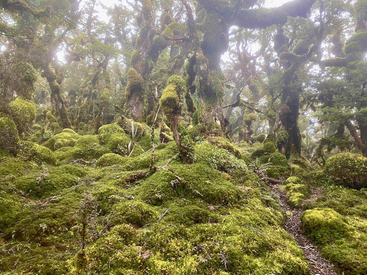
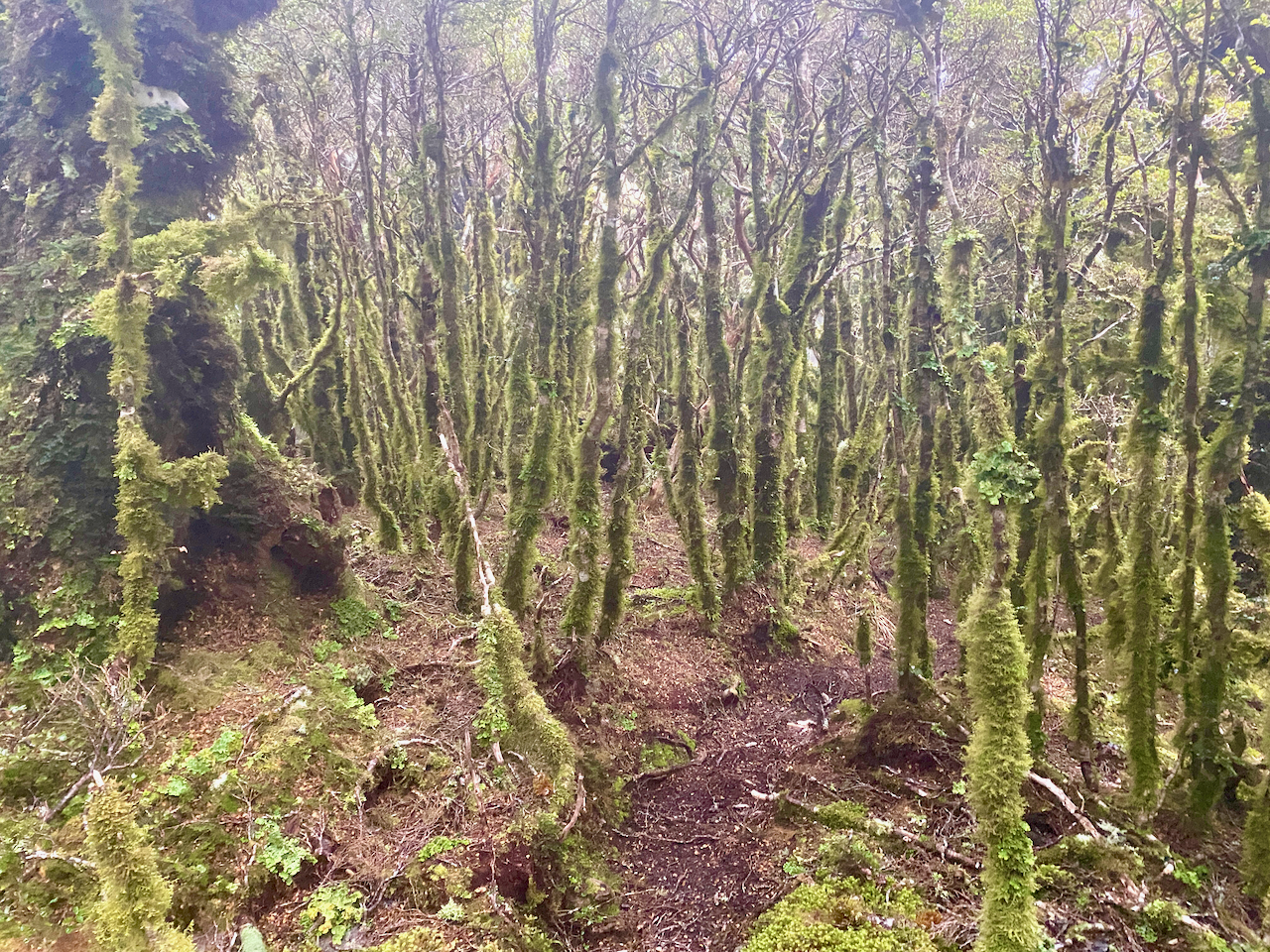
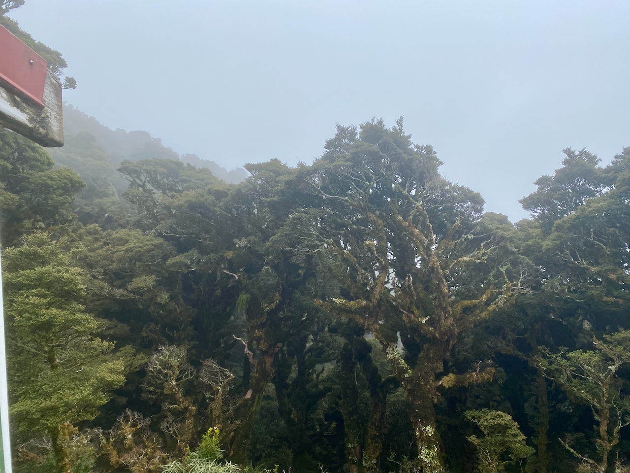
The first climb of the day had been rough, but this trail was worse, steeper, muddier, more tangled in roots. At one point, it was entirely blocked, forcing my to take time to find a way around. My river crossing was at around 320m, and three hours later I reached the sodden top of Bull Mound at 1060m. After 900m, the trees had begun to change, growing barely taller than myself, and almost completely covered in moss.
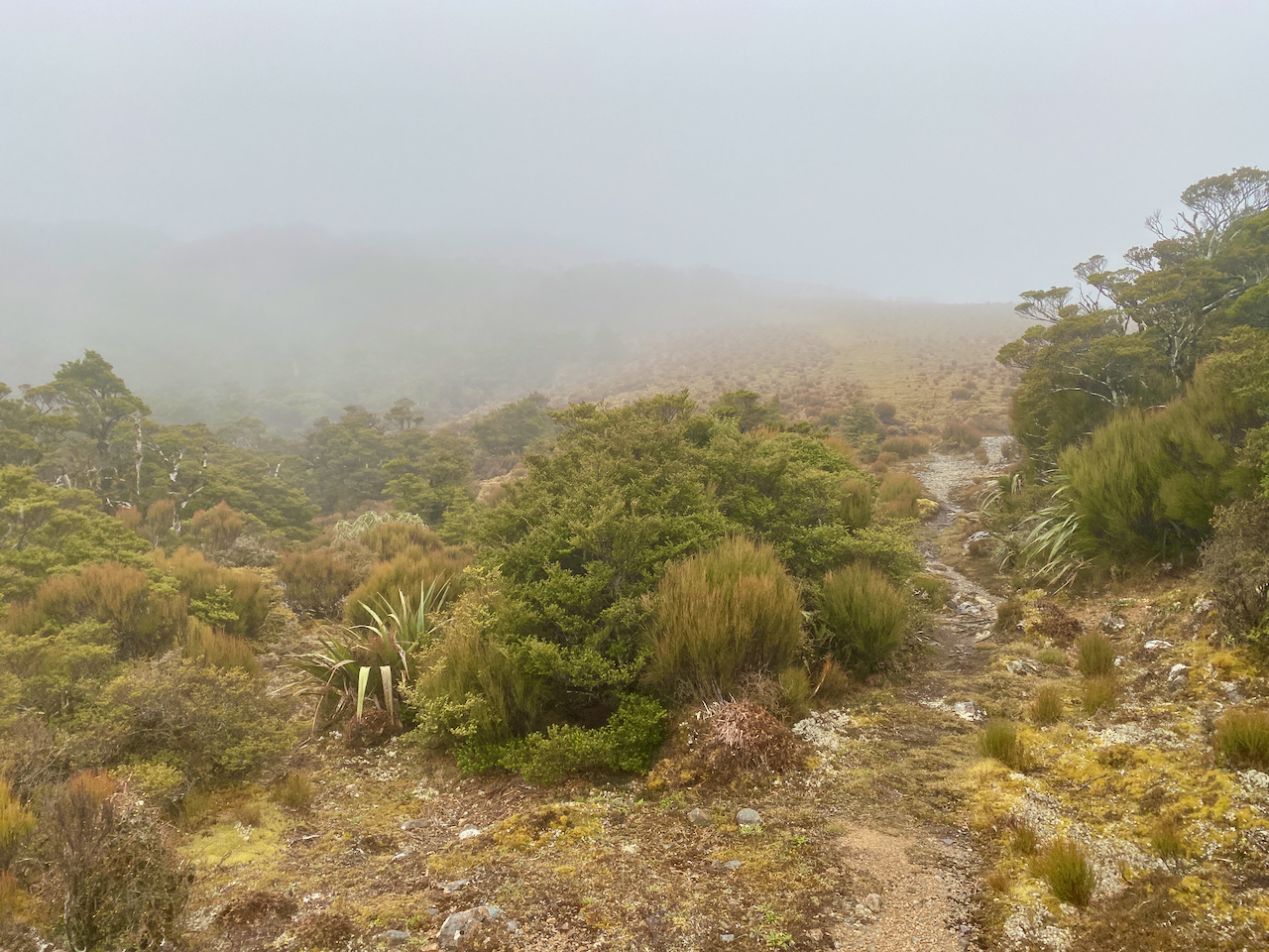
And, of course, the best view when climbing so long in the forest, the exit into the high alpine region.
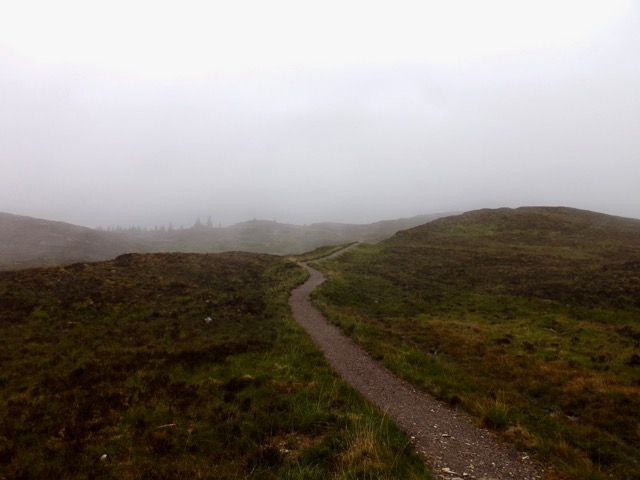
But, I couldn’t take a rest as it was cold and wet crossing the open area, so I pushed on and into the cloud layer. Fifty metres later and I crossed the top of a small hill blanketed in sodden moss.
Stepping carefully, I marched on before beginning a descent onto a saddle known as Hells Gate. Icy wind swept up from one side to another, but thankfully there were plenty of thin trees.
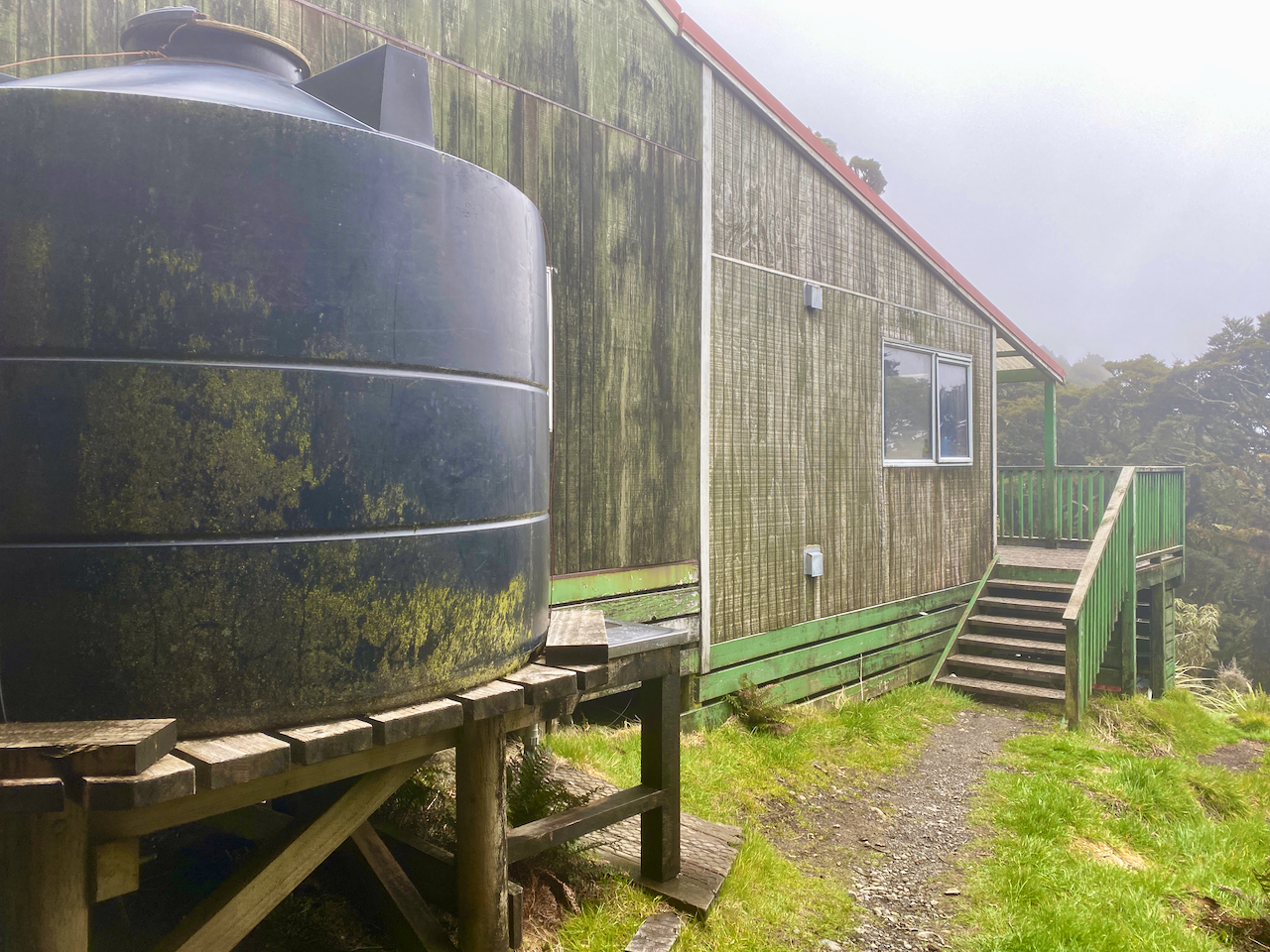
On the other side, I climbed to nearly 1200m, thankfully leaving the wind behind, but my breath was coming icy and temperatures had dropped. I descended to below 1100 before climbing again. The topographic map I was following on my phone didn’t have my hut on it, so I assumed to was near the summit of Alpha, still 200-300 metres higher than I was. But not long after, I came out of the trees to find the hut.
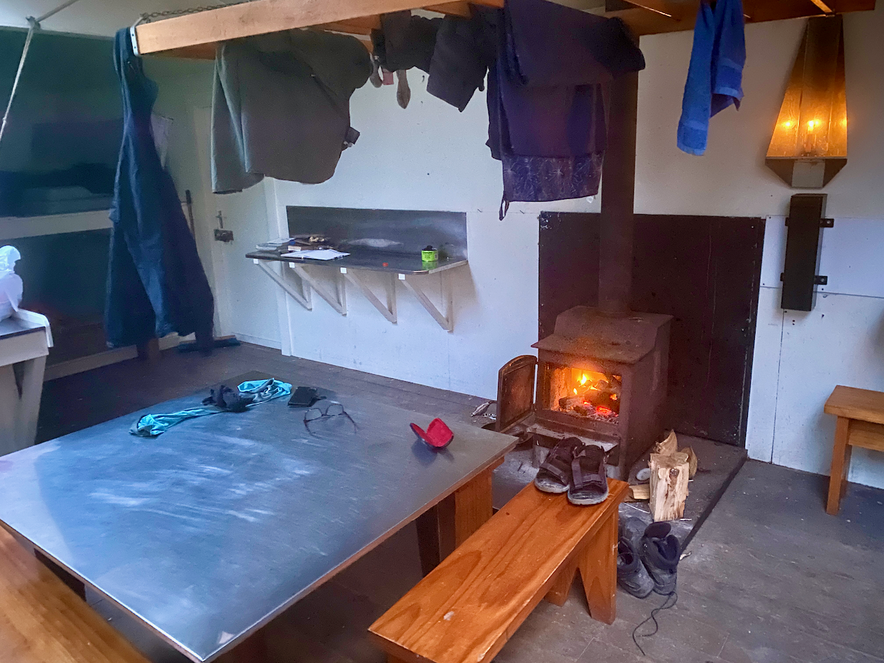
I rushed inside, and tried to get the fire going to get some warmth, but alas, none of the wood would light as it was all wet, and not being a serviced hut, firewood wasn’t periodically dropped off. I quickly cooked some food, changed into warmer clothes and still freezing, got into my sleeping bag in hopes of getting warm. During this time I did locate the small bag left behind and squirrelled it away in my pack.
Day 2 – Alpha Hut to Tutuwai Hut
I’d gone to sleep breathing into my sleeping bag, and woke up in a cloud of warm air even though it was freezing outside. I even had to throw my sleeping bag off, and remove some of my thermal clothing as I was too hot. There had been a change in weather overnight, the icy clouds were getting a push along by some pretty heavy gusts of wind. The next couple of days were to have been spent in the open ridgetops, and as a cautious hiker, I felt that high gusts on the icy ridges was not going to be safe (or fun), so I decided to descend back to the lower huts for the rest of the hike.
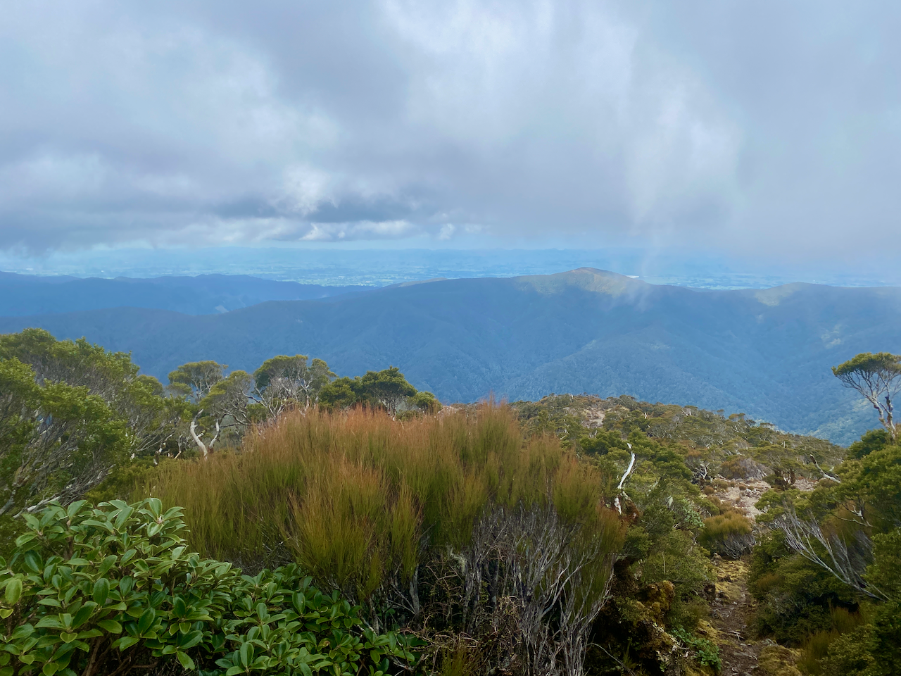
After packing I headed back along my entry the trail. I descended to Hells Gate, which was again windy, but not as cold as the afternoon before, and on the other side I came to a junction and headed up towards the summit of Omega which opened out onto the rocking area. Low clouds hung over the area but I got my first views of the low lying lands of the Wairarapa. I also had reception on my phone and contacted the owner of the small bag, informing her that I would send to her when I exit the park.
The trail down was similar to the Bull Mound Track I’d climbed the day before. But I would imagine climbing it would have been more difficult. Eventually, after several hours, I came out at the Tauherenikau River I’d crossed upstream the day before. Again I studied the best place to cross, swapped into my sandals and headed across. I’d decided that I would be staying in the Tutuwai Hut that night, and as that was not far from where I’d crossed, I kept my sandals on and walked up the track. I got to an open area with a lunch table, but no hut. It took me a few minutes to locate the hut hidden up the hill – the sign had been smashed. I settled in for the afternoon, found dry wood and got a fire going. Practicing fire making skills is always a good thing!
Just as darkness fell, a pair of young guys appeared, the only other people I’d seen in the two days I’d been in the Tararuas.
Day 3 – Tutuwai Hut to Totara Flats Hut
After a warm night in the hut, I contemplated whether to exit the park or find another hut to stay in for the night. I’d set aside four days in the Tararuas so I located another hut far enough away to give me a fair walk, but also within a fair walk ofwhere I’d parked my car. I followed the river for an hour back to the Cone Hut I’d stopped at on my first day, passing three middle aged guys going to the Tutuwai Hut.
I stopped at Cone Hut for a bit as it had begun to rain lightly, but when it didn’t stop after 15 minutes I headed on. I climbed up the track I’d come in on the first day but split off towards the Cone Saddle. The sign said 30 minutes to the saddle, but I’d discovered that most of the timeframes on the signs are works of fiction, often heavily underestimating the times… it says 1 hour to the hut, 3 hours later I arrived. In many cases, other walkers had scratched off the original times and added more realistic ones. I climbed on, and arrived at the saddle 45 min later.
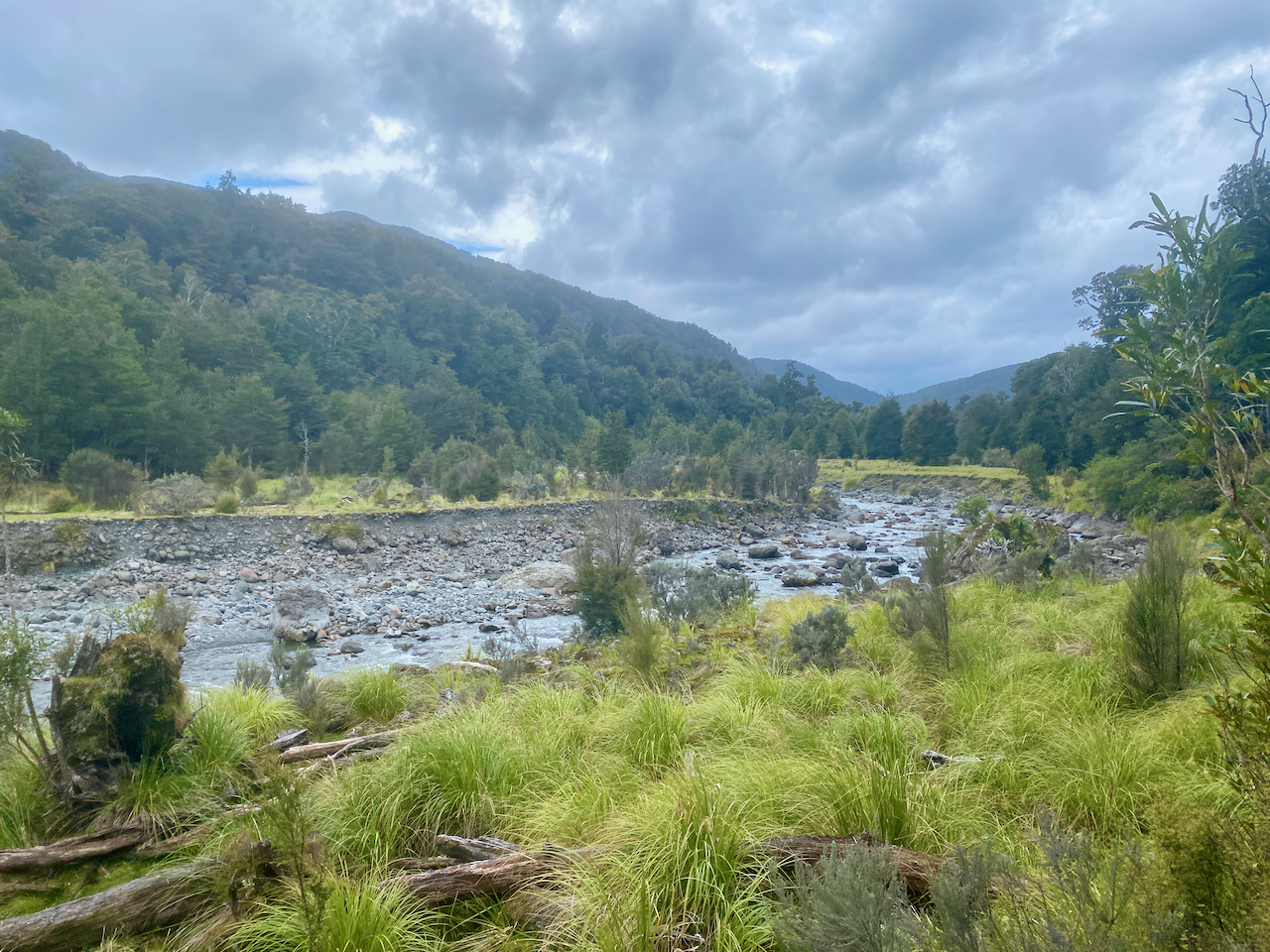
Perhaps I should have climbed the extra 500m to top of Cone peak and followed the ridge down, but I chose the easy path and headed down towards the Waiohone river. I crossed a small plateau and stopped for some lunch before continuing down to the river.
For the rest of the day, I followed the trails beside the river where I could. There was little climbing and I could take a rock hopping option instead of going up onto the knoll. There were plenty of flat areas, although this is also where the muddy ground is most prevalent. At one point the trail led me up a knoll and I decided to try rock hopping instead, but ran into a dead end and would have to wade into the river to get past, so I went back.
Then I came out onto the Totarani Flats, and for the next 45 minutes it felt like I was crossing a grassy paddock, but in slight drizzle. At one point I found a dry covered spot to have a rest, but was harassed by sand flies, so after five minutes continued on. The trail headed into the woods, and soon after the hut appeared.
As with the day before, I set about making a fire and got ready for the evening. An hour later, a lone runner appeared, stopped in to say hi and sign the hut book, the ran on again. She had started her ‘jog’ 12 hours earlier and still had a bit to go. Trail runners are insane.
Day 4 – Totara Flats Hut to Waiohine Gorge Carpark
The next morning, the weather was fine and once ready, I headed down to the bridge to have a look before donning my pack and leaving. I retraced my steps along yesterday’s trail through the flats, enjoying the sunshine. I crossed the long sections of flat trail and mud to eventually arrive at the the junction I’d passed coming from Cone Saddle. The sign said 2 hours, but who knows.
The trail turned out to be more difficult, with plentiful knotted roots and rocks. It felt like I was climbing over hurdles, up and down and up and down. 2 hours in and I was only half way towards the carpark. The final hour of the walk, and I noticed the trail was more manicured, with sections of boardwalk, cut steps lined with wood and long easy trails. I eventually arrived at the bridge I had crossed at the beginning and crossed over to my car, where I took a rest, changed and prepared to exit the path. After I’d left the Tararua Ranges, I stopped at Carteton and shipped the small bag back to the lady. Later that day, as I was relaxing at my friends’ farm south of Palmerston North, the clouds over the ranges where I’d just been looked ominous.
The Original Plan
The original plan had me going past Alpha hut, along the ridge lines known as the Dress Circle up to heights of 1500m plus to Kime hut, then the next day along the open ridge line to Maungahuka hut. In the cold wind and under cloud cover, the walk wouldn’t have been fun, and with no guarantee of heating at the huts I feel I made the best decision. Then from Maungahuka hut to the carpark I estimate the day would have been between 10 and 12 hours, with long steep descents and a huge climb. If I had done in mid summer it would have been more fun, and perhaps I would have split the last day.
Overall
The walk was good although as I had chosen to not go into the high open ridge tops, the majority of the hike was in the forest. The huts were pleasant, well, the ones where I could get the fire going. I felt cozy and enjoyed the warm solitude of the place. I was prepared for the possibility that I might not be able to get to the higher areas, and had alternative options. Perhaps if I’d chosen early summer, I would have had a different experience: more heat, more alpine, but then more people to contend with on the trail and in huts. Still, I give it a good rating and add it to my experience.
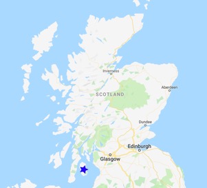
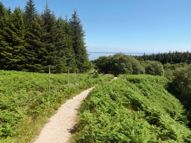
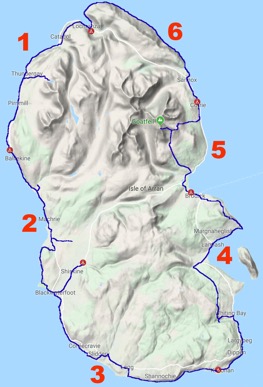
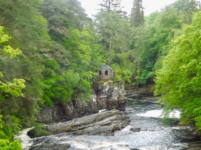
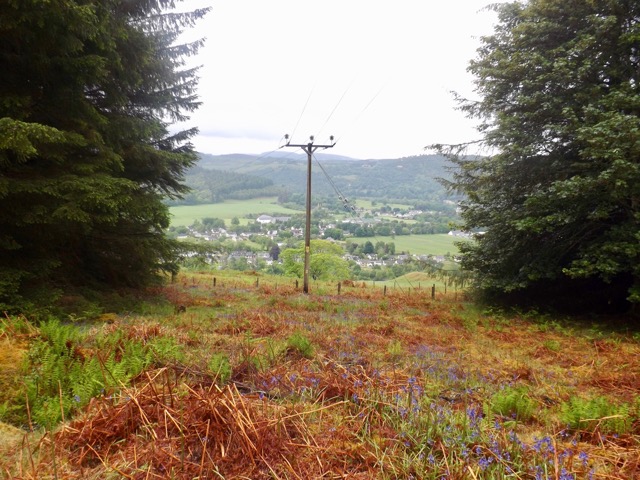
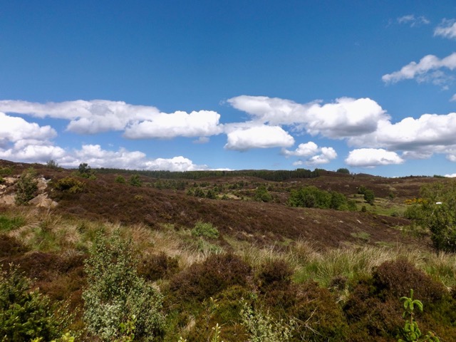
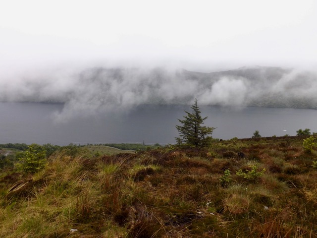
In late June 2019, I undertook a 6-day coastal hike around the Isle of Arran, my namesake island. This 65 mile / 105 km hike is a circuit of the island starting from the northernmost village and heading inland on several occasions. The weather was scheduled to be amazing with little rain.
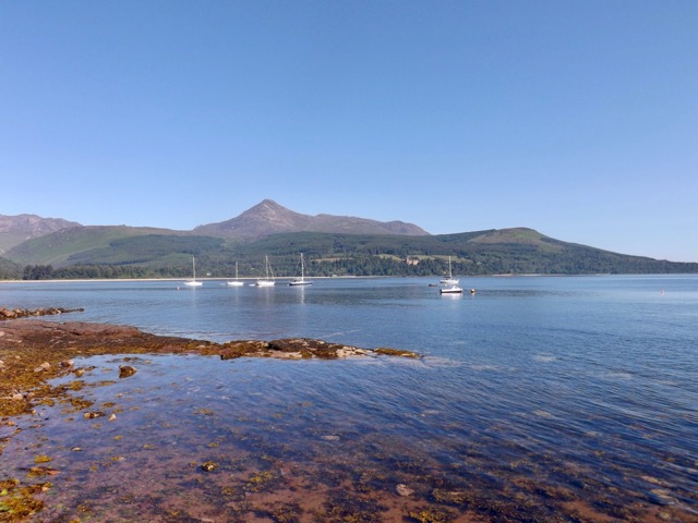
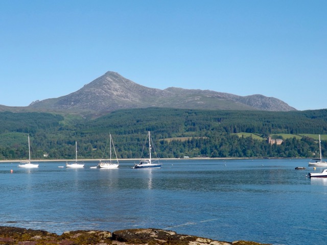
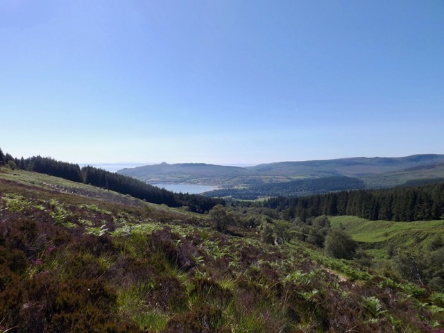
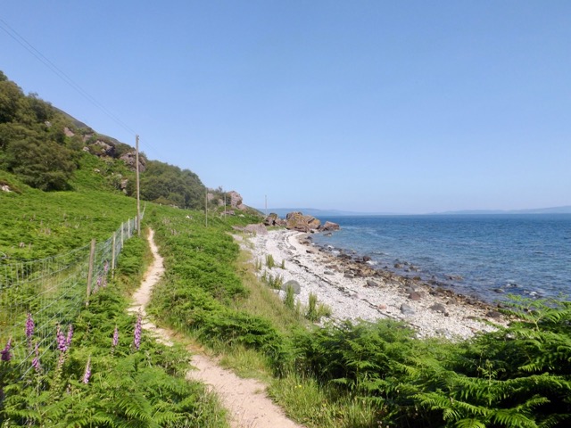
While today is the shortest day distance-wise, I will be climbing Goatfell with my pack, so it will be one of the more difficult days of the walk. Although as it is just under 900 metres, it should not take too much of the day. After my first full Scottish breakfast for this trip, I set out from the bunkhouse and through Brodick. As I walked, more people came out and began the long slow walk to the Fell.
The path led around the beach with some sand walking as I went. The Brodick castle standing prominent in the trees off to one side.
The trail around the bay and up into the trees with a mix of short steep areas and slow gliding climbs. With my march on, I passed several slower climbers. While the trees offered respite from the sun, it also stopped the breeze, so the sweat came heavy. When I finally broke out of the tree line, the cool breeze in itself was worth the climb. I looked back for a view of Brodick.
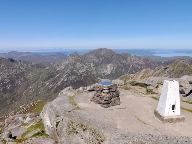
As people took breaks, I climbed on as the trail grew rockier and steeper. I crossed a wooden bridge and through a deer gate. I pushed on up the mountain, stopping for the occasional 10-second break before pushing on again. 10 seconds is enough to get the breath back before continuing on. I finally took a longer break where the trail reached a ridge that offered great views back the way I’d come, into the valley beyond and up the final 250 metres to the summit.
After 10 min I pushed on up the very steep trail with more 10 second breaks, one every 20m until I reached the summit in the glorious sunshine. The views in every direction were amazing and all who had reached the top relaxed and enjoyed the sun.
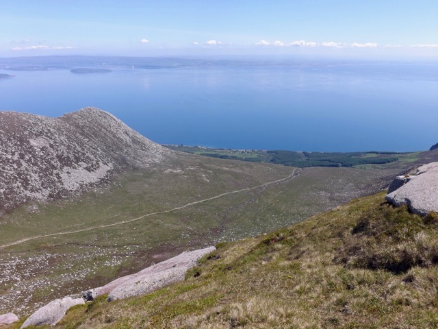
After about 30 minutes, I packed up and began the climb down. It didn’t take long to get to the junction, and I continued down the Corrie route. The way down was rockier, but I continued my charge down onto the plateau and across a stream.
At the edge of the valley, it descended again on rocky steps eventually to a forest…
…along a dirt track…
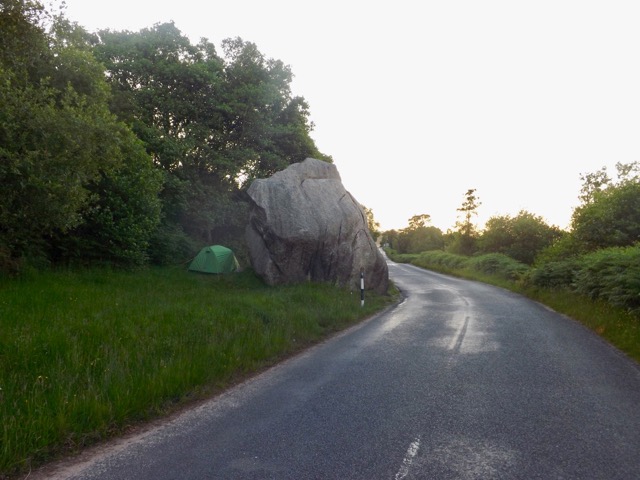
…to a road and down steeply to the main road. I found the first seat I could, got off my feet and out of my boots. After 10 minutes I headed a further few minutes to the local pub for a cider or three in the sun. I then headed on to Sannox where I would be staying the night, or so I thought. The hotel there was closed, and there were no other food options. I decided to walk the 2km back to Corrie for another cider and to wait for the hotel’s kitchen to open for dinner. After dinner, I headed along to the town hall and pitched my tent, where I had seen a bunch of people doing days earlier. It turns out I couldn’t camp there, so I headed back towards Sannox to a large boulder beside the road where I pitched a wild camp.
Day 6 – Corrie to Lochranza – 10 mi / 16.5 km
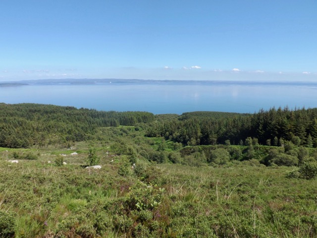
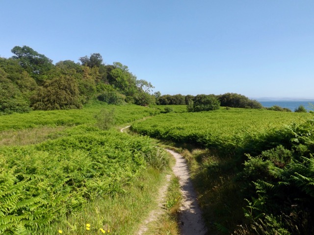
After my night of wild camping, I packed up and headed back to Corrie for breakfast. Today was the shortest day with little to see, but it is expected to be the hottest day of the year also. This is Scotland, so we’re talking 24ºC. I headed out of Corrie and back along the road to Sannox, past the site of my wild camp and on to the beach. I then walked at the top of the beach, along a trail of sand and then dry earth.
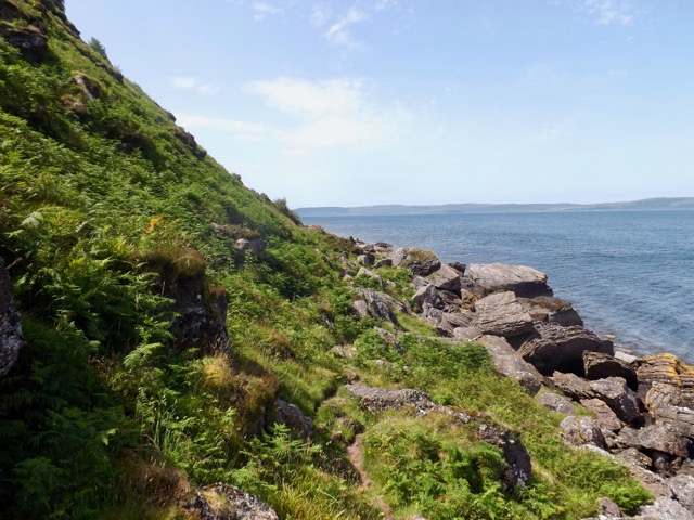
I walked on as the heat increased along with the wind, through a wooded area until I came to the Sannox Burn flowing out to sea. I didn’t see the point of walking a 400m inland and a 300m back when I could just cross on stepping stones. On the other side, I followed a sandy trail past some cliffs.
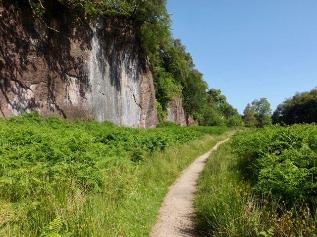
On the other side, I followed two women for more than 2km along a rocky trail until it reached a place called quite descriptively “fallen rocks”. Giant rocks had fallen from the ridge a few years back.
I passed the girls as the trail became more defined, and for the next 3 km, I followed it until it came to Laggan cottage where I popped inside to have a brief look around.
The trail became more rocky and rugged for much of the rest of the trail except for a 500m stretch of beach called Fairy Dell. It passed a rock formation known as the Cock of Arran. It, apparently, once looked like a male chicken until its head fell off a year or two ago. Now it’s just a rock.
After a short time, I came around the coast, and Lochranza appeared. Then it was only 30 minutes across the tarmac road around the bay to the ruins of the Lochranza Castle and then on to the Sandwich Shack where I began the walk.
Overall
The Arran Coastal Way was a great six-day walk. Each day had its special elements all different from previous days. It worked out well for the weather, which likely added to the enjoyment.
I would definitely recommend this walk, while fairly easy, is still enjoyable.
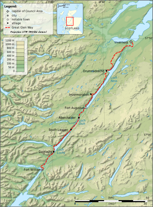
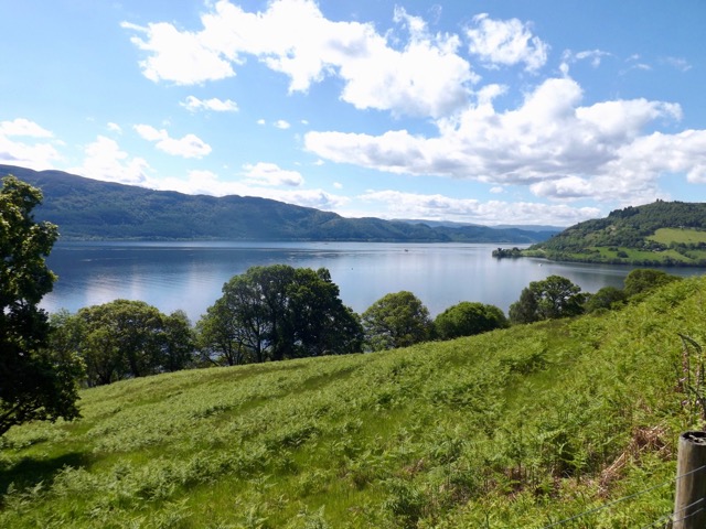
In June 2019, I decided to walk the 6-day Great Glen Way, a 79 mile / 126 km walk from one side of Scotland to the other along The Great Glen fault which separates Scotland roughly in two.
By Ayack – fr:Ayack – Own work :Topography: NASA Shuttle Radar Topography Mission (SRTM3 v.2) data (public domain);Reference used for confirmation for the additional data: ViaMichelin;Locator map: File:Saint Kilda archipelago topographic map-fr.SVG (modified) created by Sting., CC BY-SA 4.0, https://commons.wikimedia.org/w/index.php?curid=8860318
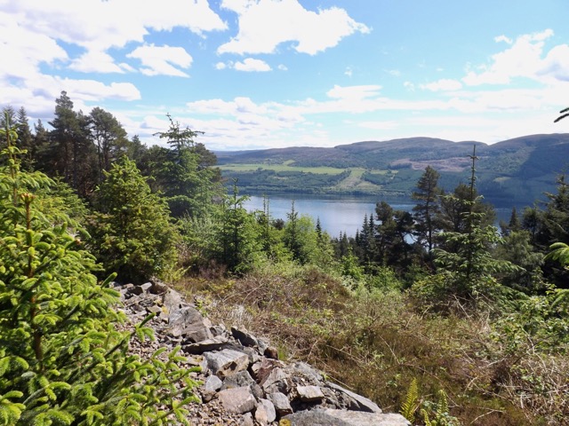
Day 5 – Invermoriston to Drumnadrochit – 13.5 miles / 23.5 km
This morning I left behind the father and son walkers I’d run into on most days so far. The father’s foot had packed it in, and they were finishing the walk there. It had rained overnight, again, and I packed a wet tent as I had several times before. I walked out of the camping ground back up to the low route. I walked the mile back to the junction I’d come down off the moors on yesterday. I continued walking, the rain taking a break and I came down to the bridge across to Invermoriston. I took a quick photo down the river…
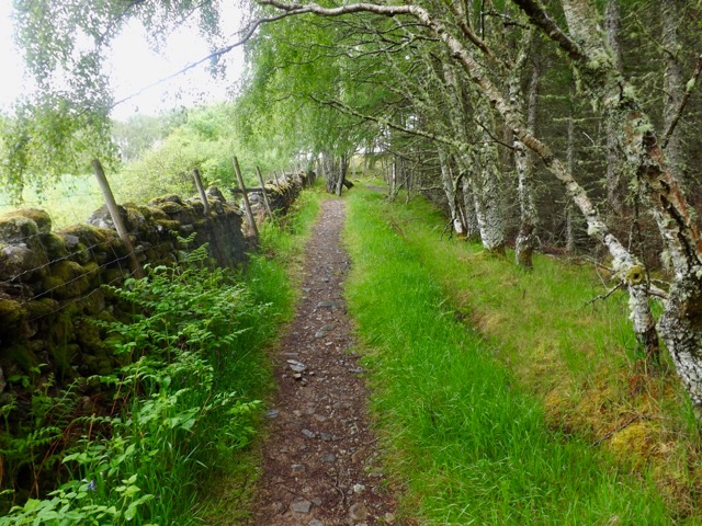
I walked 100m down the road to the cafe and a full Scottish Breakfast and coffee. After breakfast, I headed out and up several hairpins on an old country road to the top of the ridge and then higher along a trail beside a fence.
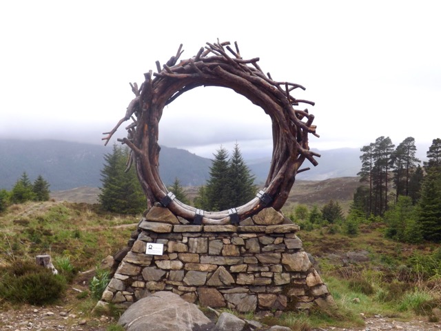
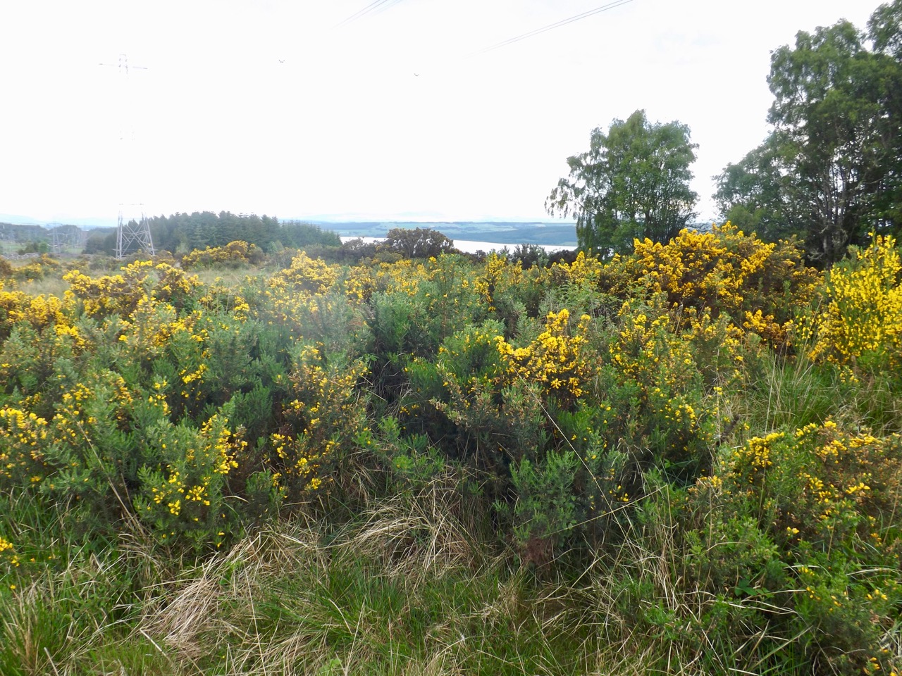
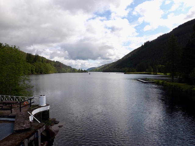
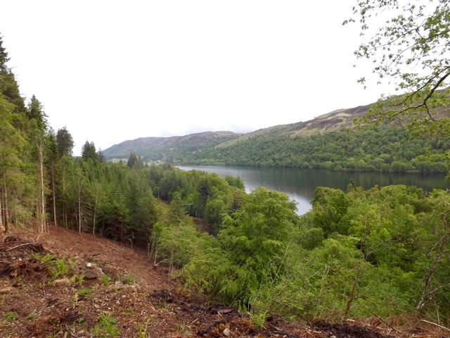
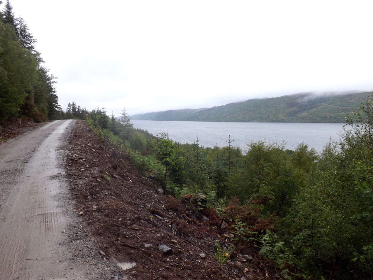
For the next few kilometres, the trail followed the fence or dipped down into the forest only to return again. The rain came and went, but it was not heavy. During the hours I spend atop the ridge line, I saw no one else. I was hidden away from Loch Ness for much of it but came past the ViewRanger, a piece of art built on the side of the hill.
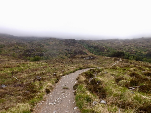
I continued across the moors for several more kilometres, clouds hanging low at times.
Then I came to the Troll Bridge and crossed it furtively but without assault, into the forest again where I continued.
On several occasions, I came to parts where there should have been a view, but the clouds were too low over Loch Ness. Then, as if it knew I wanted to see the loch, the clouds lifted slightly and finally…
At the end of the 11km, I headed across some fields on a trail to a farm road as it again began to pour with rain. I found a little shelter someone had put out with things for sale for walkers.
I put on the pace along the sealed road averaging about a km every 10 min along the 4km stretch of road.
The road dove steeply downhill, and Drumnadrochit came into view. The trail them cut through a forest as it headed down towards the river before coming out onto the camping ground I’d be staying in for that night.
After pitching my tent, showering and washing my clothes, the sun came out, and I headed across to the local pub for dinner and a well-deserved cider.
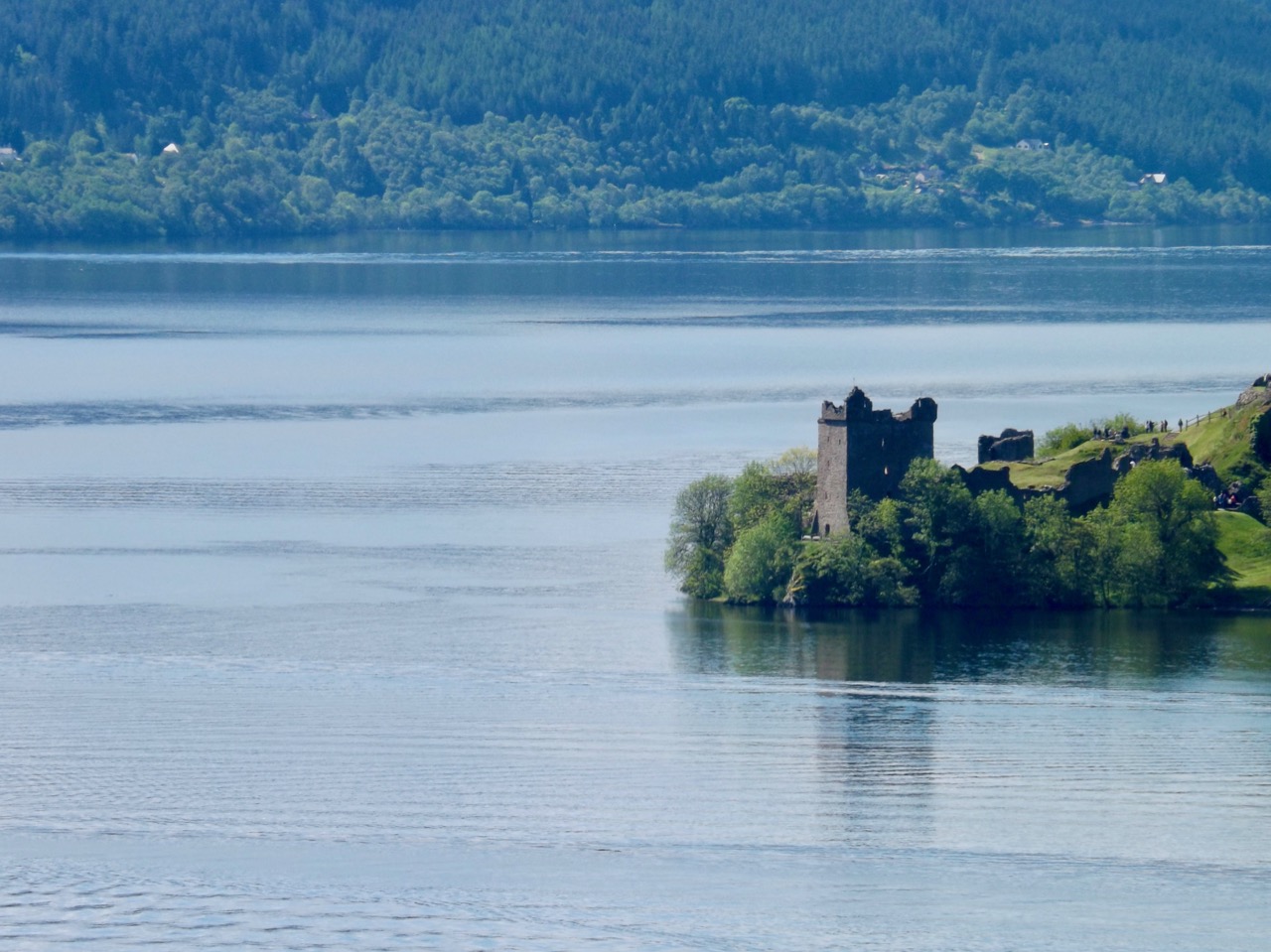
Day 6 – Drumnadrochit to Inverness – 18 miles / 28.8 km
It didn’t rain overnight and when I woke there was s thin mist over the camping ground. And, by the time I had packed the sky was blue and the sun was out. After 5 days in the rain, the final longest day was to be spent in the sun. But I was not so lucky that my tent wasn’t wet, the dew and mist had ensured I would still be packing a wet tent.
Once packed, I headed to a cafe for a big Scottish breakfast but was disappointed there was no haggis, I’ve become quite fond of it on this trip. After breakfast, I headed out through Drumnadrochit along the main highway past Drambuie farm and up a hill that gave good views back across Loch Ness…
…and the ruins of Urquhart castle.
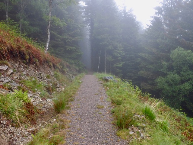
I continued on along the trail and into the forest with continuing good views.
The trail climbed for the next 2km, sometimes steeply until it eventually came out into the moors only to cut into the forest again shortly after. After the hard climb up the ridge, the trail flattened out and remained that way for much the rest of the day.
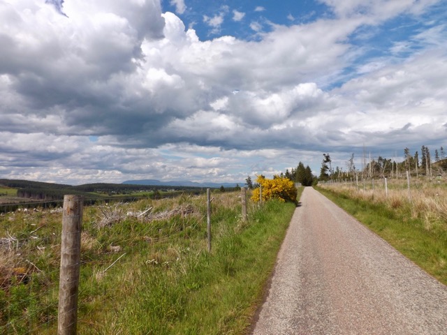
I passed a farm and stopped to tend to blister forming when I noted the farmer struggling to get a trolley onto a trailer. So I put my boot back on and gave him a hand. After my good deed for the day, I set out again along the farm road, across a highway and onto a thin track. Along the side of the track, I started to see signs of an eco cafe, so stopped off for an expensive coffee and cake in the middle of nowhere. After the break, I arrived at another road…
…and quick marched the 4 km until it merged with a dirt trail. Dark clouds seemed to come, but no rain eventuated.
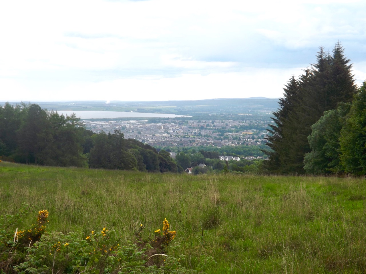
The dirt trail ran for a mile before diving into a forest and on a slow descent over 5km until I saw Beauty Firth, a stretch of sea off the coast of Inverness.
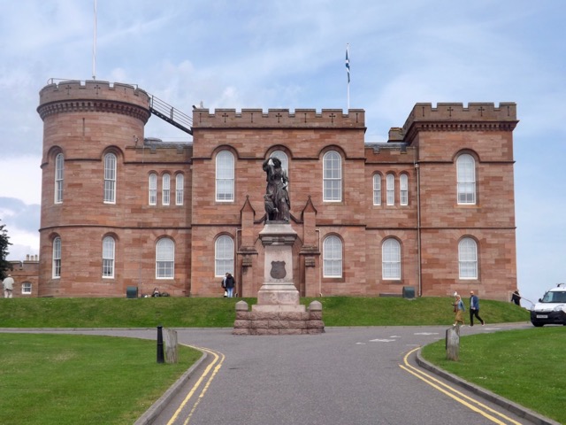
Then I rounded a hill and Inverness itself came into view. I followed a fairly steep hill down towards it.
I crossed near a golf course to the canal where I walked for 3 km, crossing the Ness Islands and eventually ending the trail at Inverness Castle, near the centre of the city.
I discovered my hostel 50 metres from the castle and checked in for a well-deserved shower. Once clean and in fresh clothes I located a Wetherspoons for dinner and, of course, a cider or three.
Day A – Inverness
I found it cheaper to stay in Inverness the night on Saturday before flying out on Sunday. I wandered around the town a little but decided against doing the tourist thing. Instead, I rested my feet and body after the hike. Saturday night, however, there was a music festival in town, so all of the pubs and restaurants were very busy. I hung out about the hostel and read a lot relaxing and watching a movie with a few people in the common room.
Overall
The Great Glen Way is a good hike, but not a great hike. The first three days a spent on the flat walking beside the canal or lake. But it is the last three days where the real hiking begins. While the climbs were not high, it gave plenty of views when they were available.
The major issue with the hike was the amount of rain, but it is Scotland in June, so you just have to go with it. It was nice to have the sun on the final day. The other issue is the general lack of food options along the way, which is likely something I should have planned better for. I survived and enjoyed my time.
In a couple of weeks, I head back up to Scotland for another six-day hike, The Isle of Arran.
In June 2019, I decided to walk the 6-day Great Glen Way, a 79 mile / 126 km walk from one side of Scotland to the other along The Great Glen fault which separates Scotland roughly in two.
By Ayack – fr:Ayack – Own work :Topography: NASA Shuttle Radar Topography Mission (SRTM3 v.2) data (public domain);Reference used for confirmation for the additional data: ViaMichelin;Locator map: File:Saint Kilda archipelago topographic map-fr.svg (modified) created by Sting., CC BY-SA 4.0, https://commons.wikimedia.org/w/index.php?curid=8860318
Day 3 – Laggan to Fort Augustus – 15 miles / 24 km
After a night in the softest bed ever, a great relief after 2 days of hiking, I set out from the hostel and ran into the two ladies I’d been chatting to most of the night before. We then walked to a local cafe a few hundred metres off the trail for breakfast and coffee. On the way, we stopped to take a photo of Loch Oich as we crossed on a swing bridge.
After eating, we headed back to the trail and began climbing the hill. As we walked and chatted we all but reached the top without noticing the climb, heading around a curve of the hill and heading back down. At the base of the path, the pair continued north while I split off to the east where I ran into the group of older walkers from the day before. I chatted with them as we crossed into Invergarry, where I stopped to look for lunch options. I didn’t find anything suitable after a quarter of an hour, so continued on.
I climbed the path, a set of hairpin lanes that led up the to a forest road which I followed as it curved around above the loch. It wound its way through forest trails for some time as it slowly descended back towards loch level before climbing again into the forest. It was here I ran into the groups of older walkers and chatted to one of the group leaders until the path was wide enough for me to pass.
I came down to the A82 highway and followed it around to the swing bridge across the canal. Off to my left was the Oich bridge, an old now-closed bridge. On the swing bridge, I noted a sign for a cafe half a mile off along the A82. It was off the trail, but I was hungry, so I made the walk up the hill. After passing several signs over the 15-minute walk, I arrived to find it was closed Tuesday – Thursday. So I walked back to the swing bridge and took a break without eating. It was here I noticed a couple of what I thought were ticks on my leg. With tweezers, I removed them even though they had not dug in; I didn’t see any other the entire hike.
After the break, I marched on alongside Loch Oich as the skies began to clear. It was six kilometres to Fort Augustus. As I walked, I noticed I was on a path between the Caledonia Canal and the River Oich. They came very close on several occasions, and I even crossed a weir that allowed water to run off from the Canal into the river if it was too high.
After an hours march, I arrived in Fort Augustus and located my camping ground. I set up my tent beside the father and son walkers I’d met on the first day and once done headed into town with them to a pub for dinner and a cider or three.
Day 4 – Fort Augustus to Invermoriston high route – 8.5 miles / 13.5km
After enjoying five ciders last night, I slept very well, somehow managing about 10 hours. But when I did wake in the night, it was raining, heavily at times. It continued into the morning. Today is the shortest leg of the six days; I held out until it stopped raining for as long as I could before packing up and heading out into town for breakfast. At the locks, I looked down the canal towards Loch Ness.
After breakfast, I headed out through town along a stretch of road still under construction until I found the trail and followed it up a hill into the forest.
The climb was short and one of the first real climbs of the hike. I came out into a new forest road and followed this for about a kilometre until the high route began. The trail cut up the hill with switchbacks and steep climbs. It finally felt like I was hiking after so much loch and canal-side walking. After about five hundred metres, I came out of the forest and onto open ground. While the rain had stopped, the clouds hung low over the moors.
After about a kilometre the trail disappeared into the low clouds, and I came across the older walking group again. I stopped for a brief chat before pushing on. The low hanging clouds over the loch and the moors gave only the occasional view.
The trail continued for another 4 kilometres through open ground before dropping down into the forest again. After several switchbacks, the trail descended very steeply. With shaking legs under the weight, I contemplated taking out my walking poles. This was, after all, why I’d brought them, but I decided to suck it up and just did it.
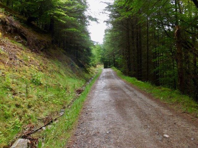
At the bottom, the trail met with the lower route, but instead of following it to Invermoriston I headed the other way, back towards Fort Augustus. I walked along the low route for two kilometres as it again started to rain. The low route is simply a fairly flat forest road with no views and is very boring. It would be good for cyclists, but hikers would find little of interest here.
I soon found the side trail leading down to the camping site where I arranged to hand my tent in the drying room. While I waited for the rain to stop and my tent to dry, I showered. When I pitched my tent, I noted across the grassy camping area, the father and son walkers I’d met several times through the walk. With little in the way of food options nearby, I bought some noodles and a can of peaches from the camping ground shop and nestled into the tent with my Kindle to read for the evening.