In the Coronavirus infested summer of 2020, I walked the 10-day Tour du Mont Blanc. Here describes days 7 & 8.
Back to days 5 & 6.
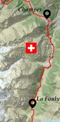
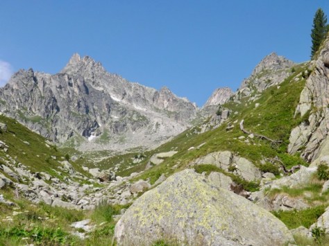
Day 7 – La Fouly to Champex – Switzerland – 14km
After a conversation with yet another Dutch couple at the campground, I discovered the last part of today’s leg will be a bit of a slog. The wife walked it alone last year, and so they are planning to skip the last half of the day by catching the bus from Issert. I certainly wasn’t going to take the bus, but I took note. I walked out of the campground and headed along an open field towards the woods where I would follow an easy slowly descending trail. It was still warm, even early in the day, so I was glad for the shade for the first few kilometres.
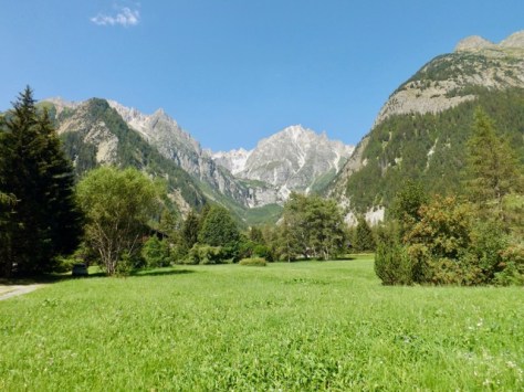
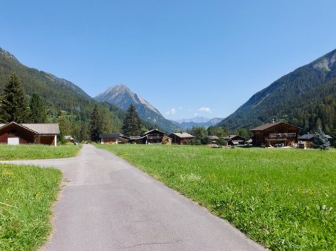
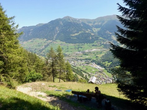
While the views from the Swiss portion are not as good as the other sides, the mountains are still beautiful.
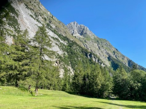
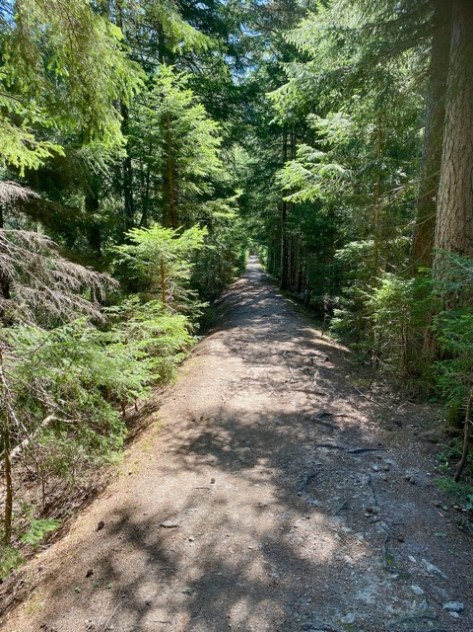
After a brief climb, the trail hugged the lower slopes of the mountain on a thin path, and one section even had a chain to hold onto, just in case. The trail then headed through the forest, and it felt as if I was walking along a long thin tree-lined avenue – a 1.5km long section of very straight trail with only two bends.
When I came out, the trail headed onto grassy fields past a Swiss hamlet. It then worked its way towards the village of Praz-de-Fort where I went looking for a cafe and a cold drink. I found the Dutch guy at one also having a drink, so I stopped for a chat.
I headed off a few minutes after him and came around onto another road with a quaint village ahead where I stopped to retrieve my lunch from my pack. I was preparing to leave when the Dutch girl came along after me. We walked together for a bit, but she stopped in the next village for a break, while I pushed on to Issert.
A hundred metres after the village the trail cut up a hill made more difficult by the summer heat. Issert sits at 1040m above sea level and my target Champex is at 1500m, not a huge climb compared to other days. The trail went into the forest for shade, but forests have their own humidity, so it is warm either way. As I had been warned, the climb was a slog, with little along the way to see. Someone, however, had carved various animals into tree stumps to give us something to see. There’s a viewpoint along the route, and well worth the wait.
And another 20m further on there is a water fountain, something common along the trail, with potable water and another view.
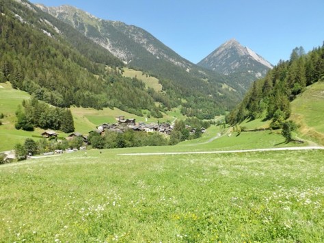
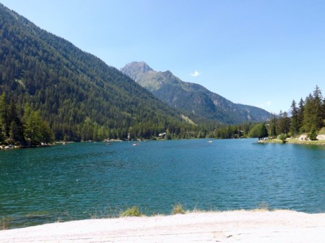
Four kilometres after Issert, I came out of the forest and climbed around the streets of Champex until I found myself above Lac de Champex. I walked to and along it for a kilometre until I reached my campground.
After pitching my tent, I headed back to the lake, where I ran into the Dutch guy. We found the English couple and the young Dutch couple from the night before, along with (yet) another Dutch couple, the girls from each Dutch couple being sisters. Yes, the Dutch invaded my TMB, but no complaints from me. A large portion of walkers are French who speak various levels of English. The few Italians along the way were similar. The Dutch I met, to a person, were fluent in English, which made it easy to connect with them. Later, after eating with the Dutch guy, everyone got together to play cards, along with an American couple — all good company.
Day 8 – Champex to La Peuty – Switzerland – 14.5km
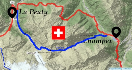
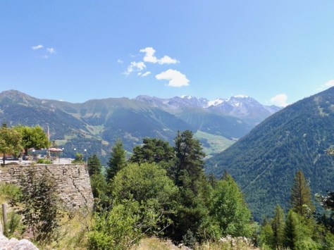
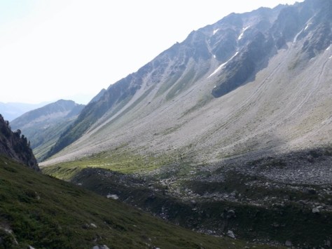
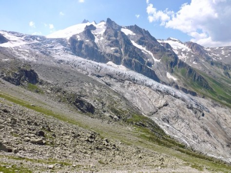
The official route today via Alp Bovine is supposed to be a forest walk with some spectacular views. However, there’s a variant, more challenging and with a climb above 2600m, the highest point of my TMB, with unmatched views. Leaving the campground, I followed a path away from the road then turned sharply and followed an irrigation channel. The trail climbed into the forest-covered valley for 1.5km until it came out at the chalets of Relain d’Arpette where I ran into the British couple from the past two evenings. I walked with them for a short time as we slowly climbed through wildflower meadows. They were faster walkers that I, so I wished them well and set my own pace into the grand view ahead.
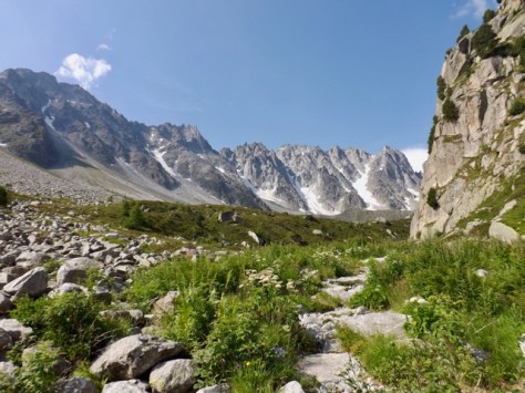
After 2km, the trail grew flatter, and I followed the line of mountains up the valley. I eventually saw the point I would be climbing to, the lowest point of the mountainscape to the right of the photo’s centre.
The trail turned steeper and rockier, and I clicked back into the pace I had perfected over the past 8 days. With my legs used to the effort, the steep climb seemed fairly easy, although the sweat continued to drip from me. Looking back the way I’d come…
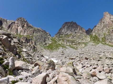
The climb is quite varied, and after a time the trail cut through a massive boulder field. Bouldering is fun, trying to balance while skipping from one to the next. Some find it hard, but it didn’t take me long to work my way past it. There were some snow patches on the mountain and one right on the trail. On the far side a very steep zigzagging path to the crossing point – Fenêtre d’Arpette.
This last part of the climb was the most difficult, and I stopped after each short zigzag to catch my breath. But still, it didn’t take me long to make it to the top and cast my eye back.

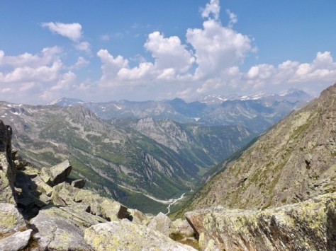
And of course, the sight you wait for while climbing… the other side. At 2665m, I sat to eat lunch and enjoy the view.
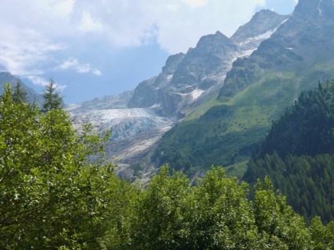
The greatest problem with climbing something tall is climbing back down again. The trail was quite thin, and after my break, I headed down, slowly. While my legs seemed used to climbing up, they still hadn’t gotten used to the down part. I descended beside the Glacier du Trient, the slick rock below it having once been covered by the glacier. As I continued down, my knees starting letting me know how much fun they were having. And, again annoying to see trail runners bounding down these slopes like they’re running down a short hill.
The trail hugged the edge of the mountain for a time on a thin trail before zig-zagging down the centre. I continued down for an hour before reaching an old hut where some people had stopped. The person before me was trying the water fountain, but it was only running warm, so I pushed on. Thankfully I found a glacial stream and drank my fill of the sweet cool water. I continued my descent for some time before the trail cut into the forest where I got a good view back up the mountain to the glacier.
Another hour and I came out at a cafe where several trails met and ran into the American couple from last night. As I’d just run out of my water, I bought a couple of soft drinks and sat with them for a chat. Then with dark clouds looming I headed off. The trail was now flat and had been purposely cut around the side of the mountain as a tourist walk. After 1.5km, I came to a downslope and to the annoyance of my legs, followed it down a zigzag path. Halfway down, I heard thunder and it began to rain lightly. I made it to the campground at La Peuty, not too wet, and ran into some of the others. In the gentle rain, I put up my tent with their help. After a shower, I booked dinner and ended up with the whole group again – British couple, 2 Dutch couples, the Dutch guy and the Dutch girl sitting around the table in a large teepee, eating burgers and drinking whiskey.
Tomorrow I head back into France where I will finish this epic trek. Tour du Mont Blanc – Switzerland/France – Days 9 & 10.
The Lone Trail Wanderer
