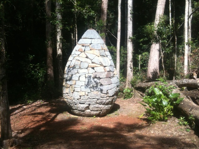
While not all of Glass House Mountains are climbable for various reasons – dangerous landslips, suitable only for rock climbing, too steep, sacred to aboriginals etc – I decided to climb all I could and walk the tracks near the ones I couldn’t. I split my walks over several weekends. Here are my first couple…
Mt Ngungun

I decided to climb Mt Ngungun because I liked the name, although at 253m it’s only considered a hill. On this day, I took along 3 companions, proving that the lone wanderer does not always wander alone. The climb is rated a class 4 – distinct track usually with steep exposed slopes or many steps. Caution needed on loose gravel surfaces and exposed outlooks. Moderate level of fitness.
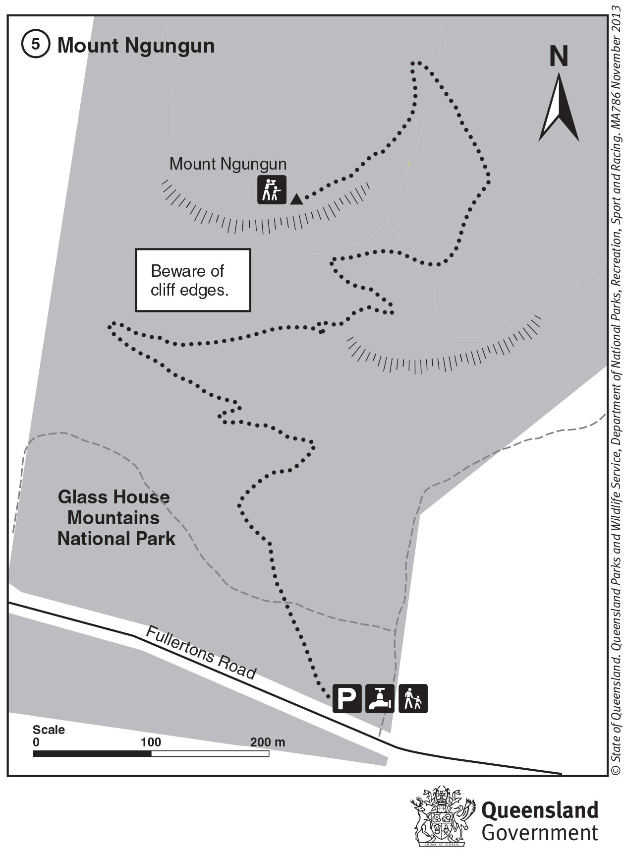
Map is owned by and used with courtesy of Queensland Government. Please visit that site for more detailed information on hiking in this region.
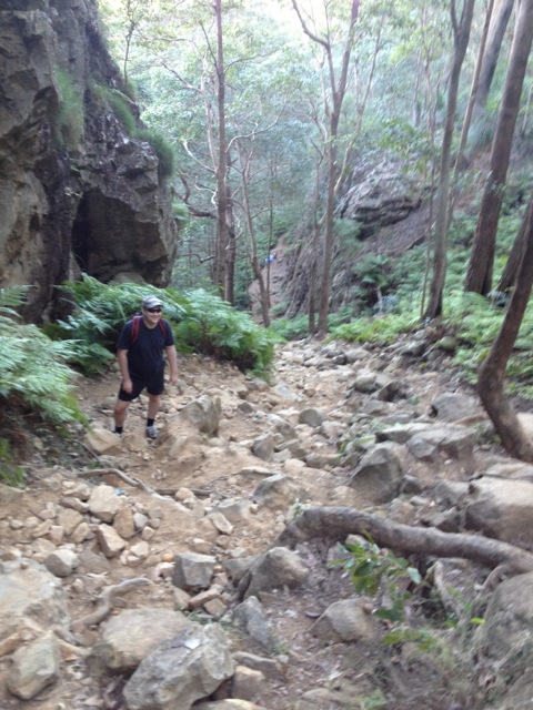
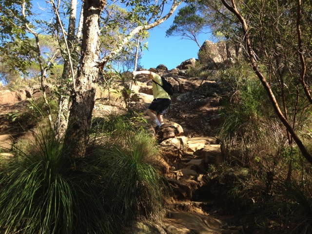
The walk through the forest to the base of the mountain was short and easy. But when we arrived at the base we certainly knew it. The fairly flat path turned into a steep, perhaps 60º climb up a rocky, tree root laden dirt trail.
It’s recommending not to climb Mt Ngungun after it has been raining and it’s easy to see why, the rocky-dirt steps would be very slippery.
The initial section of the climb is a wide channel between a rocky outcrop and the mountain. It didn’t take me long to reach the top of the first climb, the hardest section. As I waited for my companions I peeked through the trees and got only a hint of the views we’d eventually see at the top.
After a short break, and leaving one of our companions behind, we continued up the next portion of track, another rocky, root laden climb, at perhaps 45-degrees.
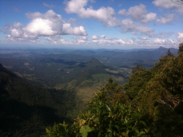
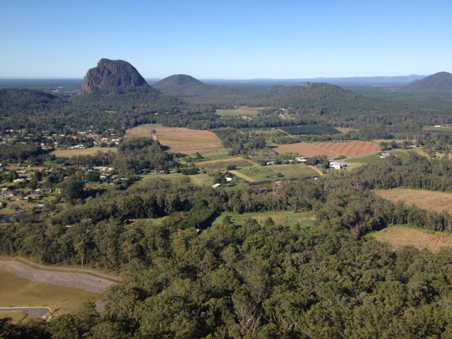
Finally there was a gentle climb along a short ridge to the very top and some fantastic panoramic views. To the east out past the city of Caloundra and the Pacific Ocean. To the west the edge of the scenic rim and to the north and south the other jutting Glass House Mountains.
The climb down was fairly straightforward. Overall a fun climb that took a total of just over an hour including the break at the top.

Back at the car, we headed to the location of our second climb of the day…
Mt Beerburrum
Anything with beer in its name has to be good, right?
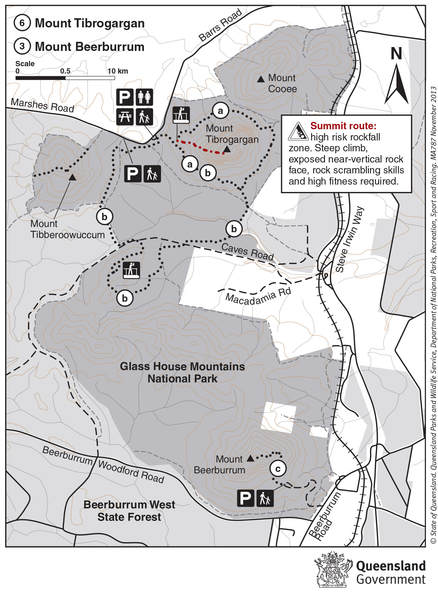
Map is owned by and used with courtesy of Queensland Government. Please visit that site for more detailed information on hiking in this region.
Mt Beerburrum is a totally different climbing experience to that of Mt Ngungun. It’s advertised as a Class 4 also, but with a 700m steep walk. After a gentle climb up to the car park at the base of the mountain, the concreted path took a sharp change, a 45-degree upwards change. Climbing a 45-degree grade is no problems when there are steps, even rough dirt steps such as was the case on Mt Ngungun. But Mt Beerburrum has no steps, not a single one, just a concrete path. And other than several switchbacks in the path it’s hard going with little respite. For my companions and I this meant stopping every 20-30 meters to break up the relentless climbing of the path.

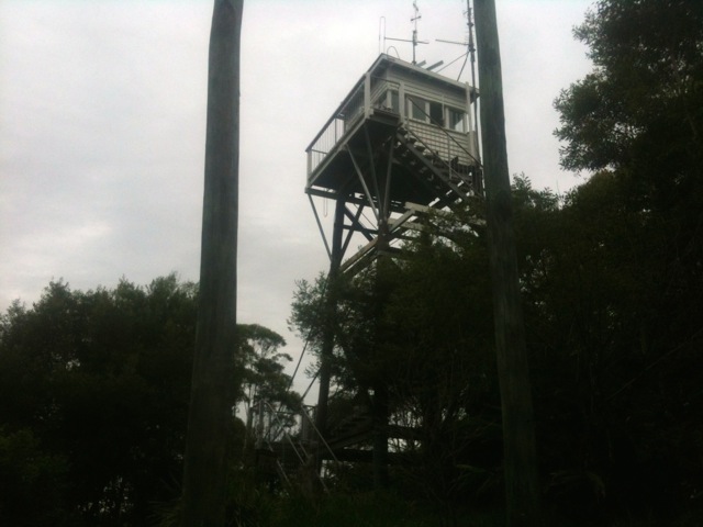
It does eventually flatten out and leads to a fire tower.
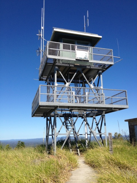
Then a simple climb to the first level of the fire tower gives the same amazing panoramic views as Mt Ngungun just several kilometres to the south. While difficult, for the view the pain of the climb is well worth it.

The walk down was slow going and the steep path was hard on the knees. Weaving along the path made it a little easier. At the bottom, the reason the word Beer in the name becomes apparent and has nothing to do with the nearby township of Beerburrum, honestly. It’s that we really needed one.
Overall, it was a good day’s climbing. I could have done more, but I didn’t want to push the limits of my companions, so left it at that.
The Trail Wanderer