Tag Archives: South America

Parque Nacional Torres del Paine – Day 9

Day 9 – Final Day – Refugio Lago Grey to Refugio Paine Grande

Today is a short day and is the official last day of the circuit for my companion and I. The walk between the Refugios is not long, about 3.5 hours. We were up early and aiming to arrive at Refugio Paine Grande in time for the catamaran that would drop us at our bus.

It had rained most of the night, nothing heavy just constant. I awoke in the dark and quickly dressed and began packing my gear. Usually the first thing I do is start brewing coffee, but as I’d lost my water bottle yesterday when the wind whipped it out of its pocket and cast it down onto the glacier, I figured it would be quicker to pack and have breakfast afterwards. Before long I had everything, including my wet tent, packed away and I was in the warmth of the cooking room heating water for coffee and soup.

We headed out by 8.30 and straight away began climbing a hill in the chill wind. It began to rain as we walked along the side of the mountain with Lago Grey below us. The trail dipped up and down through the valleys.

wpid-dscn2058-2013-04-6-20-16.jpg

There looked to have been a sprinkle of snow on the peaks above us as we passed a raging waterfall well stocked with water from the rain.

wpid-dscn2059-2013-04-6-20-16.jpg

The trail continued and as we crossed a couple of ridges, the wind was so icy coming off the glacier and the rain so constant I was forced to put on my waterproof jacket. If it rains when I’m hiking, I tend not to worry about my jacket. While it protects me from the rain, I still sweat, so get wet inside anyway. It does make a good wind breaker though, so in this case it helped a lot. We passed a couple of miradors but the wind was too fierce to consider standing out in the open looking back at the glacier.

We then climbed a hill around the side of a laguna…
wpid-dscn2069-2013-04-6-20-16.jpg

…before crossing a final ridgeline to follow a kilometre long gully down towards the blue of Lago Pehoe, where Refugio Paine Grande is situated.

wpid-dscn2070-2013-04-6-20-16.jpg

Eventually we arrived at the bottom and walked the short distance to the refugio. 30 minutes later and we were on the catamaran and heading away from the park.

wpid-dscn2071-2013-04-6-20-16.jpg

Final Note

With the weather in Patagonia known for being very changeable, we were blessed with having 7 wonderful days out of the nine we were on the hike. The Parque Nacional Torres del Paine is a wondrous place with many great attractions. While the popularity is one of its downsides, I’m glad I went in low season as peak season would be just insane, with far too many people. Still, the mystical mountain peaks, both with and without snow and, the Lagos and Rios surrounding it, the Lagunas within it and the wonderful sights on all sides of the park were amazing. I’m glad I decided to do the circuit as the far side of the park is quieter and entirely different to the front side, with the glaciers, the pass and the south patagonian ice field in the distance.

I also enjoyed my companions for the hike, Chris, the young American guy I walked with most of the hike; Pip and Dan from Sydney and Sam from London, who walked as a threesome, but were with us at camps except the last (as they got stuck behind the landslide). Thanks to these people for making the experience what it was. Also, thanks to the many people we met at various parts of the hike, especially the two american couples on the back side – but who didn’t start with us – the Aussie couple who were from my hostel, and the group of young american girls studying in Santiago (kept Chris busy!).

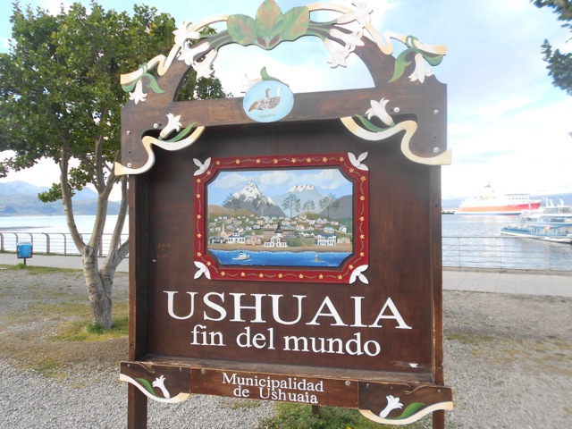
Next I’m off to El Calafate in Argentina for a couple of rest days near the lake, before off to El Chalten for a three day hike around Mt Fitz Roy.

The Trail Wanderer

Parque Nacional Torres del Paine – Day 8

Day 8 – Campamento Los Perros to Refugio Lago Grey

Today is slated as the hardest on the entire circuit as we’re climbing over the windblown Paso John Gardner, more than 1350m. This is one of the main attractions of walking the back side of park.

As Campamento Los Perros is hidden away in the forest, I couldn’t tell what the weather was doing when I woke. But, it was just before I’d finished breakfast that I discovered I was the only person left in camp. It would seem that everyone else had decided to get an early start. So, I packed up quickly and headed out.

The trail heads straight up a hill for some time, through the forest and a rather large patch of mud. I continued following the trail, stepping over mud and the occasional fallen tree as I worked my way slowly up the pass. In the forest I could hear gusts of wind above me in the trees. After an hour I came to the end of the trees and out into rocks. The wind was now gusting over me heavily as I moved and I was forced to lean down into the stones to stop from being blown off my feet. You can hear the large gusts coming, so when a large one has passed, I rushed along the rocky path to the next set of trees. Yet while I was sheltered from the wind I was again subject to the mud.

wpid-dscn2026-2013-04-6-17-47.jpg

Then I’m out into the rocks again and again am being blasted by the wind gusts. It’s a quick march across the rocks, stooping low for the heavier gusts which are picking up small stones and blasting them against my arms and back of my head. I raced down towards the river along the trail and around the final patch of trees and my last protection from the wind. I then marched up the trail as quickly as the stones and wind would allow, ducking and setting my feet and poles to stop from being blown around too severely.

The views back down the valley where I had come are pretty with the red of the trees and the flowing river.

wpid-dscn2025-2013-04-6-17-47.jpg

I pushed on up the pass as it began to get steeper but no less ragged with the wind. At one stage I was lifted from my feet and landed 2 metres back, skidding in the rocks. While this could be scary there was a real sense of exhilaration of constantly fighting the wind. Further up the pass I could see the wind whipping water from various streams into mist and I could hear the wind whistling madly through the snowy mountain tops. I pushed on, climbing a steeper area, resting briefly close to a glacier until the wind chilled me enough to push me further on.

wpid-dscn2027-2013-04-6-17-47.jpg

Finally, about 200 metres from the top of the Paso, I came over a ridge and the trail flattened out. It was then a short walk through a windy gully to reach the cairns at the top of the paso. The wind was howling past me when I came over the top and light rain was being propelled full force at me. After 7 beautiful days, it would be typical that on this the hardest day of the hike, the weather would change to make it even harder.

At the top of the pass, you look down on top of Glacier Grey, but to get a better view, you walk down about fifty metres through the icy winds to closer to the edge of the ridge. It’s not the greatest atmosphere to take photos, but I did what I could in the wind and rain.

wpid-dscn2031-2013-04-6-17-47.jpg

I had to stop and put on my jacket, more to break the icy wind coming at me than to avoid the rain. Putting on a jacket in these high winds is challenging, to say the least. I made it to the edge of the ridge and looked down on Glacier Grey. I’ve seen plenty of glaciers, but not from directly above and Glacier Grey is a mighty specimen, stretching 6km across the valley to the icy snow covered mountains on the far side, very much like Antarctica. The glacier is said to be more than 100km long, but this finger of ice disappeared around the mountain in the distance.

wpid-dscn2033-2013-04-6-17-47.jpg

This small piece of ice – yes small – is a part of the southern Patagonian Ice Field, one of the three largest fields of ice in the world.

The trail heads down steeply on a slate and scree slope, weaving on a defined path, then follows the glacier, a kilometre below, to where it forks at Lago Grey.

wpid-dscn2038-2013-04-6-17-47.jpg

At a certain point the trail leads into the trees that have turned fiery autumn red, and finally there is some respite from the wind. The trail begins its slow downward heading, with plentiful steps.
wpid-dscn2040-2013-04-6-17-47.jpg

After several hundred metres, it finally ends at Campamento Paso. Going down in no wind is still harder than going up in lots of wind. I was planning to stay here tonight, but when I discovered the Pass had only taken just over 4 and a half hours, I decided to head on the extra 4 hours to Refugio Lago Grey with the hope of finishing the hike tomorrow.

After a 5 minute break, I pushed on. Half an hour into the walk, the rain became heavy and the wind continued. There was a hand drawn map in the shelter at Campamento Paso that showed the trail heading steadily downhill to the Refugio, but it wasn’t like that at all, in fact, much of the first half was going up. At many times there were good vies of the glacier as you walked.

wpid-dscn2043-2013-04-6-17-47.jpg

There are a couple of gullies on the walk that are too steep to climb. The park rangers have set up steel ladders to help walkers.

wpid-dscn2050-2013-04-6-17-47.jpg

Just after the first of the ladders, the trail leads around the top of a cliff line. There is only a foot wide path with nothing to hang on to, wind dragging at you and a fall of half a kilometre to a glacier. It was perhaps one of the more frightening experiences of my life, as I literally crawl along this path hanging onto large rocks. Twice I actually lay in a gap waiting for the wind to die down so I could continue. Apparently, the next morning, some of this very cliff line slipped away and the walkers behind me were stuck, so it was lucky I decided to walk on when I did.

The trail continued but most of it was inside the forested area and I was pleased not to be exposed more on this particular day. I climbed another of the steel ladders, crossed a long wire bridge and climbed down several quiet forest gullies. There was a mirador along the way, right above the end of the glacier. I stayed briefly to watch, but after 8 hours walking and the cold, I didn’t stay long. Murphy’s Law, however… nothing happened while I was watching, but as I walked away… a large section of ice calved from the glacier into the lake.

wpid-dscn2054-2013-04-6-17-47.jpg

The last hour of the day was spent staggering through the trees until I finally arrived at the Refugio. That night as I cooked in the refugio’s common cooking area, I gave advice to new hikers on the trail who had started the hike that day.

The Lone Trail Wanderer

Punta Arenas, Chile – Impressions.

Punta Arenas (loosely translated as Sands Point) is the largest city in Southern Patagonia and is described as a spiralling metropolis, although it didn’t actually seem that large when approaching it. My bus ride from Ushuaia took 12 hours including a stop at Rio Grande for Argentinian customs. We stopped again at the Chilean customs before crossing the Magallenes Strait from Isla Grande to the South American mainland by ferry.

wpid-punta_arenas_collage-2013-03-18-15-57.jpg
Collage of Punta Arenas care of Wikipedia

My primary reason for coming to Punta Arenas was as a stop off on the way to Puerto Natales, as there was not direct bus route. While I was only there for two days and only got to see a small amount of the city, it felt like a typical western city except everyone spoke in spanish. Thankfully english speakers are more common in Chile than in Argentina.

My hostel – Hospedaje Costanera – was near the city centre and once I’d settled in, I walked the eight blocks back into the centre. The city wasn’t a mad rush like Buenos Aires and was easy to get around.

The collectivo system in Punta Arenas – and Chile in general – is something different. While there are traditional taxis and the occasional bus, collectivos are level between. Occasionally they are mini-vans, but usually just normal cars that travel a set route, back and forth. All you do is stand on its route, wave it down and if there’s room they’ll stop. Then, jump in with whoever is already in the car, pay 450 Chilean pesos (about 90 AU cents) and off you go. When close to where you want to go, yell and they’ll stop. It’s knowing where the routes go is the difficult thing.

The city is also in the tax-free zone of Patagonia and has a vast tax-free shopping centre – Zona Franca. I went to check it out and it was the size of a large mall. It contained many electronics stores, all with cheaper prices that Ushuaia, but still more expensive than Australia. It was interesting to walk around but I didn’t buy anything, although I was tempted by some SLR cameras.

Punta Arenas has some touristy things to do as well, access to penguin colonies and glaciers, but having only just returned from Antarctica this week I’d seen plenty, so I saved my money.  Some of these sights are:

  • Cape Froward, the southernmost tip of mainland South America
  • Isla Magdalena and it’s penguin colonies
  • Alberto de Agostini National Park, a land of mountains, lakes and glaciers
  • Los Pingüinos Natural Monument, another penguin colony

On the morning of my departure I simply went to the bus station, booked a bus and within a couple of hours was on my way to north Puerto Natales.

The Lone Trail Wanderer

Laguna Esmaralda

The weather of the last couple of days hasn’t been welcoming enough to hike and last night it was icy enough to sprinkle the mountains with a new set of snow. Today, it’s all blue skies, so together with an Australian couple and a trio of Israeli girls fresh out of their military service, I set off to see Esmaralda Lagoon.

Once our minibus arrived, the six of us were on our way. But nothing here can be done without at least a little drama… As we exited the city, the minibus was pulled over at a police roadworthy station and because one of our headlamps was not functioning, we were turned back. The driver headed back into town, to a mechanic, where he bought a new bulb and we sat waiting as he replaced it. Then, 30 minutes later, we were off again.

Laguna Esmaralda is on private land and the minibus dropped us at the owner’s place, Refugio Valle Los Lobos – a Siberian Husky breeder – where we paid 10 peso each – $1 Australian – to enter the area.

We headed off past the dog kennels and along a dirt road towards the mountains that held the laguna and the glacier – Glaciar del Albino – that feeds it…

wpid-dscn1585-2013-03-8-17-07.jpg

The road was a little muddy, but the worst was yet to come… We passed a pair of beaver dams, although we didn’t see any beavers as they only come out late in the afternoon.

wpid-dscn1590-2013-03-8-17-07.jpg

We crossed an arroyo and though a forest before heading out across a peat field where most of our steps were soggy. Thankfully my leather hiking boots do a awesome job keeping out the water. On all sides as we crossed the field were snow capped mountains and a subarctic wind.

wpid-dscn1597-2013-03-8-17-07.jpg

The arroyo wound its way across the field and we found the least muddy and wet ground was alongside it where there were plentiful stones to stand on.

wpid-dscn1598-2013-03-8-17-07.jpg

The hike itself is only 3 hours return but it’s slow going, as every step has to be made with caution to ensure you don’t sink too deeply in the mud or peat, and you don’t slip off branches that had been laid across said wet patches. Eventually, the arroyo leads to a small waterfall and we climb up the short rocky cliff…

wpid-dscn1600-2013-03-8-17-07.jpg

As we breach the top of the cliff we see Laguna Esmaralda below us, tinged blue-green by the million year old minerals flowing down from the glacier. Across the lagoon, the Albino Glacier flowed down the side of the mountain and into the laguna.

wpid-dscn1601-2013-03-8-17-07.jpg

The six of us stopped for lunch, but it was a little chilly and after a while the cold began to get to the girls, so we headed back. There was only one guy there when we arrived and he seemed to be acting a little odd – he went for a run around the lagoon and when he got back stood dancing to himself with his headphones on. We joked that he must have eaten one of the mushrooms we’d seen growing in many places across the field.

wpid-dscn1603-2013-03-8-17-07.jpg

The return trail was easier to cross as we had a better idea where we were going but it still ended up being a slow process of watching every step. We made it back to the breeder’s place, passing perhaps three dozen other people heading to see the lake. We were glad we went when we did and as we pretty much had it all to ourselves – except for the one strange guy.

Tomorrow I make my final preparations for my trip to Antarctica.

The Trail Wanderer

Paso de la Oveja – Tierra Del Fuego – Argentine Patagonia

Paso de la Oveja – Sheep Pass – is a two day hike starting to the east of Ushuaia and cutting a circuit around the Martial mountains, running 25kms along Valle de Andorra to end at the west side of the city. This is my first overnight hike in Patagonia and the only one I’ll be doing this far south.

I was a little nervous about this hike as I brought my tent and sleeping bag from Australia. While they did the job on that continent, they’re not designed for the cold climate. Leading up to the hike, I investigated many of the adventure stores in Ushuaia’s Centro district looking for a means to add warmth to the sleeping bag without spending a thousand or more pesos buying a new one. I didn’t find anything so took the light fleece blanket from my bed in my hostel.

Day 1 – Turbera Valle Andorra to Laguna del Caminante

To get to the beginning of the hike, I took a taxi from my hostel around the side of the Martial Mountains to a locked gate. While my spanish isn’t very good, I figured I’d show the driver the map and point out my destination. For some reason he got the idea I was wanting to be dropped off at the end!? I corrected him and he eventually delivered me to my start point. Past a locked gate I headed out along a dirt road towards the mountains with another glacier in view.

wpid-dscn1501-2013-03-5-18-222.jpg

My directions said to walk 5 minutes to a set of shacks and take a faint 4WD track to the right. I did and it led me into a set of peat fields where horses grazed.

wpid-dscn1502-2013-03-5-18-22.jpg

But after a while I discovered that the peat fields were rather soggy. By discovered I mean going knee deep into a bog. YAY! By the sounds of the description of the hike I was following, I wasn’t where I was supposed to be. So, I headed towards the mountains, picking my way through boggy grass. This took me some time but I eventually made it into forest. But this still didn’t feel right, and was also rather boggy with more knee high mud. I kept going towards the mountains and eventually found a not very faint but still rather muddy 4WD track. I followed it for a couple of kilometres through the forest with the occasional view of a mountain top.

The 4WD track eventually petered out at a sign announcing my entry into Parque Nacional Tierra del Fuego. The trail crossed an arroyo – stream – that came down from the back of the Martial Glacier.

wpid-dscn1514-2013-03-5-18-22.jpg

It then followed the arroyo for some time through the forest…

wpid-dscn1517-2013-03-5-18-22.jpg

At one point I came to an opening that led into a large red tinged field. This was off track, but as it gave good views of the mountains, I decided to head onto it. After only a step I discovered the field was in fact a growth of reddish green moss the size of a rugby field. It was spongy below my feet but supported my weight.

wpid-dscn1521-2013-03-5-18-22.jpg

I pushed on along the trail for another couple of kilometres through the forest, with the occasional show of towering rock above the trees.

wpid-dscn1544-2013-03-5-18-22.jpg

Late in the afternoon I arrived at a set of cascades in the river. Up until now Valle de Andorra had been flat, but according to my map the cascades marked the beginning of a 4km long climb. Nothing too high, just a constant climb. I crossed the arroyo several times on makeshift log bridges and wound my way up the side of the mountain. I broke the tree line and came to a T-junction and a sign.

wpid-dscn1546-2013-03-5-18-22.jpg

I headed right, towards the Laguna climbing along the top of a steep grassy bank with a fast flowing arroyo at the bottom. The trail was difficult and I made my way carefully to ensure I didn’t end up tumbling 50m to the stream. As I began along the track, I heard voices and a group of six other hikers appeared out of the forest behind. I hadn’t seen a single other person since starting, so they must have held just behind me all day. At a highpoint on the trail I got views back along the Valle de Andorra.

wpid-dscn1553-2013-03-5-18-22.jpg

A short distance on, I came around a jutting rocky outcrop to see the lake nestled below me…

wpid-dscn1556-2013-03-5-18-22.jpg

To get down to it, I had to descend along a muddy bank and a rocky stream bed, watching each of my steps until I arrived at the bottom beside a waterfall. I walked along the arroyo that led to the lake and around a section of trees to locate a perfect campsite on the edge of the lake. There was already one set of hikers and the group of six arrived shortly after. Over the course of the next hour 3 other pairs arrived, but there was plenty of room and only the tents of the large group were close together.

As the sun went down, I sat in my tent and looked out over the lake.

wpid-dscn1557-2013-03-5-18-22.jpg

Day 2 – Laguna del Caminante to Autodromo Ushuaia
The next morning, as I packed it rained a little, showering the lake surface with ripples. It didn’t last and I was soon off, back tracking along the path above the arroyo to the junction.

wpid-dscn1570-2013-03-5-18-22.jpg

The trail then climbed to the pass where the grass gave way to a slate like rocky area with plentiful cairns to show the way. A 250m climb later I reached the top of the pass that gives this hike it’s name and a tall cairn. I’m not sure why it’s called Sheep Pass as there aren’t any sheep here. Perhaps in times past…

wpid-dscn1575-2013-03-5-18-22.jpg

After taking a break in the pass I pushed on. The trail headed down into Cañadon del la Oveja – Sheep Canyon – where the trail hugged the side of the mountain range hundreds of metres above a grassy area. While the thin trail at times felt precarious, careful progress was all that was needed along the 3km trail before it zig-zagged down the mountain and into the forest.

wpid-dscn1578-2013-03-5-18-22.jpg

Before I was surrounded in trees once more, I looked back along the Cañadon.

wpid-dscn1582-2013-03-5-18-22.jpg

The forest was supposed to be easy, but a portion of it looked to have been thrown about by a storm some time ago. This forced me to spend some time climbing over smashed trunks and broken limbs, a long and arduous task. I eventually got through and came out onto private property where I got a final look at a rocky mountain before heading down the hill towards and old motor racing track – autodromo.

wpid-dscn1583-2013-03-5-18-22.jpg

Overall the hike was amazing with brilliant views and special places. I didn’t end up needing the blanket, but better to have it than not. With only 6 days until I leave for Antarctica, there are a handful of other short hikes I’d like to do if the weather holds up. I’ll see which ones I can fit in.

The Lone Trail Wanderer.

Martial Glacier – Martial Mountains – Tierra del Fuego

wpid-dscn1478-2013-03-1-17-5211.jpg

The Martial Mountain range – Montes Martial – is a small range of mountains behind the city of Ushuaia. The city itself is nestled in the foothills where the mountains meet the Beagle Canal. While not as jagged and tooth-like as others in the area, the mountain ramparts are still spectacular when seen from below. During winter much of the range is likely covered in snow, but as it is late summer there are only small dots of dirty white along the range, in all places except where I’m headed today.

wpid-dscn1471-2013-03-1-17-526.jpg

This mass of snow is above the glacier and is where I’ll be walking with a companion from the hostel. Because Ushuaia isn’t a large city we decided to walk from the hostel to the base of the mountains. We work our way through the confusing mass of streets until we cross a bridge that crosses the Arroyo Buena Esperanza – ‘Arroyo’ being spanish for stream – which cuts through the centre of the city to the sea. On the far side begins the road leading up through the short wood covered foothills.

wpid-dscn1472-2013-03-1-17-523.jpg

The road winds its way up the side of the foot hills with the occasional large hotel at the side. The initial trail doesn’t follow the winding road, but takes a more direct route with only the last hundred metres or so following the road to its end at a cafe and chair lift. Above us as we walk is the snow field although it’s sometimes covered in a lazy sweeping low cloud.

wpid-dscn1473-2013-03-1-17-521.jpg

The Arroyo runs down the side of the mountain beside the wide rocky trail with the chair lift of the other side. The trail is not overly steep, but is rises constantly with the occasional wood covered ditch used as a water overflow during the summer melt.

wpid-dscn1496-2013-03-1-17-521.jpg

The chairlift is almost 1,200 metres in length and ends in a tea house. We cross a small bridge below the tea house and stop for lunch on the side of the stream. A couple of hundred more metres above and the trail splits three ways – to the right it leads to the beginning of a ski slope, to the left the top of a jagged peak (we are forbidden to climb without specialised equipment) and straight on to the glacier. This is where I leave my companion and head on alone – she is due elsewhere and heads back down the trail.

wpid-dscn1482-2013-03-1-17-521.jpg

The trail continues beside the stream as I climb between the mountains on either side. After another couple of hundred metres, the wide road-sized trail ends and a very thin trail climbs steeply up the mountain. It doesn’t go far before turning to the left and heading out of view.

wpid-dscn1485-2013-03-1-17-521.jpg

I climb the trail and it is indeed steep. It’s not a stepped climb, but an intense scree slope worn by many feet. I have to rest a couple of times on my ascent until I reach a line of orange markers denoting where the trail heads to the left and over a ridge. With this hardest part of the climb down, I head over the ridge and a further hundred metres or so to the base of the glacier. The views from here of the canal, the city and the surrounding mountains are spectacular, and the cloudy day has even given way to blue skies for this moment.

wpid-dscn1489-2013-03-1-17-52.jpg

The glacier itself is a patch of snow with water running under it, and there are signs forbidding passage beyond a certain point. There were a couple of groups up there and we all ignore the signs and climb a little further to the base of the snow. 50 metres up I sat on a set of rocky shelves, similar to those I climbed in Tasmania and rest after my two and a half hour climb.

wpid-dscn1491-2013-03-1-17-52.jpg

Heading down was easier, as you would expect, with the only difficult part the thin, steep scree trail. After 90 minutes I arrived back at the hostel for a welcoming shower.

Next I head for my first overnight hike in Patagonia, Paso de la Oveja – Pass of the Sheep – which follows a long valley behind the back of Montes Martial.

The Lone Trail Wanderer

Ushuaia, Tierra Del Fuego, Argentina

Ushuaia is the city at ‘fin del mundo’ – the end of the world. It’s the southernmost city in the world located on Tierra Del Fuego, an island at the southern end of Patagonia shared by Argentina and Chile. Apart from the other islands of southern Patagonia, the only place further south than here is the great White Continent.

DSCN1458

The taxi drive from the hostel in Buenos Aires was a rather exciting and scary experience. I shared with a Japanese lady and the pair of us huddled in the back seat as we hurtled headlong along the motorway to the airport. While the lanes were well-marked, the driver didn’t seem to notice them. He shot along at 130km, weaving madly even though the road wasn’t busy. We both felt safer once we arrived at the airport.

The 3 hour and 45 minute flight became an adventure of its own when fog in Ushuaia forced the plane to land at Rio Gallegos, some distance to the north, to sit it out. Thankfully it didn’t take long. The approach to Ushuaia was along the Beagle Channel which separates Isla del Tierra Del Fuego from Isla Navarino to the south. As we descended into the airport the sights were mind-blowing with snow-capped, rocky mountain peaks on either side.

wpid-dscn1460-2013-02-26-15-13.jpg

Ushuaia was larger than I expected. I’d pictured a quaint little port township nestled on the edge of the mountains, but it’s actually quite large. Stepping out of the airport the sights were amazing, the city nestled under the mountains on the edge of the channel with the mountains spreading from horizon to horizon.

wpid-dscn1464-2013-02-26-15-13.jpg

While I’d been warned not to expect much from the weather, it was fairly clear when I arrived and over the next couple of days, became cloudy and overcast. The mountains usually begun the day covered in cloud, only to clear as the day progressed.

DSCN1468

The Ushuaia Freestyle Hostel was a fairly nice place although like most cram as many people into a small amount of space. There were several common rooms including a large TV room and games room on the top level. Mostly the staff were friendly, although one or two had an ‘I don’t really care’ attitude unless you were spanish or an attractive woman. The wireless internet was pretty poor forcing everyone to wait for the two provided computers or go into town.  While one of the better hostels in town, it closed down shortly after I was there, becoming part of hotel next door.

wpid-dscn1466-2013-02-26-15-13.jpg

Downtown Ushuaia was a lot larger than I expected, the main road being quite long and for the most part has shops along both sides. The city is a little touristy, which isn’t a bad thing, and it actually has a full supermarket, something I wasn’t able to find in central Buenos Aires. There are all sorts of shops here and many more shopkeepers speak english than in Buenos Aires, but I was still unable to find a mini SIM card at one of the many mobile phone stores. Not that I needed to call anyone, it would have been useful to have a steady means to get access to the internet.

DSCN1470

Overall, Ushuaia was beautiful and even at the end of summer, it wasn’t that cold.  I did get some strange looks walking around in the middle of the day in flip-flops and a t-shirt. Evenings got cooler, but not freezing.  It was just chilly enough to be refreshing (for me anyway) but most people were decked out in their warm clothing. I still carried a jacket, just in case, but got hot quickly climbing up the hill to the hostel or when I entered an air-conditioned shop. Winter there would be seriously icy.

DSCN1459

I went to Ushuaia with no strict travel plans and just figured it out as I went. I did book one of the Antarctic cruises, for 12 days and it cost me more than I had planned, but when was I going to have the opportunity again? It did mean I had 10 days to kill in Ushuaia.

Here are some of the adventures I had in region:

Other things to do in the region I didn’t get time for:

  • Tierra del Fuego National Park for short walks and Lago Roca
  • Dublin Bar, the southernmost Irish pub in the world
  • Skiing at Cerro Castor (in winter)
  • The Maritime Museum of Ushuaia
  • The 4-5 day Dientes Circuit hike

Next, I headed off on my Antarctic Voyage.  On my return from the great white continent, I caught a bus north to Punta Arenas, Chile.

So many adventures to be had. But thus is life.

The Lone Trail Wanderer

Buenos Aires, Argentina – Impressions

After an exhausting 11-hour flight from Auckland to Santiago de Chile, wandering around the Aeropuerto Internacional, I quickly realised my 8-week spanish course hadn’t prepared me for being in a place where no-one speaks english. The airport wasn’t the most straightforward of places, but I eventually found my way to my connecting flight, not before walking up and down the airport at least a dozen times.  Luckily I had plenty of layover time.

As I flew out of the pencil thin country the sight of the many layers of the Andes blew my mind. Alas, my phone battery had died on the long flight so was unable to take photos.

Unlike the rather mountainous and brown Chile, Argentina is flat and plentifully green. Two hours after leaving Santiago de Chile I landed in Buenos Aires, a sprawling city of 13 million people. I booked my bus to the hostel and 90 minutes later I arrived. Being driven around Buenos Aires is an experience. There are lines on the road to help make things orderly but few drivers use them, they jam themselves in willy nilly. On several occasions we nearly clipped another vehicle, a regular occurrence based on the amount of dents many cars have.

I stayed in the America del Sur Hostel in the inner city suburb of San Telmo and found it an excellent hostel. The english speaking staff were always helpful, the beer fridge well stocked, and the wi-fi was good.

DSCN1456

It was hot and muggy in Buenos Aires, but since I’d been living in Brisbane I was used to it. I took my opportunity to wander the streets and see what was around. I’d originally planned a bicycle tour so didn’t take many photos, but due to flight changes didn’t end up taking the tour.

While touring Australia a couple of months earlier I’d been notified that my flights to Ushuaia had changed. Two days before the flight I was notified that it’d been changed again, a day earlier.  This cost me money to try to contact them, prepaid nights at the hostel and caused me to miss my bicycle tour. This wasn’t the first trouble I’ve had with Orbitz – a US travel company – and do not intend to use them again.

DSCN1455

The streets of Buenos Aires are narrow and many are paved. They must hold regular elephant races through the streets as many footpaths are smashed and have jagged concrete sticking up in many places. After a bit of a walk I found a statue, parliament house and the main central city open-air shopping mall.

DSCN1452

While there were plentiful police around, I stayed aware of the people around me and a kept my hands near my valuables. Buenos Aires has a dangerous reputation for petty crime with street thugs, pickpockets and muggings.  For my first Latin American experience I erred on the side of caution.

The open-air mall was very large, continuing for many blocks and crossing roads – mostly one way streets, where cars race by almost unannounced. There was also the ever-present call of ‘cambio, cambio’ – change, change – from black market foreign money exchangers.  I was warned not to use their services even though they can offer some excellent rates, but since they only accept US dollars and the Euro, I had nothing to change anyway.

DSCN1453

They have everything you could need in the central city, although the streets are dirty, with rubbish, dog faeces, people sitting around at random spots, old buildings, broken foot paths, broken buildings and the smokers – EVERYONE smokes. But this doesn’t make Buenos Aires a bad place, just mysterious, quaint and smoky.

Then, just as I started to get used to it, it was time to leave. My stay in Buenos was about settling into a foreign speaking country, dealing with the culture shock and getting a few things sorted for my ongoing trip.

Next, I headed to Ushuaia, in the province of Tierra del Fuego – Land of the Fire – the southernmost region of Patagonia.

The Lone Trail Wanderer