
Day 1 – Ambleside to Rosthwaite – 13 miles (21km) – 8 hours
There is only one word that can describe today, drizzle. This was the forecast for the day, and that’s it turned out. While I’ve had spells of rain on other hikes, such as when I climbed Snowdon, today it rained all day. This constant wetness put some of my gear to the test, but I’m glad I invested in dry bags, as my pack cover did a fairly average job at keeping things in my pack dry.
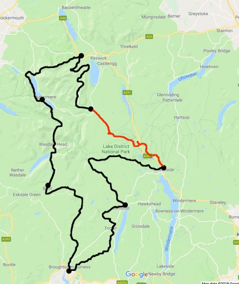
I left my accommodation late this morning, my packing taking longer than I had hoped. When I did get away, there was already a slight drizzle. The YHA Ambleside is a kilometre from central Ambleside, and this added extra distance to the day. When I got into town, I found more adventure stores than I could count. I stopped at the local Tesco to pick up some zip lock bags to protect my phone, then I headed north following a major road. After a while, I was led across Rydal Park and with some of the fells just beginning to be covered in clouds.
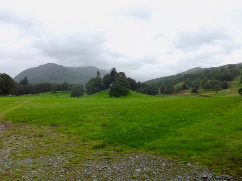
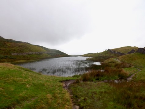
At the far end of the park is Rydal, a quaint little village that I swept quickly through. I followed a stony trail, gently gaining altitude as I climbed around a hill called Nab Scar. To my left, I began to see Rydal Water coming more into view, with Heron Island in the centre.
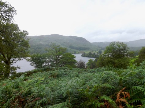
The trail continued to ascend slowly, passing the occasional cottage. The path then cut north and began to climb towards Alcock Tarn, a small mountain lake. As I got higher, I looked down onto Grasmere Lake.

Alongside the lake near the village of Town End there was a gathering of some kind, a race day perhaps, based on the voices coming off the PA system.
In the weather, my GPS tracker seemed on the fritz, so I followed the map as best as I could in the weather. At one point, as I climbed, I could hear the baying of dogs from above. I stopped, and more than a dozen dogs, all of the same breed, came screaming down the hill, leaping the trail as it went. I am not sure where they were going, but they were going there in a hurry. After some time and much climbing, I eventually make it to Alcock Tarn.
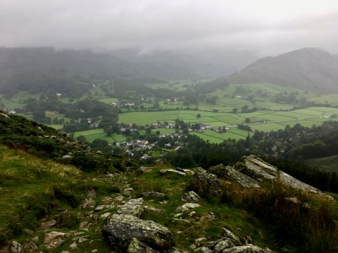
While the climb was fairly steep, the descent was worse as the stones were slippery. This forced me to take my time as I made my way down. After a time I eventually came down into the township of Grassmere. Like Ambleside, it was bloated with tourists, with many cafes and other places tourists like to go. It is, after all, school holidays and a bank holiday weekend.
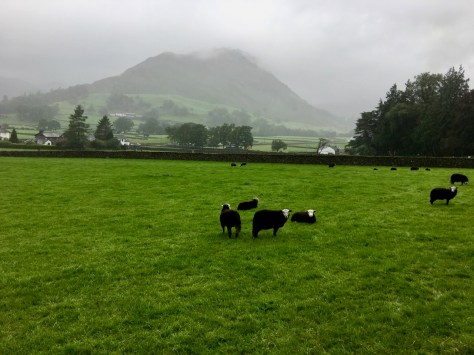
As I passed through Grassmere, I came across a paddock filled with black sheep. I had seen the occasional black sheep during my many walks in England, but this one paddock looked like something had gone wrong. A sheep death march or something.
At the other side of the village, I crossed a footbridge over Basedale Beck and out onto a path made from large cobbles. In the distance, I got my first sight of where another Beck came down out of the hills.

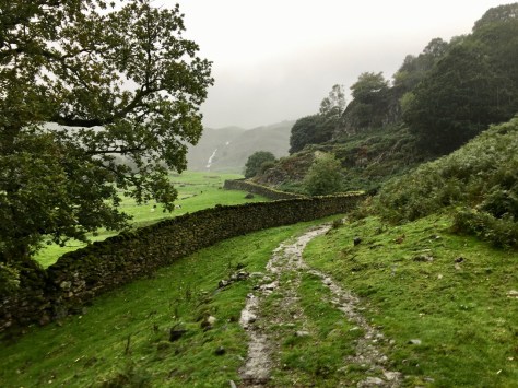
I cross some paddocks, and then followed a trail along a stonewall under Jackdaw Crag, again the Beck coming down out of the hills was visible in the distance.
The climb was long and somewhat arduous, but in the ever-present rain, I slogged on, my little umbrella doing wonders. I climbed higher up Far Easedale Gill, the rain coming harder and the hills around me disappearing into the mist. I pushed on unable to see how much further I had to go. When I got to the top, it was a brief flat area before I began climbing Greenup Edge. In the rain, it was not difficult, only long. Eventually, I did get to the top to a long plateau of boggy ground.
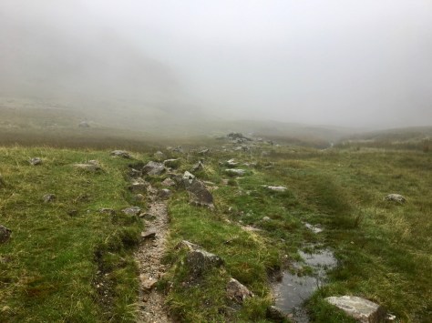
It was here I got a little lost, my GPS was working, but in the mist, I could not find the correct trail. I followed the path ahead of me, but the squelching of my boots that were by now completely filled with water was not fun.
I did eventually find the trail and found that there was a series of cairns set up by previous walkers. As I walked, I heard a shout and looked up to see five people rushing towards me, so I stopped. When they arrived, they were very pleased to see me. It seems, they had been lost for a couple of hours in the mist, and I was the first person they had seen. Thankfully, I was on the correct trail and gave them some advice on how to get to Grassmere.

At the top of a crag, I looked down the Greenup Gill. As I began my descent into the valley, I noticed someone climbing towards me. When he arrived, I stopped for a chat. It was a South African guy who had lived in New Zealand for several years. I gave him the same ‘follow the cairns’ advice I had given the previous group, and he set off again. The wind had picked up, so I put down my umbrella and for the first time in the day, took out my walking poles. Slippery stones are dangerous, and I did not wish to hurt myself on my first day of seven.
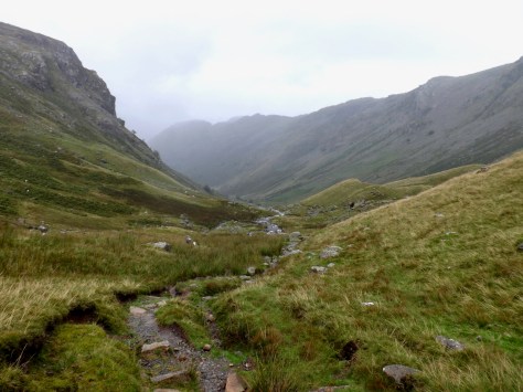
The Stonethwaite Beck was running fast due to recent rain. I crossed on a footbridge where another river joined it, crossed that second river and followed a stony road around past a cottage.

After another kilometre, and passing through Stonethwaite, I finally arrived at my accommodation for the night. A long hard walk in the rain, but that’s what you sometimes get, at least it was not as bad as it could have been.
The Lone Trail Wanderer
