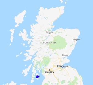
In late June 2019, I undertook a 6-day coastal hike around the Isle of Arran, my namesake island. This 65 miles/ 105 km hike is a circuit of the island starting from the northernmost village and heading inland on several occasions. The weather was scheduled to be amazing with little rain.
Back to Part 1
Day 3 – Pien via Blackwaterfoot to Kildonan – 14.5 mi / 23.5 km
I set out from my campsite and walked the 3.5 km back to Blackwaterfoot, where I stopped for a coffee and a breakfast cheeseburger with haggis. When in Scotland… I headed out along the beach on a mixed track of pebble beach dirt running through long grass. Scotland is tick central, so I made sure to stop every few minutes to check my legs. I still walk on shorts, it’s too hot otherwise, so it’s best to monitor my legs. Nettle sting goes away, so I tend to ignore it, but I’m vigilant with checking for ticks.
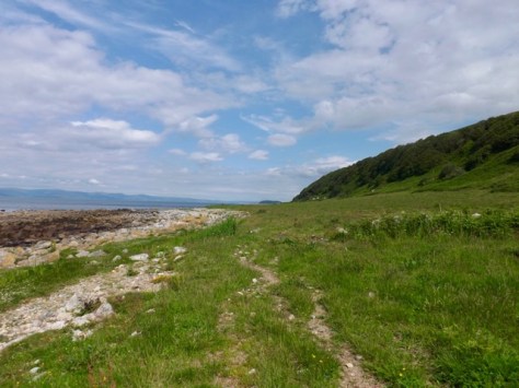
For the next 8 km, I followed the trail around with more of the same. The weather, while supposedly cloudy all day became more sunny and warm along with a nice breeze.

The trail then split, the easy route heading up to the road while the alternative continued along a more difficult beach track. I, of course, took the more difficult route as it hasn’t really been that strenuous so far. The trail was harder, to find that is, and I found myself crossing a farm and chatting to some quite vocal cows on the way.
After a while, I came to a driveway that led me up off the beach to the main road. I followed this road for 4 km to Lagg, where I stopped at the cafe for lunch, a coffee, then next door to the hotel for a cider. Then on down to the beach past a 5000-year-old burial mound.

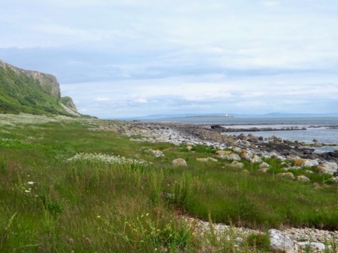
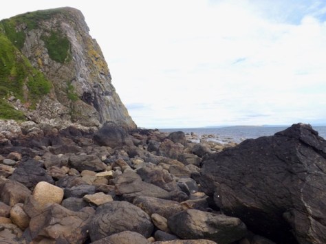
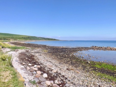
My next target was Bennan Head, which I had to pass before high tide else I would be stuck. I had monitored the tide times and had aimed to get there with at least an hour to spare. As I came along the beach, it turned into rock hopping, with the seas slowly closing in.
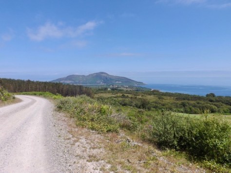
On the way, Pladda Isle appeared with its lighthouse as did the more distant Ailsa Craig, a volcanic plug poking out from the ocean.

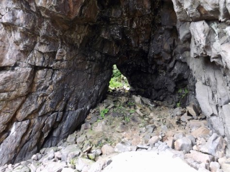
It was almost two kilometres of rock hopping, but about midway, I came to Bennan Head and Black cave, the largest cave on Arran. With time running out, I decided to climb up the back of the cave to see where it went. Out through the gap and around to a viewpoint. I didn’t stay long, climbing down again and getting on with the walk.
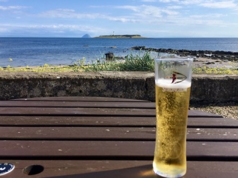
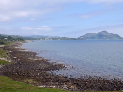
I rock hopped around the head to the beach before working my way along the beach to Kildonan, my stop for the night where I enjoyed a sunny view from a pub out past the lighthouse to the volcanic island. And, of course, a cider.
Day 4 – Kildonan to Brodick – 16.5 mi / 27.5 km
Today will be the longest day if the hike. The day started cloudy, and the wind from the night before was still there. This kept the morning cool and more importantly, the midges away. I packed up and headed out of the caravan park along the beach. My first goal today was to get around Dippin head. As I walked, I passed the Kildonan Castle, although it was technically only a watchtower.

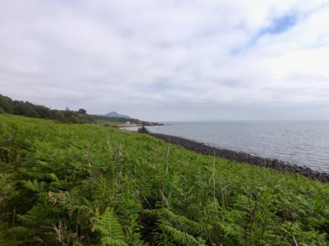
Thankfully the tide was on the way out, but with the boulder field twice as long as Bennan Head yesterday, I soon got fed up with rock hopping. Finally, I came out the other side onto a thistle packed, nettle studded tall grassy trail and headed along the beach to Largybeg.
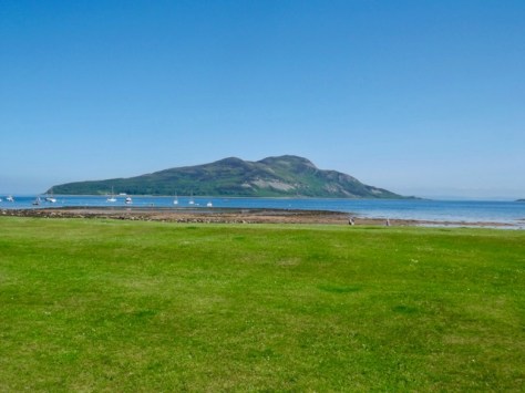
Not long after I arrived at Whiting Bay and found a cafe for coffee and brunch. I ran into two ladies who had camped near me overnight and chatted to them about my next leg as they’d come a different way. The view on the way into Whiting Bay with the Holy Island at the end (the mountains to the right).
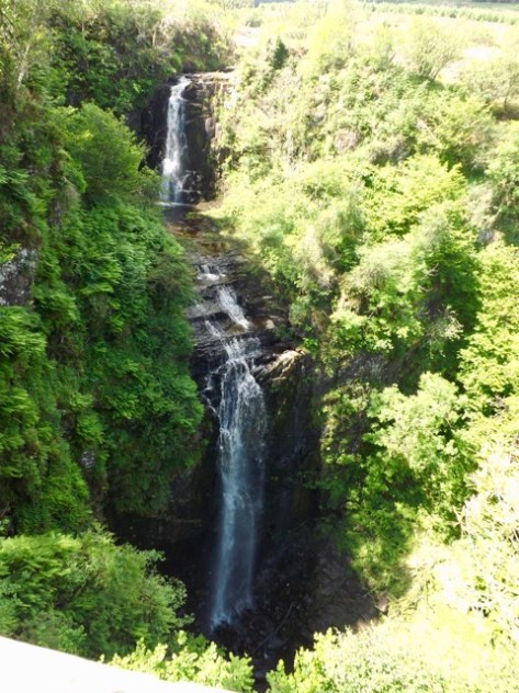
I then headed out up into the hills on a steep set of roads that turned into a dirt trail through the woods. I followed this through a section of felled trees to Glenashdale Falls and around to a viewing platform.
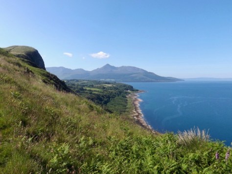
The sky cleared almost completely and stayed that way for the rest of the day. I followed the road first up to a high point with amazing views.
The road continued on for another 4 km, but I enjoyed the few times when trees offered shade, and I got some respite from the sun. I eventually arrived at the bottom of the road and decided to push on into Lamlash for a cider and a break from the heat. I found a bar and sat out the front with my drink looking out to Holy Island in the bay.
After the drink, I headed on to Clauchlands Point, 2.5 km from Lamlash and the easternmost tip of the island.
I rounded the point to be presented with 2 options, the standard trail along the coast all the way to Brodick or the alternative ‘high’ route. Of course, I took the high route. At the top of the first climb, I saw the trail meandered up over the cliff tops working its way higher and higher. This, of course, gave amazing views in all directions.
I eventually headed downhill come out at a road the would lead me down into Brodick. It would have been another three km to the wild camping spot, and after my long walk and climbs in the sun, I found a bunkhouse and booked. My first bed in 4 days.
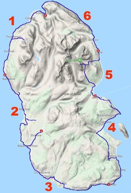
Next days 5 and 6 of the Arran Coastal Way.
The Lone Trail Wanderer
