
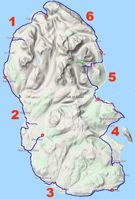
In late June 2019, I undertook a 6-day coastal hike around the Isle of Arran, my namesake island. This 65 mile / 105 km hike is a circuit of the island starting from the northernmost village and heading inland on several occasions. The weather was scheduled to be amazing with little rain.
Day 1 – Lochranza to Imachar – 11 mi / 18.2 km
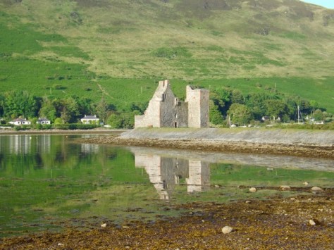
The first day of the walk is not scheduled to be a long one, but there is s sidewalk added for a bit of variety. Lochranza is the northernmost village on the island and even has a ruined castle on the bay.
I walked out of the hostel and along to the Sandwich Shack for breakfast and a coffee. Then I headed up the hill on a steep farmers driveway past the ruins of the island’s oldest house.
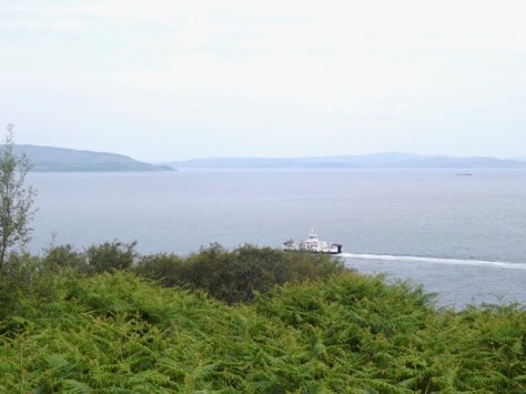
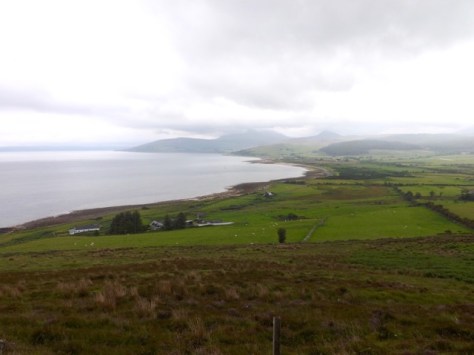
While I was only 60 metres or so above sea level, the views were still enjoyable out across to the Mull of Kintyre, reminding me of the old song of the same name.
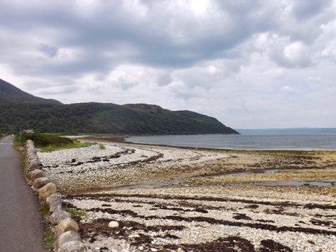
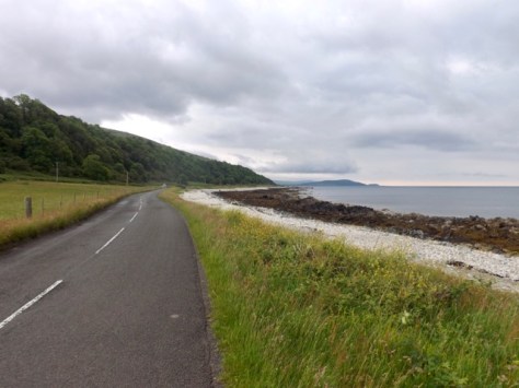
I rounded the hill with the trail descending a little before it ran behind the long row of houses at Catacol. I climbed down to the road and onto the pebble beach where I picked my way along for the next 4.5km.
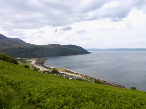
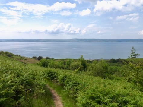
About two-thirds of the way through the day is the side trail, which climbs up the hill to Coire Fhionn Lochan, a small lake nestled in the bowl beneath small peaks. The climb was pretty straightforward to 340m, and I passed several families on my way up. When I got to the small lake, I dropped my pack for a rest and chatted to some other climbers.

The wind was blustery but not cold. I was told the lake can be a mirror but for the wind, a shame but a good view anyway. After my break, I climbed back down, passing a family that had still not made it to the top. The view back the other way was wonderful.
When I got back to the road, I continued on along the beach. I arrived at Pirnmill with enough time for a light lunch at the restaurant before they closed until dinner. I hung out in the sunshine and topped up supplies at the shop next door before setting off again along the beach.
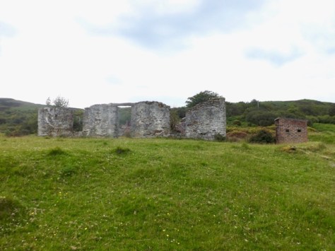
For the next 3.5 km, I picked my way along the beach until I eventually arrived at where my map said was Imacher. But instead of what I thought might be a village, was absolutely nothing. The road went up over the hill, so I took a walk up it and found a small handful of houses, most of them abandoned and overgrown. But when I rounded the corner on one abandoned house, I ran into this male peacock showing his stuff.
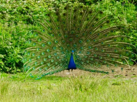
There was an ostentation of peacocks, with several males (peafowl), 3 females and some chicks. After the show, I headed down to a wild camping spot I’d walked past, pitched my tent and settled in for the rest of the day.

Day 2 – Inachar to Pien via Blackwaterfoot – 11 mi / 18 km
It had rained overnight but and I had no wild visitors overnight. I had a breakfast of oat biscuits before breaking camp. The sky was dark, and the wind gusty as I set out onto the road.
Today, walking along the beach was not such an option. It would have been possible but I was racing to avoid the forecasted rain, so I took the quicker alternative along the road. Today is the only day forecast for rain, let’s hope the sun stays for the rest of the week. My first port of call is Cafe Thyme 5km along from my wild camp. The walk was fairly straightforward, and along the way, I even spied seals chilling on some rocks.

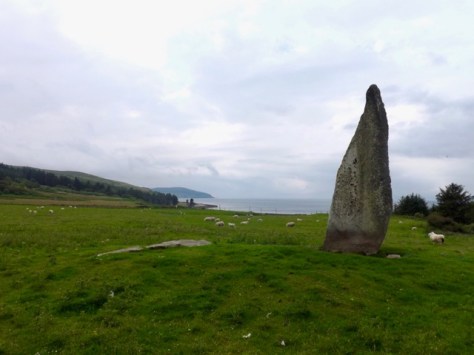
When I arrived at the cafe, they were just opening. They did not serve breakfast, but the waitress organised some scrambled eggs for me anyway. We chatted about life in general and getting out of London, which she had done 10 months earlier. After coffee, I set off and noted a standing stone in a paddock. So, I crossed to get a better look.
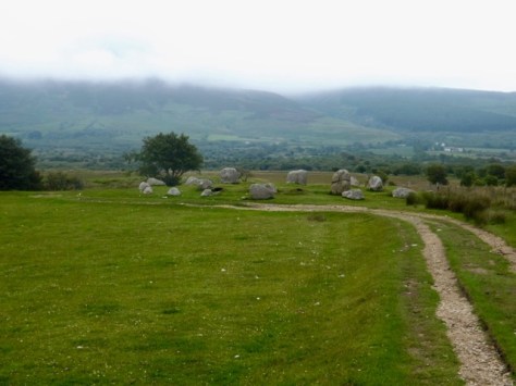
Two kilometres on and I came past Dunedin (the name of a house) to the Machrie Bay Golf Club tea rooms where I bought some water. Then another kilometre further on to car park for the Machrie Moors Standing Stones. I walked the mile to the moors and the several groups of standing stones there…
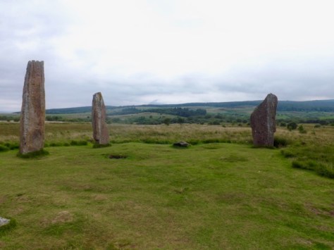
…not to mention rock circles.
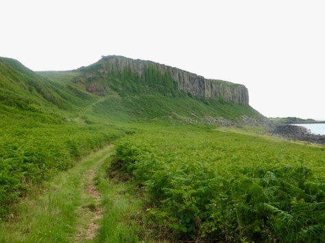
Then, as I made my way back to the road, it began to rain. A mile further along and I came to the Torr Righ Beag, a small wooded National Park. I walked around the outskirts looking back along the coast to where I had started the day (at the furthermost edge of the coast).
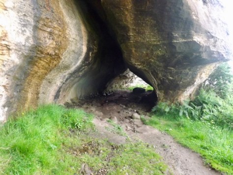
I continued around the path to the coast and before heading down a steep trail to the beach. I walked past the King’s cave, which is caged off, and a pair of natural arches.
I then set my sights on the Doon Fort, a rock formation where an iron aged fort had once stood.
I walked around the back and up to the top, getting great views across the bay. After a look around I climbed down the Tor to a golf club where I walked to the beach and along to Blackwaterfoot. I found a bar to wait for the restaurant to open, allowing me to have cider and get my feet out of my sodden boots.

After dinner a walked the 3 km along roads to the campground where I would encounter plentiful midges but a hot shower!
Next, days 3 and 4 of the Arran Coastal Way.
The Lone Trail Wanderer
