About six hundred years ago, the volcanic cone that is Rangitoto Island erupted its way out of Auckland Harbour beside Motutapu Island. Rangitoto is the largest of the approximately 53 cones in the Auckland volcanic field, all of which are considered dormant.

I’ve not previously been to either island, and at NZ$39 return for the ferry, I decided to make the most of it and do an overnight hike. There’s no formal hike here though, only a number of day hikes on one or the other. So I made one starting and finishing at the Rangitoto Wharf and camping at Home Bay, the only public campsite on the far side of Motutapu Island.
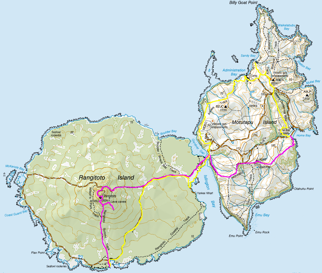
Rangitoto Wharf to Home Bay Campsite – 12.3km – 4 hours
I booked the last ferry to the island for the day at 12:15 pm. The trip over was only 25 minutes, with a stop at Devonport. There were few people on the ferry, one other guy and his son who would be staying at Home Bay, and a day walker. The Auckland weather was sunny and warm, and there was a slight breeze on the top of the ferry as we crossed although clouds hung across both islands, stretching off into the distance.

On arrival, I marched along the wharf and through the waharoa.

Rangitoto Island has the largest forest of Pohutikawa trees in the world, although large portions of the island are covered in jagged volcanic rock. A wide path had been cleared and flattened in many places for the numerous tourists who climb the peak.
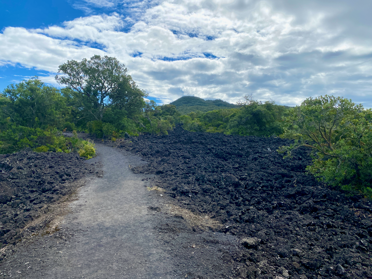
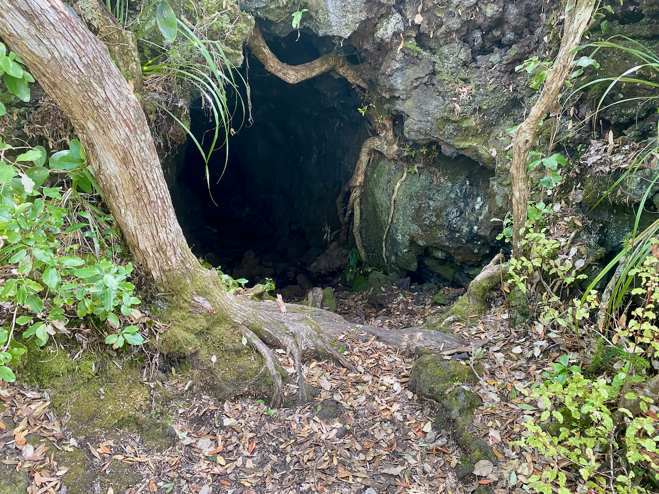
After a while, the clouds moved on leaving a hot day for the rocky climb cutting a fairly straight line up the side of the 260m cone. About 15 minutes from the summit, I came to a small camping area with a trail leading off on the side track to the lava caves.

As I had no intention of returning this way, I cut off along the side track, finding some rocky paths that led back down the slope a little before coming to the first of two main lava tubes. At the first, there were two women and their young children, so I left them to it and continued to the second lava tube. This tunnel was about 30 metres long with a nice spot in the middle with a ceiling gap. At the end I had to stoop down to get through before following a trail back to the start of the tube where I’d left my pack.
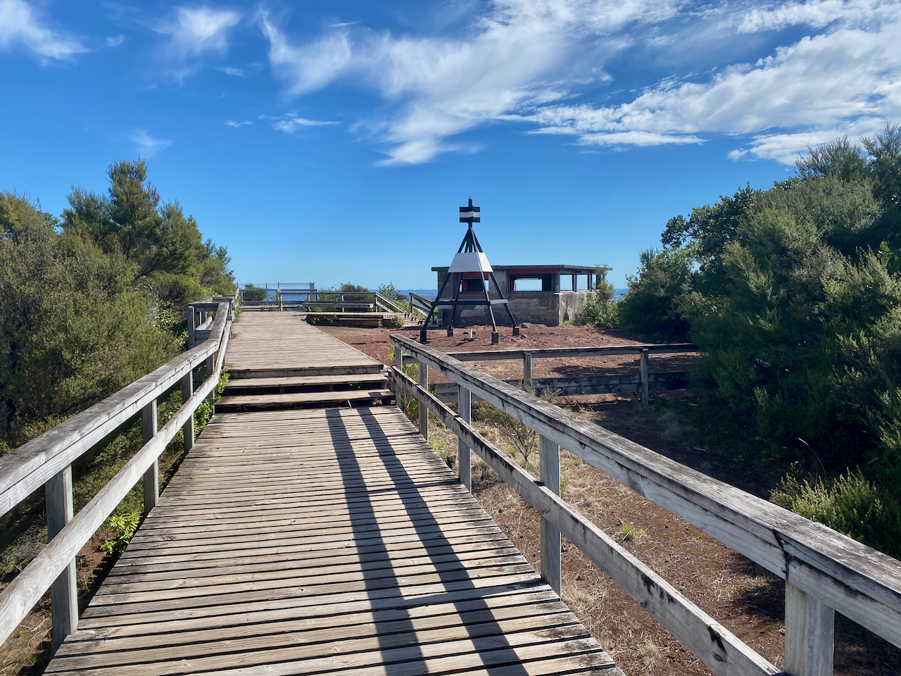
The kids were just leaving the other tube when I got back to it, but the holes were only small. I walked the 15 minutes back to the main trail and climbed to the summit where there was a large viewing platform beside an old WWII bunker.
After my brief stay at the summit, I followed a trail around the side of the cone and down an overgrown path to the summit road.
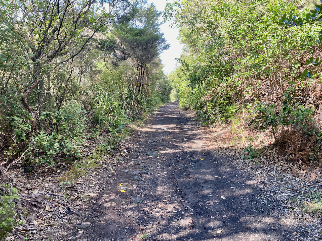
This summit road cut through trees and rock fields all the way to the causeway, which was built to connect the islands during WWII. On the road near the causeway were several baches (beach houses), remnants of the 140 built in the 1920s and 1930s before they were banned in 1937.

I stopped for a rest and at the entrance to the island.
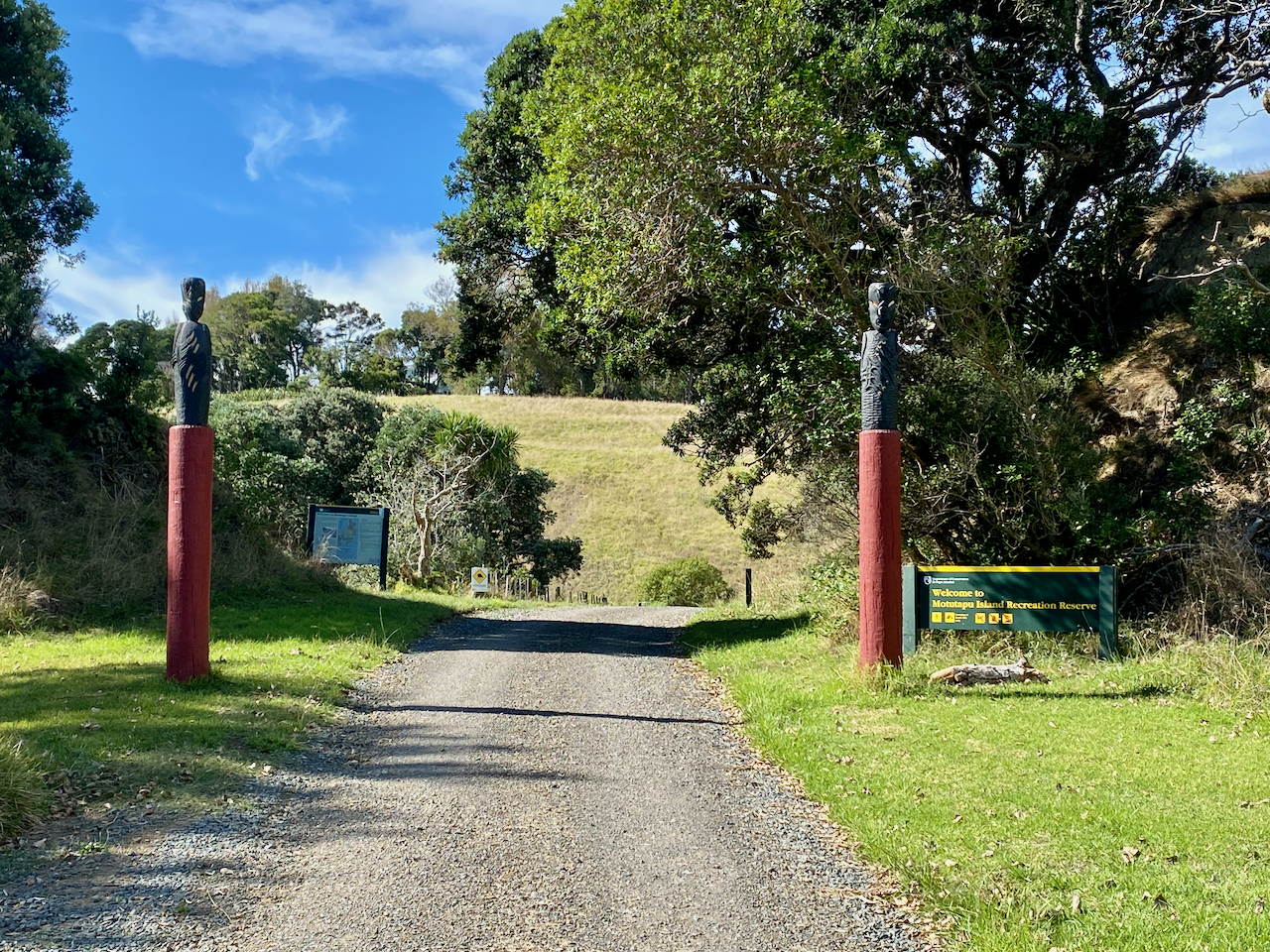
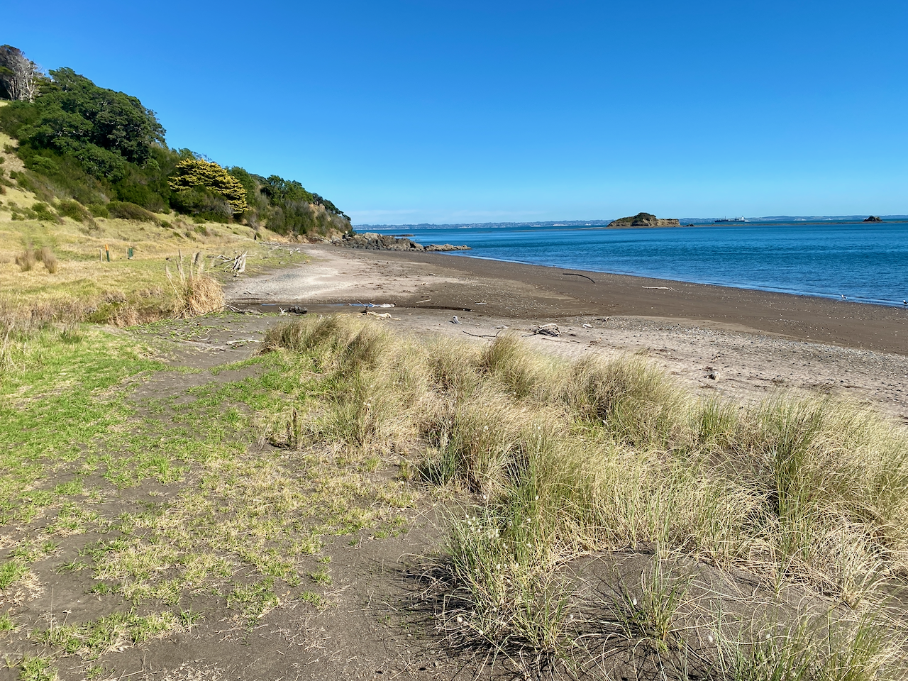
After my break, I cut along a path although the two inch grass made it somewhat hard to walk through. The two islands are like polar opposites, and could be described as Good and Evil, or Heaven and Hell. Motutapu has rolling hills, and lots of open grassy fields, while Rangitoto is harsh, with its volcanic rocks and good covering of trees and plants.

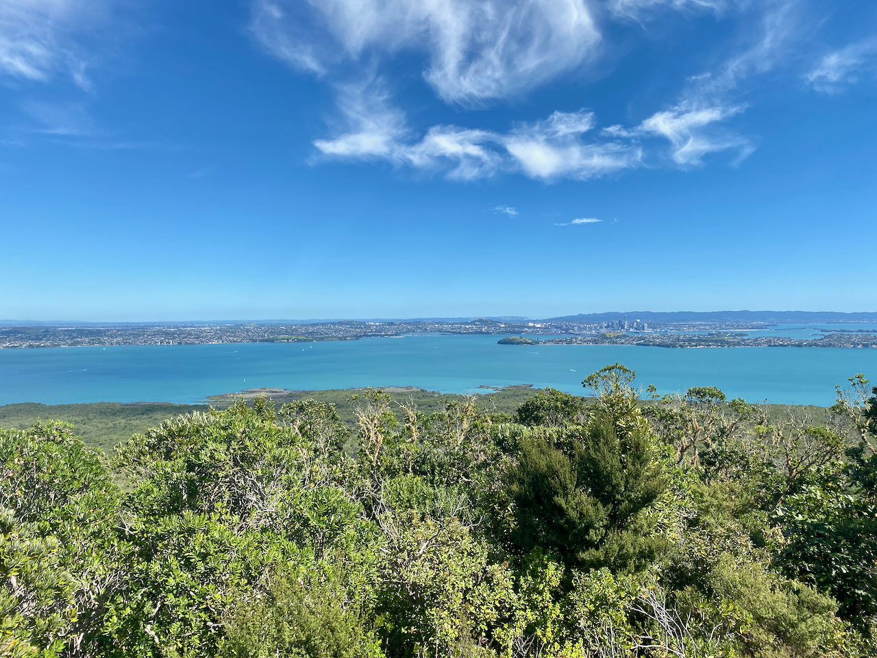
I followed the trail across the island, with good views of the harbour, islands and the Auckland Coast until Home Bay came into view.

I climbed down the hill to the campsite and found a spot to pitch my tent. The Home Bay Campsite has 142 non-powered tent sites and during my stay there was only two tents, mine and the man I’d met on the ferry on the way over with his son.

I hung out on a seat near my tent reading until the sun went down in pinks across the sky.
Home Bay Campsite to Rangitoto Wharf – 13.5km – 5 hours
There was a fine layer of dew on everything when I woke, but instead of the forecasted cloudy day, it was full on sun.

I decided I wanted to make the 2:30pm ferry, and arranged my pickup at the other end. This gave me some time to check out other parts of Motutapu Island. I headed north up the hill and along the Rotary Centennial Walkway.

The walkway came to the junction of several roads and further up a brief hill climb to a set of gun emplacements installed during WWII.

Further down the hill was the main gun emplacement area with several underground tunnels, rooms, and large emplacements along with signs explaining various parts.

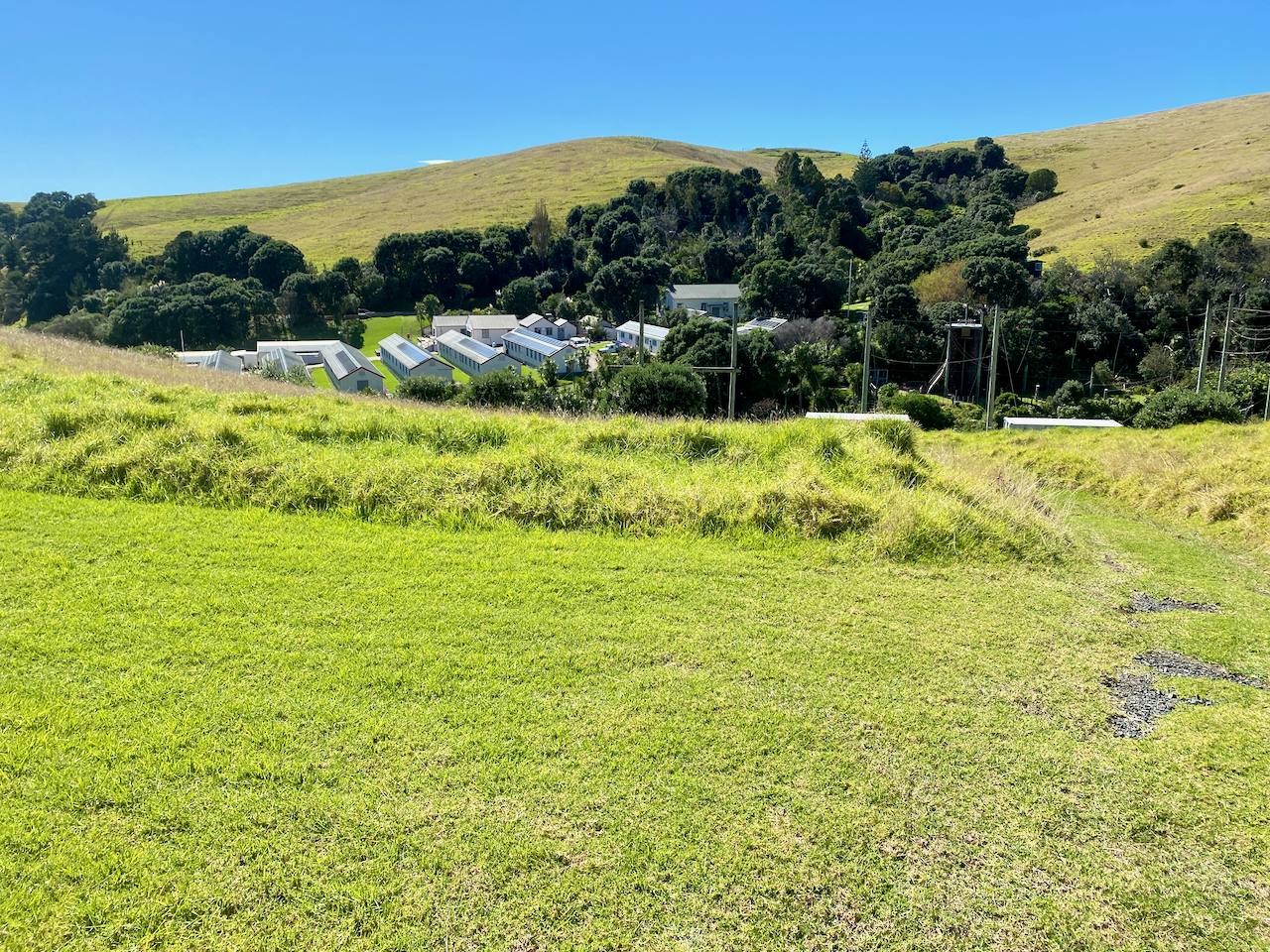
After some exploring, and checking out another set of tunnels near the junction, I followed a road along to an education camp. I was supposed to stop off at reception and announce my arrival, no exceptions, but I passed through and up the hill on the other side without talking to anyone.
I crossed Administration Bay briefly before heading back up the grassy hills and around the North Western edge of the island back to the causeway. I stopped briefly to talk with some Department of Conservation workers who were scouting for Kiwi, of which they had caught, scanned and released 23 today with a target of 50. I had no idea there were Kiwi on the island.
I stopped for a break at the causeway before beginning along the coastal trail back to Rangitoto Wharf.
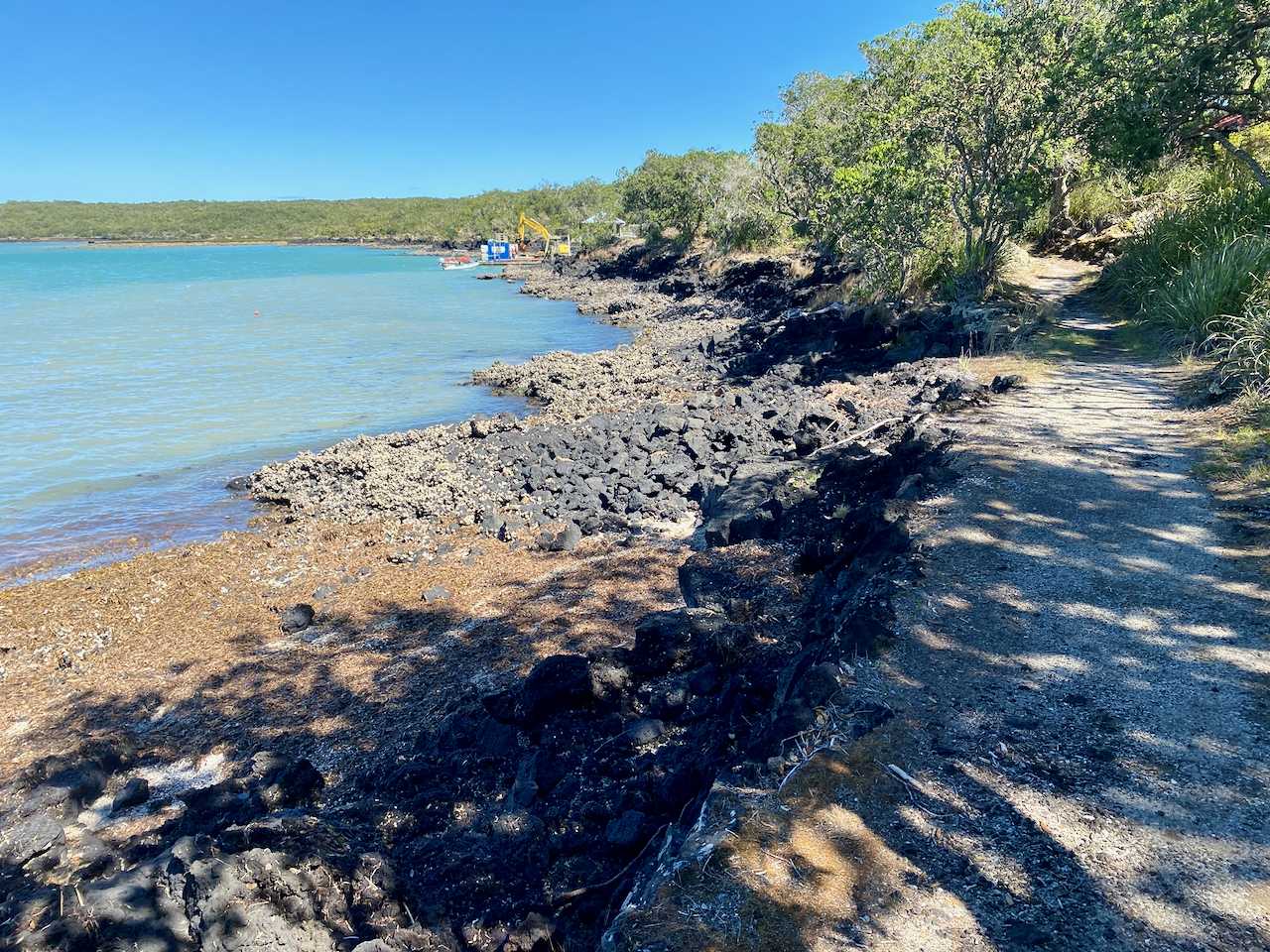
At Islington Bay Wharf, I realised the coastal track would take me too long, and I would miss my ferry, so I cut back along the road, followed it up towards the summit and split off part way to race towards the Rangitoto wharf. The sun continued to beat down during the afternoon, and it was again roasting on the rocky Rangitoto. I arrived back at the wharf just prior to the ferry arriving, but was utterly drenched in sweat. As soon as I could I got into a large bathroom and changed into my dry clothes for the trip back.
Overall,
My Rangitoto Motutapu Island circuit was a success, there was plenty to see on both islands, and being a Monday, it was quiet. I enjoyed my time there.
Next, I will wait for an opening in the weather and will find another, hopefully longer, walk before winter pushes me into hibernation.
The Lone Trail Wanderer
