
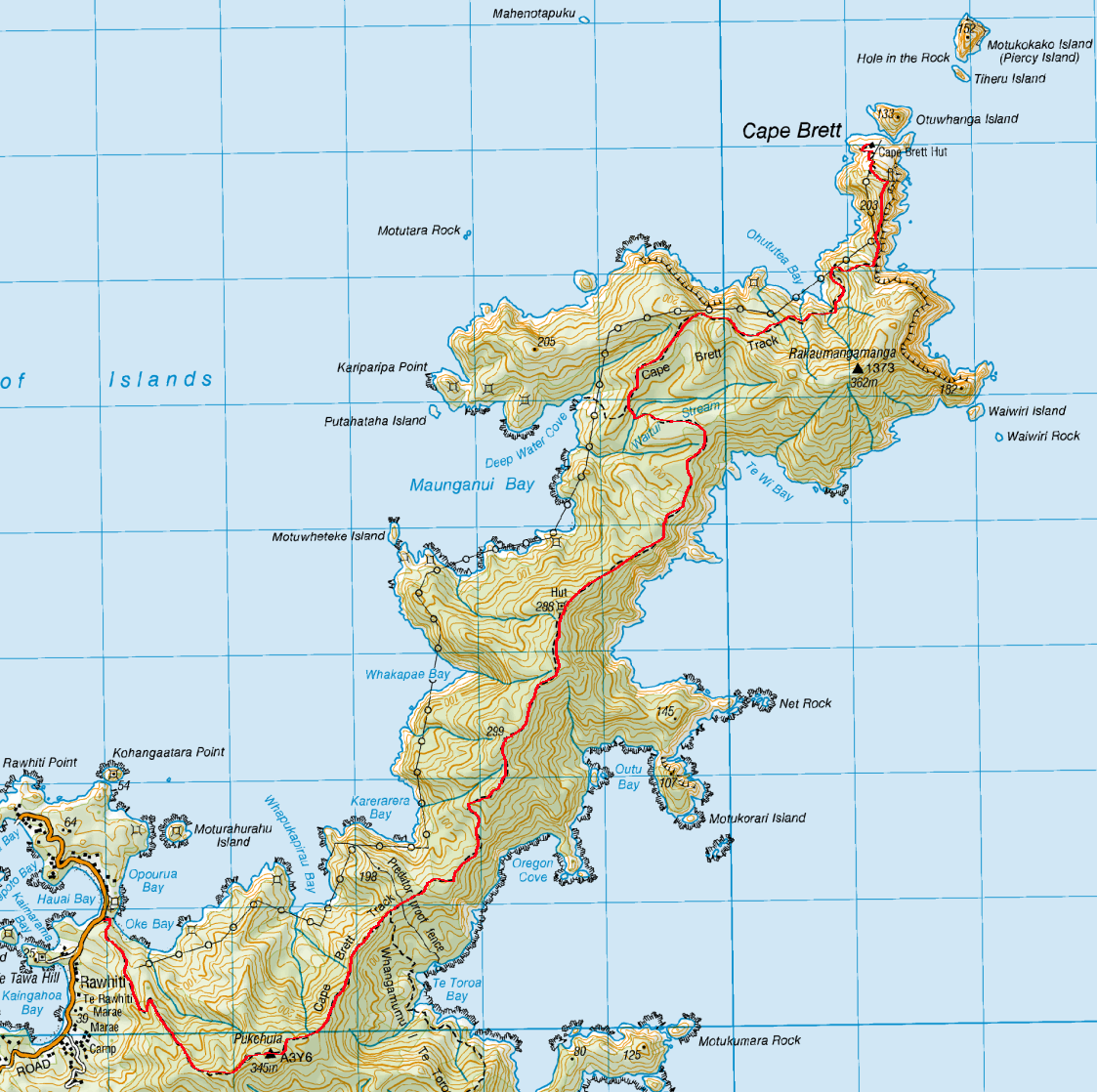
With winter and rain on the horizon, my hiking season is coming to an end. Nevertheless, with a short gap of sun I did find an interesting overnight walk and shot off up to the Bay of Islands in the Northland province.

The Bay of Islands houses Russell, site of the first European settlement in New Zealand. And, at the eastern edge of the bay is the Cape Brett Peninsula, a forest covered area with a lighthouse at its tip. One of the islands just out from the end of the peninsula is also home to one of the region’s better known tourists spots, a natural arch of rock called the Hole in the Rock.
After my drive north from Auckland, I stayed at a backpackers in Rawhiti, right near the beginning of the track, driving a winding road to Russell for dinner.
Day 1 – Oke Bay to Cape Brett Hut – 17.3km – 8 hours
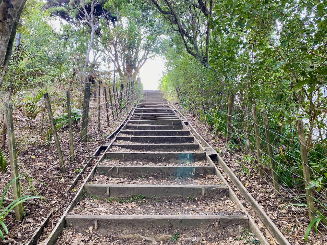
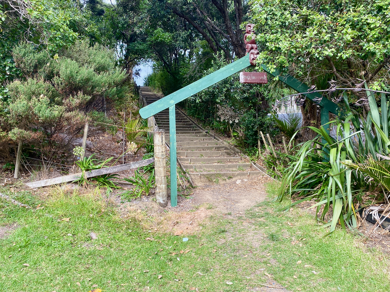
My backpackers is a kilometre from the trailhead of the Cape Brett Track, and my parking was included in the price, otherwise places charge NZ$10-20 for the night. I walked along the road past Kaingahoa Bay, to Hauai Bay, through the waharoa and up stairs.
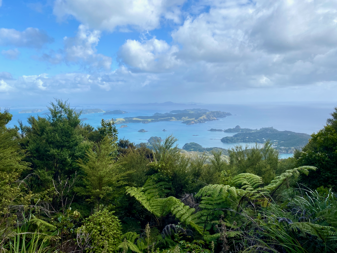
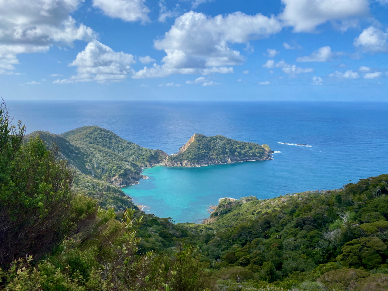
With Oke Bay at my left, I began the climb up the highest peak on the track, Pukehuia, although at 345m it isn’t as tall as some of my previous climbs. Most of the walk will be through forests, so I am resigned to just enjoying what I can. As the climb to the top of Pukehuia is over 2km, the track is not particularly steep. But as the day is warm, I made it to the rest stop at the top covered in sweat, but with great views of the Bay of Islands.
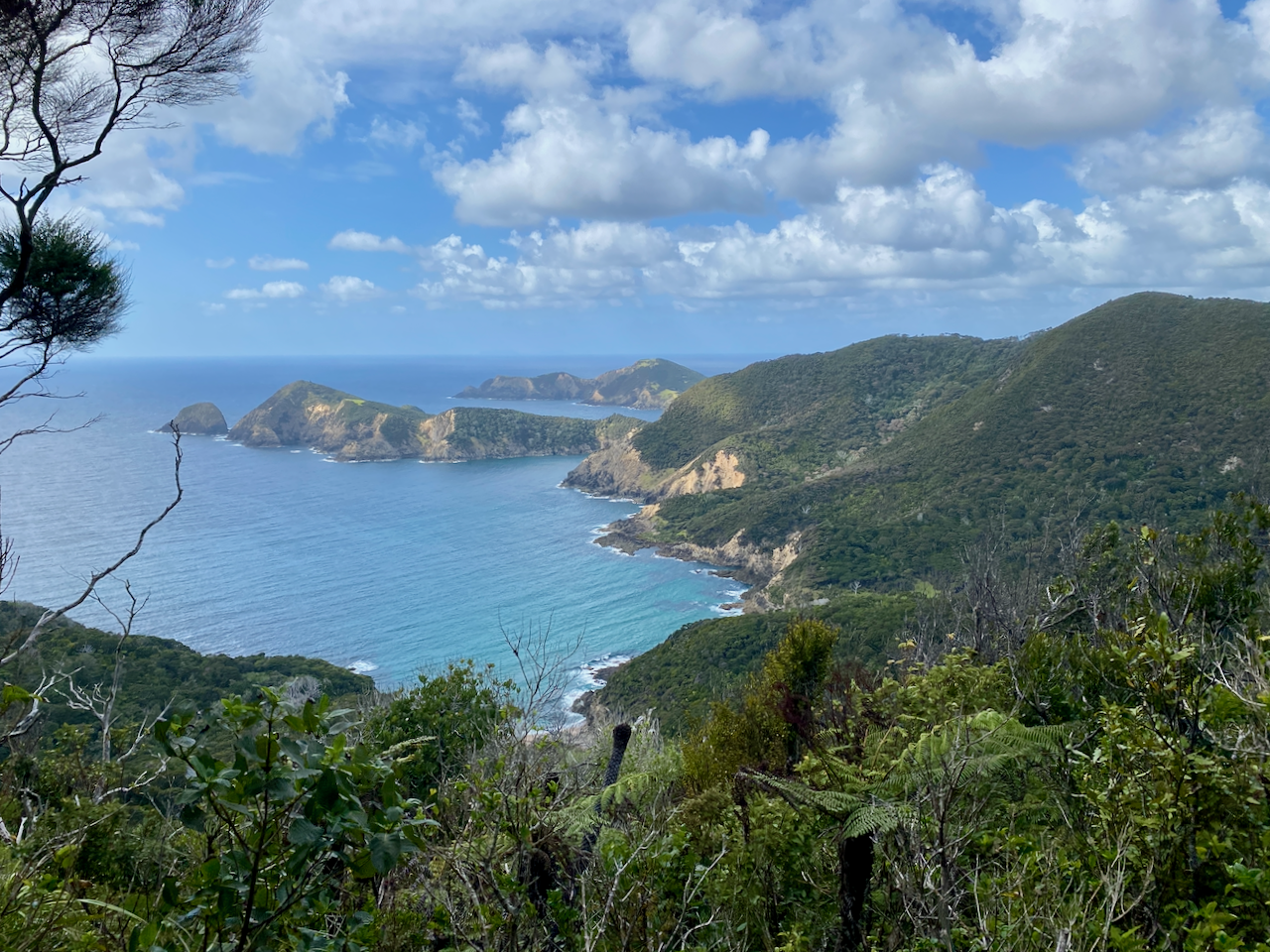
I stopped for a brief break, and when I was about to leave, I met one of the three other people I’d see during the walk. I set off again, and on the far side of the hill is a track leading south which is marked as closed. There’s also a good view south to another pair of rocky peninsulas.
At the base of Pukehuia is another closed track, this one also leading to the remains of Whangamumu whaling station. Soon after, I reached the predator proof fence that crosses the entire peninsula. It’s an electrified fence that keeps the possums out, although the gate was open when I arrived, I closed it once I’d gone through. For my second climb of day, smaller than Pukehuia, and the second highest of the walk, with a pair of peaks which I called the nipples. As I climbed down the first of these nipples, I passed the other two people I would see on the trail, and continued on to the far side of the 2nd nipple, where there’s a shelter. I stopped in an open grassy areas nearby for lunch with Outu Bay below.
Over the next several kilometres the trail descended to the Wait ui Stream before climbing steps to the junction of the only side trip of the walk and location where the Water Taxi collects people. As it would have added an hour to the walk, I skipped it and continued on up the hill to be regaled by views of the end of the peninsula and climbs yet to come.
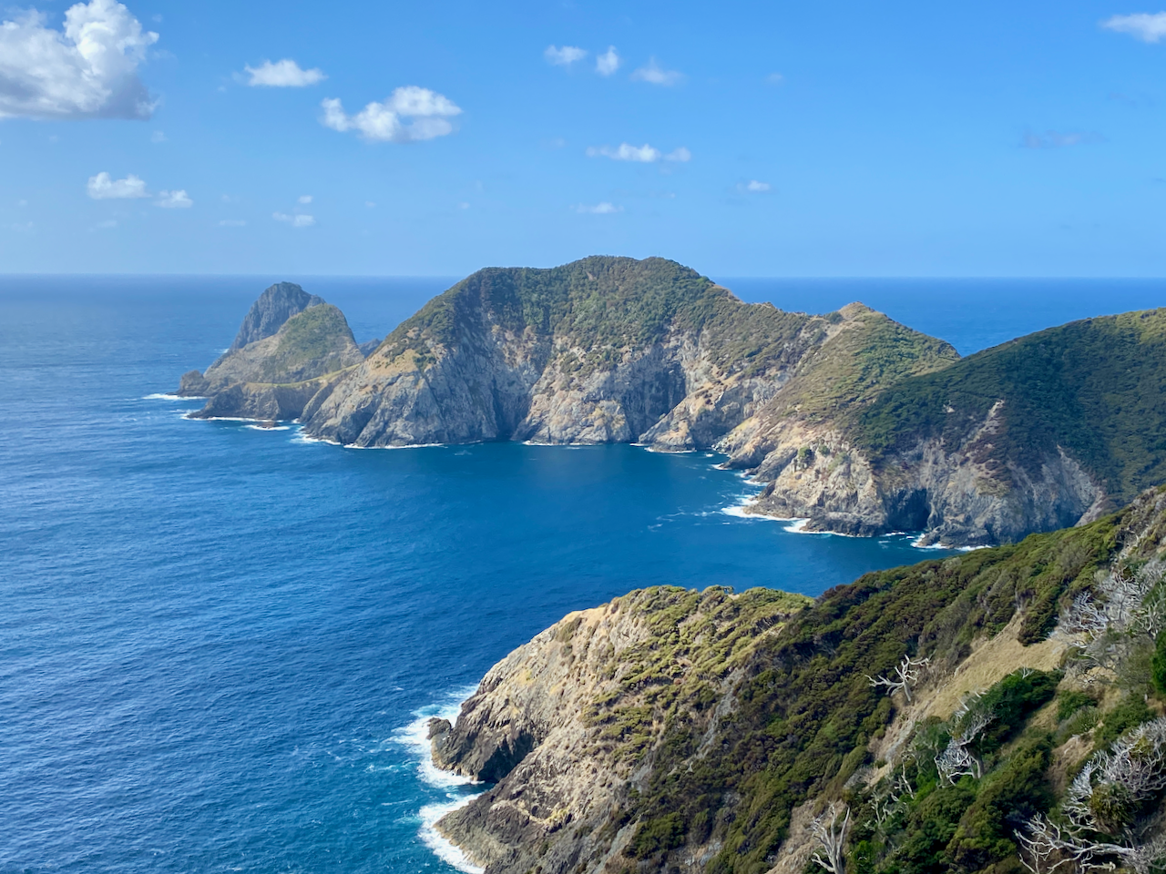
As I drew closer I could make out the track climbing along the sheer cliff face on the most dangerous part of the walk. Thankfully, today the wind was calm.

After the fourth and shortest climb of the day, I came to the cliffs leading up to the entrance of the aforementioned most dangerous part of the walk, the clifftops.

At one point, on the way to the pole that marks the highest point, there’s a guard rail to protect walkers. Beyond the highest point the thin trail leads along the top of the 200m high cliff.

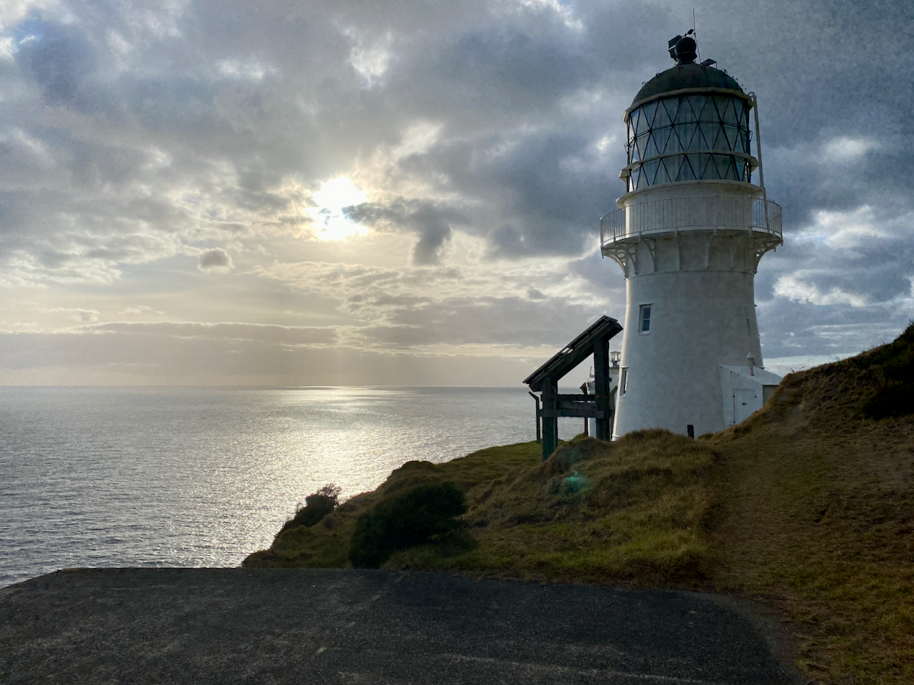
And from this last rise, the lighthouse came into view, along with Piercy Island, home of the Hole in the Rock.
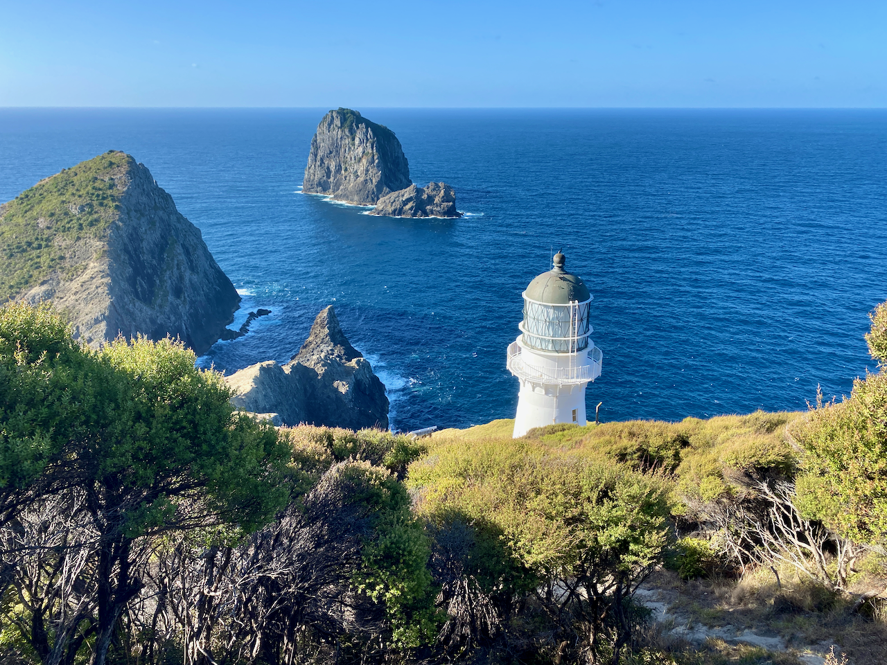
I climbed down to the old lighthouse, which is now redundant, replaced by the smaller (a tenth of its size), stronger, electric powered one on the other side. From that vantage point, I could for the first time see the old lighthouse keeper’s hut below, which has been converted into the Cape Brett Hut by the Department of Conservation. The rest of the walk is down the hill on long switchbacks, but after a long day walking, my legs are a bit like jelly.
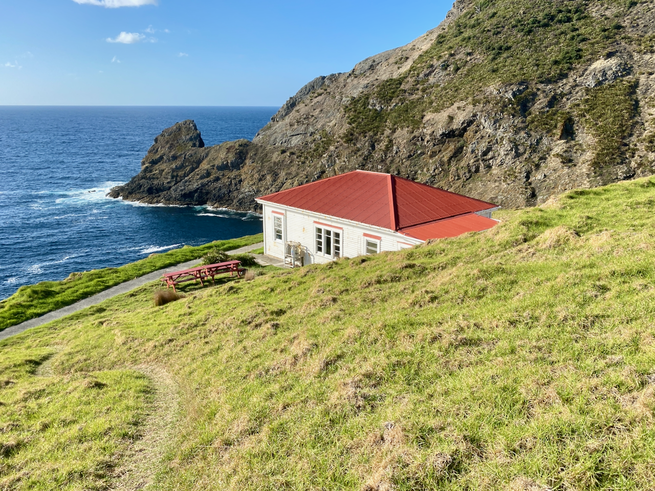
On arrival at the hut, I discovered there was already a dozen people there that had walked in earlier in the day. The hut also had its own cookers, pots and cutlery. I had been warned that as it’s late summer, the water may have run out, so I carred in extra water. But, I found there was still water in the tanks, although I still used my own water first. After reading for a while, I cooked my dinner and returned to my bunk for an early start the next day.
Day 2 – Cape Brett Hut to Oke Bay – 17.3km – 8 hours
More people had arrived after me the night before, and the hut was rather busy. There was also a cyclone pushing down on Northland, so most people in the hut were arranging to catch the water taxi before the seas got too rough. As I hadn’t seen a single person walking back the other way on day 1, I assumed they’d also got the water taxi too. Maybe I’m too cheap, but I came to walk, so I hikedout. When ready, and with a far lighter pack in the morning, I climbed the hill back to the lighthouse.
As I crossed the dangerous portion of the track, the wind was a little stronger , but nothing more substantial. While today was supposed to be mainly cloudy, most of the morning was sunny. The track was now familiar, and I remembered all the parts I walked over the day before. During the day, I met a family of 8 heading to stay in the hut overnight. I hope they didn’t get stuck there, as the water taxi doesn’t come in choppy water. A few hours later, I emerged from the trail, down the stairs and through the waharoa.
I walked the 1km to my car and drove to my night spot over an hour away in the city of Whangarei.
Overall,
The Cape Brett track was a nice overnight hike made more challenging by its distance, several climbs and the last section. While I usually prefer not to double backalong the same track, sometimes there isn’t other walking options. Overall, a good couple of days, although I wish less of it was in the forest.

Until next time,
The Lone Trail Wanderer
