Tag Archives: Island

Aotea Track, Great Barrier Island, New Zealand

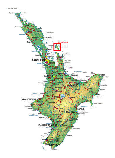
Great Barrier Island is 100km North East of Auckland Central, and sits between the Hauraki Gulf and the Pacific Ocean just to the north of the Coromandel Penninsula. More than half of the island is a nature reserve, and the 1000+ residents live off the grid.
aoteatracklocation-2023-04-5-17-27.png

I first visited Great Barrier 25 years ago, and have been trying to get back to do a hike for months now. I’ ha’d planned it as a warm up hike before my Southern Alps crossing, but it wasn’t to be. First, a downpour flooded Auckland, including the airport, so I couldn’t fly out, then the Island was closed down due to the Cyclone Gabrielle. Now, a month after completing my Southern Alps crossing, and I finally made it.

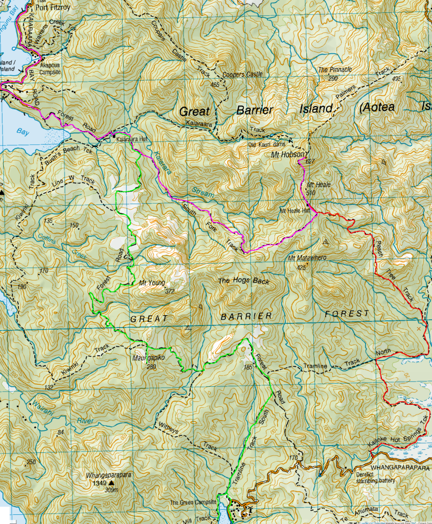
Day 1: Whangaparapara Road to Mt Heale Hut – 8.2 km – 3.5 hours – Red Track

I’d tossed around catching the car ferry over, but with the extra costs associated with it, flying was only a little more expensive. So, after a quick 30 minute flight in a 12 seater Cessna aircraft, I arrived on the island.
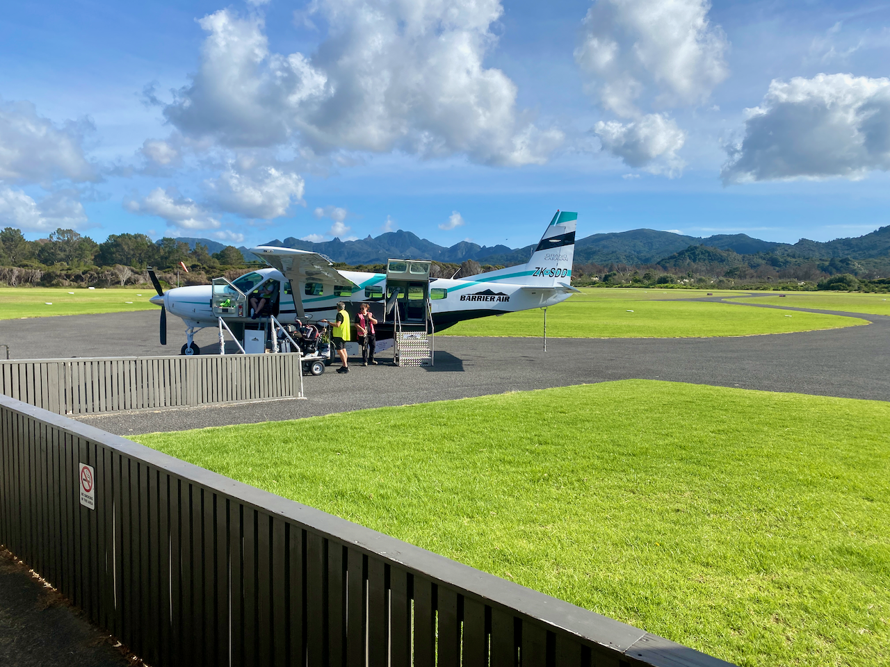
img_1445-2023-04-5-17-27.png

I’d arranged to be collected from the airport and delivered to the trailhead by a local transport. I arrived at 2:10 pm, and with an estimated 4 hours walk, I set out along a wide track beside a stream. As daylight savings ended last night, sunset was going to be just after 6, so I was going to be close.
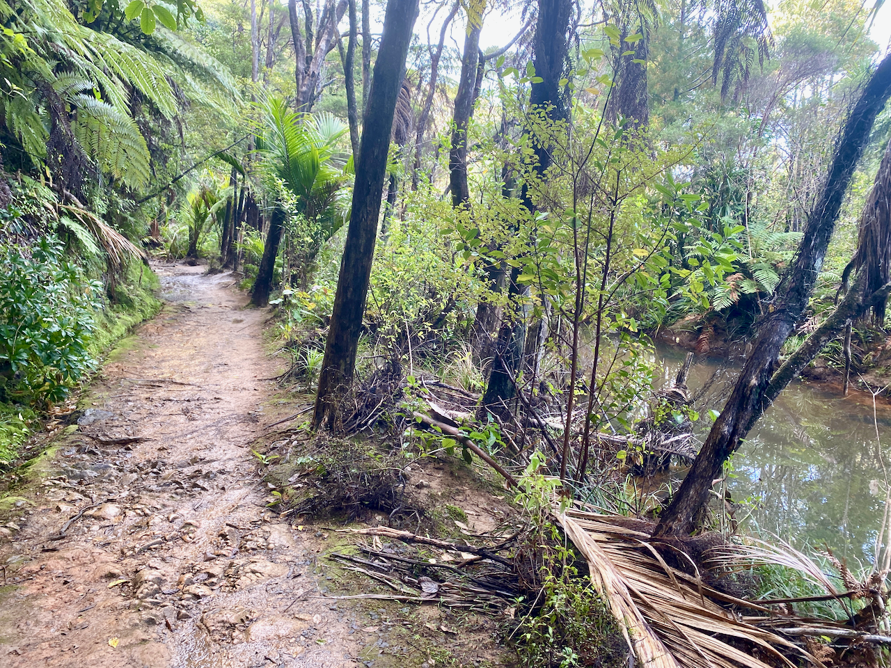
img_1308-2023-04-5-17-27.png

Along the trail I got my first look across the grasslands, with views of the short mountains beyond.
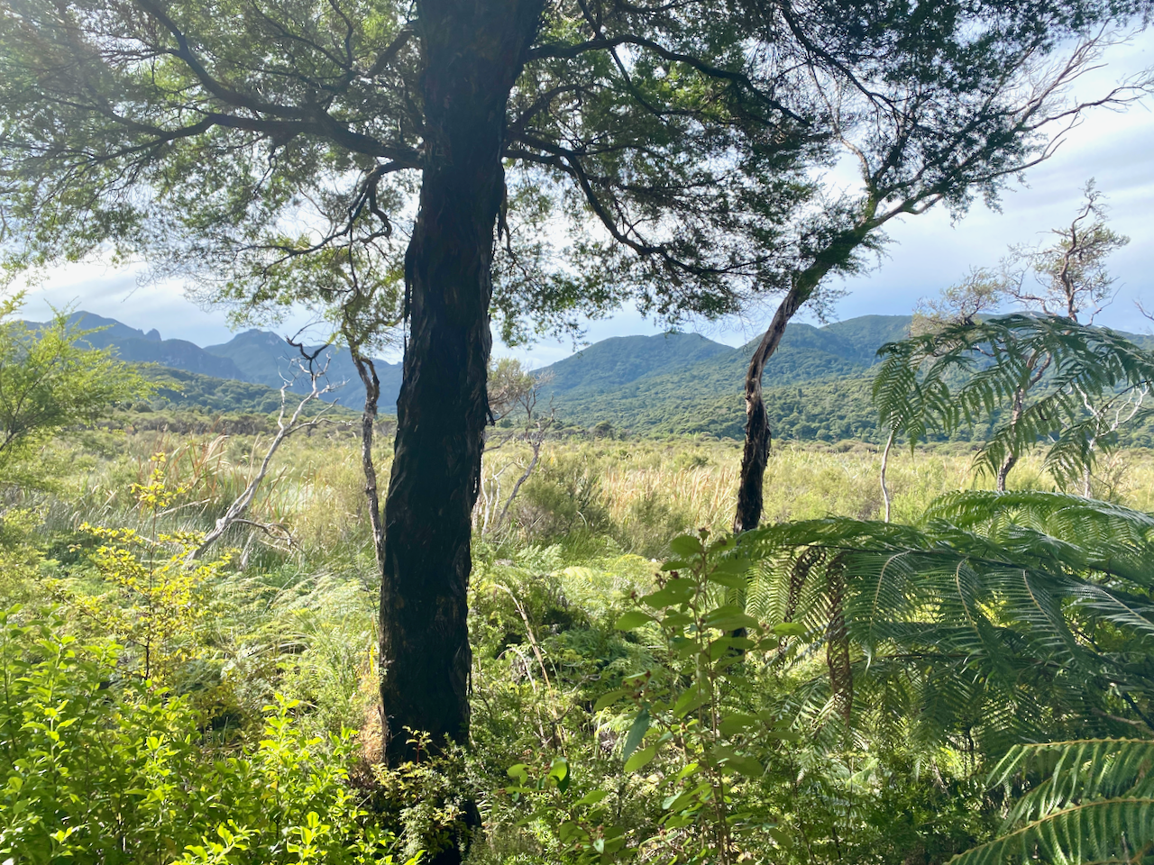
img_1312-2023-04-5-17-27.png

The trail was flat and the smell of sulphur in the air heralded in my arrival at the ‘hot springs’. The springs themselves were more of a luck warm stream with pools along it. I might have gone in if I hadn’t been pressed for time, although as they weren’t quite hot, they lost their appeal.
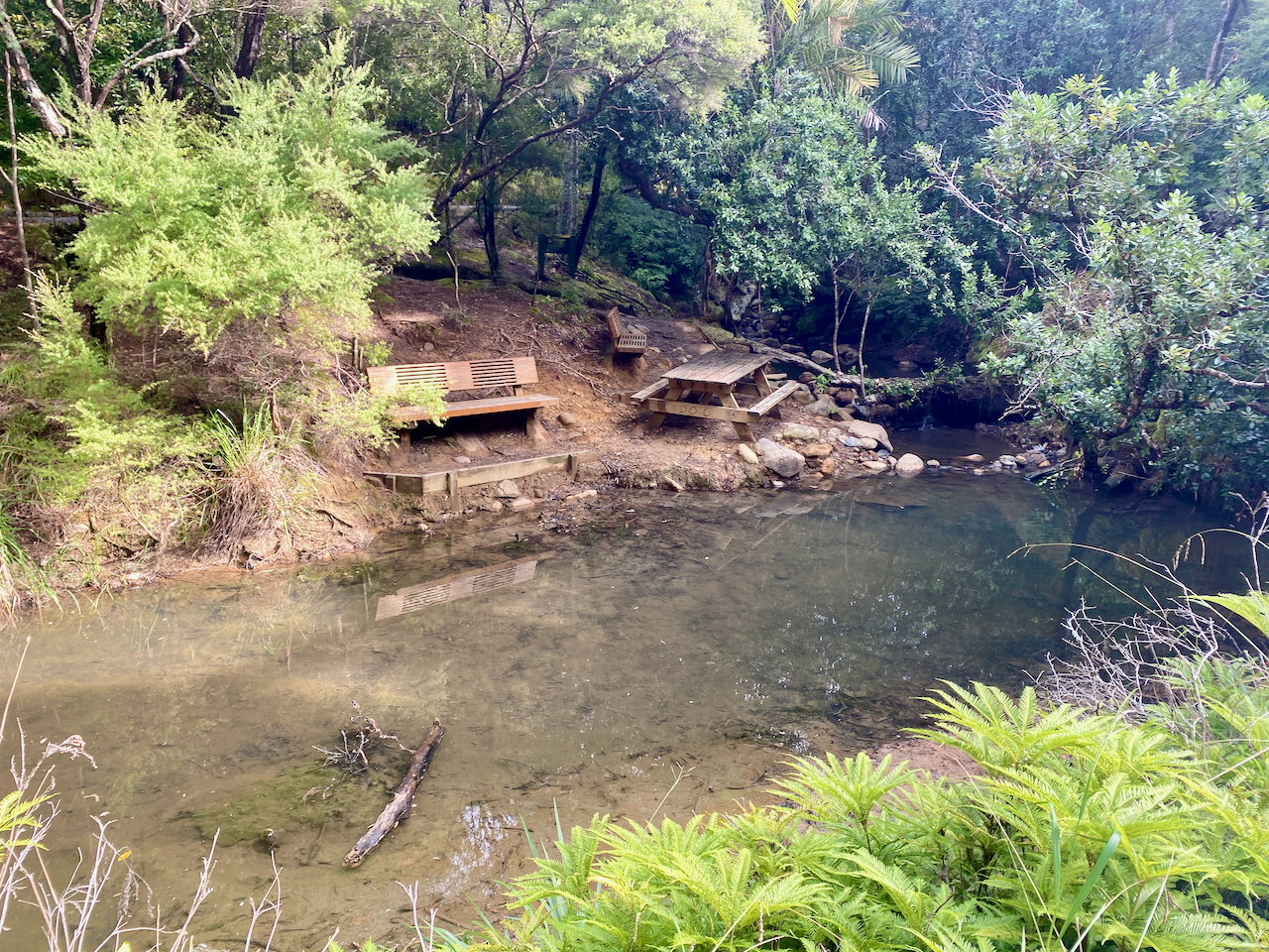
img_1318-2023-04-5-17-27.png

Not long after the hot springs, I arrived at the Tramline trail where Kauri Trees were logged more than 100 years ago. A view out over the grasslands to Kaitoke and Medlands Beaches.
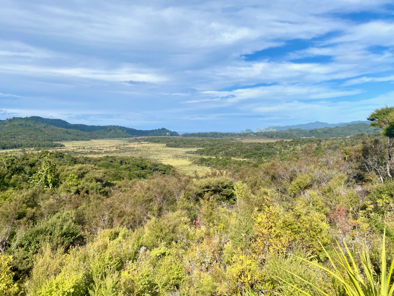
img_1319-2023-04-5-17-27.png

The Tramline track was also flat until it headed up Peach Tree Trail, which began a crazy amount of steps. This would be a reccuring theme on the island.
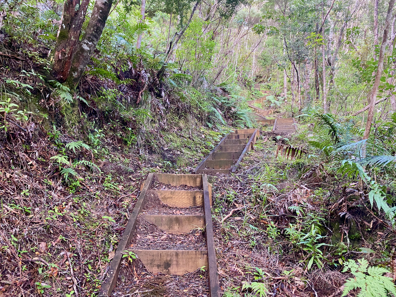
img_1334-2023-04-5-17-27.png

Starting near sea level, I climbed towards the the hut at 412m. The lack of breeze ensured that my climb felt more like I was swimming up the mountains in my own sweat. But the views were worth the energy.
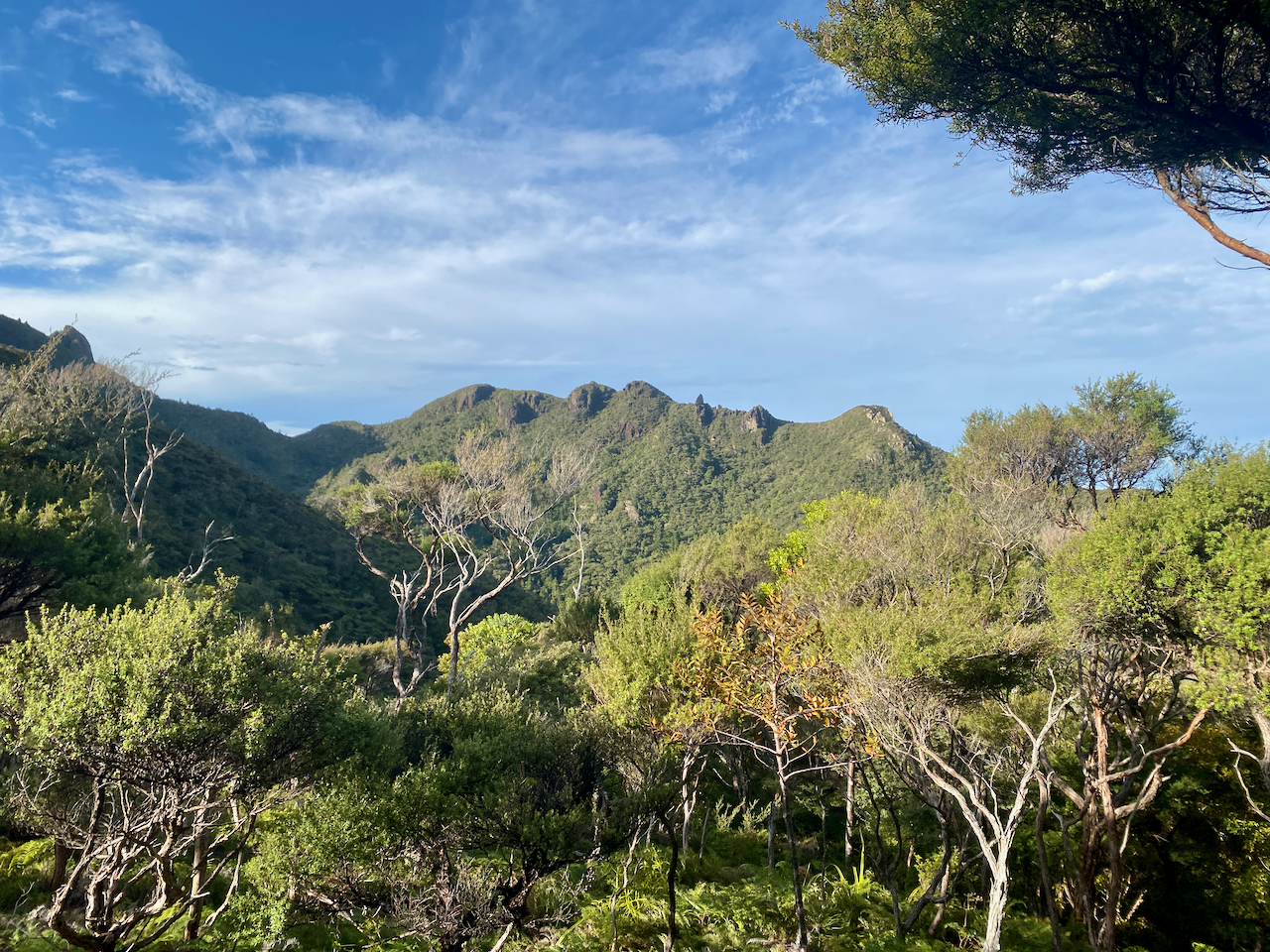
img_1341-2023-04-5-17-27.png

And I got a better look back to Kaitoke and Medlands Beaches as I got higher. The trees gave way to low scrub giving an almost alpine feel on a mix of dirt path and stairs.
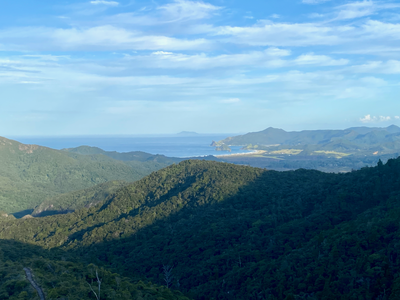
img_1352-2023-04-5-17-27.png

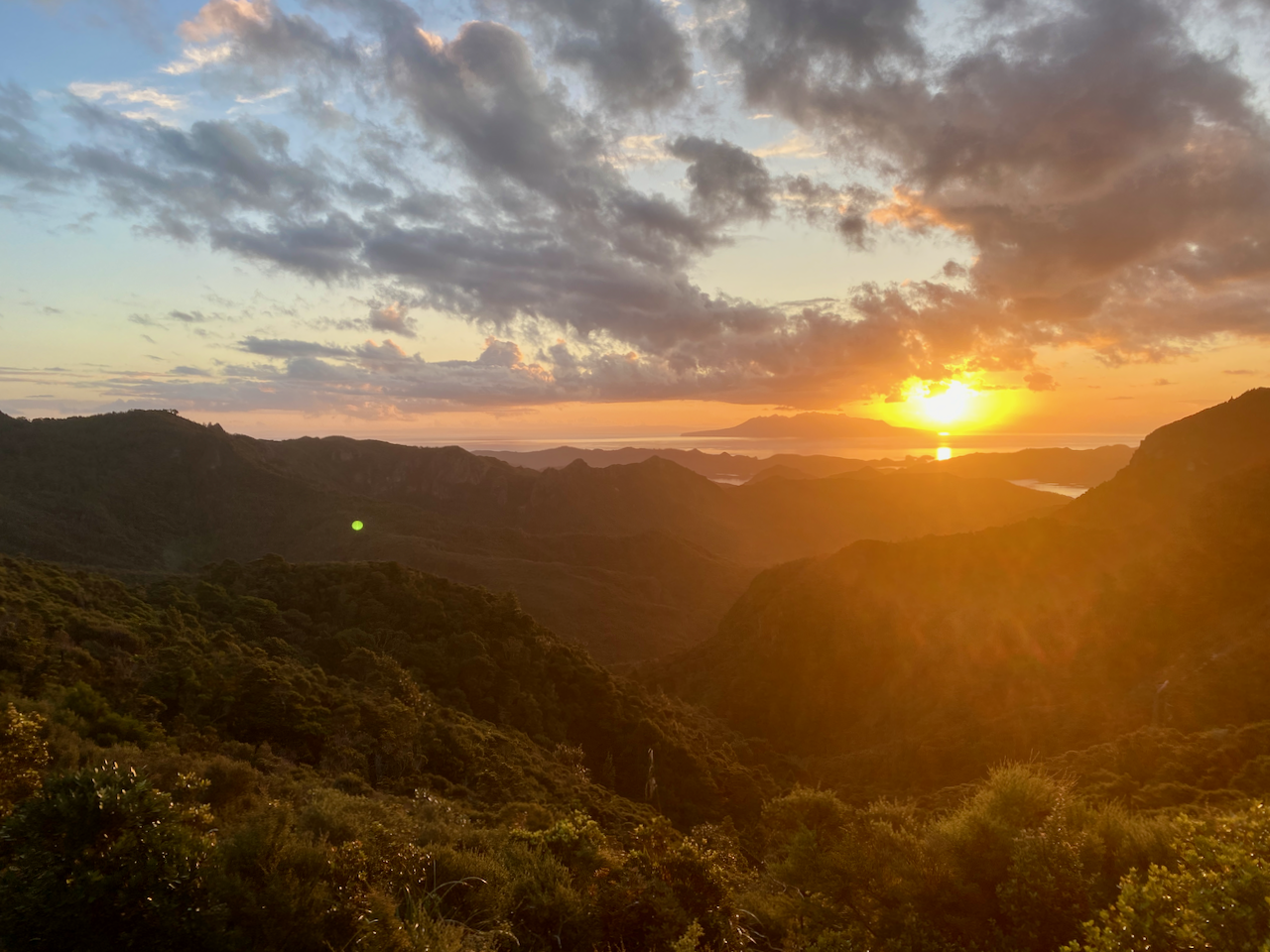
At the 400m altitude mark, I saw the sign to the Hut stating 5 min and 200 m. I arrived soon after and found a family group of 4 already there. I went in, claimed a bunk, had a quick hiker’s shower before going out to watch the sunset. Then while chatting to the family members, I cooked a Chef Corso Trail Meal, Macaroni with Bacon and Blue Cheese.
img_1357-2023-04-5-17-27.png

Day 2: Mt Heale Hut to Kaiaraara Hut via Mt Hobson Lookout and Port Fitzroy – 16.9km – 4.75 hours – Pink Track

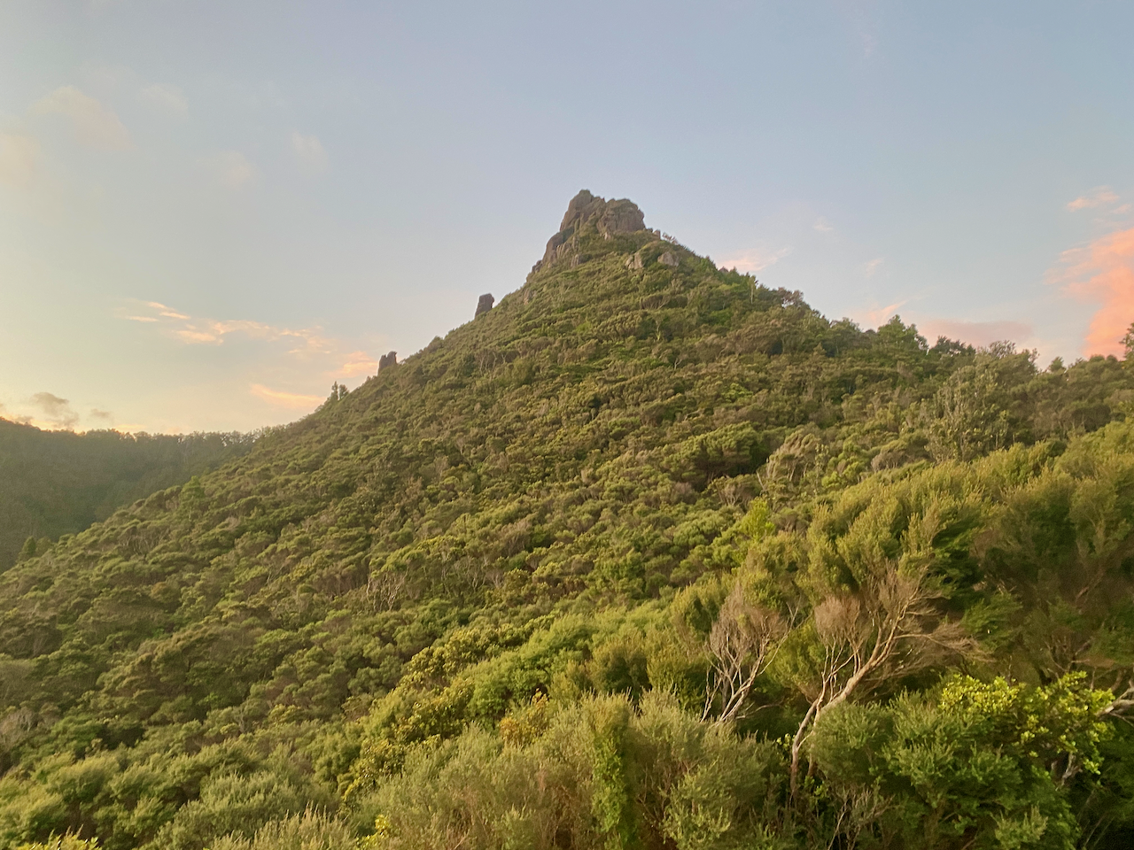
After a fitful night’s sleep, I arose and got ready for today’s walk. First, I climbed past Mt Heale to the summit of Mt Hobson, the tallest mountain on the island, at 627m. I was to have climbed past Mt Hobson and along the ridgeline to the next hut, but due to a slip the trail that was was closed. So I’d left my pack at the hut.
img_1363-2023-04-5-17-27.png

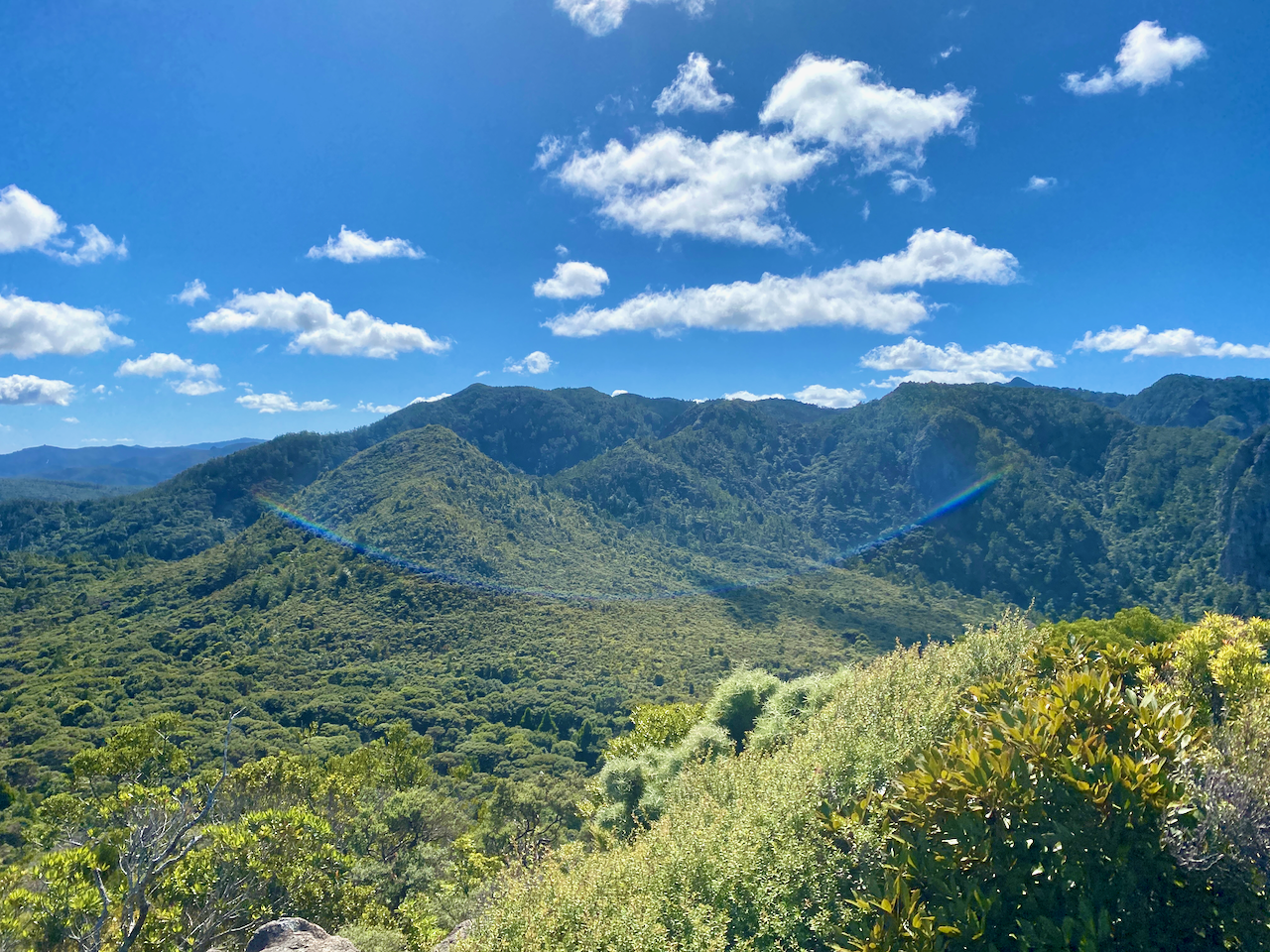
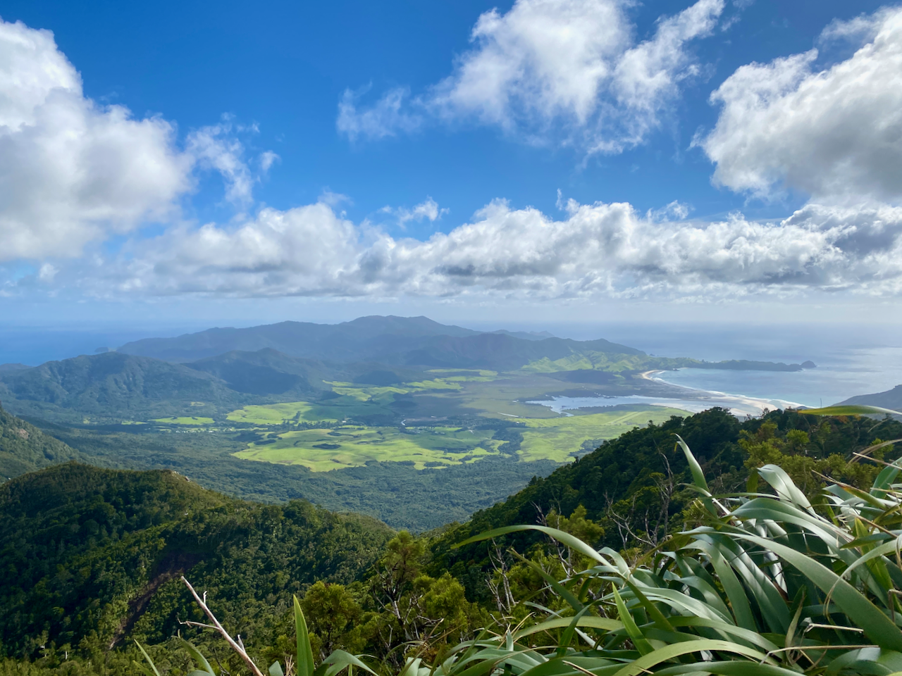
I knew there was going to be a lot of steps, as others in the hut had complained about the sheer number. I didn’t bother counting on the way up, concentrating on the climbing until I reached the summit platform with almost 360 degree views. This over Whangapoua Bay…
img_1373-2023-04-5-17-27.png

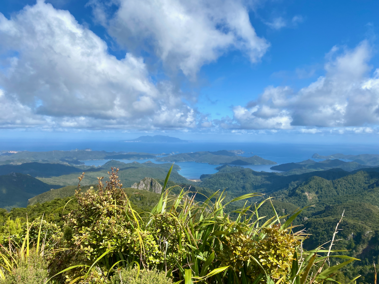
and this over Port Fitzroy with Kaikoura Island, in the centre, and Little Barrier Island, in the distance.
img_1374-2023-04-5-17-27.png

I counted 1016 stairs on the way back to the hut where I picked up my pack and headed straight off again. A sign at the top of the South Fork Track said an hour to the Forest Road, not far from the hut. So it was going to be a short day. The trail headed down slowly, crossing a wire bridge as it went.
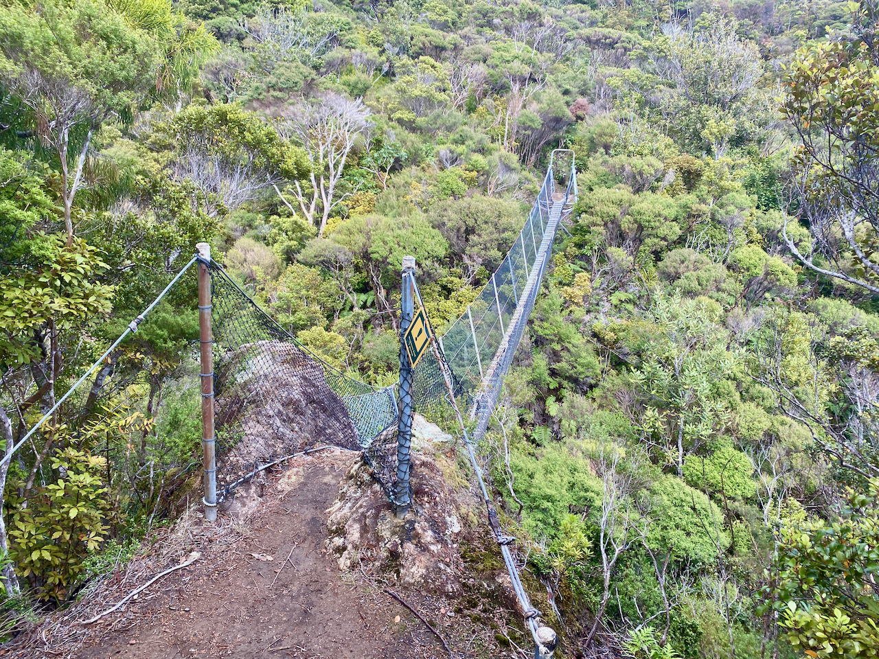
img_1379-2023-04-5-17-27.png

The trail was wide and an easy descent. Along the way I passed a pair of woman, the only two people I’d see on the track today.
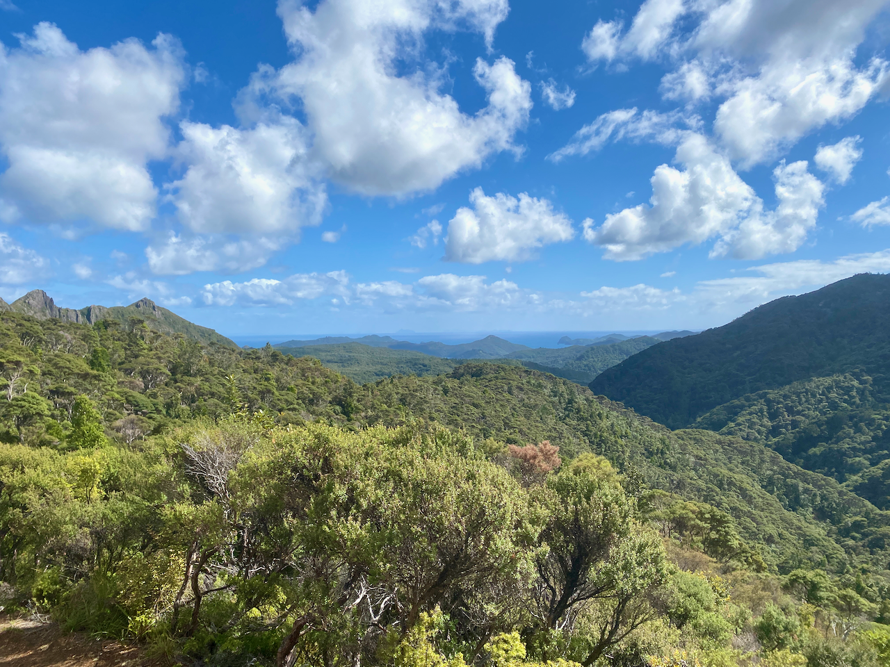
img_1386-2023-04-5-17-27.png

The trail crossed a stream several times, and was easy to avoid getting my boots wet, although the trail was a little muddy and slippery at times. I finally came out at the Forest Road after an hour and a half. Not sure where they got an hour from as I wasn’t walking slowly. The Forest Road is rocky road though the nature reserve, and the sign said 30 minutes to the hut, but it only took 10 minutes.
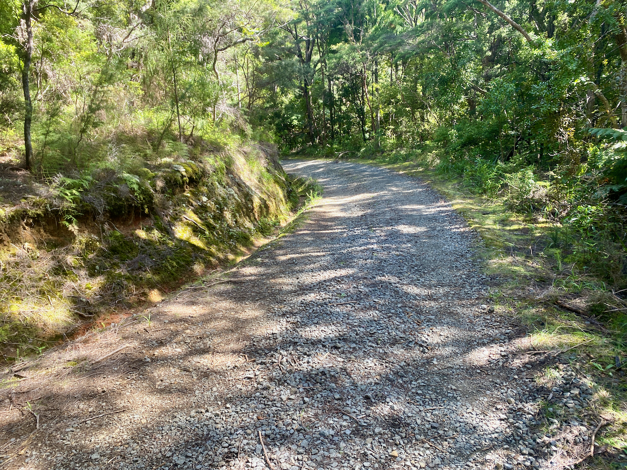
img_1390-2023-04-5-17-27.png

At the hut I ran into one of the ladies from the hut last night. It was early, so we decided to walk the 5km into Port Fitzroy. I’d heard there was a burger place, which turned out to be closed, so we continued walking to the Boat Club, hoping for a burger, but that was also closed. We did manage to persuade the owner to sell us a beer though. Afterwards, we stopped at the shop on the way back. That evening we discovered there were mice under the hut, as my hutmate had left a bag outside with a chocolate bar in it. The mice enjoyed that. Thankfully they couldn’t get inside.
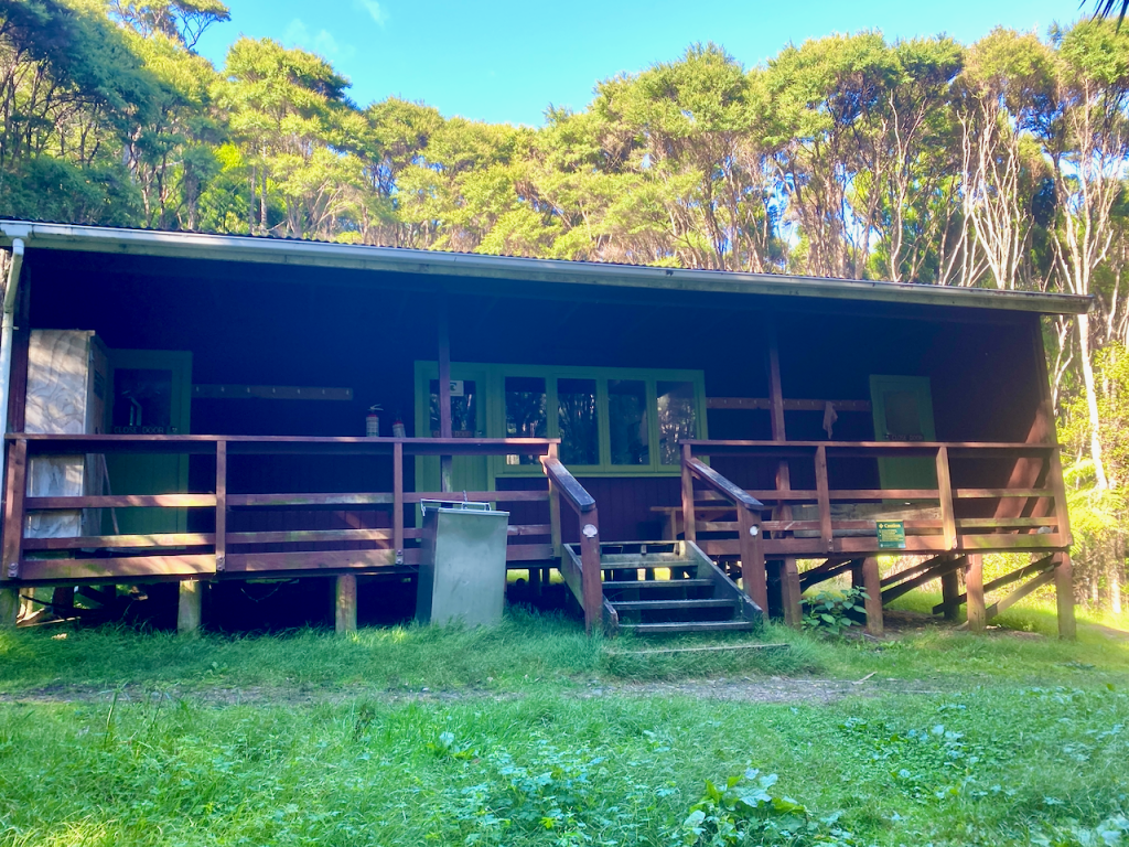
Day 3: Kaiaraara Hut to Green Campsite via Mt Maungapiko – 17km – 4 hours – Green Track

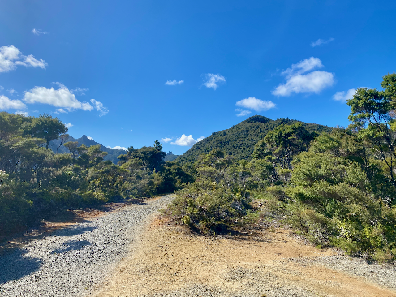
Today would be the longest day, although most of it would be spent walking along the Forest Road. Unfortunately, there wasn’t much of a view most of the time, so I took whatever photos I could.
img_1406-2023-04-5-17-27.png

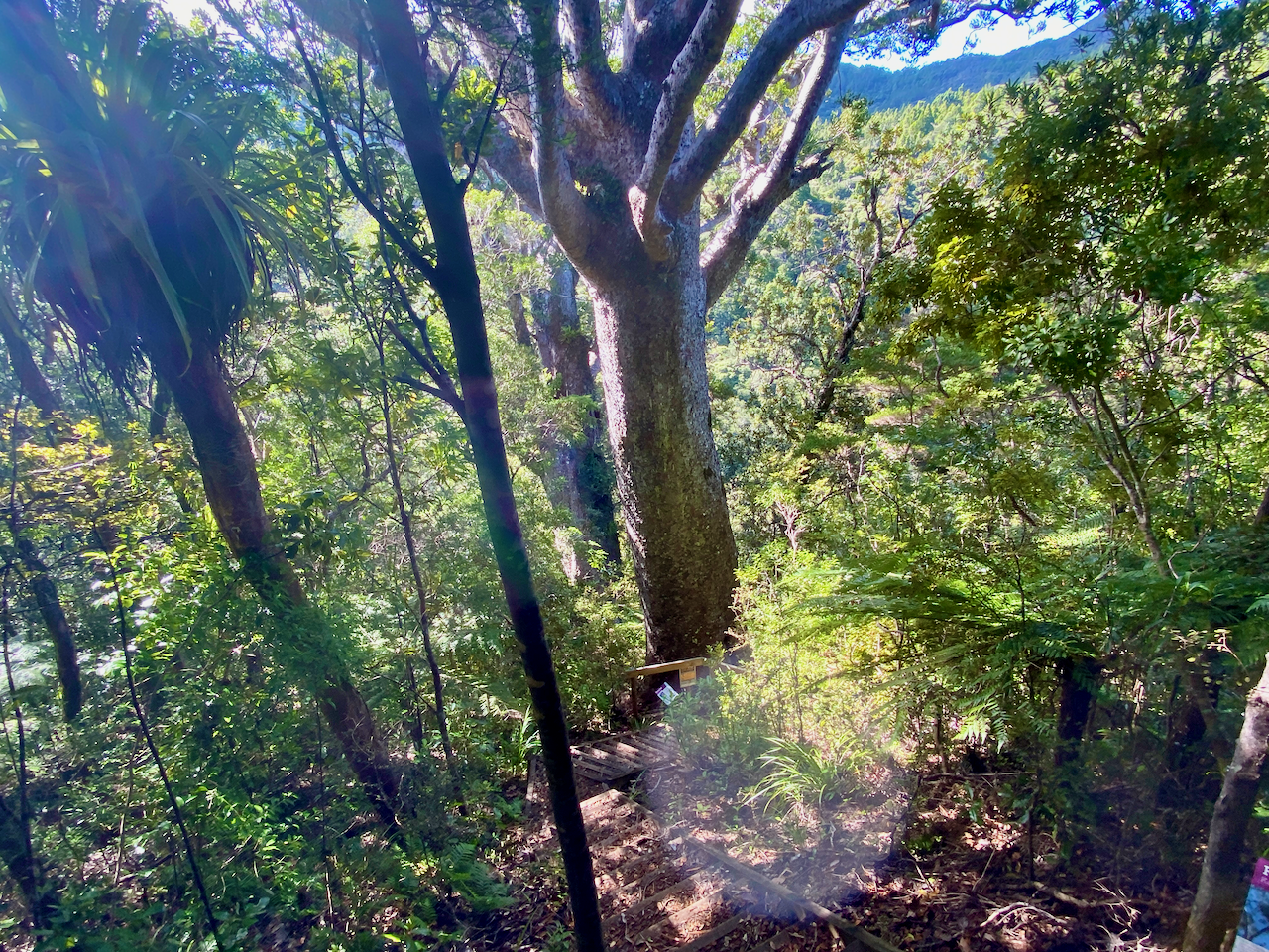
Then a short side trail with a bunch of stairs led down 50m to a pair of large Kauri Trees. After the logging a century ago, there were few of the ancient giants left, and with Kauri Dieback Disease, there are likely to be few others living to such greatness.
img_1418-2023-04-5-17-27.png

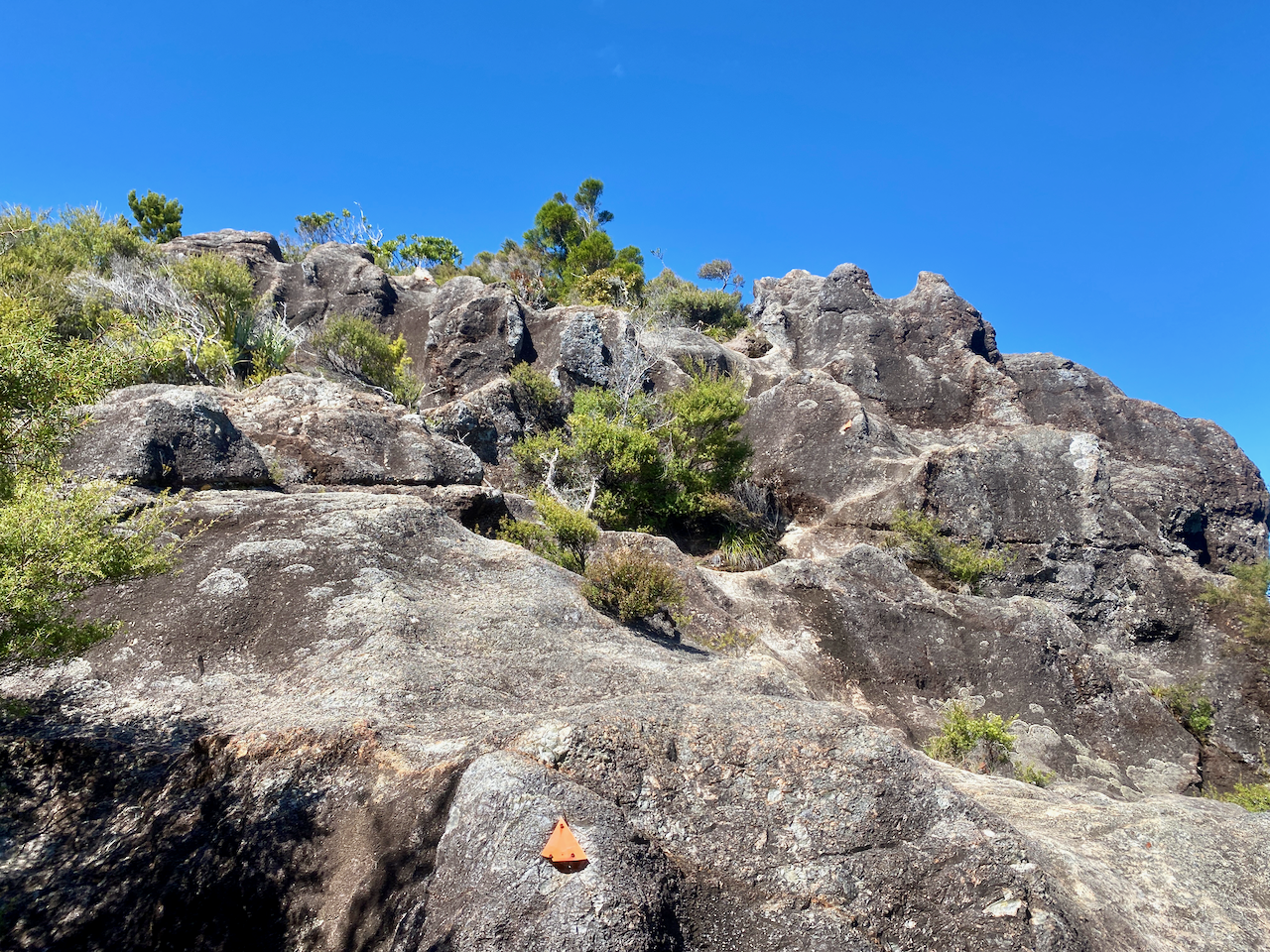
30 minutes later, I came to the turn off to Mt Maungapiko, a 280m peak with good views. It was the only climb off the Forest Road, and in time for lunch, so I took the opportunity, and climbed the rough rock to the top where there’s a wooden bench.
img_1426-2023-04-5-17-27.png

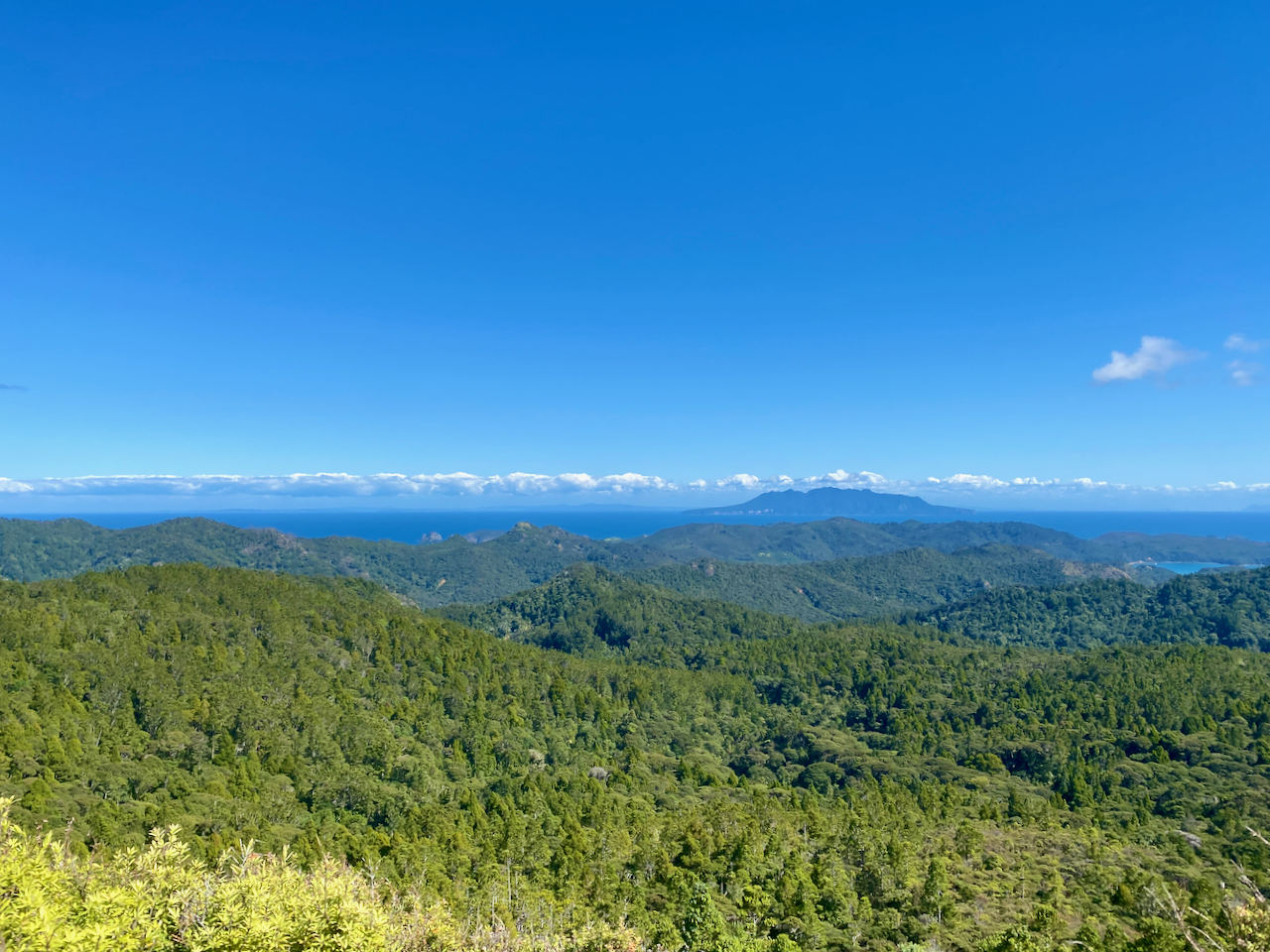
I stopped for lunch, taking photos of the near 360 degree views.
img_1421-2023-04-5-17-27.png

And back the way I’d come.

img_1425-2023-04-5-17-27.png

Back on the Forest Road, I headed down to a stream, the climbed for the final time before finally reaching the South Tramline Track. The actual metal tramline had been removed many years ago, leaving just a steep descent. About halfway down I came to the turnoff to the Kauri Falls, and stopped to have a look.
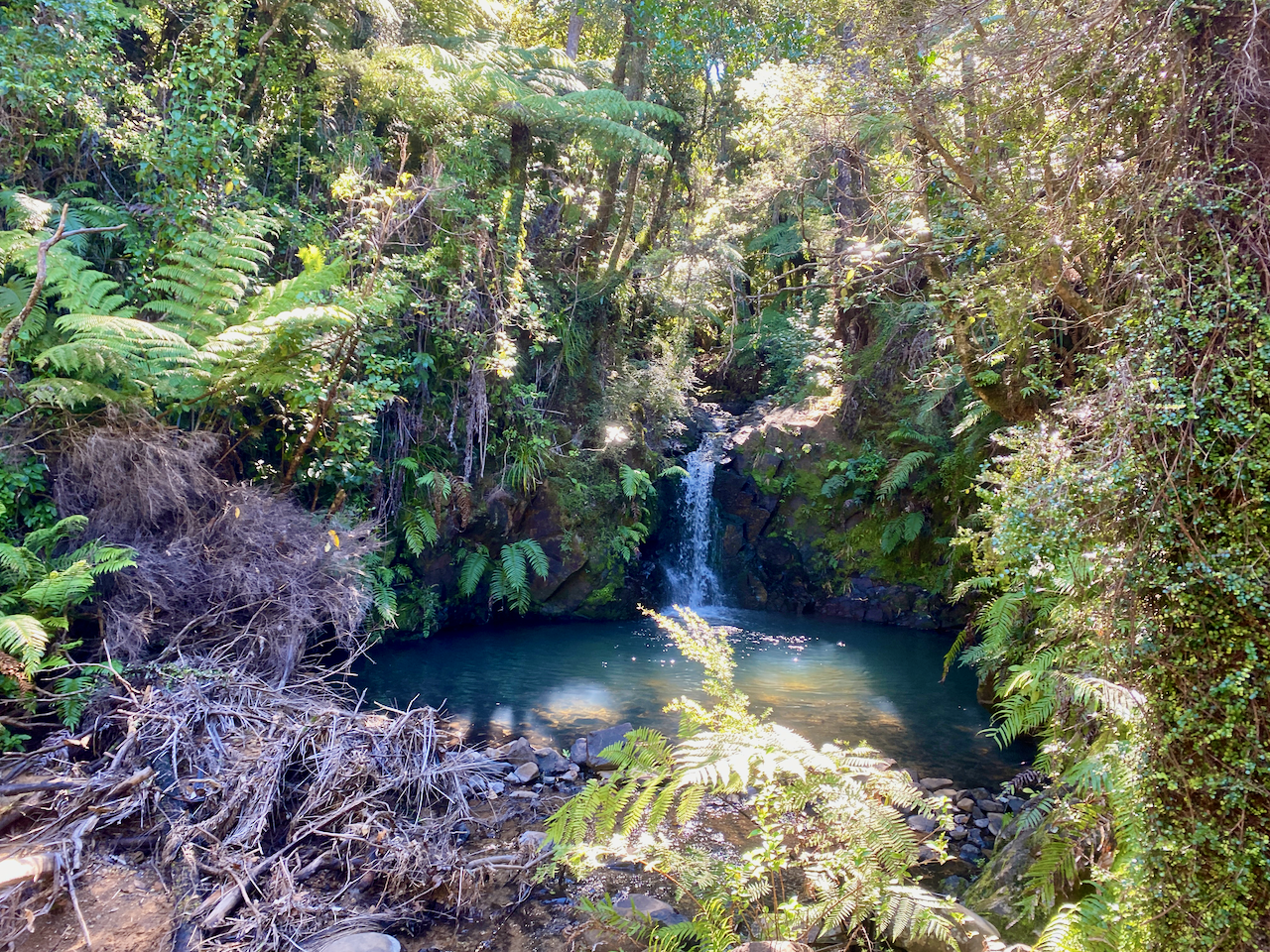
img_1432-2023-04-5-17-27.png

Then it was a fairly easy walk, crossing numerous streams via wooden bridges, before I came out near Whangaparapara, then a 7 minute walk to the Green Campsite, opposite the village. I set up my tent, then went for a short walk along the main road of Whangaparapara hoping to find a beer at the lodge, but it was closed. So, I just chilled, reading in the sun.
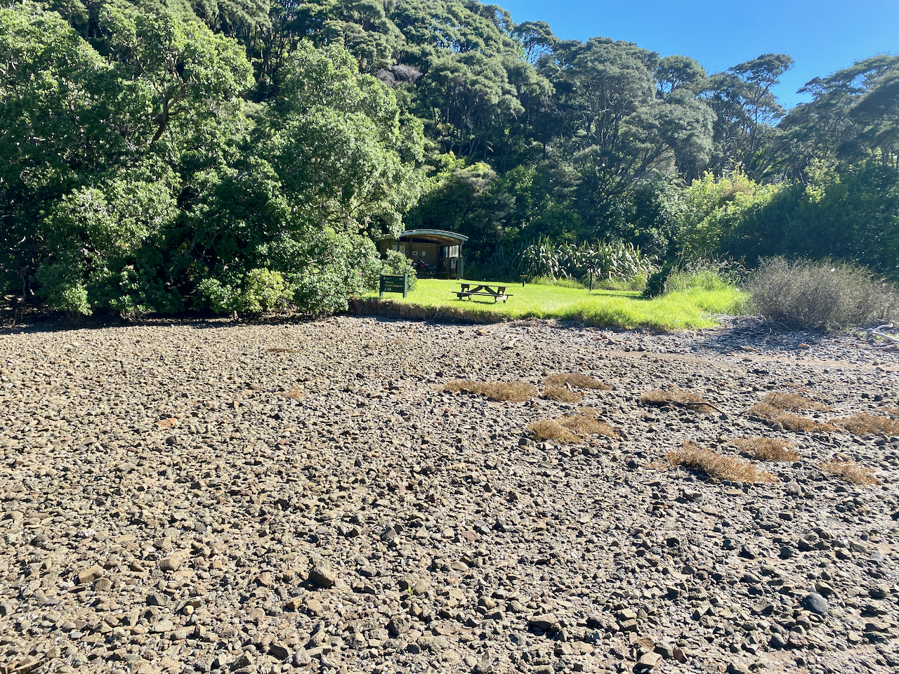
img_1437-2023-04-5-17-27.png

The next morning, I packed and had breakfast, before I met the trail transport guy who dropped me off at the airport for my 30 minute flight home.
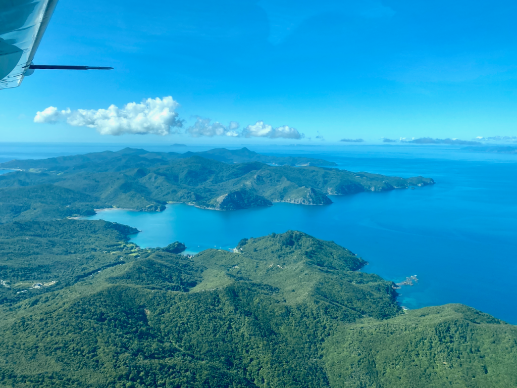
Overall

The hike was a fairly easy walk over three days, and would have made the perfect warmup hike had it not been for the weather events. I enjoyed my time there in relative quiet.

The Lone Trail Wanderer

Aitutaki Island, Cook Islands – Impressions

While staying on Rarotonga, fellow backpackers mentioned travelling to Aitutaki, the Cook Islands’ second most popular location. So, I booked a flight and went to see what it was all about.

img_9751-2022-06-27-13-52.png

The Island
Aitutaki is 45 minutes by small plane north of Rarotonga and is the main island of an Atol of 15 islands is a loose equilateral triangle, surrounding a much more defined lagoon. Indeed, many people fly to the island for a day trip, with an hour long tour of the island, and a half day lagoon tour.

aitutaki-map-small-large-2022-06-27-13-52.jpg

The atol is vastly quieter than Rarotonga, with fewer locals also. Some tourists have said the locals live more poorly here, I think they don’t need the lavish housing of Rarotonga or NZ. The community is more friendly, not that those on Rarotonga aren’t, the Aitutaki community is just more friendly. And, if you stay more than a couple of days, you quickly become a member of said community. Unlike Rarotonga, Aitutaki has no dogs, so the cats have taken over, making it their island.

Lagoon Tour
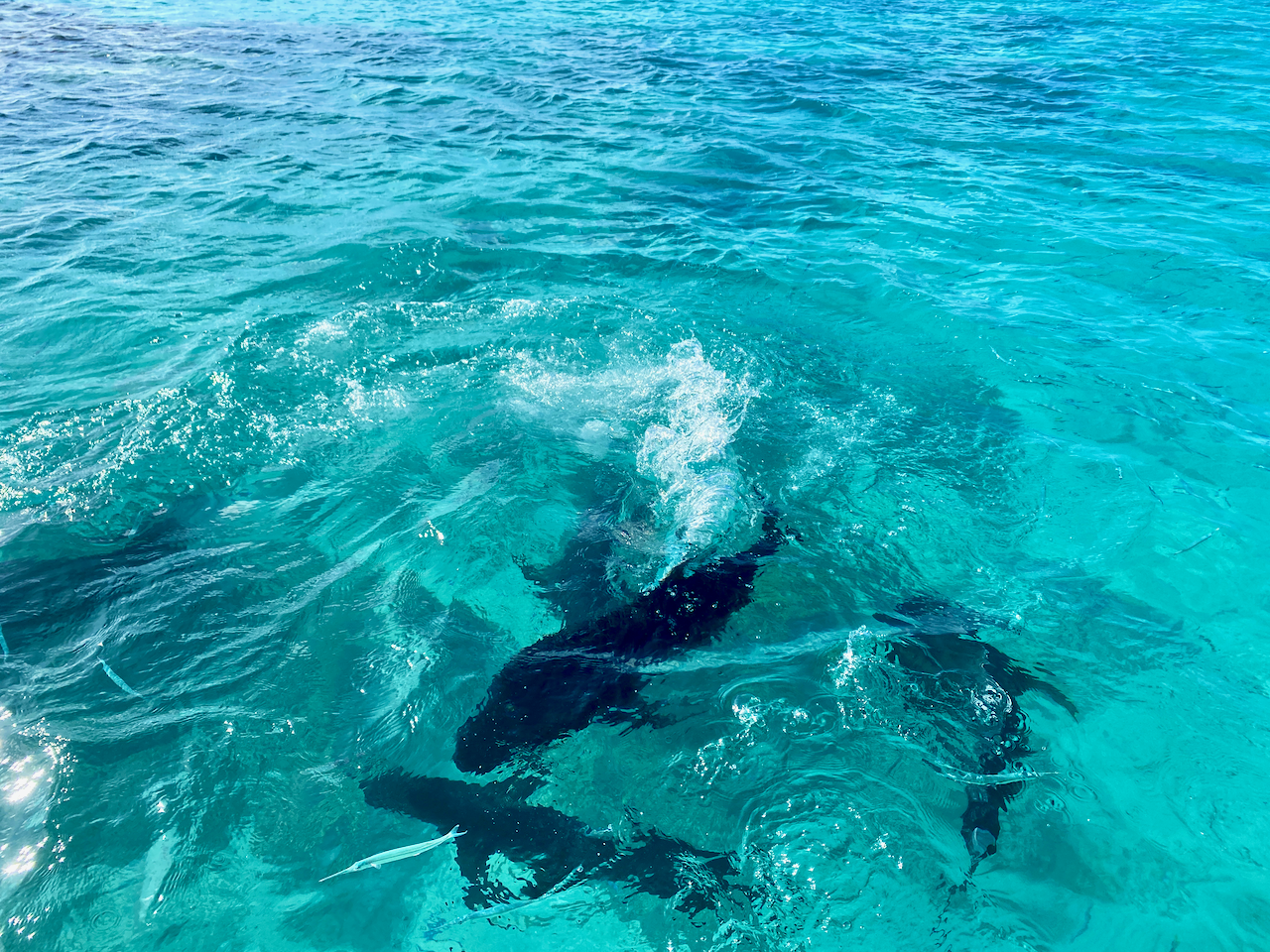
On my first full day on the island, I was collected in the morning and taken out on the water with 16 others for a full day tour. We headed towards Honeymoon Island, stopping to snorkel on the way. Unfortunately my old waterproof camera decided not to work, but it was an enjoyable swim with some giant blue trevally and a rusted shipwreck.

img_9731-2022-06-27-13-52.png

Honeymoon island is the classic tropical island, and would be empty except for the Kite Surfing school in it’s only hut.

img_9738-2022-06-27-13-52.png

We crossed to Maina island, where we stopped for lunch, a fantastic feed of fresh tuna steaks, chicken and local salads, including the classic curried papaya.

img_9745-2022-06-27-13-52.png

It was then back onto the boat to our second snorkelling spot. We passed a 2000 year old Brain Coral as we swam along a series of bouys eventually meeting the boat in a metre of water. The bar opened and we drank beer as we floated in the warm water while a giant white trevally swam around us. Our third stop had to be cut short as the wind was picking up and the water was getting a little dangerous, but we got a quick dip to see some blue and purple coral.

img_9748-2022-06-27-13-52.png

We then stopped off at Tekopua island, also known as One Foot Island, for a walk around and another beer. There’s a post office on this little island, so I handed over my passport and got a stamp. It was then back to Aitutaki and the end of an excellent day on the bay. That night, the guys in the hostel, kite-surfers who had been there for two months, had cooked curried fish and curried papaya. As I said, community.

img_9746-2022-06-27-13-52.png

Scooter Adventure
With a day and a half to spare on the island, I called the hostel owner looking for a scooter and he brought me his personal one on loan. Unlike Rarotonga, you don’t need a licence to ride on Aitutaki, this gave me free reign of the island and I took full advantage.

img_9761-2022-06-27-13-52.png

I found some prime snorkelling sites, and got in on a couple, although it was murky in both.

I found some good cafes, the Koru Cafe at the end of the Airport Runway, and the Avatea Cafe at the other end of the Island, serving amazing fish tacos. I found my way to a Marine Research facility where they were breeding clams, both the small local ones and the giant Australian ones for repopulating the lagoon.

img_9773-2022-06-27-13-52.png

With the aide of the scooter, I climbed the two higher ‘peaks’ on the island, barely over 100m, but still providing excellent views. This is from Piraki…

img_9784-2022-06-27-13-52.png

… and the tallest at 124m, Maungapu.

img_9787-2022-06-27-13-52.png

Then as darkness fell, one of hostel mates snuck us into a local resort where some of his friends were performing after the local feast. It was nice to see the traditional dancing and music for the first time.

img_9792-2022-06-27-13-52.png

Impressions
While I was only on the island three nights, I felt that was about enough to see what the island had to offer. I liked the quietness away from the crowds in Rarotonga, but in turn, it was a little too quiet for a tourist. Still, it felt like the real Cook Islands and not the tourist centre that is the main island.

img_9777-2022-06-27-13-52.png

Until next time,
The World Wanderer.

Rarotonga Island, Cook Islands – Impressions

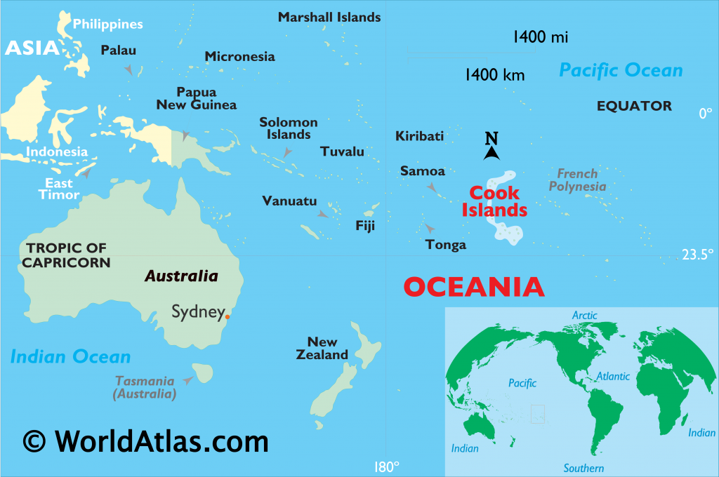
Three and a half hours by plane north east of New Zealand is Rarotonga, the largest and capital island of the Cook Islands.

img_9608-2022-06-22-10-14.png

As COVID lockdowns ease across New Zealand, I skipped out on winter for a bit and shot off to this tropical paradise. Here are some of my explorations during my time there.

where-are-the-cook-islands-located_2899-1-1024x680-2022-06-22-10-14.png

The Island
Rarotonga is surrounded by a reef where waves crash sometimes a hundred or more metres out. The shallow lagoon it provides makes plentiful snorkelling available right from the beach, assuming clear waters on windless days. The island sits atop a 3000m volcano with 600m sticking out of the water. Thankfully, Rarotonga has been dormant for millions of years.

rarotonga-island-map-2022-06-22-10-14.jpg

The inner parts of the island are hilly, with many climbable albeit forest covered peaks. On the south east is the largest lagoon with four explorable small islands. As a tropical island, there are huge amounts of sun, sand, palm trees, coconuts and, of course, mosquitoes.

img_9609-2022-06-22-10-14.png

A road runs around the coast and is a constant buzz of motorcycles, scooters and small vehicles. Two buses run in opposite directions on an almost hourly basis, circling in about 50-75 minutes depending on number of stops. Bussing is affordable enough that you don’t have to go through the rigmarole of sitting your scooter license and its associated costs. Much of the island is on ‘Island Time’, though, so the buses don’t operate on Sundays, and businesses tend to close early.

img_9655-2022-06-22-10-14.png

Rarotonga is a dog island, with dogs everywhere. While most run loose, they are collared but aren’t wild, having their own territories around the Island. They tend to get excited when you walk along the beach, but ignore them and they lose interest quickly enough.

Round the Island Walk
With no buses running Sundays, what better day to walk the entire ring road of the Island? At about 32km, it’s a fair walk in the winter tropical heat, thankfully at around 27-28ºC with only 70% humidity. Still warm, but not hideous.

img_9618-2022-06-22-10-14.png

Thankfully in many places there is an offshore wind, and the shore is fairly close to the road. Also, thankfully, there’s a store at least every kilometre selling all manner of refreshments.

The walk took me about 6 hours with most being flat. My problem with flat walks, is that I tend to walk too fast, sustaining around 5.5km an hour with few breaks. This caused my Tibialis Anterior muscles – the front muscles below the knee – to be in pain for the next three days.

The island has plenty to see. The south has the best views out to the ocean, while the south east, around the second largest town, Muri, has the best lagoon views and its four smaller islands. The north is the site of the main township, Avarua and the North west is the airport, where tourists tend to hover waiting to watch planes fly over. The island’s peaks can be seen from all sides, although I felt the best views are the north and the east.

img_9654-2022-06-22-10-14.png

Raumaru Walk
A couple of days after my Island Circuit walk, I decided to climb one of the hills near my hostel, on the island’s western side. The start of the walk is near where I was staying, so together with one of the girls from the hostel, I headed out in the heat of the morning.

img_9672-2022-06-22-10-14.png

We cut along a road to the inland circular road and climbed an easy dirt road to the trailhead. From here we followed a dirt track skimming under branches. It wasn’t a hard walk, more of a steady gentle climb. The main issue was the heat with sweat pouring off us for much of it. It had rained overnight, and showered twice during the walk making the path slippery even in my hiking boots.

img_9673-2022-06-22-10-14.png

About a kilometre and a half into the climb, the trail came to a rock scramble, with a knotted rope and climbing struts hammered into the rock wall. I got a few metres up, and with a good ten more to go, I decided against proceeding. I could have made it, but was concerned about coming down on the slippery rock, and my companion was adamant she didn’t wish to climb. Taking advantage of what views we did have, we headed back down.

img_9679-2022-06-22-10-14.png

Captain Tama’s Lagoon Cruise
There are many cruises in the Lagoon out from Muri, I chose Captain Tama’s as they seemed very popular. And, indeed, on the day we had four boats and about 80 people, not including the ‘captains’.

img_9689-2022-06-22-10-14.png

The weather, however, was not the greatest, and we were told the snorkelling might not be the best due to the murky waters, but we were heading out to see what was possible.

img_9690-2022-06-22-10-14.png

We got out near the edge of the lagoon, but found it indeed too murky and rough to snorkel. Annoying, as this was why I came, but it is what it is. We headed back to one of the islands for lunch, a show and a bit of a swim in the shallow but still murky waters. Then it was across the bay and back to the main island and home.

img_9693-2022-06-22-10-14.png

Cross Island Walk
While the Cross Island walk can be done without a guide, I chose to go with one to hear stories of the island and its local flora and fauna. Pa was the guide I wanted to walk with, a local hero, but it wasn’t to be.

img_9700-2022-06-22-10-14.png

Pa had been crossing the island on tours barefoot for 35 years, doing more than 5000 times. However, when COVID hit, and at the ripe old age of 70, he retired, handing the reins to his niece’s husband. He was awarded the above monument for his efforts.

img_9703-2022-06-22-10-14.png

The walk was still good, and I learned a lot following Bruce, with the walk being fairly easy and the partial climb up The Needle on ropes and chains fun and the views across the island great.

One other in our small group struggled due to fitness levels, which slowed the walk, but as it was only a half day walk anyway, there was plenty of time.

img_9716-2022-06-22-10-14.png

We ended at the Papua Waterfall with lunch provided before being dropped back at the hostel.

img_9719-2022-06-22-10-14.png

Markets
There are two main markets on the island, The Punanga Nut day markets, every morning but Sunday in Avarua, and the Muri Night Markets, 3 nights a week. Both offer different experiences and were worth the visit. The Punanga Day Markets are the classic markets, selling clothes, food, drinks, and on Saturday mornings some of the island’s best selections of fruit, vegetables and local cooking. While it’s quiet most of the week, Saturday morning can get busy with tourists.

img_9696-2022-06-22-10-14.png

The Muri Night Markets is more of an outdoor food court surrounded by food shacks. While there was some local food types, there were many typical foods, such as waffles or pizza on offer. The atmosphere, however, was still great.

img_9686-2022-06-22-10-14.png

Snorkelling
As the island is surrounded by a shallow lagoon, if the weather is right, there are many good places to snorkel. I had several occasions to to get in the water, even hiring fins to make getting around a little easier.

img_9681-2022-06-22-10-14.png

I was able to spy many different varieties of fish during my sessions, some the length of my arm. I was even able to see several Moray Eels while swimming, usually just poking their heads from holes, but on one occasion, one at full swim.

p1000426-2022-06-22-10-14.png

I had brought my old waterproof camera, and used this until one day it just stopped working. After that, I had to do what I could without it.

img_9631-2022-06-22-10-14.png

Impressions
Overall, my time in Rarotonga was most enjoyable. A couple of weeks away from New Zealand’s winter on a tropical island. While it was more expensive than I was expecting but not surprising given COVID shut down the country for most of 2 years. I got to see many sights, both physically and culturally, and while the Cook Islands’ culture has its similarities in NZ’s, it was good to see the differences. A fun overall trip to what I am calling Little New Zealand.

img_9670-2022-06-22-10-14.png

Until Next Time

The World Wanderer

Rangitoto Motutapu Circuit – Auckland

About six hundred years ago, the volcanic cone that is Rangitoto Island erupted its way out of Auckland Harbour beside Motutapu Island. Rangitoto is the largest of the approximately 53 cones in the Auckland volcanic field, all of which are considered dormant.

I’ve not previously been to either island, and at NZ$39 return for the ferry, I decided to make the most of it and do an overnight hike. There’s no formal hike here though, only a number of day hikes on one or the other. So I made one starting and finishing at the Rangitoto Wharf and camping at Home Bay, the only public campsite on the far side of Motutapu Island.

Rangitoto Wharf to Home Bay Campsite – 12.3km – 4 hours

I booked the last ferry to the island for the day at 12:15 pm. The trip over was only 25 minutes, with a stop at Devonport. There were few people on the ferry, one other guy and his son who would be staying at Home Bay, and a day walker. The Auckland weather was sunny and warm, and there was a slight breeze on the top of the ferry as we crossed although clouds hung across both islands, stretching off into the distance.

On arrival, I marched along the wharf and through the waharoa.

Rangitoto Island has the largest forest of Pohutikawa trees in the world, although large portions of the island are covered in jagged volcanic rock. A wide path had been cleared and flattened in many places for the numerous tourists who climb the peak.

After a while, the clouds moved on leaving a hot day for the rocky climb cutting a fairly straight line up the side of the 260m cone. About 15 minutes from the summit, I came to a small camping area with a trail leading off on the side track to the lava caves.

As I had no intention of returning this way, I cut off along the side track, finding some rocky paths that led back down the slope a little before coming to the first of two main lava tubes. At the first, there were two women and their young children, so I left them to it and continued to the second lava tube. This tunnel was about 30 metres long with a nice spot in the middle with a ceiling gap. At the end I had to stoop down to get through before following a trail back to the start of the tube where I’d left my pack.

The kids were just leaving the other tube when I got back to it, but the holes were only small. I walked the 15 minutes back to the main trail and climbed to the summit where there was a large viewing platform beside an old WWII bunker.

After my brief stay at the summit, I followed a trail around the side of the cone and down an overgrown path to the summit road.

This summit road cut through trees and rock fields all the way to the causeway, which was built to connect the islands during WWII. On the road near the causeway were several baches (beach houses), remnants of the 140 built in the 1920s and 1930s before they were banned in 1937.

I stopped for a rest and at the entrance to the island.

After my break, I cut along a path although the two inch grass made it somewhat hard to walk through. The two islands are like polar opposites, and could be described as Good and Evil, or Heaven and Hell. Motutapu has rolling hills, and lots of open grassy fields, while Rangitoto is harsh, with its volcanic rocks and good covering of trees and plants.

I followed the trail across the island, with good views of the harbour, islands and the Auckland Coast until Home Bay came into view.

I climbed down the hill to the campsite and found a spot to pitch my tent. The Home Bay Campsite has 142 non-powered tent sites and during my stay there was only two tents, mine and the man I’d met on the ferry on the way over with his son.

I hung out on a seat near my tent reading until the sun went down in pinks across the sky.

Home Bay Campsite to Rangitoto Wharf – 13.5km – 5 hours

There was a fine layer of dew on everything when I woke, but instead of the forecasted cloudy day, it was full on sun.

I decided I wanted to make the 2:30pm ferry, and arranged my pickup at the other end. This gave me some time to check out other parts of Motutapu Island. I headed north up the hill and along the Rotary Centennial Walkway.

The walkway came to the junction of several roads and further up a brief hill climb to a set of gun emplacements installed during WWII.

Further down the hill was the main gun emplacement area with several underground tunnels, rooms, and large emplacements along with signs explaining various parts.

After some exploring, and checking out another set of tunnels near the junction, I followed a road along to an education camp. I was supposed to stop off at reception and announce my arrival, no exceptions, but I passed through and up the hill on the other side without talking to anyone.

I crossed Administration Bay briefly before heading back up the grassy hills and around the North Western edge of the island back to the causeway. I stopped briefly to talk with some Department of Conservation workers who were scouting for Kiwi, of which they had caught, scanned and released 23 today with a target of 50. I had no idea there were Kiwi on the island.

I stopped for a break at the causeway before beginning along the coastal trail back to Rangitoto Wharf.

At Islington Bay Wharf, I realised the coastal track would take me too long, and I would miss my ferry, so I cut back along the road, followed it up towards the summit and split off part way to race towards the Rangitoto wharf. The sun continued to beat down during the afternoon, and it was again roasting on the rocky Rangitoto. I arrived back at the wharf just prior to the ferry arriving, but was utterly drenched in sweat. As soon as I could I got into a large bathroom and changed into my dry clothes for the trip back.

Overall,
My Rangitoto Motutapu Island circuit was a success, there was plenty to see on both islands, and being a Monday, it was quiet. I enjoyed my time there.

Next, I will wait for an opening in the weather and will find another, hopefully longer, walk before winter pushes me into hibernation.

The Lone Trail Wanderer

Isle of Wight, England – Impressions

After lockdown eased and on the first British long weekend, I couldn’t help getting out of London. I’d put this trip off after booking it a year ago, and I’m now looking forward to exploring the island a little.

isleofwightmap-2021-06-1-20-28.jpg

The Isle of Wight is in the English Channel off England’s south coast, near Portsmouth, Southhampton and Bournemouth. The island is known for being Queen Victoria’s favourite summer holiday location and a hotbed of dinosaur fossils and a pivotal defence for the region against the Spanish Armada and in the Battle of Britain.

img_7563-2021-06-1-20-28.jpeg

My trip to the island was long, with an hour-long train ride across London, a 2-hour train to Portsmouth and a 25-minute catamaran ferry crossing to the township of Ryde.

img_7499-2021-06-1-20-28.jpeg

If I’d done a little more research, I’d have noted one of the world’s last commercial hovercraft services still operates from Portsmouth to Ryde and would have booked that instead of the ferry.

img_7500-2021-06-1-20-28.jpeg

With several hours to kill before my accommodation opened in Shanklin, on the south side of the island, I hung out in Ryde for lunch and had a wander around. After many weeks of rain in the UK, the sun decided to make up for it all in one go, marking the arrival of summer. I ordered takeaway fish and chips and sat in a small park overlooking the channel while I ate. Of course, fish and chips are a staple in London, but fresh cooked on the seaside is just better.

img_7503-2021-06-1-20-28.jpeg

Due to track upgrades, the cross-island train was closed, so after lunch and a climb through Ryde’s commercial streets, I made my way to the bus station for the trip to Shanklin. I arrived almost an hour later, but still too early for my accommodation. I stopped off at the local information centre/cafe, grabbed a map and a cider, then I began looking at things to do for the weekend. After checking into my accommodation, I explored the township, finding a path down to the beachfront.

img_7505-2021-06-1-20-28.jpeg

While Ryde is a typical British seaside township, Shanklin is a typical beachside township with many hotels and restaurants on the shoreline. The Pirate Cove and Jurassic Bay Adventure Park spanned several blocks, with plentiful ice cream stalls dotted about. At the end of the bay is the Shanklin Chine, a small tourist gorge with woodland paths leading up the cliff to come out near my accommodation.

img_7508-2021-06-1-20-28.jpeg

The Chine is nicely set up with well-manicured paths, a waterfall and a heritage centre with historical displays. Later that evening, coloured lights came on in the gorge, giving it an almost magical feel that photos don’t quite do justice. Then, after a beachfront dinner, I headed back to my accommodation.

img_7514-2021-06-1-20-28.jpeg

The following morning over my Full English Breakfast, I had to decide what to do for the day. While one of the main attractions on the island is The Needles, a series of chalk stacks in the bay, they’re 2 hours away by bus on the far end of the island. So, I decided on the less travel option, to the township of New Port near the island’s centre, to check out Carisbrook Castle, the Newport Minister, a museum of island history and a Roman villa.

img_7539-2021-06-1-20-28.jpeg

Newport is an hour by bus, and the castle on the hill outside of town, a further 20-minute walk. When I arrived, I discovered they weren’t accepting walk-in visitors, so I booked a ticket online. With 90 minutes until I was allowed in, I walked to a local supermarket to get some lunch, then back up the hill to wait for my entrance time.

img_7525-2021-06-1-20-28.jpeg

Carisbrook Castle was built in the 12th century atop a hillside where several roman forts had once stood. It is most notable for being the prison of King Charles I before his execution for treason and then 250 years later, the home of Princess Beatrice, Queen Victoria’s daughter.

img_7542-2021-06-1-20-28.jpeg

On a more personal note, the major sporting venue in Dunedin, New Zealand, was named after this very castle. The castle was in better repair than many I’d seen in the UK over the past few years. After I toured the castle and the high keep on the hill above it, I made my way back into town.

img_7547-2021-06-1-20-28.jpeg

I contemplated taking the bus to the Needles, but it drove by before I could get to the bus stop, so decision made, I headed back into Newport. When I got to the Minister, I found it was closed, at 2 in the afternoon on the Sunday of a long weekend. Disappointing.

img_7554-2021-06-1-20-28.jpeg

I headed to the Roman Villa and found that closed too, and was equally bemused to see the museum also closed. I’m not sure if this was due to the COVID lockdown or if the smaller town didn’t merit having these items open on a long weekend? So, I caught the bus back to the beach. But instead of stopping at Shanklin, I continued on to Sandown at the other end of the bay. With tourists enjoying the sun and beach, I walked around towards the white cliffs.

img_7556-2021-06-1-20-28.jpeg

When the path ran out, I walked back towards Shanklin, past the Sandown pier. The beachfront goes all the way to Shanklin, so I decided to walk the 3 miles back. A peaceful and enjoyable walk. In Shanklin, I stopped for dinner and a couple of ciders before heading back to my accommodation for the night.

img_7557-2021-06-1-20-28.jpeg

The next morning after breakfast, I caught the bus back to Ryde with the intention of walk to a nearby winery. But during the bus ride, I discovered the short tour I wanted to take was also on hold due to COVID. So, with nothing else to do, I went to the waterfront for lunch and awaited my ferry back to the mainland. Thankfully, I was able to take an earlier crossing to Portsmouth and its Emirates Spinnaker tower before my 2 and a half hour train ride home.

img_7566-2021-06-1-20-28.jpeg

Overall Impressions
The Isle of Wight was a lovely weekend away from London, but many things were closed due to the timing. This made travel times on the island long and meant I couldn’t see everything I’d have liked to. Disappointing, but perhaps I’ll return again in the future with a vehicle to make getting around a little easier.

The World Wanderer

Arran Coastal Way, Scotland – Part 1

In late June 2019, I undertook a 6-day coastal hike around the Isle of Arran, my namesake island. This 65 mile / 105 km hike is a circuit of the island starting from the northernmost village and heading inland on several occasions. The weather was scheduled to be amazing with little rain.

scotland-2019-07-8-14-01.jpg

Day 1 – Lochranza to Imachar – 11 mi / 18.2 km

The first day of the walk is not scheduled to be a long one, but there is s sidewalk added for a bit of variety. Lochranza is the northernmost village on the island and even has a ruined castle on the bay.

dscf9568-2019-07-8-14-01.jpg

I walked out of the hostel and along to the Sandwich Shack for breakfast and a coffee. Then I headed up the hill on a steep farmers driveway past the ruins of the island’s oldest house.

dscf9574-2019-07-8-14-01.jpg

While I was only 60 metres or so above sea level, the views were still enjoyable out across to the Mull of Kintyre, reminding me of the old song of the same name.

dscf9578-2019-07-8-14-01.jpg

I rounded the hill with the trail descending a little before it ran behind the long row of houses at Catacol. I climbed down to the road and onto the pebble beach where I picked my way along for the next 4.5km.

dscf9581-2019-07-8-14-01.jpg

About two-thirds of the way through the day is the side trail, which climbs up the hill to Coire Fhionn Lochan, a small lake nestled in the bowl beneath small peaks. The climb was pretty straightforward to 340m, and I passed several families on my way up. When I got to the small lake, I dropped my pack for a rest and chatted to some other climbers.

dscf9596-2019-07-8-14-01.jpg

The wind was blustery but not cold. I was told the lake can be a mirror but for the wind, a shame but a good view anyway. After my break, I climbed back down, passing a family that had still not made it to the top. The view back the other way was wonderful.

dscf9600-2019-07-8-14-01.jpg

When I got back to the road, I continued on along the beach. I arrived at Pirnmill with enough time for a light lunch at the restaurant before they closed until dinner. I hung out in the sunshine and topped up supplies at the shop next door before setting off again along the beach.

dscf9583-2019-07-8-14-01.jpg

For the next 3.5 km, I picked my way along the beach until I eventually arrived at where my map said was Imacher. But instead of what I thought might be a village, was absolutely nothing. The road went up over the hill, so I took a walk up it and found a small handful of houses, most of them abandoned and overgrown. But when I rounded the corner on one abandoned house, I ran into this male peacock showing his stuff.

dscf9620-2019-07-8-14-01.jpg


There was an ostentation of peacocks, with several males (peafowl), 3 females and some chicks
. After the show, I headed down to a wild camping spot I’d walked past, pitched my tent and settled in for the rest of the day.

dscf9623-2019-07-8-14-01.jpg


Day 2 – Inachar to Pien via Blackwaterfoot – 11 mi / 18 km

It had rained overnight but and I had no wild visitors overnight. I had a breakfast of oat biscuits before breaking camp. The sky was dark, and the wind gusty as I set out onto the road.

dscf9625-2019-07-8-14-01.jpg

Today, walking along the beach was not such an option. It would have been possible but I was racing to avoid the forecasted rain, so I took the quicker alternative along the road. Today is the only day forecast for rain, let’s hope the sun stays for the rest of the week. My first port of call is Cafe Thyme 5km along from my wild camp. The walk was fairly straightforward, and along the way, I even spied seals chilling on some rocks.

dscf9627-2019-07-8-14-01.jpg

When I arrived at the cafe, they were just opening. They did not serve breakfast, but the waitress organised some scrambled eggs for me anyway. We chatted about life in general and getting out of London, which she had done 10 months earlier. After coffee, I set off and noted a standing stone in a paddock. So, I crossed to get a better look.

dscf9636-2019-07-8-14-01.jpg

Two kilometres on and I came past Dunedin (the name of a house) to the Machrie Bay Golf Club tea rooms where I bought some water. Then another kilometre further on to car park for the Machrie Moors Standing Stones. I walked the mile to the moors and the several groups of standing stones there…

dscf9650-2019-07-8-14-01.jpg


…not to mention rock
circles.

dscf9644-2019-07-8-14-01.jpg

Then, as I made my way back to the road, it began to rain. A mile further along and I came to the Torr Righ Beag, a small wooded National Park. I walked around the outskirts looking back along the coast to where I had started the day (at the furthermost edge of the coast).

dscf9659-2019-07-8-14-01.jpg

I continued around the path to the coast and before heading down a steep trail to the beach. I walked past the King’s cave, which is caged off, and a pair of natural arches.

dscf9667-2019-07-8-14-01.jpg

I then set my sights on the Doon Fort, a rock formation where an iron aged fort had once stood.

dscf9673-2019-07-8-14-01.jpg

I walked around the back and up to the top, getting great views across the bay. After a look around I climbed down the Tor to a golf club where I walked to the beach and along to Blackwaterfoot. I found a bar to wait for the restaurant to open, allowing me to have cider and get my feet out of my sodden boots.

dscf9680-2019-07-8-14-01.jpg

After dinner a walked the 3 km along roads to the campground where I would encounter plentiful midges but a hot shower!

isleofarrancopy-2019-07-8-14-01.jpg

Next, days 3 and 4 of the Arran Coastal Way.

The Lone Trail Wanderer

Langkawi Island, Malaysia – Impressions

Langkawi the Jewel of Kedah, as it’s officially known, is Malaysia’s answer to Bali, albeit a much quieter version. Tourists come to the island because of the amazing beaches and the lack of crowds, giving it a more secluded feel than nearby Penang.

wpid-malaysia-langkawi-2014-12-12-17-00.jpg

Langkawi, meaning Island of the Reddish-Brown Eagle, was originally believed to be cursed. A beautiful young woman named Mahsuri was accused of adultery and executed on the island. With her dying breath she brought down a curse of bad luck for seven generations. Her tomb is a popular tourist location, although a village has been built around it and fees charged to enter.

wpid-dscf5960-2014-12-12-17-00.jpg

Palau Langkawi is slightly larger than Penang Island and like its southern sister, the best way to get around it is via scooter. Yay! While more expensive to hire than in Penang they’re still cheap at only NZ$12 per day. A tank of gas will cost just over NZ$2 and will get close to two laps around the entire island.

Beaches
Surrounded with beaches of white sand, Langkawi is definitely a picturesque paradise. Most people stay in the touristy Cenang area, with Pantai Cenang perhaps the beach most similar to Kuta Beach in Bali.

wpid-dscf5975-2014-12-12-17-00.jpg

And within walking distance is another popular beach, Pantai Tangah.

wpid-dscf5963-2014-12-12-17-00.jpg

If you have transport, there are more beaches within reach. Only 30 minutes north is the empty Pantai Kok.

wpid-dscf5908-2014-12-12-17-00.jpg

And another 30 minutes through the mountains to the northern side of the island there’s such beauties as Pantai Tanjung Rhu, right near Scarborough Fish n Chips, the best on the island.

wpid-dscf5948-2014-12-12-17-00.jpg

Waterfalls
Scattered around the island are several waterfalls. While they aren’t spectacularly tall or wide, they’re enjoyed by locals and visitors alike as swimming spots. On our scooters, we stopped by at 7 Wells waterfall…

wpid-dscf5938-2014-12-12-17-00.jpg

… and Durian Perangai Falls.

wpid-dscf5953-2014-12-12-17-00.jpg

Oriental Village

Located at the northern end of Pantai Kok, the oriental village is an open air complex surrounding a small lake. It’s an entertainment zone with many different things to do. For the kids, there’s the water balls, round or tubular…

wpid-dscf5915-2014-12-12-17-00.jpg

The village, while not very oriental looking, has elephant rides, eagle viewing, tiger watching and snake cuddling…

wpid-dscf5923-2014-12-12-17-00.jpg

It’s also home to the Skycab, the cable car that takes people to the top of nearby mountains…

wpid-dscf5914-2014-12-12-17-00.jpg

The panoramic views over most of the island are spectacular. While the ascent can be a little breathtaking, the journey is worth it for the views alone.

wpid-dscf5934-2014-12-12-17-00.jpg

Overall, Langkawi is a perfect place to take a break away from the world. With only 65,000 residents, it’s a very peaceful place with a handful of tourist options and many beaches to relax at.

Next we head north for the craziness of Christmas and New Years in Thailand.

The Trail Wanderers

Bali, Indonesia – Adventures

When you have three weeks in Bali you can’t just languish around the pool or at the beach the entire time. Actually, I guess you probably could, but I can’t. There’s just too many other things to see around the island…

Mt Batur

In Bali’s highlands there are several volcanos. Mt Batur is the most active, having erupted 20 times in the last 200 years.

wpid-dscf4918-2014-10-22-14-26.jpg

It’s a fairly small volcano that lies in the caldera of a once more mighty volcano, one that stood over twice Mt Batur’s current height. And on the south-eastern side of the caldera is Danau Batur, the largest crater lake in Bali.

wpid-dscf4916-2014-10-22-14-26.jpg

Coffee Tour

Indonesia is the fourth largest producer of coffee in the world and Bali’s highlands has its share of plantations. During the tour we discovered the many tastes of Bali’s coffees and teas, all of which were delicious, although some were overly sweet.

wpid-dscf4914-2014-10-22-14-26.jpg

Indonesia has a most unusual coffee called Kopi Luwak. It’s the most expensive coffee in the world because the beans are fed to the Asian Palm Civet, collected from its droppings, cleaned and roasted. Enzymes in the animal’s gut react with the beans to give them a rich and smooth flavour.

wpid-dscf4911-2014-10-22-14-26.jpg

There are growing concerns about the ‘farming’ of Kopi Luwak as the animals are held in battery cages and forced to eat the beans. The two animals at the plantation weren’t so cramped in their larger cages although seemed quite disinterested in our being there.

Highland Cycle Tour

A gentle way to see the highlands of Bali is via a bicycle tour. A large group of us ventured out one morning on a tour which started in the highlands and worked its way down quiet roads. This provided plentiful views of rural Bali including many rice paddies.

wpid-dscf4943-2014-10-22-14-26.jpg

We were introduced to many of the local traditions as we rode through several villages and past many small temples, including this temple to the Destroyer, surrounded by palm trees.

wpid-dscf4939-2014-10-22-14-26.jpg

Midget Fun Boxing

Beyond all Bali’s standard evening entertainments of fine dining, drinking, beach-side bands and dancing there’s Midget Fun Boxing. While this might seem like a strange and violent form of entertainment, it’s actually quite fun. Reminiscent of the classic days of WWF wrestling, it’s more of a comedy fare with the midgets wearing gloves that cover more than half of their arms. Midway through a bout the competitors stop to dance to whatever music comes on, head banging to AC/DC or bopping to other types of music. But should one opponent take his attention from the other he gets belted. With a low centre of gravity the midgets are easily knocked over and then it’s a free for all. Here, after knocking his opponent over, this boxer jumped on top and pretended to hump him.

wpid-img_1879-2014-10-22-14-26.jpg

Between bouts female midgets dance around on stage with some of the younger members of the audience. Cheeky boxers would stuff a boxing glove down their oversized shorts and chase the dancing-girls. Overall it was a fun night with much hilarity. No midgets were hurt in the process, although that can’t be said for this audience member during post event photos.

wpid-img_1923-2014-10-22-14-26.jpg

Manta Ray Safari

On a hot and humid island in the tropics there’s usually plenty to do out on the water. I took the opportunity to go out by boat and snorkel with Manta Rays. Four metres from wingtip to wingtip these placid creatures fly through water without a care. Unperturbed by us being there they would come up close to have a good look before swimming on.

wpid-p1000289-2014-10-22-14-26.jpg

Bali also has some very diverse coral reefs, with 500 species of coral recorded around the one island. This is more than the entire Caribbean Sea. We snorkelled around the reefs in the warm waters for much of the day.

wpid-p1000309-2014-10-22-14-26.jpg

Next, we hired some scooters and checked out some temples, but that for another day…

The Lone Trail Wanderer

Bali, Indonesia – Impressions

After seven months working and biding my time in England, I’m back on the road again! This time doing the rounds of Asia.

While you’re never truly alone when travelling, this time I’m being accompanied by my brother for the first 6 months.

To get us started we’re heading to Bali for three weeks to attend a family reunion and to get to know the popular Indonesian tourist mecca.

Indonesia

Paradise in Indonesia

With just over 4 million people, Bali began to gain popularity as a tourist destination in the 1960’s when it was ‘discovered’ by a small group of Australian surfers. Only 3 hours flight from Perth, Bali’s popularity erupted and tourists swept into the island. This influx of foreign money greatly lifted the standard of living on the island.

DSCF4939

During the early 2000s two religious-based terror attacks in tourist areas set the industry back. But in the years that followed the island’s reputation bounced back. Australians make up a large portion of the foreign tourists on the island often giving the impression that there are more Aussies than Balinese. China has the second highest tourist count here.

A Day at the Beach

There are several main tourist areas in Bali, one is Kuta on the south-western coast surrounded by the townships of Legian and Seminyak. With beaches of golden sand, a day at the beach in Bali means hiring deck chairs and relaxing in the heat under a sun umbrella.

wpid-dscf5214-2014-10-22-14-22.jpg

With the deck chairs tended by beach bars there’s easy access to drinks, food, the warm ocean and plentiful bronzed bodies ripe for people watching. But be warned, while you’re relaxing if you should pay even the slightest attention to hawkers on the beach, they’ll appear in swarms trying to selling sunglasses, watches, sarongs, toys, hats, clothes or wanting to massage, paint nails, groom, plait hair and the like. Learn to ignore them and they’ll move on to the next target leaving you to relax in relative peace.

wpid-dscf5186-2014-10-22-14-22.jpg

As the sun sets, deck chairs are replaced with bean bags and the bars begin serving all manner of dinner and cocktails. The hawkers are still active, trying to sell glowing or sparkling light toys, while mosquitos come out dine.

Massages

Walking around the bustling tourist areas there are plentiful spas and massage houses offering all kinds beauty therapies and massages. With the prices averaging between 60,000 and 100,000 rupiah per hour (AU$6 – 10) getting one every 2nd day is easy. And yes, that was AU$6 – 10! Because of the sheer number of massage houses and fierce competition, groups of young women try to coax wandering tourists into the spas with calls of ‘massards’ and the waving of price lists.

wpid-dscf5203-2014-10-22-14-22.jpg

While I’m sure ‘Happy Endings’ can be found if that’s your thing, sticking to reputable outlets and the service will be professional.

Dental Work
Bali has many specialist dental surgeries at a fraction of the price of Australia or New Zealand, so it’s not uncommon to come here for a holiday and get some work done. The dentists are highly qualified and provide top quality services. Thankfully I needed nothing more that a checkup and clean.

Fine Dining
Bali has many restaurants offering all manner of food. This is probably the downside of holidaying on this Indonesian paradise, too much choice. While most restaurants serve traditional local foods such as Nasi Goreng, most serve Western foods too. There are restaurants that specialise in French, Italian, Spanish, Russian and American foods, not to mention Thai, Malaysian, Indian, Vietnamese, Chinese and Japanese. I particularly enjoyed the Japanese Jazz restaurant for both the food and the live band.

wpid-dscf5212-2014-10-22-14-22.jpg

Prices are close to Australian prices and can add up if eating out every night. However, it’s not difficult to locate local eateries with plentiful great food at cheap prices.

wpid-img_1978-2014-10-22-14-22.jpg

A popular restaurant, Warung Murah, literally meaning ‘Cheap Restaurant’ in the Kuta area provides excellent food at a good price. If you go over the top and get a large plate, you could pay somewhere close to AU$6 for your meal. Be warned! There are also plentiful local street venders carrying their hot food around on the back of their scooters.

Drinking
Indonesia has an international quality beer named Bintang which is very popular among tourists, especially when served in the Bintang Tower.

wpid-10698560_10205325302638507_6144956122416888335_n-2014-10-22-14-22.jpg

Balinese wine, in many tourist’s opinions however, isn’t up to international standards and with foreign wines being expensive, most stick with the beer. There are plentiful spirits, but only drink the known labelled brands, as the cheaper local brands may include an ethanol blend that has been known to cause death when consumed.

Next, I take a look at some of my adventures on the island paradise of Bali.

The Lone Trail Wanderer

Mapping My Journey So Far

Sixteen months on the road is a long time. During that time I covered quite a distance and did many things. While I’ve been ‘resting’ in the United Kingdom, I’ve put together a step by step rundown of my trip including maps.

South East Australia

wpid-seaustralia-2014-05-8-14-57.jpg

In a van called the Pointy Brick I…

Antarctica, Chile and Argentina

wpid-southernsouthamerica-2014-05-8-14-57.jpg

From Brisbane, I flew to Auckland and spent 3 weeks with family before flying to South America where I…

Brazil, Bolivia, Peru and Ecuador

wpid-northernsouthamerica-2014-05-8-14-57.jpg

From Buenos Aires I…

Colombia, Central America and Mexico

wpid-centralamerica-2014-05-8-14-57.jpg

From Ecuador I…

The Full Map. May take some time to load.

wpid-ajtravelmap3-2014-05-8-14-57.jpg

The World Wanderer