
At the beginning of Spring, I set out on a road trip around New Zealand’s North Island to see some friends and walk a couple of hikes. After several days I found my way to Masterton preparing to head into the Tararua Ranges.
As I didn’t wish to spend the entire walk in the forest, I planned a walk across the open ridges, staying in huts as I went. The weather can change quickly in the ranges, and being a cautious walker I was prepared to change plans if needed, and indeed, I did. So, this hike is different to my original plan, which is described later.
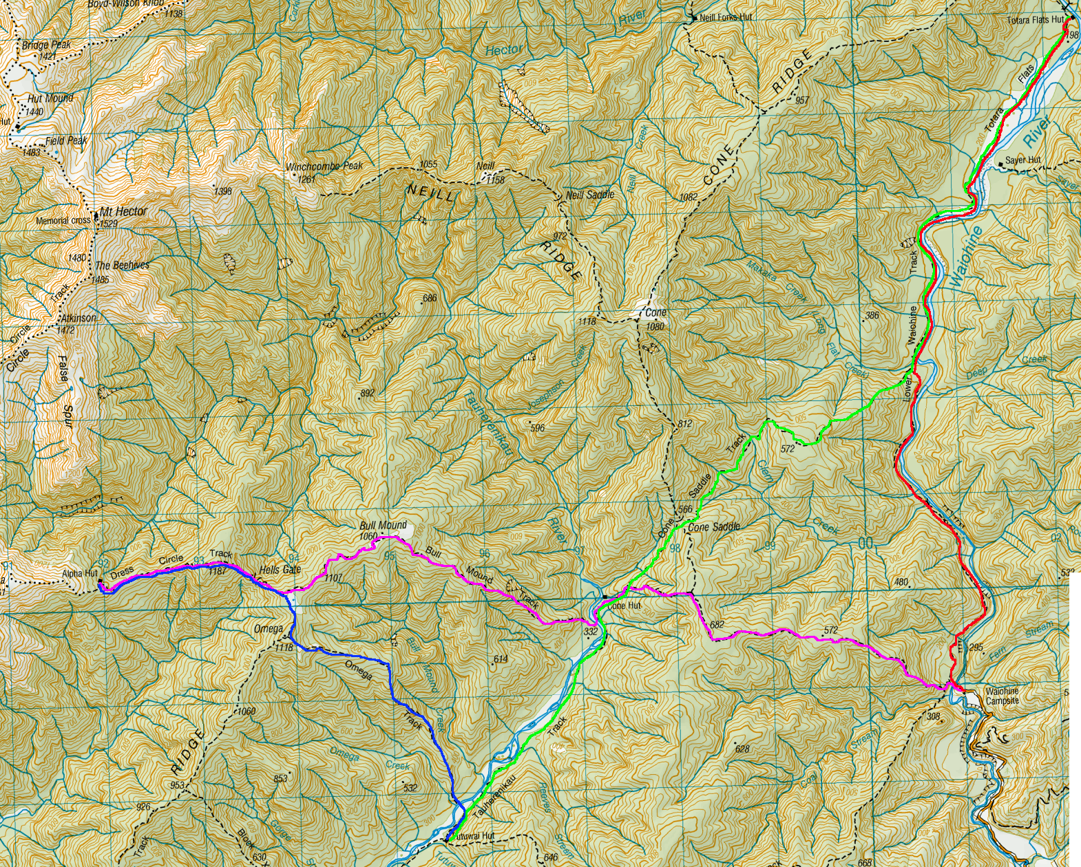
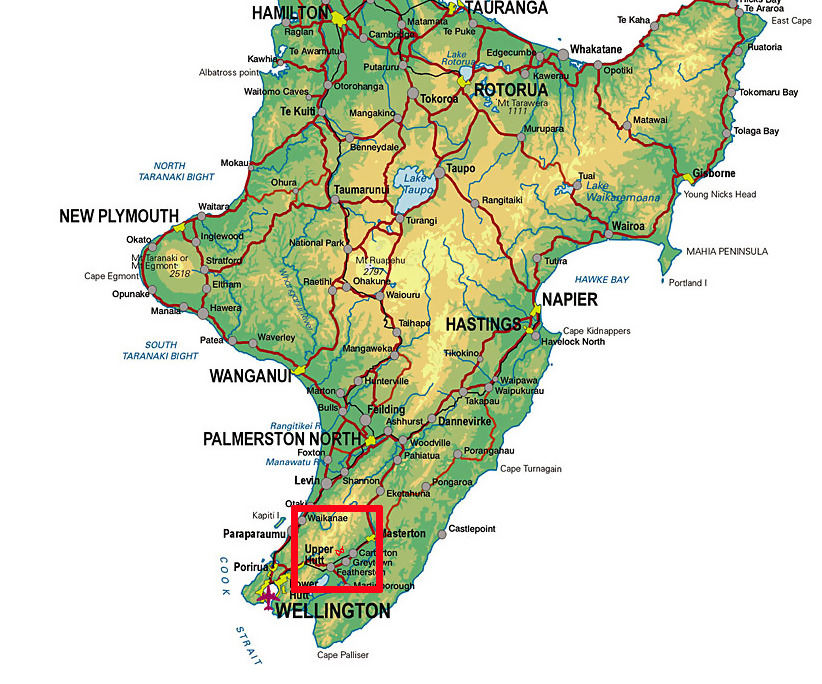
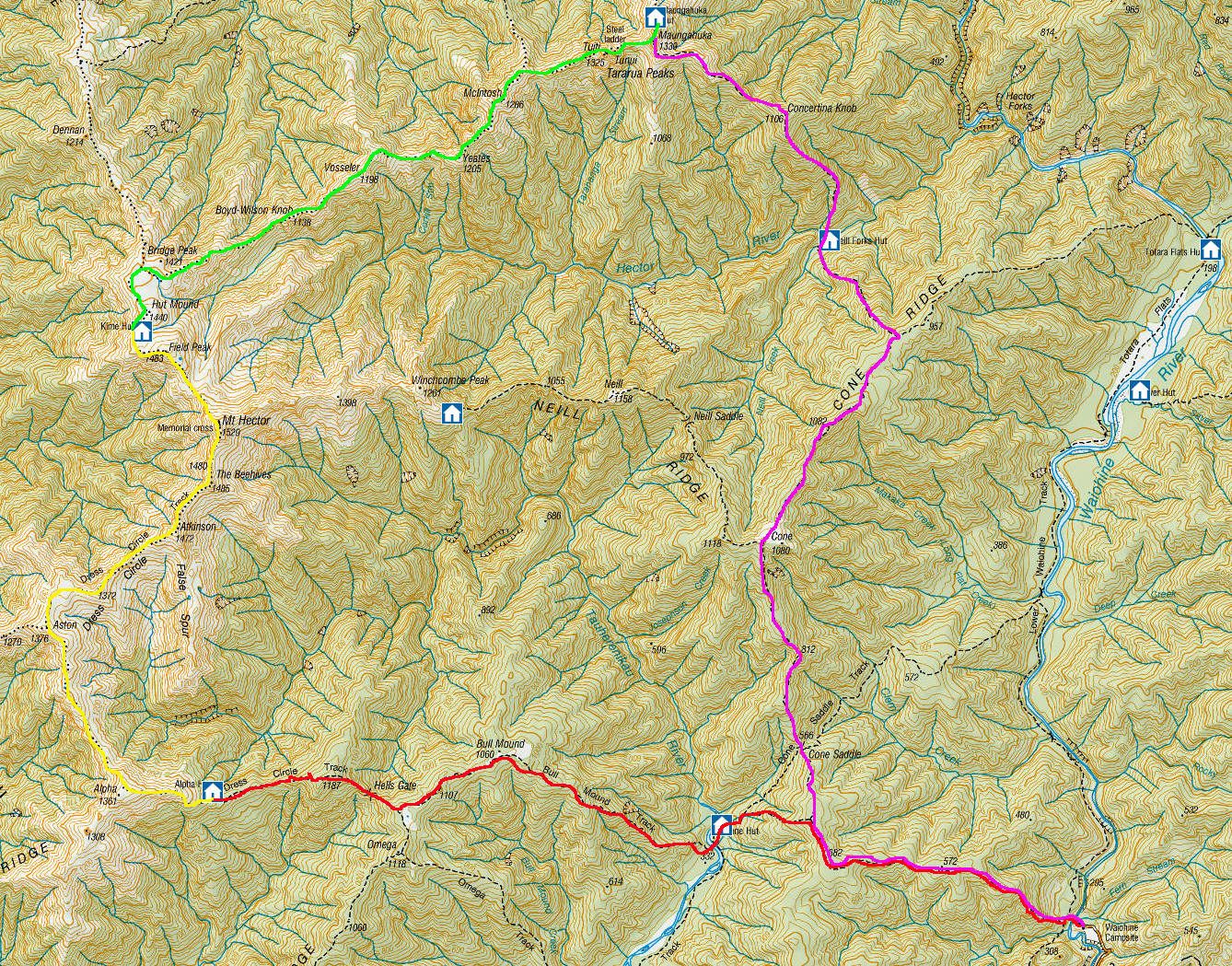
Day 1 – Waiohine Gorge Carpark to Alpha Hut
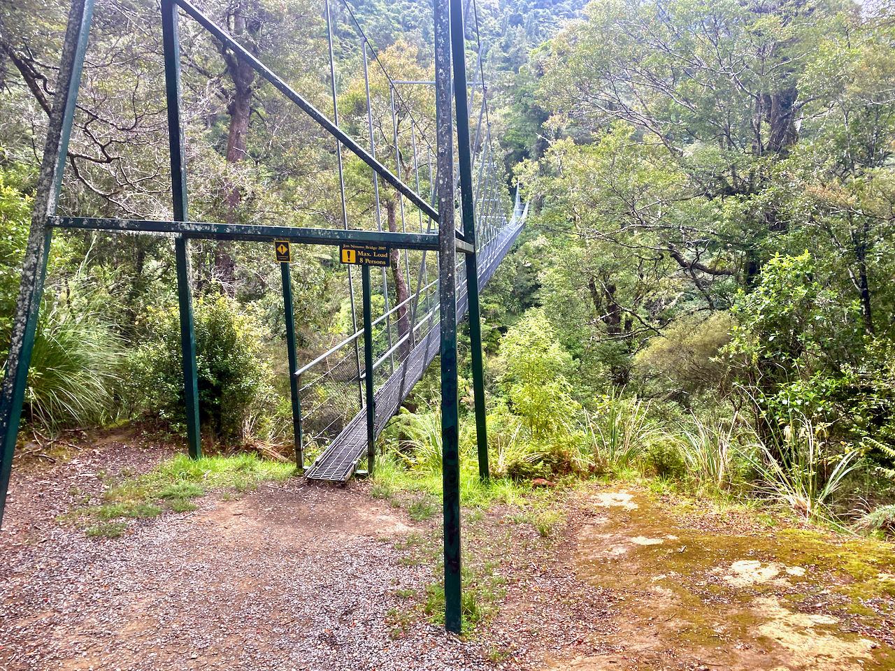
I set out from my accommodation in Masterton and drove into the Tararua ranges on a dirt road, parking at the Waiohine Gorge Carpark. I then headed out from the carpark laden with pack and across the swing bridge over the Waiohine River.
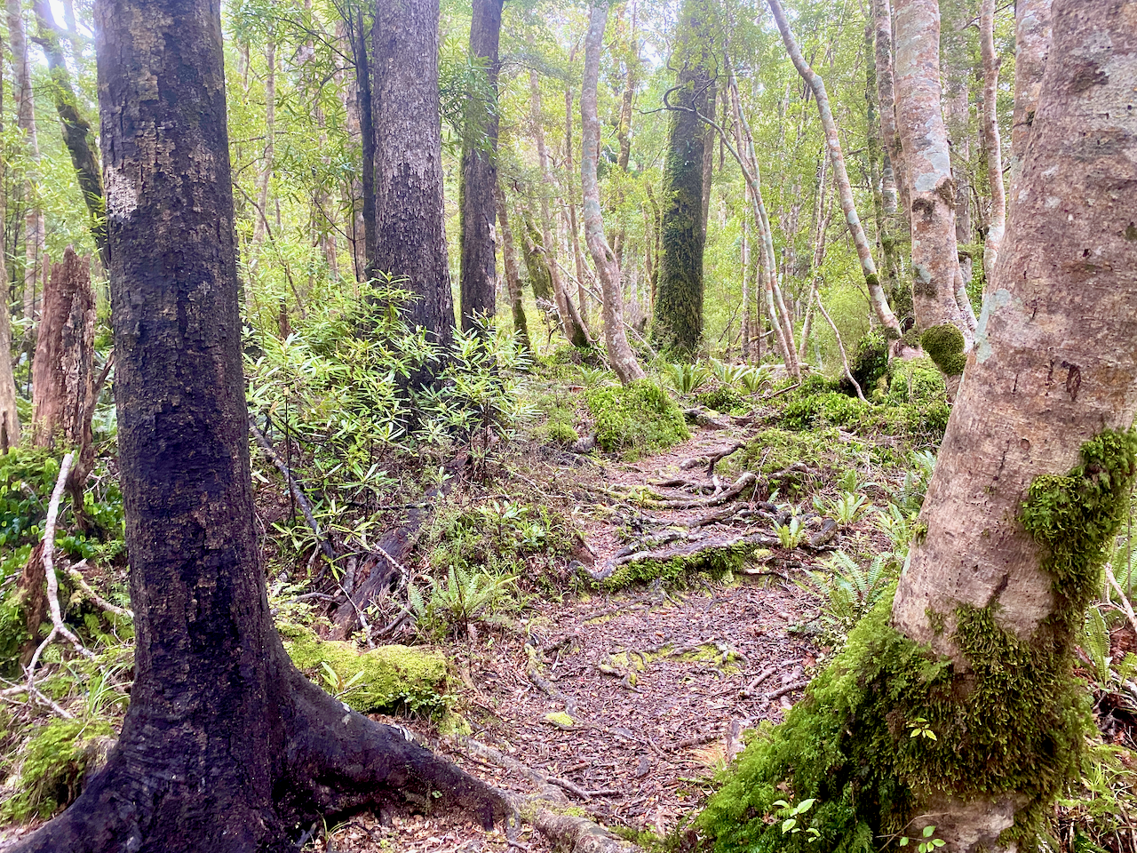
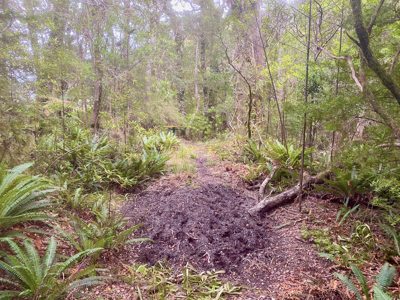
On the other side, the trail began climbing steeply immediately. The track was thin and knotted with roots, moist and slippery underfoot, with puddles of mud along the way. I began at around 170m above sea level and climbed to around 570m before it flattened out a little.
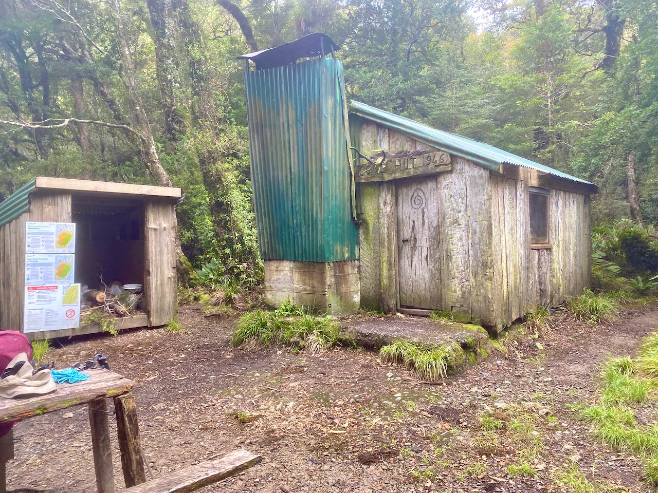
I continued on, climbing another 100m over a longer distance before the trail headed down, to come out at Cone Hut built in 1946. I stopped here for lunch. I also noted that a previous walker had marked in the hut logbook that they had left a small bag in the Alpha Hut. I would keep an eye out for it.
To continue, I had to cross the river and had bought sandals for this occasion. Before changing I spent some time looking for a way to cross, but with not luck I waded across in my sandals and up the bank. Back in my boots, I began climbing up the Bull Mound Track towards the Bull Mound, although I never did figure out why it was called that.

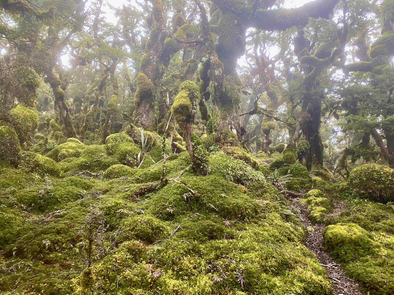
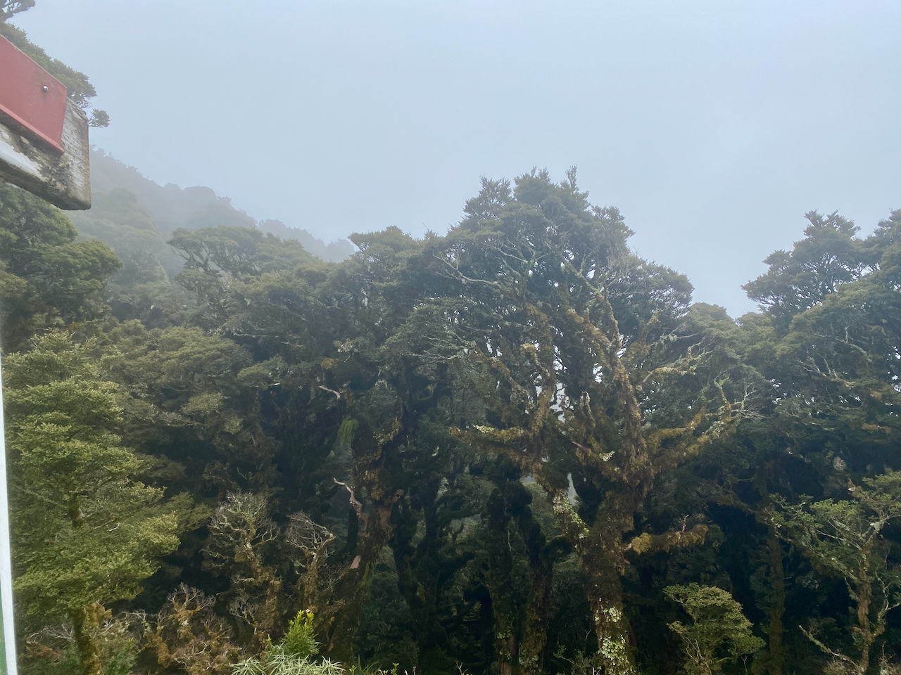
The first climb of the day had been rough, but this trail was worse, steeper, muddier, more tangled in roots. At one point, it was entirely blocked, forcing my to take time to find a way around. My river crossing was at around 320m, and three hours later I reached the sodden top of Bull Mound at 1060m. After 900m, the trees had begun to change, growing barely taller than myself, and almost completely covered in moss.
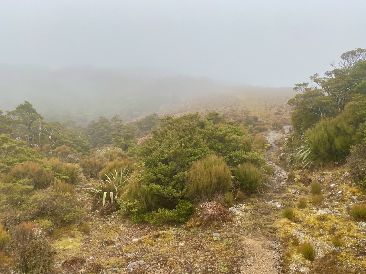
And, of course, the best view when climbing so long in the forest, the exit into the high alpine region.

But, I couldn’t take a rest as it was cold and wet crossing the open area, so I pushed on and into the cloud layer. Fifty metres later and I crossed the top of a small hill blanketed in sodden moss.
Stepping carefully, I marched on before beginning a descent onto a saddle known as Hells Gate. Icy wind swept up from one side to another, but thankfully there were plenty of thin trees.
On the other side, I climbed to nearly 1200m, thankfully leaving the wind behind, but my breath was coming icy and temperatures had dropped. I descended to below 1100 before climbing again. The topographic map I was following on my phone didn’t have my hut on it, so I assumed to was near the summit of Alpha, still 200-300 metres higher than I was. But not long after, I came out of the trees to find the hut.
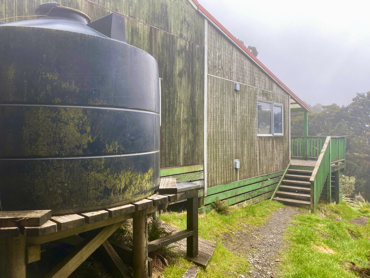
I rushed inside, and tried to get the fire going to get some warmth, but alas, none of the wood would light as it was all wet, and not being a serviced hut, firewood wasn’t periodically dropped off. I quickly cooked some food, changed into warmer clothes and still freezing, got into my sleeping bag in hopes of getting warm. During this time I did locate the small bag left behind and squirrelled it away in my pack.
Day 2 – Alpha Hut to Tutuwai Hut
I’d gone to sleep breathing into my sleeping bag, and woke up in a cloud of warm air even though it was freezing outside. I even had to throw my sleeping bag off, and remove some of my thermal clothing as I was too hot. There had been a change in weather overnight, the icy clouds were getting a push along by some pretty heavy gusts of wind. The next couple of days were to have been spent in the open ridgetops, and as a cautious hiker, I felt that high gusts on the icy ridges was not going to be safe (or fun), so I decided to descend back to the lower huts for the rest of the hike.
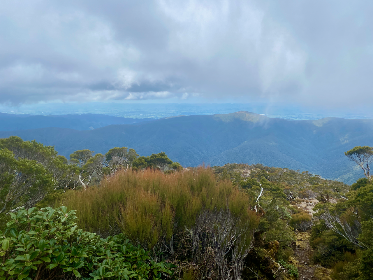
After packing I headed back along my entry the trail. I descended to Hells Gate, which was again windy, but not as cold as the afternoon before, and on the other side I came to a junction and headed up towards the summit of Omega which opened out onto the rocking area. Low clouds hung over the area but I got my first views of the low lying lands of the Wairarapa. I also had reception on my phone and contacted the owner of the small bag, informing her that I would send to her when I exit the park.
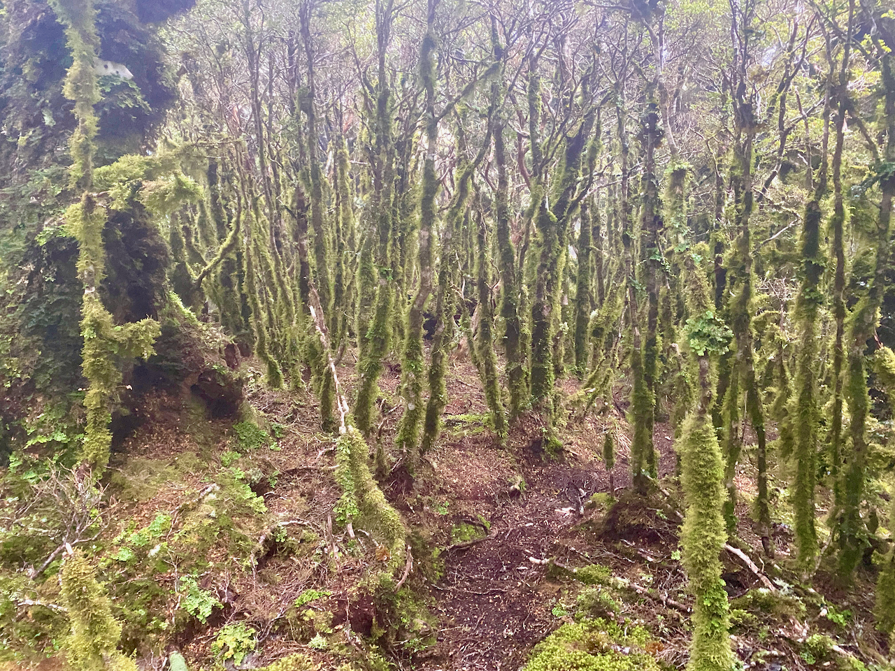
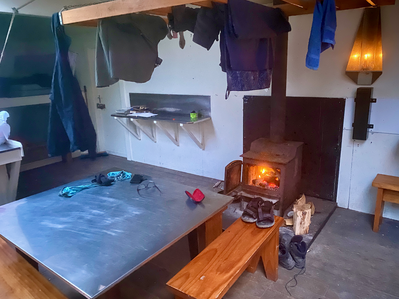
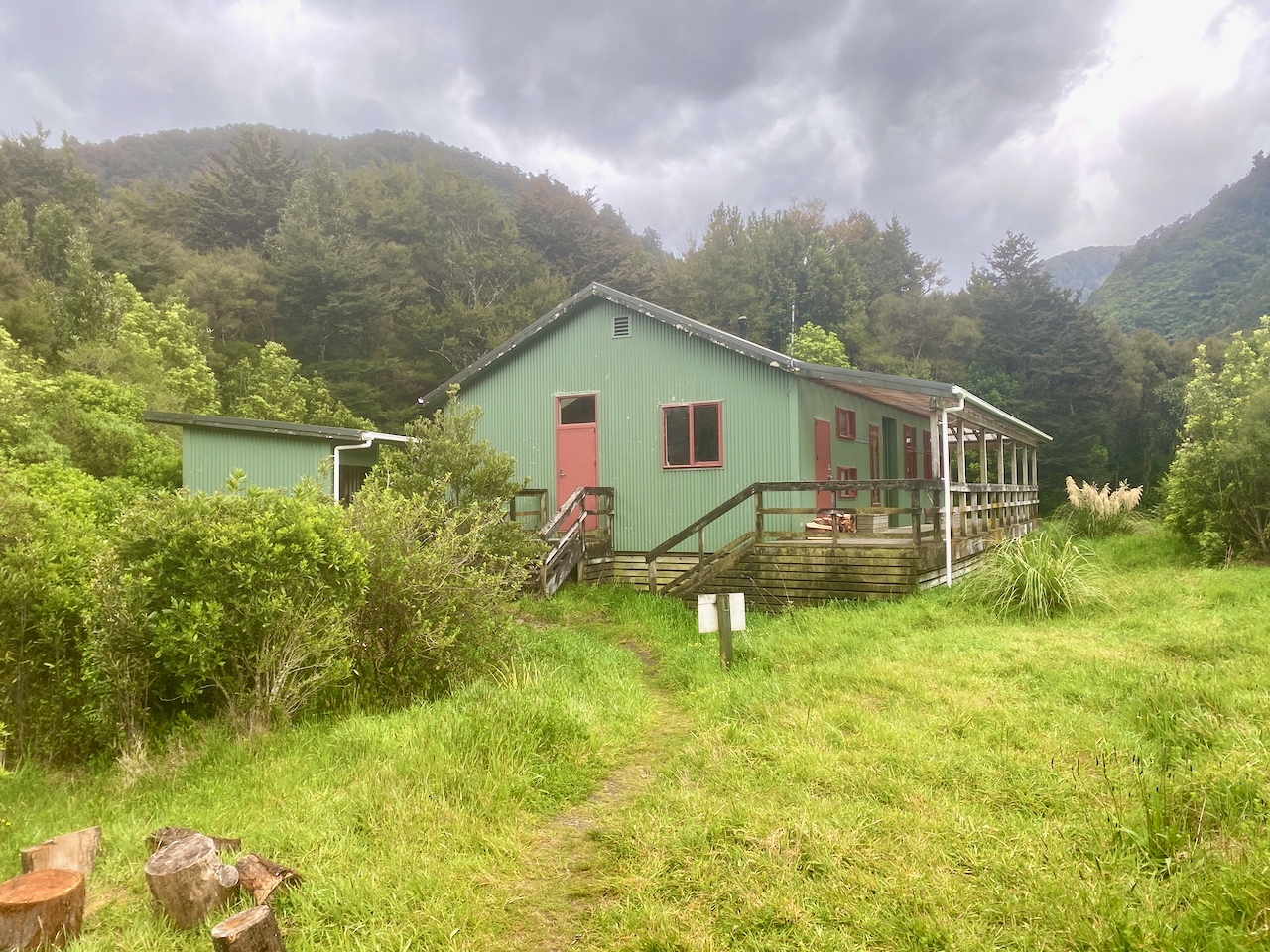
The trail down was similar to the Bull Mound Track I’d climbed the day before. But I would imagine climbing it would have been more difficult. Eventually, after several hours, I came out at the Tauherenikau River I’d crossed upstream the day before. Again I studied the best place to cross, swapped into my sandals and headed across. I’d decided that I would be staying in the Tutuwai Hut that night, and as that was not far from where I’d crossed, I kept my sandals on and walked up the track. I got to an open area with a lunch table, but no hut. It took me a few minutes to locate the hut hidden up the hill – the sign had been smashed. I settled in for the afternoon, found dry wood and got a fire going. Practicing fire making skills is always a good thing!
Just as darkness fell, a pair of young guys appeared, the only other people I’d seen in the two days I’d been in the Tararuas.
Day 3 – Tutuwai Hut to Totara Flats Hut
After a warm night in the hut, I contemplated whether to exit the park or find another hut to stay in for the night. I’d set aside four days in the Tararuas so I located another hut far enough away to give me a fair walk, but also within a fair walk ofwhere I’d parked my car. I followed the river for an hour back to the Cone Hut I’d stopped at on my first day, passing three middle aged guys going to the Tutuwai Hut.
I stopped at Cone Hut for a bit as it had begun to rain lightly, but when it didn’t stop after 15 minutes I headed on. I climbed up the track I’d come in on the first day but split off towards the Cone Saddle. The sign said 30 minutes to the saddle, but I’d discovered that most of the timeframes on the signs are works of fiction, often heavily underestimating the times… it says 1 hour to the hut, 3 hours later I arrived. In many cases, other walkers had scratched off the original times and added more realistic ones. I climbed on, and arrived at the saddle 45 min later.
Perhaps I should have climbed the extra 500m to top of Cone peak and followed the ridge down, but I chose the easy path and headed down towards the Waiohone river. I crossed a small plateau and stopped for some lunch before continuing down to the river.

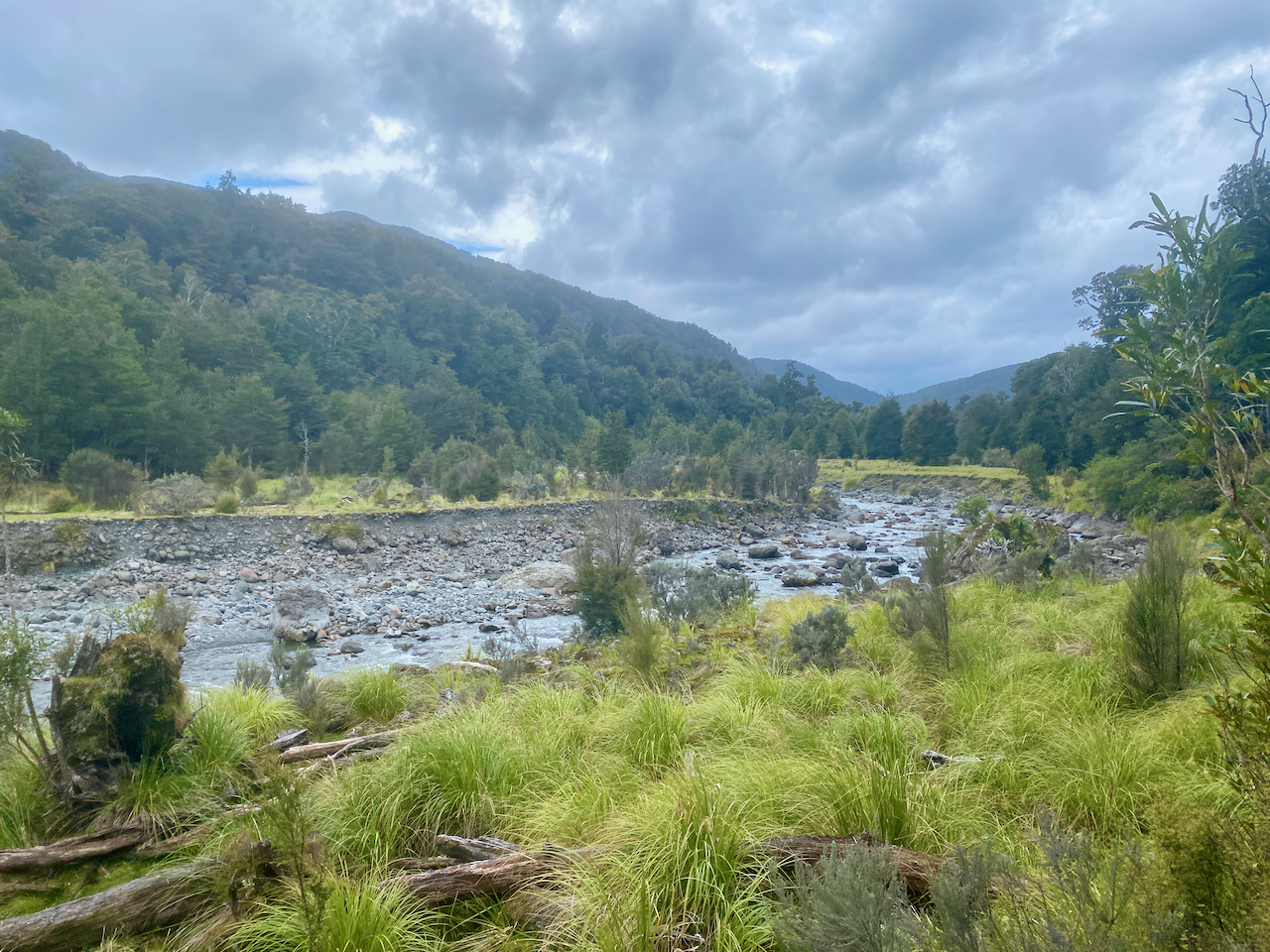
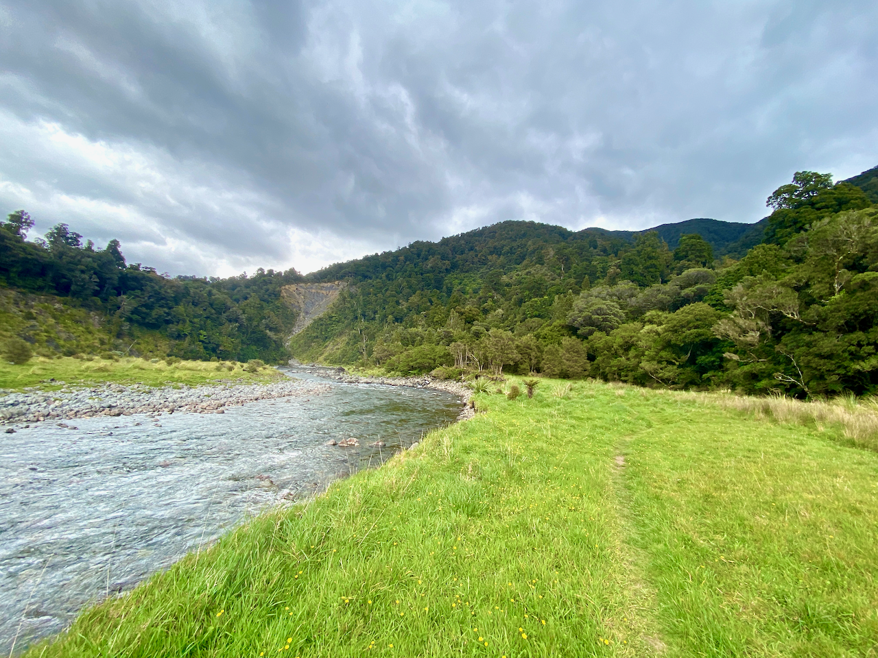
For the rest of the day, I followed the trails beside the river where I could. There was little climbing and I could take a rock hopping option instead of going up onto the knoll. There were plenty of flat areas, although this is also where the muddy ground is most prevalent. At one point the trail led me up a knoll and I decided to try rock hopping instead, but ran into a dead end and would have to wade into the river to get past, so I went back.
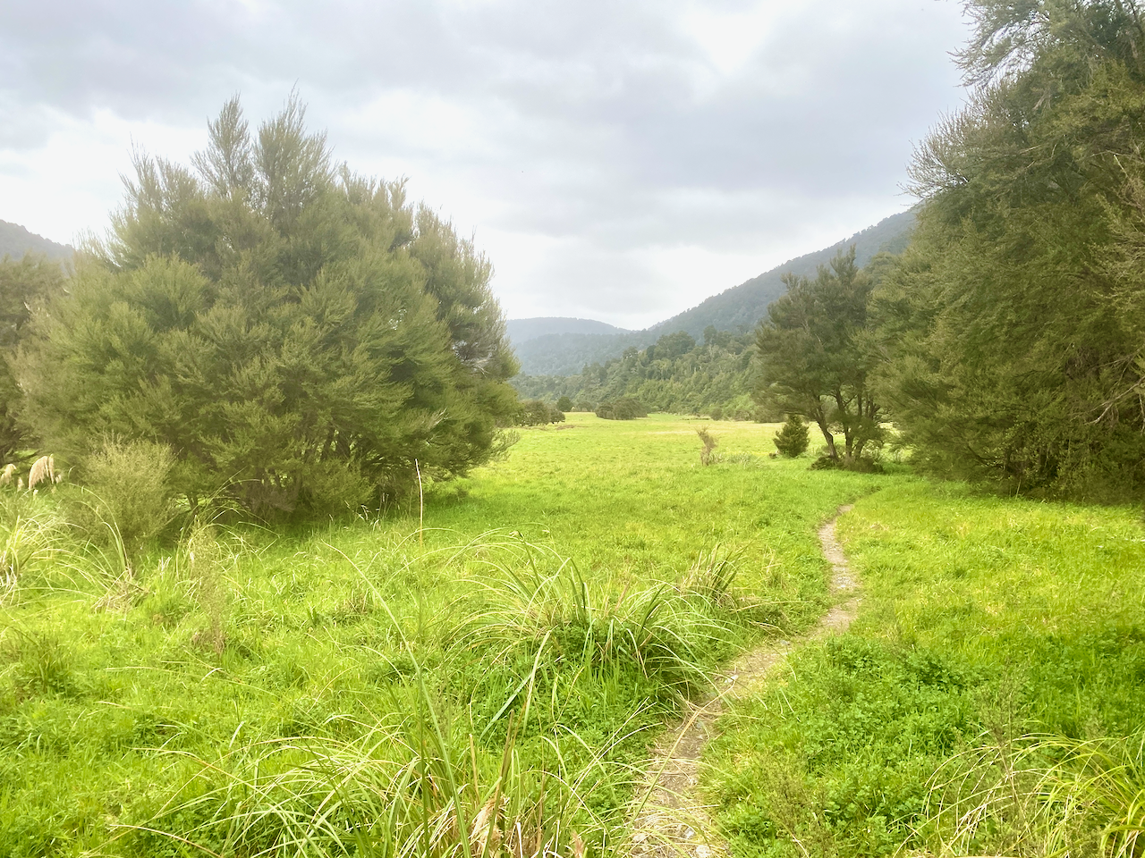
Then I came out onto the Totarani Flats, and for the next 45 minutes it felt like I was crossing a grassy paddock, but in slight drizzle. At one point I found a dry covered spot to have a rest, but was harassed by sand flies, so after five minutes continued on. The trail headed into the woods, and soon after the hut appeared.
As with the day before, I set about making a fire and got ready for the evening. An hour later, a lone runner appeared, stopped in to say hi and sign the hut book, the ran on again. She had started her ‘jog’ 12 hours earlier and still had a bit to go. Trail runners are insane.

Day 4 – Totara Flats Hut to Waiohine Gorge Carpark
The next morning, the weather was fine and once ready, I headed down to the bridge to have a look before donning my pack and leaving. I retraced my steps along yesterday’s trail through the flats, enjoying the sunshine. I crossed the long sections of flat trail and mud to eventually arrive at the the junction I’d passed coming from Cone Saddle. The sign said 2 hours, but who knows.
The trail turned out to be more difficult, with plentiful knotted roots and rocks. It felt like I was climbing over hurdles, up and down and up and down. 2 hours in and I was only half way towards the carpark. The final hour of the walk, and I noticed the trail was more manicured, with sections of boardwalk, cut steps lined with wood and long easy trails. I eventually arrived at the bridge I had crossed at the beginning and crossed over to my car, where I took a rest, changed and prepared to exit the path. After I’d left the Tararua Ranges, I stopped at Carteton and shipped the small bag back to the lady. Later that day, as I was relaxing at my friends’ farm south of Palmerston North, the clouds over the ranges where I’d just been looked ominous.

The Original Plan
The original plan had me going past Alpha hut, along the ridge lines known as the Dress Circle up to heights of 1500m plus to Kime hut, then the next day along the open ridge line to Maungahuka hut. In the cold wind and under cloud cover, the walk wouldn’t have been fun, and with no guarantee of heating at the huts I feel I made the best decision. Then from Maungahuka hut to the carpark I estimate the day would have been between 10 and 12 hours, with long steep descents and a huge climb. If I had done in mid summer it would have been more fun, and perhaps I would have split the last day.
Overall
The walk was good although as I had chosen to not go into the high open ridge tops, the majority of the hike was in the forest. The huts were pleasant, well, the ones where I could get the fire going. I felt cozy and enjoyed the warm solitude of the place. I was prepared for the possibility that I might not be able to get to the higher areas, and had alternative options. Perhaps if I’d chosen early summer, I would have had a different experience: more heat, more alpine, but then more people to contend with on the trail and in huts. Still, I give it a good rating and add it to my experience.
I think I would walk in the Tararua Ranges again.
The Lone Trail Wanderer
