
In late February 2023 I embarked on my longest walk in New Zealand, 13 days across the Southern Alps of the South Island. Go back to Days 4 – 6 or the beginning Days 1 – 3.

Day 7 – Rata Lodge Backpackers Otira to Dillon Hut – 14 km – 8 hours – Yellow
After a breakfast down at the local cafe, I packed and was delivered to the start point by the owner of the Backpackers. I’d originally planned to stop at Carroll Hut at the top of today’s climb, but after finding there was no heating there I decided to walk further. In the carpark I took my obligatory selfies to prove I was on the walk, then set off up the trail into the forest. I was barely 10 metres when a man emerged with pack on. He would be the last person I’d see for more than 24 hours.

The climb was by no means difficult but no easy fair either. I pushed on step by step and was rewarded by the occasional view out across the mountains. For the first steep climb of the walk, I finally got a good sweat on.
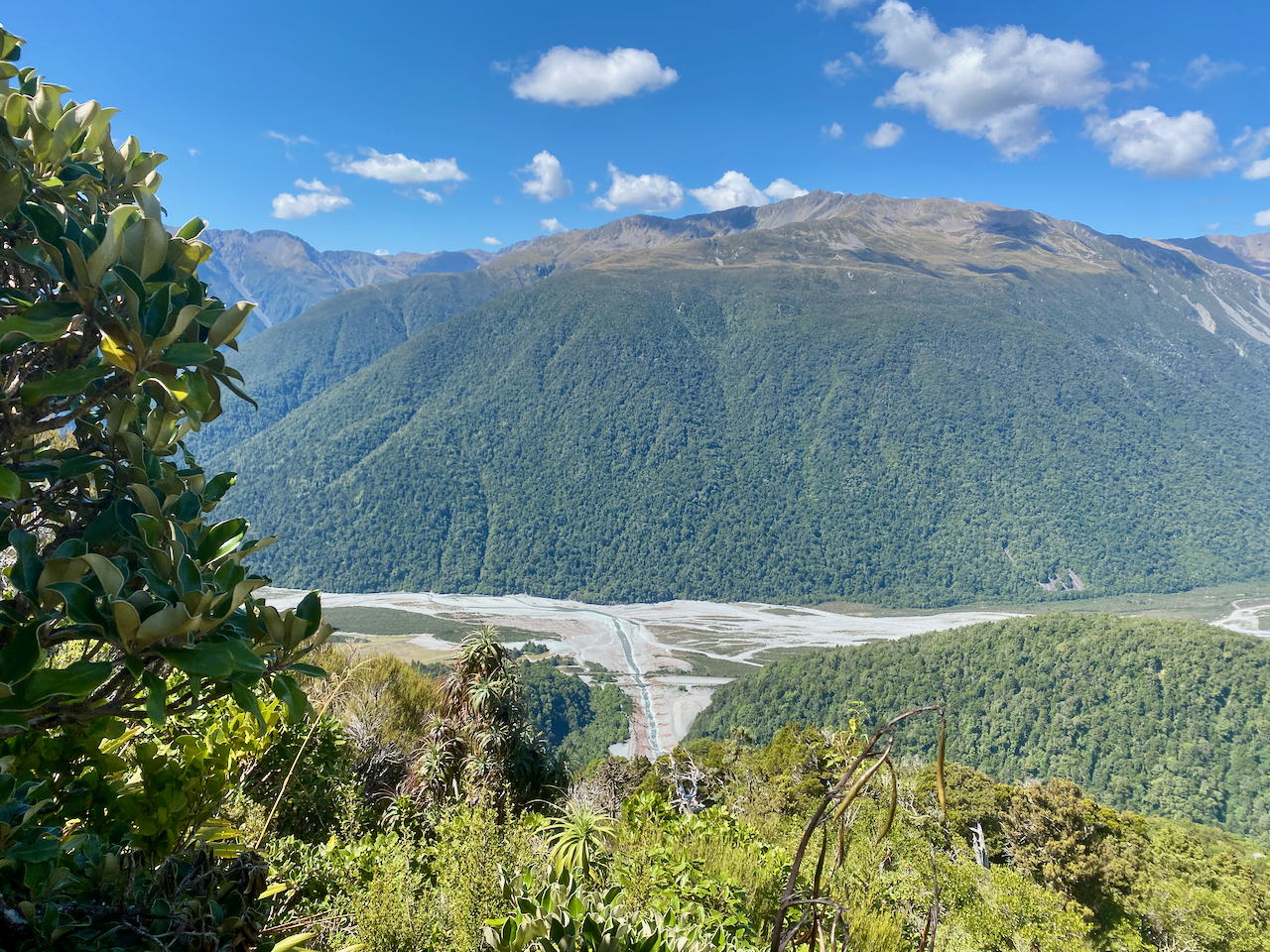
The good weather continued as I climbed out of the forest, passing the short stubby trees towards the top as I always seem to. I stopped and got another good shot along the range with Otira and Authur’s Pass in the distance.

The top two hundred metres the trail grew more rocky, feeling more exposed and dangerous.

But I finally crossed onto the tussock covered top and Carroll Hut came into view. At the hut I stopped for 30 minutes for lunch and to dry my sweaty clothes.
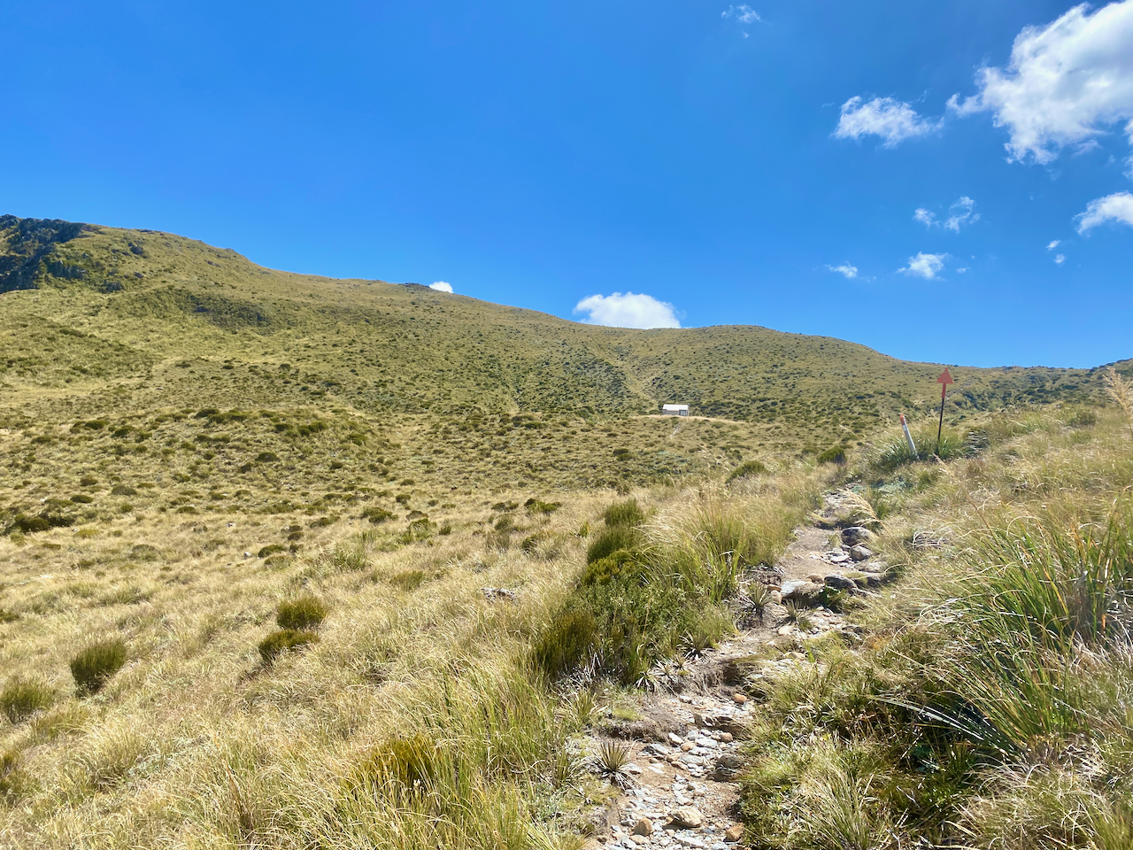
From here the trail was marked with posts, but the trail was not as well defined as before. This was fine atop the range which felt more like rolling hilltops than craggy mountain peaks.
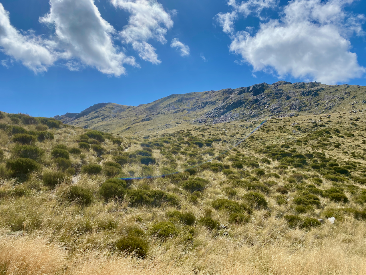
As long as I could see the next pole, it didn’t matter that there were a meander of little trails leading to it. I go my first views down the other side where I’d eventually be descending to the river valley below.

The poles continued as did the suggested routes, which were fairly obvious due to the short vegetation. However, the mapping software I’d used to plot my course only listed the huts I’d planned to stay at, but as I’d decided to stay at a different one, I was forced to guess exactly where it was. Today was fairly easy, but later in my walk it would be more of an issue.
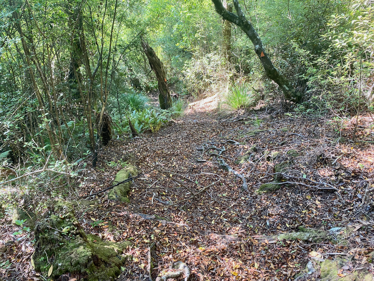
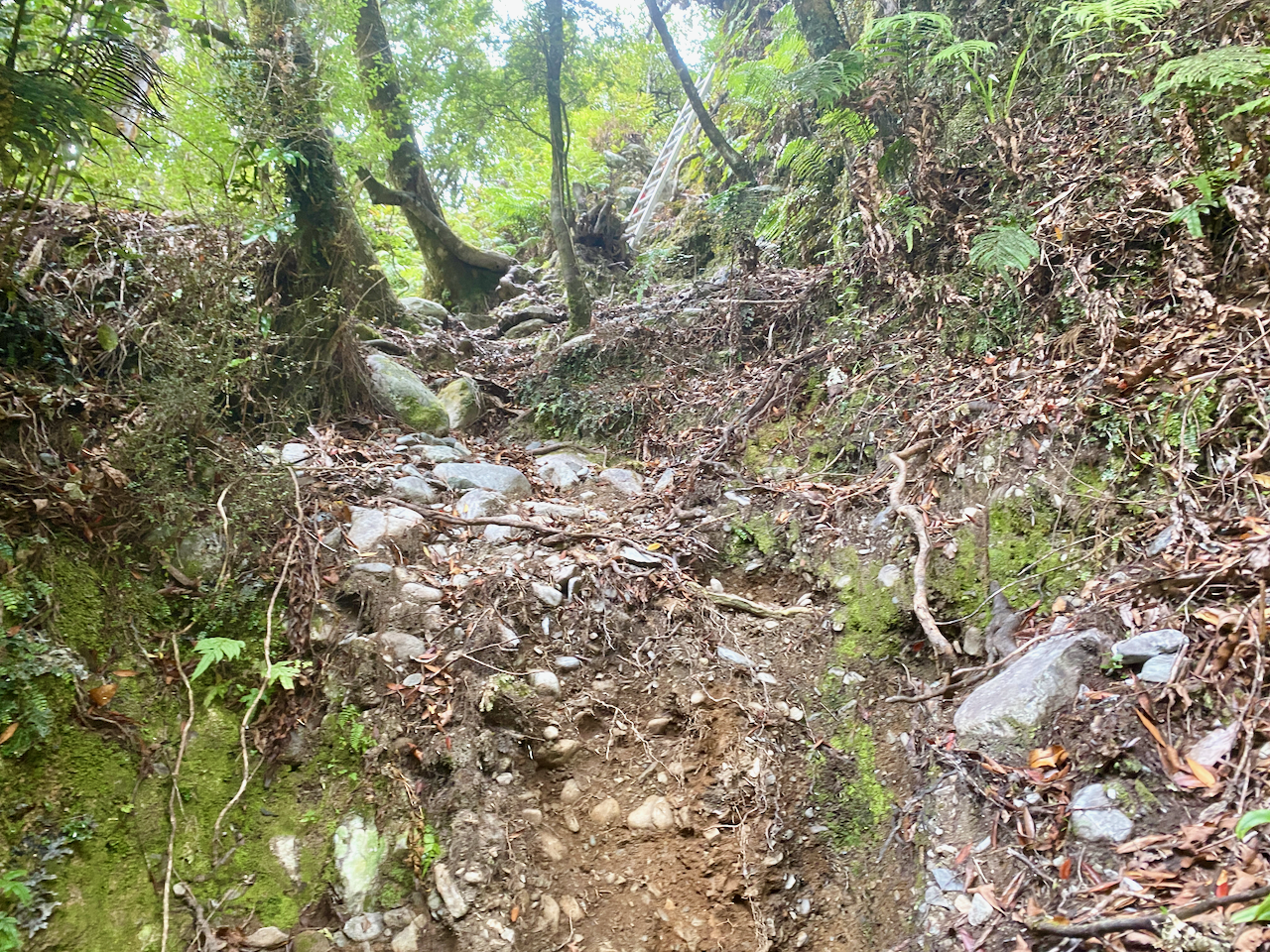
As the trail disappeared beneath the longer vegetation I was forced to bush bash from post to post. This was the beginning of my scratched legs woes, and my regret at not bringing full length gators.

The trail grew more prominent as I crossed into the tree line, with the usual orange triangles marking the route. At the top I easily descended 200m quickly before the trail got a little more precarious, but nothing too dangerous.
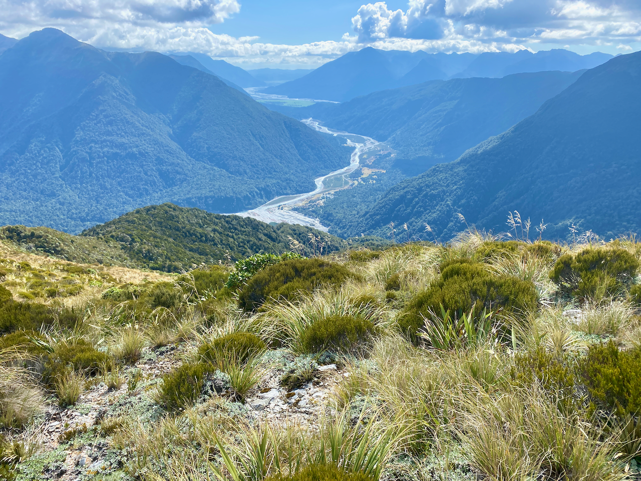
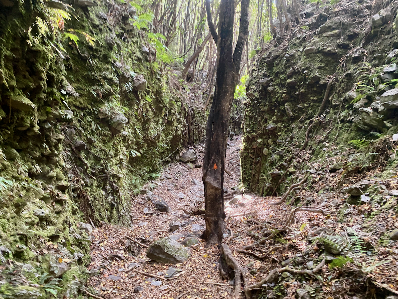
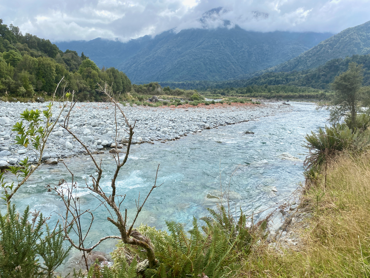
I came out atop a slip giving good views down. Then, near the base the trail lead through a rocky passage with a lone tree in the centre then popped out onto a rocky creek.
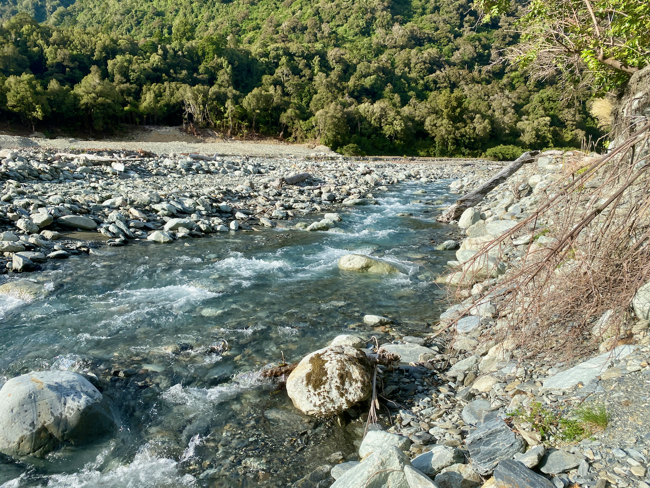
The creek was raging in places, and after a long day, I wanted to find the huts less than a kilometre away and rest. I skirted along the lower bank beside the creek, but couldn’t get past. So, trying to ensure my boots remained dry, I skirted back again looking for a place to cross. I found one, and jumped over, but I think my sunglasses came off my pack here, as I didn’t see them again. I walked along the other side, and found a place to cross.
Then it was up the bank and along a 4 x 4 track. I quickly saw the Dillon Homestead Hut and stopped to check it out. The homestead hut has been around since 1945 and has a lot of character in it. I could have stayed here and I’m not sure why I didn’t, but I chose to push on to the nearby Dillon hut, a far newer Department of Conservation hut. I wasn’t disappointed and as I had it to myself I got set up for my first night alone on this trek. And as it had been a warm day, I didn’t bother with a fire.

Day 8 – Dillon Hut to Mid Taipo Hut – 8.9km – 3 hours – Pink
Because yesterday was long day, and tomorrow will be too, I chose a more chilled walk today along the Taipo River. I’d planned to climb to the Dunn Creek Hut at the end of the day, but had read that it wasn’t in the best of shape and being rebuilt. Again my map didn’t have the alternative huts marked, so I was guessing by the end of the day. I headed out from Dillon Hut in an overcast sky.
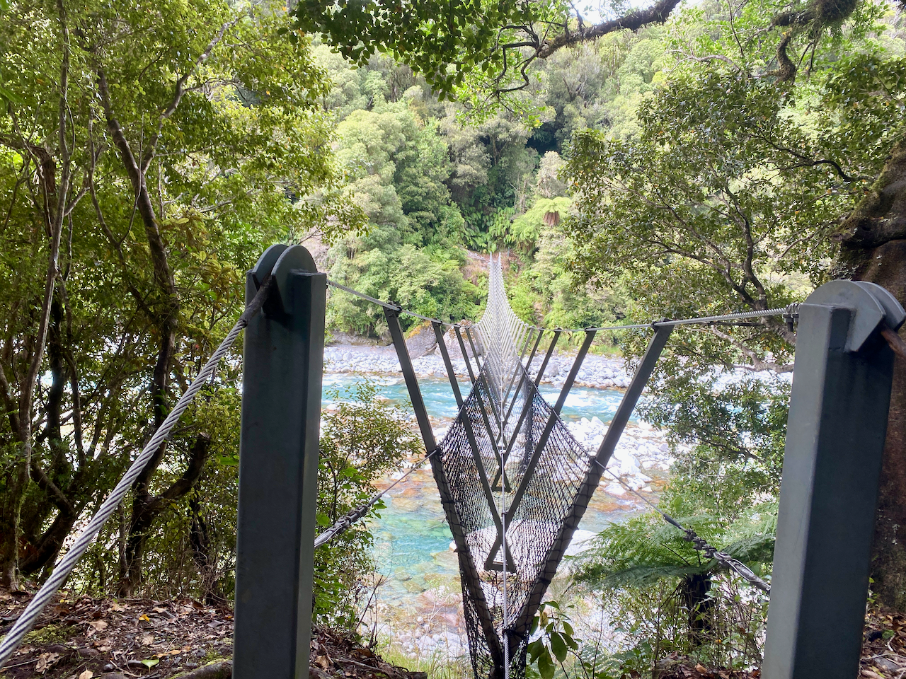
As the river was wide and deep in places, I stayed on the left bank waiting for a three cable crossing I knew was further along.
To get to the crossing, I had to climb the side of a high rocky outcrop, then follow the path and a super steep descent where a ladder had been installed to help.
I crossed the bridge over a raging river, and on the other side, had a hard climb almost straight up the dirt bank that seemed endlessly.
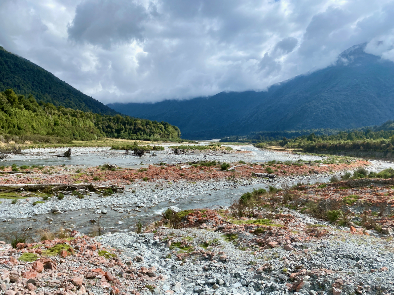
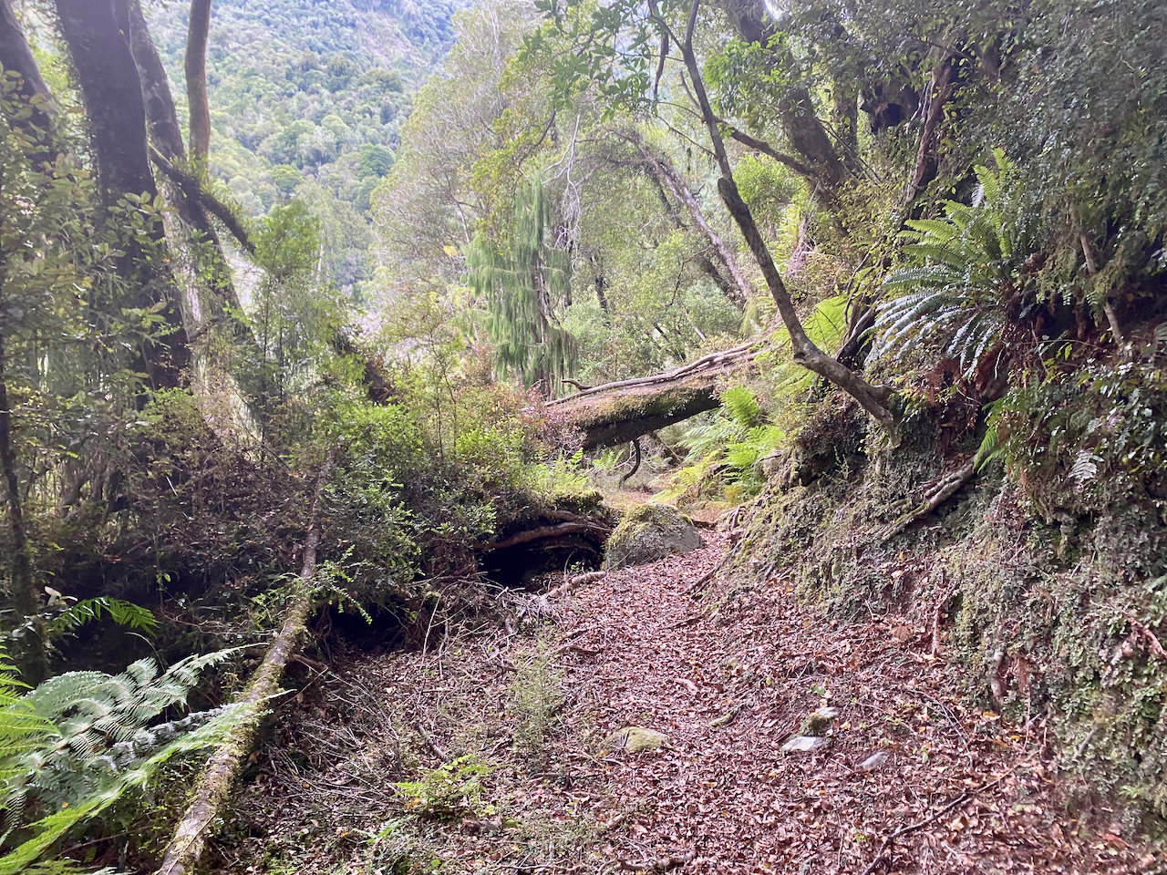
It eventually flattened out before an easier descent down the side to pop out near the river, which had split in two.

I then followed vague trails along the river bank and grassy flats.

…before running into two guys who’d come from a hut further up the river. From a few minute chat, one suggested that if I was going up to Dunn Creek Hut to go up the creek instead of the trail further around as it was less steep. I’d originally planned to do that, but as I was no longer going to that hut tonight, I might have to be satisfied with the more difficult route up.

The river gully became quite tight with no way to walk along the side, so I was forced to push up the side of the bank on a forest trail. It was by no means a easy walk, and cemented in my mind that I wouldn’t be coming back to climb Dunn Creek.
I finally popped out at the Mid Taipo Hut having passed the less than obvious junction to tomorrow’s climb. There were bits of sun and it was warm. I decided to wash my sweaty clothes, so I stripped down tossed my clothes in a waterproof bag with some special organic cleaner and headed out to the river to do the washing. In my naked state, I kept an eye out should someone pop out of the wilderness, but no-one did. I took my washing back to the hut and hung it up outside, then went back to the river and bathed. The water was pretty icy, but I got it done and returned to the hut to chill out as it began to rain. I lit the fire to help dry the clothes and got on with my afternoon.

Next, Days 9 – 10 of my Southern Alps Crossing.
The Lone Trail Wanderer
