Tag Archives: Hike

Parque Nacional Torres del Paine – Introduction and Days 1 & 2

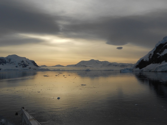
The Parque Nacional Torres del Paine is the most famous national park in Chile. The Torres del Paine – The Towers of Paine – is technically part of the Patagonian Andes Mountain range, but isn’t actually part of the main Andes chain. It’s also the second most expensive hiking area in South America after Machu Picchu.

wpid-dscn1808-2013-04-5-09-18.jpg

There are three main hikes in the Parque Nacional, the W, the O and the Q.

The W is the main reason the park is so popular. It sees hundred of thousands of walkers a year, sometimes with a hundred tents at each camping site each day during peak times – December to March. It’s called the W because of the distinctive W shape that it makes from one end to the other. On average it takes between 3 and 5 days to hike and there are refugios – small hotel facilities that rent beds, provide food etc – along the way, so not all travellers have to carry equipment or camp if they choose not to. You must pay to camp and most camping sites and they provide facilities such as toilets. During the low season, some of the campsites are closed – you can still camp there, it’s free, but the facilities are all closed.

The Paine Circuit, is called the O because it walks you around the entire Paine Massif. It’s not really in the shape of an O, as it includes the W and takes 8-10 days to complete. It’s where hikers go to both avoid the crowds of the W and to get a more hardcore experience – the paso John Gardner. During peak seasons, though, there can still be plentiful people on the O, sometimes up to 50 tents at the the one Refugio on the other side.

The Q, is simply the O, but with the extension added, a small ‘tail’ heading from the Administration building, for almost 20km to the beginning of the W. This adds another day to the O.

For my hike, I decided to do the Q and went along to the daily information session at the Erratic Rock, a hostel in Puerto Natales, to find other hikers to do it with. There were 4 others that I joined up with and while I’d only be walking with one other during the day, we’d hang out together as a group at each campsite. Walking alone is not recommended when doing the circuit, as Paso John Gardner can be challenging. We also planned to do the hike over 10 days, although that could change as we go depending on whether and length of some sections. At Erratic Rock, there were 30 other people that were planning to do the W. It’s low season, but it will still be fairly busy.

Day 1 – Administrativa to Campamento Las Carretas

We designed today to be a short day along the tail of the Q and as an initial warm up for the coming days.

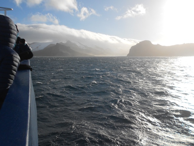
At 7:30am the bus picked up the masses from around town to head the 2 hour journey to the entrance of the Parque Nacional. While it’s the end of the season, there are still 5 buses going. We stop at the entrance – Porteria Y Guardia Laguna Amarga – where we pay the entrance fee and watch a short ‘be nice to our parque’ video. Some walkers leave from here via a short van ride to the Hotel Las Torres – the official eastern starting point of the hike – but most continue on to the western start point, via catamaran across the Lago Pehoe – another 30 minutes on the bus.

wpid-dscn1809-2013-04-5-09-18.jpg

Then on a single bus, my little team of five, continue for yet another 30 minutes to the parque administrativa centre and the beginning of the Q.

wpid-dscn1810-2013-04-5-09-18.jpg

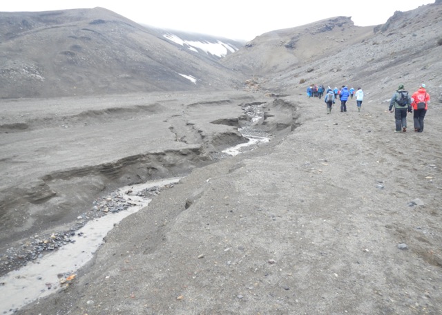
After some last minute preparation, we walked out across the flat grassy plain with the entire massif in the distance. Most of the two hours of todays hike was flat until the last couple of hundred metres where hills ran up the side of Rio Grey.

wpid-dscn1811-2013-04-5-09-18.jpg

As we walk, we split into two teams, myself and an American guy walk together, while the others are two Australians – a guy and girl – and a female Brit. It doesn’t take us long to arrive at the camp site and we set up our tents and check out the place. There are only a small number of tent sites, a cooking shelter and a toilet, that we promptly ban anyone from using, preferring the wilderness latrine style of digging a hole. The day had been beautiful, so the five of us hung out as we cooked dinner and chatted until it grew dark.

While we were there, we met a Polish couple going the other way. They had just done the W and it had rained for all 5 days. We are hoping for a better experience.

Overnight it did rain a little and we were woken by brisk winds blasting at our tents. While the wind remained in the morning, there were blue skies.

wpid-dscn1814-2013-04-5-09-18.jpg

Day 2 – Campamento Las Carretas to Campamento Italiano

We headed out into the brisk wind through the hills above Rio Grey. We weaved along the side of the river for some time eventually taking a break in a protected valley as the rio turned off.
wpid-dscn1817-2013-04-5-09-18.jpg

The hill then led down onto a yellow grass plain where wind hurtled towards us with such force that at times we couldn’t move forward. With packs on, the wind can really blow you around. We struggled on towards the main towers of Cerro Paine Grande.

wpid-dscn1815-2013-04-5-09-18.jpg

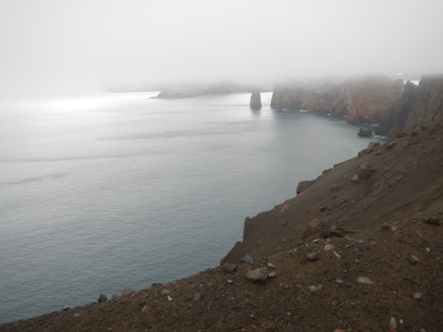
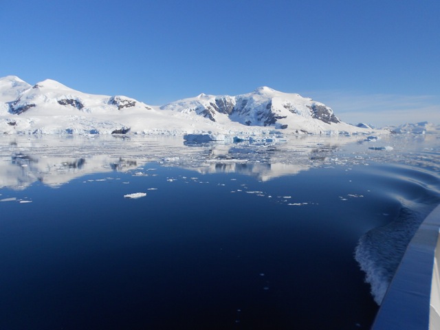
Eventually we arrived at Mirador Pehoe – a lookout across Lago Pehoe – the aqua waters being hammered by the winds.
wpid-dscn1826-2013-04-5-09-18.jpg

We spied the midday catamaran crossing the lake to deliver a new load of hikers to the refugio. From the mirador the terrain became more hilly and we climbed up and down through burnt forest. We eventually came down a steep hill and arrived at Refugio Paine Grande where we stopped for lunch.
wpid-dscn1827-2013-04-5-09-18.jpg

The refugio has a shop and I enjoyed a coke and some chocolate before we headed off again. The terrain became fairly hilly as we headed for the next campsite under the 3km tall towering mass of Cerro Paine Grande – the tallest peak of the massif. We passed several groups of people, going in both directions. The next couple of days is going to be busy as we’re on the W, the most popular part of the hike. We then walked along the length of the Lago Skottsberg, it’s water a totally different blue…

wpid-dscn1832-2013-04-5-09-18.jpg

We took a break as the trail began to get a little muddy. It was here that the burnt trees stopped and living trees began again. We set off again towards the rocky spires of Cuernos del Paine, which will be above tonight’s campsite.
wpid-dscn1834-2013-04-5-09-18.jpg

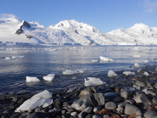
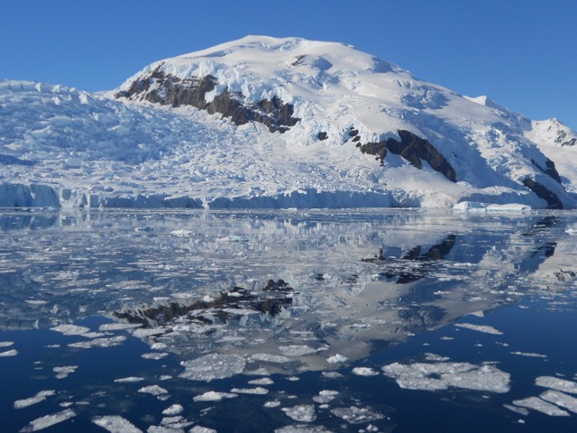
A one point, a group of guys came past and between them a guy sitting on a specially designed wheeled carriage, obviously specially designed for him. It was great to see how the group had found a way for their less able friend to hike with them. We continued on passing the snow covered glacier face of Cumbre Principle – the main peak of Cerro Paine Grande. We arrived at a river and crossed into Campamento Italiano. After setting up camp, our little group of five sat at the river watching pieces of the glacier calve off from the mountain.

wpid-dscn1850-2013-04-5-09-18.jpg

The Trail Wanderer

Antarctic Voyage – The Journey Back to Civilisation.

Find Days 1 – 3 here: We’re Going South Baby, WAY South!
Days 4 – 5 here: Along The Great White Peninsula
Days 6 – 7 here: Next Stop, The Polar Circle

Day 8 – Returning Along The Peninsula

Last night the swell rocked the boat so madly many people were unable to sleep. While the seas weren’t often bad and many of us no longer show signs of sea sickness, some can barely get out of bed to attend meals.

On the morning of Day 8 we anchored off Verdnasky Island and were invited by the Ukrainian science team there to visit Verdnasky station.

wpid-dscn1932-2013-03-21-16-10.jpg

We broke into three groups: a third visited the station first, another third visited the abandoned Wordie station on the other side of the same island, and the remaining third were the kayakers and divers.  Each group eventually got a turn to visit the main research station.

wpid-dscn1931-2013-03-21-16-10.jpg

Wordie Station was the original research station and must have been built for short, thin people as it’s pretty cramped.  When researchers moved to the newly built Vernadsky station, Wordie station was converted into a museum.  To get between the two stations we had to cruise through sets of pure blue icebergs with amazing natural textures on them.

DSCN1922

Verdnasky Station is huge in comparison to Wordie with a pair of long sprawling corridors leading to many different science labs. Outside there are other rooms and silos for storage, additional labs and fuel. Upstairs there’s a relaxation room which holds the southernmost gift shop and the southernmost Post Office in the world, where we got our passports stamped and sent postcards (most took more than a year to arrive). Through an archway was the world’s southernmost bar where we could buy large shots of vodka for US$3.

After exiting the station and waiting for the Zodiacs to collect us, we gathered on the pier to watch a leopard seal torment a penguin. When it noticed it had an audience, it made a display of tearing its lunch to pieces before consuming it.  While macabre, it’s part of nature and we couldn’t take our eyes from it. Back on the ship we headed further north to Petermann Island for another short hike. The island itself has different colours of snow – green from algae and pink from penguin poo.

wpid-dscn1939-2013-03-21-16-10.jpg

The hike was a walk up a slippery mound to a cairn and down the other side. This island had some beautiful views, but was the smelliest island I’ve ever been to. While the old saying: ‘Don’t eat the yellow snow’ still stands, a new one came from this trip: Definitely don’t eat the pink snow.

wpid-dscn1942-2013-03-21-16-10.jpg

As we made our way back to the ship we spied another leopard seal enjoying a penguin. Penguins are considered the rabbits of the south, they breed like crazy and provide good food sources for the seals and larger sea birds.

Across the bay, we could see the base of several majestic looking spires their tops hidden behind the cover of clouds.  Thankfully the clouds began moving as we were leaving, giving us a partially better view.

wpid-dscn1953-2013-03-21-16-10.jpg

Day 9 – Final Landfall – Deception Island

The plan for the day was to make landfall in the morning and begin the journey back across the Drake Passage in the afternoon. This was not to be, however, as the wind and seas were too harsh. Instead we sailed back to the South Shetland Islands to attempt Deception Island again. When we arrived the wind was still strong, but thankfully in the right direction allowing us to enter the volcano via a stretch of water known as Neptune’s Bellows.

wpid-dscn1972-2013-03-21-16-10.jpg

We sailed through and even with the low clouds it was picturesque. The bay inside was huge and we anchored in a smaller bay just inside called Whalers Bay. On reaching land, we set foot on black volcanic pebbles and sand. There were a number of old broken down buildings which we were warned not to enter because they were unstable.

wpid-dscn1976-2013-03-21-16-10.jpg

Deception Island erupts every 40 years, the last time being 40 years earlier. We were prepared should it go up but it didn’t, obviously. On land there were few penguins and many fur seals. We walked along the beach for a while and climbed the semi-collapsed wall to Neptune’s window…

wpid-dscn1979-2013-03-21-16-10.jpg

…which provided great views both inside and out.

wpid-dscn1987-2013-03-21-16-10.jpg

We then followed a stream up the side of the volcano…

DSCN1991

…to a higher perch. With the clouds and the blue-green of the sea, the sight looked like a mystical world that photos just don’t do justice to.

DSCN1992

Back on board, we set sail for the Drake passage and as expected the seas were a little rough.

Day 10 and 11 – Back across the Drake Passage

For two days we sailed across the open and slightly choppy seas. It wasn’t as crazy as we’d expected, but after making landfall twice each day in the Antarctic, hanging about the ship sent many of us a little stir crazy. There were lectures to bide the time but I dove into a book and managed to finish the second of two novels I’d begun on the journey.

We arrived into the shelter of the Beagle Channel in the late afternoon of Day 11 and docked in the early morning at Ushuaia. We disembarked after breakfast.

Overall

My Antarctic trip will always be one of the most memorable experiences of my life and worth far more than I paid for it. The many places where we made landfall and the multitude of wildlife were unreal. People on board were friendly, although with 37 different nationalities it was sometimes difficult to communicate well. There were many new experiences and I’m glad I chose the Plansius from Oceanwide Expeditions, as I’ve heard some of the other cruises were not as well organised or the crews were not as interested in giving passengers the best experience.

Next, after a couple of days in Ushuaia, I began my long journey north along the Andes starting with Patagonia.

The Ocean Cruising Trail Wanderer

Antarctic Voyage – Along The Great White Peninsula

Find Days 1 – 3 here: We’re Going South Baby, WAY South!

Day 4 – More South Shetland Islands

The weather continued to be great, but it wasn’t the weather that was to darken the day… more on that later.  The beauty of the white islands was immense and even more so because of the blue skies.  Overnight the ship was moved further along the South Shetlands to Half Moon Island.

DSCN1674

We made landfall early and hiked along the beach with plentiful Chinstrap Penguins hanging out on the rock formations.  Nestled among one group we found a solitary Macaroni Penguin.

wpid-dscn1687-2013-03-21-16-15.jpg

While not as plentiful as the penguins, there were many fur seals in groups along the rocky beach.  They too were interested in us, but were more dangerous, so we took care not to get too close as they have a tendency charge. They’re easily warded off if they do by presenting a strong hand and calling ‘stop’, or by simply clapping hands.

wpid-dscn1679-2013-03-21-16-15.jpg

While not available to those of us who took ‘Last Minute Deals’ those who pre-booked the cruise were able to also book kayaking and diving. While today was too windy for the kayakers the divers got to get in the water, well, some of them at least…

DSCN1681

Not long after going ashore, we started hearing reports over our expedition leader’s walkie-talkie about a diver that had gone missing. For the rest of the morning our leaders began to act a little strange, anxious. Our stay on Half Moon Island was extended an hour longer than planned. Then after being ferried back to the boat, we were called to an urgent debriefing. The diver that had gone missing was an experienced Japanese woman. They’d found her drifting in 5 metres of water and had attempted resuscitation, but after 90 minutes she had been pronounced dead. No other news was forthcoming.

This set a somber tone across the boat and we weren’t sure if the trip was to continue. We eventually did get word we were and got back underway, but some of the crew were called to deal with certain things such as contacting next of kin, authorities, embassies and the storage of the body.

wpid-dscn1705-2013-03-21-16-15.jpg

That afternoon we sailed for Deception Island, one of the two known active volcanos in Antarctica. Centuries ago, Deception Island blew one of its sides and seawater flowed in to fill the crater. The plan was for us to sail into crater via Poseidon’s Bellows, where the wall had collapsed…

DSCN1708

But the weather wasn’t playing nice and with 35 knot winds, the captain decided it would be too dangerous. Instead we set sail for our next destination,  the Antarctic Mainland and The Great White Peninsula. On the way we spotting what was to become a very common sight… Humpback Whales.

Crossing the channel was an experience. Because of the winds the swell went a little crazy and that evening only a little of half of us passengers made it to dinner. It wasn’t long before I too retired to my cabin a little worse for wear.

Day 5 – Antarctic Peninsula

We were lucky, today was the fifth beautiful day in a row, clear and sunny. That’s five more than some expeditions. I awoke at 4am after going to bed at 8.30pm the night before and felt great. I peered from the cabin window and saw clear seas and the long white peninsula. We anchored at Cuverville Island surrounded by white cliff lines in a bay dotted with icebergs. It’s hard to describe the beauty of this place.

DSCN1718

We landed and wandered around the Gentoo Penguin colonies for some time.

wpid-dscn1720-2013-03-21-16-15.jpg

On the way back we were taken on a short zodiac cruise through the icebergs, many of which were a pure blue…

wpid-dscn1744-2013-03-21-16-15.jpg

I even had the wonderful experience of a leopard seal coming up to the craft to check us out before it went back to playing with the penguin that would eventually become its next meal.

DSCN1738

After lunch the ship moved into a large and beautiful bay strewn with icebergs with the plan to make landfall at the end. The boat slid gracefully through the crystal clear waters…

DSCN1771

…and in some places it was so calm the icy water mirrored the snow-covered mountains and massive frozen glaciers.

DSCN1776

We made landfall, and set foot on the main landmass of Antarctica at Neko Harbour. Woo-ha! And guess what? There were Penguins! Surprise!

We hiked up the side of a mountain to a great viewing spot. I was first to sit on a rocky outcrop looking out across the magnificent bay.

581900_10100327431821222_1470759107_n

Then some of us took a ‘polar plunge’, going for a swim among the icebergs.  Since salt water freezes at just below zero degree celsius, it was cold but not as cold as expected.  If anything, it was colder getting out.

Then in the beautiful clear evening what else do you do in Antarctica? We had a BBQ on deck, of course! It was a little chilly but great! We put down anchor in Leith Cove and watched the sunset.

DSCN1801

Next we’re heading further along the peninsula our Next Stop, The Polar Circle.

The Antarctic Voyager

Laguna Esmaralda

The weather of the last couple of days hasn’t been welcoming enough to hike and last night it was icy enough to sprinkle the mountains with a new set of snow. Today, it’s all blue skies, so together with an Australian couple and a trio of Israeli girls fresh out of their military service, I set off to see Esmaralda Lagoon.

Once our minibus arrived, the six of us were on our way. But nothing here can be done without at least a little drama… As we exited the city, the minibus was pulled over at a police roadworthy station and because one of our headlamps was not functioning, we were turned back. The driver headed back into town, to a mechanic, where he bought a new bulb and we sat waiting as he replaced it. Then, 30 minutes later, we were off again.

Laguna Esmaralda is on private land and the minibus dropped us at the owner’s place, Refugio Valle Los Lobos – a Siberian Husky breeder – where we paid 10 peso each – $1 Australian – to enter the area.

We headed off past the dog kennels and along a dirt road towards the mountains that held the laguna and the glacier – Glaciar del Albino – that feeds it…

wpid-dscn1585-2013-03-8-17-07.jpg

The road was a little muddy, but the worst was yet to come… We passed a pair of beaver dams, although we didn’t see any beavers as they only come out late in the afternoon.

wpid-dscn1590-2013-03-8-17-07.jpg

We crossed an arroyo and though a forest before heading out across a peat field where most of our steps were soggy. Thankfully my leather hiking boots do a awesome job keeping out the water. On all sides as we crossed the field were snow capped mountains and a subarctic wind.

wpid-dscn1597-2013-03-8-17-07.jpg

The arroyo wound its way across the field and we found the least muddy and wet ground was alongside it where there were plentiful stones to stand on.

wpid-dscn1598-2013-03-8-17-07.jpg

The hike itself is only 3 hours return but it’s slow going, as every step has to be made with caution to ensure you don’t sink too deeply in the mud or peat, and you don’t slip off branches that had been laid across said wet patches. Eventually, the arroyo leads to a small waterfall and we climb up the short rocky cliff…

wpid-dscn1600-2013-03-8-17-07.jpg

As we breach the top of the cliff we see Laguna Esmaralda below us, tinged blue-green by the million year old minerals flowing down from the glacier. Across the lagoon, the Albino Glacier flowed down the side of the mountain and into the laguna.

wpid-dscn1601-2013-03-8-17-07.jpg

The six of us stopped for lunch, but it was a little chilly and after a while the cold began to get to the girls, so we headed back. There was only one guy there when we arrived and he seemed to be acting a little odd – he went for a run around the lagoon and when he got back stood dancing to himself with his headphones on. We joked that he must have eaten one of the mushrooms we’d seen growing in many places across the field.

wpid-dscn1603-2013-03-8-17-07.jpg

The return trail was easier to cross as we had a better idea where we were going but it still ended up being a slow process of watching every step. We made it back to the breeder’s place, passing perhaps three dozen other people heading to see the lake. We were glad we went when we did and as we pretty much had it all to ourselves – except for the one strange guy.

Tomorrow I make my final preparations for my trip to Antarctica.

The Trail Wanderer

Paso de la Oveja – Tierra Del Fuego – Argentine Patagonia

Paso de la Oveja – Sheep Pass – is a two day hike starting to the east of Ushuaia and cutting a circuit around the Martial mountains, running 25kms along Valle de Andorra to end at the west side of the city. This is my first overnight hike in Patagonia and the only one I’ll be doing this far south.

I was a little nervous about this hike as I brought my tent and sleeping bag from Australia. While they did the job on that continent, they’re not designed for the cold climate. Leading up to the hike, I investigated many of the adventure stores in Ushuaia’s Centro district looking for a means to add warmth to the sleeping bag without spending a thousand or more pesos buying a new one. I didn’t find anything so took the light fleece blanket from my bed in my hostel.

Day 1 – Turbera Valle Andorra to Laguna del Caminante

To get to the beginning of the hike, I took a taxi from my hostel around the side of the Martial Mountains to a locked gate. While my spanish isn’t very good, I figured I’d show the driver the map and point out my destination. For some reason he got the idea I was wanting to be dropped off at the end!? I corrected him and he eventually delivered me to my start point. Past a locked gate I headed out along a dirt road towards the mountains with another glacier in view.

wpid-dscn1501-2013-03-5-18-222.jpg

My directions said to walk 5 minutes to a set of shacks and take a faint 4WD track to the right. I did and it led me into a set of peat fields where horses grazed.

wpid-dscn1502-2013-03-5-18-22.jpg

But after a while I discovered that the peat fields were rather soggy. By discovered I mean going knee deep into a bog. YAY! By the sounds of the description of the hike I was following, I wasn’t where I was supposed to be. So, I headed towards the mountains, picking my way through boggy grass. This took me some time but I eventually made it into forest. But this still didn’t feel right, and was also rather boggy with more knee high mud. I kept going towards the mountains and eventually found a not very faint but still rather muddy 4WD track. I followed it for a couple of kilometres through the forest with the occasional view of a mountain top.

The 4WD track eventually petered out at a sign announcing my entry into Parque Nacional Tierra del Fuego. The trail crossed an arroyo – stream – that came down from the back of the Martial Glacier.

wpid-dscn1514-2013-03-5-18-22.jpg

It then followed the arroyo for some time through the forest…

wpid-dscn1517-2013-03-5-18-22.jpg

At one point I came to an opening that led into a large red tinged field. This was off track, but as it gave good views of the mountains, I decided to head onto it. After only a step I discovered the field was in fact a growth of reddish green moss the size of a rugby field. It was spongy below my feet but supported my weight.

wpid-dscn1521-2013-03-5-18-22.jpg

I pushed on along the trail for another couple of kilometres through the forest, with the occasional show of towering rock above the trees.

wpid-dscn1544-2013-03-5-18-22.jpg

Late in the afternoon I arrived at a set of cascades in the river. Up until now Valle de Andorra had been flat, but according to my map the cascades marked the beginning of a 4km long climb. Nothing too high, just a constant climb. I crossed the arroyo several times on makeshift log bridges and wound my way up the side of the mountain. I broke the tree line and came to a T-junction and a sign.

wpid-dscn1546-2013-03-5-18-22.jpg

I headed right, towards the Laguna climbing along the top of a steep grassy bank with a fast flowing arroyo at the bottom. The trail was difficult and I made my way carefully to ensure I didn’t end up tumbling 50m to the stream. As I began along the track, I heard voices and a group of six other hikers appeared out of the forest behind. I hadn’t seen a single other person since starting, so they must have held just behind me all day. At a highpoint on the trail I got views back along the Valle de Andorra.

wpid-dscn1553-2013-03-5-18-22.jpg

A short distance on, I came around a jutting rocky outcrop to see the lake nestled below me…

wpid-dscn1556-2013-03-5-18-22.jpg

To get down to it, I had to descend along a muddy bank and a rocky stream bed, watching each of my steps until I arrived at the bottom beside a waterfall. I walked along the arroyo that led to the lake and around a section of trees to locate a perfect campsite on the edge of the lake. There was already one set of hikers and the group of six arrived shortly after. Over the course of the next hour 3 other pairs arrived, but there was plenty of room and only the tents of the large group were close together.

As the sun went down, I sat in my tent and looked out over the lake.

wpid-dscn1557-2013-03-5-18-22.jpg

Day 2 – Laguna del Caminante to Autodromo Ushuaia
The next morning, as I packed it rained a little, showering the lake surface with ripples. It didn’t last and I was soon off, back tracking along the path above the arroyo to the junction.

wpid-dscn1570-2013-03-5-18-22.jpg

The trail then climbed to the pass where the grass gave way to a slate like rocky area with plentiful cairns to show the way. A 250m climb later I reached the top of the pass that gives this hike it’s name and a tall cairn. I’m not sure why it’s called Sheep Pass as there aren’t any sheep here. Perhaps in times past…

wpid-dscn1575-2013-03-5-18-22.jpg

After taking a break in the pass I pushed on. The trail headed down into Cañadon del la Oveja – Sheep Canyon – where the trail hugged the side of the mountain range hundreds of metres above a grassy area. While the thin trail at times felt precarious, careful progress was all that was needed along the 3km trail before it zig-zagged down the mountain and into the forest.

wpid-dscn1578-2013-03-5-18-22.jpg

Before I was surrounded in trees once more, I looked back along the Cañadon.

wpid-dscn1582-2013-03-5-18-22.jpg

The forest was supposed to be easy, but a portion of it looked to have been thrown about by a storm some time ago. This forced me to spend some time climbing over smashed trunks and broken limbs, a long and arduous task. I eventually got through and came out onto private property where I got a final look at a rocky mountain before heading down the hill towards and old motor racing track – autodromo.

wpid-dscn1583-2013-03-5-18-22.jpg

Overall the hike was amazing with brilliant views and special places. I didn’t end up needing the blanket, but better to have it than not. With only 6 days until I leave for Antarctica, there are a handful of other short hikes I’d like to do if the weather holds up. I’ll see which ones I can fit in.

The Lone Trail Wanderer.

Martial Glacier – Martial Mountains – Tierra del Fuego

wpid-dscn1478-2013-03-1-17-5211.jpg

The Martial Mountain range – Montes Martial – is a small range of mountains behind the city of Ushuaia. The city itself is nestled in the foothills where the mountains meet the Beagle Canal. While not as jagged and tooth-like as others in the area, the mountain ramparts are still spectacular when seen from below. During winter much of the range is likely covered in snow, but as it is late summer there are only small dots of dirty white along the range, in all places except where I’m headed today.

wpid-dscn1471-2013-03-1-17-526.jpg

This mass of snow is above the glacier and is where I’ll be walking with a companion from the hostel. Because Ushuaia isn’t a large city we decided to walk from the hostel to the base of the mountains. We work our way through the confusing mass of streets until we cross a bridge that crosses the Arroyo Buena Esperanza – ‘Arroyo’ being spanish for stream – which cuts through the centre of the city to the sea. On the far side begins the road leading up through the short wood covered foothills.

wpid-dscn1472-2013-03-1-17-523.jpg

The road winds its way up the side of the foot hills with the occasional large hotel at the side. The initial trail doesn’t follow the winding road, but takes a more direct route with only the last hundred metres or so following the road to its end at a cafe and chair lift. Above us as we walk is the snow field although it’s sometimes covered in a lazy sweeping low cloud.

wpid-dscn1473-2013-03-1-17-521.jpg

The Arroyo runs down the side of the mountain beside the wide rocky trail with the chair lift of the other side. The trail is not overly steep, but is rises constantly with the occasional wood covered ditch used as a water overflow during the summer melt.

wpid-dscn1496-2013-03-1-17-521.jpg

The chairlift is almost 1,200 metres in length and ends in a tea house. We cross a small bridge below the tea house and stop for lunch on the side of the stream. A couple of hundred more metres above and the trail splits three ways – to the right it leads to the beginning of a ski slope, to the left the top of a jagged peak (we are forbidden to climb without specialised equipment) and straight on to the glacier. This is where I leave my companion and head on alone – she is due elsewhere and heads back down the trail.

wpid-dscn1482-2013-03-1-17-521.jpg

The trail continues beside the stream as I climb between the mountains on either side. After another couple of hundred metres, the wide road-sized trail ends and a very thin trail climbs steeply up the mountain. It doesn’t go far before turning to the left and heading out of view.

wpid-dscn1485-2013-03-1-17-521.jpg

I climb the trail and it is indeed steep. It’s not a stepped climb, but an intense scree slope worn by many feet. I have to rest a couple of times on my ascent until I reach a line of orange markers denoting where the trail heads to the left and over a ridge. With this hardest part of the climb down, I head over the ridge and a further hundred metres or so to the base of the glacier. The views from here of the canal, the city and the surrounding mountains are spectacular, and the cloudy day has even given way to blue skies for this moment.

wpid-dscn1489-2013-03-1-17-52.jpg

The glacier itself is a patch of snow with water running under it, and there are signs forbidding passage beyond a certain point. There were a couple of groups up there and we all ignore the signs and climb a little further to the base of the snow. 50 metres up I sat on a set of rocky shelves, similar to those I climbed in Tasmania and rest after my two and a half hour climb.

wpid-dscn1491-2013-03-1-17-52.jpg

Heading down was easier, as you would expect, with the only difficult part the thin, steep scree trail. After 90 minutes I arrived back at the hostel for a welcoming shower.

Next I head for my first overnight hike in Patagonia, Paso de la Oveja – Pass of the Sheep – which follows a long valley behind the back of Montes Martial.

The Lone Trail Wanderer

Bogong Wilderness – North Kosciusko National Park – NSW

Kosciusko National Park in New South Wales is part of the Great Dividing Range that starts in North Queensland and ends at the Grampians in western Victoria. Kosciusko National Park gets its name from Mt Kosciusko the tallest mountain in Australia, which is situated at the southern end of the park. I’ve climbed that mountain twice now, so for my final hike of my South East Australian adventure tour, I’ll be walking around the north end of the park, an area called the Bogong Wilderness.

wpid-dscn1433-2013-01-17-08-38.jpg

The Bogong Wilderness is a small region of the park around Bogong Mountain. Not Mt Bogong, which is a different mountain – the tallest in Victoria. The Bogong, from which both mountains get their name, is a dark coloured Australian moth, which was apparently used as a food by the aborigines.

The Bogong Wilderness walk is an overnight hike stretching 42km through forest. It’s a linear hike, so I’m hoping someone will give me a lift back to The Pointy Brick tomorrow afternoon.

Day 1 – Prosser Fire Trail to Ring Creek
On the way to the start point, I passed a lookout and stopped for a photo. A sign at the lookout pointed out some features of the wilderness that I’d be passing in my travels. It was like looking at my hiking route from the side.

wpid-dscn1431-2013-01-17-08-38.jpg

I arrived at the beginning of Prosser Fire Trail and donning my pack, headed off into the wilderness.

There’s actually not a lot I can say about the trail. It’s fairly wide and like all fire trails, is designed to allow access for 4WD vehicles into the wilderness in event of a fire. On that note, there are plentiful fires going on throughout New South Wales at the moment, but just not here – I did make sure to check before coming.

wpid-dscn1437-2013-01-17-08-38.jpg

A lot of the 20.5km of today’s walk is climbing and I’m well used to that. The trail meanders – a word I have tried to put in every post so far – through the wilderness, ascending and descending, and crossing the occasional creek.

wpid-dscn1438-2013-01-17-08-38.jpg

The entire day I’m surrounded by forest, so there’s not much to see. I’m constantly hounded by horse flies that try to bite when I stop for breaks. There are now plentiful dead March Flies littered around the area no doubt providing a food source for the ant populations.

At the end of the day, I arrive at a large grassy patch beside Ring Creek and set up for the night.

Day 2 – Ring Creek to Humes Crossing
Unlike yesterday, most of today is down hill. I have the option to climb Bogong Mountain, but it would mean an hour of bush bashing and with 21km ahead of me, I decided not to. While this may have led to some good views of the surrounding forests, it was also forecast to be hot today, and after the last time, I didn’t want to push it.

Again, as per yesterday, there’s not much to be said about the trail. While I was no longer on the Prosser Fire Trail, I was on another fire trail and it looked pretty much the same.

wpid-dscn1440-2013-01-17-08-38.jpg

It wasn’t until the final five kilometres that the views began and they were the reason I’d decided on this hike. Looking down off the mountains you see Blowering Reservoir, a beautiful stretch of lake, that while fairly thin, stretches off to either side. The views are minimal at first, the reservoir seen through the trees, but as I descended they got better.

wpid-dscn1444-2013-01-17-08-38.jpg

There’s a catch though… the trail descends very steeply for several kilometres. Normally this wouldn’t be an issue but the surface is light scree over hard dirt. This meant every step had to be carefully made else an uncontrolled slip down the steep trail. This is definitely a place where hiking poles come in handy. The descent took me down 800m steeply, so it was a slow process but with growing views.

wpid-dscn1445-2013-01-17-08-38.jpg

As I broke the tree line I headed out onto dry grassy plains for the last couple of kilometres. But without the shelter of the trees, I began to feel the heat of the day. As I came down, I crossed paths with several groups of kangaroos. After a rest, I made it to the road and began walking towards my van, which was only 27km away. The heat of the bitumen added to that of the day, plus the one thing you don’t notice when driving…roadkilled kangaroo stinks, and there are plenty of them. I did see an Emu crossing the road, though. First time I’ve seen one in the wild. Of course, then I came to an ‘Emu Crossing’ road sign…

wpid-dscn1448-2013-01-17-08-38.jpg

After about 2km – walking on bitumen is fairly speedy – I was picked up and dropped off at The Pointy Brick.

So, here ends my South East Australian adventure. Next, I’m taking a well deserved rest while I wrap up things here in Australia and sell the Pointy Brick. Then it’s off to New Zealand for a couple of weeks before delving into South America, to begin the next leg of my adventure.

Until then,

The Lone Trail Wanderer

Mt Bogong Big River Circuit – Alpine National Park – Central Victoria

Alpine National Park is in the Central Victorian Highlands and is a well known Victorian skiing area. Mt Bogong is the tallest mountain in Victoria at just under 2000m above sea level.

Day 1 – Watchbed Creek Trailhead to Cole Cleve Memorial Hut
This morning I drove, from where I’d been resting for a few days at Mt Beauty (a township not a mountain), up to the Bogong High Plains and Watchbed Creek Trailhead. The Trailhead is about 1500m from the locked gate that is the beginning of the hike. I parked down the bottom as I didn’t deem the road suitable of the Pointy Brick.

wpid-dscn1380-2013-01-12-14-161.jpg

I was preparing to walk up the track and add the 1.5km to the already 20.5km for the day when an old lady drove up. She asked about the condition of the road and telling me how she used to come here years ago. She decided to drive it and offered to give me a lift.

From the gate, the trail walks out across the grassy high plains gently climbing to a point where it meets the Australian Alps Walking Trail. The AAWT, as it’s known, is a 650km long trail starting in lower Victoria and crossing all of the country’s highest areas to its end point near Canberra. I might do that another time. Maybe.

wpid-dscn1382-2013-01-12-14-161.jpg

Since the highland is above the tree line, the knolls and knobs are the mountains. Sadly, this makes them not as impressive as the rocky Tasmanian mountains. The trail climbed gently through the mountains with the distant sets of rolling mountains coming into view from time to time in all directions. The track is fairly easy to follow as it’s a 4WD track cut across the grass. The side tracks, of which there are plenty, are harder to see. Along the side of the track are snow posts each 3 metres tall.

wpid-dscn1387-2013-01-12-14-161.jpg

At a junction the track separates and I follow the less defined one. The other is my return track in a couple of days. After a couple of kilometres the trail heads below the tree line and shortly after I arrive at Roper Hut. The hut is surrounded in the white Snow Gum trees, their high branches standing white against the surrounding greenery. The hut itself was burnt down in the 2003 fires, and has been rebuilt. It looks new on the inside.

wpid-dscn1388-2013-01-12-14-161.jpg

The trail from here climbs steeply down 800 metres…

wpid-dscn1392-2013-01-12-14-16.jpg

…to Big River, which is probably a lot bigger during wetter seasons, where I stopped for lunch in preparation for the 800 metre climb on the other side back up the mountain.

wpid-dscn1393-2013-01-12-14-16.jpg

While the climbing was hard, it wasn’t too torturous but did seem to go on until 90 minutes later I arrived at the top and a junction. The AAWT went one way and I went the other to Cole Cleve Memorial Hut, another well set up hut, this one even had running water, a shower and a connecter to enhance your cellphone reception. This far up, I was expecting to be alone, but there were 3 other groups here.

Day 2 – Cole Cleve Memorial Hut to Big River Ford
While it was slightly cold on the highlands overnight, nothing a pair of socks couldn’t fix.

Today’s walk begins with a steep climb up to Mt Bogong, but as it’s above the tree line the time goes past quickly because you can see how much further you have to go.

Following the line of snow poles, I made my way up the mountain. Climbing in the highlands doesn’t have the same grandeur as some other places.

wpid-dscn1398-2013-01-12-14-16.jpg

Yes, I was climbing the tallest mountain in Victoria, but it felt more like I’d just strolled to the top of the neighbourhood grassy hill. There are no rocky fingers or parapets, just a grassy knoll high above everything else. Yup, that’s the high point…

wpid-dscn1406-2013-01-12-14-16.jpg

At the top of Mt Bogong is a giant cairn and 360 degree views.

wpid-dscn1410-2013-01-12-14-16.jpg

The views are awesome, lines and lines of mountains in all directions…

wpid-dscn1411-2013-01-12-14-16.jpg

and one large valley where sits the township of Mt Beauty.

wpid-dscn1408-2013-01-12-14-16.jpg

I crossed Hooker Plateau and found a spot for lunch looking along the valley. Then I was off again. The only way down is along Quartz Ridge, and awesome rocky spine. This was the fun part of the day with a deep gully on either side. I climbed along it cautiously.

wpid-dscn1419-2013-01-12-14-16.jpg

A few hundred metres later I broke the tree line and followed the trail down through the Snow Gums at times feeling like I was walking in a tree graveyard, the white fingers sticking up with growth around the base.

wpid-dscn1423-2013-01-12-14-16.jpg

A couple of tree covered knolls later I came to a junction and followed it for a kilometre to the Big River Fire Trail I’d left yesterday (when I headed to Roper Hut). Another kilometre downhill I came to the Big River at a ford about 8km along from yesterday’s crossing. The fire trail continued on the other side, but there was an open patch of ground that I used as a camping spot. Unlike Cole Cleve Memorial hut, there’s nothing here other than a flattened area of ground and a fire pit. Not even a toilet. I set up the tent and then went down for a dip in the icy river.

Day 3 – Big River Ford to Watchbed Creek Trailhead.
From the ford, the fire trail heads up at a constant slope up to the junction where I left it two days ago. Most of the walk was along the side of the mountains, meandering their way slowly up towards the tree line.

wpid-dscn1426-2013-01-12-14-16.jpg

Once at the junction, it was another 2 and a half hours retracing my steps back across the highlands until I arrived at the locked gate. This time there was no old lady to drive me, so I walked down to The Pointy Brick.

While the hike wasn’t as grand as others I’ve done, I still felt like I achieved a feat. Next, after a couple of days off, I go to the Kosciusko National Park, home of the tallest mountain in Australia, in the highlands of New South Wales. Mt Kosciusko is actually at the southern end of the National Park, but as I’ve already climbed it twice, I’m walking an area called the Bogong Wilderness at the northern end. This is the last hike of my South East Australian adventure, then after a short break, I head to Argentina to continue my travels.

The Lone Trail Wanderer.

Wilsons Promontory – Victoria

Wilsons Promontory is the southern most tip of mainland Australia and is also known as the South-East Cape. Located about 200km south east of Melbourne, it’s a common holiday destination. In fact, it’s so popular, each year there’s a ballot for the many camping spots at Tidal River, the township on The Prom.

wpid-dscn1209-2013-01-12-12-50.jpg

There are several walking tracks around The Prom on both the north and south sides. I’ll be walking the south side, merging two 2-day hikes into a 3-day one.

Day 1 – Telegraph Saddle to Little Waterloo Bay
I parked The Pointy Brick in the Overnight Hiker’s car park just outside Tidal River and prepared for the walk. A shuttle bus leaves Tidal River via the car park every 15 minutes, so when I was ready, I waited and was transported up the hill to Oberon car park at Telegraph Saddle.

Originally, I was going to walk across The Prom to Sealer’s Cove and around the bay working my way to Little Waterloo Bay, but since the floods of May 2011 – 19 months ago – the track has been closed. I discovered this during the week before and planned accordingly although this meant my first day was shorter and easier.

I headed down the centre of the southern end of The Prom via a gravel road. The road continues all the way to the Lighthouse, which is tomorrow’s lunch destination. I walked along the road gently downhill for about 6km through the mountains.

wpid-dscn1213-2013-01-12-12-50.jpg

The mountains here are different to those of Tasmania, they’re mainly tree covered and those that aren’t are large smooth boulder covered mounds. In fact, one of the mountains is called Boulder Mountain.

The turn off to Waterloo Bay is a sandy track that meanders gently through a gap in the mountains and past a tree covered rocky outcrop called The Mussolini Rocks, but I don’t see the likeness.

wpid-dscn1216-2013-01-12-12-50.jpg

Eventually the track arrived at Waterloo Bay – a beach of pristine white sands and azure blue water.

wpid-dscn1219-2013-01-12-12-50.jpg

Little Waterloo Bay is a kilometre away on the other side of a jutting rocky outcrop. When I arrived, I discovered many people were already here. I found a spot, set up my tent and went to the beach where I sat reading on a set of boulders.

wpid-dscn1226-2013-01-12-12-50.jpg

Day 2 – Little Waterloo Bay to Roaring Meg
Many people had departed before me this morning, most heading around the coast towards Sealer’s Cove (the cove isn’t closed, only the trail to it from Telegraph Saddle).

I walked back to the junction and then along the beach for a kilometre. Sand is perhaps one of the hardest surfaces to walk on and it’s slow going. At the end of the beach the trail headed up the mountain on a sandy path. The constant climbing was a change from none at all yesterday. There were a couple of good vantage points as I walked.

wpid-dscn1227-2013-01-12-12-50.jpg

At the top of the mountain the trail flattened out giving some good views out to the south and the small rocky islands in the distance.

wpid-dscn1232-2013-01-12-12-50.jpg

I rested on a large smooth boulder before heading off again, with my aim to be at the lighthouse by lunchtime. The trail began slowly downhill before climbing again around the sides of two other mountains. It cut through the forest and along a steep cliff line before arriving at the junction to the lighthouse.

I hid my pack and with day pack I made my way downhill towards a set of Remarkable Rocks similar to those I’d seen on Kangaroo Island.

wpid-dscn1237-2013-01-12-12-50.jpg

To get to the lighthouse, there’s a very steep concrete road which was used to transport supplies from the beach below. You can book to stay at the lighthouse, but I hadn’t so was just visiting. While I was there, I ran into the ranger who offered me a jug of ice water! Real treated water and ice, it’s almost like having a pub on the trail, just without beer.

wpid-dscn1250-2013-01-12-12-50.jpg

After lunch, I returned to my pack and continued on. For the first hour, I climbed around the mountains at the southern edge of The Prom working my way up to the plateau. After a couple of flat kilometres, there was a series of steep ups and downs before finally crossing a stream via a wooden bridge and into Roaring Meg, a two level camping area.

I set up my tent at the bottom near the stream before being invited for a mug of tea with a couple of older gents who were already camping.

Day 3 – Roaring Meg to Tidal River
Today was forecast to be a hot one, so I was glad my route took me via Oberon Bay beach. The trail headed me briefly uphill before it met the road and then wound its way back to the junction I’d left to get to Waterloo Bay.

On the way down from the mountains, I came across a foot long grass snake in the middle of the road. I stopped for a brief chat as it slithered across.

wpid-dscn1256-2013-01-12-12-50.jpg

The heat was already in the air as I arrived at Halfway Hut and decided to stop for morning tea. I was sitting on a log at the side of an empty campsite when I looked up to see a metre long Tiger Snake slithering not a metre away. I, of course, followed it but it went into the brush before I could get a photo. Snakes aren’t scary and they generally only bite as a defensive measure, usually when you stand on them. There’s a trick to snakes, don’t stand on them.

wpid-dscn1259-2013-01-12-12-50.jpg

Twenty minutes later I came to the turn off and headed west towards Oberon Bay. The road turned to sand and became hard going. Thankfully there were plentiful tree covered areas for me to stop in the 5km to the beach as it was starting to become very hot.

wpid-dscn1264-2013-01-12-12-50.jpg

At the end of the trail was the beach, not as picturesque as Waterloo Bay, but it was water. I walked 500m to the end before stripping off and getting in. The water was beautiful but by the time I got back to my clothes and dressed I was sweating again. I ate a quick lunch before setting off on the final 7km around the bays to town.

By now, the heat was draining as I reached Little Oberon Bay and crossed it. On the far end, there’s a dune to climb to get back to the trail. The effort took it from me and I had to rest at the end, almost throwing up from the over exertion in the heat. It was only 4km to go and I discovered my water was hot. I sat in some shade at the top of the dune for about 30 minutes trying to dry off and recover. When I was ready, I headed on again. There was more climbing to be done before the end and I dragged myself 500m at a time before having to stop for a rest and cool off.

wpid-dscn1267-2013-01-12-12-50.jpg

I came around the point and could see Norman Beach in front of Tidal River which gave me hope, so I staggered on. I stopped once before the beach, once at the beach and once on the way to the car park. I was relieved when I finally got to the Pointy Brick. After changing, I headed to Tidal River for a cold drink, and ice block and then a swim in the sea.

It turned out to be 44 degrees that day. I decided to take a few days off before my next hike – Mt Bogong and Big River in the Central Victorian Highlands.

The Lone Trail Wanderer.

Overland Track Day 7 – Pine Valley to Cynthia Bay

I’d planned to climb the Acropolis this morning – one of the last climbable mountain on the trail – but rain had fallen all night. My plans also had me staying on the trail one more day, but with the rain, I decided to walk out. So, packing the wet tent, I headed off across the pair of suspension bridges to the junction, then across a river…

wpid-dscn1199-2013-01-8-17-27.jpg

It did not take long to get to Narsassus Hut, where I’d planned to stay the night. I stopped for a bite of lunch then pushed on.

wpid-dscn1201-2013-01-8-17-27.jpg

The lake quickly came into view as I walked through the forest along its side, walking around large muddy patches as I went.

wpid-dscn1202-2013-01-8-17-27.jpg

Two hours on from Narsassus hut I came to Echo Point Hut, and called for the ferry. Half an hour later I stood on the wharf at the end of the Overland Track.

wpid-dscn1203-2013-01-8-17-27.jpg

It wasn’t how I’d intended to finish, but with the changeable nature of Tasmanian weather, it was for the best.

Afterwards, I enjoyed a hot shower and a steak dinner with the Brits as we chatted about our experiences.

Overall, I enjoyed the hike in all of its different parts, and while I’d have preferred more open spaces and less forests, I’d still recommend this hike to anyone wanting to get into the sport. It has something for everyone, beginners and experienced walkers, allowing you to chose the difficulty of most days as you go.

Next, I drive back across Tasmania, catch the ferry back to Melbourne and head to Wilsons Promontory, also know as the South-east Cape, the southernmost tip of Mainland Australia. There I’m back into my boots and hitting a three day trail.

The Lone Trail Wanderer.