Colca Canyon is the third most visited destination in Peru and is twice as deep as the Grand Canyon in the United States. The canyon itself is just a massive yawning gorge in the middle of the vast tall mountain landscape of Peru. It’s an amazingly picturesque wonderland and a great place to spend a few days hiking.

There are many tours into the canyon, most of them visit the same place, the tourist destination of Sangalle, also known as the Oasis. It has plentiful hotels and entertainment for those who wish to pay for a guide to lead them down the massive face of the canyon wall. And for those who can’t or don’t want to climb back out again, there are mules for hire. The Oasis…

But a guided tour isn’t necessary. You can catch a bus from Arequipa to Cabanaconde, the township at the top of the canyon, and from there just walk into the canyon at your own timing and direction.
There’s actually quite a lot you can do in the canyon; numerous little settlements dotted across the other side, several archaeological dig sites, a waterfall high up in the mountains and a set of hot pools right on the river. You could spend a week here exploring. Plus, you don’t need camping equipment, cooking equipment or food, as it’s all available in the settlements (including beer). So, grab a couple of hundred Soles and get down there!
Day 1 – Arequipa to San Juan de Chuccho
Being picked up at 3 a.m. followed by a 7 hour bus ride is a god awful way to start a trek. Trust me on this! Especially when you’ve only managed 3 hours sleep the night before.
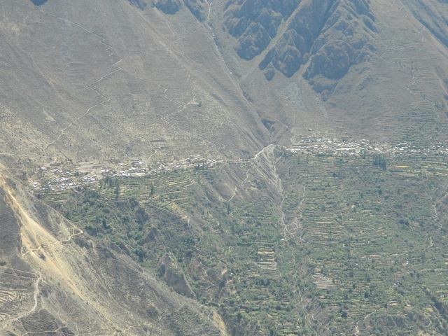
The bus arrived at Cabanaconde at 10 a.m. and in the heat, everyone else headed off with their guides to do their tours while I tried to find the start point of my solo hike. With the quality of the maps in general being poor and with no topographic ones at all, this was one of only tow navigation challenges I had. I asked one of the locals and was pointed out along the road the bus had come in along. A few hundred metres outside of town, I waved down a policia on a bike and he pointed me further on. At least I was on the right track. I eventually reached the San Miguel Mirador and looked back at Cabanaconde…

…and across at a couple of the settlements on the far side of the canyon. These two are, Malata and Cosñirwa. These are just two of about ten scattered along the canyon.

From the mirador I continued along the edge of the cliff following the wide trail to a large shelter with no walls. I stopped for lunch out of the heat. While it’s the middle of winter it’s still hot, reminding me of summer in Victoria, Australia, or late winter in Central Australia. Like those areas it’s dry, dusty and the sun shines brightly off the light coloured dust, making it annoying to discover that my sunglasses are broken. Yay! And I haven’t even started yet! Cheap Brazilian rubbish!
The trail is about 2 metres wide here and stays near the top of the cliff for a while. This path was recently closed because of rock slides blocking the path and while it’s officially open again, I’m still cautious.

The trail continues on, always heading slightly downwards and I can see where the trail has been repaired in several places. The direct sunlight is very draining, not that I had much energy to start with. I come across some workman having lunch in a shelter and they point me the right way when the trail forks. The other way no longer functions, I guess.
Soon I reach an area where the trail begins to zigzag down the mountain. I stop for a break and take off my boots to dry my feet – good practice on a hot hike. Looking down, I see the settlement of San Juan de Chuccho, my target for the day.

The trail zigzags steeply the entire way down the canyon wall and is long, hot and arduous. As I descend I see the bridge across the Rio Colca still several hundreds metres below that I’m aiming for with San Juan de Chuccho 50 metres up the hill beyond it.

Finally, after hours in the sun I reach the bridge and take another rest. I see an arrow and the word Roy’s pointing off along the trail, so I when I muster the energy I follow. It heads further along the canyon then begins climbing to eventually come to the small set of clay huts that is San Juan de Chuccho. Roy’s, it would appear, is the name of a hotel here, the first one. I find the owner’s son – perhaps 8 – who takes me to a room. His mother appears moments later and takes me to a better one with a double bed, bathroom, hot shower, and a bay window looking directly across the canyon to the trail I’d just climbed down…

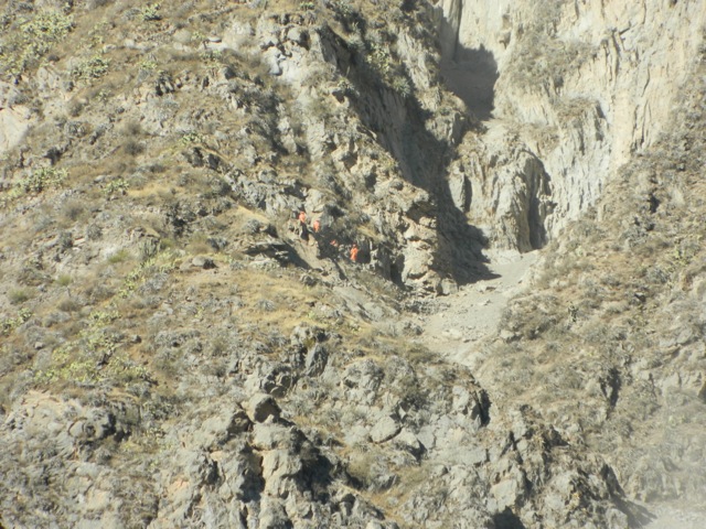
And high up on the trail, the tiny figures of the workers fixing the trail.

The price of the room? 20 Soles or about US$7.50. Less than camping fees in many places in Australia. I bought a large bottle of beer, a large bottle of water for tomorrow and booked dinner, each for 10 Soles. That’s expensive for the beer and water, but they have to carry it in by pack mule, so I wasn’t complaining. It was a couple of hours to dinner, so I took a nap, then after dinner I collapsed into bed.
Day 2 – San Juan de Chuccho to Llahuar
After 12 hours of sleep I was made pancakes for breakfast! Hell yeah!
After breakfast I packed and was off. It was already hot when I left, heading up past another three hotels and onto the trail that would take me the length of the populated canyon face to the hot pools at the far end. The trail meandered its way along the side of the canyon for 30 minutes before rounding a corner and heading up a gully. Along the gully a water channel had been created sending water from the small stream directly back to San Juan de Chuccho. Further up the gully, the trail crossed a bridge and began zigzagging steeply up the bank. I climbed, stopping regularly in the heat. 30 minutes later I arrived at the top and into the village Cosñirwa (the first of the twin towns I showed 6 photos up).
From here a dirt road led through the village, but I don’t see a soul as I walked. On the other side of town, I follow the road up a little to the second town – Malata – a couple of hundred metres further on. I also don’t see anyone until a truck came rumbling up the road carrying passengers in the back. I guess this is the only form of bus in the canyon. I walked on and the trail forks, the road continues on, while an old trail leads up to it. I decide to follow the trail and about half way along, the footing becomes so precarious I couldn’t continue, but instead of heading back and taking the road like a normal person, I decide to climb up a rocky gully instead, about 30m with my 15kg+ pack. This was difficult and took time, but I got there with only a few scratches. I’m thankful for all that time I spent indoor rock climbing. Useful!
The road continued until I came to a small dugout in the rock wall where I was able to take shelter from the sun and again take my boots off. From my vantage point, I could see some of the ‘Oasis’ below and the steep zigzag trail leading down to it…

And while I watched I could see several groups climbing down it, including this laden mule caravan…

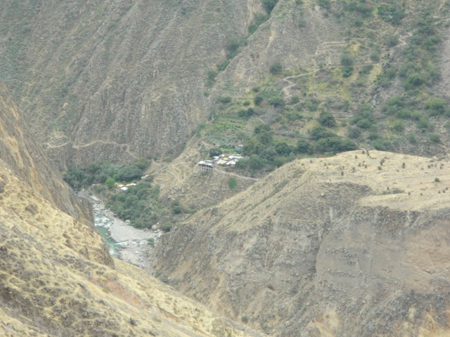
Heading off again, I continued along the road as it slowly climbed towards mirador Apacheta, the highest point I’d climb on this side of the canyon. This gave me a view further along the canyon, with my destination down near the river.

After a break, I headed off again down a dusty path that I consider to be rather dangerous, not because of the long fall of the side of a cliff, there is that but because of the potentially painful fall into one of the three varieties of spiked cacti here. Ouch!

As I headed carefully along the trail to a road and then along it, I passed two small communities, stopping at the second one for a refreshing bottle of Coca Cola. After a zigzagging climb down the next short bank, I crossed the river and headed briefly up the trail to my destination, Llahuar – pronounced ‘ya-oo-ar’ with a rolled r at the end. Two Ls together is a y sound, so Llama is pronounced Yama.
I stopped to rest and cool off with a cerveza – beer – before being shown to the aguas calientes – hot pools – belonging to the hostel, where I soaked right next to the river chatting to a solo french trekker who was doing the same. A perfect way to end a hot dusty day of trekking. Tomorrow I climb the zigzagging trail up the 1000m tall bank to the top of the canyon and back to Cabanaconde to end this little adventure. While it’s going to be difficult, being under the constant sun the entire way will make it worse.
Day 3 – Llahuar to Cabanaconde
After another 12 hour sleep, today began overcast and with pancakes for breakfast. I guess it’s difficult to bake or keep bread here… After packing, and donating some money to the French guy who hadn’t brought enough, I set off. The code of the hiker, always help other hikers in need. I climbed back up to the settlement I’d bought the coke from the day before and looked down the valley to the bridge that would mark the beginning of the hardest part of my hike.

I followed the road down to the bridge and found a small natural geyser bubbling away next to the river.

Then it was off up the trail and after climbing for 20 minutes I discovered I was going the wrong way, so had to head partially down again before finding another trail that lead me back up to the right trail. I didn’t need the extra work, but you get that. I began climbing and while it was generally overcast, and I was thankful to not be under the full sun, it was still warm. A way up the trail, I looked back down the valley to the tiny settlement of Llahuar and the pools at the edge of the river.

A short time later, an aging local man casually comes climbing past me like he was walking up a slight hill. The trail was long and hard, and I stopped on many occasions for breaks. At point high on the canyon wall, the trail wound in along a deep gully, the first part that actually went slightly down before crossing a bridge at the top of the gully and again heading up the side of the mountain.
I finally reached the top of the canyon to discover the trail continued on along the top of the cliffs for another couple of kilometres, up and down several small hills before arriving in Cabanaconde. With the town finally in sight I quick marched to the centre plaza and found a hostel. It was a little crumby, but all I needed was a shower and a bed behind a locking door.
After my third 12 hour sleep in a row, I was on the bus and back to Arequipa, stopping briefly for a photo of the plains at the end of the canyon, before heading off again. On the way back, over the highest points – near 5000m above sea level – it snowed and I’m glad I wasn’t still in the canyon.

Colca Canyon is a hikers’ wonderland, with so much to see. It’s not an easy walk, but for the fit there is plentiful places to visit and see, if you don’t mind climbing some pretty heavy trails with just a touch of altitude.
Next, I head north to the city of Ica, where I can gain access to the Paracas National Reserve, the Red Beaches and sand boarding.
The Lone Trail Wanderer

2 thoughts on “Colca Canyon, Peru”