Tag Archives: Waterfalls

Savai’i Island, Samoa – Impressions

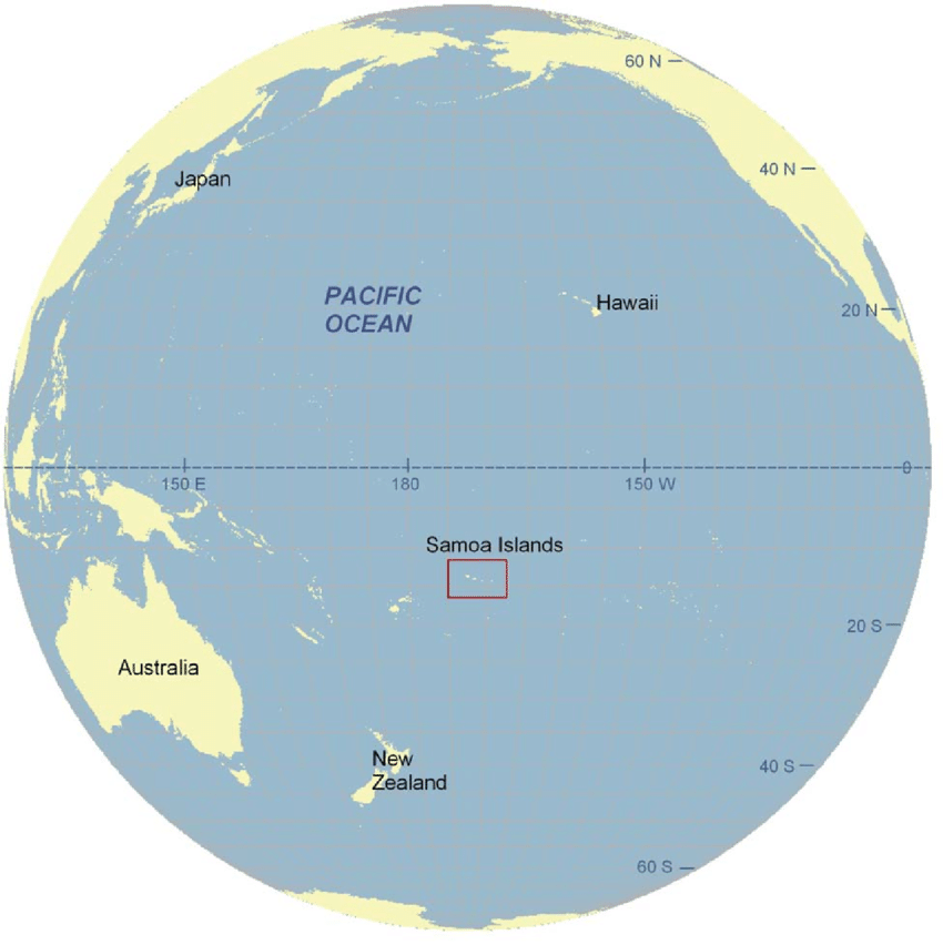
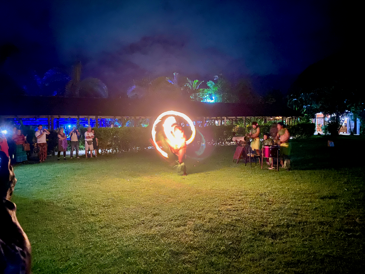
In March 2023 I headed out to Samoa for a weeklong family gathering in Upolu, the country’s main island. Then once much of the family returned home, myself and my parents visited Samoa’s other main island, Savai’i. For me it was to explore a place I’d not been before, and for my parents it was to trace back some of our family heritage by finding a family cemetery.

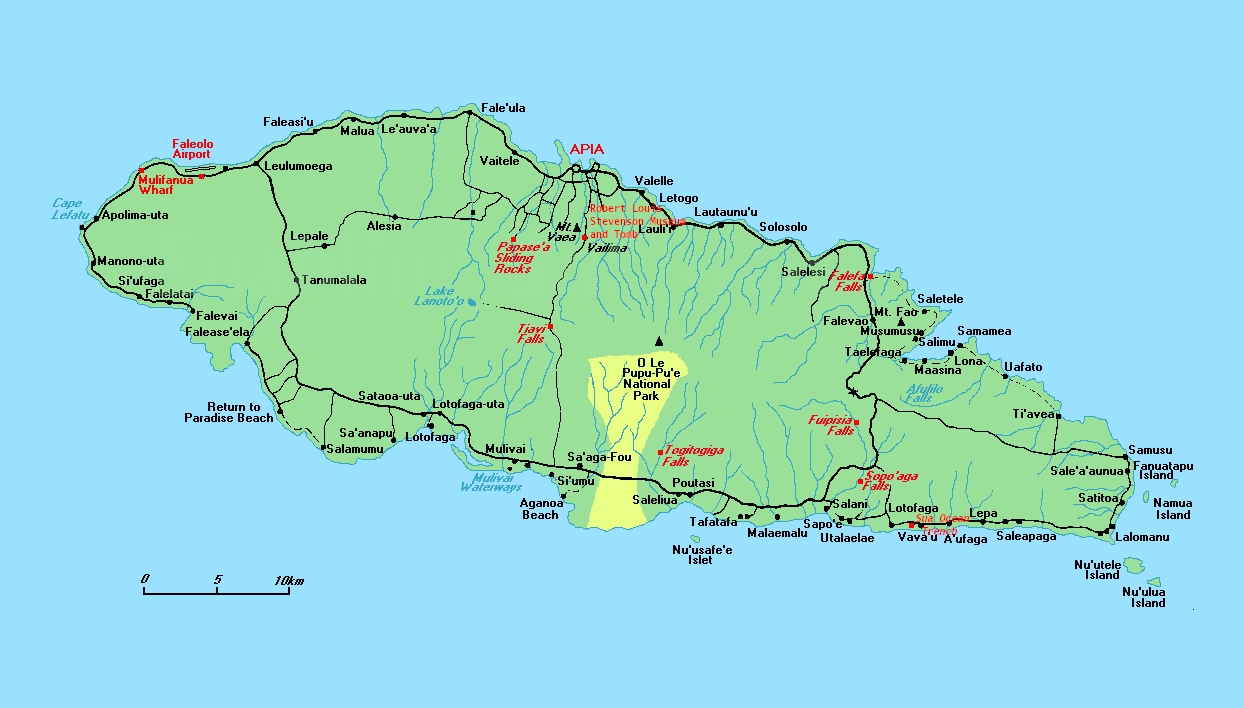
Savai’i is the largest island in the Samoan Islands chain, both in size and height, and is the sixth largest Polynesian island after the 3 New Zealand Islands and two of the Hawaiian islands. Savai’i is more traditional than Upolu with a more relaxed feel. There is also no airport on the island, so arrival must be via boat, usually the car ferry.
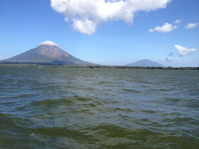
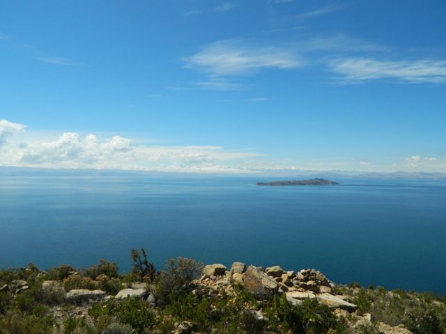
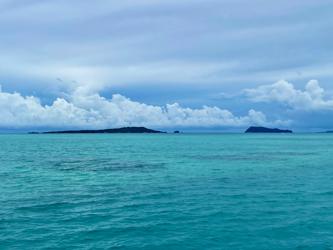
Ferry to Savai’i

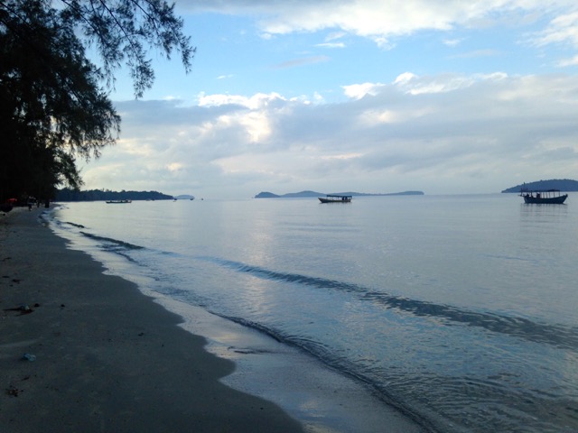
There are two ferrys to Savai’i, a small one and a larger one. On our trip over from Upolu Island, was in the small ferry. It’s the first car ferry I’ve ever had to reverse onto it, but I was guided on by helpful workers. This ferry had no sitting area, so we stayed in the car without aircon. We did find a spot at the edge of the deck where we could feel the wind. On the way back, we were on the larger ferry and locked up the car and went to sit in the airconditioned passenger seating area.

img_1147-2023-03-25-18-43.png

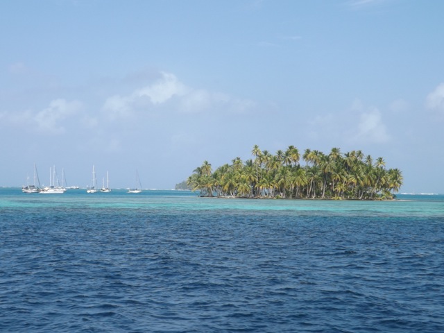
On the slow chug of the ferry, we passed the small islands of Manono and Apolima. The trip over on the small ferry took 90 minutes, while the larger one took about an hour.
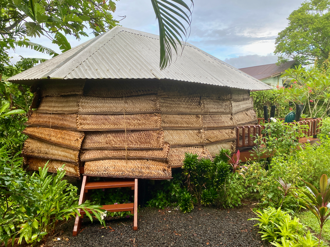
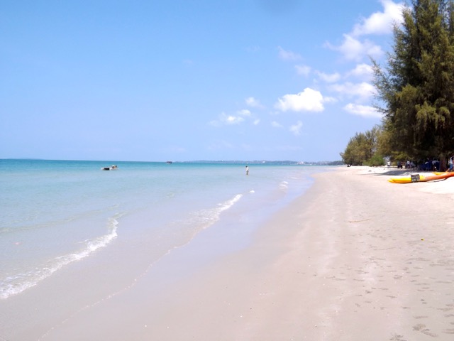
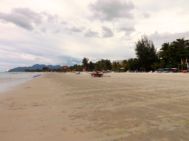
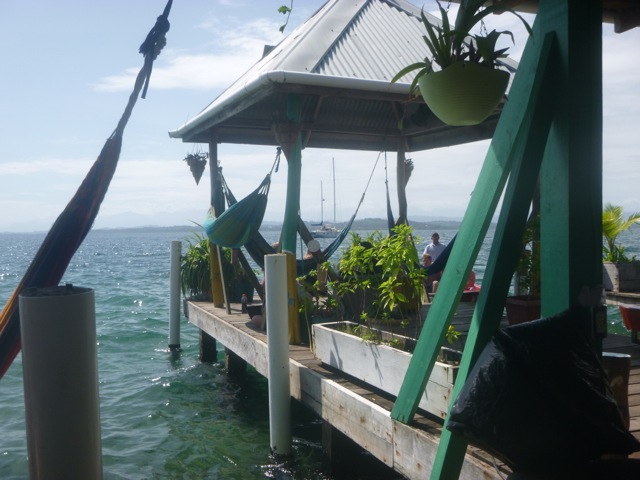
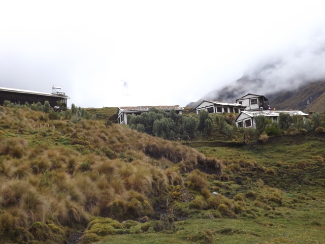
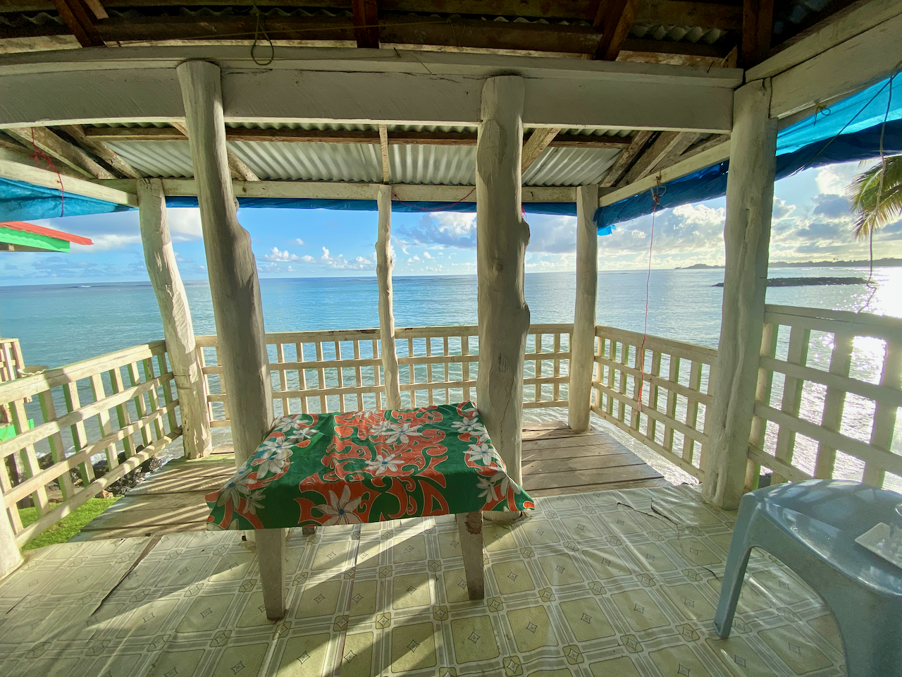
img_1140-2023-03-25-18-43.png

Beach Fale

Fale in Samoan means ‘building’, and they are very common on the islands. The original fales were simple structures made from posts and a thatched roof. These days they’ve been modernised with concrete floors and corrugated iron roofs. Beach Fales are common ways for families to make extra money by renting them out to visitors. Mine had woven shields on the back half and tarpaulin sheets on the ocean facing half. While these provide some privacy, they can block the elements, especially during heavy winds or storms. The woven panels when partially drawn are good for allowing air flow on the usually steamy island nights.

img_1148-2023-03-25-18-43.png

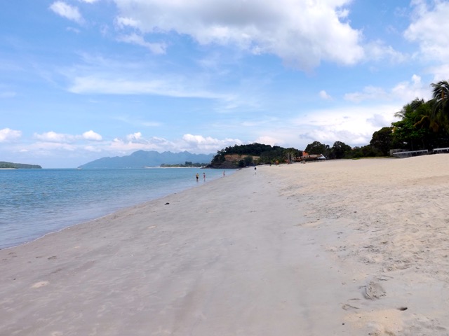
Inside mine were two beds, one with a mattress to sleep on, the other to put my bags on, plus a small table, a chair and most importantly, a mosquito net. For convenience, mine also had a light and a power plug. While not for some – my parents stayed in a resort up the road – I like trying new things, and on most days the views out the front at high tide were amazing. From time to time, I’d even see a turtle popping it’s head out of the water.

img_1150-2023-03-25-18-43.png

Breakfast and dinner are both included in accommodation, all traditional fare, and on the last night, there were lobster tails, local BBQ, a cooked salad with fried taro and potato.

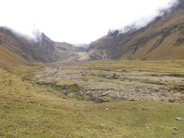
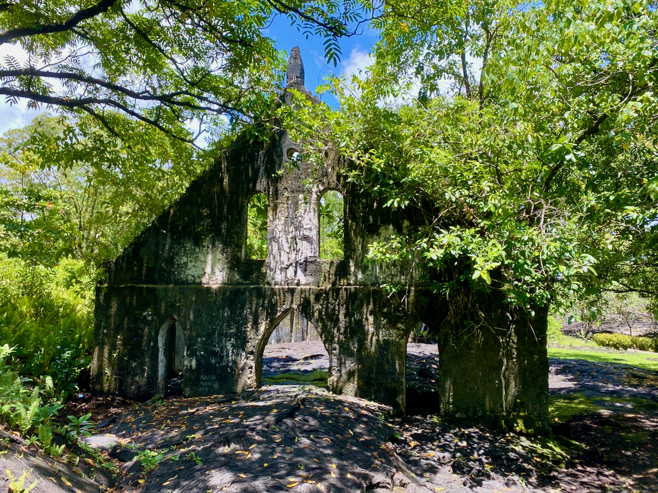
Saleaula Lava Fields

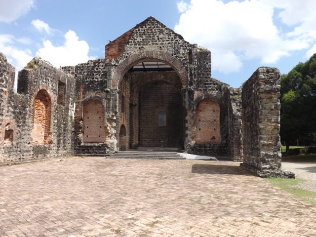
On the 3rd of August, 1905, molten lava began blowing from the ground from Mt Matavanu. It spilled over the crater’s rim filling a deep river valley leading to the flat Saleaula coastal plain, overwhelming part of Saleaula Village. A year later and much of the coastal plain had been covered, the lagoon had been filled, a vertical basalt cliff had built up over the coral reef, and five villages with their adjacent farming land had been buried. The eruption continued for a total of 6 years.

img_1155-2023-03-25-18-43.png

One of the buildings that was hit by the lava was the London Missionary Church, the remains still standing.

img_1154-2023-03-25-18-43.png

Some things didn’t succumb to the lava, like the Virgin’s Grave. Some say it belonged to a virgin daughter of a high chieftain, while others say it belonged to a virgin nun. In either case, the reasoning why the lava went around the grave instead of over was because the girl was so pure.

img_1156-2023-03-25-18-43.png

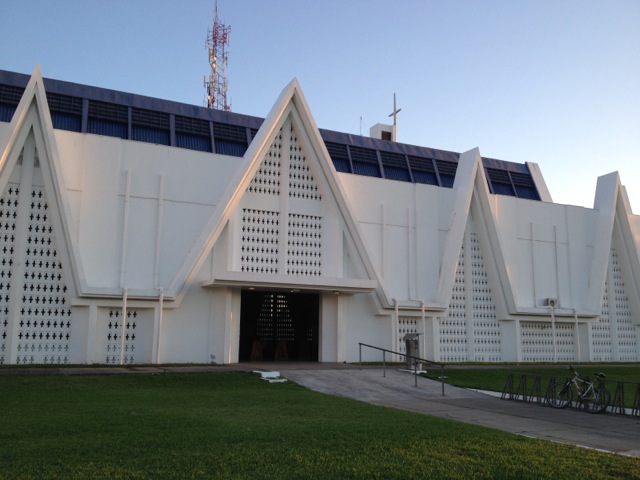
Safotu Congregational Christian Church of Samoa

This church, in the north western corner of Savai’i, is known for being the last church built from crushed coral. Coral was used to build many things in Samoa, from roads to buildings. Crushed to a fine sand, it was mixed with limestone to make a concrete. It’s been painted within the last few years to look almost new.

img_1159-2023-03-25-18-43.png

Flying Foxes

There is a species of flying fox in Samoa known as the Pe’a, which can also be found on Fiji and American Samoa. They are a hunted species, often eaten on special occasions by the locals.
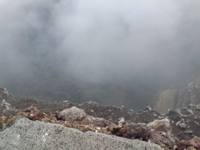
img_1163-2023-03-25-18-43.png

Pe’a Pe’a Cave

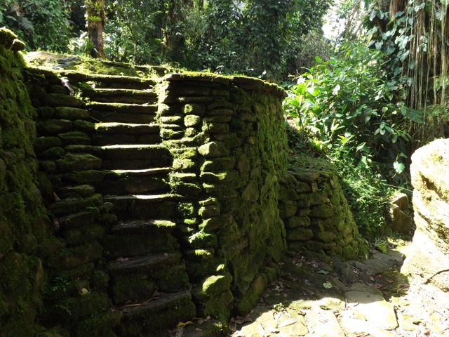
The cave is a lava tube from around the time of the First World War, when lava rushed through the area burning through whatever was here then hardening into a long tunnel. Steps lead down into the cave which then widens, running for 50m or so before the roof drops to low to walk under. I stopped there, but apparently the cave goes for a kilometre to the ocean, but can be too narrow to get through in places. The name of the cave is from the Pe’a Pe’a bird which nests in and around the cave. We saw one flying circles around the end of the cave.
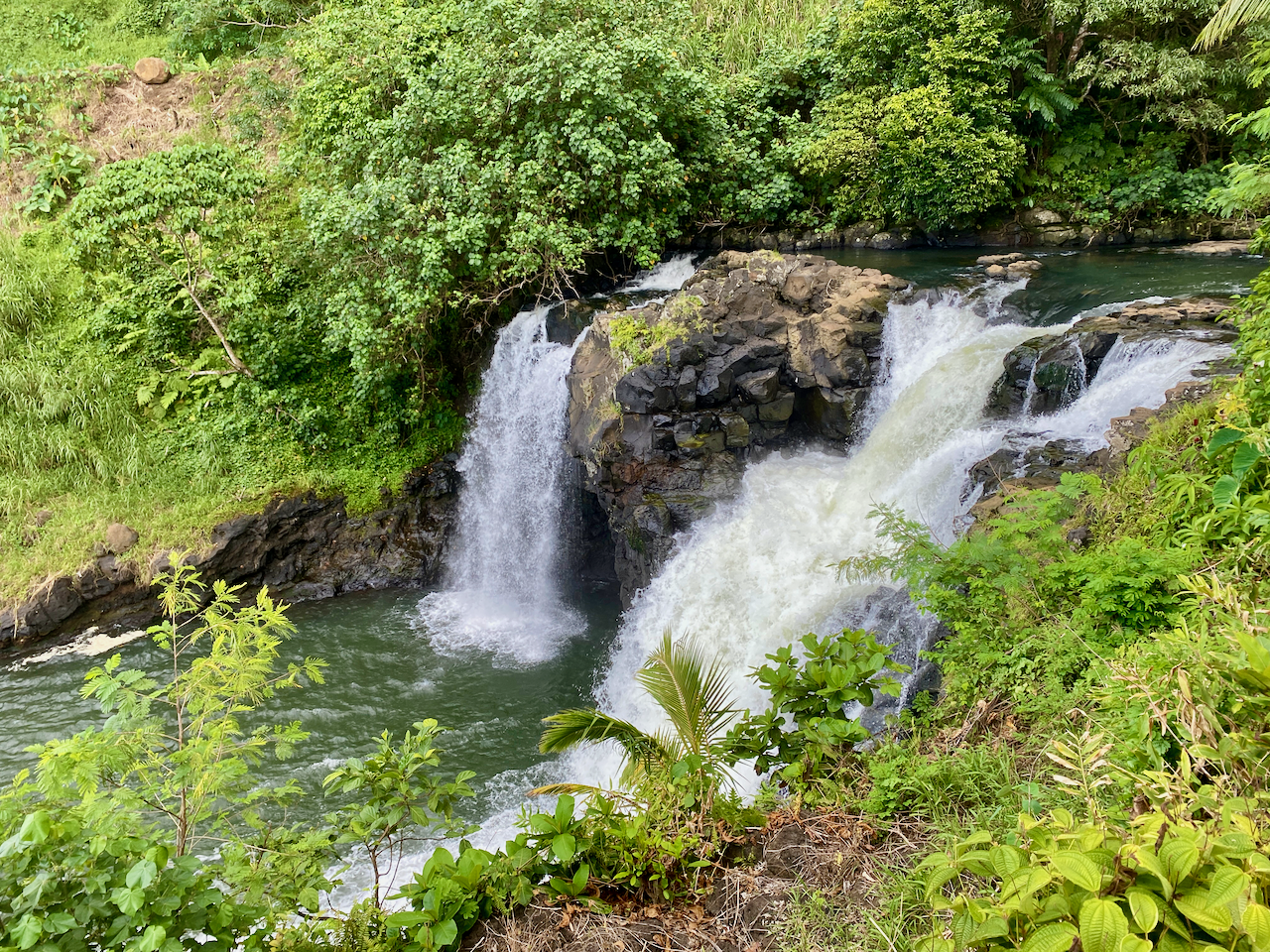
img_1171-2023-03-25-18-43.png

Alofa’aga Blowholes

These are also known as the Taga Blowholes you must pass Taga villageto get to the blowholes and pay WST5 to use the land. Here, lava flows have created a series of tubes connecting a flat clifftop of lava rock with the ocean below. Waves breaking against the lower end of the lava tubes push water at high pressure up through the tubes, sending spray followed by fountains into the air every few seconds. There are many of these along this area near the ancient village of Fagaloa.
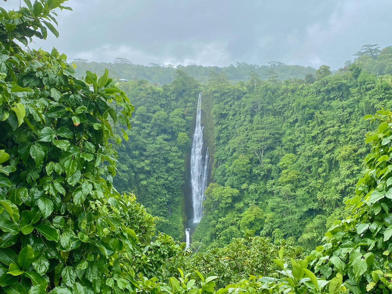
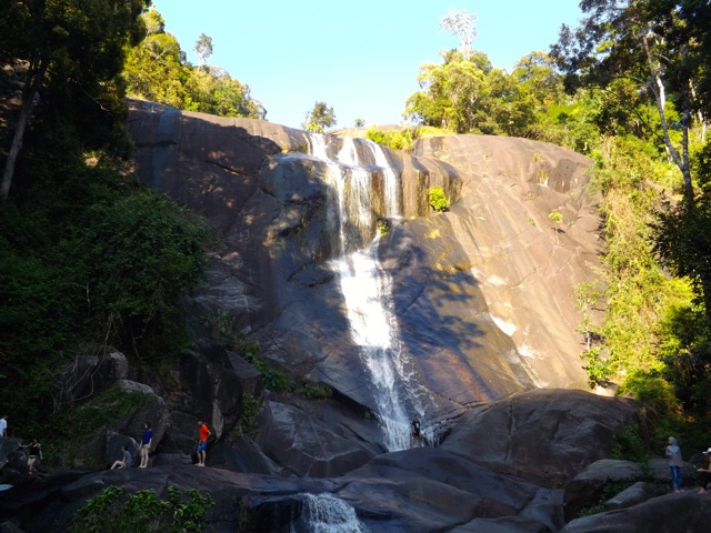
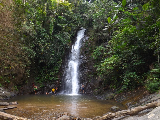
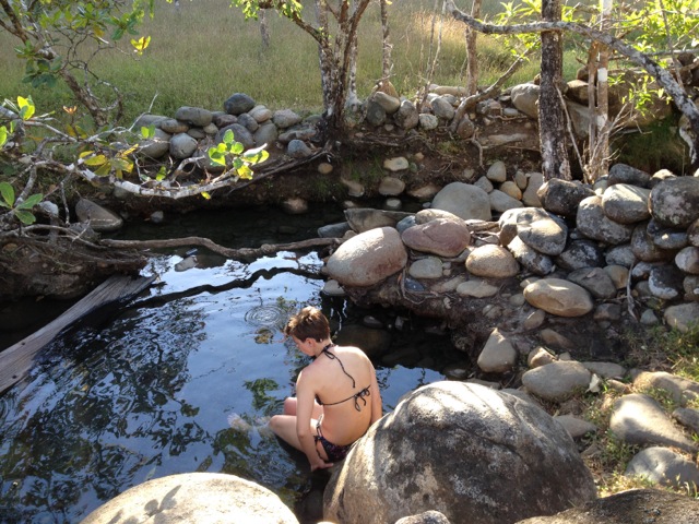
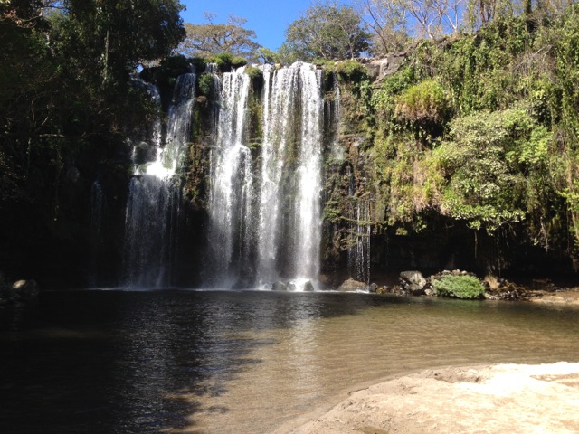
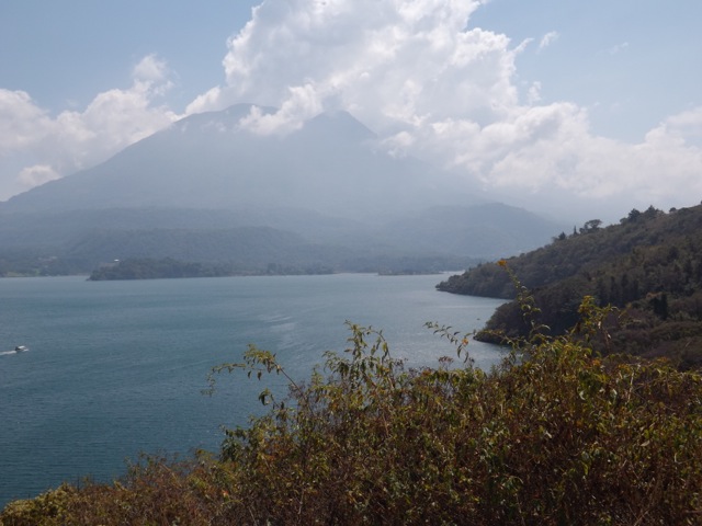
img_1179-2023-03-25-18-43.png

Afu Aau Waterfall

The waterfall was WST10 to go into as it is on Palauli land. There are three parts to the falls, the two minor falls along the track, and the main one at the end. There is a legend that a giant named Mafane lived near the Palauli village. Over time he turned into a mountain that erupted forming a crater for water. Twenty-five streams run from the crater – the 25 warriors of Mafane’s battalion – feeding 7 rivers, one of which runs down the Afu Aau waterfalls. The pool was large and two of us from the tour swam in it, climbing up the rocks behind the waterfall and jumping in the pool. Note, there are rocks in the pool, so it’s suggested to be careful when jumping. The pool was cool and crisp, great in the heat of the day, although the steps to get out were slippery. Some girls in the next fale from me went a few days after we did, and the waterfall wasn’t flowing. The could still swim in the pool though.

img_1201-2023-03-25-18-43.png

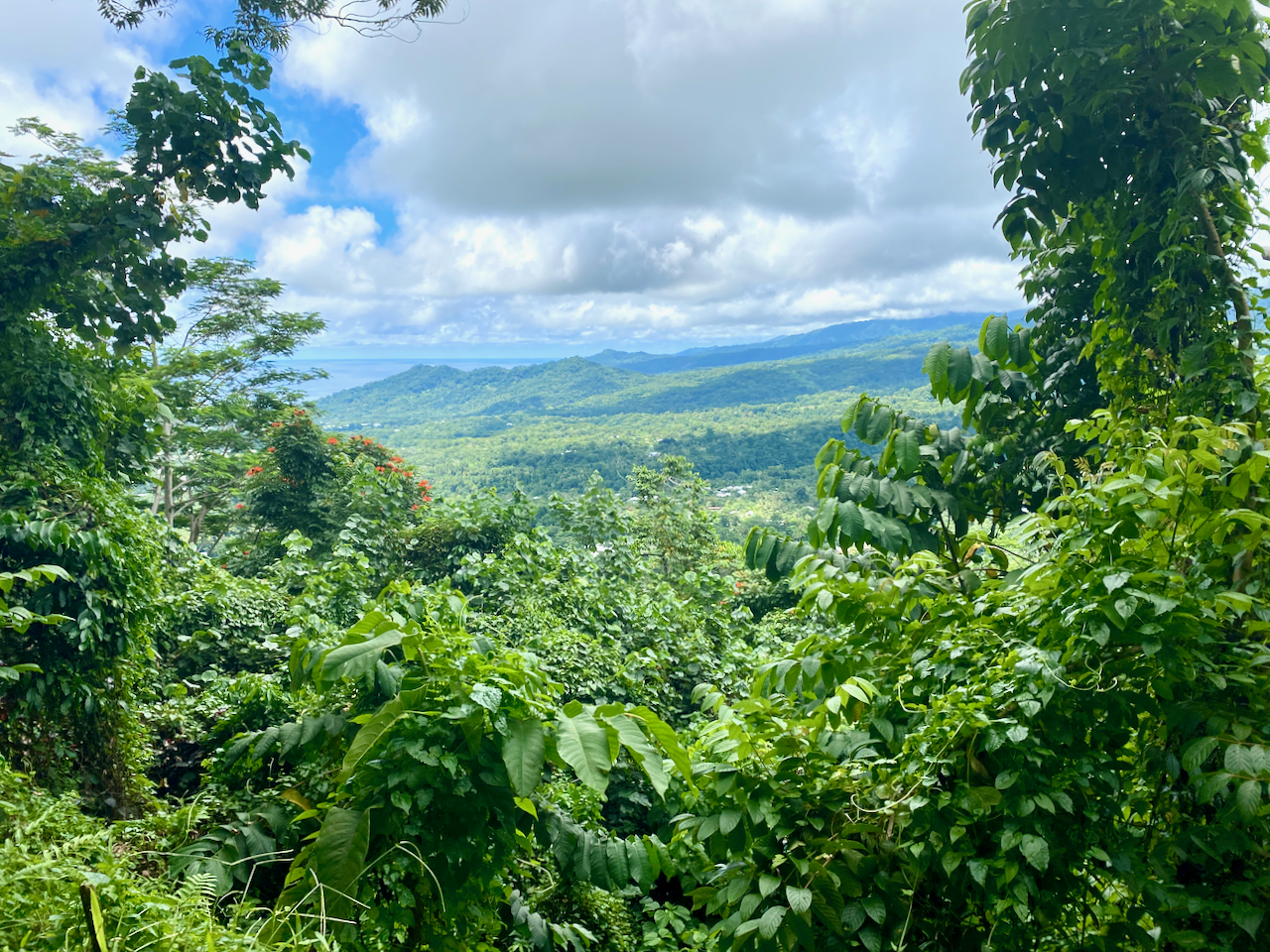
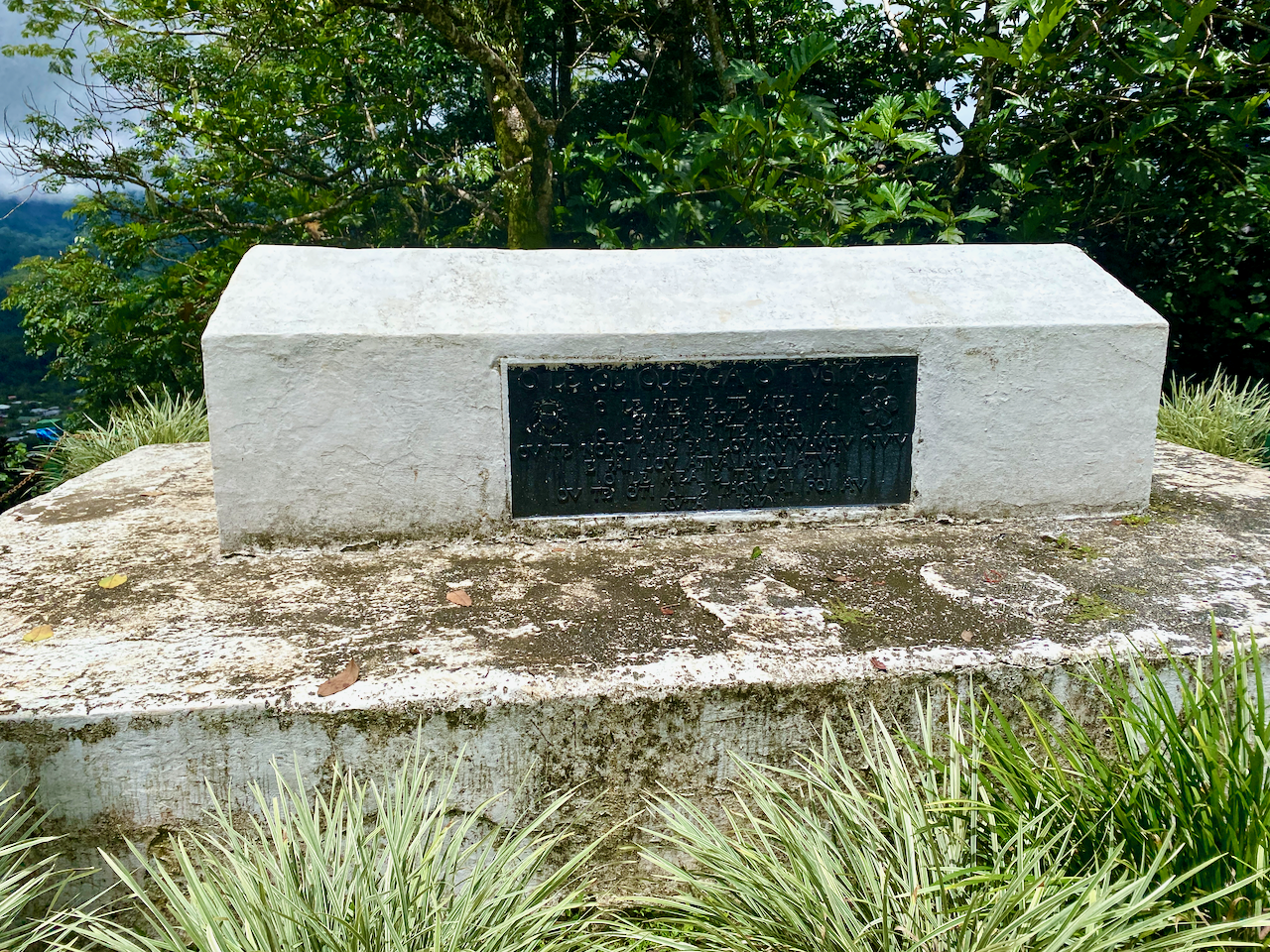
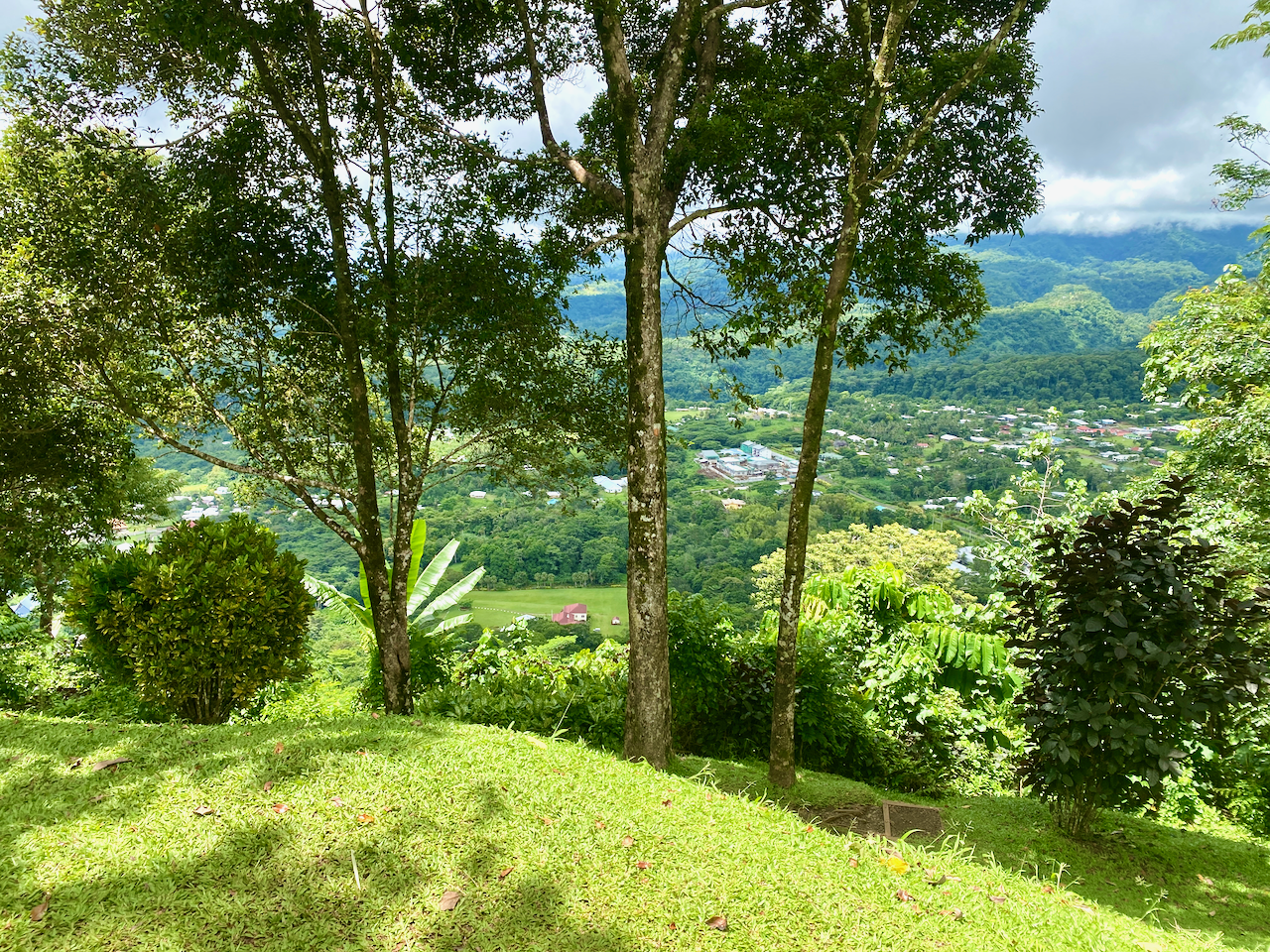
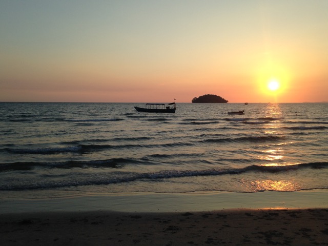
John Williams Memorial

Samoa is a christian society with over 100 churches on the islands and strict holy day views with church services important. John Williams was a British missionary who visited many of the island chains throughout the Pacific bringing the word of christianity. The first was one of the islands of French Polynesia, before he moved on to the Cook Islands and many others. He arrived in Samoa in 1830 to meet with the then high chief who accepted christianity immediately. Then, with the aid of local translators he created the first bibles for the Pacific Islands. Unfortunately, on arriving in the New Hebrides, now known as Vanuatu, he was killed and eaten by cannibals. This monument was built in his honour and stands on the eastern shore of Savai’i.

img_1202-2023-03-25-18-43.png

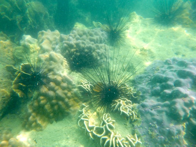
Matautu Bay Snorkelling

I’d brought my own snorkelling gear so I wanted to get in amongst the coral at some point on my Samoan explorations. I found the only Dive company on the island – Dive Savai’i Samoa – and booked a trip. Because of the small numbers, there were three separate groups on the boat, snorkelers, divers training for their accreditation and an accredited diver. Each of the three groups had a guide/instructor. They took us out to three separate locations around Matautu Bay. The one thing I was missing was an underwater camera, as mine had died in Rarotonga and new ones were quite expensive.

img_1206-2023-03-25-18-43.png

At our first stop, we swum behind the guide along the length of a coral reef with many fish, and to my surprise many turtles, some sleeping around the coral, others just out for an afternoon swim. The second spot was near an old ship wreak, the John Williams 5 apparently, but I was unable to find any information online about it. And while we were there, a turtle came to visit, eating little squares of Papaya skin we threw to it. Last stop was the coral garden, but we had to be careful, as some areas were quite shallow. Overall, a great day out on and in the water.

img_1211-2023-03-25-18-43.png

Cemetery of Distant Relatives

One of the main reasons to come to Savai’i was to track down our family’s burial ground so dad could continue his work crafting the family history. We were shown the family houses in the Manase village close to where we were staying, and found that the cemetery was up on the hill. Unfortunately, with dad’s health he’s unable to climb a hill in the heat, but I was able to talk to the woman who owns my fale and tell her our story. In true Samoan style, she was off next door to organise a 4 x 4 vehicle to take us up there. An hour later we were being driven up a crazy 4 x 4 track, bobbing madly back and forth as it went. Before long we came out at the cemetery where they were preparing a grave for a funeral at the end of our stay. There were only headstones there, but they dated back more than 100 years to Dad’s adopted father’s parents and kin. Later, I was come to learn that the owner of my fale is also a distant relative.

img_1219-2023-03-25-18-43.png

Impressions

Savai’i Island is less built up than Upolu Island and there is less there to do and see. But we still managed to fill out time and enjoyed the more relaxing week of our stay.

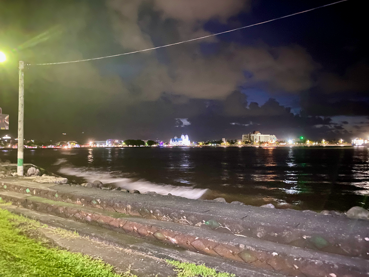
Then after the week, we were back to Apia on Upolu Island for a few more days.

The World Wanderer

Upolu Island, Samoa, Impressions

In March 2023, myself and 14 members of my extended family flew out to the Island of Upolu in Samoa for a family gathering and to bring the ashes of my grandfather home. We all set up our base in Apia, the capital of Samoa and the largest city on Upolu.

Upolu is the main island of the Samoa, previously known as Western Samoa to differentiate it from American Samoa which separated in 1899. While not the largest island of the chain, Upolu has the highest population.

Apia

Apia is a mad mash of worlds. On one hand, there are wondrous resorts, restaurants and churches. On the other there are hovel markets, lines of shops, reminisant of south east Asia selling all manner of trinkets and knicknacks, sidewalk stalls, and so many taxis. Near the heart of the Apia is the clocktower.

img_1027-2023-03-16-13-09.png

Around the bay from the resorts is the marina, with many ships and small boats docked. There’s also a more upmarket bar and restaurant area called The Edge and has views over the marina, the bay and Apia.

img_1042-2023-03-16-13-09.png

After a couple of choice cocktails during happy hour, we walked five minutes down the road to one of the best restuarants on the island, Paddles, stopping to admire the lights of Apia across the bay.

img_1048-2023-03-16-13-09.png

Garden Fale

While the other 14 members of my extended family stayed at a large and somewhat expensive resort, I went for the more local style at another resort a couple of kilometres away. And instead of an air conditioned room with TV, bar fridge, toilet and shower etc, I chose a garden fale. The fale is literally just a room with a roof and woven shades on each side pulled down for privacy and protection from the elements. It’s hot inside, but by partially pulling up some of the shades, a draft can pass through. Inside there is just a pair of mattresses on the floor, mosquito netting on each, a lockable safety box, a light and a pair of power outlets. This was my first experience with a fale of the kind, but not my last. It was a fun and sweaty experience, that I enjoyed, although in this case I only stayed two nights instead of the nine I’d booked due to bed bugs.

img_1021-2023-03-16-13-09.png

Fiafia Night

The resort where my extended family were staying hosts a Fiafia every Wednesday, so we decided to take part in this cultural event. There is much dancing and singing by our hosts, and a large buffet dinner with suckling pork on the menu. Someone even leaked to the crew that there was a birthday and they dragged my sister up to present her with a cake.

Then once the singing and dancing inside was done, we were herded outside for the fire show. An enjoyable experience.

Sua Ocean Trench

Fifteen people is a lot to transport around the island, especially if the only people mover we could rent was a 12 seater. We decided to split the group and five of us headed on a road trip across and around the island to the To-Sua, which in samoan means ‘giant swimming hole’. It has salt water flowing in from one side, and at high tide, you can climb down the crazy lader and swim in it. A great day out for the WST20 entry fee.

img_1064-2023-03-16-13-09.png

Waterfalls

On the way to and from the Sua Ocean Trench, we passed five waterfalls:

Papapapai Falls
In the centre of Upolu are the tallest falls in Samoa dropping 100m into a volcanic crater. There is a carpark on the side of the road and a short 10m trail through the the grass to the best views . There was no charge for this waterfall.

img_1053-2023-03-16-13-09.png

Togitogiga Waterfall
On the south side of Upolu is O le Pupu-Pue National Park, we followed a short road to a carpark. Then a short fairly flat 200m walk along a rocky track leads to a park with fales, a bbq, toilets and two pools, one above and one below the falls. The falls aren’t large, but gush down into the lower pool. It’s known to have been a place where great warriors of Samoa’s past swam. Four days later, we drove out to have another look with a different group, only to find that the falls were dry. How quickly things change. These falls are also free to visit.

img_1061-2023-03-16-13-09.png

Sopoaga Falls
Near the Sua Ocean Trench, a well manicured garden surrounds a viewing platform looking across a river basin to the falls. Cost to enter this area is WST10, so only I checked it out, my family members deciding to sit this one out. While not as impressive as Papapapai Falls, the garden area is a place you could spend an hour chilling over a picnic lunch or similar. The river valley flowing away from the waterfall is also rather impressive, with great green walls disappearing into the distance.

img_1070-2023-03-16-13-09.png

Fuipisia Falls
These 55m tall jungle falls are apparently spectacular, but at WST20 it was too rich for us to look at for a few minute viewing. This was however, the only waterfalls our other contingent stopped at, talking the land owner into dropping the price to WST10. Photo courtesy of them.

Falefa Falls
Near the north side of the island again, the final waterfall we visited was right by the road, and we stopped quickly to check it out. It’s only a short falls, with a river continuing to run out to sea, but apparently you can swim in it. We didn’t stop at the official garden entrance, but at the side looking down at it. But as we looked, a man came out of a fale 20m behind us and charged us WST5 to view it.

img_1084-2023-03-16-13-09.png

Parase’ea Sliding Rocks

Not far out of Apia are the Parase’ea Sliding Rocks. It’s one of those redundant double names like East Timor, which in East Timorese is literally East East. Parase’ea means ‘sliding rocks’ in Samoan. There are a trio of small waterfalls, all with somewhat smooth rocks that can be slid down into a pool at the bottom. Entry fee is WST5 each.

The top falls were the shortest and easiest to slide down (photo not included). The second and main slide is more dramatic and when you come down the 100 or so steps to the sliding rocks it’s the first you come to. The far side is the correct side, due to there being a deep enough pool. It’s nerve-racking sitting at the top and pushing yourself over, but it ends quickly enough with a splash at the bottom.

img_1102-2023-03-16-13-09.png

The bottom one has two parts. I called the first part the devil’s throat as it reminded me of the Iguazu Falls in South America. Sliding down into the pool surrounded by water from three sides.

img_1104-2023-03-16-13-09.png

Then pushing up onto a lip and sliding down the next on the left side, gaining air at the end before dropping into a pool.

img_1105-2023-03-16-13-09.png

Then, once we were done, we climbed back to the carpark where there are great views down over Apia.

Robert Louis Stevenson Museum

Robert Louis Stevenson was a British writer born in 1850 who wrote such classics as Treasure Island and Strange Case of Dr Jekyll and Mr Hyde. Suffering from health problems for most of his life, he decided to move to the Samoa in 1889 where the climate greatly helped his condition. In 1890 he purchased land and had a large 2-story house built, the first in the country. He would die here four years later, but not before becoming a beloved advocate of the Samoan people.

img_1224-2023-03-16-13-09.png

During the last days of my stay, I caught a taxi to his house, which has since been converted into a museum. I took the tour and heard tales of him, his wife, her 2 children from her previous marriage, and his mother.

img_1274-2023-03-16-13-09.png

On his sudden death in 1893, Samoans stood a vigil over his body for the night, before clearing a way to the top of the hill nearby where they carried his body, and laid it to rest. After the tour, I set off up a trail to the top of that hill. There are two paths, the short steep one, and the long, not so steep one. I climbed the short one, and dripping heavily with sweat in the 32º heat, stopped several times to catch my breath and check out the view.

img_1279-2023-03-16-13-09.png

I finally reached the top where I found his resting place and a cool breeze.

img_1281-2023-03-16-13-09.png

There were excellent views back down to his house and the surrounding area. When I was done, I decided to take the longer route back down again, which was certainly a lot longer and less step, along with being fairly muddy.

img_1282-2023-03-16-13-09.png

Impressions

Upolu wasn’t what I was expecting, especially after my month in Rarotonga a year ago. The number of cars racing everywhere, dozens of taxis taking people back and forth for next to nothing, the mass of people in Apia, then the quieter areas all over the rest of the island. The sheer number of Fales and villages was all an experience, especially in the 32 degree heat. The people are generally friendly wherever you go and the atmosphere is very laid back. It was a good time to see a new country, and spend time with the extended family while we scattered the ashes in the sea outside where my grandfather grew up.

The World Wanderer

Sihanoukville, Cambodia – Impressions

Five hours by bus south-west of Phnom Penh is Cambodia’s only deep water port, Sihanoukville. The port was used by the US during the American War with Vietnam. When the US evacuated the region the Khmer Rouge attacked, seizing a US container ship. This led a two-day rescue operation by marines including airstrikes across the city.

wpid-cambodia-sihanoukville-2015-02-27-12-41.jpg

Sihanoukville is becoming more popular among tourists because of its long golden sandy beaches and peaceful untouched islands. It’s lack of infrastructure is the only reason it has yet to become like the southern Thailand islands, Koh Phangan and Koh Samui. But it’s only a matter of time.

wpid-dscf7398-2015-02-27-12-41.jpg

Beyond hanging at the beach and cruising the islands, there’s little to do in the area. This didn’t stop me hiring a scooter and heading out to see what I could find.

Wat Leu
One of five main temples in and around Sihanoukville.

wpid-dscf7368-2015-02-27-12-41.jpg

Wat Leu is also called the Upper Wat as it stands on a hill providing great views along the bay.

wpid-dscf7372-2015-02-27-12-41.jpg

Kbal Chhay Waterfall
This small waterfall is 7km from Sihanoukville and the main source of fresh clean water for the city.

wpid-dscf7393-2015-02-27-12-41.jpg

The falls became a hiding place for the Khmer Rouge in 1963 effectively cutting off the water supply.

wpid-dscf7392-2015-02-27-12-41.jpg

Island Tour
With little else left on land to do here but sit at the beach, I booked myself on a boat and was out on the beach waiting for it in the warm early morning air.

wpid-img_2402-2015-02-27-12-41.jpg

During the tour, we visited three different islands, swam, stopped for a bbq lunch on the beach and snorkelled. As the water was mostly murky, it wasn’t the best for snorkelling but I enjoyed the time anyway.

wpid-p1000407-2015-02-27-12-41.jpg

On our return, I hung out at a $5 bbq restaurant on the beach watching the sun set.

wpid-img_2401-2015-02-27-12-41.jpg

Overall, Sihanoukville is a lovely, serene and peaceful place to stay for a couple of days if you like basking in the sun. The location where I was staying was a distance out of town and was particularly relaxed and quiet.

Next, Siem Reap and the much-lauded Angkor Wat.

The Lone Trail Wanderer

Langkawi Island, Malaysia – Impressions

Langkawi the Jewel of Kedah, as it’s officially known, is Malaysia’s answer to Bali, albeit a much quieter version. Tourists come to the island because of the amazing beaches and the lack of crowds, giving it a more secluded feel than nearby Penang.

wpid-malaysia-langkawi-2014-12-12-17-00.jpg

Langkawi, meaning Island of the Reddish-Brown Eagle, was originally believed to be cursed. A beautiful young woman named Mahsuri was accused of adultery and executed on the island. With her dying breath she brought down a curse of bad luck for seven generations. Her tomb is a popular tourist location, although a village has been built around it and fees charged to enter.

wpid-dscf5960-2014-12-12-17-00.jpg

Palau Langkawi is slightly larger than Penang Island and like its southern sister, the best way to get around it is via scooter. Yay! While more expensive to hire than in Penang they’re still cheap at only NZ$12 per day. A tank of gas will cost just over NZ$2 and will get close to two laps around the entire island.

Beaches
Surrounded with beaches of white sand, Langkawi is definitely a picturesque paradise. Most people stay in the touristy Cenang area, with Pantai Cenang perhaps the beach most similar to Kuta Beach in Bali.

wpid-dscf5975-2014-12-12-17-00.jpg

And within walking distance is another popular beach, Pantai Tangah.

wpid-dscf5963-2014-12-12-17-00.jpg

If you have transport, there are more beaches within reach. Only 30 minutes north is the empty Pantai Kok.

wpid-dscf5908-2014-12-12-17-00.jpg

And another 30 minutes through the mountains to the northern side of the island there’s such beauties as Pantai Tanjung Rhu, right near Scarborough Fish n Chips, the best on the island.

wpid-dscf5948-2014-12-12-17-00.jpg

Waterfalls
Scattered around the island are several waterfalls. While they aren’t spectacularly tall or wide, they’re enjoyed by locals and visitors alike as swimming spots. On our scooters, we stopped by at 7 Wells waterfall…

wpid-dscf5938-2014-12-12-17-00.jpg

… and Durian Perangai Falls.

wpid-dscf5953-2014-12-12-17-00.jpg

Oriental Village

Located at the northern end of Pantai Kok, the oriental village is an open air complex surrounding a small lake. It’s an entertainment zone with many different things to do. For the kids, there’s the water balls, round or tubular…

wpid-dscf5915-2014-12-12-17-00.jpg

The village, while not very oriental looking, has elephant rides, eagle viewing, tiger watching and snake cuddling…

wpid-dscf5923-2014-12-12-17-00.jpg

It’s also home to the Skycab, the cable car that takes people to the top of nearby mountains…

wpid-dscf5914-2014-12-12-17-00.jpg

The panoramic views over most of the island are spectacular. While the ascent can be a little breathtaking, the journey is worth it for the views alone.

wpid-dscf5934-2014-12-12-17-00.jpg

Overall, Langkawi is a perfect place to take a break away from the world. With only 65,000 residents, it’s a very peaceful place with a handful of tourist options and many beaches to relax at.

Next we head north for the craziness of Christmas and New Years in Thailand.

The Trail Wanderers

Looking Back, Central America

While it took ten months to work my way up the massive continent of South America, three months seemed only a short time to explore the Central America sub-continent even though it’s barely larger than Colombia. But since I was in the neighbourhood…

wpid-04838a73ba16566078c9dbd7f4f662c1-2014-03-25-19-32.jpg

Panama

San Blas Islands

With no straightforward bus route from Colombia to Panama, I chose a five-day cruise through the San Blas Islands, finishing in Panama City. The San Blas Islands are a glorious chain of islands in the Caribbean Sea, but make sure you do your research as the cruises aren’t always up to standard.

wpid-dscf3016-2014-03-25-19-32.jpg

Panama City

After so long in South America Panama City feels a little like home with its massive skyscrapers, malls, cinemas and fast food chains. When travelling long-term you lose the sense of time and on arrival in Panama days before Christmas I forget that it was prime holiday season for the locals. With most of the holiday destinations booked solid and long lines to get on any buses, I decided to spend the holidays hanging around the city. While there I visited the colonial old quarter of Casco Viejo, the canal and the ruins of Panama Viejo.

wpid-dscf3062-2014-03-25-19-32.jpg

Being in Panama City feels like being in the United States. There are so many Americans and I rarely needed to use my spanish skills as most people spoke english.

wpid-p1000006-2014-03-25-19-32.jpg

Bocas del Toro

After the holiday break I headed west to Bocas del Toro, an archipelago on the border of Costa Rica. In the surf/party town I took the opportunity to spend a day on a catamaran snorkelling around the reefs and another sitting in a hammock at the hostel.

wpid-p1000110-2014-03-25-19-32.jpg

Boquete

Then taking a chicken bus, I spent three days in the cooler climes of the mountain town of Boquete. While there I climbed the tallest mountain in the country – Volcán Barú. The views were wonderful from the top, but starting the 26km hike at midnight is difficult. So to recover I spent time in some natural hot springs just outside of town.

wpid-img_1631-2014-03-25-19-32.jpg

Costa Rica

San José

Costa Rica has a reputation for being the most expensive country in Central America. From the capital, San José, I took a tour to the top of a volcano before boating along a river to see monkeys, a sloth, caimans, crocodiles and many different types of birds. It was during this tour that Iguana was served for lunch.

wpid-dscf3195-2014-03-25-19-32.jpg

Liberia

Next I headed north to the city of Liberia from where I visited the beach town of Playa del Coco and a set of waterfalls.

wpid-img_1661-2014-03-25-19-32.jpg

Nicaragua

San Juan del Sur

My first stop in Nicaragua was the surf town of San Juan del Sur. A beautiful place to spend a couple of days with bars and beach-front restaurants aplenty. The town even has a statue of Christ atop a hill at the end of the beach.

wpid-dscf3226-2014-03-25-19-32.jpg

Isla Ometepe

No trip to Nicaragua is complete without catching the ferry across Lake Nicaragua to Ometepe Island with its pair of volcanos. Cruising around the volcanos on a scooter is a lot of fun, visiting beaches, cafés and thermal pools. Both volcanos are climbable and a group of us scaled the largest of the two.

wpid-img_1677-2014-03-25-19-32.jpg

Granada

Next, I was on a bus to the touristic city of Granada at the northern end of the lake for some amazing food and a visit to yet another volcano, this one spewing smoke from the crater within its crater.

wpid-dscf3308-2014-03-25-19-32.jpg

León

Then a quick stop off on the city of Léon to go hurtling down the side of an active volcano on a volcano board.

wpid-dscf3378-2014-03-25-19-32.jpg

Honduras and El Salvador

With limited time, I set foot only briefly in both countries, mainly at customs on the borders. San Salvador, the capital of El Salvador seemed nice though for the thirty minutes we stopped there for lunch.

Guatemala

Antigua

Most travellers in Central America rave about Guatemala.  I arrived into Antigua to find another touristic city at the base of another volcano. Unlike other parts of Central America, Antigua has a lot of colonial architecture, although after numerous earthquakes over the centuries, many are in ruins.

wpid-dscf3448-2014-03-25-19-32.jpg

San Pedro la Laguna

I enjoyed a couple of days in San Pedro la Laguna on Lago Antitla with its thin streets, crazy Tuk Tuk drivers, great small restaurants and amazing lake views.

wpid-dscf3471-2014-03-25-19-32.jpg

Flores and Tikal

Then after a brief visit back in Antigua, I caught a bus to the north of the country to the island of Flores on Lago de Petén Itzá.

wpid-dscf3654-2014-03-25-19-32.jpg

Flores is a tourist destination and gateway to the great Maya ruins of Tikal, where I spent several hours exploring.

wpid-dscf3560-2014-03-25-19-32.jpg

Belize

Caye Caulker

Then on the one year anniversary of my time in Latin America I arrived in Belize, an english speaking country. Staying on the party island of Caye Caulker, I spent some time in the pristine waters snorkelling with Nurse sharks and Eagle Rays, some larger than I am.

wpid-dscf3752-2014-03-25-19-32.jpg

Mexico

While Mexico is actually in North America I included the southern portions as part of my Central American adventure. From Caye Caulker, I caught a ferry to Chetumal in Mexico and stopped for the night before heading on.

Palenque and Yaxchilán

After an eight-hour bus ride I arrived at the city of Palenque to continue The Maya Ruins Trail I began at Tikal. My first stop was the peaceful ruins of Yaxchilán and its connected site of Bonampak on the Guatemalan Border.

wpid-dscf3863-2014-03-25-19-32.jpg

Next it was to the Palenque ruins only twenty minutes out of the city.

wpid-dscf3977-2014-03-25-19-32.jpg

Merida and Uxmal

Four hours north in the Yucatán is Merida, a large and popular touristic city and the nearby ruins of Uxmal and one of its satellite cities, Kabah.

wpid-dscf4011-2014-03-25-19-32.jpg

Valladolid and Chichén Itzá

Then it was across to the city of Valladolid to see Mexico’s most visited archaeological site, Chichén Itzá, seen by more people every year than Peru’s Macchu Pichu.

wpid-dscf4176-2014-03-25-19-32.jpg

Tulum

Then it was back to the Caribbean Coastline to the town of Tulum and the Maya fortress of the same name.

wpid-dscf4233-2014-03-25-19-32.jpg

Cancún and Playa del Carmen

The final distinction in my thirteen month trip through Latin America, Cancún, where I did little more than prepare for my exit from Latin America, but managed a quick visit to the beaches at Playa del Carmen.

wpid-dscf4270-2014-03-25-19-32.jpg

Next, is a well deserved rest from travelling for six months to save and plan a year through Asia.

Adios America Latina,

The World Wanderer.

Costa Rica – Adventures

With an official end date to my Latin American adventures quickly approaching I’ve had to make some hard decisions. One of these was to only spend a week in Costa Rica, this being on the basis that it’s the most expensive country in Central America.

wpid-political-map-of-costa-rica-2014-01-24-16-48.jpg

From David in Panama, I caught a bus to Costa Rica’s capital, San Jose. The bus ride was around eight hours including the border crossing, which wasn’t as stressful as I was led to believe. Like Panama, when entering the country ‘proof of exit’ is required. This time I had a fake booking set up but was not asked for it.

San Jose isn’t as influenced by the US as Panama City is, and since my plan was to stay in the city only two nights I didn’t spend a lot of time exploring the city beyond finding a restaurant and a supermarket. This still took me past a municipal building.

wpid-img_1648-2014-01-24-16-48.jpg

Soon after arriving, I arranged for a full day tour to see as much as I could in the short time I was here. I confirmed the time of pick up and was prepared for the early start. The next morning the tour operator arrived 30 minutes early and when I wasn’t ready, left without me. This led me to wonder if I’d heard the wrong time. When the staff member at the hostel arrived for the morning, he confirmed that I had been correct and set about getting my money back. He booked me on another tour for the following day, a cheaper one, with the difference in price covering the cost of another night in the hostel.

The next morning the tour operator arrived at the correct time and we were off. First stop was the ruins of the Temple of the Santiago Apostle Parish. The building of the temple began in 1870 but stalled after an earthquake destroyed part of it. Building again began several years later but again stalled because of another earthquake. This happened several times over the course of 40 years until in 1910 when it was decreed that God didn’t wish the temple built and construction was abandoned.

wpid-dscf3147-2014-01-24-16-48.jpg

Our next stop was Volcán Irazú, the tallest active volcano in Costa Rica. As we drove to the top, the cone was shrouded in clouds so it was unclear if we’d be able to see much. At the top the crater was barely visible through the mist and we put on rain jackets to save getting wet. Like Volcán Barú in Panama, Volcán Irazú can sometimes give views of both the Pacific Ocean and the Caribbean Sea, but today was not one of those rare days. The clouds cleared enough after 10 minutes and we finally got to see the crater.

wpid-dscf3159-2014-01-24-16-48.jpg

After the volcano visit, the tour headed to a restaurant for breakfast then north across the continental divide to the Caribbean side of the country. After a couple of hours in the bus we stopped at Rio Puerto Veijo and got on a river boat for a 90 minute cruise along the river.

wpid-dscf3170-2014-01-24-16-48.jpg

On the trip we spied plentiful birds, including the rare Red Macaw – which are often poached and sold on the black market for US$30,000 each. We then encountered a lone Iguana sitting in the bushes on the side of the river…

wpid-dscf3177-2014-01-24-16-48.jpg

There were also sightings of a Sloth and its baby asleep in high boughs…

wpid-dscf3182-2014-01-24-16-48.jpg

Then a lone Caiman about the length of my arm. Caimans have no ridges along their backs and are much smaller than their larger cousins…

wpid-dscf3195-2014-01-24-16-48.jpg

We heard several Howler Monkeys, although only caught glimpses in the trees. Then small camouflaged micro-bats on the trunk of a tree and lastly, Crocodiles. This one is about three metres long.

wpid-dscf3198-2014-01-24-16-48.jpg

We then stopped at an animal sanctuary that houses poisonous frogs, an Asper snake and a butterfly conservatory. The poisonous frogs were the most interesting. There were two varieties, one black with luminous green spots about the size of your big toenail, and the other tiny and red about the size of your little fingernail. Their poison was used in blow guns by natives of Latin America. Lunch was a traditional Costa Rican meal but included Iguana, which like crocodile, tastes very like chicken. Then it was a 2 hour bus ride back to the hostel.

The following day, I caught a bus to the northern city of Liberia, a hub of tourism in Costa Rica. Like many Costa Rican cities, it has a more modern church…

wpid-img_1655-2014-01-24-16-48.jpg

During the couple of days I stayed, I made my way to Playa del Coco – Coco Beach, which is a touristy beach town set on the Pacific Ocean. As much of Costa Rica is tropical, even in winter, I enjoyed a swim in the cool waters of the ocean.

wpid-img_1657-2014-01-24-16-48.jpg

For my last day in the country, I visited Llanos de Cortez waterfall where myself and three women from the hostel enjoyed swimming. This is just one of the many waterfalls in the area…

wpid-img_1661-2014-01-24-16-48.jpg

Next I head to the beach town of San Juan del Sur in southern Nicaragua.

The World Wanderer

Looking Back, Part 2 – Central South America

After a 20 hour bus ride from Patagonia, I arrived in Mendoza, Central Argentina. Mendoza is a wine region and boasts some of the best red wines in the world. While I wasn’t the biggest fan of red wine before, after my time in the city I was a Malbec convert. One of the fun things I did while in the City of Steak and Red Wine was to spend the day enjoying some aguas calientes, a set of hot pools near the city. While this might seem strange for a desert city, it was amazing and included a huge buffet lunch.

wpid-dscn2443-2013-12-17-12-23.jpg

Around Mendoza are several wine areas and the best way to see them is via bicycle tours. The wine was delicious and cycling around the area after many glasses of wine was both crazy and fun at the same time.

Beyond the vineyards, the tallest mountain of the Andes, Aconcagua.

wpid-dscn2467-2013-12-17-12-23.jpg

Next I caught a bus across Argentina to Cordoba, the country’s second largest city. While staying in the city I got out-of-town to Parque Nacional Quebrada del Condorito – Condor Gorge National Park – for a long day walk in the heat.

wpid-dscn2517-2013-12-17-12-23.jpg

Next I headed to the Buenos Aires and stayed in a different area of the capital from the beginning of my trip. As I knew I was heading back to the city, I made contact with a friend of a friend and organised to hang out with him and his friends while I was in the city. They were very friendly and I stayed in the city over two weeks to spend time with them.

wpid-dscn2559-2013-12-17-12-23.jpg

During my stay in Buenos Aires, I caught a ferry across the river to the Uruguayan city of Colonia. While I could have stayed in Uruguay longer I was happy to see the more expensive country for the day and get the stamp in my passport. I enjoyed learning about the city and the country in a guided tour.

wpid-dscn2524-2013-12-17-12-23.jpg

I then bused headed north for my final Argentinian destination, Puerto Iguazú. While the township was very touristy, it had good reason, Iguazú Falls is one of the more popularly visited places in the region. While it had been raining the day I visited the Argentinean side of the falls they were still like nothing I’d seen before. I even took a boat to get right up close to the spraying water.

wpid-dscn2634-2013-12-17-12-23.jpg

The following day, I took a bus across the border to the Brazilian side – Iguaçu Falls. While it’s the same set of falls, it’s a totally different sight and you get closer to the Devil’s Throat, a formation of rock that water pours into from three sides. Both Argentinian and Brazilian sides are a must see if travelling to this end of the world. It was then back across the border to Argentina for a final night before booking a bus to Rio de Janiero.

wpid-dscn2677-2013-12-17-12-23.jpg

After a 24 hour bus ride to Rio de Janeiro – the longest trip in a bus I would take – I found the city to be dirtier than expected. It also gave me a sense of danger I hadn’t experienced in either Argentina or Chile. I’d booked a cheap hostel near the location of Carnival and it turned out to be the smallest hostel I’ve ever stayed in, squeezing 18 people into the space most hostels would fit 6. It also only had one bathroom.

wpid-dscn2746-2013-12-17-12-23.jpg

The hostel aside, the natural wonders of Rio were amazing. I visited Christ the Redeemer, Sugarloaf Mountain and took a bicycle ride along both Ipanema and Copacobana beaches.

wpid-dscn2820-2013-12-17-12-23.jpg

I then took my second 24 hour bus ride to a city called Campo Grande in western Brazil for an overnight tour through Brazil’s Pantanal. The Pantanal is a vast swampy area south of the Amazon. It’s similar to the jungle in many ways, just without the trees. We spent the night on the border of Brazil and Paraguay (the closest I would get to the landlocked country). On arrival we ate Piranha, the mean looking faces leering up at us from the pot. The next morning, we took a boat trip along the river to fish for more Piranha…

wpid-dscn2845-2013-12-17-12-23.jpg

…and to see Caimans, smaller cousins of Alligators.

wpid-dscn2861-2013-12-17-12-23.jpg

Then it was over the border and into Bolivia. As soon as you enter it’s obvious that Bolivia is the poorest country on the continent. The roads are bad, the towns are dirty and the buses are owner operated family affairs and include the kids running up and down the aisles while badly dubbed Steven Segal movies are blasted very loudly. My first stop was the city of Santa Cruz, where I stayed at a brand new hostel for a couple of days before heading on to La Paz.

La Paz is a bustling city high in the Andes and when I arrived my head was exploding from the altitude. It only took a good night’s sleep to recover, thankfully. While the entirety of La Paz is terracotta in colour it grows on you as you explore the city centre and beyond. The lights at night are amazing up the walls of the bowl the city is built in.

wpid-dscn2896-2013-12-17-12-23.jpg

Using La Paz as a base, I had many adventures in Bolivia. For a start, you can’t come to the city without hearing about or doing Death Road. Death Road is a crazy stretch of dirt road 65km long and famous for the cliffs on one side with no barriers. It gets its name from the people who have plummeted to their deaths from it. Riding down it on a bike is one of the most thrilling and fun things I’ve done on this trip.

wpid-dsc01629-2013-12-17-12-23.jpg

Next I hiked along an alternative route to Death Road called El Choro, through cloud forests and past my first Incan ruins. During the hike I climbed to the highest I have ever hiked, 4900m, and at that altitude the climb was intense and difficult. It was a great hike and also my first with a guide. Not something I relish, preferring to carry all of my own gear and cook my own meals.

wpid-dscn2967-2013-12-17-12-23.jpg

Then I caught a bus to Uyuni for a 3 day tour around the Salt Flats and along the Andean High Plains to the three-way border of Bolivia, Argentina and Chile. The Salt Flats are like an inland sea without the water.

wpid-dscn3077-2013-12-17-12-23.jpg

There were so many different terrains on the high plains and many stunning views. We visited some very interesting places, like the lodge made entirely from blocks of salt where we stayed on the first night. Views across Lago Roja – Red Lake.

wpid-dscn3174-2013-12-17-12-23.jpg

Then it was back to La Paz where I managed to suffer from food poisoning, an illness everyone seems to get in Bolivia. Don’t trust the street food! For my final days in Bolivia, I caught the bus up to Lake Titicaca, the highest navigable lake in the world. After a day tour to Isla del Sol, I booked a bus into Peru…

wpid-dscn3258-2013-12-17-12-23.jpg

Next, Part 3 of my Look Back Series where I complete my time in South America by working my way to Colombia.

The World Wanderer

Looking Back, Part 1 – Patagonia, South America

Patagonia is at the southern end of South America and is an area that is jointly owned by both Chile and Argentina. Patagonia contains the tail end of the Andes mountains, the second largest ice field in the world and is predominantly set up for tourism with is brilliant mountains, amazing lakes and so many hikes you could walk around it forever. Thankfully, that was the primary reason I came to Patagonia.

wpid-dscn2358-2013-06-9-18-24.jpg

I arrived in Usuhaia, Argentina in the last days of summer and was stunned by the beauty of the mountains and the seas near the most southern city in the world.

wpid-dscn1489-2013-06-9-18-24.jpg

With Autumn came low season and a slowing down of the tourism industry. This didn’t mean there was a lack of people, just not as many. And, if anything, it was a good thing because the numbers in high season can be overbearing. In Ushuaia, as I waited for a boat to Antarctica I did several hikes in and around the Martial Mountains.

wpid-dscn1598-2013-06-9-18-24.jpg

After a 12 day trip to the White Continent…

wpid-dscn1771-2013-06-9-18-24.jpg

I left Ushuaia for a 12 hour bus trip to Punta Arena, the southern most city in Chile, for a two day stop of before heading to Puerto Natales, another 5 hour bus ride north.

Puerto Natales has a large tourism industry set around two places, the southern fiords of Chile and Parque Nacional Torres del Paine, Chile’s most popular and most expensive national park. I spent a couple of days in Puerto Natales preparing for my hike before heading to the national park where I spent 9 days hiking around the Torres del Paine Massif. A fantastic hike.

wpid-dscn1815-2013-06-9-18-24.jpg

Back in Puerto Natales, I made the decision to catch the Navimag Ferry though the patagonian fiords, but I also wanted to head into Argentina to hike around Mt Fitz Roy. So I decided to do both. I booked the five day ferry trip and with several days before it departed, I caught a 5 hour bus across the border to El Calafate in Argentina.

wpid-dscn2189-2013-06-9-18-24.jpg

There is a famous glacier near El Calafate in Parque Nacional Los Glaciares called Perito Merino. But after coming back from 9 days hiking, and having seen plentiful glaciers in Antarctica, I decided to just rest in El Calafate for 3 days before heading north to El Chaltén. In El Calafate I had, perhaps, the best Asado – BBQ – I’ve had in South America.

El Chaltén is 3 hours by bus from El Calafate and is set at the north end of Parque Nacional Los Glaciares. The town principally supports hiking around Mt Fitz Roy, which is another name for Chaltén. For three days, I walked what I call the Fitz Roy Triangle around the mountains to see some wondrous peaks and lakes.

wpid-dscn2140-2013-06-9-18-24.jpg

Then I was back on a bus to El Calafate for the night before then heading back to Puerto Natales once more.

The following night I was on the Navimag Ferry and was preparing for the trip. The ferry left Puerto Natales at 4am the following morning and wended its way south west to pass through a thin gap before heading north. That was when the rain started and it stayed with us for the rest of the trip. It was a shame because we missed a lot of the mountain views due to the low clouds. So the only thing to do was to stay inside and get to know some of the travellers.

wpid-dscn2217-2013-06-9-18-24.jpg

I arrived in Puerto Montt at the end of the journey and made my way to my Hospedaje, a home stay style hostel. Compared to the small relaxed towns of lower Patagonia, Puerto Montt felt like a bustling atrocity set beneath a might volcano.

wpid-800px-puerto_montt_2009-2013-06-9-18-24.jpg

I guess it was just the more people all in one place. After a couple of days around town, I headed 2 hours north by bus to Osorno with the intention of hiking the Puyehue National Park and climbing a small volcano. I hitch-hiked out to the parque to find it had been closed because of a missing hiker. So I stayed the night in a cabin before flagging down a bus heading to Osorno.

wpid-dscn2271-2013-06-9-18-24.jpg

Three hours north of Osorno, again by bus, is the town of Pucón. Pucón is a beautiful little town on a lake and below a large active volcano. Every tourist seems to climb the volcano, so instead I’d planned a 6 day hike around the base of both it and the one behind it. All I needed was a nice space of fine weather, but after a fortnight the break in the weather never come. The time wasn’t wasted, I spent much of the time writing. Before leaving Pucón, I caved and climbed the volcano…

wpid-dscn2281-2013-06-9-18-24.jpg

A day or so later, I said a final goodbye to Chile as I crossed the border back into Argentina to the city of Bariloche in the Lakes Region. In Bariloche, I decided to take a 2 week Spanish course,  But on the weekend prior I climbed to Refugio Lopez near the top of Cerro Lopez to look down upon the lakes that give this region its name.

wpid-dscn2305-2013-06-9-18-24.jpg

A week later, during my weekend off study, I climbed Cerro Catedral and stayed at Refugio Frey next to a frozen mountain lake.

wpid-dscn2396-2013-06-9-18-24.jpg

After my second week of study, I travelled a 100km south to the small not very hippie-like, hippie town of El Bolson. It would have been nice to have hiked in the mountains there, but due to the time of year, it turned out to be a rather uninspiring visit.

wpid-dscn2432-2013-06-9-18-24.jpg

After two nights, I was back to Bariloche for my final days in Patagonia before heading north by bus for 19.5 hours to the warmer wine regions of Argentina – Mendoza.

My trip to Patagonia was wondrous trip through the southern portion of South America, reminding me very much of the South Island of my home country, New Zealand. And being such a vast place, you just can’t see all of it. Perhaps one day I will come back and explore more of it…

Next, I head around northern Argentina and then through Central South America…

The World Wanderer

The Lost City – Ciudad Perdida, Sierra Nevada National Park, Colombia

In the jungles of northern Colombia there’s a magical city known as Ciudad Perdida – ‘Lost City’ in spanish. Believed to be built around 800AD (650 years before Machu Picchu in Peru) the site is said to be the central city of the Tairona people, connecting the many small villages around it. Originally home to between 2,000 and 8,000 people the city is said to be four times as large as Machu Picchu and far more spread out.  Abandoned around the time of the Spanish conquests and the city was only rediscovered in 1972.

There are now regular jungle hikes to the site taking between 4 and 6 days. It’s considered a moderately difficult hike and since I was in the area I decided to do it.

Day 1
I was picked up from my hostel at 9am with just my little pack. I’m not used to carrying so little and I almost felt like I didn’t have enough with me. But then I usually don’t go on guided treks, preferring to walk alone with all my own equipment.

After a ten minute minivan ride from Taganga – the beach town where I’m staying – I was dropped off to the tour company’s office in Santa Marta where I was to meet the others in the group. I’d figured I wouldn’t be alone on this fairly popular trek but I didn’t expect to be one of 19 plus guides. With so many others hikers it was difficult to find the serenity of nature I enjoy when hiking alone. But I did my best.

wpid-dscf2848-2013-12-9-13-02.jpg

By 11am, we were off in a pair of 4x4s heading towards El Mamey, the village that serves as the hike’s trailhead. An hour later, we left the sealed highway and headed along a rough dirt road suitable only for 4x4s, motorcycles and horses. A further hour later and we arrived at El Mamey where we were provided with lunch.

After lunch and once we were all ready we headed out along a dirt road, crossing a pair of rivers as we went.

wpid-dscf2853-2013-12-9-13-02.jpg

It wasn’t long before we began to climb in the muggy heat. While the steep climb was not at altitude like my previous few hikes, where lack of oxygen slowed me down, the somewhat oppressive heat stripped me of my energy, having a similar effect. As we worked our way slowly up the tree covered hill, the clay of the trail seemed to capture the heat and send it at us from all directions. Sweat ran from everywhere and I was soon soaked completely, a state I was to be in for the entire four days of the hike.

We had reached the top of the hill and were walking along a ridge line when the afternoon rains finally arrived to cool us down.

wpid-dscf2866-2013-12-9-13-02.jpg

We took shelter at a small cabaña until the shower passed but it was not to be the end of the rain for the day. As we continued, low clouds began to move in around the hills, bringing a much appreciated cool breeze.

wpid-dscf2864-2013-12-9-13-02.jpg

We continued along the cloudy ridge until it dove down a long steep clay and mud trail before crossing the river to another village. Finally, we climbed a smaller hill to the cabaña where we’d be staying the night.

Under a wall-less tin roofed building there were line upon line of hammocks covered with mosquito netting.

wpid-dscf2870-2013-12-9-13-02.jpg

One section of the wall-less hut was a massive kitchen where the guides prepared our dinner of chicken, potatoes and rice. As we ate the rain returned, this time very heavily and accompanied by long peels of thunder and brilliant flashes of lightning. After dinner and a couple of beers – no South American hike would be complete without beer at the camps – I headed to bed in preparation for the next day.

Day 2
It rained heavily for a large portion of the night, well past the time I’d gone to sleep. Sleeping in a hammock was a first and quite comfortable using a blanket as a pillow. I used a second blanket briefly early in the morning when it grew a little cooler and I was thankful for the protection of the mosquito nets.

At 5am we were up and given breakfast. It was an early start to avoid the oppressive humidity later in the day. It was still hot, a wet heat that made it difficult to regulate my own temperature. But this was only a problem when I was climbing, which was much of the morning following the dirt trail through the endless trees of the jungle. During the climb we paused from time to time in various villages to get our breaths back and to take photos.

wpid-dscf2880-2013-12-9-13-02.jpg

The trail dove down hill again for a long period and at the bottom we were forced to remove our boots to cross a river. Wading across, the water came up to our thighs in all its cold and gloriousness.

With only 30 minutes to our evening’s cabaña, most of us stripped down to our shorts (or to bikinis for the girls) and went for a swim. It was difficult for us to leave the river, but we eventually tore ourselves away, dressed and walked the 30 minutes along one bank to the cabaña.

After lunch it was shower and relax time as we waited for the afternoon rains. We are only 1km away from the steps leading up to the Lost City. So close we could hear the buzzing of mosquitos.

Day 3
Many of us were woken by the breakfast crew at 3.30am, not because we had to get up but because they were being noisy. I managed to get back to sleep and at 5.30 was up and having breakfast. Then we were off along the bank for the 1km to another river crossing where we again had to remove our boots. Even first thing in the morning the cold of the river was refreshing. On the other side we found the 1,200 or so steps that lead up to Ciudad Perdida.

wpid-dscf2905-2013-12-9-13-02.jpg

The ancient tribes must have had small feet as the steps are tiny. Still, it didn’t take us long to get to the top where we emerged into the city’s market area covered in sweat. After reapplying insect repellant, I zipped on my leggings and rolled down my sleeves as defence against the mobs of ravenous insects.

We spent three hours walking around Ciudad Perdida…

wpid-dscf2915-2013-12-9-13-02.jpg

From the market, we headed up the hill by steps…

wpid-dscf2926-2013-12-9-13-02.jpg

…that led to the rich quarter of the city where the best views could be had.

wpid-dscf2935-2013-12-9-13-02.jpg

There aren’t any buildings left from the day of the city builders, as unlike the Incas, the Tairona built houses from bamboo, wood and mud. A few natives do live here but their buildings are recent.

In places around the city are gun toting soldiers, protecting visitors to the city for the last decade. The last kidnapping in the area was ten years ago in 2003. Next we headed down a long flight of steps to the poorer quarters.

wpid-dscf2939-2013-12-9-13-02.jpg

After some history lessons we climbed back down the main steps, very slowly and eventually made it to the river where the boots were off again as we crossed. 30 minutes later and we were back at our last nights accommodation for lunch.

Next was a long ten kilometre hike back along the trail to our final night’s cabaña at the bottom of a very long downhill. In the heat of the afternoon, and still drenched with sweat, we were thankful to arrive at the camp. It didn’t take us long to get out of our wet clothes and into the cool river. On the far bank a waterfall feeds into a grotto behind a huge rock. There’s an elaborate technique for getting across, the last of which is to power swim through the strongest current. A couple of us made a chain to catch some of the less strong swimmers as they were being swept past.

wpid-dscf2946-2013-12-9-13-02.jpg

That evening we relaxed under the beady eyes of many Cane Toads enjoying the rain.

Day 4
The final day was simply returning along the trail we’d walked on our first day – up a steep long climb, back along the ridge line and down a very long climb. 15 minutes before we arrived back at El Mamey, we stopped at the river for a final swim – they couldn’t have stopped us if they tried! Then after 30 minutes in the water, we were back on the trail for the final short walk to the village, where we stopped for lunch before being transported to Santa Marta and the end of the adventure.

wpid-dscf2876-2013-12-9-13-02.jpg

Overall, the 4 day jungle trek was a great adventure, and while the constant sweating and dripping wet clothes left me covered in a heat rash, it was worth it to get to the Lost City and my final adventure in South America.

The Lone Trail Wanderer.

El Altar, Sanjay National Park, Ecuador

Nearly two years ago, the government of Ecuador changed the laws regarding multi-day hikes. Because so many people were getting lost or dying, all hikes in the national parks now require a certified guide. Peru has a similar law, although it doesn’t police it as stringently as Ecuador does. And at US$50-80 a day for a guide, my dreams of doing a multi-day hike in Ecuador came to a screaming holt.

My companion and I caught a bus to Riobamba, a city six hours south of Quito and set about finding a hike we could do without a guide. After some investigation we found one – El Altar – an overnight hike into an area of mountains only policed one day a week.

Day 1
We were up early and waiting for the taxi. A crazy drive through the mountains followed to Hacienda Releche, the ‘trail head’ of the hike. We met the owners of the hacienda who quoted us 5-6 hours to their lodge in the mountains and at $12 per person per night it’s far cheaper than a guide.

We began climbing along a dirt track following a gully. On either side was a thin line of trees and beyond were fields; one containing rows of flowers, the other grazing cows.

wpid-dscf2507-2013-10-13-21-07.jpg

For the first two hours of the walk the trail climbed steeply up the side of the hill with the occasional short area of boggy mud. While the skies were cloudy there was no rain. A look back along the valley gave great views of the surrounding hills. By the deep green of the hills, I’d suggest it rains here fairly regularly.

wpid-dscf2510-2013-10-13-21-07.jpg

As we continued climbing, the trail grew less steep, but the mud increased dramatically. As the easiest way to get to the lodge is by horseback, this churns up the mud. In many places, it was difficult to pass without squelching our way through. Luckily, waterproof leather hiking boots have no issues with mud and we waded our way through, trying to fall over as little as possible. This is only a problem if the mud is soggy and wet, which for the most part it wasn’t.

wpid-dscf2525-2013-10-13-21-07.jpg

We stopped for a late lunch with a view of a road across the valley, before marching on. As the afternoon wore on, the rain began, and we decided to rest out of the rain for a bit, so following a short path we found a pair of large pine trees as shelter.

While we were waiting, we heard hooves on the track. I went to have a look in the rain and discovered around ten large horned, cows trampling along the trail. When they saw me they stared for a few moments before bolting back up the trail. A few minutes later, we heard hooves again, this time it was a group of riders leading the cows. Two of the cows had climbed the bank and charged through the area where we were sheltering, scaring the wits out of my companion.

wpid-dscf2537-2013-10-13-21-07.jpg

By this stage, we’d already walked 5-6 hours with no sign of the lodge. We continued on, crossing through gullies and the occasional stream. As darkness began to fall, we still hadn’t found the lodge and my companion began making suggestions of roughing it, as we didn’t have a tent with us. So under the light of our head torches we kept an eye out for sheltered spots but continued walking.

An hour and a half after dark we rounded a hill and could just make out buildings ahead in the vague moonlight. We reached the buildings and found the first one open. It was a dorm room with bunk beds and a bathroom. We dropped our packs and investigated the other four buildings. Two were locked dorms while the others were dining areas with kitchens and fireplaces. We found a bunch of candles and set up our room, cooked some dinner and collapsed into our sleeping bags.

Day 2

The next day we were up and after breakfast, we cleaned up the room, packed our bags and stowed them away in a hidden room off one of the kitchens. We then headed out across a stretch of soggy, rocky ground towards The Altar, a collapsed volcano surrounded by peaks. The valley is at about 4000m above seas level, and even with a slight grade crossing it was a struggle because of the altitude.

wpid-dscf2544-2013-10-13-21-07.jpg

At the far side was a tough climb up the valley wall. While the sky was cloudy and mist covered many of the mountains, we could just make out a snowy peak above us as we climbed. My younger companion raced ahead while I struggled with the altitude, even without a pack. During one of our regular breaks, we discovered another pair of guys close behind us. This pushed us on and eventually we came over the ridge to see the large crater lake and the bottom of the mountains surrounding it. El Altar.

wpid-dscf2555-2013-10-13-21-07.jpg

We waited up there for almost two hours, watching as the clouds came and went. I noticed more than a dozen kinds of wild flowers growing in the area so set about taking photos of as many as I could.

At about 1pm, the sky began to clear and I was able to take a panoramic shot – something I’d not done before on my new camera.

wpid-dscf2572-2013-10-13-21-07.jpg

On the way back we passed two other groups of people totalling 10 between them, before arriving back at the lodge to meet the lodge owner’s father, who was also the caretaker. Unfortunately, he didn’t speak english and our spanish wasn’t enough to get across that we had already paid for the previous night. The message finally got across with the help of one of the other guys and we booked another night. This time, we had a more luxury room – one of the locked ones.

Day 3

After breakfast, we packed and headed down from the lodge.

wpid-dscf2591-2013-10-13-21-07.jpg

The climb down was fairly uneventful. There was the occasional rain, but nothing worrying. Most of the trail was dry mud but we also passed through several different levels soggy levels of it as we went: dirt, wet dirt, hard mud, soft mud, sludge and water pooled mud. For the most part, we found little of the last two and mainly plentiful soft mud. When climbing down a dirt or rocky trail, it can be hard on your knees, even with walking poles. But soft mud cushions your footsteps without swallowing your boots totally. As we walked, we saw more of the wild flowers…

wpid-dscf2595-2013-10-13-21-07.jpg

We finally reached the owner’s hacienda just as the rain began. After a lunch prepared by the owner’s mother, we waited for the bus that didn’t come before talking the park rangers into giving us a lift back to Riobamba. This was ironic because they would have stopped us from doing the trek if they had caught us at the beginning. We arrived back to the hotel we’d been staying at and the luxury of hot showers.

Summary
Overall, the trek was a lot longer than we expected, but we still had an awesome time and saw one of the few sights available without a guide in Ecuador. While the trail was muddy, it made the trek more of a technical challenge than an annoyance. For the views and the lodge, I would recommend this to anyone looking for an overnight and cheap hike in Ecuador.

Next we are off to Cuenca in Southern Ecuador to see Ingapirka, the most famous Inkan ruins in Ecuador.

The Trail Wanderer