Tag Archives: Mountains

Parque Nacional Los Glaciers – Mt Fitz Roy Triangle

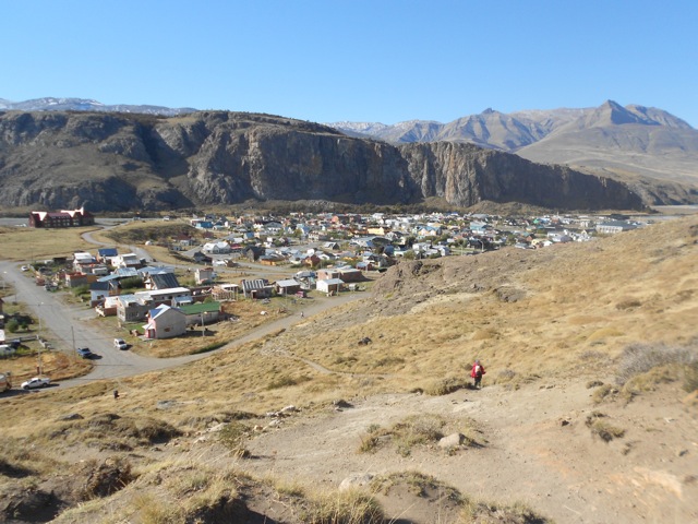
Across the border and about 8 hours by bus north of Parque Nacional Torres del Paine is a small town called El Chalten. El Chalten is inside the north end of Parque Nacional los Glaciares and is the only way to walk around Mt Fitz Roy. If there was no Mt Fitz Roy, there’d be no El Chalten.

There’s also no actual hike called ‘The Triangle’, it’s purely name I gave it, because the 3-day hike is, well, a triangle. The walk itself isn’t especially difficult and most days are rather short. But, much like the Overland Track in Tasmania, it’s the side tracks that allow you to adjust its difficulty.

Day 1 – El Chalten to Campamento Poincenot

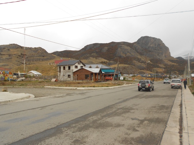
The wind was fairly brisk as I headed out of my hostel. And because the hostel doesn’t provide breakfast – a first for me so far this trip – I stopped at a nice little cafe/bakery down the road. Then, late in the morning, I set out towards the northern start point of the hike. You can start the triangle from both ends, but I chose the northern end because, well, I wanted to.

I found the entrance to the parque fairly easily and followed the trail up the hill beyond the sign. The trail heads up and around Cerro Rosado, a small rocky mound just over 800m above sea level – El Chalten is 400m. I soon come to a rocky outcrop with a good view back to town.

wpid-dscn2078-2013-04-13-09-34.jpg

Further on, I came to a mirador looking north along Rio de Las Vueltas and the mountains beyond with their light topping of overnight snow.

wpid-dscn2080-2013-04-13-09-34.jpg

The trail continued on slowly climbing towards the plateau. After a time I arrived at a sign announcing a fork in the trail. One way leads to Mirador Mt Fitz Roy while the other to Laguna Capri, then both meet again on the other side. I walked to the lookout but much of the mountains were covered in cloud.

wpid-dscn2088-2013-04-13-09-34.jpg

It did looked like the sky was clearing so I went for a short walk to kill some time. After hearing a tapping sound I discovered a pair of black and red woodpeckers hammering away at some old trees. I stopped to watch for a bit and when I returned to the mirador the mountains were a little clearer, but not much. I headed on down the trail and found a spot out of the wind to have lunch. By the time I was ready to leave, only the main spire was covered in cloud.

wpid-dscn2112-2013-04-13-09-34.jpg

Not far along the trail I found the fork back to Laguna Capri and went to check it out.

wpid-dscn2102-2013-04-13-09-34.jpg

I then headed on towards the campsite, following Arroyo del Salto.

wpid-dscn2106-2013-04-13-09-34.jpg

I crossed the plateau and rounded the base of the hill under the spires. Shortly after, I arrived at camp and set up my tent. Still early afternoon, I went to check out one of the two main side trails from camp, I took the easier one and headed off down Rio Blanco towards Laguna Piedras Blancas. After about 30 minutes I found an obvious trail that led me over huge boulders to the laguna.

wpid-dscn2122-2013-04-13-09-34.jpg

On the way back it started getting icy even before the sun had gone down. This means cold overnight, but usually clear skies in the morning. During the night I popped out of the tent to see the vastness of the stars and to check out the peaks at night.

wpid-dscn2131-2013-04-13-09-34.jpg

Day 2 – Campamento Poincenot to Campamento De Agostini

It was cold overnight, but especially the last couple of hours before dawn, with the sun rising at 8.30am. By then I’d slept about 10 hours anyway. There’s not much to do on a hike after dark and going to sleep by 10 is considered late. In the cold, I emerged from my tent to take early morning pictures of the mountains before heading back to the warmth of my sleeping bag to brew coffee.

wpid-dscn2133-2013-04-13-09-34.jpg

After breakfast, I packed but left my tent up and with my day pack, headed up the other side track, to Laguna de los Tres, under the towers of Mt Fitz Roy. The climb started in the forest near the camp but after the ‘climbers only’ camp at Campamento Rio Blanco it turned rocky and stayed that way, climbing steeply for the rest of the half kilometre climb. About half way up, the trail started to turn to ice and I became more cautious with my steps, then three quarters of the way up, there was snow, but not huge amounts. I eventually arrived at the top and sat looking over the lake with the peaks towering over me. The lake is 1170m above sea level, while Mt Fitz Roy towers to 3405m.

wpid-dscn2140-2013-04-13-09-34.jpg

After a while, I headed down and caught the view across the valley to Lago Viedma.

wpid-dscn2145-2013-04-13-09-34.jpg

I stopped for lunch back at camp before packing up my tent. Thirty minutes later and I was following my steps across the plateau and taking the trail to the south. It was fairly flat and I walked past Lagunas Madre and Hija.

wpid-dscn2151-2013-04-13-09-34.jpg

Then the trail dove into trees with the occasional grassy clearing. After 2 hours the trail headed steeply down into a valley to Rio Fitz Roy where I stopped for a break. Following the river, I came upon a fantastic view of Cordon Adela – The Adela mountain chain – in all it’s icy glory backing onto the South Patagonian Ice Field.

wpid-dscn2157-2013-04-13-09-34.jpg

For the rest of the trail I walked steadily towards the cordon and finally arrived at Campamento de Agostini just short of Laguna Torre. The lake is fed by Glacier Grande that hangs from the bottom of the range. I pitched my tent and climbed up to look at the laguna, but with the sun hidden behind the mountains it was fairly dark.

Day 3 – Campamento De Agostini to El Chalten

Again it was icy in the last hours before dawn, so I brewed a coffee to keep warm. Then, I stood at a viewpoint waiting for the first rays of light to hit the Adela Cordon.

wpid-dscn2166-2013-04-13-09-34.jpg

Once I’d seen it, I packed up and again left my tent. With my day pack I headed around the top of the laguna and climbed towards Mirador Maestri. On the way there were a couple of views of small waterfalls, but once I got to the mirador I was a little disappointed to find that it was just closer to the cordon than from the other side of the laguna. I did get better views of the laguna with light though.

wpid-dscn2168-2013-04-13-09-34.jpg

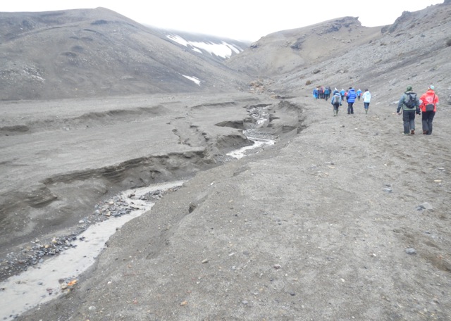
I headed back to camp where I packed up my tent and headed out back along the trail. For the most part, following the rio, the trail was fairly flat. I passed the junction with the trail I’d come off yesterday and continued on flat beside the river. As I got closer to El Chalten, the trail began to climb a small set of hills to eventually arrive at a mirador looking back over the cordon. This was designed for day walkers to be able to see the mountains without doing the entire hike and is similar to the mirador near Laguna Capri. The trail headed over a couple of ridges before descending towards town.

wpid-dscn2184-2013-04-13-09-34.jpg

Overall, the Mt Fitz Roy Triangle is an excellent short hike experience around some amazing mountains. It’s cheaper than Torres del Paine but still has plenty to see. There are slightly less day walkers, although that might be because it is the low season.

Next I’m heading back to Puerto Natales, where I board the Navimag ferry and cruise through the fjords heading my way up Patagonia to Puerto Montt.

The Lone Trail Wanderer

El Chaltén, Argentina – Impressions

El Chaltén is a small town at the northern end of Parque Nacional Los Glaciares in Argentina. It’s a town bred purely from the tourism generated by the National Park and Mt Fitz Roy.

DSCN2184

El Chaltén was quaint and had plenty of hostels, although many were aimed more towards the hotel end of the market than to backpackers. There were plentiful tour operators and adventure stores selling the big named adventure gear for both hiking, ice climbing and glacier expeditions. There was also a small cafe/bakery scene in the town which was great, as the hostels don’t provide breakfast.

I stayed at the Hostal Pioneros del Valle. This large and fairly cheap hostel had plenty of rooms, most set up with 6 beds. But as it was low season when I stayed I had the room to myself. Splendid!

DSCN2072

High season is December to the end of March and outside of these times more than half of El Chaltén’s businesses close down. The several restaurants in town are reasonably priced restaurants, including the local micro-brewery, which is good considering the town doesn’t have good facilities for buying your own food. While there are supermarcados, they aren’t very ‘super’.

The National Park had great day walks and several longer hikes – some very intense indeed. Being short on time, I only did a 3-day hikes. It doesn’t have an official name but I called it the Mt Fitz Roy Triangle. The other great advantage of the Parque Nacional is it’s cost. It’s free. Something different in a land of expensive national park entrance fees.

Here are some of the other walks:

  • Cascada Margarita
  • De las Vuetas River Canyon
  • Piedras Blancas Glacier
  • Punta Norte – Hito Limítrofe

Next, I head back through El Calafate to Puerto Natales in Chile to catch the Navimag Ferry

The Lone Trail Wanderer

Parque Nacional Torres del Paine – Day 9

Day 9 – Final Day – Refugio Lago Grey to Refugio Paine Grande

Today is a short day and is the official last day of the circuit for my companion and I. The walk between the Refugios is not long, about 3.5 hours. We were up early and aiming to arrive at Refugio Paine Grande in time for the catamaran that would drop us at our bus.

It had rained most of the night, nothing heavy just constant. I awoke in the dark and quickly dressed and began packing my gear. Usually the first thing I do is start brewing coffee, but as I’d lost my water bottle yesterday when the wind whipped it out of its pocket and cast it down onto the glacier, I figured it would be quicker to pack and have breakfast afterwards. Before long I had everything, including my wet tent, packed away and I was in the warmth of the cooking room heating water for coffee and soup.

We headed out by 8.30 and straight away began climbing a hill in the chill wind. It began to rain as we walked along the side of the mountain with Lago Grey below us. The trail dipped up and down through the valleys.

wpid-dscn2058-2013-04-6-20-16.jpg

There looked to have been a sprinkle of snow on the peaks above us as we passed a raging waterfall well stocked with water from the rain.

wpid-dscn2059-2013-04-6-20-16.jpg

The trail continued and as we crossed a couple of ridges, the wind was so icy coming off the glacier and the rain so constant I was forced to put on my waterproof jacket. If it rains when I’m hiking, I tend not to worry about my jacket. While it protects me from the rain, I still sweat, so get wet inside anyway. It does make a good wind breaker though, so in this case it helped a lot. We passed a couple of miradors but the wind was too fierce to consider standing out in the open looking back at the glacier.

We then climbed a hill around the side of a laguna…
wpid-dscn2069-2013-04-6-20-16.jpg

…before crossing a final ridgeline to follow a kilometre long gully down towards the blue of Lago Pehoe, where Refugio Paine Grande is situated.

wpid-dscn2070-2013-04-6-20-16.jpg

Eventually we arrived at the bottom and walked the short distance to the refugio. 30 minutes later and we were on the catamaran and heading away from the park.

wpid-dscn2071-2013-04-6-20-16.jpg

Final Note

With the weather in Patagonia known for being very changeable, we were blessed with having 7 wonderful days out of the nine we were on the hike. The Parque Nacional Torres del Paine is a wondrous place with many great attractions. While the popularity is one of its downsides, I’m glad I went in low season as peak season would be just insane, with far too many people. Still, the mystical mountain peaks, both with and without snow and, the Lagos and Rios surrounding it, the Lagunas within it and the wonderful sights on all sides of the park were amazing. I’m glad I decided to do the circuit as the far side of the park is quieter and entirely different to the front side, with the glaciers, the pass and the south patagonian ice field in the distance.

I also enjoyed my companions for the hike, Chris, the young American guy I walked with most of the hike; Pip and Dan from Sydney and Sam from London, who walked as a threesome, but were with us at camps except the last (as they got stuck behind the landslide). Thanks to these people for making the experience what it was. Also, thanks to the many people we met at various parts of the hike, especially the two american couples on the back side – but who didn’t start with us – the Aussie couple who were from my hostel, and the group of young american girls studying in Santiago (kept Chris busy!).

Next I’m off to El Calafate in Argentina for a couple of rest days near the lake, before off to El Chalten for a three day hike around Mt Fitz Roy.

The Trail Wanderer

Parque Nacional Torres del Paine – Day 8

Day 8 – Campamento Los Perros to Refugio Lago Grey

Today is slated as the hardest on the entire circuit as we’re climbing over the windblown Paso John Gardner, more than 1350m. This is one of the main attractions of walking the back side of park.

As Campamento Los Perros is hidden away in the forest, I couldn’t tell what the weather was doing when I woke. But, it was just before I’d finished breakfast that I discovered I was the only person left in camp. It would seem that everyone else had decided to get an early start. So, I packed up quickly and headed out.

The trail heads straight up a hill for some time, through the forest and a rather large patch of mud. I continued following the trail, stepping over mud and the occasional fallen tree as I worked my way slowly up the pass. In the forest I could hear gusts of wind above me in the trees. After an hour I came to the end of the trees and out into rocks. The wind was now gusting over me heavily as I moved and I was forced to lean down into the stones to stop from being blown off my feet. You can hear the large gusts coming, so when a large one has passed, I rushed along the rocky path to the next set of trees. Yet while I was sheltered from the wind I was again subject to the mud.

wpid-dscn2026-2013-04-6-17-47.jpg

Then I’m out into the rocks again and again am being blasted by the wind gusts. It’s a quick march across the rocks, stooping low for the heavier gusts which are picking up small stones and blasting them against my arms and back of my head. I raced down towards the river along the trail and around the final patch of trees and my last protection from the wind. I then marched up the trail as quickly as the stones and wind would allow, ducking and setting my feet and poles to stop from being blown around too severely.

The views back down the valley where I had come are pretty with the red of the trees and the flowing river.

wpid-dscn2025-2013-04-6-17-47.jpg

I pushed on up the pass as it began to get steeper but no less ragged with the wind. At one stage I was lifted from my feet and landed 2 metres back, skidding in the rocks. While this could be scary there was a real sense of exhilaration of constantly fighting the wind. Further up the pass I could see the wind whipping water from various streams into mist and I could hear the wind whistling madly through the snowy mountain tops. I pushed on, climbing a steeper area, resting briefly close to a glacier until the wind chilled me enough to push me further on.

wpid-dscn2027-2013-04-6-17-47.jpg

Finally, about 200 metres from the top of the Paso, I came over a ridge and the trail flattened out. It was then a short walk through a windy gully to reach the cairns at the top of the paso. The wind was howling past me when I came over the top and light rain was being propelled full force at me. After 7 beautiful days, it would be typical that on this the hardest day of the hike, the weather would change to make it even harder.

At the top of the pass, you look down on top of Glacier Grey, but to get a better view, you walk down about fifty metres through the icy winds to closer to the edge of the ridge. It’s not the greatest atmosphere to take photos, but I did what I could in the wind and rain.

wpid-dscn2031-2013-04-6-17-47.jpg

I had to stop and put on my jacket, more to break the icy wind coming at me than to avoid the rain. Putting on a jacket in these high winds is challenging, to say the least. I made it to the edge of the ridge and looked down on Glacier Grey. I’ve seen plenty of glaciers, but not from directly above and Glacier Grey is a mighty specimen, stretching 6km across the valley to the icy snow covered mountains on the far side, very much like Antarctica. The glacier is said to be more than 100km long, but this finger of ice disappeared around the mountain in the distance.

wpid-dscn2033-2013-04-6-17-47.jpg

This small piece of ice – yes small – is a part of the southern Patagonian Ice Field, one of the three largest fields of ice in the world.

The trail heads down steeply on a slate and scree slope, weaving on a defined path, then follows the glacier, a kilometre below, to where it forks at Lago Grey.

wpid-dscn2038-2013-04-6-17-47.jpg

At a certain point the trail leads into the trees that have turned fiery autumn red, and finally there is some respite from the wind. The trail begins its slow downward heading, with plentiful steps.
wpid-dscn2040-2013-04-6-17-47.jpg

After several hundred metres, it finally ends at Campamento Paso. Going down in no wind is still harder than going up in lots of wind. I was planning to stay here tonight, but when I discovered the Pass had only taken just over 4 and a half hours, I decided to head on the extra 4 hours to Refugio Lago Grey with the hope of finishing the hike tomorrow.

After a 5 minute break, I pushed on. Half an hour into the walk, the rain became heavy and the wind continued. There was a hand drawn map in the shelter at Campamento Paso that showed the trail heading steadily downhill to the Refugio, but it wasn’t like that at all, in fact, much of the first half was going up. At many times there were good vies of the glacier as you walked.

wpid-dscn2043-2013-04-6-17-47.jpg

There are a couple of gullies on the walk that are too steep to climb. The park rangers have set up steel ladders to help walkers.

wpid-dscn2050-2013-04-6-17-47.jpg

Just after the first of the ladders, the trail leads around the top of a cliff line. There is only a foot wide path with nothing to hang on to, wind dragging at you and a fall of half a kilometre to a glacier. It was perhaps one of the more frightening experiences of my life, as I literally crawl along this path hanging onto large rocks. Twice I actually lay in a gap waiting for the wind to die down so I could continue. Apparently, the next morning, some of this very cliff line slipped away and the walkers behind me were stuck, so it was lucky I decided to walk on when I did.

The trail continued but most of it was inside the forested area and I was pleased not to be exposed more on this particular day. I climbed another of the steel ladders, crossed a long wire bridge and climbed down several quiet forest gullies. There was a mirador along the way, right above the end of the glacier. I stayed briefly to watch, but after 8 hours walking and the cold, I didn’t stay long. Murphy’s Law, however… nothing happened while I was watching, but as I walked away… a large section of ice calved from the glacier into the lake.

wpid-dscn2054-2013-04-6-17-47.jpg

The last hour of the day was spent staggering through the trees until I finally arrived at the Refugio. That night as I cooked in the refugio’s common cooking area, I gave advice to new hikers on the trail who had started the hike that day.

The Lone Trail Wanderer

Parque Nacional Torres del Paine – Days 5, 6 and 7

Day 5 – Campamento Los Torres to Campamento Seron

While most people climbed to see the towers, I slept in. Then as they began to return, I headed out of camp. The trip back down the mountain is far easier than the walk up, plus I was fresher than yesterday. I stopped for a brief break at Chileno, then climbed the hill to where my trail yesterday met the main trail. I took a break before heading down, aiming for Hotel Los Torres at the bottom. With good poles, the trip down was easy and I passed many day walkers going the there way.

wpid-dscn1971-2013-04-6-17-09.jpg

The Hotel is extravagant, some calling it an eyesore, and there are a set of refugios not far from it for hikers to stay. I stopped for a coke, then headed on. From here on, I’m officially on the back of the park and there are less people. In fact, the only person I see until I reach camp is a man running – yes running – the other way early on. The trail led up a hill along a fence and through a forest of autumn colours on a 4WD track.

wpid-dscn1976-2013-04-6-17-09.jpg

It reminded me very much of walking in Australia. As I came down the hill an hour later in the hot beaming sunlight, I could see the beautiful yellow plains with Rio Paine weaving its blue green way through it. I could also see the shining roof of the camp building.

wpid-dscn1980-2013-04-6-17-09.jpg

I arrived on the plains and while it doesn’t look long, the walk just seemed to go on and on, mainly because there was little change in scenery and I was expectant of finding the camp after my long day of walking in the sun.

wpid-dscn1985-2013-04-6-17-09.jpg

Eventually I arrived at camp to find 5 other walkers already camping, today being their first day. It would seem that my little group of five is growing.

I set up camp and met my new travelling companions.

Day 6 – Campamento Seron to Refugio Dickson

The night was warm and I was woken at one point by a rabbit who must have mistaken my green tent for the grass in the moonlight; I heard it bounce off and go bounding away. Then later in the morning a puma was sighted in the field, but not by me. Gusts of warm wind began buffeting my tent as I began to get ready for the day, a vast difference to the cold winds of days past.

wpid-dscn1986-2013-04-6-17-09.jpg

The trail followed the river around initially on the plains, but quickly began rising into the hills and up the side of one particularly tall hill. At the top, the wind was gusting so heavily it was hard to walk, but we got a great view of Lago Paine with Rio Paine winding into the distance.
wpid-dscn1989-2013-04-6-17-09.jpg

Angry clouds rolled past the tall mountains at the other end of the valley, making odd shapes as they crossed the peaks, thankfully not heading towards us.
wpid-dscn1992-2013-04-6-17-09.jpg

We continued across the wind blasted hilltops before weaving our way along the side of the mountains at the edge of the plains. These mountains are the back of those we got close and personal with on the other side of the park. They look vastly different from here.

As we walked, the Patagonian Ice Field came into view at one end of the mountains, reminding me of my Antarctic trip not two weeks ago now. This was truly an unexpected and fantastic sight.

wpid-dscn2006-2013-04-6-17-09.jpg

We walked on and at the end of the plains we crossed a muddy valley and came to a sign that said ’45 minutes to camp’. After a rest, we continued, crossing beams of wood that had been placed to help us not get so mud soaked. We climbed a final hill and saw Refugio Dickson sitting at the end of a flat peninsula jutting into Lago Dickson, and a river wending past it.

wpid-dscn1999-2013-04-6-17-09.jpg

It was about here that the slight rain started. We crossed the hill and after a steep climb down, we made our way to the Refugio, where over a beer we stopped to wait out the rain. We then hurriedly erected our tents and went back to the refugio where the cook was hand making a meat and egg pie. It looked so delicious that I decided to sit in on the meal. It turned out to be an excellent decision.

Day 7 – Refugio Dickson to Campamento Los Perros

During the night it had been warm and I’d stripped off most my night clothes off. But at some point in the night there was a change and I got very cold, having to put everything on again and I still wasn’t warm. There was frost on the ground outside when I emerged. But along with the frost came blue skies and wispy white clouds.

Today’s an easy walk of only 9km and slightly up hill through a forest. Being short serves nicely as a warmup for tomorrow’s hard climb up and over Paso John Gardner.

We began walking around the hill that we’d climbed down last night in the rain and began the slow climb into the forest towards the most obvious pass through the mountains. At one point we came to a small rocky area which allowed us awesome views back to the ice field, then it was back into the trees. We climbed for most of the morning, vaguely following Rio Los Perros. The trail meandered through the forest before going around a large patch of the red moss I’d seen in Tierra del Fuego on the Paso de la Oveja hike.

wpid-dscn2008-2013-04-6-17-09.jpg

The trail then went down the hill to a bridge crossing a stream that fed into the river. After walking for a while we soon came to a waterfall…
wpid-dscn2011-2013-04-6-17-09.jpg

…where the Rio fed down into a narrow channel.

wpid-dscn2012-2013-04-6-17-09.jpg

We stopped for a look and a break before charging on. The forest flattened out and I somehow managed to leave my companion behind. An hour passed and before I knew it I’d crossed a pair of bridges and was out of the forest and climbing up a field of rock towards the Galcier Los Perros. After a stiff climb, zig zagging up the slope, I eventually arrived at the top and looked down across the glacier lake to the glacier itself.

wpid-dscn2021-2013-04-6-17-09.jpg

The view back down the valley where I’d come was just as impressive.

wpid-dscn2018-2013-04-6-17-09.jpg

From here it was another 20 min walk picking my way around the lake and across another rocky field before entering the forest to arrive at Campamento Los Perros.

The Lone Trail Wanderer

Parque Nacional Torres del Paine – Days 3 and 4

Day 3 – Campamento Italiano to Refugio Los Cuernos

Most of today will be spent climbing along the length of Valle del Frances. French Valley is the central park of the W and is a fairly rocky climb all the way to the top. The good thing about the valley is you must come back the same way meaning there’s no need to carry your pack. So with a day pack and some water we headed off up the valley. The climb is fairly strenuous, starting out by climb up through the forest alongside the glacier where every now and again a loud thunderous crack would announce another piece of ice falling from it.

The trail followed Rio del Frances up to a large tarn at the base of the glacier previously unseen. After crossing a gully with a small waterfall, the terrain grew rockier and headed further up the side of the river which was crashing down across the rocks.

wpid-dscn1872-2013-04-6-11-57.jpg

Looking back, the plains below started to open up and we could see the lagos at the base of the mountains.

wpid-dscn1870-2013-04-6-11-57.jpg

The trail headed into the forest again, this time steeper.
After a while, we popped out at an open rocky area and looked to to see we were surrounded by mountains. The view here was amazing in all directions. Ten minutes further on we arrived at the closed Campamento Britanico. We pushed on further for ten minutes to arrive at the mirador, a small peak set in the middle of the mountains.

wpid-dscn1885-2013-04-6-11-57.jpg

Standing on the peak, it felt like we were standing on the tongue of the mountains surrounded by teeth with the molars behind us to the jagged incisors ahead of us. Unfortunately no picture could truly capture the sense of being surround by these peaks.

wpid-dscn1884-2013-04-6-11-57.jpg

There was a sign telling us that we had reached the end of the mountain trail with a rather obvious trail going beyond it. My companion and I followed it for a while to another rubbly peak a little higher.

It took us about an hour to make our way back down again. Back at camp, we packed up and headed on to Refugio Cuernos. This next Refugio is the most expensive of the Parque Nacional and my companion decided to walk on to the next camp beyond it instead of paying the price – another 5 hours walk – so I walked on alone. The rest of the trail wasn’t too difficult, along the edge of Lago Nordernskjold.

wpid-dscn1920-2013-04-6-11-57.jpg

I crossed a pair of hills before arriving at the Refugio Los Cuernos where they had platforms available to pitch tents upon. The wind was too strong to use my camp stove, so I opted for dinner at the refugio, but for the amount I paid it wasn’t that great. As darkness fell, I headed to bed with the hardest part of the W ahead of me.

Day 4 – Refugio Y Campamento Los Cuernos to Campamento Los Torres

Overnight the sky cleared and the full moon was bright in the sky. Camping on platforms among trees sheltered my tent from the slight wind. I’d expected rain overnight too but none came and today I’m greeted by a slightly cloudy day. The weather has been great so far, thankfully.

I headed out of camp and up a hill, looking back across the refugio and the small chalets that are part of it.

wpid-dscn1909-2013-04-6-11-57.jpg

My morning was spent walking up and down slight hills as I worked my way alongside Lago Nordenskjold and under the peaks of Cuernos del Paine.
wpid-dscn1917-2013-04-6-11-57.jpg

At the top of some of the hills there are good views of the lake in both directions. The trail plodded on and I had to step aside on occasion for a train of horses heading one way or the other along the trail.

wpid-dscn1929-2013-04-6-11-57.jpg

We have been told of a shortcut and I came to the sign about three quarters of the way to Hotel Los Torres and followed it.

wpid-dscn1931-2013-04-6-11-57.jpg

It seemed to run parallel to the other trail for a while then began climbing the hill towards Refugio Chileno. The terrain changed as I walked, from the yellow grass into flowing green grasslands. I looked back to see a small lake.

wpid-dscn1936-2013-04-6-11-57.jpg

The climb isn’t steep, but it climbs steadily, which can be worse. Thankfully there is the occasional flat area giving some respite. Soon the path connects with the one coming from the Hotel Los Torres, the path changes and there are more day walkers. There’s a short steep climb before it heads down equally steeply towards Chileno, just visible where the river meets the forest.

wpid-dscn1941-2013-04-6-11-57.jpg

The refugio is now closed for the season but it’s still a good place to stop for lunch. I crossed the river and dropped my pack at a picnic table, sitting in the sun. After 30 minutes I headed on for the last part of the day’s walk.

wpid-dscn1945-2013-04-6-11-57.jpg

Within 5 minutes, the trail crossed back across the river and was a difficult climb for 90 minutes through the forest. I veritably crawled into Campamento Los Torres and after a rest, I set up my tent. I then decided to climb further up the mountain to see the towers in the afternoon light.

While they say it’s best at sunrise and most people will be climbing up in the morning, my walk tomorrow is long and I don’t wish to add to it. The track begins climbing steeply through the forest and is hard work, I sit and rest after 15 minutes before continuing up a rocky section of the track which meanders through the boulders for another 30 minutes before eventually coming out at the towers and the glacier lake below it. The view in the afternoon sun is still stunning. I walk down to the edge of the pristine blue green lake and drink from the water.

wpid-dscn1955-2013-04-6-11-57.jpg

After enjoying the view for a while, I headed down again.

The Lone Trail Wanderer

Parque Nacional Torres del Paine – Introduction and Days 1 & 2

The Parque Nacional Torres del Paine is the most famous national park in Chile. The Torres del Paine – The Towers of Paine – is technically part of the Patagonian Andes Mountain range, but isn’t actually part of the main Andes chain. It’s also the second most expensive hiking area in South America after Machu Picchu.

wpid-dscn1808-2013-04-5-09-18.jpg

There are three main hikes in the Parque Nacional, the W, the O and the Q.

The W is the main reason the park is so popular. It sees hundred of thousands of walkers a year, sometimes with a hundred tents at each camping site each day during peak times – December to March. It’s called the W because of the distinctive W shape that it makes from one end to the other. On average it takes between 3 and 5 days to hike and there are refugios – small hotel facilities that rent beds, provide food etc – along the way, so not all travellers have to carry equipment or camp if they choose not to. You must pay to camp and most camping sites and they provide facilities such as toilets. During the low season, some of the campsites are closed – you can still camp there, it’s free, but the facilities are all closed.

The Paine Circuit, is called the O because it walks you around the entire Paine Massif. It’s not really in the shape of an O, as it includes the W and takes 8-10 days to complete. It’s where hikers go to both avoid the crowds of the W and to get a more hardcore experience – the paso John Gardner. During peak seasons, though, there can still be plentiful people on the O, sometimes up to 50 tents at the the one Refugio on the other side.

The Q, is simply the O, but with the extension added, a small ‘tail’ heading from the Administration building, for almost 20km to the beginning of the W. This adds another day to the O.

For my hike, I decided to do the Q and went along to the daily information session at the Erratic Rock, a hostel in Puerto Natales, to find other hikers to do it with. There were 4 others that I joined up with and while I’d only be walking with one other during the day, we’d hang out together as a group at each campsite. Walking alone is not recommended when doing the circuit, as Paso John Gardner can be challenging. We also planned to do the hike over 10 days, although that could change as we go depending on whether and length of some sections. At Erratic Rock, there were 30 other people that were planning to do the W. It’s low season, but it will still be fairly busy.

Day 1 – Administrativa to Campamento Las Carretas

We designed today to be a short day along the tail of the Q and as an initial warm up for the coming days.

At 7:30am the bus picked up the masses from around town to head the 2 hour journey to the entrance of the Parque Nacional. While it’s the end of the season, there are still 5 buses going. We stop at the entrance – Porteria Y Guardia Laguna Amarga – where we pay the entrance fee and watch a short ‘be nice to our parque’ video. Some walkers leave from here via a short van ride to the Hotel Las Torres – the official eastern starting point of the hike – but most continue on to the western start point, via catamaran across the Lago Pehoe – another 30 minutes on the bus.

wpid-dscn1809-2013-04-5-09-18.jpg

Then on a single bus, my little team of five, continue for yet another 30 minutes to the parque administrativa centre and the beginning of the Q.

wpid-dscn1810-2013-04-5-09-18.jpg

After some last minute preparation, we walked out across the flat grassy plain with the entire massif in the distance. Most of the two hours of todays hike was flat until the last couple of hundred metres where hills ran up the side of Rio Grey.

wpid-dscn1811-2013-04-5-09-18.jpg

As we walk, we split into two teams, myself and an American guy walk together, while the others are two Australians – a guy and girl – and a female Brit. It doesn’t take us long to arrive at the camp site and we set up our tents and check out the place. There are only a small number of tent sites, a cooking shelter and a toilet, that we promptly ban anyone from using, preferring the wilderness latrine style of digging a hole. The day had been beautiful, so the five of us hung out as we cooked dinner and chatted until it grew dark.

While we were there, we met a Polish couple going the other way. They had just done the W and it had rained for all 5 days. We are hoping for a better experience.

Overnight it did rain a little and we were woken by brisk winds blasting at our tents. While the wind remained in the morning, there were blue skies.

wpid-dscn1814-2013-04-5-09-18.jpg

Day 2 – Campamento Las Carretas to Campamento Italiano

We headed out into the brisk wind through the hills above Rio Grey. We weaved along the side of the river for some time eventually taking a break in a protected valley as the rio turned off.
wpid-dscn1817-2013-04-5-09-18.jpg

The hill then led down onto a yellow grass plain where wind hurtled towards us with such force that at times we couldn’t move forward. With packs on, the wind can really blow you around. We struggled on towards the main towers of Cerro Paine Grande.

wpid-dscn1815-2013-04-5-09-18.jpg

Eventually we arrived at Mirador Pehoe – a lookout across Lago Pehoe – the aqua waters being hammered by the winds.
wpid-dscn1826-2013-04-5-09-18.jpg

We spied the midday catamaran crossing the lake to deliver a new load of hikers to the refugio. From the mirador the terrain became more hilly and we climbed up and down through burnt forest. We eventually came down a steep hill and arrived at Refugio Paine Grande where we stopped for lunch.
wpid-dscn1827-2013-04-5-09-18.jpg

The refugio has a shop and I enjoyed a coke and some chocolate before we headed off again. The terrain became fairly hilly as we headed for the next campsite under the 3km tall towering mass of Cerro Paine Grande – the tallest peak of the massif. We passed several groups of people, going in both directions. The next couple of days is going to be busy as we’re on the W, the most popular part of the hike. We then walked along the length of the Lago Skottsberg, it’s water a totally different blue…

wpid-dscn1832-2013-04-5-09-18.jpg

We took a break as the trail began to get a little muddy. It was here that the burnt trees stopped and living trees began again. We set off again towards the rocky spires of Cuernos del Paine, which will be above tonight’s campsite.
wpid-dscn1834-2013-04-5-09-18.jpg

A one point, a group of guys came past and between them a guy sitting on a specially designed wheeled carriage, obviously specially designed for him. It was great to see how the group had found a way for their less able friend to hike with them. We continued on passing the snow covered glacier face of Cumbre Principle – the main peak of Cerro Paine Grande. We arrived at a river and crossed into Campamento Italiano. After setting up camp, our little group of five sat at the river watching pieces of the glacier calve off from the mountain.

wpid-dscn1850-2013-04-5-09-18.jpg

The Trail Wanderer

Antarctic Voyage – The Journey Back to Civilisation.

Find Days 1 – 3 here: We’re Going South Baby, WAY South!
Days 4 – 5 here: Along The Great White Peninsula
Days 6 – 7 here: Next Stop, The Polar Circle

Day 8 – Returning Along The Peninsula

Last night the swell rocked the boat so madly many people were unable to sleep. While the seas weren’t often bad and many of us no longer show signs of sea sickness, some can barely get out of bed to attend meals.

On the morning of Day 8 we anchored off Verdnasky Island and were invited by the Ukrainian science team there to visit Verdnasky station.

wpid-dscn1932-2013-03-21-16-10.jpg

We broke into three groups: a third visited the station first, another third visited the abandoned Wordie station on the other side of the same island, and the remaining third were the kayakers and divers.  Each group eventually got a turn to visit the main research station.

wpid-dscn1931-2013-03-21-16-10.jpg

Wordie Station was the original research station and must have been built for short, thin people as it’s pretty cramped.  When researchers moved to the newly built Vernadsky station, Wordie station was converted into a museum.  To get between the two stations we had to cruise through sets of pure blue icebergs with amazing natural textures on them.

DSCN1922

Verdnasky Station is huge in comparison to Wordie with a pair of long sprawling corridors leading to many different science labs. Outside there are other rooms and silos for storage, additional labs and fuel. Upstairs there’s a relaxation room which holds the southernmost gift shop and the southernmost Post Office in the world, where we got our passports stamped and sent postcards (most took more than a year to arrive). Through an archway was the world’s southernmost bar where we could buy large shots of vodka for US$3.

After exiting the station and waiting for the Zodiacs to collect us, we gathered on the pier to watch a leopard seal torment a penguin. When it noticed it had an audience, it made a display of tearing its lunch to pieces before consuming it.  While macabre, it’s part of nature and we couldn’t take our eyes from it. Back on the ship we headed further north to Petermann Island for another short hike. The island itself has different colours of snow – green from algae and pink from penguin poo.

wpid-dscn1939-2013-03-21-16-10.jpg

The hike was a walk up a slippery mound to a cairn and down the other side. This island had some beautiful views, but was the smelliest island I’ve ever been to. While the old saying: ‘Don’t eat the yellow snow’ still stands, a new one came from this trip: Definitely don’t eat the pink snow.

wpid-dscn1942-2013-03-21-16-10.jpg

As we made our way back to the ship we spied another leopard seal enjoying a penguin. Penguins are considered the rabbits of the south, they breed like crazy and provide good food sources for the seals and larger sea birds.

Across the bay, we could see the base of several majestic looking spires their tops hidden behind the cover of clouds.  Thankfully the clouds began moving as we were leaving, giving us a partially better view.

wpid-dscn1953-2013-03-21-16-10.jpg

Day 9 – Final Landfall – Deception Island

The plan for the day was to make landfall in the morning and begin the journey back across the Drake Passage in the afternoon. This was not to be, however, as the wind and seas were too harsh. Instead we sailed back to the South Shetland Islands to attempt Deception Island again. When we arrived the wind was still strong, but thankfully in the right direction allowing us to enter the volcano via a stretch of water known as Neptune’s Bellows.

wpid-dscn1972-2013-03-21-16-10.jpg

We sailed through and even with the low clouds it was picturesque. The bay inside was huge and we anchored in a smaller bay just inside called Whalers Bay. On reaching land, we set foot on black volcanic pebbles and sand. There were a number of old broken down buildings which we were warned not to enter because they were unstable.

wpid-dscn1976-2013-03-21-16-10.jpg

Deception Island erupts every 40 years, the last time being 40 years earlier. We were prepared should it go up but it didn’t, obviously. On land there were few penguins and many fur seals. We walked along the beach for a while and climbed the semi-collapsed wall to Neptune’s window…

wpid-dscn1979-2013-03-21-16-10.jpg

…which provided great views both inside and out.

wpid-dscn1987-2013-03-21-16-10.jpg

We then followed a stream up the side of the volcano…

DSCN1991

…to a higher perch. With the clouds and the blue-green of the sea, the sight looked like a mystical world that photos just don’t do justice to.

DSCN1992

Back on board, we set sail for the Drake passage and as expected the seas were a little rough.

Day 10 and 11 – Back across the Drake Passage

For two days we sailed across the open and slightly choppy seas. It wasn’t as crazy as we’d expected, but after making landfall twice each day in the Antarctic, hanging about the ship sent many of us a little stir crazy. There were lectures to bide the time but I dove into a book and managed to finish the second of two novels I’d begun on the journey.

We arrived into the shelter of the Beagle Channel in the late afternoon of Day 11 and docked in the early morning at Ushuaia. We disembarked after breakfast.

Overall

My Antarctic trip will always be one of the most memorable experiences of my life and worth far more than I paid for it. The many places where we made landfall and the multitude of wildlife were unreal. People on board were friendly, although with 37 different nationalities it was sometimes difficult to communicate well. There were many new experiences and I’m glad I chose the Plansius from Oceanwide Expeditions, as I’ve heard some of the other cruises were not as well organised or the crews were not as interested in giving passengers the best experience.

Next, after a couple of days in Ushuaia, I began my long journey north along the Andes starting with Patagonia.

The Ocean Cruising Trail Wanderer

Antarctic Voyage – Next Stop, the Polar Circle

Find Days 1 – 3 here: We’re Going South Baby, WAY South!
Find Days 4 – 5 here: Along The Great White Peninsula

Day 6 – Antarctic Peninsula

Overnight the weather had changed and on awakening we found it had begun to snow. While we’d loved the clear days, it just hadn’t felt like Antarctic until now.

wpid-dscn1815-2013-03-21-16-08.jpg

We set out across the bay to an Argentinian base called Almirante Brown where some of us docked and the others cruised around the harbour in Zodiacs looking at the scenery and the natural colours in the rocks…

wpid-DSCN1823-2013-03-21-16-08.jpg

As we moved through the water we could see the snow slowing beginning to freeze the water. We were told the process starts with a type of ice called ‘grease ice’, which gives the ocean a strange greasy look, then moves on through several more stages before the bay freezes over.

DSCN1849

It would have taken hours, so no chance of us being iced in. After 45 minutes of cruising through the icebergs we were dropped off at the jetty.

DSCN1833

We walked across the new snow to the base, stepping carefully so as not to slip into the sea…

DSCN1835

…and up the hill behind it where a pinnacle of rock provided a great, albeit foggy view.

wpid-dscn1842-2013-03-21-16-08.jpg

There’s only one real way down from the pinnacle: on your backside skidding down a previously rendered track. I shot down the first part but there was an older guy in front of me who was struggling to get going. I couldn’t stop in time and careened off the side of him to slide sideways down the rest of the hill. Awesome! If there had been more time, many of us would have climbed up and gone again.

Then we were back on the ship and heading out along the beautiful Lemaire channel, with great icy mountains and glaciers along both sides. Whales have now become a common sight and penguins are just everywhere. Icebergs larger than previously seen dot the waters, the very occasional one having a leopard seal napping on it. We came out into a bay known as The Iceberg Graveyard, full of huge icebergs some twice the size of the ship or larger.

DSCN1856

Our next stop was Booth Island. We land and see our fourth variety of penguin, the Adelie along with their tracks in the fresh snow.

DSCN1859

We then climbed a hill to get awesome views in all directions, but because of the low clouds only the base of several rocky spires could be seen.

DSCN1866

We couldn’t resist sliding down the hill before being whisked back to the ship. That evening the boat made its way down the peninsula in hope of crossing the polar circle. According to the captain, it depended on the weather and sea conditions if we were to cross.  We all went to bed hoping the conditions would be right.

Day 7 – Antarctic Polar Circle

The polar circles are defined by the sun. In winter, Antarctica is a sunless icy land, while in summer there is 24-hour sunshine.

Today the battery of my fairly new camera refused to charge, evidently affected by the atmospheric cold.  Thankfully one of my shipmates had a spare he could lend me. So, while I wasn’t using my own camera, all of the shots are my own.

DSCN1889

It was snowing when we were roused for breakfast and the seas were rather rough. At breakfast we watched the largest iceberg we’ve seen float past. It was massive, the part we could see above water was the size of a city block and perhaps 100m tall. Under the water, we’re told it’s 7 times larger.

Then just after breakfast, we gathered in the observation lounge and with a glass of champagne to celebrate the crossing of the polar circle. We had only a single landfall below the circle. Two hours later we entered a bay where the water was significantly calmer. After another 30 minutes we boarded the Zodiacs and make our way around icebergs to land at Detaille Island, site of a former English research base.

The snow was thick on the ground and there were two different kinds of seals just languishing on icebergs – the Crabeater Seal and the Weddell Seal. They peer up as we go by but we don’t interest them so they go back to their napping. On the island is the hut where the researchers lived and we were able to go inside. It’s fairly roomy and once housed 8 scientists comfortably.

DSCN1893

After our time on the island we were taken on a cruise through the icebergs to get a little closer to the napping seals.

DSCN1907

Then back onboard the Plansius we set off again, beginning the long journey back along the peninsula.

DSCN1909

Mid afternoon, after we cross the polar circle again, we came across a large pod of Orca hunting. We circled them for about an hour, trying to determine what they were doing. The pod was about 10 animals strong and had a huge male with them. We were told they were killing an Arnoux Beaked Whale by trying to drown it  They did this by lying on top of it to prevent it getting to the surface. Once they considered it dead, they began tearing into it. It’s nasty, but it’s nature. This kind of action takes documentary makers 10 years to find, and we were lucky to chance upon it. Pictures don’t give it justice, however.

Next, The Journey Back To Civilisation.

The Antarctic Wanderer

Antarctic Voyage – Along The Great White Peninsula

Find Days 1 – 3 here: We’re Going South Baby, WAY South!

Day 4 – More South Shetland Islands

The weather continued to be great, but it wasn’t the weather that was to darken the day… more on that later.  The beauty of the white islands was immense and even more so because of the blue skies.  Overnight the ship was moved further along the South Shetlands to Half Moon Island.

DSCN1674

We made landfall early and hiked along the beach with plentiful Chinstrap Penguins hanging out on the rock formations.  Nestled among one group we found a solitary Macaroni Penguin.

wpid-dscn1687-2013-03-21-16-15.jpg

While not as plentiful as the penguins, there were many fur seals in groups along the rocky beach.  They too were interested in us, but were more dangerous, so we took care not to get too close as they have a tendency charge. They’re easily warded off if they do by presenting a strong hand and calling ‘stop’, or by simply clapping hands.

wpid-dscn1679-2013-03-21-16-15.jpg

While not available to those of us who took ‘Last Minute Deals’ those who pre-booked the cruise were able to also book kayaking and diving. While today was too windy for the kayakers the divers got to get in the water, well, some of them at least…

DSCN1681

Not long after going ashore, we started hearing reports over our expedition leader’s walkie-talkie about a diver that had gone missing. For the rest of the morning our leaders began to act a little strange, anxious. Our stay on Half Moon Island was extended an hour longer than planned. Then after being ferried back to the boat, we were called to an urgent debriefing. The diver that had gone missing was an experienced Japanese woman. They’d found her drifting in 5 metres of water and had attempted resuscitation, but after 90 minutes she had been pronounced dead. No other news was forthcoming.

This set a somber tone across the boat and we weren’t sure if the trip was to continue. We eventually did get word we were and got back underway, but some of the crew were called to deal with certain things such as contacting next of kin, authorities, embassies and the storage of the body.

wpid-dscn1705-2013-03-21-16-15.jpg

That afternoon we sailed for Deception Island, one of the two known active volcanos in Antarctica. Centuries ago, Deception Island blew one of its sides and seawater flowed in to fill the crater. The plan was for us to sail into crater via Poseidon’s Bellows, where the wall had collapsed…

DSCN1708

But the weather wasn’t playing nice and with 35 knot winds, the captain decided it would be too dangerous. Instead we set sail for our next destination,  the Antarctic Mainland and The Great White Peninsula. On the way we spotting what was to become a very common sight… Humpback Whales.

Crossing the channel was an experience. Because of the winds the swell went a little crazy and that evening only a little of half of us passengers made it to dinner. It wasn’t long before I too retired to my cabin a little worse for wear.

Day 5 – Antarctic Peninsula

We were lucky, today was the fifth beautiful day in a row, clear and sunny. That’s five more than some expeditions. I awoke at 4am after going to bed at 8.30pm the night before and felt great. I peered from the cabin window and saw clear seas and the long white peninsula. We anchored at Cuverville Island surrounded by white cliff lines in a bay dotted with icebergs. It’s hard to describe the beauty of this place.

DSCN1718

We landed and wandered around the Gentoo Penguin colonies for some time.

wpid-dscn1720-2013-03-21-16-15.jpg

On the way back we were taken on a short zodiac cruise through the icebergs, many of which were a pure blue…

wpid-dscn1744-2013-03-21-16-15.jpg

I even had the wonderful experience of a leopard seal coming up to the craft to check us out before it went back to playing with the penguin that would eventually become its next meal.

DSCN1738

After lunch the ship moved into a large and beautiful bay strewn with icebergs with the plan to make landfall at the end. The boat slid gracefully through the crystal clear waters…

DSCN1771

…and in some places it was so calm the icy water mirrored the snow-covered mountains and massive frozen glaciers.

DSCN1776

We made landfall, and set foot on the main landmass of Antarctica at Neko Harbour. Woo-ha! And guess what? There were Penguins! Surprise!

We hiked up the side of a mountain to a great viewing spot. I was first to sit on a rocky outcrop looking out across the magnificent bay.

581900_10100327431821222_1470759107_n

Then some of us took a ‘polar plunge’, going for a swim among the icebergs.  Since salt water freezes at just below zero degree celsius, it was cold but not as cold as expected.  If anything, it was colder getting out.

Then in the beautiful clear evening what else do you do in Antarctica? We had a BBQ on deck, of course! It was a little chilly but great! We put down anchor in Leith Cove and watched the sunset.

DSCN1801

Next we’re heading further along the peninsula our Next Stop, The Polar Circle.

The Antarctic Voyager