Tag Archives: National Park

Parque Nacional Torres del Paine – Days 5, 6 and 7

Day 5 – Campamento Los Torres to Campamento Seron

While most people climbed to see the towers, I slept in. Then as they began to return, I headed out of camp. The trip back down the mountain is far easier than the walk up, plus I was fresher than yesterday. I stopped for a brief break at Chileno, then climbed the hill to where my trail yesterday met the main trail. I took a break before heading down, aiming for Hotel Los Torres at the bottom. With good poles, the trip down was easy and I passed many day walkers going the there way.

wpid-dscn1971-2013-04-6-17-09.jpg

The Hotel is extravagant, some calling it an eyesore, and there are a set of refugios not far from it for hikers to stay. I stopped for a coke, then headed on. From here on, I’m officially on the back of the park and there are less people. In fact, the only person I see until I reach camp is a man running – yes running – the other way early on. The trail led up a hill along a fence and through a forest of autumn colours on a 4WD track.

wpid-dscn1976-2013-04-6-17-09.jpg

It reminded me very much of walking in Australia. As I came down the hill an hour later in the hot beaming sunlight, I could see the beautiful yellow plains with Rio Paine weaving its blue green way through it. I could also see the shining roof of the camp building.

wpid-dscn1980-2013-04-6-17-09.jpg

I arrived on the plains and while it doesn’t look long, the walk just seemed to go on and on, mainly because there was little change in scenery and I was expectant of finding the camp after my long day of walking in the sun.

wpid-dscn1985-2013-04-6-17-09.jpg

Eventually I arrived at camp to find 5 other walkers already camping, today being their first day. It would seem that my little group of five is growing.

I set up camp and met my new travelling companions.

Day 6 – Campamento Seron to Refugio Dickson

The night was warm and I was woken at one point by a rabbit who must have mistaken my green tent for the grass in the moonlight; I heard it bounce off and go bounding away. Then later in the morning a puma was sighted in the field, but not by me. Gusts of warm wind began buffeting my tent as I began to get ready for the day, a vast difference to the cold winds of days past.

wpid-dscn1986-2013-04-6-17-09.jpg

The trail followed the river around initially on the plains, but quickly began rising into the hills and up the side of one particularly tall hill. At the top, the wind was gusting so heavily it was hard to walk, but we got a great view of Lago Paine with Rio Paine winding into the distance.
wpid-dscn1989-2013-04-6-17-09.jpg

Angry clouds rolled past the tall mountains at the other end of the valley, making odd shapes as they crossed the peaks, thankfully not heading towards us.
wpid-dscn1992-2013-04-6-17-09.jpg

We continued across the wind blasted hilltops before weaving our way along the side of the mountains at the edge of the plains. These mountains are the back of those we got close and personal with on the other side of the park. They look vastly different from here.

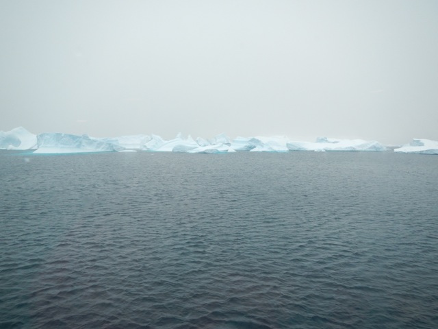
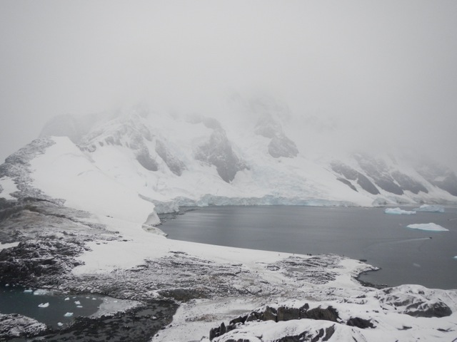
As we walked, the Patagonian Ice Field came into view at one end of the mountains, reminding me of my Antarctic trip not two weeks ago now. This was truly an unexpected and fantastic sight.

wpid-dscn2006-2013-04-6-17-09.jpg

We walked on and at the end of the plains we crossed a muddy valley and came to a sign that said ’45 minutes to camp’. After a rest, we continued, crossing beams of wood that had been placed to help us not get so mud soaked. We climbed a final hill and saw Refugio Dickson sitting at the end of a flat peninsula jutting into Lago Dickson, and a river wending past it.

wpid-dscn1999-2013-04-6-17-09.jpg

It was about here that the slight rain started. We crossed the hill and after a steep climb down, we made our way to the Refugio, where over a beer we stopped to wait out the rain. We then hurriedly erected our tents and went back to the refugio where the cook was hand making a meat and egg pie. It looked so delicious that I decided to sit in on the meal. It turned out to be an excellent decision.

Day 7 – Refugio Dickson to Campamento Los Perros

During the night it had been warm and I’d stripped off most my night clothes off. But at some point in the night there was a change and I got very cold, having to put everything on again and I still wasn’t warm. There was frost on the ground outside when I emerged. But along with the frost came blue skies and wispy white clouds.

Today’s an easy walk of only 9km and slightly up hill through a forest. Being short serves nicely as a warmup for tomorrow’s hard climb up and over Paso John Gardner.

We began walking around the hill that we’d climbed down last night in the rain and began the slow climb into the forest towards the most obvious pass through the mountains. At one point we came to a small rocky area which allowed us awesome views back to the ice field, then it was back into the trees. We climbed for most of the morning, vaguely following Rio Los Perros. The trail meandered through the forest before going around a large patch of the red moss I’d seen in Tierra del Fuego on the Paso de la Oveja hike.

wpid-dscn2008-2013-04-6-17-09.jpg

The trail then went down the hill to a bridge crossing a stream that fed into the river. After walking for a while we soon came to a waterfall…
wpid-dscn2011-2013-04-6-17-09.jpg

…where the Rio fed down into a narrow channel.

wpid-dscn2012-2013-04-6-17-09.jpg

We stopped for a look and a break before charging on. The forest flattened out and I somehow managed to leave my companion behind. An hour passed and before I knew it I’d crossed a pair of bridges and was out of the forest and climbing up a field of rock towards the Galcier Los Perros. After a stiff climb, zig zagging up the slope, I eventually arrived at the top and looked down across the glacier lake to the glacier itself.

wpid-dscn2021-2013-04-6-17-09.jpg

The view back down the valley where I’d come was just as impressive.

wpid-dscn2018-2013-04-6-17-09.jpg

From here it was another 20 min walk picking my way around the lake and across another rocky field before entering the forest to arrive at Campamento Los Perros.

The Lone Trail Wanderer

Parque Nacional Torres del Paine – Days 3 and 4

Day 3 – Campamento Italiano to Refugio Los Cuernos

Most of today will be spent climbing along the length of Valle del Frances. French Valley is the central park of the W and is a fairly rocky climb all the way to the top. The good thing about the valley is you must come back the same way meaning there’s no need to carry your pack. So with a day pack and some water we headed off up the valley. The climb is fairly strenuous, starting out by climb up through the forest alongside the glacier where every now and again a loud thunderous crack would announce another piece of ice falling from it.

The trail followed Rio del Frances up to a large tarn at the base of the glacier previously unseen. After crossing a gully with a small waterfall, the terrain grew rockier and headed further up the side of the river which was crashing down across the rocks.

wpid-dscn1872-2013-04-6-11-57.jpg

Looking back, the plains below started to open up and we could see the lagos at the base of the mountains.

wpid-dscn1870-2013-04-6-11-57.jpg

The trail headed into the forest again, this time steeper.
After a while, we popped out at an open rocky area and looked to to see we were surrounded by mountains. The view here was amazing in all directions. Ten minutes further on we arrived at the closed Campamento Britanico. We pushed on further for ten minutes to arrive at the mirador, a small peak set in the middle of the mountains.

wpid-dscn1885-2013-04-6-11-57.jpg

Standing on the peak, it felt like we were standing on the tongue of the mountains surrounded by teeth with the molars behind us to the jagged incisors ahead of us. Unfortunately no picture could truly capture the sense of being surround by these peaks.

wpid-dscn1884-2013-04-6-11-57.jpg

There was a sign telling us that we had reached the end of the mountain trail with a rather obvious trail going beyond it. My companion and I followed it for a while to another rubbly peak a little higher.

It took us about an hour to make our way back down again. Back at camp, we packed up and headed on to Refugio Cuernos. This next Refugio is the most expensive of the Parque Nacional and my companion decided to walk on to the next camp beyond it instead of paying the price – another 5 hours walk – so I walked on alone. The rest of the trail wasn’t too difficult, along the edge of Lago Nordernskjold.

wpid-dscn1920-2013-04-6-11-57.jpg

I crossed a pair of hills before arriving at the Refugio Los Cuernos where they had platforms available to pitch tents upon. The wind was too strong to use my camp stove, so I opted for dinner at the refugio, but for the amount I paid it wasn’t that great. As darkness fell, I headed to bed with the hardest part of the W ahead of me.

Day 4 – Refugio Y Campamento Los Cuernos to Campamento Los Torres

Overnight the sky cleared and the full moon was bright in the sky. Camping on platforms among trees sheltered my tent from the slight wind. I’d expected rain overnight too but none came and today I’m greeted by a slightly cloudy day. The weather has been great so far, thankfully.

I headed out of camp and up a hill, looking back across the refugio and the small chalets that are part of it.

wpid-dscn1909-2013-04-6-11-57.jpg

My morning was spent walking up and down slight hills as I worked my way alongside Lago Nordenskjold and under the peaks of Cuernos del Paine.
wpid-dscn1917-2013-04-6-11-57.jpg

At the top of some of the hills there are good views of the lake in both directions. The trail plodded on and I had to step aside on occasion for a train of horses heading one way or the other along the trail.

wpid-dscn1929-2013-04-6-11-57.jpg

We have been told of a shortcut and I came to the sign about three quarters of the way to Hotel Los Torres and followed it.

wpid-dscn1931-2013-04-6-11-57.jpg

It seemed to run parallel to the other trail for a while then began climbing the hill towards Refugio Chileno. The terrain changed as I walked, from the yellow grass into flowing green grasslands. I looked back to see a small lake.

wpid-dscn1936-2013-04-6-11-57.jpg

The climb isn’t steep, but it climbs steadily, which can be worse. Thankfully there is the occasional flat area giving some respite. Soon the path connects with the one coming from the Hotel Los Torres, the path changes and there are more day walkers. There’s a short steep climb before it heads down equally steeply towards Chileno, just visible where the river meets the forest.

wpid-dscn1941-2013-04-6-11-57.jpg

The refugio is now closed for the season but it’s still a good place to stop for lunch. I crossed the river and dropped my pack at a picnic table, sitting in the sun. After 30 minutes I headed on for the last part of the day’s walk.

wpid-dscn1945-2013-04-6-11-57.jpg

Within 5 minutes, the trail crossed back across the river and was a difficult climb for 90 minutes through the forest. I veritably crawled into Campamento Los Torres and after a rest, I set up my tent. I then decided to climb further up the mountain to see the towers in the afternoon light.

While they say it’s best at sunrise and most people will be climbing up in the morning, my walk tomorrow is long and I don’t wish to add to it. The track begins climbing steeply through the forest and is hard work, I sit and rest after 15 minutes before continuing up a rocky section of the track which meanders through the boulders for another 30 minutes before eventually coming out at the towers and the glacier lake below it. The view in the afternoon sun is still stunning. I walk down to the edge of the pristine blue green lake and drink from the water.

wpid-dscn1955-2013-04-6-11-57.jpg

After enjoying the view for a while, I headed down again.

The Lone Trail Wanderer

Parque Nacional Torres del Paine – Introduction and Days 1 & 2

The Parque Nacional Torres del Paine is the most famous national park in Chile. The Torres del Paine – The Towers of Paine – is technically part of the Patagonian Andes Mountain range, but isn’t actually part of the main Andes chain. It’s also the second most expensive hiking area in South America after Machu Picchu.

wpid-dscn1808-2013-04-5-09-18.jpg

There are three main hikes in the Parque Nacional, the W, the O and the Q.

The W is the main reason the park is so popular. It sees hundred of thousands of walkers a year, sometimes with a hundred tents at each camping site each day during peak times – December to March. It’s called the W because of the distinctive W shape that it makes from one end to the other. On average it takes between 3 and 5 days to hike and there are refugios – small hotel facilities that rent beds, provide food etc – along the way, so not all travellers have to carry equipment or camp if they choose not to. You must pay to camp and most camping sites and they provide facilities such as toilets. During the low season, some of the campsites are closed – you can still camp there, it’s free, but the facilities are all closed.

The Paine Circuit, is called the O because it walks you around the entire Paine Massif. It’s not really in the shape of an O, as it includes the W and takes 8-10 days to complete. It’s where hikers go to both avoid the crowds of the W and to get a more hardcore experience – the paso John Gardner. During peak seasons, though, there can still be plentiful people on the O, sometimes up to 50 tents at the the one Refugio on the other side.

The Q, is simply the O, but with the extension added, a small ‘tail’ heading from the Administration building, for almost 20km to the beginning of the W. This adds another day to the O.

For my hike, I decided to do the Q and went along to the daily information session at the Erratic Rock, a hostel in Puerto Natales, to find other hikers to do it with. There were 4 others that I joined up with and while I’d only be walking with one other during the day, we’d hang out together as a group at each campsite. Walking alone is not recommended when doing the circuit, as Paso John Gardner can be challenging. We also planned to do the hike over 10 days, although that could change as we go depending on whether and length of some sections. At Erratic Rock, there were 30 other people that were planning to do the W. It’s low season, but it will still be fairly busy.

Day 1 – Administrativa to Campamento Las Carretas

We designed today to be a short day along the tail of the Q and as an initial warm up for the coming days.

At 7:30am the bus picked up the masses from around town to head the 2 hour journey to the entrance of the Parque Nacional. While it’s the end of the season, there are still 5 buses going. We stop at the entrance – Porteria Y Guardia Laguna Amarga – where we pay the entrance fee and watch a short ‘be nice to our parque’ video. Some walkers leave from here via a short van ride to the Hotel Las Torres – the official eastern starting point of the hike – but most continue on to the western start point, via catamaran across the Lago Pehoe – another 30 minutes on the bus.

wpid-dscn1809-2013-04-5-09-18.jpg

Then on a single bus, my little team of five, continue for yet another 30 minutes to the parque administrativa centre and the beginning of the Q.

wpid-dscn1810-2013-04-5-09-18.jpg

After some last minute preparation, we walked out across the flat grassy plain with the entire massif in the distance. Most of the two hours of todays hike was flat until the last couple of hundred metres where hills ran up the side of Rio Grey.

wpid-dscn1811-2013-04-5-09-18.jpg

As we walk, we split into two teams, myself and an American guy walk together, while the others are two Australians – a guy and girl – and a female Brit. It doesn’t take us long to arrive at the camp site and we set up our tents and check out the place. There are only a small number of tent sites, a cooking shelter and a toilet, that we promptly ban anyone from using, preferring the wilderness latrine style of digging a hole. The day had been beautiful, so the five of us hung out as we cooked dinner and chatted until it grew dark.

While we were there, we met a Polish couple going the other way. They had just done the W and it had rained for all 5 days. We are hoping for a better experience.

Overnight it did rain a little and we were woken by brisk winds blasting at our tents. While the wind remained in the morning, there were blue skies.

wpid-dscn1814-2013-04-5-09-18.jpg

Day 2 – Campamento Las Carretas to Campamento Italiano

We headed out into the brisk wind through the hills above Rio Grey. We weaved along the side of the river for some time eventually taking a break in a protected valley as the rio turned off.
wpid-dscn1817-2013-04-5-09-18.jpg

The hill then led down onto a yellow grass plain where wind hurtled towards us with such force that at times we couldn’t move forward. With packs on, the wind can really blow you around. We struggled on towards the main towers of Cerro Paine Grande.

wpid-dscn1815-2013-04-5-09-18.jpg

Eventually we arrived at Mirador Pehoe – a lookout across Lago Pehoe – the aqua waters being hammered by the winds.
wpid-dscn1826-2013-04-5-09-18.jpg

We spied the midday catamaran crossing the lake to deliver a new load of hikers to the refugio. From the mirador the terrain became more hilly and we climbed up and down through burnt forest. We eventually came down a steep hill and arrived at Refugio Paine Grande where we stopped for lunch.
wpid-dscn1827-2013-04-5-09-18.jpg

The refugio has a shop and I enjoyed a coke and some chocolate before we headed off again. The terrain became fairly hilly as we headed for the next campsite under the 3km tall towering mass of Cerro Paine Grande – the tallest peak of the massif. We passed several groups of people, going in both directions. The next couple of days is going to be busy as we’re on the W, the most popular part of the hike. We then walked along the length of the Lago Skottsberg, it’s water a totally different blue…

wpid-dscn1832-2013-04-5-09-18.jpg

We took a break as the trail began to get a little muddy. It was here that the burnt trees stopped and living trees began again. We set off again towards the rocky spires of Cuernos del Paine, which will be above tonight’s campsite.
wpid-dscn1834-2013-04-5-09-18.jpg

A one point, a group of guys came past and between them a guy sitting on a specially designed wheeled carriage, obviously specially designed for him. It was great to see how the group had found a way for their less able friend to hike with them. We continued on passing the snow covered glacier face of Cumbre Principle – the main peak of Cerro Paine Grande. We arrived at a river and crossed into Campamento Italiano. After setting up camp, our little group of five sat at the river watching pieces of the glacier calve off from the mountain.

wpid-dscn1850-2013-04-5-09-18.jpg

The Trail Wanderer

Antarctic Voyage – Next Stop, the Polar Circle

Find Days 1 – 3 here: We’re Going South Baby, WAY South!
Find Days 4 – 5 here: Along The Great White Peninsula

Day 6 – Antarctic Peninsula

Overnight the weather had changed and on awakening we found it had begun to snow. While we’d loved the clear days, it just hadn’t felt like Antarctic until now.

wpid-dscn1815-2013-03-21-16-08.jpg

We set out across the bay to an Argentinian base called Almirante Brown where some of us docked and the others cruised around the harbour in Zodiacs looking at the scenery and the natural colours in the rocks…

wpid-DSCN1823-2013-03-21-16-08.jpg

As we moved through the water we could see the snow slowing beginning to freeze the water. We were told the process starts with a type of ice called ‘grease ice’, which gives the ocean a strange greasy look, then moves on through several more stages before the bay freezes over.

DSCN1849

It would have taken hours, so no chance of us being iced in. After 45 minutes of cruising through the icebergs we were dropped off at the jetty.

DSCN1833

We walked across the new snow to the base, stepping carefully so as not to slip into the sea…

DSCN1835

…and up the hill behind it where a pinnacle of rock provided a great, albeit foggy view.

wpid-dscn1842-2013-03-21-16-08.jpg

There’s only one real way down from the pinnacle: on your backside skidding down a previously rendered track. I shot down the first part but there was an older guy in front of me who was struggling to get going. I couldn’t stop in time and careened off the side of him to slide sideways down the rest of the hill. Awesome! If there had been more time, many of us would have climbed up and gone again.

Then we were back on the ship and heading out along the beautiful Lemaire channel, with great icy mountains and glaciers along both sides. Whales have now become a common sight and penguins are just everywhere. Icebergs larger than previously seen dot the waters, the very occasional one having a leopard seal napping on it. We came out into a bay known as The Iceberg Graveyard, full of huge icebergs some twice the size of the ship or larger.

DSCN1856

Our next stop was Booth Island. We land and see our fourth variety of penguin, the Adelie along with their tracks in the fresh snow.

DSCN1859

We then climbed a hill to get awesome views in all directions, but because of the low clouds only the base of several rocky spires could be seen.

DSCN1866

We couldn’t resist sliding down the hill before being whisked back to the ship. That evening the boat made its way down the peninsula in hope of crossing the polar circle. According to the captain, it depended on the weather and sea conditions if we were to cross.  We all went to bed hoping the conditions would be right.

Day 7 – Antarctic Polar Circle

The polar circles are defined by the sun. In winter, Antarctica is a sunless icy land, while in summer there is 24-hour sunshine.

Today the battery of my fairly new camera refused to charge, evidently affected by the atmospheric cold.  Thankfully one of my shipmates had a spare he could lend me. So, while I wasn’t using my own camera, all of the shots are my own.

DSCN1889

It was snowing when we were roused for breakfast and the seas were rather rough. At breakfast we watched the largest iceberg we’ve seen float past. It was massive, the part we could see above water was the size of a city block and perhaps 100m tall. Under the water, we’re told it’s 7 times larger.

Then just after breakfast, we gathered in the observation lounge and with a glass of champagne to celebrate the crossing of the polar circle. We had only a single landfall below the circle. Two hours later we entered a bay where the water was significantly calmer. After another 30 minutes we boarded the Zodiacs and make our way around icebergs to land at Detaille Island, site of a former English research base.

The snow was thick on the ground and there were two different kinds of seals just languishing on icebergs – the Crabeater Seal and the Weddell Seal. They peer up as we go by but we don’t interest them so they go back to their napping. On the island is the hut where the researchers lived and we were able to go inside. It’s fairly roomy and once housed 8 scientists comfortably.

DSCN1893

After our time on the island we were taken on a cruise through the icebergs to get a little closer to the napping seals.

DSCN1907

Then back onboard the Plansius we set off again, beginning the long journey back along the peninsula.

DSCN1909

Mid afternoon, after we cross the polar circle again, we came across a large pod of Orca hunting. We circled them for about an hour, trying to determine what they were doing. The pod was about 10 animals strong and had a huge male with them. We were told they were killing an Arnoux Beaked Whale by trying to drown it  They did this by lying on top of it to prevent it getting to the surface. Once they considered it dead, they began tearing into it. It’s nasty, but it’s nature. This kind of action takes documentary makers 10 years to find, and we were lucky to chance upon it. Pictures don’t give it justice, however.

Next, The Journey Back To Civilisation.

The Antarctic Wanderer

Antarctic Voyage – Along The Great White Peninsula

Find Days 1 – 3 here: We’re Going South Baby, WAY South!

Day 4 – More South Shetland Islands

The weather continued to be great, but it wasn’t the weather that was to darken the day… more on that later.  The beauty of the white islands was immense and even more so because of the blue skies.  Overnight the ship was moved further along the South Shetlands to Half Moon Island.

DSCN1674

We made landfall early and hiked along the beach with plentiful Chinstrap Penguins hanging out on the rock formations.  Nestled among one group we found a solitary Macaroni Penguin.

wpid-dscn1687-2013-03-21-16-15.jpg

While not as plentiful as the penguins, there were many fur seals in groups along the rocky beach.  They too were interested in us, but were more dangerous, so we took care not to get too close as they have a tendency charge. They’re easily warded off if they do by presenting a strong hand and calling ‘stop’, or by simply clapping hands.

wpid-dscn1679-2013-03-21-16-15.jpg

While not available to those of us who took ‘Last Minute Deals’ those who pre-booked the cruise were able to also book kayaking and diving. While today was too windy for the kayakers the divers got to get in the water, well, some of them at least…

DSCN1681

Not long after going ashore, we started hearing reports over our expedition leader’s walkie-talkie about a diver that had gone missing. For the rest of the morning our leaders began to act a little strange, anxious. Our stay on Half Moon Island was extended an hour longer than planned. Then after being ferried back to the boat, we were called to an urgent debriefing. The diver that had gone missing was an experienced Japanese woman. They’d found her drifting in 5 metres of water and had attempted resuscitation, but after 90 minutes she had been pronounced dead. No other news was forthcoming.

This set a somber tone across the boat and we weren’t sure if the trip was to continue. We eventually did get word we were and got back underway, but some of the crew were called to deal with certain things such as contacting next of kin, authorities, embassies and the storage of the body.

wpid-dscn1705-2013-03-21-16-15.jpg

That afternoon we sailed for Deception Island, one of the two known active volcanos in Antarctica. Centuries ago, Deception Island blew one of its sides and seawater flowed in to fill the crater. The plan was for us to sail into crater via Poseidon’s Bellows, where the wall had collapsed…

DSCN1708

But the weather wasn’t playing nice and with 35 knot winds, the captain decided it would be too dangerous. Instead we set sail for our next destination,  the Antarctic Mainland and The Great White Peninsula. On the way we spotting what was to become a very common sight… Humpback Whales.

Crossing the channel was an experience. Because of the winds the swell went a little crazy and that evening only a little of half of us passengers made it to dinner. It wasn’t long before I too retired to my cabin a little worse for wear.

Day 5 – Antarctic Peninsula

We were lucky, today was the fifth beautiful day in a row, clear and sunny. That’s five more than some expeditions. I awoke at 4am after going to bed at 8.30pm the night before and felt great. I peered from the cabin window and saw clear seas and the long white peninsula. We anchored at Cuverville Island surrounded by white cliff lines in a bay dotted with icebergs. It’s hard to describe the beauty of this place.

DSCN1718

We landed and wandered around the Gentoo Penguin colonies for some time.

wpid-dscn1720-2013-03-21-16-15.jpg

On the way back we were taken on a short zodiac cruise through the icebergs, many of which were a pure blue…

wpid-dscn1744-2013-03-21-16-15.jpg

I even had the wonderful experience of a leopard seal coming up to the craft to check us out before it went back to playing with the penguin that would eventually become its next meal.

DSCN1738

After lunch the ship moved into a large and beautiful bay strewn with icebergs with the plan to make landfall at the end. The boat slid gracefully through the crystal clear waters…

DSCN1771

…and in some places it was so calm the icy water mirrored the snow-covered mountains and massive frozen glaciers.

DSCN1776

We made landfall, and set foot on the main landmass of Antarctica at Neko Harbour. Woo-ha! And guess what? There were Penguins! Surprise!

We hiked up the side of a mountain to a great viewing spot. I was first to sit on a rocky outcrop looking out across the magnificent bay.

581900_10100327431821222_1470759107_n

Then some of us took a ‘polar plunge’, going for a swim among the icebergs.  Since salt water freezes at just below zero degree celsius, it was cold but not as cold as expected.  If anything, it was colder getting out.

Then in the beautiful clear evening what else do you do in Antarctica? We had a BBQ on deck, of course! It was a little chilly but great! We put down anchor in Leith Cove and watched the sunset.

DSCN1801

Next we’re heading further along the peninsula our Next Stop, The Polar Circle.

The Antarctic Voyager

Antarctic Voyage – We’re Going South Baby, WAY South!

Day 1 – Embarkment

In the mid afternoon of Day 1 we boarded the Plancius, a converted Dutch naval boat that’s been taking expeditions to both the Antarctic and Arctic regions for the past 9 years.

DSCN1610

Once settled in out rooms, we set sail along the Beagle Channel with the glorious Patagonian mountain ranges along either side.  Before dinner we were called to the main common area where we took part in the mandatory safety lecture and trial evacuation.

DSCN1613

Dinner was then served in the dining hall with a preset menu, which was brought to the tables by the wait staff. All onboard meals were three courses, including breakfast, but with the lack of gym facilities, we figured we’re all going to be putting on weight by the end of the voyage. The seas were calm and outside it was cold. Thankfully the agency I’d booked through had supplied warm clothing for the trip. As we ate our first whale was spotted, a sperm whale. Then as dinner finished we passed the last signs of civilisation, Puerto Williams, Chile.

DSCN1618

The boat wasn’t large but then it wasn’t small either. There’s the main common room/ forward observing deck/bar, where many lectures were held, and then two floors down and towards the rear is the dining hall. There are plenty of outdoor areas, but did I mention it’s rather cold out? This meant when there was a lecture, the only place to comfortably hang out was in your cabin. Mine was a twin share room.  But for the most part we all went to the lectures.

wpid-dscn1612-2013-03-18-14-062.jpg

Day 2 – The Drake Passage

Sleep was difficult during the first night not because of the constant listing of the boat, of which there was little, but that the blankets on the beds were overly hot. But without then it became too cold. It took some adjusting.

We were warned that the thousand kilometre, 2-day journey across the Drake Passage was often subject to high winds and rough seas, but on Day 2 we are blessed with a beautiful clear day and calm seas. Most of us were using sea sickness patches or tablets just in case.

DSCN1621

That morning we attended two lectures, one identifying the seabirds of the south we’d likely encounter and the other about why the weather is like it is in the Antarctic. The lectures were interesting and gave us something to do other than sit watching the expansive ocean go by.

After a three course lunch, including two massive trays of cheese, we relaxed in the common room playing card games and socializing until the afternoon lecture. The expedition leader announced that due to the good weather we’d be arriving in Antarctic waters 12 hours early, and would be going ashore on the South Shetland Islands the following afternoon. While the Islands are considered part of Antarctica, they’re still a distance from the Antarctic Peninsula.

Day 3 – The South Shetland Islands

During our wakeup call on the 3rd morning, we were alerted to a large iceberg floating past the port side of the ship.  While it wasn’t close, it was the first evidence of the great white land to come.

DSCN1622

It had been cloudy overnight, but would turn out to be another fabulous day in the Drake Passage, we even spied whales swimming beside us.

As was suggested, because of the good weather we were on target to arrive at the Shetland Islands 12 hours early.  By late morning we began to see the icy cliffs of an Antarctic Island ahead of us.

DSCN1625

As the hours passed, the white landmass grew along with the number of icebergs.  We began to see rocky islands, dispelling the idea that Antarctica is just a land of ice.

DSCN1631

We started to see signs of wildlife including the Giant Petrels with their 2 metre wingspan, and other birds mentioned in the lectures. There were occasional sightings of fur seals and more whales.

DSCN1649

But it was the penguins that stole our attentions. While we’ve all seen them on land, they swim like nothing we’d seen before, skipping gracefully out of the water for breath every few moments before darting off again at amazing speeds once back in the water.

We passed many small rocky islands and icebergs before nearing our first landfall site, Barrientos Island.

After a briefing, we dressed in out cold weather clothing and got into the Zodiacs that would deliver us to island.

Barrientos Island is a penguin colony with two different breeds of Penguin, the white-faced Chinstrap penguins …

wpid-dscn1653-2013-03-18-14-061.jpg

…and the red beaked Gentoo penguins.

wpid-dscn1654-2013-03-18-14-06.jpg

While on the island, we saw many different penguin behaviours and learnt a lot about them in a short period time. They have little fear of humans, often coming up to peck at our boots. There were plentiful of young learning to swim in the shallows, moulting out of the fluffy grey fur or being weaned off being fed by the parents.  The weaning process is called the ‘feed chase’, where the parent just runs away when the young comes to feed.  The youngster usually takes up a grand chase through the colony until the parent eventually gives in or more commonly escapes into the ocean, forcing the young to fend for itself.

All over the islands are strange white lines, sometimes several splaying out from one spot. It looks like someone has crazily marked the rock with chalk, but it’s actually squirt lines. The penguins lift their tails and squirt in a line up to half a metre in length.

wpid-dscn1657-2013-03-18-14-06.jpg

After a couple of hours Zodiacs delivered us  back to the Plansius in time for dinner after which we settled in for more socializing and card games.

Out first sunset in Antarctica was like nothing we’d seen before…

DSCN1667

…shining pink across the ice.

DSCN1670

Next, we’re off Along The Great White Peninsula.

The Antarctic Voyager.

Laguna Esmaralda

The weather of the last couple of days hasn’t been welcoming enough to hike and last night it was icy enough to sprinkle the mountains with a new set of snow. Today, it’s all blue skies, so together with an Australian couple and a trio of Israeli girls fresh out of their military service, I set off to see Esmaralda Lagoon.

Once our minibus arrived, the six of us were on our way. But nothing here can be done without at least a little drama… As we exited the city, the minibus was pulled over at a police roadworthy station and because one of our headlamps was not functioning, we were turned back. The driver headed back into town, to a mechanic, where he bought a new bulb and we sat waiting as he replaced it. Then, 30 minutes later, we were off again.

Laguna Esmaralda is on private land and the minibus dropped us at the owner’s place, Refugio Valle Los Lobos – a Siberian Husky breeder – where we paid 10 peso each – $1 Australian – to enter the area.

We headed off past the dog kennels and along a dirt road towards the mountains that held the laguna and the glacier – Glaciar del Albino – that feeds it…

wpid-dscn1585-2013-03-8-17-07.jpg

The road was a little muddy, but the worst was yet to come… We passed a pair of beaver dams, although we didn’t see any beavers as they only come out late in the afternoon.

wpid-dscn1590-2013-03-8-17-07.jpg

We crossed an arroyo and though a forest before heading out across a peat field where most of our steps were soggy. Thankfully my leather hiking boots do a awesome job keeping out the water. On all sides as we crossed the field were snow capped mountains and a subarctic wind.

wpid-dscn1597-2013-03-8-17-07.jpg

The arroyo wound its way across the field and we found the least muddy and wet ground was alongside it where there were plentiful stones to stand on.

wpid-dscn1598-2013-03-8-17-07.jpg

The hike itself is only 3 hours return but it’s slow going, as every step has to be made with caution to ensure you don’t sink too deeply in the mud or peat, and you don’t slip off branches that had been laid across said wet patches. Eventually, the arroyo leads to a small waterfall and we climb up the short rocky cliff…

wpid-dscn1600-2013-03-8-17-07.jpg

As we breach the top of the cliff we see Laguna Esmaralda below us, tinged blue-green by the million year old minerals flowing down from the glacier. Across the lagoon, the Albino Glacier flowed down the side of the mountain and into the laguna.

wpid-dscn1601-2013-03-8-17-07.jpg

The six of us stopped for lunch, but it was a little chilly and after a while the cold began to get to the girls, so we headed back. There was only one guy there when we arrived and he seemed to be acting a little odd – he went for a run around the lagoon and when he got back stood dancing to himself with his headphones on. We joked that he must have eaten one of the mushrooms we’d seen growing in many places across the field.

wpid-dscn1603-2013-03-8-17-07.jpg

The return trail was easier to cross as we had a better idea where we were going but it still ended up being a slow process of watching every step. We made it back to the breeder’s place, passing perhaps three dozen other people heading to see the lake. We were glad we went when we did and as we pretty much had it all to ourselves – except for the one strange guy.

Tomorrow I make my final preparations for my trip to Antarctica.

The Trail Wanderer

Paso de la Oveja – Tierra Del Fuego – Argentine Patagonia

Paso de la Oveja – Sheep Pass – is a two day hike starting to the east of Ushuaia and cutting a circuit around the Martial mountains, running 25kms along Valle de Andorra to end at the west side of the city. This is my first overnight hike in Patagonia and the only one I’ll be doing this far south.

I was a little nervous about this hike as I brought my tent and sleeping bag from Australia. While they did the job on that continent, they’re not designed for the cold climate. Leading up to the hike, I investigated many of the adventure stores in Ushuaia’s Centro district looking for a means to add warmth to the sleeping bag without spending a thousand or more pesos buying a new one. I didn’t find anything so took the light fleece blanket from my bed in my hostel.

Day 1 – Turbera Valle Andorra to Laguna del Caminante

To get to the beginning of the hike, I took a taxi from my hostel around the side of the Martial Mountains to a locked gate. While my spanish isn’t very good, I figured I’d show the driver the map and point out my destination. For some reason he got the idea I was wanting to be dropped off at the end!? I corrected him and he eventually delivered me to my start point. Past a locked gate I headed out along a dirt road towards the mountains with another glacier in view.

wpid-dscn1501-2013-03-5-18-222.jpg

My directions said to walk 5 minutes to a set of shacks and take a faint 4WD track to the right. I did and it led me into a set of peat fields where horses grazed.

wpid-dscn1502-2013-03-5-18-22.jpg

But after a while I discovered that the peat fields were rather soggy. By discovered I mean going knee deep into a bog. YAY! By the sounds of the description of the hike I was following, I wasn’t where I was supposed to be. So, I headed towards the mountains, picking my way through boggy grass. This took me some time but I eventually made it into forest. But this still didn’t feel right, and was also rather boggy with more knee high mud. I kept going towards the mountains and eventually found a not very faint but still rather muddy 4WD track. I followed it for a couple of kilometres through the forest with the occasional view of a mountain top.

The 4WD track eventually petered out at a sign announcing my entry into Parque Nacional Tierra del Fuego. The trail crossed an arroyo – stream – that came down from the back of the Martial Glacier.

wpid-dscn1514-2013-03-5-18-22.jpg

It then followed the arroyo for some time through the forest…

wpid-dscn1517-2013-03-5-18-22.jpg

At one point I came to an opening that led into a large red tinged field. This was off track, but as it gave good views of the mountains, I decided to head onto it. After only a step I discovered the field was in fact a growth of reddish green moss the size of a rugby field. It was spongy below my feet but supported my weight.

wpid-dscn1521-2013-03-5-18-22.jpg

I pushed on along the trail for another couple of kilometres through the forest, with the occasional show of towering rock above the trees.

wpid-dscn1544-2013-03-5-18-22.jpg

Late in the afternoon I arrived at a set of cascades in the river. Up until now Valle de Andorra had been flat, but according to my map the cascades marked the beginning of a 4km long climb. Nothing too high, just a constant climb. I crossed the arroyo several times on makeshift log bridges and wound my way up the side of the mountain. I broke the tree line and came to a T-junction and a sign.

wpid-dscn1546-2013-03-5-18-22.jpg

I headed right, towards the Laguna climbing along the top of a steep grassy bank with a fast flowing arroyo at the bottom. The trail was difficult and I made my way carefully to ensure I didn’t end up tumbling 50m to the stream. As I began along the track, I heard voices and a group of six other hikers appeared out of the forest behind. I hadn’t seen a single other person since starting, so they must have held just behind me all day. At a highpoint on the trail I got views back along the Valle de Andorra.

wpid-dscn1553-2013-03-5-18-22.jpg

A short distance on, I came around a jutting rocky outcrop to see the lake nestled below me…

wpid-dscn1556-2013-03-5-18-22.jpg

To get down to it, I had to descend along a muddy bank and a rocky stream bed, watching each of my steps until I arrived at the bottom beside a waterfall. I walked along the arroyo that led to the lake and around a section of trees to locate a perfect campsite on the edge of the lake. There was already one set of hikers and the group of six arrived shortly after. Over the course of the next hour 3 other pairs arrived, but there was plenty of room and only the tents of the large group were close together.

As the sun went down, I sat in my tent and looked out over the lake.

wpid-dscn1557-2013-03-5-18-22.jpg

Day 2 – Laguna del Caminante to Autodromo Ushuaia
The next morning, as I packed it rained a little, showering the lake surface with ripples. It didn’t last and I was soon off, back tracking along the path above the arroyo to the junction.

wpid-dscn1570-2013-03-5-18-22.jpg

The trail then climbed to the pass where the grass gave way to a slate like rocky area with plentiful cairns to show the way. A 250m climb later I reached the top of the pass that gives this hike it’s name and a tall cairn. I’m not sure why it’s called Sheep Pass as there aren’t any sheep here. Perhaps in times past…

wpid-dscn1575-2013-03-5-18-22.jpg

After taking a break in the pass I pushed on. The trail headed down into Cañadon del la Oveja – Sheep Canyon – where the trail hugged the side of the mountain range hundreds of metres above a grassy area. While the thin trail at times felt precarious, careful progress was all that was needed along the 3km trail before it zig-zagged down the mountain and into the forest.

wpid-dscn1578-2013-03-5-18-22.jpg

Before I was surrounded in trees once more, I looked back along the Cañadon.

wpid-dscn1582-2013-03-5-18-22.jpg

The forest was supposed to be easy, but a portion of it looked to have been thrown about by a storm some time ago. This forced me to spend some time climbing over smashed trunks and broken limbs, a long and arduous task. I eventually got through and came out onto private property where I got a final look at a rocky mountain before heading down the hill towards and old motor racing track – autodromo.

wpid-dscn1583-2013-03-5-18-22.jpg

Overall the hike was amazing with brilliant views and special places. I didn’t end up needing the blanket, but better to have it than not. With only 6 days until I leave for Antarctica, there are a handful of other short hikes I’d like to do if the weather holds up. I’ll see which ones I can fit in.

The Lone Trail Wanderer.

Martial Glacier – Martial Mountains – Tierra del Fuego

wpid-dscn1478-2013-03-1-17-5211.jpg

The Martial Mountain range – Montes Martial – is a small range of mountains behind the city of Ushuaia. The city itself is nestled in the foothills where the mountains meet the Beagle Canal. While not as jagged and tooth-like as others in the area, the mountain ramparts are still spectacular when seen from below. During winter much of the range is likely covered in snow, but as it is late summer there are only small dots of dirty white along the range, in all places except where I’m headed today.

wpid-dscn1471-2013-03-1-17-526.jpg

This mass of snow is above the glacier and is where I’ll be walking with a companion from the hostel. Because Ushuaia isn’t a large city we decided to walk from the hostel to the base of the mountains. We work our way through the confusing mass of streets until we cross a bridge that crosses the Arroyo Buena Esperanza – ‘Arroyo’ being spanish for stream – which cuts through the centre of the city to the sea. On the far side begins the road leading up through the short wood covered foothills.

wpid-dscn1472-2013-03-1-17-523.jpg

The road winds its way up the side of the foot hills with the occasional large hotel at the side. The initial trail doesn’t follow the winding road, but takes a more direct route with only the last hundred metres or so following the road to its end at a cafe and chair lift. Above us as we walk is the snow field although it’s sometimes covered in a lazy sweeping low cloud.

wpid-dscn1473-2013-03-1-17-521.jpg

The Arroyo runs down the side of the mountain beside the wide rocky trail with the chair lift of the other side. The trail is not overly steep, but is rises constantly with the occasional wood covered ditch used as a water overflow during the summer melt.

wpid-dscn1496-2013-03-1-17-521.jpg

The chairlift is almost 1,200 metres in length and ends in a tea house. We cross a small bridge below the tea house and stop for lunch on the side of the stream. A couple of hundred more metres above and the trail splits three ways – to the right it leads to the beginning of a ski slope, to the left the top of a jagged peak (we are forbidden to climb without specialised equipment) and straight on to the glacier. This is where I leave my companion and head on alone – she is due elsewhere and heads back down the trail.

wpid-dscn1482-2013-03-1-17-521.jpg

The trail continues beside the stream as I climb between the mountains on either side. After another couple of hundred metres, the wide road-sized trail ends and a very thin trail climbs steeply up the mountain. It doesn’t go far before turning to the left and heading out of view.

wpid-dscn1485-2013-03-1-17-521.jpg

I climb the trail and it is indeed steep. It’s not a stepped climb, but an intense scree slope worn by many feet. I have to rest a couple of times on my ascent until I reach a line of orange markers denoting where the trail heads to the left and over a ridge. With this hardest part of the climb down, I head over the ridge and a further hundred metres or so to the base of the glacier. The views from here of the canal, the city and the surrounding mountains are spectacular, and the cloudy day has even given way to blue skies for this moment.

wpid-dscn1489-2013-03-1-17-52.jpg

The glacier itself is a patch of snow with water running under it, and there are signs forbidding passage beyond a certain point. There were a couple of groups up there and we all ignore the signs and climb a little further to the base of the snow. 50 metres up I sat on a set of rocky shelves, similar to those I climbed in Tasmania and rest after my two and a half hour climb.

wpid-dscn1491-2013-03-1-17-52.jpg

Heading down was easier, as you would expect, with the only difficult part the thin, steep scree trail. After 90 minutes I arrived back at the hostel for a welcoming shower.

Next I head for my first overnight hike in Patagonia, Paso de la Oveja – Pass of the Sheep – which follows a long valley behind the back of Montes Martial.

The Lone Trail Wanderer

Bogong Wilderness – North Kosciusko National Park – NSW

Kosciusko National Park in New South Wales is part of the Great Dividing Range that starts in North Queensland and ends at the Grampians in western Victoria. Kosciusko National Park gets its name from Mt Kosciusko the tallest mountain in Australia, which is situated at the southern end of the park. I’ve climbed that mountain twice now, so for my final hike of my South East Australian adventure tour, I’ll be walking around the north end of the park, an area called the Bogong Wilderness.

wpid-dscn1433-2013-01-17-08-38.jpg

The Bogong Wilderness is a small region of the park around Bogong Mountain. Not Mt Bogong, which is a different mountain – the tallest in Victoria. The Bogong, from which both mountains get their name, is a dark coloured Australian moth, which was apparently used as a food by the aborigines.

The Bogong Wilderness walk is an overnight hike stretching 42km through forest. It’s a linear hike, so I’m hoping someone will give me a lift back to The Pointy Brick tomorrow afternoon.

Day 1 – Prosser Fire Trail to Ring Creek
On the way to the start point, I passed a lookout and stopped for a photo. A sign at the lookout pointed out some features of the wilderness that I’d be passing in my travels. It was like looking at my hiking route from the side.

wpid-dscn1431-2013-01-17-08-38.jpg

I arrived at the beginning of Prosser Fire Trail and donning my pack, headed off into the wilderness.

There’s actually not a lot I can say about the trail. It’s fairly wide and like all fire trails, is designed to allow access for 4WD vehicles into the wilderness in event of a fire. On that note, there are plentiful fires going on throughout New South Wales at the moment, but just not here – I did make sure to check before coming.

wpid-dscn1437-2013-01-17-08-38.jpg

A lot of the 20.5km of today’s walk is climbing and I’m well used to that. The trail meanders – a word I have tried to put in every post so far – through the wilderness, ascending and descending, and crossing the occasional creek.

wpid-dscn1438-2013-01-17-08-38.jpg

The entire day I’m surrounded by forest, so there’s not much to see. I’m constantly hounded by horse flies that try to bite when I stop for breaks. There are now plentiful dead March Flies littered around the area no doubt providing a food source for the ant populations.

At the end of the day, I arrive at a large grassy patch beside Ring Creek and set up for the night.

Day 2 – Ring Creek to Humes Crossing
Unlike yesterday, most of today is down hill. I have the option to climb Bogong Mountain, but it would mean an hour of bush bashing and with 21km ahead of me, I decided not to. While this may have led to some good views of the surrounding forests, it was also forecast to be hot today, and after the last time, I didn’t want to push it.

Again, as per yesterday, there’s not much to be said about the trail. While I was no longer on the Prosser Fire Trail, I was on another fire trail and it looked pretty much the same.

wpid-dscn1440-2013-01-17-08-38.jpg

It wasn’t until the final five kilometres that the views began and they were the reason I’d decided on this hike. Looking down off the mountains you see Blowering Reservoir, a beautiful stretch of lake, that while fairly thin, stretches off to either side. The views are minimal at first, the reservoir seen through the trees, but as I descended they got better.

wpid-dscn1444-2013-01-17-08-38.jpg

There’s a catch though… the trail descends very steeply for several kilometres. Normally this wouldn’t be an issue but the surface is light scree over hard dirt. This meant every step had to be carefully made else an uncontrolled slip down the steep trail. This is definitely a place where hiking poles come in handy. The descent took me down 800m steeply, so it was a slow process but with growing views.

wpid-dscn1445-2013-01-17-08-38.jpg

As I broke the tree line I headed out onto dry grassy plains for the last couple of kilometres. But without the shelter of the trees, I began to feel the heat of the day. As I came down, I crossed paths with several groups of kangaroos. After a rest, I made it to the road and began walking towards my van, which was only 27km away. The heat of the bitumen added to that of the day, plus the one thing you don’t notice when driving…roadkilled kangaroo stinks, and there are plenty of them. I did see an Emu crossing the road, though. First time I’ve seen one in the wild. Of course, then I came to an ‘Emu Crossing’ road sign…

wpid-dscn1448-2013-01-17-08-38.jpg

After about 2km – walking on bitumen is fairly speedy – I was picked up and dropped off at The Pointy Brick.

So, here ends my South East Australian adventure. Next, I’m taking a well deserved rest while I wrap up things here in Australia and sell the Pointy Brick. Then it’s off to New Zealand for a couple of weeks before delving into South America, to begin the next leg of my adventure.

Until then,

The Lone Trail Wanderer