Luang Prabang, Laos – Impressions

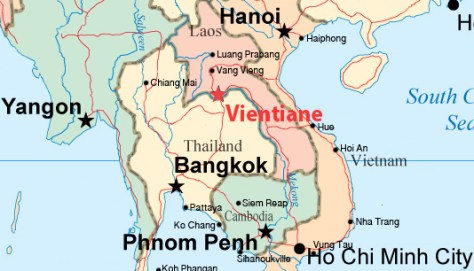
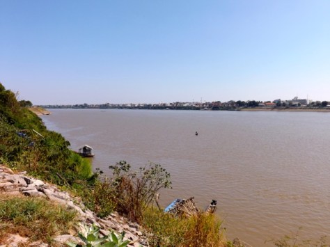
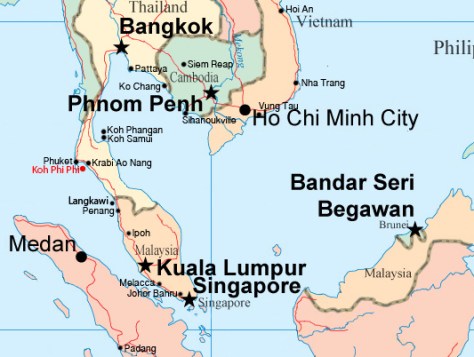
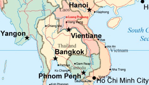
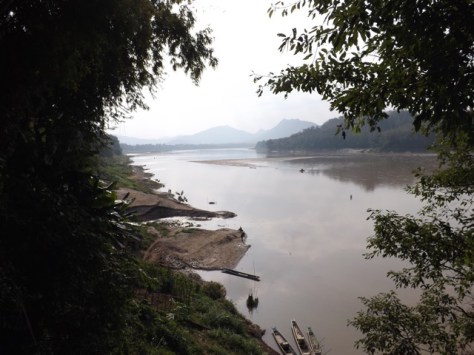
Literally, “Royal Buddha Image”, Luang Prabang is the Royal Capital of Laos. The city is on the Mekong River and surrounded by mountains in central northern Laos.

wpid-laos-luangprabang-2015-01-24-08-18.jpg

The trip from Vang Vieng by minivan is seven hours on the badly maintained roads which are the norm in Laos. Luang Prabang is an expensive city, with the price of many things – tours, transport, food – double elsewhere in the country. Only the large number of hostels manage to keep accommodation prices down. And beer is the same price everywhere.
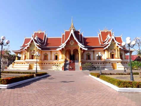
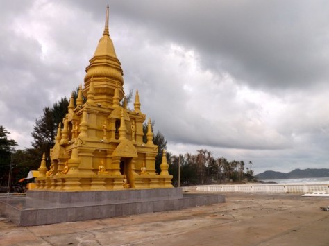
wpid-dscf6569-2015-01-24-08-18.jpg

Temples
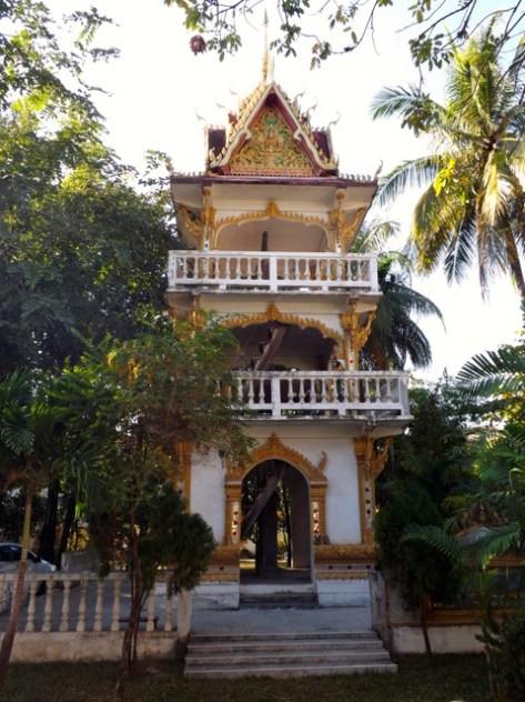
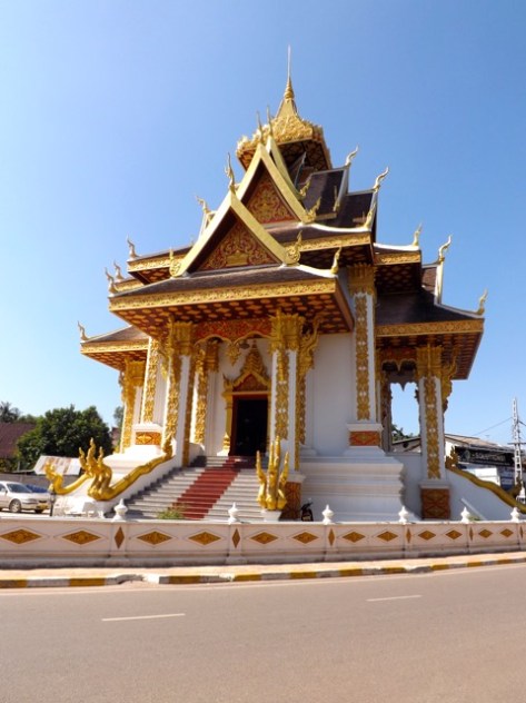
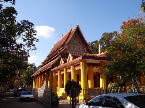
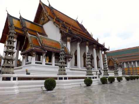
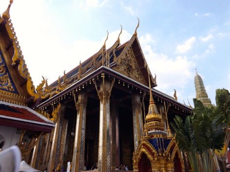
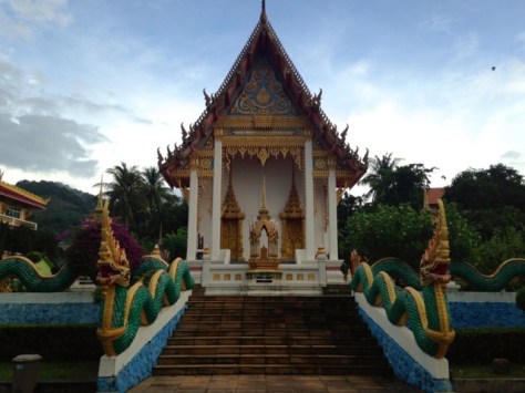
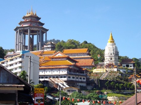
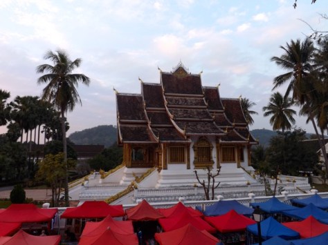
Luang Prabang is well-known for its temples and monasteries which accommodate many monks. Early each morning hundreds of monks walk the streets collecting alms. One of the many temples in the city is Wat Manorom…

wpid-dscf6551-2015-01-24-08-18.jpg

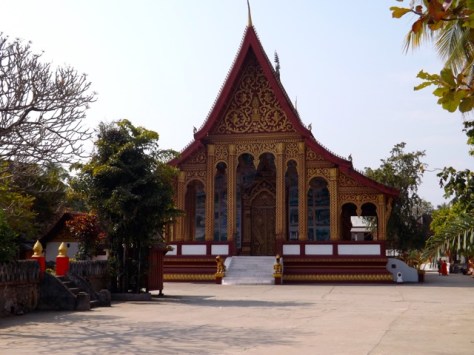
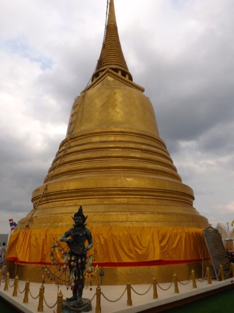
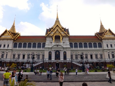
…and, on the grounds of the Royal Palace, Haw Pha Bang…
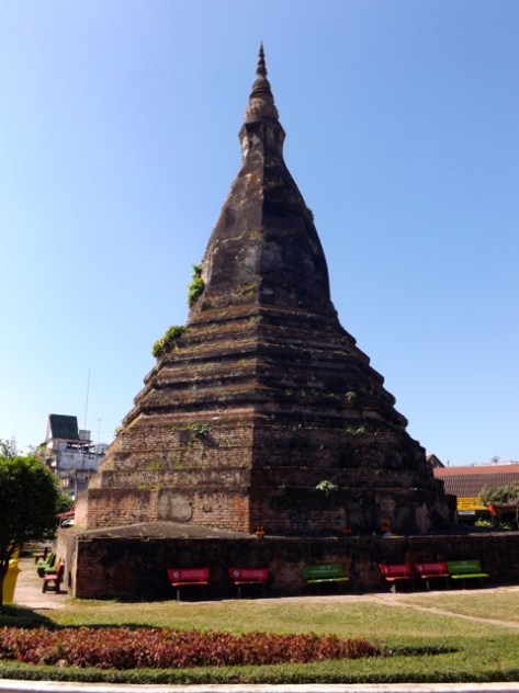
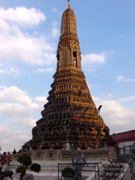
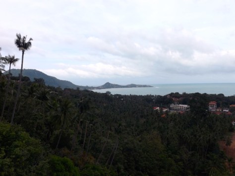
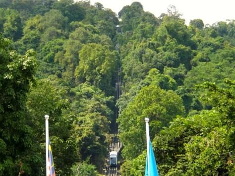
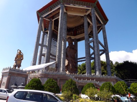
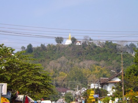
wpid-dscf6550-2015-01-24-08-18.jpg

Mt Phou Si
At the centre of old town and across the night markets from the Royal Palace is the 100 metre tall Mount Phou Si. Atop the hill’s summit is Wat Chom Si, a buddhist temple.

wpid-dscf6553-2015-01-24-08-18.jpg

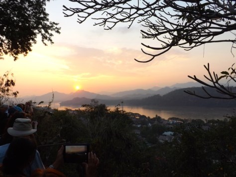
The steep climb to the temple is very popular among tourists especially during the hour leading up to sunset. The views before during and after the sunset are wondrous, although fighting for a position during that time was quite an adventure in itself.
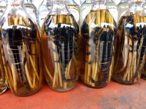
wpid-dscf6582-2015-01-24-08-18.jpg

Whisky Village
On our journeys we stopped off at a village about 30 minutes out from the main city. The village, like many in the region, brews its own whiskey – Lao-Lao, plus two types of sweet rice wine – Lao-Khao and Lao-Hai.

wpid-dscf6614-2015-01-24-08-18.jpg

We were able to try some of each and while some would argue that Lao-Lao isn’t whiskey but moonshine, it tasted pretty good to me. Most of the bottles include some form of local creature: usually large scorpions, cobras or lizards.
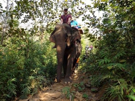
wpid-dscf6609-2015-01-24-08-18.jpg

Elephant Camp
During my visit I got the opportunity to visit the Manifa Elephant Camp, home to six female elephants. The camp has a good reputation, feeding the animals well and looking after them.

wpid-dscf6624-2015-01-24-08-18.jpg

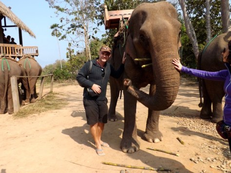
To raise funds for the camp groups are taken for rides through the forest, including the feeding the animals sugar cane and bananas. Because there was an odd number in our group, I got to sit atop the largest elephant’s neck instead of the flat wooden seats. This was quite an experience as the constant moving of her front legs jabbed into my butt cheeks, making it a little sore to walk for a bit after.

wpid-dscf6635-2015-01-24-08-18.jpg

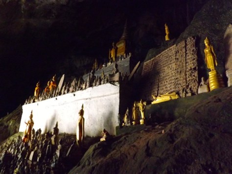
Pak Ou Caves – 4000 Buddha Caves
Across the Mekong river from the Elephant Camp are a pair of caves popular with tourists. The upper cave, Tham Theung, has a pair of shrines buried in the darkness. Torches are available for those willing to provide a donation.

wpid-dscf6655-2015-01-24-08-18.jpg

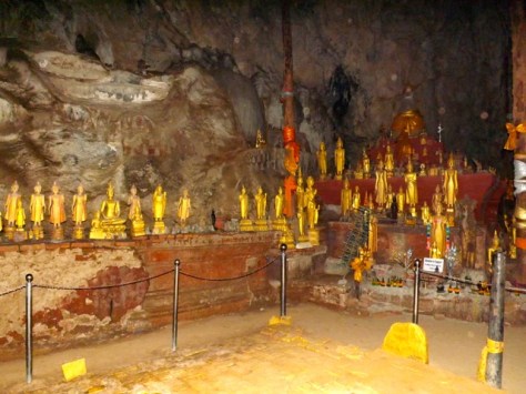
Tham Ting, the lower cave, is decorated by many hundreds of small buddhas sitting in any nook and cranny large enough to hold them. The number of the buddhas is ever-growing, as locals bring new ones to the caves every day.
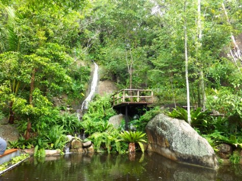
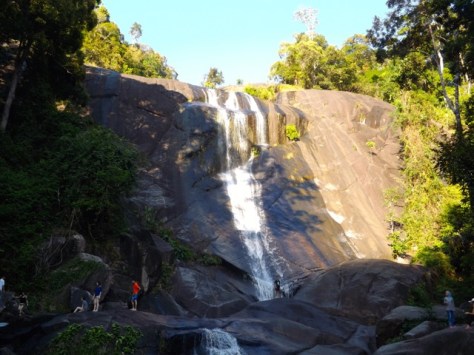
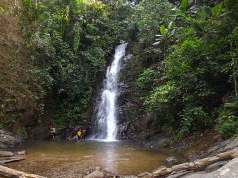
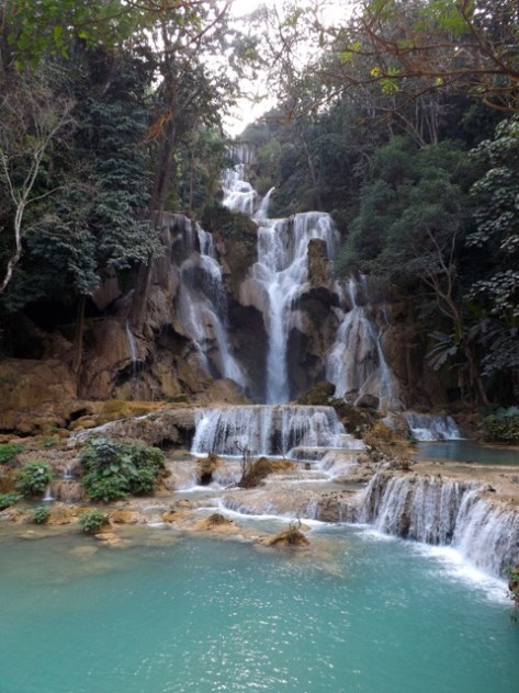
wpid-dscf6664-2015-01-24-08-18.jpg

Kuang Si Falls
Perhaps one of the more famous attractions in the city is the Kuang Si Falls. Forty-five minutes out of town, the main section of the falls where water cascades down many levels.

wpid-dscf6671-2015-01-24-08-18.jpg

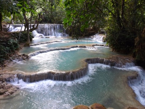
But the main falls are not all there is to see here. For a couple of hundred metres the river cascades into shallow turquoise blue pools. There are many such pools, with the lower areas available for swimming. As we arrived late in the day, during cool season, I wasn’t so keen to get in the icy waters.

wpid-dscf6683-2015-01-24-08-18.jpg

Overall, while Luang Prabang is more expensive than the other cities in Lao, it’s just as touristic and still a fun place to spend a couple of days.

Next I take a very long bus ride to Hanoi, Vietnam.

The Lone Trail Wanderer

Vang Vieng, Laos – Impressions

Vang Vieng was little more than a staging post Vientiane and Luang Prabang until the US airforce built an airbase there during the Vietnam War. Since the war the town has attracted backpackers who have flocked there as a site of adventure.

wpid-laos-vangvieng-2015-01-16-21-08.jpg

Four hours by bus north of Vientiane, Vang Vieng is nestled on the Nam Song river surrounded by mountains. It was perhaps the second worst bus ride of my travels but on arrival it felt glorious to be in the mountains again. But even though Vang Vieng is only 234 metres above sea level, the days are cooler and the nights often chilly. It’s the first time I’ve had to wear long pants in Asia.

wpid-dscf6487-2015-01-16-21-08.jpg

Vang Vieng has a reputation. The New Zealand Herald once suggested, “If teenagers ruled the world, it might resemble Vang Vieng.” And I would have to agree with them. Vang Vieng’s target audience seems to be backpackers in their 20s.

Wat That?
Well duh, it’s a temple. Wat That is one of five such temples in town in the typical Laotian style.

wpid-dscf6493-2015-01-16-21-08.jpg

Pha Poak Mountain
Not far from town is a small rocky hill which gives great views over the larger mountains and a panoramic view across the town. While on a casual stroll around town, I followed a sign across the river and through a set of fields to the hill.

wpid-dscf6518-2015-01-16-21-08.jpg

I hadn’t intended to climb anything as I was only in flip-flops, but since I was there I climbed it and indeed the views were superb.

wpid-dscf6520-2015-01-16-21-08.jpg

Tubing
Take a large tyre inner tube, a backpacker and a river, and you have tubing. An idea formed by the locals who organised themselves into a cooperative business involving more than 1,555 households. Tuk-tuks drop groups ten kilometres upstream where they launch into the water and drift their way slowly back to town a handful of hours later.

wpid-dscf6527-2015-01-16-21-08.jpg

While the views are amazing along the way the scenery isn’t the only drawcard. At various points along the river, locals have set up river bars for tubers, throwing out ropes to drag them in. Along the river there are other adventures to be had, trekking to caves, zip lining and other such activities.

wpid-p1000390-2015-01-16-21-08.jpg

Unfortunately, the safety levels are fairly low and 22 tourists were killed during 2011 on such tubing trips. Supposedly safety measures have been better implemented since then. and while it has reduced the deaths, they haven’t stopped entirely. I chose not to do the tubing, instead choosing another method to float down the river.

Kayaking
As part of a full day tour, I kayaked with a group along the river. Unfortunately because it’s dry season the river was low, so we only kayaked for about 6km instead of the usual 15km. I managed to get a solo kayak to myself and this allowed me more freedom.

wpid-p1000396-2015-01-16-21-08.jpg

The views of the river and surrounding mountains were marvellous. A little way along, we started encountering the river bars and stopped at one for a beer.

wpid-p1000380-2015-01-16-21-08.jpg

Then it was back in the water and paddling along through brief periods of rapids and slow patches. On my smaller solo kayak I was able to quickly paddle back up the river to some of the other kayaks, spin around and paddle backwards, or just drift sideways. It was a lot of fun. I found that many of the more dangerous swings and other activities had been closed.

wpid-p1000393-2015-01-16-21-08.jpg

Wet Cave
I did end up on an inner tube at one point. As part of the kayaking day tour, we floated into a low-roofed water-filled cave with head lamps on.

wpid-p1000352-2015-01-16-21-08.jpg

The water was quite cold, but I quickly became accustomed to it. The cave was perhaps only 50 metres long with a loop at the end.

wpid-p1000369-2015-01-16-21-08.jpg

Elephant Cave
Perhaps one of the smaller of many dozens of caves in the region, we went to a cave where elephants used to sleep when it rained. When humans moved to the area and planted crops, the elephants ate it all, so the locals were forced to move the animals. The cave is now a buddha shrine.

wpid-p1000374-2015-01-16-21-08.jpg

Overall, Vang Vieng is a peaceful little town on the backpacker route. It’s just a shame that the backpackers are often attracted here more for the partying aspect rather than the adventure, but thus is South-East Asia. If I had more time, I would have hiked through the mountains for several days. Perhaps another time…

Next I head north for my final Laos destination, Luang Prabang.

The Long Trail Wanderer

Vientiane, Laos – Impressions

Compared to the massive sprawling beasts that are most capital cities in South East Asia, Vientiane – pronounced ‘Vieng chan’ — is decidedly small town. But even with only two hundred and ten thousand people, Vientiane is still the largest city in the Laos.

wpid-laos-vientiane-2015-01-12-16-37.jpg

Because ‘chan’ has two meanings in the modern Lao language, Vientiane is known as both the ‘City of the Moon’ and ‘City of Sandalwood’. The city is nestled on the northern bank of the Mekong River, with Thailand on the other side.

wpid-dscf6402-2015-01-12-16-37.jpg

Sleeper Train
The 12-hour journey from Bangkok to Laos was by overnight train, my first experience on a sleeper train. I booked in the second class car and ended up with an upper berth. Being 189 cm tall (6’3”), I was concerned that I might not fit. But when the bed was made up and I climbed into it, it was just enough.

wpid-img_2325-2015-01-12-16-37.jpg

I’ve slept in tighter locations and actually got a good sleep. The train has two toilets per car, a western toilet and a squat toilet, but instead of going into a septic tank, waste simply drops out a hole in the bottom of the car onto the tracks. I guess it’s biodegradable. By about 10pm the car was silent with most curtains closed.

wpid-img_2324-2015-01-12-16-37.jpg

Buddha Park
About 25 km east of Vientiane is a sculpture park called Xiang Khuan, meaning Spirit City. The site was begun in 1958 by a monk who integrated both Hinduism and Buddhism into the sculptures. There are over a hundred statues in the park, some quite massive. The largest is the reclining buddha…

wpid-dscf6424-2015-01-12-16-37.jpg

Another piece has a crawlway inside and has several chambers on three levels and access to the roof.

wpid-dscf6419-2015-01-12-16-37.jpg

There are several ways to get to the park, by tour bus, tuk-tuk, or as I did, by scooter!

Petuxai – The Victory Gate
Also known as the Gate of Triumph, the monument is dedicated to those who fought for independence from France in 1949.

wpid-dscf6466-2015-01-12-16-37.jpg

The monument resembles the Arc de Triomphe in Paris, but is Laotian in design and decorated with mythological creatures. The structure has 7 levels, the top three giving great views across Vientiane.

Pha That Luang
The golden buddhist stupa is regarded as the most important national monument in Laos and is a national symbol. It is suggested to have been built in the 3rd century and is surrounded on three sides by other temples.

wpid-dscf6479-2015-01-12-16-37.jpg

That Dam
A black stupa said to be inhabited by a seven-headed naga, a water deity taking on the form of a large snake with the upper body of a female. This creature was to have protected Laos from the Siamese army in 1827.

wpid-dscf6389-2015-01-12-16-37.jpg

Nagas are the divine enemy of Garuda, the great eagle ridden by Shiva in the Hindu religion.

Temples
Like all cities in Asia, Vientiane is littered with temples. Most temples have a very Thai design — or maybe the Thai temples have a Laotian design — but in Lao the temple compound is usually surrounded by a series of shrines. Laotian temples often have a tower in their compounds that can be climbed.

wpid-dscf6371-2015-01-12-16-37.jpg

Here are some of the temples I visited in my travels in Vientiane:

Wat Si Maung

wpid-dscf6396-2015-01-12-16-37.jpg

Wat Si Saket

wpid-dscf6394-2015-01-12-16-37.jpg

Wat Mixai

wpid-dscf6369-2015-01-12-16-37.jpg

Wat Thatlueng Neua

wpid-dscf6480-2015-01-12-16-37.jpg

COPE Visitor Centre
Laos is the most bombed country in the world. With a major portion of the Ho Chi Minh trail running through Laos it was bombed heavily during the Vietnam War in attempts to sever the Vietcong supply lines. But also during bombing runs, if the US had not expended all of its ordinance it would be discarded over Laos.

COPE is an organisation that provides rehabilitation to Laotians who have suffered disabilities from unexploded munitions left over from the war. The Visitor Centre is a museum which also presents a documentary film following one such victim.

wpid-dscf6484-2015-01-12-16-37.jpg

Overall, Vientiane surprised me. Considering Laos is a poor country, the capital was more advanced than I expected. There were more Apple stores than any other city I have ever been to (including the US), a large western style cafe district and a decided lack of US chain restaurants — not a KFC, McDonalds or Starbucks in sight.

Next, I head north to the backpacker town of Vang Vieng.

The Lone Trail Wanderer

Bangkok, Thailand – Impressions

Bangkok is known in Thai as Krung Thep Mahanakhon, which means “City of the Deity”.

wpid-thailand-bangkok-2015-01-8-20-59.jpg

After my brother headed home I travelled to Bangkok to continue my adventures. But never alone long, I met a British girl at the hostel and we spent 3 days exploring the city.

Day 1 – Getting Around In Bangkok

Cruising Chao Phraya River
The rapid growth of the city has caused major troubles with traffic congestion and pollution. While four metro train lines have been built to combat this, they do little to cover the city. Only one train stop goes near the Chao Phraya River, where commuters can transfer to express boats to move along its length. As these boats are the easiest ways to see the city, we booked tickets and headed out to see what Bangkok had to offer.

wpid-dscf6150-2015-01-8-20-59.jpg

Wat Pho – Temple of the Reclining Buddha
Named after a temple in India where the Buddha was believed to have lived, Wat Pho is a massive complex with many traditional Thai designed temples and buildings. It is also known as the home of traditional Thai Massage.

wpid-dscf6186-2015-01-8-20-59.jpg

A major building in the complex contains a massive golden buddha in a reclining position. It’s the most popular building on the site where tourists filter in one side, around the feet and out past the back of the head.

wpid-dscf6170-2015-01-8-20-59.jpg

Khao San Road
Originally a rice market, the road is now considered a backpacker ghetto and party zone. As I prefer quieter hostels, I didn’t to stay in the area. During the day there are plentiful backpackers, markets and food stalls. In the evenings, bars appear and backpackers party away the night.

wpid-dscf6226-2015-01-8-20-59.jpg

Democracy Monument
At the end of Khao San Road is the grand monument commemorating the Siamese Revolution of 1932 which led to the establishment of a constitutional monarchy. Unfortunately, the widening of the road to accommodate the monument and ceremonial boulevard meant mass evictions of local residents and the cutting down of hundreds of shade trees.

wpid-dscf6228-2015-01-8-20-59.jpg

Wat Saket
Known as the Golden Mountain, this Buddhist temple sits atop an artificial mountain. The temple has a rounded golden feature atop it giving it the sense of being a mountain. The roof of the temple allows great views across Bangkok.

wpid-dscf6257-2015-01-8-20-59.jpg

Wat Suthat
One of the ten first-grade temples in Bangkok. King Rama I began the construction himself in 1807. King Rama II helped to carve the doors during his reign and the temple was finally completed by King Rama III in 1847. There are 28 Chinese pagodas at the base of the temple to commemorate the 28 buddhas born on this earth.

wpid-dscf6237-2015-01-8-20-59.jpg

Day 2 – Wat? More Temples?
Bangkok is the city of temples and while we’d visited several on day one there were a couple more we wanted to see.

The Victory Monument
Our hostel was right near the monument commemorating the 59 Thais killed during the 2 month Franco-Thai war in 1941. The outcome of the war was decided by the Japanese, who didn’t want a prolonged war between two of its allies just prior to its own war of conquest in SE Asia.

wpid-dscf6264-2015-01-8-20-59.jpg

Jim Thompson House
One of the most popular tourist locations in Thailand, the house was created by a US soldier during the 1950’s and 60’s. He put together 6 Thai houses made from Teak and brought from all over Thailand. After Jim went missing in Malaysia, his nephew created the Jim Thompson Foundation and turned the site into a museum.

wpid-dscf6271-2015-01-8-20-59.jpg

The Grand Palace and The Emerald Buddha Temple
Another of the most popular tourist attractions in Thailand, the Grand Palace was the home to the Kings of Siam between 1782 and 1925. The Palace compound is huge with many Temples, Halls and of course, the Palace.

wpid-dscf6316-2015-01-8-20-59.jpg

The compound is also the site of the Emerald Buddha Temple, home of a famous buddha statue. Labelled ‘emerald’ because of its green colour, it’s actually carved from Jasper. The statue has a long history, being carved in India, taken to Sri Lanka, lost on its way to Burma and ending up in Angkor Wat in Cambodia before the Siamese invaded and claimed it. Unfortunately, photos aren’t permitted within the temple.

wpid-dscf6309-2015-01-8-20-59.jpg

What Arun – Temple of Dawn
Once home to Emerald Buddha and named after a Hindu God, the Temple of Dawn is said to catch the first rays of the sun each morning, glowing with pearly iridescence.

wpid-dscf6338-2015-01-8-20-59.jpg

The main temple has very steep stairs that climb two tiers and give great views of the city.

wpid-dscf6340-2015-01-8-20-59.jpg

Day 3 – Market Day

All templed out by day 3, my British companion and I decided to explore a couple of weekend markets around the city.

Khlong Lat Mayom Floating Market
Bangkok has several floating markets, although the largest and most popular take over 90 minutes outside the city. We aimed for a smaller, less touristy floating market closer to central Bangkok. A floating market is a river market navigable by boat, with other boats and vendors along the sides of the river selling goods. Khlong Lat Mayom only has a small floating aspect…

wpid-dscf6356-2015-01-8-20-59.jpg

The market is mainly a food market which stretches across the river but with only the occasional boat floating by. As it was raining we were happy not to be on the water. Instead we enjoyed the local food, a spicy chicken side and some fried squid eggs in a batter. Interesting.

wpid-img_2320-2015-01-8-20-59.jpg

Chatuchak Weekend Markets
Known as Jatujak in the Thai language, the markets are not only the largest markets in the city, but the largest markets I’ve ever been to. As the name suggests, it’s only open on the weekends, and is vastly busy during this time.

wpid-dscf6367-2015-01-8-20-59.jpg

The markets have 27 sections and 8000 stalls! Beyond seeing the markets, my major reason for going was to find and consume a fried scorpion on a stick. Unfortunately, after spending hours searching, I wasn’t able to find one so settled for a frozen banana dipped in chocolate and chopped almonds instead. While not entirely the dish I was looking for, it would have to do but my search will continue.

wpid-dscf6368-2015-01-8-20-59.jpg

Overall, Bangkok is a busy capital city with plenty to do assuming you aren’t already over temples.

Next, I catch my first sleeper train to Vientiane, capital of Laos.

The Lone Trail Wanderer

Ao Nang, Thailand – Impressions

Ao Nang, pronounced ‘ow nang’, is also known as Krabi Ao Nang, as Ao Nang Beach is near Krabi City in the Krabi province of Thailand.

wpid-thailand-krabiaonang-2015-01-1-13-07.jpg

Ao Nang falls within Thailand’s ‘party zone’ which stretches from Phuket across to Koh Tao in the Gulf of Thailand.

wpid-southern-thailand-map-khao-sok-lake-2015-01-1-13-07.jpg

With its closeness to party island Koh Phi Phi, Ao Nang is commonly used as a transit point for 20-somethings crossing the peninsula to the islands of Koh Samui, Koh Phangan and Koh Tao. But Ao Nang is more than just a transit town, it’s a beach resort town with a beauty of its own and access to many interesting beaches.

wpid-dscf6103-2015-01-1-13-07.jpg

The main street of Ao Nang runs along the beachfront and along its length are hundreds of vendors and restaurants During high season, December to March, it’s common to see large numbers of people at all times of the day and night, shopping or looking for something to eat.

wpid-dscf6104-2015-01-1-13-07.jpg

The vibe of Ao Nang is different to the nearby Koh Phi Phi or Koh Samui. There are less roving packs of 20-somethings and more family groups. While there are bars and a clubbing area, Ao Nang is not about rampant partying and drunk people doing stupid things. Ao Nang is all about the beaches and is a far more family friendly location.

wpid-dscf6134-2015-01-1-13-07.jpg

Like other parts of the Malay Peninsula, there are plentiful limestone mountains protruding from both land and sea. At the end of Ao Nang Beach is a peninsula entirely cut off by a limestone ridgeline leaving the beaches of Railay Peninsula only accessible by long tail boats.

wpid-dscf6121-2015-01-1-13-07.jpg

There are three main beaches on the Railay Peninsula, and all a connected by walkways, along which there are many resorts and restaurants. While the beaches are beautiful and worth the effort to get to, they aren’t quiet, tranquil places. They can be more popular than the main beaches along Ao Nang.

wpid-dscf6131-2015-01-1-13-07.jpg

There are numerous things to do near Ao Nang, although not a lot of them could be considered cultural. Tours from here predominantly head out around the islands in the bay to snorkel, kayak, scuba dive or just take in the sights.

wpid-dscf6112-2015-01-1-13-07.jpg

The most popular thing to do in the area is hang out on a beach. And for the period of a few days between Christmas and New Years, the peak of the tourist time, we did just that. A great place to hang out, eat good food and just relax.

wpid-dscf6137-2015-01-1-13-07.jpg

Next, we fly back to Kuala Lumpur for a Thai Visa run and to wish farewell to my brother. Then I’m back to Thailand and on my way north to Bangkok.

The Trail Wanderers

Koh Samui, Thailand – Impressions

Koh Samui is the largest of the three popular tourist islands off the east coast of Thailand, the other two being Koh Phangan and Koh Tao. These three islands plus Koh Phi Phi off the west coast make up Thailand’s main party zone.

wpid-thailand-kohsamui-2014-12-28-20-20.jpg

While tourism is the primary funding source for the islands, the region’s party reputation seems to attract mainly early twenty somethings, who drink copious amounts of alcohol and do stupid things. This party reputation stems from the monthly Full Moon parties at Haad Rin, a beach at the southern tip of Koh Phangan. 40,000 youngsters invade the beach each month to indulge in a drug and alcohol fuelled party on the beach.

wpid-kohphangnafull-moon-party-datesparty-2014-12-28-20-20.jpg

Our choice to stay at Koh Samui was because it has a somewhat better reputation and a slightly older tourist base. Unfortunately it still serves as a party zone during the week leading up to the Phangan Full Moon parties.

Sickness Strikes Again!
We booked three nights on Koh Samui over christmas as it’s near impossible to get bookings over New Years. After 8 hours of buses, ferries and local transport, we arrived at the hostel on the evening of Christmas Eve. We ate at a fairly popular local restaurant, but what seemed like a fairly standard pork schnitzel would see me throwing up for the better part of the night and on throughout Christmas Day.

It would seem that of the times I’ve been ill on this journey it’s been because of pork. While bacon seems fine, for the rest of the trip I’l be avoiding pork.

Scooters, of course.
With one of our two full days on the island spent in bed, I didn’t have much time to explore. To make the most of our time I hired a scooter and rode up the east coast to see what I could find. The bad weather that had plagued our Thailand visit continued, but thankfully I had a waterproof poncho, so I remained mostly dry.

wpid-dscf6058-2014-12-28-20-20.jpg

At the northern end of the island, I found a pair of temples dedicated to buddha with associated giant statues.

wpid-dscf6063-2014-12-28-20-20.jpg

While the Big Buddha statues were impressive, so were the temples themselves.

wpid-dscf6065-2014-12-28-20-20.jpg

Near these two temples I found an artist’s store where he builds life-sized metal statues of science fictional creatures.

wpid-dscf6061-2014-12-28-20-20.jpg

As the weather began to clear up, I rode south again to find some of the other hidden gems of the island. I stopped at Lamai beach, where the sea comes right up to the front of the resorts.

wpid-dscf6071-2014-12-28-20-20.jpg

I climbed to a lookout over Lamai Beach for a different perspective…

wpid-dscf6079-2014-12-28-20-20.jpg

And then rode to the southern-most tip of the island where I found the Laem So Pagoda.

wpid-dscf6085-2014-12-28-20-20.jpg

Cleaning Station
Throughout Thailand, I’ve seen ‘cleaning stations’ on the street at the front of massage places. These cleaning stations are large fish tanks containing many small fish which suck on your feet, cleaning off dead skin and drawing out toxins. I’ve been intrigued by this and have wanted to give them a try. On my day’s journey, I located a place with a full cleaning pool…

wpid-dscf6077-2014-12-28-20-20.jpg

Normally the fish are fairly small, perhaps 2 centimetres long and very thin. The fish in the pool were larger, perhaps 6-8 centimetres and the sucking sensation takes some getting used to. When a dozen of them suck on one heel it’s a strange feeling. When a hundred suck on each foot at the same time, it takes an effort just to keep your feet in the water. It has to be the weirdest sensation I’ve ever felt.

wpid-dscf6078-2014-12-28-20-20.jpg

Next we head back to Krabi Ao Nang, a more family friendly beach area, for New Years.

The Trail Wanderers

Koh Phi Phi

Koh Phi Phi (pronounced ‘co pee pee’) is a small group of islands off the coast of Phuket in Thailand. While a small time tourist destination in the 90s, since the release of the film “The Beach”, which was partially filmed on the island group’s second largest island, tourism has exploded.

wpid-thailand-kohphiphi-2014-12-23-11-55.jpg

Koh Phi Phi Don, the largest island, has a pair of limestone ridges with a thin area of beaches connecting them. This strip of sandy isthmus forms a double-sided bay which is completely covered in resorts, housing, bars and hostels. On December 26, 2004, the water in both bays receded before tsunamis flowed in to meet in the middle, completely devastating the island.

Unlike Phuket, where businesses took only months to get back on their feet, it took 6 years to rebuild the base infrastructure, with construction still continuing 10 years later.

wpid-dscf5989-2014-12-23-11-55.jpg

The most popular daytime activity here is visiting the islands and spending time out at sea, snorkelling and diving. While the bad weather that had plagued us up the Malay Peninsula continued, I booked a day out on a boat anyway, to do some snorkelling and check out some of the beaches.

Beaches
The soft golden sand of the isthmus stretch between the pair of limestone ridge-lines giving great views from both beaches.

wpid-dscf6003-2014-12-23-11-55.jpg

Beyond getting out on the water, sitting on the beach is where most people can be found during the day.

Nightlife
The nightlife is one of the major reasons people come Koh Phi Phi and perhaps also its worst aspect. Koh Phi Phi Don is a haven for 18-25 year olds to drink copious amounts of alcohol and act stupidly. Many outlets even sell drinks by the bucket, and I’m not talking about a handful of bottles of beer in a bucket, I’m talking about a bucket of spirits.

wpid-img_2992-2014-12-23-11-55.jpg

Monkey Beach
While the waters in this part of the world are usually clear and rife with fish, the bad weather had churned it up a little. The best area in the water was just outside Monkey Bay with large areas of spiky sea urchins and fish.

wpid-p1000339-2014-12-23-11-55.jpg

Monkey Beach is, as the name suggests, a beach where monkeys harass tourists for food. There are plentiful young and some have a tendency to chase the tourists and bite them.

wpid-p1000342-2014-12-23-11-55.jpg

Bamboo Island
North of the main islands, this island is surrounded by golden sandy beaches. Because the wind was increasing, we kayaked from the boat to the island instead of swam.

wpid-p1000346-2014-12-23-11-55.jpg

On a sunny day the island would have the mystique of a desert island with nothing more than soft sand, a calm crystal clear ocean, bamboo and, because it’s Thailand, a bar.

wpid-p1000348-2014-12-23-11-55.jpg

Maya Bay
Renown for being the location where the movie The Beach was filmed, it’s a popular place with people swarming to it every day. While the beach is spectacular, it’s still little more than just a golden sand beach with limestone hills around the mouth of the bay.

wpid-p1000330-2014-12-23-11-55.jpg

The inland area, as seen on the movie, is not actually on the islands. But around the bay around the beach has crystal clear turquoise waters.

wpid-dscf6029-2014-12-23-11-55.jpg

Overall, Koh Phi Phi was a little disappointing as its main purpose seems to revolve around young adults getting hammered, spending the day recovering on the beach before doing it again the next night. The setting is beautiful and was otherwise only hampered by the rain.

Next we cross the Malay Peninsula to the island of Koh Samui.

The Trail Wanderers

Phuket, Thailand – Impressions

While Phuket is the largest island in Thailand it’s only three-quarters the size of Singapore. Like much of this portion of South-East Asia Phuket grew because of a Tin mining industry supplemented by trade in Rubber.

wpid-thailand-phuket-2014-12-21-16-49.jpg

In 2004 the island was hit hard by the Boxing Day tsunami which devastated its west-coast beaches and lowlands. Officially some 250 people including tourists were killed, unofficially 1000 illegal Burmese workers were also thought to have been killed. Within 2 months most of the resorts in the area were back in business and within a year little evidence of the tsunami remained.

Sickness Strikes
Our visit to Phuket would begin with sickness. On the bus into Thailand I succumbed to a virus that would see me sleep through our first two days. Whenever I awoke I would be so groggy all I felt like doing was sleeping. After forcing myself to eat, I took some pain killers and seemed to snap out of it. On my first well afternoon we went for a walk and discovered the pretty Wat Suwankiriket.

wpid-img_2293-2014-12-21-16-49.jpg

Karon Beach
Near where we were staying, Karon Beach is popular with tourists especially couples and families. The area has a strong Eastern European influence and a very popular holiday spot for Russian visitors.

wpid-dscf5981-2014-12-21-16-49.jpg

Patong Beach
Not far from Karon Beach, Patong Beach has amazing golden beaches. The Patong area is popular with singles and those who enjoy partying as it has extensive nightlife in areas such as the famous Bangla Road and the Paradise Complex.

wpid-dscf5979-2014-12-21-16-49.jpg

Sickness Strikes Again
I extended our stay in Phuket to make up for the days I’d lost due to sickness. This was to allow me to see places such as Bangla Road at night, the Giant Buddha, Old Phuket Town and Promthep Cape. But alas, the sickness I’d experienced on the first couple of days struck again. I spent much of the day in bed sleeping it off. I’ll just have to return to the city at another time.

Next we’re off to Koh Phi Phi Islands where I’m hoping to have better luck with my health.

The Trail Wanderers

Langkawi Island, Malaysia – Impressions

Langkawi the Jewel of Kedah, as it’s officially known, is Malaysia’s answer to Bali, albeit a much quieter version. Tourists come to the island because of the amazing beaches and the lack of crowds, giving it a more secluded feel than nearby Penang.

wpid-malaysia-langkawi-2014-12-12-17-00.jpg

Langkawi, meaning Island of the Reddish-Brown Eagle, was originally believed to be cursed. A beautiful young woman named Mahsuri was accused of adultery and executed on the island. With her dying breath she brought down a curse of bad luck for seven generations. Her tomb is a popular tourist location, although a village has been built around it and fees charged to enter.

wpid-dscf5960-2014-12-12-17-00.jpg

Palau Langkawi is slightly larger than Penang Island and like its southern sister, the best way to get around it is via scooter. Yay! While more expensive to hire than in Penang they’re still cheap at only NZ$12 per day. A tank of gas will cost just over NZ$2 and will get close to two laps around the entire island.

Beaches
Surrounded with beaches of white sand, Langkawi is definitely a picturesque paradise. Most people stay in the touristy Cenang area, with Pantai Cenang perhaps the beach most similar to Kuta Beach in Bali.

wpid-dscf5975-2014-12-12-17-00.jpg

And within walking distance is another popular beach, Pantai Tangah.

wpid-dscf5963-2014-12-12-17-00.jpg

If you have transport, there are more beaches within reach. Only 30 minutes north is the empty Pantai Kok.

wpid-dscf5908-2014-12-12-17-00.jpg

And another 30 minutes through the mountains to the northern side of the island there’s such beauties as Pantai Tanjung Rhu, right near Scarborough Fish n Chips, the best on the island.

wpid-dscf5948-2014-12-12-17-00.jpg

Waterfalls
Scattered around the island are several waterfalls. While they aren’t spectacularly tall or wide, they’re enjoyed by locals and visitors alike as swimming spots. On our scooters, we stopped by at 7 Wells waterfall…

wpid-dscf5938-2014-12-12-17-00.jpg

… and Durian Perangai Falls.

wpid-dscf5953-2014-12-12-17-00.jpg

Oriental Village

Located at the northern end of Pantai Kok, the oriental village is an open air complex surrounding a small lake. It’s an entertainment zone with many different things to do. For the kids, there’s the water balls, round or tubular…

wpid-dscf5915-2014-12-12-17-00.jpg

The village, while not very oriental looking, has elephant rides, eagle viewing, tiger watching and snake cuddling…

wpid-dscf5923-2014-12-12-17-00.jpg

It’s also home to the Skycab, the cable car that takes people to the top of nearby mountains…

wpid-dscf5914-2014-12-12-17-00.jpg

The panoramic views over most of the island are spectacular. While the ascent can be a little breathtaking, the journey is worth it for the views alone.

wpid-dscf5934-2014-12-12-17-00.jpg

Overall, Langkawi is a perfect place to take a break away from the world. With only 65,000 residents, it’s a very peaceful place with a handful of tourist options and many beaches to relax at.

Next we head north for the craziness of Christmas and New Years in Thailand.

The Trail Wanderers

George Town, Malaysia – Impressions

George Town is a city at the north-eastern corner of the Malaysian island of Penang. Named after the British King George III, the island was leased to a British trade boat captain in exchange for protection from the Burmese and Siamese armies. The captain, however, had no intention of fulfilling the lease and instead set up George Town as a trading port.

wpid-malaysia-penang-2014-12-6-21-23.jpg

While the island is commonly reached by ferry from the mainland for less than a dollar, it is reachable by road via a pair of bridges. Penang bridge is 13.5km long while the newer Penang 2 bridge is 23.5km. George Town has several long waterfronts adorned with hotels and shipping yards.

wpid-dscf5875-2014-12-6-21-23.jpg

Street Art
Like most other major cities in Malaysia, George Town’s streets are littered with art. In 2012 the city announced a street art project for the annual George Town Festival. Now there are more than 100 pieces on walls across Old City. Some pieces were created by Ernest Zacharevic, the famous Lithuanian artist responsible for other works across Malaysia.

wpid-dscf5815-2014-12-6-21-23.jpg

While some of the art is in the form of murals, often with a cat theme, other pieces use props. One of the more famous pieces includes a bicycle set against a plastered wall with a pair of children painted to look like they’re riding it.

wpid-dscf5817-2014-12-6-21-23.jpg

Since the festival, wrought iron comic designs have also begun appearing around Old City.

wpid-dscf5807-2014-12-6-21-23.jpg

Penang Hill
Penang Hill is the tallest hill on the island and is one of the most popular tourist locations. At 883 metres, it gives amazing views over George Town, the coastline and mainland Malaysia.

wpid-dscf5848-2014-12-6-21-23.jpg

The easiest way to get to the top is by funicular train, a train operated from top and bottom by cable. Near the top the train passes through a brief tunnel, noted as being the steepest train tunnel in the world. While the ascent is fairly sedate with the training chugging up the hill, the descent can be quite exhilarating as it races towards the bottom.

wpid-dscf5853-2014-12-6-21-23.jpg

At the top there is a double story food court, several private restaurants, an owl museum, a mosque and a hindu temple.

wpid-dscf5840-2014-12-6-21-23.jpg

Penang National Park
The smallest national park in Malaysia, Tama Negara Pulau Pínang, is in the very north-west of the island, about 13km by road from George Town. There are several ways to get to the national park, by tour bus, local bus, car or as we did, by scooter. We couldn’t help ourselves, we enjoy riding them.

wpid-dscf5855-2014-12-6-21-23.jpg

While the park is small, it does have several longer trails, the longest being 6km. There are many species of animals in the park, including two different species of monkeys. This cute but cautious girl is a Spectacled Leaf Monkey.

wpid-dscf5869-2014-12-6-21-23.jpg

With rain imminent when we arrived, we decided to only take a short walk to the Canopy Walk, about 20 minutes along the trail. The Canopy Walk stretches for 250m through the tree tops. Unfortunately, when we arrived it was closed. So we walked back through the forest and along the waterfront to the scooters before heading back across the island.

wpid-dscf5868-2014-12-6-21-23.jpg

Fort Cornwallis
As part of the lease for Penang Island, the fort was built to protect the island from pirates, the Siamese and the Burmese, but it never actually saw battle. The grounds of are now used as concert venue.

wpid-dscf5859-2014-12-6-21-23.jpg

The cannon barrels that remain on the walls are sometimes used by locals as a fertility charm. If flowers are left by barrels it’s supposed to help an infertile woman get pregnant. I guess size does matter when it comes to cannons…

Kek Lok Si Temple
On our way to Penang Hill we spied a very large temple at its base. On our final morning in George Town and with a few hours left of our scooter hire, we headed inland to check it out.

wpid-dscf5879-2014-12-6-21-23.jpg

Ken Lok Si, meaning Temple of Supreme Bliss, is said to be the largest buddhist temple in South East Asia. At the temple entrance there are lines of shops, restaurants and a turtle pond, a buddhist tradition. The main Pagoda is built in three distinct architectural styles, the lower third is Chinese, the midsection Thai and the top Burmese.

wpid-dscf5902-2014-12-6-21-23.jpg

On the hill above the temple, up a 100m skylift, is a 30m tall bronze statue of Kuan Yin, the Goddess of Mercy.

wpid-dscf5893-2014-12-6-21-23.jpg

Overall, George Town has a modern feel about it and is set up both for locals and tourists alike. The Old Town does have a more closed-in feeling, with thin streets and many hostels and guesthouses.

Next we catch a ferry to Langkawi, the Jewel of Kedah.

The Trail Wanderers