Tag Archives: South America

Cali, Colombia – Impressions

With 47 million people, Colombia has the second largest population in South America after Brazil and it’s whopping 201 million. My first port of call, Cali, is the 3rd biggest city in Colombia, with 2.5 million. Cali is known as the capital of sport and salsa dancing in Colombia.

Most people I’ve met on my travels have said Colombia was an amazing place with very friendly people. This is in vast contrast to what’s generally said about the country. While it’s less dangerous than it’s been, there’s still a guerrilla presence. They are kept at bay by the plentiful armed military, police and security guards everywhere.

After an eventful 20 hour bus ride from Quito in Ecuador, I welcomed my arrival. The bus was full of Colombians in their early 20’s who had boarded the bus in Lima, Peru, 2 days earlier! They were more raucous the normal, meaning I didn’t get much sleep overnight.

In Cali, I caught a taxi to my hostel and went out to check my surroundings. The hostel is in an outer suburb but I found a large area of restaurants just around the corner, including 2 supermarkets.

Then after a better sleep, I decided to see the city centre by taking a free walking tour. Cali has its share of awesome architecture, although in 1971 they decided to tear much of it down to make room for the Pan American Games. Some still remain though, such as this church…

wpid-dscf2705-2013-10-31-16-46.jpg

And this plaza with a history of the city on the wall beyond it.

wpid-dscf2715-2013-10-31-16-46.jpg

Of course it wouldn’t be South America without a fountain or sixty.

wpid-dscf2728-2013-10-31-16-46.jpg

Or the occasional colonial building…

wpid-dscf2733-2013-10-31-16-46.jpg

I only stayed three nights in Cali, so I tried to make the most of my time. I caught a taxi up to see Cristo Rey… yes, a giant statue of Christ. Many cities in South America have one of these in the hills ‘protecting’ the people. Unlike the one in Rio de Janeiro, this one is free.

wpid-dscf2748-2013-10-31-16-46.jpg

It also allowed me to see some awesome views of the city from above.

wpid-dscf2736-2013-10-31-16-46.jpg

Then after 3 rather warm days – it’s quite humid in Cali – I caught the bus north to the country’s capital – Bogotá.

The World Wanderer

Cuenca, Ecuador – Adventures

Cuenca is a city of half a million people nestled in the southern Ecuadorian Andes. The city is only four hours south of Riobamba by local bus (US$2.50) and the main attraction of the area being Ingapirca, the largest Incan ruins in Ecuador. This was the major reason I decided to travel here, but hoped there’d be more on offer.

Cuenca City
It seemed to be raining everywhere in Ecuador when we arrived in Cuenca. But then Ecuador isn’t large, only marginally larger than New Zealand. On the bus, my friend and I ran into a woman we’d met in the hostel in Quito a week earlier. So, as the light began to fade and the rain continued lightly, the three of us wandered the streets and discovered plentiful examples of excellent architecture. Like many places in South America, the architecture is great, but they aren’t well looked after. The Basilica…

wpid-dscf2601-2013-10-17-17-08.jpg

The next morning the rain had eased and we wandered around some more. The central plaza has a statue, and yes, a fountain too, hidden away in one corner.

wpid-dscf2603-2013-10-17-17-08.jpg

We also found two small Incan ruins that had been surrounded by the city. This one is just a small lot, while the other is more spread out and is part of the local botanical gardens, although only the foundations of the ruins are still visible.

wpid-dscf2614-2013-10-17-17-08.jpg

The next day we booked a tour of Ingapirca, but as part of the tour we had to book a train ride down the Devil’s Nose.

The Devil’s Nose – Nariz del Diablo
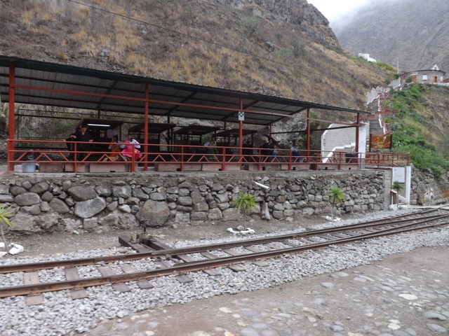
After a three hour van ride north, we arrived at the town of Alausi where we boarded the train that would take us down the Devil’s Nose – a hill that looks sort of like a nose.

When building a railway through the country, the Ecuadorian government had to find a way to connect a station at the top of Devil’s Nose with one 800m below. Unable to go around, they decided to build a switchback system where the train goes back and forth down hill.

wpid-dscf2666-2013-10-17-17-08.jpg

Thirteen thousand locals took part in the creation of the switchback, of which 2,500 were killed during the process through dynamite explosions, apparently.

At the bottom station there’s a small museum, some traditional dancing and a cafe.

wpid-dscf2661-2013-10-17-17-08.jpg

Ingapirca

After the train ride back and another 2-hour van ride, we arrived at the largest ruins in Ecuador, Ingapirca – a thousand year old pre-Incan fortress. Like most of the Incan cities, the spanish destroyed it, using the bricks as foundations for some of the buildings in the surrounding cities, including Cuenca. The only building left standing was the sun temple, set to catch the sun four times a year on the solstices and equinoxes.

wpid-dscf2689-2013-10-17-17-08.jpg

It was raining, so we didn’t spend a lot of time in the ruins, but the guide was very knowledgable. This stone below was used as a calendar. There are 28 holes cut into the rock, one for each day of the thirteen lunar months of the Incan year. It’s said that they could tell the date by which of the holes the moon was shining in.

wpid-dscf2692-2013-10-17-17-08.jpg

The sun temple has two sides, so it can catch the morning light and the evening light.

wpid-dscf2695-2013-10-17-17-08.jpg

Then it was back in the van for a 90 minute ride back to Cuenca.

Overall
Cuenca and the surrounds is a nice area of the Ecuadorian Andes and worth a visit if you are travelling through from Peru or as a nine hour bus ride from Quito.

Next, I head back to Quito for a couple of days to plan my way north into Columbia.

The World Wanderer

El Altar, Sanjay National Park, Ecuador

Nearly two years ago, the government of Ecuador changed the laws regarding multi-day hikes. Because so many people were getting lost or dying, all hikes in the national parks now require a certified guide. Peru has a similar law, although it doesn’t police it as stringently as Ecuador does. And at US$50-80 a day for a guide, my dreams of doing a multi-day hike in Ecuador came to a screaming holt.

My companion and I caught a bus to Riobamba, a city six hours south of Quito and set about finding a hike we could do without a guide. After some investigation we found one – El Altar – an overnight hike into an area of mountains only policed one day a week.

Day 1
We were up early and waiting for the taxi. A crazy drive through the mountains followed to Hacienda Releche, the ‘trail head’ of the hike. We met the owners of the hacienda who quoted us 5-6 hours to their lodge in the mountains and at $12 per person per night it’s far cheaper than a guide.

We began climbing along a dirt track following a gully. On either side was a thin line of trees and beyond were fields; one containing rows of flowers, the other grazing cows.

wpid-dscf2507-2013-10-13-21-07.jpg

For the first two hours of the walk the trail climbed steeply up the side of the hill with the occasional short area of boggy mud. While the skies were cloudy there was no rain. A look back along the valley gave great views of the surrounding hills. By the deep green of the hills, I’d suggest it rains here fairly regularly.

wpid-dscf2510-2013-10-13-21-07.jpg

As we continued climbing, the trail grew less steep, but the mud increased dramatically. As the easiest way to get to the lodge is by horseback, this churns up the mud. In many places, it was difficult to pass without squelching our way through. Luckily, waterproof leather hiking boots have no issues with mud and we waded our way through, trying to fall over as little as possible. This is only a problem if the mud is soggy and wet, which for the most part it wasn’t.

wpid-dscf2525-2013-10-13-21-07.jpg

We stopped for a late lunch with a view of a road across the valley, before marching on. As the afternoon wore on, the rain began, and we decided to rest out of the rain for a bit, so following a short path we found a pair of large pine trees as shelter.

While we were waiting, we heard hooves on the track. I went to have a look in the rain and discovered around ten large horned, cows trampling along the trail. When they saw me they stared for a few moments before bolting back up the trail. A few minutes later, we heard hooves again, this time it was a group of riders leading the cows. Two of the cows had climbed the bank and charged through the area where we were sheltering, scaring the wits out of my companion.

wpid-dscf2537-2013-10-13-21-07.jpg

By this stage, we’d already walked 5-6 hours with no sign of the lodge. We continued on, crossing through gullies and the occasional stream. As darkness began to fall, we still hadn’t found the lodge and my companion began making suggestions of roughing it, as we didn’t have a tent with us. So under the light of our head torches we kept an eye out for sheltered spots but continued walking.

An hour and a half after dark we rounded a hill and could just make out buildings ahead in the vague moonlight. We reached the buildings and found the first one open. It was a dorm room with bunk beds and a bathroom. We dropped our packs and investigated the other four buildings. Two were locked dorms while the others were dining areas with kitchens and fireplaces. We found a bunch of candles and set up our room, cooked some dinner and collapsed into our sleeping bags.

Day 2

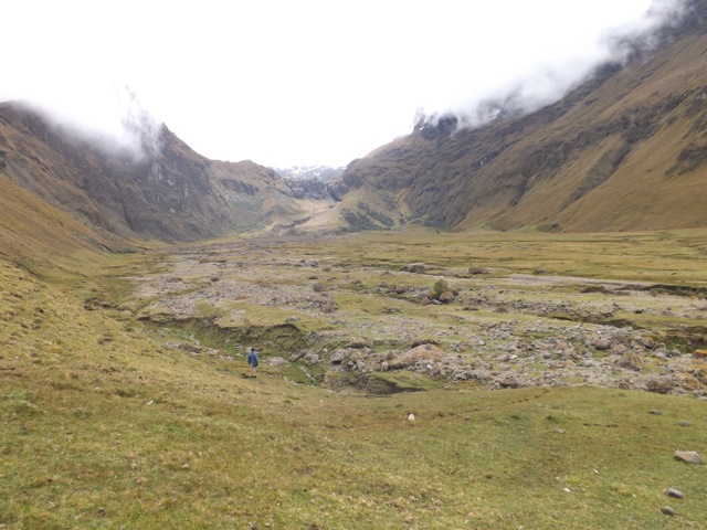
The next day we were up and after breakfast, we cleaned up the room, packed our bags and stowed them away in a hidden room off one of the kitchens. We then headed out across a stretch of soggy, rocky ground towards The Altar, a collapsed volcano surrounded by peaks. The valley is at about 4000m above seas level, and even with a slight grade crossing it was a struggle because of the altitude.

wpid-dscf2544-2013-10-13-21-07.jpg

At the far side was a tough climb up the valley wall. While the sky was cloudy and mist covered many of the mountains, we could just make out a snowy peak above us as we climbed. My younger companion raced ahead while I struggled with the altitude, even without a pack. During one of our regular breaks, we discovered another pair of guys close behind us. This pushed us on and eventually we came over the ridge to see the large crater lake and the bottom of the mountains surrounding it. El Altar.

wpid-dscf2555-2013-10-13-21-07.jpg

We waited up there for almost two hours, watching as the clouds came and went. I noticed more than a dozen kinds of wild flowers growing in the area so set about taking photos of as many as I could.

At about 1pm, the sky began to clear and I was able to take a panoramic shot – something I’d not done before on my new camera.

wpid-dscf2572-2013-10-13-21-07.jpg

On the way back we passed two other groups of people totalling 10 between them, before arriving back at the lodge to meet the lodge owner’s father, who was also the caretaker. Unfortunately, he didn’t speak english and our spanish wasn’t enough to get across that we had already paid for the previous night. The message finally got across with the help of one of the other guys and we booked another night. This time, we had a more luxury room – one of the locked ones.

Day 3

After breakfast, we packed and headed down from the lodge.

wpid-dscf2591-2013-10-13-21-07.jpg

The climb down was fairly uneventful. There was the occasional rain, but nothing worrying. Most of the trail was dry mud but we also passed through several different levels soggy levels of it as we went: dirt, wet dirt, hard mud, soft mud, sludge and water pooled mud. For the most part, we found little of the last two and mainly plentiful soft mud. When climbing down a dirt or rocky trail, it can be hard on your knees, even with walking poles. But soft mud cushions your footsteps without swallowing your boots totally. As we walked, we saw more of the wild flowers…

wpid-dscf2595-2013-10-13-21-07.jpg

We finally reached the owner’s hacienda just as the rain began. After a lunch prepared by the owner’s mother, we waited for the bus that didn’t come before talking the park rangers into giving us a lift back to Riobamba. This was ironic because they would have stopped us from doing the trek if they had caught us at the beginning. We arrived back to the hotel we’d been staying at and the luxury of hot showers.

Summary
Overall, the trek was a lot longer than we expected, but we still had an awesome time and saw one of the few sights available without a guide in Ecuador. While the trail was muddy, it made the trek more of a technical challenge than an annoyance. For the views and the lodge, I would recommend this to anyone looking for an overnight and cheap hike in Ecuador.

Next we are off to Cuenca in Southern Ecuador to see Ingapirka, the most famous Inkan ruins in Ecuador.

The Trail Wanderer

Mindo, Ecuador – Impressions

80km north of Quito is the town of Mindo, buried deep in the rainforest of North Ecuador.

As one of my friends leaves South America in the next week three of us, who’ve been hanging out in Quito, decided to go away for the weekend to have one last adventure together. Spending $8 in the taxi to the bus terminal, we paid $2.50 each for the 2 hour bus ride!

Mindo is a charming little town with a lot to offer, which is why it’s a common weekend destination for travellers stopping off in Quito. While it’d take a week to do everything on offer here, with only two days we decided to take it easy and enjoy ourselves.

To start with, we found a place that served breakfast and ordered. While we were waiting on the balcony for the food to arrive, Hummingbirds flitted around, stopping to drink from a feeder.

wpid-dscf2404-2013-10-6-18-53.jpg

They skit and bob around like insects with their wings blurred and are the only birds that can fly backwards. It was impossible to get a clean photo of them while they were flying as the camera just couldn’t focus on them fast enough. There are 14 different types of them here.

After breakfast, we went for a walk to check out what the town had to offer. 10 minutes later, we were done having seen the bar district and the restaurant district. The town consists of a main street, several short side streets and a plaza.

wpid-dscf2402-2013-10-6-18-53.jpg

Next, we decided to go zip lining and walked the 3km up the hill to one of the companies that offered it. There were 10 different lines and on most of them we were able to ‘fly’ while accompanied by one of the two guides. Hanging from our backs we sped along with arms wide, aeroplane style. Overall, it was a most fun two hours.

wpid-dscf2438-2013-10-6-18-53.jpg

That evening, we headed out to the bar district for tapas and sangria. We discovered we were some of the only foreigners in town that night, so after eating, we headed back to hostel for our own little party, just the three of us.

We woke late the next day and after breakfast, decided to visit the waterfalls. By the time we headed up there it was early afternoon. To get to the falls, we caught a taxi the 10km to a home-made cable car which took us across the valley. The engine was made from an old van with gears and all…

wpid-dscf2467-2013-10-6-18-53.jpg

On the other side of the valley, we walked down a dirt trail in the rainforest for some time arriving at some of the waterfalls. Hot from the walk, two of us donned our swimmers and leapt in, and out again, as the water was as cold as expected. There are 7 sets of waterfalls in the area, but in the two hours before the cable car stopped for the day we got to four of them.

wpid-dscf2477-2013-10-6-18-53.jpg

That evening we hung out with a group of new arrivals at the hostel before heading to bed early. While we had only two days in the town, there are many other things we could have done, including canyoning (where you rappel down a waterfall), tubing down a river (like rafting but large tire tubes tied together) and an animal sanctuary, to name a few.

It’s a peaceful change from the city and at the price to visit and stay, it is well worth the effort if you are in Quito with a few days to spare. Just remember to take your Malaria tablets and try to avoid mosquitos, although it was the midges that feasted on us.

Next, it’s back to Quito to prepare for a four day walk around Cotopaxi, one of the world’s tallest active volcanos.

The Trail Wanderer

Galapagos Islands Cruise

The Galapagos Islands are an amazing set of volcanic islands just under 1000km from mainland Ecuador. There are several ways to see the islands each with benefits and drawbacks:

  • Pre-booked cruises are the most popular means to see the Islands and are commonly booked from the mainland. They are perfect for those with only a short vacation time but can also be the most expensive.
  • Booking a Last Minute cruise when you arrive on the islands is more suitable for long term travellers or those with plenty of available time. The cruises are up to half the price of a pre-booked cruise but there may be some wait before departure day.
  • Island hopping is possibly the cheapest means of seeing the islands and can be tailored to however long you have available. They take more work to organise and you can’t get to some of the more distant islands the cruises can take you to.

For my trip to the Galapagos, I simply flew to the Islands and booked a Last Minute 4-day cruise. The cruise started several days after I booked it, giving me time to explore parts of Isla Santa Cruz and Puerto Ayora.

Day 1
The day began early with myself and my Uraguayan friend leaving the hostel at 7a.m., having a quick breakfast in town before catching a taxi to the bus terminal. After a 90-minute mixed bus and ferry ride we arrived at the airport where we met our tour guide and some of the other passengers. We were taken to the boat, the Estrella del Mar – Star of the Sea. The boat’s passenger capacity was 16 and my friend and I were the oldest of the group.

wpid-dscf2273-2013-09-27-20-42.jpg

Onboard the Estrella del Mar we were given a delicious lunch and as we sailed to our first destination, Isla Bartolomé, had a chance to get to know the other passengers. As we travelled the choppy seas and the rocking of the small boat caused me to feel a little sick, so I took some sea sickness pills I had left over from my Antarctic cruise.

We arrived into the calm waters of Bartolome Island in the early afternoon and donned our wetsuits. We were dropped off on the shore and snorkelled for an hour around the pinnacle – a large piece of weathered rock sticking up at the edge of the beach.

wpid-dscf2240-2013-09-27-20-42.jpg

While there wasn’t any coral, there were plenty of fish. As we swam we located several Galapagos Penguins hanging out on the rocks and the occasional Galapagos sea lion doing the same.

wpid-dscf2252-2013-09-27-20-42.jpg

There were also plenty of small colourful crabs climbing the rocks so I swum in for a closer look. As I got nearer to the shore, I went underwater and came face to face with a White Tip Reef shark sleeping in a small cave under the rocks. While they aren’t usually aggressive, I was still cautious for the few minutes I watched it. I did eventually get a shot of the colourful rock crab.

wpid-dscf2249-2013-09-27-20-42.jpg

After returning to the beach, we were taxied to the boat where we changed before being delivered to another part of the island, to hike to the top of a volcanic hill. There were great views and our guide was very knowledgable about the formation of the islands.

wpid-dscf2266-2013-09-27-20-42.jpg

After the hike, we returned to the boat for dinner while it headed north. At about 11p.m. we cross the equator.

Day 2
Our cabin was on the lower level at the front of the boat. So, while we were in motioned overnight, the cabin was very hot even with the air conditioning on.

In the early hours of the morning we arrived at Isla Genovesa, an extinct volcano where a massive sinkhole had filled with water to form a natural harbour. After a large breakfast, we were taken in the zodiacs to the beach, where we went for a short walk around the beach and a small patch of mangroves. This allowed us to see several nesting species of birds, black Marine Iguanas and fur seals, including this cub.

wpid-dscf2281-2013-09-27-20-42.jpg

We then changed into our wetsuits on the beach before heading into the water. We snorkelled for about an hour in the fairly murky water. We saw plenty of fish similar to yesterday, but little else. We were taken back to the boat briefly before being taken across the bay for more snorkelling. This is the only spot on our cruise where Hammerhead sharks are commonly seen but after an hour in the water we had no luck. I had fun swimming a little way down the shelf that drops off to a depth deeper than the ships sonar can see, making it more than 350m deep.

wpid-dscf2303-2013-09-27-20-42.jpg

Back on the boat, we had lunch and relaxed for a couple of hours. Many of us napped after a long morning of swimming. When we were ready, a small group of us were taken to third spot in the bay for yet more snorkelling. It was calmer and warmer in the water as the sun had broken through the clouds during lunch. We swam along the wall of the bay, the rocks climbing up about 20 metres. We were joined by a couple of sea lions, but they only played for a few minutes before heading back to their rocks. We snorkelled on, but saw little more.

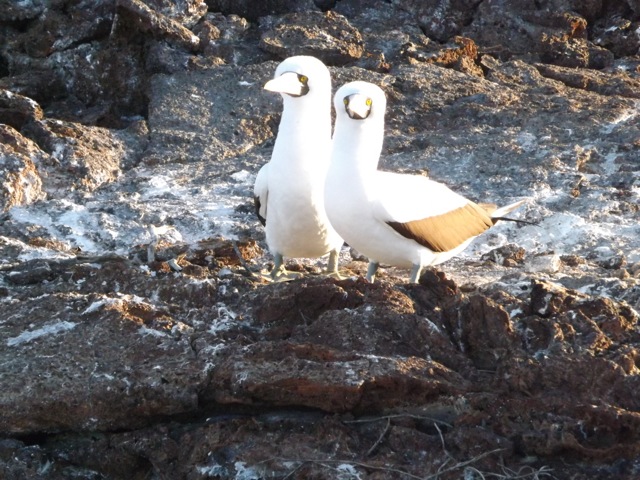
Lastly, after heading back to the boat for a shower, we climbed to the top of the rocky wall and walked through the hardy trees to see more wildlife. We spied the Blue Footed Boobie, a Petrel, a rare sighting of a Galapagos Owl – which actually hunts during the day – and a lovely pair of boobies, Nazca Boobies that is…

wpid-dscf2298-2013-09-27-20-42.jpg

After the hike, we were taken back to the boat for dinner and an early night following a very busy day. During the night we headed back across the equator and it was again very rocky aboard.

wpid-dscf2304-2013-09-27-20-42.jpg

Day 3
Overnight the rocking of the boat caused me to feel very sick, but only in my cabin, so I forwent my usual evening movie and just went to sleep. And this was after having taken seasickness pills. I awoke in the morning to calm seas and felt much better.

After a hearty breakfast, we set about getting ready for our first activity, a short hike across South Plaza Island to see some wildlife.

We started on the beach where many fur seals were sleeping.

wpid-dscf2308-2013-09-27-20-42.jpg

We then walked along the rocky trail stopping for photo opportunities and discussions about the flora and fauna. Among the various species of birds we spied a land Iguana. This one is a metre long.

wpid-dscf2309-2013-09-27-20-42.jpg

Then it was back to the boat and off across the strait to Isla Santa Fé where we had lunch and prepared for another walk. We landed on the beach amidst plentiful napping sea lions…

wpid-dscf2324-2013-09-27-20-42.jpg

We walked along a rocky path seeing two species of lizard, the metre long yellow land Iguana…

wpid-dscf2334-2013-09-27-20-42.jpg

…and the 10cm long gecko.

wpid-dscf2332-2013-09-27-20-42.jpg

Then, it was back to the boat to change into our wetsuits in preparation for our final snorkelling session of the cruise. Swimming in the bay at Isla Santa Fé makes me want to buy an underwater camera. Firstly, there were playful sea lions and I finally found my first coral in the waters. It wasn’t very colourful, but some coral is better than no coral. Then, as we snorkelled across the small bay, we were joined by sea turtles and stingrays sucking at the sand on the bottom. All in all, an excellent snorkelling session for our final day.

wpid-dscf2336-2013-09-27-20-42.jpg

Back on the boat, we set sail for Puerto Ayora harbour where we dropped anchor for the evening.

Day 4
The final day on the cruise was a little disappointing. When booking the cruise, we enquired if they would be going to either the Giant Tortoise colony or to Charles Darwin Research Station, where they look after the young animals. We were told the cruise would finish at the Research station, so prior to the cruise, my Uraguayan friend and I headed up to see the Giant Tortoises. As it turned out, the group was taken to see the Giant Tortoises. But instead of seeing them again, we called an end to our trip and headed back to the hostel.

Summary
Overall, the cruise around the Galapagos Islands was great. While the islands don’t feel as tropical as other Pacific Islands, the diverse species of animals, especially the ones that are native to these islands were amazing. A most enjoyable cruise.

After a couple more days in the Galapagos Islands, I fly back to Quito.

The Trail Wanderer

Galapagos Islands, Equador – Adventures

The Galapagos Islands is an archipelago of volcanic islands about 1,000 kilometres off the coast of Ecuador. While they’re technically Pacific Islands, they don’t have the same tropical islands feel like that of Tonga or Fiji. There are no palm trees here, for example.

Most people travelling to the Galapagos come for a cruise to see the diverse animal species. Most cruises are organised from the mainland before arriving and can be expensive. So, I decided to book a flight to the islands and to look for a ‘last minute’ deal when I got there, like I had for Antarctica 7 months ago. If you have time to spare, this is the cheaper way to go.

After an hour in a taxi from the hostel to the airport, a 30 minute stop off in the port city of Guayaquil and a 90 minute flight, I finally arrived on the islands. The airport is situated on a desert island, not the sandy romantic type, but a more rough dry vegetation type. What they don’t advertise is the US$100 entry fee into the National Marine Park – which covers all of the islands. Luckily, I had just enough on me, otherwise they would have taken my passport and I would have had to pay and collect it somewhere in town.

wpid-dscf2162-2013-09-22-22-081.jpg

I caught a bus to the ferry pier, caught a ferry to Santa Cruz Island, and another bus to Puerto Ayora. After my early flight I napped for the hour and a half it took to cross the island. I woke as I arrived in the port town…

wpid-dscf2170-2013-09-22-22-08.jpg

At the hostel I met a Uraguayan guy, Ernesto, who I ended up hanging out with for the rest of my time on the islands. We were greeted by the owner Kevin, from the US. Kevin took us on a free tour of the town introducing many of the aspects that were useful to know. At the end of the tour, Ernesto and I booked a 4-day cruise at a fairly good price. It was a couple of days away, so we explored some parts of the island.

Giant Tortoises
At the top of the island is a sanctuary for the massive giant tortoises that can only be found on these islands. They wallow in mud, chew grass and take very leisurely strolls down the side of the main cross island road. While fencing is used to separate properties on the islands, the tortoises are allowed to go anywhere they want, albeit slowly.

A taxi to anywhere in town is US$1 by law, but to get to the Giant Tortoise sanctuary it costs US$30 and the driver who takes you up there becomes your impromptu tour guide – thankfully Ernesto could translate. At the end of the tour, the driver takes you to several other places before dropping you back at your hostel.

wpid-dscf2201-2013-09-22-22-08.jpg

The reserve on Santa Cruz Island isn’t large but we met many of the tortoises who were just sitting around munching grass or drinking muddy water. The very large ones are the males (some 1.5m long) while females are smaller. There were several young aged 3-5 years, which were about the size of normal turtles. You’re not allow to approach to within 2 metres of the animals, but even at 5 metres some of them pull in their heads and hiss. They could no doubt give a nasty bite, so we kept our distance.

wpid-dscf2185-2013-09-22-22-08.jpg

Lava Tube
After visiting the tortoises, the driver took us to a large lava tunnel and dropped us at the start before going to wait for us at the exit. Stairs descend into the tube, which was slightly taller and wider than a train tunnel. The tube is nearly 500m long and is lit by sporadic lights.

wpid-dscf2207-2013-09-22-22-08.jpg

Near the end the tunnel roof descends, giving only a crawl space for about 2 metres. After crawling through on our bellies we met the taxi and were taken back to town.

Swimming Hole
While it’s not steaming hot in the islands, it can be a little muggy first thing in the morning. The day before the cruise was cloudy but warm, so we decided to find the swimming hole we’d been told about. Just prior to leaving, an English couple arrived at the hostel and we invited them to join us.

From the pier at the centre of town a water taxi takes us across the small harbour for 60 cents, zig-zagging through the yachts.
wpid-dscf2229-2013-09-22-22-08.jpg

We then walked across volcanic rock for 20 minutes to a natural fissure in the rock about 40 metres deep. The bottom 10 metres is filled with water.

wpid-dscf2217-2013-09-22-22-08.jpg

A pair of bikini clad girls from Florida at the edge of the swimming hole told us the water was cold. Of course the best way to get into cold water is to dive. But, the water wasn’t as cold as expected and the four of us ended up swimming for an hour, occasionally climbing up the sides and jumping from the rocks.

Eating
Puerto Ayroa has plentiful restaurants and being in the Pacific, seafood is common. For the three nights we stayed we ate in three different places. Firstly, at the pier where the boats bring daily fresh catches. In the morning they sell their catches of fish and crayfish, then in the evening they have a cheap seafood fry up. Very tasty.

wpid-dscf2358-2013-09-22-22-08.jpg

On night two, we discovered a street where all the small restaurants block the road by setting up plastic tables down the middle. At one particular restaurant, I ate a local fish dish – Caviche – where they slowly cook raw fish in a lime throughout the day. Yum!

wpid-dscf2361-2013-09-22-22-08.jpg

Day three, with our new English friends, we ate at a normal restaurant. Boring, but still tasty.

Tortuga Bay Beach
Lastly, on returning from the cruise, we decided to head to Tortuga Bay beach, a 30 minute walk along a 2.5km path. The day we went was warm but very cloudy and when we arrived at the beach it was beautiful but rather cold.

wpid-dscf2349-2013-09-22-22-08.jpg

As we walked we spotted several black Marine Iguanas wandering down the beach. Middle right in the above picture. When necessary, he uses his long tail to swim through the surf. Then, at one end of the beach, we also found an Iguana pile…

wpid-dscf2356-2013-09-22-22-08.jpg

As evening approaches, the Iguanas head a special location and pile on top of each other to conserve heat during the night. The Marine Iguanas are the only species of in the world that do this, and at a half a metre long each, that’s a big pile.

Next, the 4-day cruise around the islands.

The Trail Wanderer

Mancora, Northern Peru – Impressions

Máncora is the second most popular tourist destination in Peru, with Cusco / Machu Picchu the first and Arequipa / Colca Canyon the third. While most of Peru’s tourist destinations have plentiful tours – hiking, boating, climbing, rafting and the like; Máncora is different. There are tours, but the main attraction is the sand and the amazing beaches.

My original plan was to skip Máncora on the way to Ecuador. But the bus from Lima to Quito is nearly 2 days long, so to break it up, I decided to wait for the bus to pass through by hanging out at the beach for a few days. Sounds horrible, I know, all that waiting.

Máncora has a local population of just over 9,000 people and has an average altitude of 11m above sea level. This is of interest because I’ve spent most of my time in Peru at 3,000m and above.

On arriving in the town, the first thing I noticed was the number of Tuk Tuks on the main street.

wpid-dscf2149-2013-09-22-22-08.jpg

As I stepped off the bus I was accosted by the usual taxi drivers but made sure I booked my ticket to Quito first. Then it was a mad dash on a slow Tuk Tuk to my hostel, which was right on the beach front.

wpid-dscf2147-2013-09-22-22-08.jpg

My cabaña was a two level dorm with 5 beds and a balcony which looked out of the Pacific Ocean, only 20 metres away. The golden sand is hot and the sun blaring, but what do you expect from the beach?

While I went into town a couple of times; once for dinner at one of Máncora’s many amazing restaurants, and once for a look around. But I didn’t find much there as it’s a beachside town and people don’t visit for its shopping. So, for most of the four days I was in town, I just lay around on the beach, wrote, or swapped movies. It seemed that everyone staying at the hostel had a hard drive. So, while we were sitting on the beach, our computers were copying our selections. Honestly, what else is there to do on the beach? Such a hard life!

wpid-dscf2148-2013-09-22-22-08.jpg

Then at the end of the 4 days, my bus arrived and I was off again to Quito.

The Trail Wanderer

Lima, Peru – Take 2

After four days walking the Santa Cruz trek in Cordillera Blanca, I returned to Huaraz and tried to book a bus ticket to Equador. I discovered that there’s only one bus to Quito and it leaves every Wednesday, which is great, as it was Wednesday. The problem is it leaves from Lima 8 hours away. With no possibility of catching it, I decided to head back to Peru’s capital for a couple of days.

Last time I was in Lima, I stayed in the suburb of Miraflores and found it very touristy. This time I decided to see the real Lima, so I booked a hostel in Centro – downtown. When I arrived, I marvelled at the streets, roundabouts, parks and tall buildings. It’s not a mass of skyscrapers concentrated in one central place like Buenos Aires or Rio de Janeiro, the buildings are more spread out.

I dropped my bags off at the hostel and went out to have a look. It was after dark in the city, but at 8pm on a thursday there are still large numbers of people walking around. I headed along the road and across a park with – surprise surprise – a fountain! They are very common in Peru. (Pictures were taken the next day).

wpid-dscf2129-2013-09-14-00-16.jpg

Something else that’s very common in Peru are the Public Displays of Affection. There are always couples everywhere cuddling and canoodling. They can’t seem to keep their hands off each other. You do get used to it.

I kept walking and found a shopping mall with a food court. The peruvians love their ‘Chifa’ – Chinese food so I decided to get some. After dinner, I went for a long walk though the streets. Lima Centro is full of amazing architecture and building design. I walked several blocks to San Martin Plaza. The plaza is a beautiful square with fountain in the centre and is entirely surrounded by well maintained, architecturally beautiful buildings.

wpid-dscf2137-2013-09-14-00-16.jpg

Along one side of the plaza is an open air shopping mall. None of dirty markets of the other cities, this is a street with plentiful clothing and food stores. At the end of the street is another plaza, with another fountain more beautiful than the others, and is also entirely surrounding by well maintained, architecturally beautiful buildings.

wpid-dscf2141-2013-09-14-00-16.jpg

Lima Centro is definitely a place for lovers of awesome buildings, and is something about cities I do enjoy.

wpid-dscf2134-2013-09-14-00-16.jpg

But a couple of days in Lima was enough me and I began planning my way north, first to the beachside town of Mancora, and then on to Equidor.

The World Wanderer

Santa Cruz trek, Cordillera Blanca, Peru

While there are many hikes in the Cordillera Blanca, the Santa Cruz hike is the most popular, and is usually done with a guide. Hiking with a guide doesn’t feel like true hiking, especially when they carry half of the equipment, set up tents and prepare your food. So, I decided to do it without one. As it happens, four Americans at my hostel were also planning to go guideless. And while I prefer to hike alone, I wouldn’t be totally alone in the mountains… We booked a bus to the start and prepared to leave early the following morning.

Day 1

Not having a good night’s sleep the night before a hike is a bad thing. I discovered this on the Colca Canyon hike and well, it seemed to happen again!

The bus trip to the beginning of the hike is five hours on a local bus. Unlike the five of us lads, peruvians have short legs, so there was not a lot of room in the bus. The cramped first two hours of the trip was on a sealed road and then the last three hours was to be on a very rocky dirt road. Five minutes onto that dirt road, however, the bus gave up and with black smoke pouring out the side, the transmission fell out. The pool of red transmission fluid under the bus is not obvious in this photo, but it’s there…

wpid-dscf2031-2013-09-13-13-322.jpg

After an hour the bus was fixed, but only enough for it to return to base leaving us to wait for another one. Three hours later it arrived and we were on our way again. Three hours of jaw rocking dirt road meant no napping for me!

We were delivered to the small village of Yanama and discovered a group of three girls and a french couple who were also doing the hike without a guide. While the french couple were quite typical of many french people I’ve met in South America so far – they treated us like we didn’t exist and totally avoided us – the three girls decided to join the group. With eight of us, and two particularly chatty girls, my hike was going to be noisier than I wanted. So, I let the other seven head off and dropped to the back to walk alone.

The first part of the hike leads out of Yanama and down the hill via a steep dry track, crossing one dirt road on the way and eventually the river via a concrete bridge. I headed left as the trail widened leading through a couple of villages where every small child ran up and demanded bon-bons. Never give the kids bon-bons!

wpid-dscf2033-2013-09-13-13-322.jpg

Finally, I came to my first climb of the day. It wasn’t a large one but my lack of sleep caused me to struggle up it. I met the others at the top and stopped for a rest as they headed off again. I was hoping there wasn’t going to be many more climbs as the direct sunshine on top of my tiredness was draining. But there were a few. Eventually, I rounded a bend in the valley and saw a group of tents a couple of kilometres away and figured this was my companions. I set out towards them, making slow progress across some small hills.

wpid-dscf2034-2013-09-13-13-321.jpg

I was getting close to the tents when I came across a pair of cows on the trail, staring me down. Did you know that more hikers are killed every year by cows than anything else? It’s true! Google it. Not wishing to be trampled to death for getting too close, I went around, through a boggy area of ground. Exhausting!

wpid-dscf2037-2013-09-13-13-321.jpg

I finally made it to the tents to discover it wasn’t my group but a guide and his party. He pointed me further along the trail, so I struggled on. After another kilometre I still hadn’t located my amigos and with the trail leading up some hills, I picked a spot for a camp near the river and set up my tent. After cooking dinner and getting ready for the next day, I slumped into my sleeping bag and slept.

Day 2

From my planning, I was aware that Day 2 was the most difficult day of the hike. From my camp at 3,800 metres (above sea level) I would walk 13 kilometres and climb nearly a kilometre to a pass called Punta Union at a height of 4,750 metres. Followed by a further 3 kilometres down the other side.

While The Choro trek in Bolivia began 50 metres higher, I only had to climb 100m total before descending on that hike. If that 100m was hard because of the altitude, this one was going to be a very difficult day indeed fighting the altitude the entire way.

wpid-dscf2041-2013-09-13-13-321.jpg

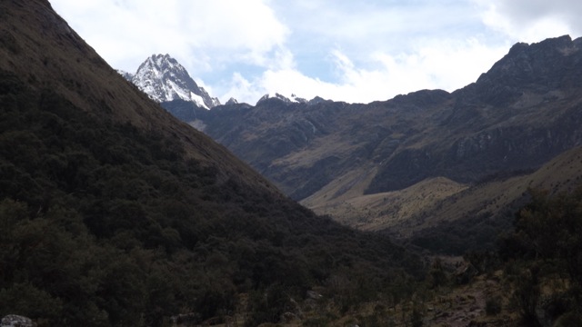
I packed up and left my camping spot. After a fairly good sleep, I had more energy, so I set off along the trail with more vigour. But while climbing hills was still hard, it was easier than day 1.
wpid-dscf2047-2013-09-13-13-321.jpg

After a kilometre, I found the empty campsite where the other seven had camped. I headed along the valley slowly climbing as I went. As the day progressed I climbed higher along the valley. I consider any height above 3,700m to have a thin atmosphere – with less air pressure. Being a large framed, large lunged person, the higher I went the more trouble I had getting enough air and spent a lot of the time out of breath. There was a point where I had to take a break to catch my breath after every 10 steps; but only when climbing.

I climbed slowly over small knolls and past several tarns – small mountain lagoons, with towering snow covered mountains and glaciers across from me. I came over a knoll to see the ridge line I still had to climb, with the small gap at the top that was the pass.

wpid-dscf2054-2013-09-13-13-321.jpg

I continued on and the higher I went, the harder it became. Every five steps I had to take a rest to get my breath back. I even took my pack off every 100m or so for a longer break. As I climbed, my rate got slower and with only about 50 metres to the gap I slowed to only 3 steps before resting. Then for the final few metres it was only one step before resting. So…slow… But I did have a good view back along the valley.

wpid-dscf2058-2013-09-13-13-32.jpg

When I finally went through the gap, I passed an altitude marker and slumped down on the other side in the sun, taking my pack off and uttering, ‘Thank f**k for that!”

wpid-dscf2062-2013-09-13-13-32.jpg

Down was a lot easier and I powered through the switchbacks below a massive white glacier…

wpid-dscf2063-2013-09-13-13-32.jpg

…and above an azure mountain lake.

wpid-dscf2067-2013-09-13-13-32.jpg

I could see tents in the distance and marched on feeling more energised that I was no longer climbing. I stopped only once before I arrived at the tents 2-3 kilometres from the gap only to find it was another tour group. So, I walked on across the flat river plains following the river.

wpid-dscf2065-2013-09-13-13-32.jpg

Eventually, passing another guided group, I found the tents of my group and set up camp.

Day 3

The main part of Day 3 takes only 3 hours, so to extend it most people climb to Laguna Arhueycocha.

We started the day climbing slightly to a higher valley. Slightly is still difficult at 4,000m.

wpid-dscf2070-2013-09-13-13-32.jpg

On reaching the valley we left our packs with covers on as it had rained overnight. Even walking along the high valley without packs wasn’t easy and after a couple of kilometres I arrived exhausted at the base of the wall that climbs up to the laguna. The rest of the group decided to climb it, but I opted to stay at the bottom. I’ve seen plenty of glacier lakes in this trip, so decided to save my energy.

wpid-dscf2074-2013-09-13-13-32.jpg

There were some buildings nearby, so I decided to investigate those instead. They were only 50m away, up a climb of about 5 metres, but even that was exhausting. The buildings were empty, but looked to have been a camping area with a place for donkeys. While I was there it began to snow a little.

When the group returned, we headed back down the valley – an easier walk – donned out packs and climbed back down to the main valley. For the rest of the walk, we followed the valley and river along, firstly through a dry river bed thick with sand.

wpid-dscf2099-2013-09-13-13-32.jpg

Sand is difficult to walk on carrying a pack. We climbed about 10 metres up the other bank and followed the trail that undulated as it went. We passed along the side of a large laguna and took a break for lunch at the other end as we looked along the valley.

wpid-dscf2103-2013-09-13-13-32.jpg

We were to pass another laguna, but it turned out to be little more than a marsh. Perhaps it’s larger in the rainy season. Cows, ponies, horses and donkeys were everywhere as we walked along the sometimes sandy, sometimes rocky trail. Eventually I saw the campsite ahead and marched off, arriving to a set of rocky walls at a place called Llamacorral. I pitched my tent as the others arrived and we began preparing dinner when we got a visit from a pony who decided he didn’t want grass for dinner.

wpid-dscf2105-2013-09-13-13-32.jpg

Later, we made a fire in a deep rocky fire pit and sat around talking for the evening.

Day 4

The sky was clear the next day, so after breakfast I packed up my things and headed off, walking ahead of the group for a change. Most of the day saw me walking the rocky track along the side of the valley as the river snaked its way through the landscape. There wasn’t much to see as I walked and after 90 minutes I took a short break off the trail. When I was putting my pack back on, I saw the group go past.

wpid-dscf2108-2013-09-13-13-32.jpg

I marched after them, I saw a waterfall opposite which marked the halfway point of the day. For the rest of the walk, the trail descended following the river down through the gorge. With the sun high in the sky and the sandy trail, it was very hot. A distinct contrast from the day before with its slight snow.

wpid-dscf2112-2013-09-13-13-32.jpg

An hour later, I rounded a bend to find my group stripping down to their underwear at a nice spot in the river. The gingerly got into the freezing water. I was steaming hot, so I stripped down and threw myself into the river. No wading here, boys and girls, the only way into a freezing river is as quickly as possible. I was out just as quickly though and drying on the side.

Then, we were off again and 20 minutes later arrived at the end of the trail after passing a group of larger people heading back the other way. I wondered how they were going to manage the climbing. They were part of a guided group, so weren’t carrying much gear, but they didn’t look as fit as my group, and we struggled at times.

Five minutes after we’d signed out of the trail, we were walking past a house and the owner rushed out offering us cold soft drinks and beer. He told us he’d call a Collectivo – mini van – for us. It would take us to a larger town where another Collectivo would take us back to Huaraz.

As we were driven away in the van, we could see the gap from which we’d exited the hike and the surrounding landscapes.

wpid-dscf2126-2013-09-13-13-32.jpg

Conclusion

Because the trek was at such altitude, it goes down in my books as being the most difficult hike I’ve ever done. With day 2 being the most difficult day’s hike, even more difficult than day three of the Colca Canyon hike. Did my week in Lima at a low altitude cause me to lose the acclimatisation I’d previously gained in Bolivia and Northern Peru? Probably. I should have given it a couple of extra days in Huaraz before I did the hike. But these are the things you learn.

Next, I’m off north to the beach city of Mancora in far northern Peru before crossing the border into Ecuador. I’ll see what adventures await me there.

The Trail Wanderer.

Lima, Peru – Impressions

Lima is the capital of Peru and with 9 million people, is by far the largest city in the country. It’s a popular starting point for people with only a limited time to travel and who only really seeing Peru, Bolivia and the top of Argentina. Beyond this, I’ve been told not to stay too long as there isn’t much to do in the city. So, with low expectations I decided not to spend too much time wandering the city and more time writing.

The outskirts of Lima reminded me of Arequipa or La Paz, with half built brick buildings and dirt roads. This is the way they build houses here, instead of taking out mortgages and building a house. They build part of a house with the money they have and live in it until they have enough money to build more.

When I arrived at the bus terminal, I caught a taxi to Miraflores, a trendy suburb not far from the beach. Miraflores reminded me of the centre of a many cities in the West, with all the fast food restaurants, the clothes stores, restaurants and malls. I guess in this way it feels very touristy and not like a South American city at all.

wpid-dscf2019-2013-09-5-22-12.jpg

And for the time I was here, the weather was fairly overcast and not very exciting. It is winter, I guess. So, it didn’t tempt me to leave the hostel except to get food, a replacement camera and to sit in Starbucks and write. With the beach not even ten blocks away, I didn’t bother taking the time to go and have a look. But there was a cathedral in the central square…

wpid-dscf2021-2013-09-5-22-12.jpg

Overall, I would say that Lima seems like a nice city, but if you’re looking for something not so touristy, then Miraflores is not for you. I’ve heard there places in Centro worth seeing, with museums and likely more fountains, since Peru does them so well.

wpid-dscf2022-2013-09-5-22-12.jpg

Next, I’m off to Huaraz, back into the mountains, to prepare for a hike in Cordillera Blanca.

The Lone Trail Wanderer