Tag Archives: Pacific Island

Savai’i Island, Samoa – Impressions

In March 2023 I headed out to Samoa for a weeklong family gathering in Upolu, the country’s main island. Then once much of the family returned home, myself and my parents visited Samoa’s other main island, Savai’i. For me it was to explore a place I’d not been before, and for my parents it was to trace back some of our family heritage by finding a family cemetery.

Savai’i is the largest island in the Samoan Islands chain, both in size and height, and is the sixth largest Polynesian island after the 3 New Zealand Islands and two of the Hawaiian islands. Savai’i is more traditional than Upolu with a more relaxed feel. There is also no airport on the island, so arrival must be via boat, usually the car ferry.

Ferry to Savai’i

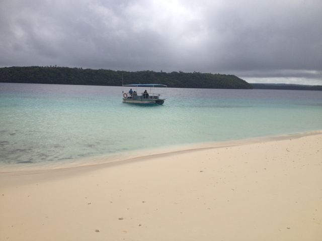
There are two ferrys to Savai’i, a small one and a larger one. On our trip over from Upolu Island, was in the small ferry. It’s the first car ferry I’ve ever had to reverse onto it, but I was guided on by helpful workers. This ferry had no sitting area, so we stayed in the car without aircon. We did find a spot at the edge of the deck where we could feel the wind. On the way back, we were on the larger ferry and locked up the car and went to sit in the airconditioned passenger seating area.

img_1147-2023-03-25-18-43.png

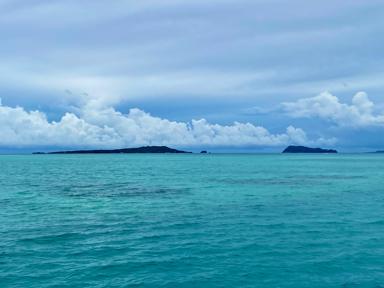
On the slow chug of the ferry, we passed the small islands of Manono and Apolima. The trip over on the small ferry took 90 minutes, while the larger one took about an hour.
img_1140-2023-03-25-18-43.png

Beach Fale

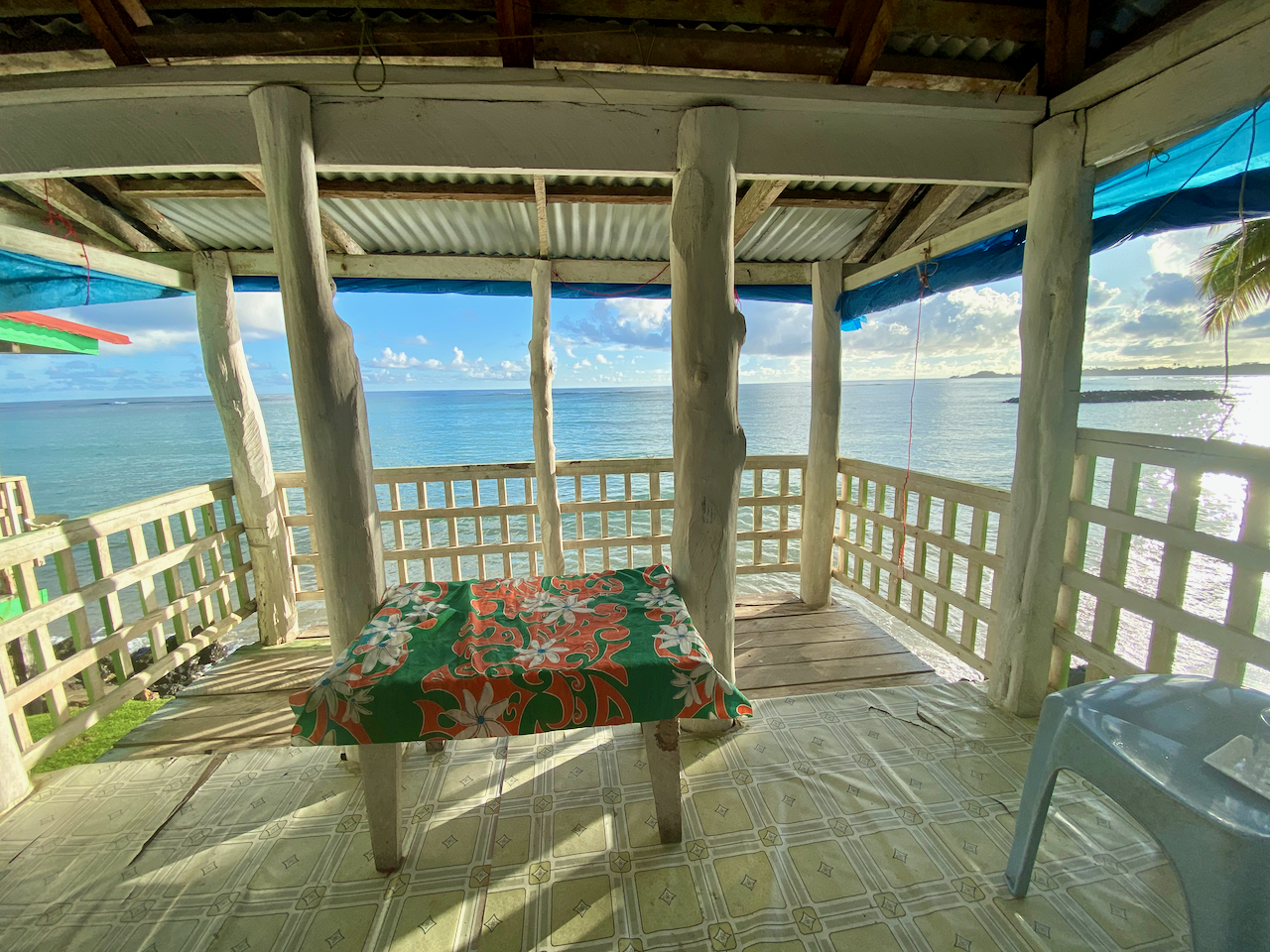
Fale in Samoan means ‘building’, and they are very common on the islands. The original fales were simple structures made from posts and a thatched roof. These days they’ve been modernised with concrete floors and corrugated iron roofs. Beach Fales are common ways for families to make extra money by renting them out to visitors. Mine had woven shields on the back half and tarpaulin sheets on the ocean facing half. While these provide some privacy, they can block the elements, especially during heavy winds or storms. The woven panels when partially drawn are good for allowing air flow on the usually steamy island nights.

img_1148-2023-03-25-18-43.png

Inside mine were two beds, one with a mattress to sleep on, the other to put my bags on, plus a small table, a chair and most importantly, a mosquito net. For convenience, mine also had a light and a power plug. While not for some – my parents stayed in a resort up the road – I like trying new things, and on most days the views out the front at high tide were amazing. From time to time, I’d even see a turtle popping it’s head out of the water.
img_1150-2023-03-25-18-43.png

Breakfast and dinner are both included in accommodation, all traditional fare, and on the last night, there were lobster tails, local BBQ, a cooked salad with fried taro and potato.

Saleaula Lava Fields

On the 3rd of August, 1905, molten lava began blowing from the ground from Mt Matavanu. It spilled over the crater’s rim filling a deep river valley leading to the flat Saleaula coastal plain, overwhelming part of Saleaula Village. A year later and much of the coastal plain had been covered, the lagoon had been filled, a vertical basalt cliff had built up over the coral reef, and five villages with their adjacent farming land had been buried. The eruption continued for a total of 6 years.

img_1155-2023-03-25-18-43.png

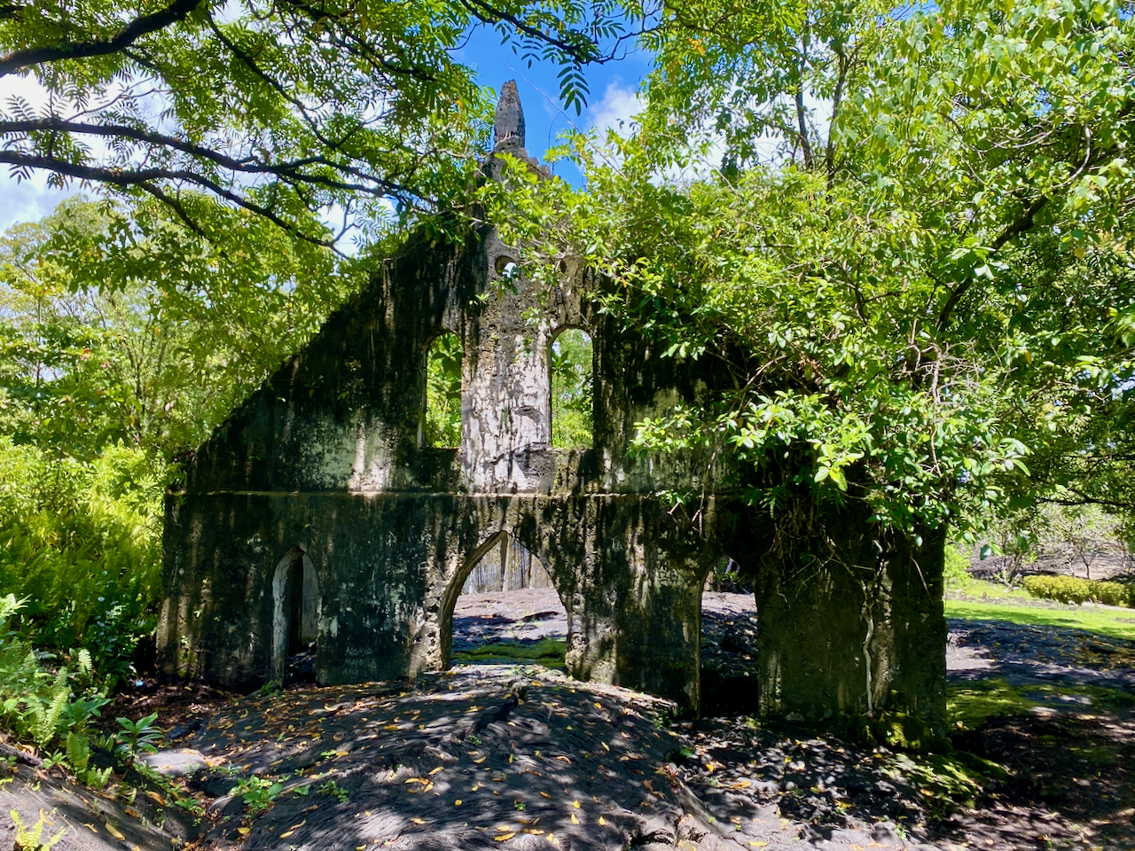
One of the buildings that was hit by the lava was the London Missionary Church, the remains still standing.
img_1154-2023-03-25-18-43.png

Some things didn’t succumb to the lava, like the Virgin’s Grave. Some say it belonged to a virgin daughter of a high chieftain, while others say it belonged to a virgin nun. In either case, the reasoning why the lava went around the grave instead of over was because the girl was so pure.

img_1156-2023-03-25-18-43.png

Safotu Congregational Christian Church of Samoa

This church, in the north western corner of Savai’i, is known for being the last church built from crushed coral. Coral was used to build many things in Samoa, from roads to buildings. Crushed to a fine sand, it was mixed with limestone to make a concrete. It’s been painted within the last few years to look almost new.

img_1159-2023-03-25-18-43.png

Flying Foxes

There is a species of flying fox in Samoa known as the Pe’a, which can also be found on Fiji and American Samoa. They are a hunted species, often eaten on special occasions by the locals.

img_1163-2023-03-25-18-43.png

Pe’a Pe’a Cave

The cave is a lava tube from around the time of the First World War, when lava rushed through the area burning through whatever was here then hardening into a long tunnel. Steps lead down into the cave which then widens, running for 50m or so before the roof drops to low to walk under. I stopped there, but apparently the cave goes for a kilometre to the ocean, but can be too narrow to get through in places. The name of the cave is from the Pe’a Pe’a bird which nests in and around the cave. We saw one flying circles around the end of the cave.

img_1171-2023-03-25-18-43.png

Alofa’aga Blowholes

These are also known as the Taga Blowholes you must pass Taga villageto get to the blowholes and pay WST5 to use the land. Here, lava flows have created a series of tubes connecting a flat clifftop of lava rock with the ocean below. Waves breaking against the lower end of the lava tubes push water at high pressure up through the tubes, sending spray followed by fountains into the air every few seconds. There are many of these along this area near the ancient village of Fagaloa.

img_1179-2023-03-25-18-43.png

Afu Aau Waterfall

The waterfall was WST10 to go into as it is on Palauli land. There are three parts to the falls, the two minor falls along the track, and the main one at the end. There is a legend that a giant named Mafane lived near the Palauli village. Over time he turned into a mountain that erupted forming a crater for water. Twenty-five streams run from the crater – the 25 warriors of Mafane’s battalion – feeding 7 rivers, one of which runs down the Afu Aau waterfalls. The pool was large and two of us from the tour swam in it, climbing up the rocks behind the waterfall and jumping in the pool. Note, there are rocks in the pool, so it’s suggested to be careful when jumping. The pool was cool and crisp, great in the heat of the day, although the steps to get out were slippery. Some girls in the next fale from me went a few days after we did, and the waterfall wasn’t flowing. The could still swim in the pool though.

img_1201-2023-03-25-18-43.png

John Williams Memorial

Samoa is a christian society with over 100 churches on the islands and strict holy day views with church services important. John Williams was a British missionary who visited many of the island chains throughout the Pacific bringing the word of christianity. The first was one of the islands of French Polynesia, before he moved on to the Cook Islands and many others. He arrived in Samoa in 1830 to meet with the then high chief who accepted christianity immediately. Then, with the aid of local translators he created the first bibles for the Pacific Islands. Unfortunately, on arriving in the New Hebrides, now known as Vanuatu, he was killed and eaten by cannibals. This monument was built in his honour and stands on the eastern shore of Savai’i.

img_1202-2023-03-25-18-43.png

Matautu Bay Snorkelling

I’d brought my own snorkelling gear so I wanted to get in amongst the coral at some point on my Samoan explorations. I found the only Dive company on the island – Dive Savai’i Samoa – and booked a trip. Because of the small numbers, there were three separate groups on the boat, snorkelers, divers training for their accreditation and an accredited diver. Each of the three groups had a guide/instructor. They took us out to three separate locations around Matautu Bay. The one thing I was missing was an underwater camera, as mine had died in Rarotonga and new ones were quite expensive.

img_1206-2023-03-25-18-43.png

At our first stop, we swum behind the guide along the length of a coral reef with many fish, and to my surprise many turtles, some sleeping around the coral, others just out for an afternoon swim. The second spot was near an old ship wreak, the John Williams 5 apparently, but I was unable to find any information online about it. And while we were there, a turtle came to visit, eating little squares of Papaya skin we threw to it. Last stop was the coral garden, but we had to be careful, as some areas were quite shallow. Overall, a great day out on and in the water.

img_1211-2023-03-25-18-43.png

Cemetery of Distant Relatives

One of the main reasons to come to Savai’i was to track down our family’s burial ground so dad could continue his work crafting the family history. We were shown the family houses in the Manase village close to where we were staying, and found that the cemetery was up on the hill. Unfortunately, with dad’s health he’s unable to climb a hill in the heat, but I was able to talk to the woman who owns my fale and tell her our story. In true Samoan style, she was off next door to organise a 4 x 4 vehicle to take us up there. An hour later we were being driven up a crazy 4 x 4 track, bobbing madly back and forth as it went. Before long we came out at the cemetery where they were preparing a grave for a funeral at the end of our stay. There were only headstones there, but they dated back more than 100 years to Dad’s adopted father’s parents and kin. Later, I was come to learn that the owner of my fale is also a distant relative.

img_1219-2023-03-25-18-43.png

Impressions

Savai’i Island is less built up than Upolu Island and there is less there to do and see. But we still managed to fill out time and enjoyed the more relaxing week of our stay.

Then after the week, we were back to Apia on Upolu Island for a few more days.

The World Wanderer

Upolu Island, Samoa, Impressions

In March 2023, myself and 14 members of my extended family flew out to the Island of Upolu in Samoa for a family gathering and to bring the ashes of my grandfather home. We all set up our base in Apia, the capital of Samoa and the largest city on Upolu.

Upolu is the main island of the Samoa, previously known as Western Samoa to differentiate it from American Samoa which separated in 1899. While not the largest island of the chain, Upolu has the highest population.

Apia

Apia is a mad mash of worlds. On one hand, there are wondrous resorts, restaurants and churches. On the other there are hovel markets, lines of shops, reminisant of south east Asia selling all manner of trinkets and knicknacks, sidewalk stalls, and so many taxis. Near the heart of the Apia is the clocktower.

img_1027-2023-03-16-13-09.png

Around the bay from the resorts is the marina, with many ships and small boats docked. There’s also a more upmarket bar and restaurant area called The Edge and has views over the marina, the bay and Apia.

img_1042-2023-03-16-13-09.png

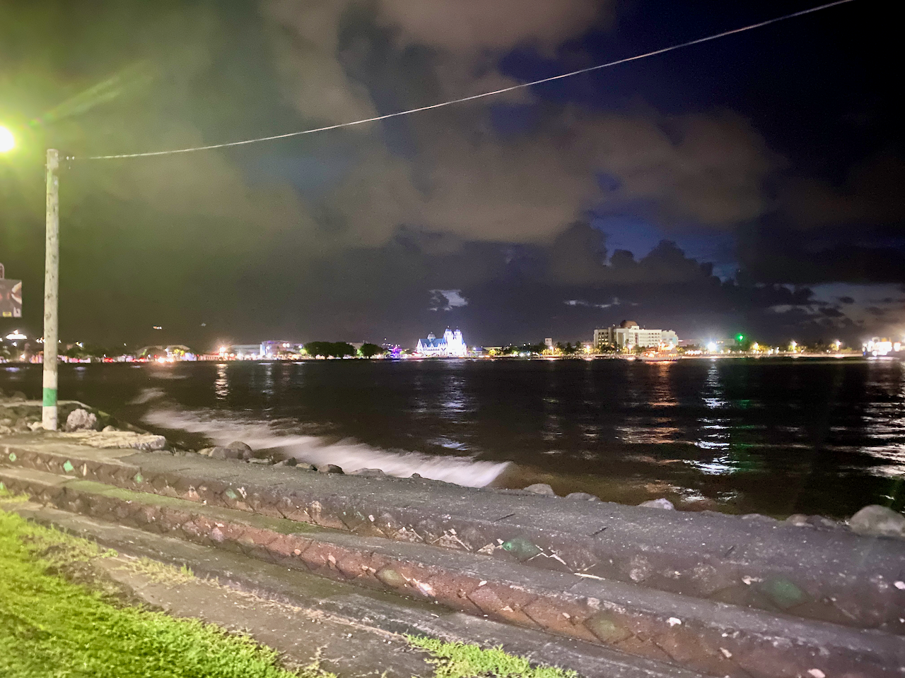
After a couple of choice cocktails during happy hour, we walked five minutes down the road to one of the best restuarants on the island, Paddles, stopping to admire the lights of Apia across the bay.

img_1048-2023-03-16-13-09.png

Garden Fale

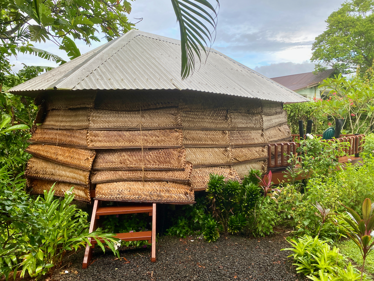
While the other 14 members of my extended family stayed at a large and somewhat expensive resort, I went for the more local style at another resort a couple of kilometres away. And instead of an air conditioned room with TV, bar fridge, toilet and shower etc, I chose a garden fale. The fale is literally just a room with a roof and woven shades on each side pulled down for privacy and protection from the elements. It’s hot inside, but by partially pulling up some of the shades, a draft can pass through. Inside there is just a pair of mattresses on the floor, mosquito netting on each, a lockable safety box, a light and a pair of power outlets. This was my first experience with a fale of the kind, but not my last. It was a fun and sweaty experience, that I enjoyed, although in this case I only stayed two nights instead of the nine I’d booked due to bed bugs.

img_1021-2023-03-16-13-09.png

Fiafia Night

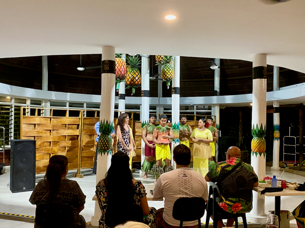
The resort where my extended family were staying hosts a Fiafia every Wednesday, so we decided to take part in this cultural event. There is much dancing and singing by our hosts, and a large buffet dinner with suckling pork on the menu. Someone even leaked to the crew that there was a birthday and they dragged my sister up to present her with a cake.

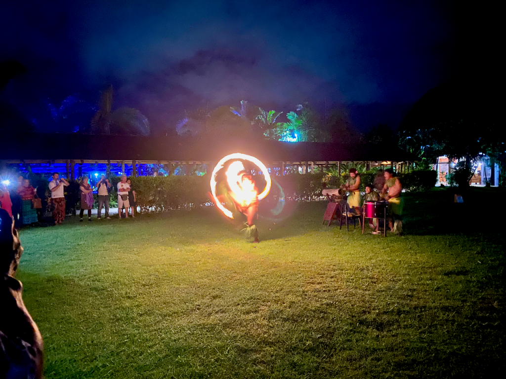
Then once the singing and dancing inside was done, we were herded outside for the fire show. An enjoyable experience.

Sua Ocean Trench

Fifteen people is a lot to transport around the island, especially if the only people mover we could rent was a 12 seater. We decided to split the group and five of us headed on a road trip across and around the island to the To-Sua, which in samoan means ‘giant swimming hole’. It has salt water flowing in from one side, and at high tide, you can climb down the crazy lader and swim in it. A great day out for the WST20 entry fee.

img_1064-2023-03-16-13-09.png

Waterfalls

On the way to and from the Sua Ocean Trench, we passed five waterfalls:

Papapapai Falls
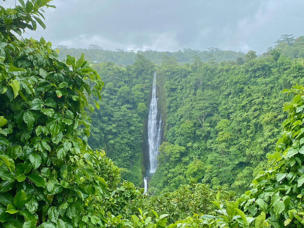
In the centre of Upolu are the tallest falls in Samoa dropping 100m into a volcanic crater. There is a carpark on the side of the road and a short 10m trail through the the grass to the best views . There was no charge for this waterfall.

img_1053-2023-03-16-13-09.png

Togitogiga Waterfall
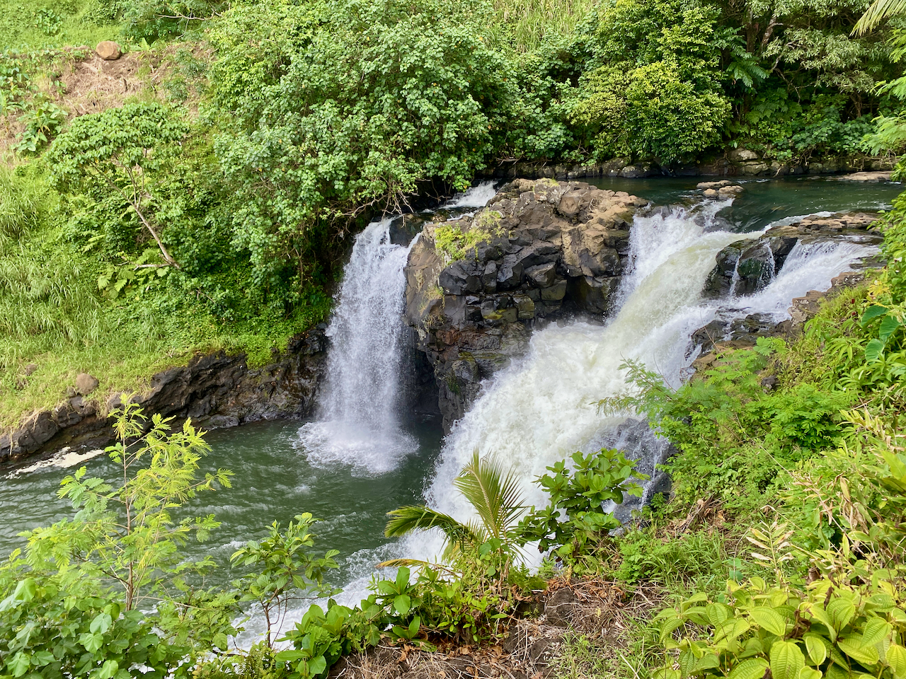
On the south side of Upolu is O le Pupu-Pue National Park, we followed a short road to a carpark. Then a short fairly flat 200m walk along a rocky track leads to a park with fales, a bbq, toilets and two pools, one above and one below the falls. The falls aren’t large, but gush down into the lower pool. It’s known to have been a place where great warriors of Samoa’s past swam. Four days later, we drove out to have another look with a different group, only to find that the falls were dry. How quickly things change. These falls are also free to visit.

img_1061-2023-03-16-13-09.png

Sopoaga Falls
Near the Sua Ocean Trench, a well manicured garden surrounds a viewing platform looking across a river basin to the falls. Cost to enter this area is WST10, so only I checked it out, my family members deciding to sit this one out. While not as impressive as Papapapai Falls, the garden area is a place you could spend an hour chilling over a picnic lunch or similar. The river valley flowing away from the waterfall is also rather impressive, with great green walls disappearing into the distance.

img_1070-2023-03-16-13-09.png

Fuipisia Falls
These 55m tall jungle falls are apparently spectacular, but at WST20 it was too rich for us to look at for a few minute viewing. This was however, the only waterfalls our other contingent stopped at, talking the land owner into dropping the price to WST10. Photo courtesy of them.

Falefa Falls
Near the north side of the island again, the final waterfall we visited was right by the road, and we stopped quickly to check it out. It’s only a short falls, with a river continuing to run out to sea, but apparently you can swim in it. We didn’t stop at the official garden entrance, but at the side looking down at it. But as we looked, a man came out of a fale 20m behind us and charged us WST5 to view it.

img_1084-2023-03-16-13-09.png

Parase’ea Sliding Rocks

Not far out of Apia are the Parase’ea Sliding Rocks. It’s one of those redundant double names like East Timor, which in East Timorese is literally East East. Parase’ea means ‘sliding rocks’ in Samoan. There are a trio of small waterfalls, all with somewhat smooth rocks that can be slid down into a pool at the bottom. Entry fee is WST5 each.

The top falls were the shortest and easiest to slide down (photo not included). The second and main slide is more dramatic and when you come down the 100 or so steps to the sliding rocks it’s the first you come to. The far side is the correct side, due to there being a deep enough pool. It’s nerve-racking sitting at the top and pushing yourself over, but it ends quickly enough with a splash at the bottom.

img_1102-2023-03-16-13-09.png

The bottom one has two parts. I called the first part the devil’s throat as it reminded me of the Iguazu Falls in South America. Sliding down into the pool surrounded by water from three sides.

img_1104-2023-03-16-13-09.png

Then pushing up onto a lip and sliding down the next on the left side, gaining air at the end before dropping into a pool.

img_1105-2023-03-16-13-09.png

Then, once we were done, we climbed back to the carpark where there are great views down over Apia.

Robert Louis Stevenson Museum

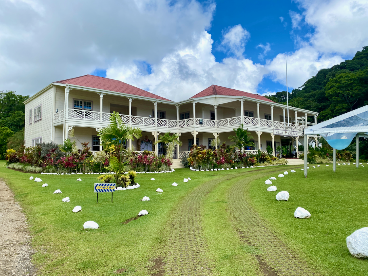
Robert Louis Stevenson was a British writer born in 1850 who wrote such classics as Treasure Island and Strange Case of Dr Jekyll and Mr Hyde. Suffering from health problems for most of his life, he decided to move to the Samoa in 1889 where the climate greatly helped his condition. In 1890 he purchased land and had a large 2-story house built, the first in the country. He would die here four years later, but not before becoming a beloved advocate of the Samoan people.

img_1224-2023-03-16-13-09.png

During the last days of my stay, I caught a taxi to his house, which has since been converted into a museum. I took the tour and heard tales of him, his wife, her 2 children from her previous marriage, and his mother.

img_1274-2023-03-16-13-09.png

On his sudden death in 1893, Samoans stood a vigil over his body for the night, before clearing a way to the top of the hill nearby where they carried his body, and laid it to rest. After the tour, I set off up a trail to the top of that hill. There are two paths, the short steep one, and the long, not so steep one. I climbed the short one, and dripping heavily with sweat in the 32º heat, stopped several times to catch my breath and check out the view.

img_1279-2023-03-16-13-09.png

I finally reached the top where I found his resting place and a cool breeze.

img_1281-2023-03-16-13-09.png

There were excellent views back down to his house and the surrounding area. When I was done, I decided to take the longer route back down again, which was certainly a lot longer and less step, along with being fairly muddy.

img_1282-2023-03-16-13-09.png

Impressions

Upolu wasn’t what I was expecting, especially after my month in Rarotonga a year ago. The number of cars racing everywhere, dozens of taxis taking people back and forth for next to nothing, the mass of people in Apia, then the quieter areas all over the rest of the island. The sheer number of Fales and villages was all an experience, especially in the 32 degree heat. The people are generally friendly wherever you go and the atmosphere is very laid back. It was a good time to see a new country, and spend time with the extended family while we scattered the ashes in the sea outside where my grandfather grew up.

The World Wanderer

Mapping My Journey So Far

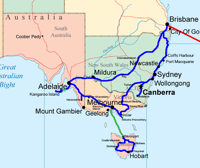
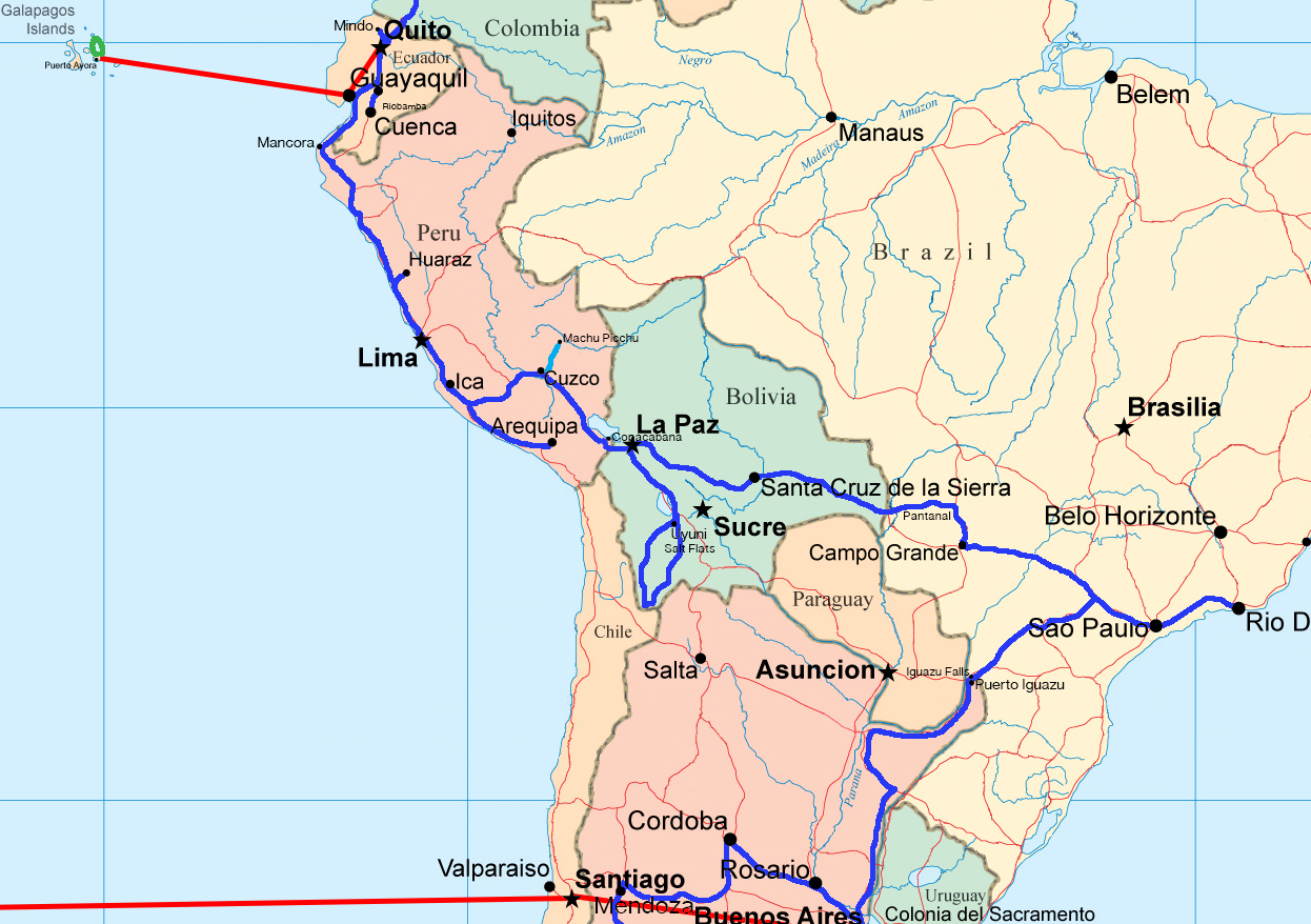
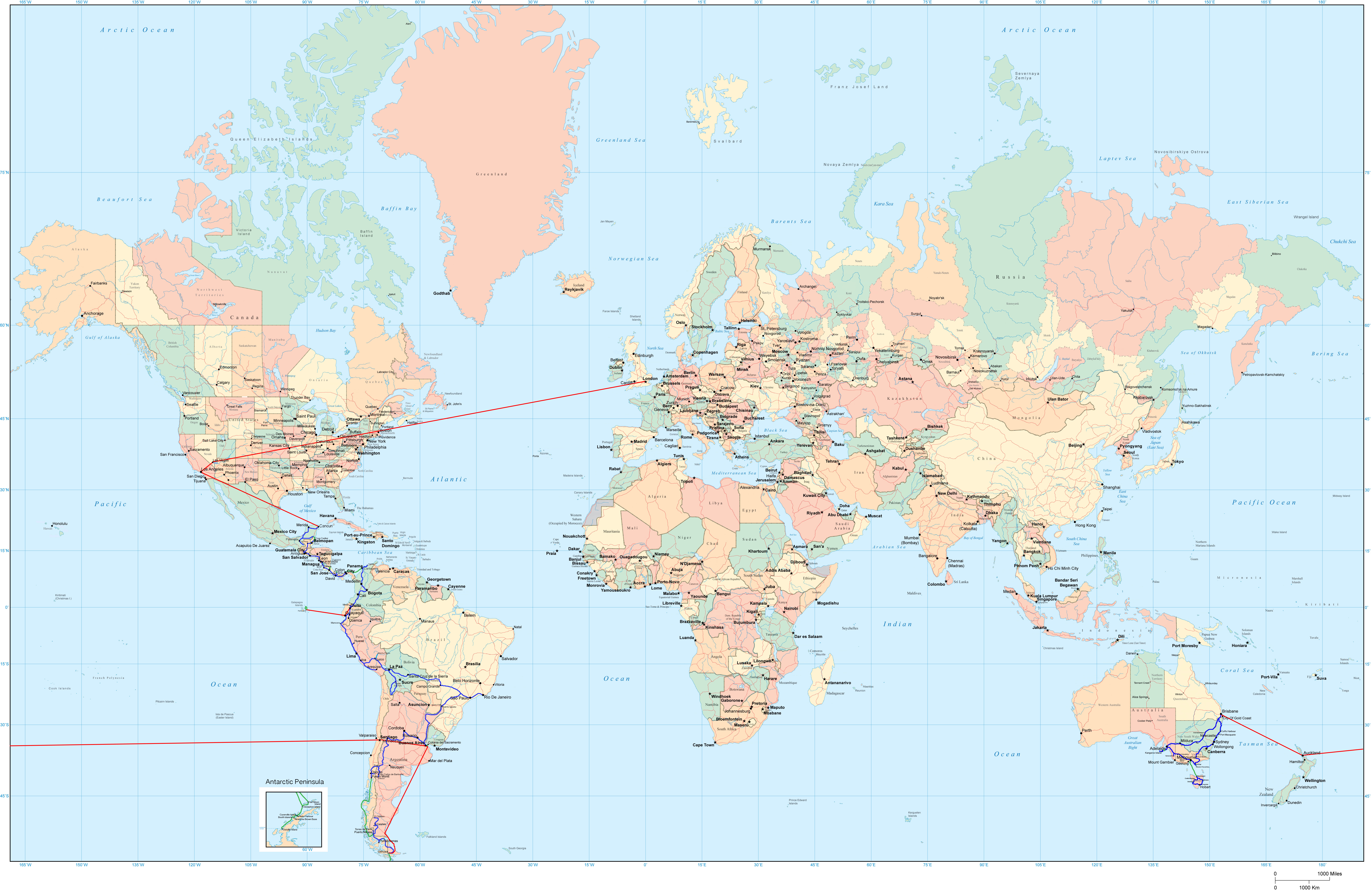
Sixteen months on the road is a long time. During that time I covered quite a distance and did many things. While I’ve been ‘resting’ in the United Kingdom, I’ve put together a step by step rundown of my trip including maps.

South East Australia

wpid-seaustralia-2014-05-8-14-57.jpg

In a van called the Pointy Brick I…

Antarctica, Chile and Argentina

wpid-southernsouthamerica-2014-05-8-14-57.jpg

From Brisbane, I flew to Auckland and spent 3 weeks with family before flying to South America where I…

Brazil, Bolivia, Peru and Ecuador

wpid-northernsouthamerica-2014-05-8-14-57.jpg

From Buenos Aires I…

Colombia, Central America and Mexico

wpid-centralamerica-2014-05-8-14-57.jpg

From Ecuador I…

The Full Map. May take some time to load.

wpid-ajtravelmap3-2014-05-8-14-57.jpg

The World Wanderer
Volcán Barú, Panama

Barely 37km from the border of Costa Rica is Panama’s tallest mountain, Volcán Barú. At just under 3,500m, it’s still considered high altitude but is really just a molehill compared to 6,000m tall mountains of Andes. Volcán Barú is commonly climbed for the rare possibility of seeing both the Pacific Ocean to the south and the Caribbean sea to the north. It’s rare because the view to the Caribbean is often blocked by a layer of clouds.

wpid-101405669-idpllmbm-panama-2014-01-17-22-32.jpg

There’s two ways to the top of Volcán Barú, either taking a 4×4 vehicle tour or to hike. The hike is difficult and long at 13km from the trailhead to the peak (with a 1,750 climb in altitude) before 13km back again. What makes it a challenge is most people begin climbing at midnight, aiming to see the sunrise from the summit after walking 6 hours in the dark. Hiking 26km makes for a long day at the best of times, but beginning at midnight makes it just nasty. I even tried to nap in the afternoon, but only managed an hour, which was nowhere near enough.

wpid-dscf3124-2014-01-17-22-32.jpg

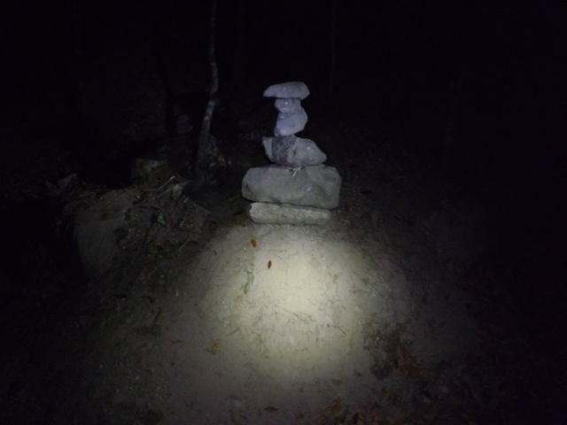
Getting to the trail head is fairly easy, with one of the hostels offering transport for US$5. Then after a very short briefing, we were pointed off along a wide track and told to just keep climbing no matter what forks in the trail we see. Except for 3 short descents, the 13km was a steady climb along the wide rocky trail. When you’re hiking at night all you have is your head torch and the ground directly ahead of you to look at.

wpid-dscf3128-2014-01-17-22-32.jpg

We were lucky to be walking under the full moon, so it wasn’t always necessary to use the head lamps. But even in daylight there would be little to see, as there are trees along both sides of the trail. We did come to several locations where we looked down upon the township of Boquete. The lights were beautiful but fleeting and too distant for good photos.

Getting to the summit for sunrise was not my aim, so I took is more slowly. When sunrise did hit, I was still half a kilometre from the summit but was able to watch it, seeing the same view as I would have from the top.

Unfortunately it was around this point where altitude sickness struck. It felt like someone had split my head in half and prodded at the insides with their fingers. As I climbed the last of the trail to the radio tower buildings at the top it grew worse and I started to feel ill.

wpid-dscf3132-2014-01-17-22-32.jpg

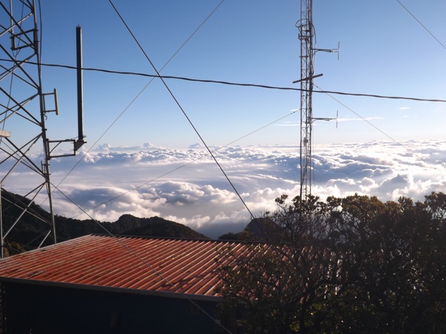
The last 500 metres was steeper than the rest and when I made it to the top I found the howling wind rough. I found a secluded spot and put on some warm clothing. When dressed, I looked around the buildings and took photos of the surrounds.

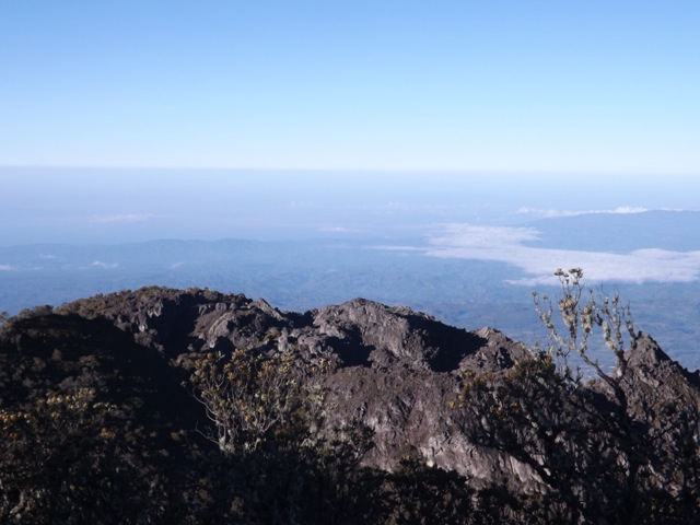
To the south was the city of David and the islands in the Gulf of Chiriqui beyond.

wpid-dscf3137-2014-01-17-22-32.jpg

To the west, Costa Rica.

wpid-dscf3138-2014-01-17-22-32.jpg

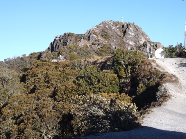
On the other side, I discovered the buildings were not at the absolute summit, as there was a rocky outcrop that climbed perhaps 30m higher. To get to the top was a rocky scramble, but with the state of my head and stomach I decided against it. The cross on top is the highest point in the country.

wpid-dscf3140-2014-01-17-22-32.jpg

From the northern side of the summit I was out of luck with seeing the Caribbean sea but instead clouds fading away into the distance.

wpid-dscf3136-2014-01-17-22-32.jpg

While I sat huddled out of the wind, one of the girls from my hostel found me and sat with me while I brewed a cup of tea using my hiking stove.

The walk down was very long but straightforward. The trail descends for most of its length except for three points where it climbs. Half way up the first and longest of the three climbs, my tiredness gave out and I lay down on a large rock for a power nap, letting my friend walk on alone. I woke forty minutes later slightly refreshed and no longer feeling the altitude.

The rest of the walk was more of a stagger although I did manage to catch my friend again. We discovered there were many wild flowers growing along the trail but was too exhausted to take photos beyond this one…

wpid-dscf3141-2014-01-17-22-32.jpg

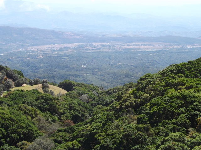
We passed some of the lookouts and caught daylight glimpse of Boquete…

wpid-dscf3143-2014-01-17-22-32.jpg

We eventually made it to the end of the trail and exhausted, booked a taxi through the ranger before being whisked away back to the hostel for a shower and a well deserved sleep.

Overall, the hike up Volcán Barú was okay. I would have enjoyed it more if I hadn’t suffered altitude sickness at the end and if we’d started at a more reasonable time. While walking at night was fine – it’s cooler out of the sun and there isn’t much to see anyway – the main difficulty is the length. To make the hike more enjoyable, I would make it a two-day hike, camping just below the summit, climbing to see the sunrise early on morning two before the long walk back again.

The Lone Trail Wanderer.

Looking Back, Part 3 – Northern South America

Peru

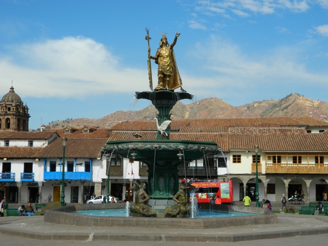
As I left Bolivia I made my way around Lake Titicaca and along the Andes to Cusco, capital city of the Inca Empire more than 600 hundred years ago. Cusco was built in the image of the Puma, a holy symbol of the Incas.

wpid-dscn3270-2013-12-22-17-56.jpg

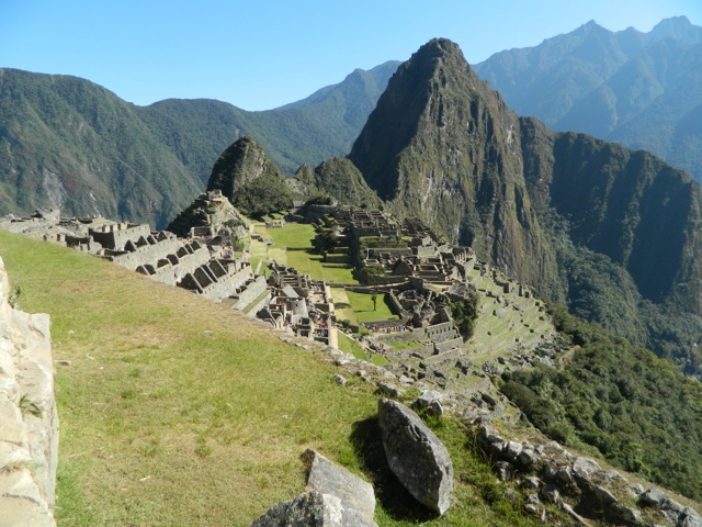
Cusco’s a popular tourist destination because of it’s closeness to Machu Picchu. To get to the ruins many people walk one of the expensive hikes in the region: the infamous Inca Trail, The Salkantay Trek or The Jungle Trek. While these hikes are said to be amazing, the expense and length of time needed to prebook put me off. Instead I caught the train to Aguas Caliente, the township at the base of Machu Picchu mountain, and climbed the near 2000 steps to the ruins. At altitude, these steps are still hard going. The ruins felt like Disneyland because of the huge number of tourists but it was still beautiful to behold…

wpid-dscn3405-2013-12-22-17-56.jpg

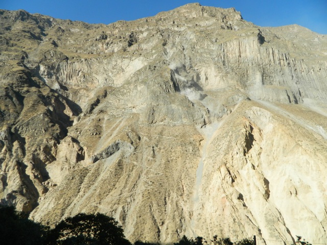
After Cusco, I travelled to the city of Arequipa, the southernmost city of Peru. Near Arequipa is the county’s third most popular destination, Colca Canyon. Colca Canyon is one of the largest canyon’s in the world, twice as deep as The Grand Canyon. The hiking there is very cheap and doesn’t require a guide. I explored the canyon for three days, including the final climb, a kilometre straight up.

wpid-dscn3461-2013-12-22-17-56.jpg

After Arequipa I headed down from the Andes for a time, stopping at Huacachina, a small town near the ocean renown for its massive sand dunes. I spent an afternoon sand boarding down the slopes.

wpid-huacachina21543-2013-12-22-17-56.jpg

Next was a visit to the capital, Lima. I stayed in the tourist zone of Miraflores which felt like I was in the centre of any other city in the world. I then moved to the historical centre and this was more to my liking with great architecture and a distinct lack of tourists.

wpid-dscf2137-2013-12-22-17-56.jpg

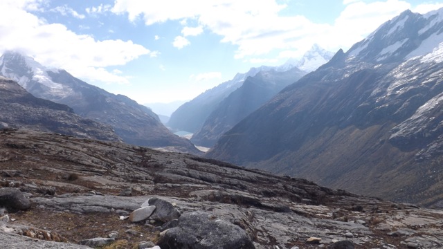
I continued north and back into the Andes to the city of Huaraz nestled between the Cordilleras Blanca and Negra. From Huaraz a group of us hiked the four-day Santa Cruz trek, with one of the hardest climbs I’ve ever completed.

wpid-dscf2065-2013-12-22-17-56.jpg

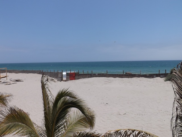
From Huaraz, I made my way to the far northern coast and the country’s second most visited destination, Mancora. Mancora is a beach town where I stayed for four days in a cabaña 20 metres from the Pacific Ocean. After the Santa Cruz hike, it was great to just sit and enjoy the beach for a few days.

wpid-dscf2147-2013-12-22-17-56.jpg

Ecuador

I left Peru and headed across the border to Ecuador’s capital, Quito, where I made plans to visit the Galapagos Islands. Two days later I was on a plane – my first since arriving in South America – and a few hours later landed on the famous archipelago. After booking a four-day cruise around the islands, I made friends with a Uruguayan guy at the hostel and spent the days prior to the cruise exploring Santa Cruz island with him, including a great swimming hole and the Giant Tortoise sanctuary.

wpid-dscf2185-2013-12-22-17-56.jpg

The cruise was amazing, I enjoyed snorkelling through the icy waters and swimming with penguins, fur seals, sea lions and sea turtles. On land there were many bird species including Blue Footed Boobies, the smaller water iguanas and the large land Iguanas.

wpid-dscf2303-2013-12-22-17-56.jpg

Back in Quito, I met some friends at the hostel and explored the city with them, including some amazing architecture, the original site of the equator and the newer more technologically accurate equatorial site. I had also prearranged with some locals to hang out with and spent a week enjoyed their company.

wpid-dscf2401-2013-12-22-17-56.jpg

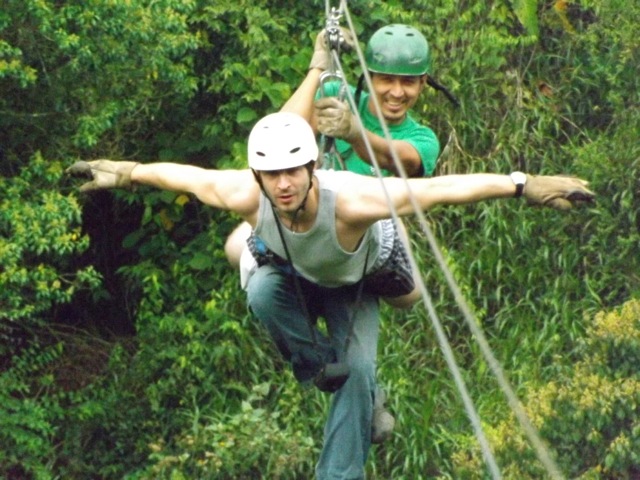
With my friends from the hostel, I headed north for a weekend to the adventure town Minca buried in the rainforest, where we hung out with Hummingbirds, zip lined ourselves crazy and generally enjoyed our stay.

wpid-dscf2438-2013-12-22-17-56.jpg

Next, two of us travelled south to the city of Riobamba where we hiked to the amazing crater lake of a collapsed volcano called El Altar. Most hiking in Ecuador must be done with a guide, but the two of us enjoyed the three-day hike without one.

wpid-dscf2555-2013-12-22-17-56.jpg

Then we headed south to the southern city of Cuenca where my friend headed into Peru and I explored Ingapirca, the ruins of an Incan Fortress.

wpid-dscf2689-2013-12-22-17-56.jpg

Colombia

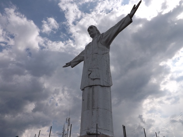
Then it was back to Quito for a last few days before I headed north into Colombia, to the city of Cali where I stayed for three days. I explored the city via a walking tour, learning its history, and climbed one of the hills to the local statue of Christ.

wpid-dscf2748-2013-12-22-17-56.jpg

From Cali I headed north via a very winding mountain road where the bus driver thought he was formula one driver. After the humidity in Cali, Bogota was cold. I’d prearranged to meet some people in Colombia’s capital and they were so friendly I stayed for three weeks to spend more time with them, including attending a huge Pop Culture Festival…S.O.F.A.

wpid-dscf2766-2013-12-22-17-56.jpg

Bogota is not well set up as a tourist destination but during my stay I caught a cable car up to a temple of the hill giving awesome views across the city.

wpid-dscf2780-2013-12-22-17-56.jpg

Then with general sadness at having to leave my friends in Bogota, I headed north to Medellin, a more popular city for tourists and home town of the late Pablo Escobar. I hung out at a New Zealand owned hostel and between a couple of nights partying I took a walking tour, both with a group and a separate one with a couple of guys from the hostel.

wpid-dscf2799-2013-12-22-17-56.jpg

Next I headed to Cartagena, a city on the Caribbean Sea where I hung out for a few days in the extreme humidity. Cartagena’s Old Town has a great stone wall around it that once protected it from pirate attacks 500 years ago. The entire old town is a world heritage site.

wpid-dscf2827-2013-12-22-17-56.jpg

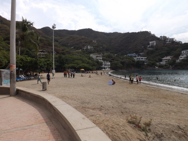
Further along the coast is a small beach town of Taganga where I stayed for a few of days. It was a quiet little town away from the bustle of the larger Colombian cities.

wpid-dscf2844-2013-12-22-17-56.jpg

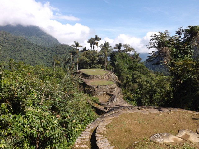
From Taganga I booked and walked the four-day jungle trek to find the Lost City, an amazing ruins of the local tribes that had been abandoned 500 years earlier. The trek was humid and sweaty, and this made the long climbs up clay trails more difficult. Swimming in the icy rivers were highlights of the sweaty days.

wpid-dscf2935-2013-12-22-17-56.jpg

After a couple of recovery days in Taganga, I headed back to Cartagena to say farewell to South America. After 9 and a half months of amazing adventure, it was sad to say farewell to the continent, although my travels were not yet at a conclusion. In Cartagena, I booked a cruise on a yacht with 11 others to make my way through the Caribbean Sea to Panama, and the beginning of my Central American adventures.

This will be an adventure I will never forget.

The World Wanderer
Galapagos Islands, Equador – Adventures

The Galapagos Islands is an archipelago of volcanic islands about 1,000 kilometres off the coast of Ecuador. While they’re technically Pacific Islands, they don’t have the same tropical islands feel like that of Tonga or Fiji. There are no palm trees here, for example.

Most people travelling to the Galapagos come for a cruise to see the diverse animal species. Most cruises are organised from the mainland before arriving and can be expensive. So, I decided to book a flight to the islands and to look for a ‘last minute’ deal when I got there, like I had for Antarctica 7 months ago. If you have time to spare, this is the cheaper way to go.

After an hour in a taxi from the hostel to the airport, a 30 minute stop off in the port city of Guayaquil and a 90 minute flight, I finally arrived on the islands. The airport is situated on a desert island, not the sandy romantic type, but a more rough dry vegetation type. What they don’t advertise is the US$100 entry fee into the National Marine Park – which covers all of the islands. Luckily, I had just enough on me, otherwise they would have taken my passport and I would have had to pay and collect it somewhere in town.

wpid-dscf2162-2013-09-22-22-081.jpg

I caught a bus to the ferry pier, caught a ferry to Santa Cruz Island, and another bus to Puerto Ayora. After my early flight I napped for the hour and a half it took to cross the island. I woke as I arrived in the port town…

wpid-dscf2170-2013-09-22-22-08.jpg

At the hostel I met a Uraguayan guy, Ernesto, who I ended up hanging out with for the rest of my time on the islands. We were greeted by the owner Kevin, from the US. Kevin took us on a free tour of the town introducing many of the aspects that were useful to know. At the end of the tour, Ernesto and I booked a 4-day cruise at a fairly good price. It was a couple of days away, so we explored some parts of the island.

Giant Tortoises
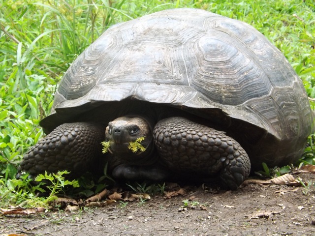
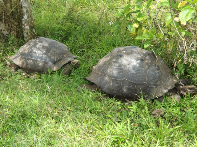
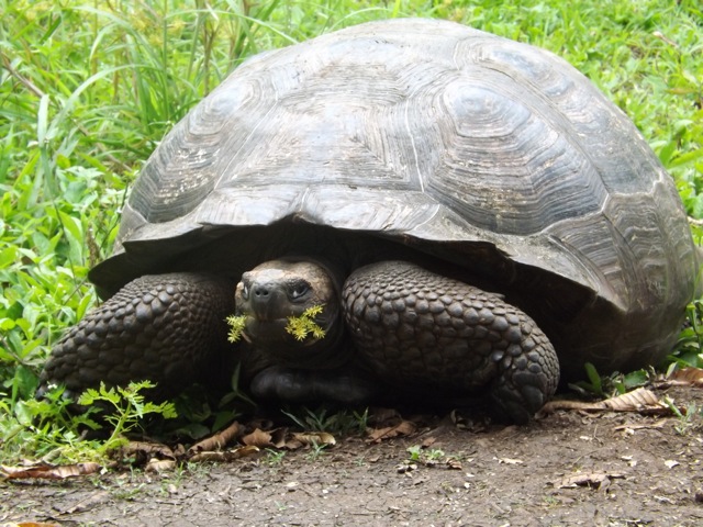
At the top of the island is a sanctuary for the massive giant tortoises that can only be found on these islands. They wallow in mud, chew grass and take very leisurely strolls down the side of the main cross island road. While fencing is used to separate properties on the islands, the tortoises are allowed to go anywhere they want, albeit slowly.

A taxi to anywhere in town is US$1 by law, but to get to the Giant Tortoise sanctuary it costs US$30 and the driver who takes you up there becomes your impromptu tour guide – thankfully Ernesto could translate. At the end of the tour, the driver takes you to several other places before dropping you back at your hostel.

wpid-dscf2201-2013-09-22-22-08.jpg

The reserve on Santa Cruz Island isn’t large but we met many of the tortoises who were just sitting around munching grass or drinking muddy water. The very large ones are the males (some 1.5m long) while females are smaller. There were several young aged 3-5 years, which were about the size of normal turtles. You’re not allow to approach to within 2 metres of the animals, but even at 5 metres some of them pull in their heads and hiss. They could no doubt give a nasty bite, so we kept our distance.

wpid-dscf2185-2013-09-22-22-08.jpg

Lava Tube
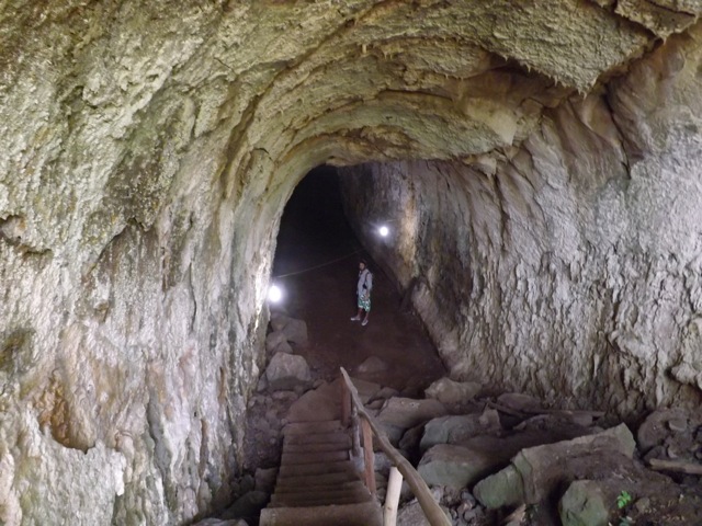
After visiting the tortoises, the driver took us to a large lava tunnel and dropped us at the start before going to wait for us at the exit. Stairs descend into the tube, which was slightly taller and wider than a train tunnel. The tube is nearly 500m long and is lit by sporadic lights.

wpid-dscf2207-2013-09-22-22-08.jpg

Near the end the tunnel roof descends, giving only a crawl space for about 2 metres. After crawling through on our bellies we met the taxi and were taken back to town.

Swimming Hole
While it’s not steaming hot in the islands, it can be a little muggy first thing in the morning. The day before the cruise was cloudy but warm, so we decided to find the swimming hole we’d been told about. Just prior to leaving, an English couple arrived at the hostel and we invited them to join us.

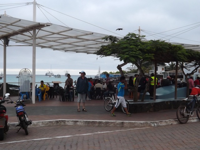
From the pier at the centre of town a water taxi takes us across the small harbour for 60 cents, zig-zagging through the yachts.
wpid-dscf2229-2013-09-22-22-08.jpg

We then walked across volcanic rock for 20 minutes to a natural fissure in the rock about 40 metres deep. The bottom 10 metres is filled with water.

wpid-dscf2217-2013-09-22-22-08.jpg

A pair of bikini clad girls from Florida at the edge of the swimming hole told us the water was cold. Of course the best way to get into cold water is to dive. But, the water wasn’t as cold as expected and the four of us ended up swimming for an hour, occasionally climbing up the sides and jumping from the rocks.

Eating
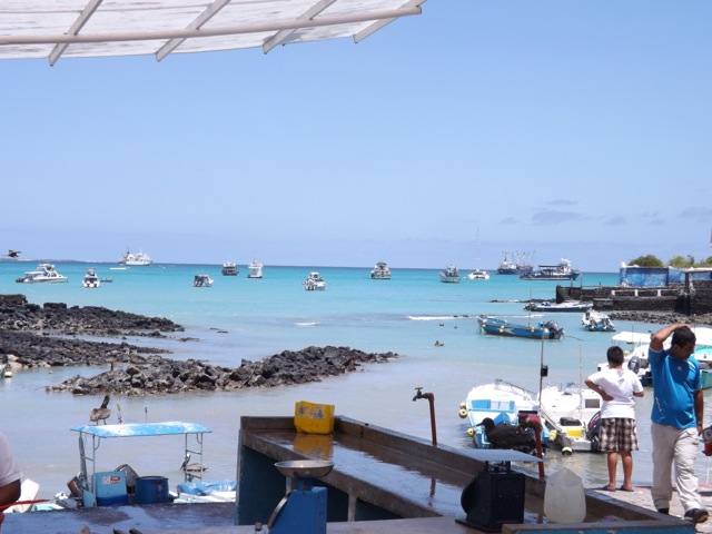
Puerto Ayroa has plentiful restaurants and being in the Pacific, seafood is common. For the three nights we stayed we ate in three different places. Firstly, at the pier where the boats bring daily fresh catches. In the morning they sell their catches of fish and crayfish, then in the evening they have a cheap seafood fry up. Very tasty.

wpid-dscf2358-2013-09-22-22-08.jpg

On night two, we discovered a street where all the small restaurants block the road by setting up plastic tables down the middle. At one particular restaurant, I ate a local fish dish – Caviche – where they slowly cook raw fish in a lime throughout the day. Yum!

wpid-dscf2361-2013-09-22-22-08.jpg

Day three, with our new English friends, we ate at a normal restaurant. Boring, but still tasty.

Tortuga Bay Beach
Lastly, on returning from the cruise, we decided to head to Tortuga Bay beach, a 30 minute walk along a 2.5km path. The day we went was warm but very cloudy and when we arrived at the beach it was beautiful but rather cold.

wpid-dscf2349-2013-09-22-22-08.jpg

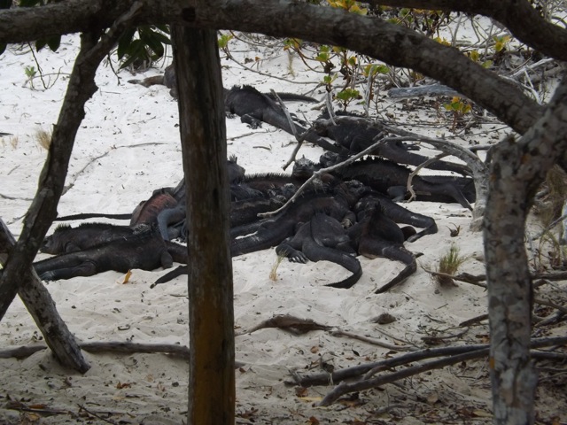
As we walked we spotted several black Marine Iguanas wandering down the beach. Middle right in the above picture. When necessary, he uses his long tail to swim through the surf. Then, at one end of the beach, we also found an Iguana pile…

wpid-dscf2356-2013-09-22-22-08.jpg

As evening approaches, the Iguanas head a special location and pile on top of each other to conserve heat during the night. The Marine Iguanas are the only species of in the world that do this, and at a half a metre long each, that’s a big pile.

Next, the 4-day cruise around the islands.

The Trail Wanderer
Vava’u – Swimming with the Whales

Today is my last day in Tonga and I must admit that I’ve rather enjoyed this little backwater Pacific Kingdom. While Vava’u has been the most commercialised of the islands groups, it’s not really that commercial at all. Tomorrow I face a flight to Tongatapu, a long wait at the international airport until my midnight flight to Auckland. I arrive at 2am and sleep in the airport until my 7am flight to Brisbane and home, well what home I have left there.

wpid-img_0636-2012-07-26-13-57.jpg

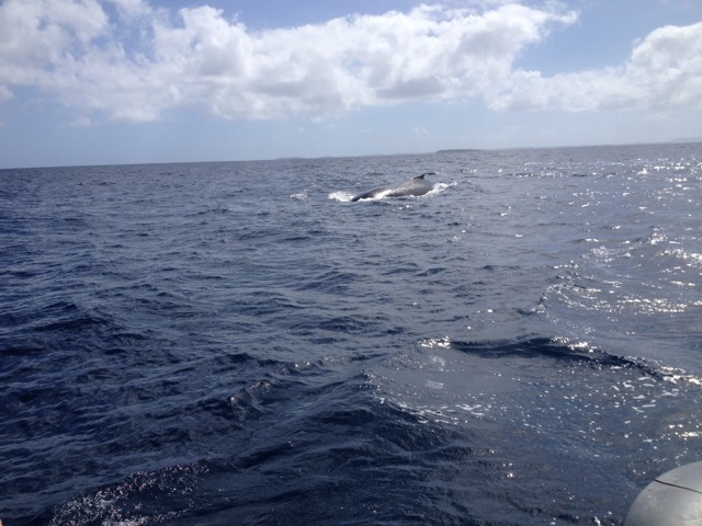
Every year as part of their breeding migration, Humpback Whales arrive in Tongan waters. This has led to a commercialised ‘swim’ with the whales all throughout the kingdom. No trip to these islands should be done without going on of the swims. I’m not sure I agree with the idea – some of nature’s creatures should be left to just get on and live, not be harassed by we humans. So, I’ve held out from going for most of my stay. But on my second to last day – yesterday – I caved and organised a trip. As I said, you can’t come to the islands without swimming with the whales.

The first objective of the captain is to find where the whales are, then get up ahead of them and send the swimmers into the water. The whales will often hang out and ‘play’ but if they move away, we get back on the boat and try again. We only try twice before ‘getting the hint’ and finding another set of whales. Because there are many operators, they often work in conjunction with each other to locate the animals and to share time with them.

wpid-img_0641-2012-07-26-13-57.jpg

We headed out to the west side of the islands and quickly located a pair of juveniles playing. We hung out around them for a while, watching them and getting the boat into position before getting into the water. In our snorkelling gear we were able to watch these animals go past. It’s magnificent to see such huge animals in their native environment. They weren’t that playful, however, and moved off. So back on the boat, we followed them and had another go. They moved away quickly again, so we left them alone.

wpid-img_0642-2012-07-26-13-57.jpg

We received a call from the other side of the islands. A crew working in conjunction had spotted a mother and her newborn. Like a tag team crew, we arrived at the specified location as other boat and it’s cargo of swimmers and they headed of – they’d been swimming with the whale for an hour – so it was our turn. We were in the water as the great juggernaut of the mother flowed past us with it’s baby – only a few days old and twice my size. The beauty of the mother just hanging there in the water was immense and we swum for a few minutes watching her interact with her baby before they swum off. Back on the boat, we followed and tried again. This time we managed only a glimpse before they give us the hint.

While I would have liked to have swum with them for longer, the mother and her calf were the last set of whales we saw for the day. We did a bit more snorkelling around the coral gardens and Swallows cave. It was a very sunny day today and the coral just shines in all its colours in the sunlight.

wpid-img_0640-2012-07-26-13-57.jpg

Not many photos of this, unfortunately, as I did not have an underwater camera today.

Back to Brisbane tomorrow and time to organise more trail walks.

The Trail Wanderer

Vava’u – Kart Safari

Today the sun came back out and the mugginess kicked in again. Having acclimatised to Queensland, I was thankful for the heat. While it hadn’t been cold, just not hot.

Today was a day I’d been looking forward to for much of my time on Vava’u… the Kart Safari day! It started in the afternoon, so I spent the morning just hanging out and relaxing in the backpackers.

wpid-img_0605-2012-07-24-15-48.jpg

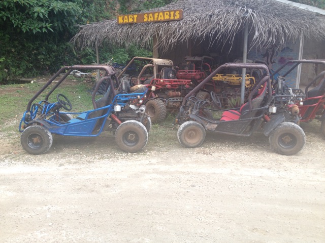
I headed down to the Kart Safari place for 1pm and met with the guy who was taking me on the tour. We waited for a couple from Melbourne to arrive and then 5 of us headed out on the tour in 3 carts. I was pleased as I had one to myself.

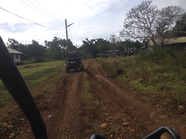
After a very brief training session: this pedal goes forward, this pedal stops, this is how you turn it on. And that’s it, easy! We strapped in and headed off. We followed the sealed road for a while taking a road I had not been along which quickly turned to dirt…

wpid-img_0609-2012-07-24-15-48.jpg

Then to track:

wpid-img_0610-2012-07-24-15-48.jpg

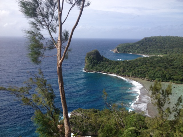
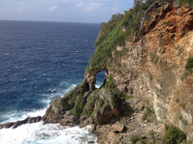
We drove to one of the most northern lookouts of the island. Great, because I had not been to the north as yet. As I had expected, the lookout was amazing, vast cliffs in both directions, hidden beaches and the raging blue of the sea.

wpid-img_0614-2012-07-24-15-48.jpg

After a while at the lookout, we headed off back along the track to the dirt road to the sealed road and to the east, heading to Keitahi Beach – a place I’d been on the scooter tour. There is a steep hill leading down to the beach that was crazy on the scooter, but awesome in the buggy.

wpid-img_0622-2012-07-24-15-48.jpg

We sat for a while and chatted to the guy who had leased the entire beach front and was building a new resort. Back in the karts, we headed up the hill and took a track which headed along the cliffs to another lookout. Again with amazing views.

wpid-img_0624-2012-07-24-15-48.jpg

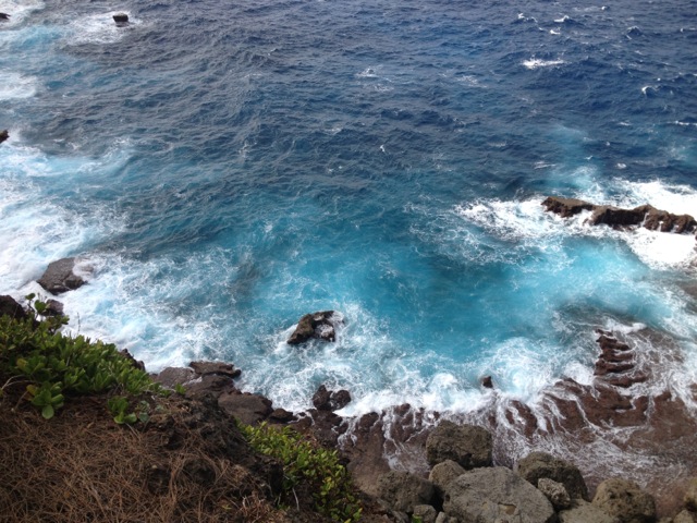
And the raging seas:

wpid-img_0629-2012-07-24-15-48.jpg

We watched flying foxes circle in the air – I love these beautiful creatures having worked in a bat hospital over christmas.

We headed out and drove down the dirt road to ‘Ene’io Beach again – I’d been there on my scooter tour also – for a beer. Then we returned to the backpackers.

Overall, it was a fun afternoon in the Karts although it could have been longer. Tomorrow I will climb Mt Talau again, this time with my Canadian friend, then on Wednesday – my last full day in Tonga – I’m off to swim with the humpback whales.

The Trail Wanderer.

Vava’u – Mt Talau National Park

So, it’s Sunday in Vava’u and like everywhere else in the Kingdom of Tonga, Vava’u shuts down and everyone goes to church. I decided to have a partial relaxing day and just hang out in the backpackers for most of it. There’s a nice common room, I know a few of the people, so I grabbed a book, my phone and just hung out on the couch.

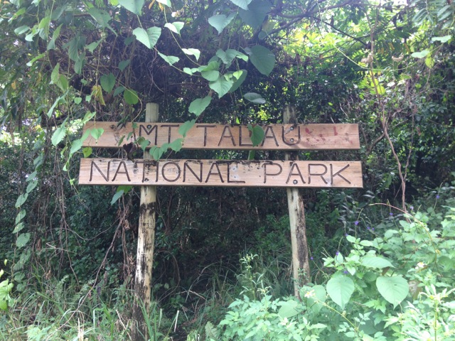
By lunchtime, I felt terribly lazy and decided to get out of the place and do something a little physical. Since I’ve not hiked on Vava’u, I decided to go for a walk. At the end of the harbour, Mt Talau stands quietly in all its mountainness. I’d say splendour, but at barely 132m from the base to the top, there isn’t any. But it’s close to town, so why not. It’s actually a fair walk to get to through the sometimes steep streets of Neiafu. By the time I reached the base of the mountain, I was sweating. A good start. I located the sign along the dirt track and kept following it.

wpid-img_0598-2012-07-23-18-18.jpg

The track grew thinner and led into the bush. I kept walking until I ran out of track. Had I gone the wrong way? Instead of heading back, I chose to climb up the side of the mountain. It had mildly rained for the last few days, so the side of the mountain was a little slick and soft, but I went up anyway, hanging on to trees and roots as I went. It wasn’t difficult going and I soon spied a track when I reached the top. Heading in one direction for about 5 metres and I found another track that went to a set of steps leading down. I had obviously missed a track leading up the mountain. Nevermind.

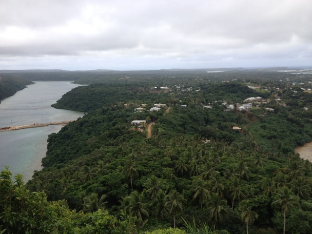
I continued along the track and it lead around the top of the mountain to a small building with a satellite dish and then on to a lookout: a fantastic view of the harbour

wpid-img_0599-2012-07-23-18-18.jpg

I walked on and found a track leading to another path down the mountain, this one with ropes to help with the climb. I guess I missed that one too. Ignoring it, I continued on to another lookout giving a view of the town:

wpid-img_0601-2012-07-23-18-18.jpg

Then on to a third lookout at the end of the track on the north side of the mountain:

wpid-img_0602-2012-07-23-18-18.jpg

I retraced my steps back to where I had climbed up and headed back the other way. I was hoping to find a lookout to the west, but the track petered out. So I headed back. (I came back again on Tuesday and redid the climb with my Canadian female friend. We pushed on into the bush and eventually found a lookout on the west side:)
wpid-img_0634-2012-07-23-18-18.jpg

I headed back to the steps near where I had climbed up and headed down. The steps lead to a roped section of path that leads to a split in the rock that you climb through. Again the dirt was a little wet and soft, but I went down anyway.

wpid-img_0604-2012-07-23-18-18.jpg

I have to say that the climb was more difficult than I expected. There were only a few places to hold on to and many places to slip. I took my time and came out of the bottom of the split in the rock to a short rock scramble down to the ground. I walked through some trees and came to a wire fence. On the other side was the original track I’d walked along.

I was heading past the Mt Talau sign when I heard voices on the side of the mountain. This must be the other way up. I headed into the bush and found the path, it actually starts about 10 metres before the sign. The good ole start the trail before the sign trick. So I decided to climb it. It was roped the entire way to the top and took me all of 5 minutes to get up. I then climbed back down – another 5 minutes – and then back to town.

Tomorrow, I’m off on a Kart Safari!

The Trail Wanderer

Vava’u – Snorkelling Tour

There are several places around the bay that I have been interested to see, so I thought a snorkelling tour would be the best means to see them. It’s with an experienced operator who knows the islands well – Hakau Tours. As it turned out, there were six of us going on the tour, all of them from the backpackers – The canadian girl I hung out with in Ha’apai, the kiwi guy from the scooters and three british medic students.

wpid-p7210184-2012-07-21-16-46.jpg

The day started out rather shabby, with a constant drizzle, but lightened up. We met the operator at 9.30 and headed off into the harbour on his boat. The wind picked up quickly and rain threatened again. After about 15 minutes we arrived alongside an island called Kapa and around to the other side. The end of the island has short cliffs with jagged rocky areas along it that the water has worn away. Just beyond the corner are two caves. These two caves are the location of our first snorkelling swim. Swallow’s cave is the largest of the two and goes into the cliff maybe 15 metres by water, and a by the looks of it, more beyond. If I had the shoes for it, I would have gone further, but we were here to swim, so we swum around the cave where there was a large number of fish swimming in a school. We headed out and along the base of the cliffs, enjoying the small other fish and the coral until we got to the smaller unnamed cave.
wpid-p7210186-2012-07-21-16-46.jpg

Back on the boat and we headed further out into the bay to Nuapapu island, the site of another cave – Mariner’s Cave. The entrance to this cave is underwater and to get to it, you need to swim through a short underwater tunnel – about 5 metres long. This cave is where the Tonga’s used to hide during the island wars when enemy ships came into the bay, then they would swim after them, climb on board and kill all the sailors. The cave is quite spacious when you get into it. I was second into the cave and while swimming through the tunnel, lost one of my fins and almost the other. I ended up scraping my foot on the tunnel – more war wounds! One of the others brought me the fin I’d lost and I swum out again. Swimming into the cave is psychologically more difficult, as you can’t really see where you are going. Swimming out again is more fun.

The water was warmer than the air, but we got out and froze as we were taken to the next place.

wpid-img_0571-2012-07-21-16-46.jpg

At the far end of Nuapapu island and stretching over to Vaka’eitu island is a large area of coral reef known as the coral gardens. We were dropped off at one end and snorkelled our way to the other side. This took about an hour and was a lot of fun.

wpid-imga0465-2012-07-21-16-46.jpg

wpid-imga0499-2012-07-21-16-46.jpg

We were then taken to a small island called Nuku where we stopped for lunch on the sandy beach. After lunch, we were dropped of a little offshore from the island and swum along its reef line. The coral was not as plentiful as the Coral Garden, but there are other things to see. A small school of barracuda swum past at one stage and at the end of the island I found a pair of clown fish. They were very inquisitive. Unlike the other fish, when I swum down to check them out, they swum up to check me out!

wpid-img_0590-2012-07-21-16-46.jpg
wpid-img_0597-2012-07-21-16-46.jpg

The trip back only took 30 minutes, but the chilling wind and rain didn’t make it very fun. Back on dry land, we all rushed back to the backpackers for a hot shower, but were disappointed as they hadn’t changed the gas for the water heater.

Tomorrow is Sunday and the country shuts down, so it might be a good day for a hike, depending on the weather.

The Trail Wanderer