Tag Archives: South America

Cerro Lopez, Parcue Nacional Nahuel Huapi, Argentina

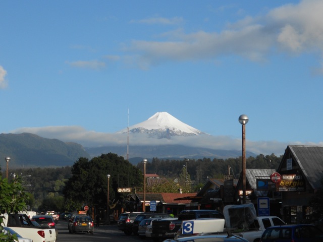
In the mountains around Bariloche there are many different walks. I had originally planned a hike called The Nahuel Huapi Traverse. This is a-4 day hike through the mountains from Cerro Catedral to Cerro López, starting about 20km from Bariloche. But since it’s almost winter much of the trail is closed because of extreme ice and snow. There is, however, still access to some of the refugios that I’d have been staying in. So, I have split the hike into two shorter ones. The first is what would have be the final day of my longer hike, up Cerro López to Refugio López.

From the hostel in Bariloche three of us from the hostel, two ladies and I, have to catch a bus the 20km to the start of the walk. It’s sunday and we have to put money on our loaned bus card and when we get to the store to do that, it’s closed. So we have to run 5 blocks to get to the next store. It’s very cold this morning, but after a five block run in my warm clothes, I’m more than hot.

Forty minutes later we arrive at the beginning of the walk and it feels icy. We headed off through the forest on a rocky trail. The wind is very brisk and there’s a mix between being hot from sweat and being frozen.

wpid-dscn2299-2013-05-14-13-16.jpg

The climb began steeply up the mountain and was challenging, especially after a few weeks of little hiking. We pushed on in the light but chill wind and stopped for a break to look back at the lakes…

wpid-dscn2305-2013-05-14-13-16.jpg

After 5 minutes, the sweat down out backs had turned to ice, so we pushed on following the red dots…

wpid-dscn2308-2013-05-14-13-16.jpg

The first 1/3 of the climb was perhaps the hardest and steepest, the second 1/3 flattened out a little, although was still fairly intensive until we came over the ridge to a lodge over looking the lakes. The lodge was closed for the season.

wpid-dscn2312-2013-05-14-13-16.jpg

The scenes of the lakes was just too vast below us to fit into one photo. Looking back towards Bariloche, the lake actually looks bluer than the other portions.

wpid-dscn2314-2013-05-14-13-16.jpg

On the peninsula below us there’s a clear patch where Hotel Llao Llao is situated. For some reason the sun only wanted to shine on this particular area.

wpid-dscn2323-2013-05-14-13-16.jpg

From the Lodge, we continued walking steeply up the hill and as we walked could see the pink Refugio Lopez perched on a ridge high above the autumn coloured trees.

wpid-dscn2338-2013-05-14-13-16.jpg

We followed the trail that became a slippery dirt trail. It lead to a 4WD track and we followed it for a while before it rounded the top of the gully and headed up steeply towards the refugio. Another 20 minutes later and after a short scramble we arrived. We knew it was going to be closed, so didn’t plan to stay longer than to eat some lunch.

wpid-dscn2330-2013-05-14-13-16.jpg

We could have continued walking up the mountain to the top, there are markings, but it’s not recommended because of the new snow…

wpid-dscn2327-2013-05-14-13-16.jpg

After a while we headed down again, faster than the climb. The slippery part was more difficult coming down and I slipped, skidding down on one knee, but kept my graces by not actually falling over.

Once we arrived at the bottom, we realised that we had 2 hours to wait for the bus. There’d been two other groups on the trail, one being two local guys waiting for a ride. One of the girls in my group asked it they had room in their car and next thing we knew we were being driven into town. The locals here are fairly friendly…

Today was a good if not strenuous walk with fantastic views of the lakes, and while it was supposed to rain it held out. Even more thankfully, it hadn’t snowed, although a few flakes had fallen. For the next week I’m taking a spanish course, then one of the girls and I are planning an overnight hike up to Cerro Cathedral, what would have been the first part of the traverse.

The Trail Wanderer

Villarrica Volcano, Parque Nacional Villarrica, Chile

Situated just over 20km south of Pucón is the Villarrica National Park and its most prominent feature, the three volcanos that cross the Andes. The main cone of the three is the smoking Volcán Villarrica with the others being Quetrupillán and Lanín behind it when looking from Pucón.

wpid-dscn2271-2013-05-11-15-57.jpg

I’d originally planned to walk the Villarrica Traverse, a 6-day hike starting on one side of Volcán Villarrica and around the southern base of both Villarrica and Quetrupillán to a small town called Puesco on the other side of the National Park. But after waiting for days for the late autumn rain to clear for an extended time, I unhappily cancelled my plans. While I don’t mind walking in the rain for short periods, walking in the rain at a temperature of 2 degrees celsius is not something I really enjoy doing.

So, I decided to do the most popular and busiest attraction of the Parque Nacional, climbing to the crater of the 2,800m snowcapped top of Volcán Villarrica.

I was up at 5.30am for a 6.30am pick up. Breakfast was supplied by my hostel, who was also providing beer and a BBQ afterwards, all included in the price. We were taken to another hostel and provided with the gear for the climb. I opted for my own boots, but took everything else – including crampons and an ice ax. We were then driven along the pot holed dirt roads up the volcano to the ski resort at the base of the climb.
wpid-dscn2273-2013-05-11-15-57.jpg

We unloaded form the bus and gathered for the talk. We’d be walking to the base of the snow cap and stopping, waiting for the guides to check the wind speed and determine if we could continue.

The climb would be in four parts, the last being the snow cap. We set off along the steep lower face of the volcano, the scree and dirt being soft and slightly difficult to climb. As we climbed, we split into groups, the younger group, the two larger American ladies, and me. There’s a reason I call myself the Lone Trail Wanderer, I like to walk alone in the serenity of nature and the quiet. The young group just yabbered away the entire climb and the less fit american girls quickly dropped back.

wpid-dscn2276-2013-05-11-15-57.jpg

In the quiet, I climbed the steep trail, zig-zagging up the side of the mountain, and trying not to be blown over by the wind, which was gusting rather strongly, blowing dust and pebbles around me. Up ahead, I saw one of the young crowd stumble in the wind and nearly lose her footing. Looking back, the lake below could be seen, and the volcanoes to the south, while sitting below the sun, and while not making good photos, still looked amazing.

wpid-dscn2274-2013-05-11-15-57.jpg

We continued walking and climbed along a gully of rocks out of the wind and took some respite before topping the ridge and heading towards the first stop, the top of a ski lift and a large wooden building, again out of the wind. We stopped for a rest and some photos before heading on. The next stop, an old burnt out ski lift building a little further up. Just before we left, the two larger girls finally arrived wondering why they had decided to climb the mountain – in words I won’t repeat here.

wpid-dscn2281-2013-05-11-15-57.jpg

The next stage was easier and again I let myself drop back to walk in the quiet again, we walked behind a ridge for most of the way, so enjoyed the lack of wind ripping at us. We stopped at old burnt out brick lift house but didn’t go in.

wpid-dscn2283-2013-05-11-15-57.jpg

The third leg became steeper again and the volcanic sands made each step harder. I again drifted back from the ongoing and incessant chatter from the other group. There was no sight of the american girls behind us and I would later discover they hadn’t gone past the second stop. We came to the base of the snow cap and were briefed on the next stage. On went the warmer clothes, the gaiters, and out came the crampons and ice axe. The guides then climbed the ice shelf to test the wind. 10 minutes later they returned to tell us that the wind was blowing 80km/hr and it wasn’t safe to continue further. Okay, no problems, they knew what they were doing, so all good. This led to half of the group arguing with the guides for the next half an hour, trying to persuade them to take them anyway. Eventually, the guides were persuaded, but I decided it more prudent to not go. The views were amazing though, although I discovered that the lens of my camera had failed. It had been giving me grief much of my trip. Time to buy a new one…

wpid-dscn2284-2013-05-11-15-57.jpg

The four of us who hadn’t gone waited for 30 more minutes in the icy wind for them to return, but when they didn’t, we headed down. Down was very quick. Because of the volcanic sands, you could slide each step and when running you skidded down rather quickly. Back at the first chair lift building we collected the two American girls and continued down, arriving at the base soon after to wait for the other climbers. They arrived an hour later and we all were back in the bus and heading back to Pucón for beer and BBQ.

It was a shame we couldn’t get right to the top – even the four that tried didn’t make it because of the clouds rolling in quickly. But the weather rules supreme in Patagonia and you must bow to its might.

The Trail Wanderer

Pucón, Chile – Impressions

Ninety minutes by bus north of Osorno in the Lakes District of Northern Patagonia is the town of Pucón.  Nestled between the shores of Laguna Villarrica and the imposing cone of Volcán Villarrica, the large town has the reputation as somewhat of a party town. Like the rest of Patagonia, the tourism industry here is rather rife based around climbing the volcano in summer or skiing it in winter.

DSCN2271

I had come in Pucón with the intention of hiking the Villarrica Traverse, a 6-day trek around the bases of Volcánes Villarrica and Quetrupillán, but the weather hadn’t looked so good. The forecast had spoken of some rain followed by a week of sunshine, not surprising for the end of autumn, so I decided to wait it out.

The first hostel I stayed in was El Refugio and had a couple of kiwi guys working there. The good thing about it was that it was right next to the bus terminals. The bad thing about it was that it was right next to the bus terminals. There was nothing wrong with the hostel beyond it being the busiest one in town, even in the low season. To accommodate that fact, they’d built a pair of large dome tents in the back yard that slept 6 in bunks. Because it had been so busy, I only stayed a couple of days before moving to another hostel, Paradise Pucón, this one owned by a kiwi guy.

DSCN2294

Paradise Pucón had a reputation as being a party hostel in high season. But as it was low season, the parties had mostly died down.

wpid-dscn2295-2013-05-10-19-08.jpg

Unfortunately, the rain didn’t let up with no sign of respite, so I took advantage of it by catching up with my writing. Long term travelling works best when you take long breaks between periods of movement. I located a nice cafe in the centre of town that made good coffee and scrambled eggs – Cafe Agora – and got to work. I also found an awesome restaurant for dinner run by an American couple which had the best burgers and a nightly happy hour. Latitude 39 is a must visit if in Pucón.

wpid-dscn2292-2013-05-10-19-08.jpg

There are numerous hot springs near Pucón and one night the hostel owner drove a group of us guys to one.  Bringing plenty of beer we sat in a pool about the size of a regular spa pool drinking and enjoying the heat.  Then after a while, as a group, we climbed down to the river and threw ourselves in, before climbing back into the hot pool. A great night!

The next day Pucón hosted the annual chocolate festival – chocolate production being very big in this area of Patagonia. There were many tables for tasting and buying different chocolates, and in the corner of the tent there was even a chocolate volcano.  The volcano proved popular with the kids as at the end of the festival it was broken into pieces and handed out.

wpid-dscn2269-2013-05-10-19-08.jpg

The party life in Pucón is pretty good, I was taken out by the owner and one of his workers – another kiwi guy – to a couple of the local clubs. Three kiwi guys on the party… Gringos are treated highly in clubs in South America and this being the first one I’d been in, I felt everyone’s eyes on us. Being the only three gringos in the club, we were also getting great drink deals. 6 drinks for the price of 2! It turned out to be a great night, even though I couldn’t talk to many people.

wpid-dscn2270-2013-05-10-19-08.jpg

Then, after being in town 12 days, I decided to give up on the traverse and just climb Volcán Villarrica, a popular day activity.

Overall, Pucón was a lovely place to spend a couple of weeks, I made some friends and caught up with my writing. Next, I crossed the border into Argentina to the Chocolate capital of South America, Bariloche.

Things to do in Pucón:

  • Climb Villarrica Volcano
  • Hike the 6-day Villarrica Traverse
  • White water raft in Trancura River
  • Ride horses in Lancura Valley
  • Visit the thermal springs, of which there are many

The Lone Trail Wanderer

Osorno, Chile – Impressions

Just an hour by bus north of Puerto Montt is Osorno, a small city in the Lakes District of Northern Patagonia. Osorno sits under the volcanic cone of Volcán Osorno, is home of the National Cattle Ranch of Chile and has a heavy german influence.

wpid-montaje_de_osorno-2013-05-2-14-59.jpg
Collage courtesy of Wikipedia

Osorno is typical Chilean city with some very spanish markets, far too many stray dogs and cheap beer. I stayed at Hostal Vermont, 10 minutes walk from the bus terminal in the city centre. The main streets and shopping malls are characteristic of larger cities with many bustling shops and people.

I came to Osorno for one reason, a hike in the neighbouring Parque Nacional Puyehue called ‘Baños del Caulle’. The hike climbs the side of Volcán Puyehue to the rim, walks around the side and down to a set of hot springs, the ‘baños’. This had originally a 4-day hike but I discovered that two years earlier, an eruption on the baños side of the volcano had destroyed the hot springs. I decided to do the hike anyway, climbing to the volcanic crater and camping further down.

As I prepared for the hike, the hostel owner informed me that one of her previous guests hadn’t returned from the hike. Three other’s had seen him there and had returned, but he had not. This didn’t worry me, and it turned out two other guests at the hostel would be doing the hike also.

To get to the national park in low season I had to catch a bus to a point about 20km from the trailhead and hitchhike the rest of the way. I was finally picked up after walking 12km and dropped off at the hike’s registration point where I could see the cone rising into the clear blue sky. On arrival I was told the police had closed the hiking trails as they were conducting a manhunt for the missing man.

That night I stayed at a small hotel next to the National Park called Anticura.  Close by was the river and several waterfalls.

DSCN2253

By morning, they still hadn’t located the missing hiker and park was still closed  as they were continuing the search. The weather had also turned, so I decided to head back. I flagged down a bus heading from Bariloche, Argentina to Osorno and an hour later was back in town.

The next day, I boarded a bus to Pucón, the party capital of Chilean Patagonia, where I was planning a 6-day hike around a pair of volcanoes.

The missing walker did eventually turn up on day three of the man hunt.  He’d gotten lost on the route.

Things to do in and around Osorno:

  • Visit Lago Puyehue
  • Climb Cerro Pantoja
  • Relax in the Termas Aguas Callientes – Hot Springs

The Lone Trail Wanderer

Puerto Montt, Chile – Impressions

Puerto Montt is a large port city in the Lakes District of northern Patagonia, in Chile.  It’s also the northern port for the Navimag Ferry, on which I arrived in the city.

wpid-dscn2239-2013-05-2-14-57.jpg

Puerto Montt is large and bustling compared to Patagonia and stretches around the top of the harbour. On a clear day, rising above the city to the north is Volcán Osorno, but as it’s late autumn, clear days are rare. Here’s what I would’ve seen at a different time, thanks to the magic of Wikipedia:

800px-Puerto_Montt_2009

I arrived at the ferry terminal and collected my bags before heading up the hill towards the hospedaje. A hospedaje (pronounced: os-pe-da-hey) is someone’s home that’s been converted into a hostel or Bed & Breakfast. They have a more homely feel, but being run by local families, they can struggle as much with english as I do with spanish. On this occasion, we got by with a mix of both. This was also the first double bed I’d slept in for some time, so it felt divine.

I was only in Puerto Montt for a couple of days, so I only explored the city centre. Ten minutes from the hospedaje is the main road and after spending so much time in small towns, small cities or at sea, I was a little unnerved by the sheer number of people crowding the street. In fairness, it was market day and the footpaths were filled with street vendors and local shoppers. Civilisation can be intense when you’ve been away from it for so long.  In comparison, Patagonia was very quiet.

wpid-dscn2243-2013-05-2-14-57.jpg

This above only shows the beginning of it. I walked through the masses and eventually, near the other end of the long main road, I found the first western fast food restaurants I’d seen in South America: McDonalds and KFC, of course! After months of cooking in hostels or eating local cuisine, I couldn’t resist but found that KFC doesn’t have that same KFC taste in Chile. At the very end of the main road I found a large shopping mall, another symbol of my return to civilisation.

DSCN2248

…and from the same spot, taken of the harbour…

DSCN2245

While I didn’t do a lot of exploring, here are a few things you can do out of Puerto Montt:

  • Climb Osorno Volcano
  • Walk around Parque Nacional Alerce Andino
  • Take a scenic drive along Seno de Reloncavi

After my couple of days, I caught a bus north to the city of Osorno.

The Lone Trail Wanderer

El Calafate, Argentina – Impressions

Just one border crossing and a five hour bus ride north from Puerto Natales is El Calafate, nestled on the edge of Lago Argentino. Named after the yellow-flowered, blueberry plant found everywhere in Argentina, El Calafate is the major access point to all ends of the vast Parque Nacional Los Glaciares.

DSCN2189

El Calafate was a pleasant place to spend a couple of days. I stayed at I Keu Ken hostel slightly up the hill with excellent views of the lake. Having the new La Anonima, Argentina’s biggest supermarket chain, only two blocks away was a bonus. I was also lucky enough to arrive the night of an asado, an Argentinian BBQ, something they have every Friday night. They served the best blood sausage I’ve ever tasted and the meat just kept coming.  There was so much, in fact, I just couldn’t eat it all. It was a great dinner and cheap at 90 Argentinian Pesos (AU$18), which included beer and wine. I Keu Ken also had the best internet in Patagonia, allowing me to post the backlog of my blogs and photos.

wpid-elcalafate-avenidasanmartin-2013-05-2-14-56.jpg

While the streets around the hostel aren’t sealed, the lower portion of the city has a certain beauty. In a bare countryside with yellow, over sheep-farmed fields, the garden town was filled with trees and flowers. The main street had the usual adventure stores and tour operators seen so commonly throughout Patagonia.

wpid-dscn2192-2013-05-2-14-56.jpg

My trip to El Calafate was merely a two-day stop off on the way to El Chaltén, a township at the northern end of the national park. After 12 days in Antarctica, and 9 days of hiking around Torres del Paine, I enjoyed a restful couple of days.

Things to do near town are:

  • Walk across the 30km long Perito Moreno Glacier
  • Sail through icebergs on Lago Argentino
  • See the rock paintings in the Walicho Caves
  • Explore the petrified forest of Bosque Petrificado La Leona

A lovely place to spend a few days and with an airport, it’s a centre point of travel through lower Patagonia.

The Lone Trail Wanderer.

Puerto Natales, Chile – Impressions

Three hours by bus north of Punta Arenas is the port city of Puerto Natales. Puerto Natales was originally a beef producing fishing port, but over the years has embraced tourism based on its proximity to Parque Nacional Torres del Paine, the most popular and most expensive national park in Chile.

Because of the number of people coming to walk the ‘W’ trek – the most popular hike in the national park – the city has expanded rapidly. While it still has a small town feel, the plentiful hostels, tour operators, adventure stores and restaurants makes it feel bigger.

wpid-dscn2200-2013-05-2-14-56.jpg

There are multiple main streets crisscrossing the city, a restaurant square, a tourist triangle and a brand new supermarket. Along most of the north and eastern horizons are the fantastic mountains of the Andes, including Torres del Paine Massif, while along the north and west of the city is the harbour.

wpid-dscn2195-2013-05-2-14-56.jpg

Puerto Natales is all about Parque Nacional Torres del Paine. Every hostel and many convenience stores – not to mention the adventure stores – hire out equipment, arrange tours and organise bus trips to the national park. And every day at 3PM at a bar called Base Camp there is an hour-long free lecture about the hike.

The hostel where I stayed, Backpackers Kaweskar, was set up specially for the hike and can provide everything you could need, even discounted transport fees. While its owner, Omar, is crazy (in a good way), is very knowledgable about the hike and definitely loves his football. While I was there he spent two solid days playing FIFA 2012 on the X-box with one of his friends. It was the low season and he did pause when needed by someone, but it made the place feel down to earth. Definitely a recommended place to stay.

DSCN2194

Puerto Natales is also the southern port of the Navimag ferry. The ferry wends its way through the Patagonian fiords for five days to Puerto Montt in the lakes district at the northern end of Patagonia.

wpid-dscn2199-2013-05-2-14-56.jpg

Puerto Natales is in a class of its own and should be on everyone’s visit list if they wish to hike anywhere in Patagonia.

From Puerto Natales:

The Lone Trail Wanderer

Navimag Ferry – Puerto Natales to Puerto Montt

wpid-ferry-evangelistas-02-2013-04-18-16-07.jpeg

The Navimag is a large ferry that travels a regular route through the fiords of Patagonia from Puerto Natales to Puerto Montt, and back again. The trip takes four nights and five days, although the first afternoon and night are spent in Puerto Natales Harbour, waiting to set sail in the early hours of Day 2.

wpid-mapa-pnatales-pmontt_en1-2013-04-18-16-07.jpg

While it was not the cheapest or quickest mode of transport in Patagonia, for the price we got many amenities, time through some amazing landscapes and food included. Alcohol was also available for purchase at the bar. The Navimag has been a transport for many years, but only in the last decade has been allowed to transport people.

The ferry was larger than the ship that took me to Antarctica, but there was about the same number of passengers. Much of the boat consisted of cargo bays, carrying vehicles and other cargo for the local market, including live cattle that could be heard mooing at the most unusual times.  Once we were onboard, the cargo bays were of limits to us.

The ship contained three levels we passengers were allowed onto during the voyage. At the top was the bar, a fairly large area where we spent most of their time when not eating, sleeping or doing some of the other activities on board.

DSCN2233

Level two contained the more expensive cabins and the dining hall. This large room was used for, well, dining, but also for lectures, which they gave twice, once in spanish and once in english. These lectures were about Patagonia, birds, whales, our destination and the like. In the afternoons/evenings they showed movies or documentaries here also. While we were sailing, they showed: The March of the Penguins, Ice Age 4, James Bond – Skyfall, The Vow and several others.

wpid-dscn2238-2013-04-18-16-07.jpg

Lastly, on the lowest level were the main sleeping quarters. There were several different levels of cabins, from ones with windows and toilets to ones without. Also in the sleeping quarters was The Dorm, a figure eight corridor with a series of 22 bunks set into the walls. Each bunk had a curtain, a light, a power socket and at the end a locker. There were several bathrooms scattered around the corridor. This lowest level of accommodation was adequate, but the noise of people going past or having conversations  kept you awake unless you have a good set of ear plugs.

DSCN2236

I boarded the ferry on Monday night and hung out in the bar with a friend before heading off to bed. The ferry left port at 8am on Day 2 and meandered its way along the fiords towards the southernmost part of the route, a place called the White Narrows, before it again heading north along a series of channels. The weather grew steadily worse as we went, but we did get a few pictures in the morning.

DSCN2204

While I was expecting landscapes similar to Antarctica because of our proximity to the South Patagonian Ice Field, the low cloud ensured we saw little of the ice field. The views were mainly of rocky islands with the occasional bird.

wpid-dscn2217-2013-04-18-16-07.jpg

There were apparent sightings of dolphins and a seal, but not while I was out looking for them. The White Narrow was the only place in the fiords the ship can pass through to head north without heading into the Pacific Ocean and while it was particularly narrow, it wasn’t white.

DSCN2219

For the rest of the day and night we worked our way through channels with the aim of coming out through the English Narrow into the Golfo de Penas. We were warned that the sea might get a little rough and many of us medicated with seasickness pills just in case. From the gulf we headed out into the Pacific Ocean to round Region Alsen del General Carlos Ibanez del Campo.

wpid-dscn2209-2013-04-18-16-07.jpg

The rain started before we headed through the English Narrow on Day 3 and continued for most of the rest of the journey. Strong winds hit us in the gulf as did the swell. While my group of companions and I held out fine, that evening the dining room was only half full and many people hovered in their rooms/bunks or threw up in the bathrooms. After my trip to Antarctica, I actually rather enjoyed the roughness of the sea, finding it fun fighting against the listing of the boat to get from one area to the next.

DSCN2227
An old shipwreck sitting on a bank.

In the afternoon of Day 4, we crossed back into the fiords and reached Canal Moraldes.  Overnight we sailed north through Golfo Corcovado, passing Isla del Chiloe before eventually arriving at Puerto Montt in the early afternoon of Friday. We’d been due to arrive earlier that morning, but the winds in the Pacific caused us to run 7 hours late. While cruising slowly into Puerto Montt harbour we were escorted by a Southern Right Whale, a pair of dolphins and a seal. And yes, I saw them this time.

While the weather wasn’t the best for the trip and the views weren’t always great, the cruise itself was still most enjoyable. I made friends and hung with them in the bar, playing my board games (Carcasonne and Coloretto). They were very popular as they were different to the standards: the chess, checkers, dominos and the like that was available at the bar.

From here, I spent two nights in Puerto Montt planning my trip north and getting supplies ready for hiking in the Lakes Regions, a slightly warmer region of Northern Patagonia.

The Boat Wanderer

Parque Nacional Los Glaciers – Mt Fitz Roy Triangle

Across the border and about 8 hours by bus north of Parque Nacional Torres del Paine is a small town called El Chalten. El Chalten is inside the north end of Parque Nacional los Glaciares and is the only way to walk around Mt Fitz Roy. If there was no Mt Fitz Roy, there’d be no El Chalten.

There’s also no actual hike called ‘The Triangle’, it’s purely name I gave it, because the 3-day hike is, well, a triangle. The walk itself isn’t especially difficult and most days are rather short. But, much like the Overland Track in Tasmania, it’s the side tracks that allow you to adjust its difficulty.

Day 1 – El Chalten to Campamento Poincenot

The wind was fairly brisk as I headed out of my hostel. And because the hostel doesn’t provide breakfast – a first for me so far this trip – I stopped at a nice little cafe/bakery down the road. Then, late in the morning, I set out towards the northern start point of the hike. You can start the triangle from both ends, but I chose the northern end because, well, I wanted to.

I found the entrance to the parque fairly easily and followed the trail up the hill beyond the sign. The trail heads up and around Cerro Rosado, a small rocky mound just over 800m above sea level – El Chalten is 400m. I soon come to a rocky outcrop with a good view back to town.

wpid-dscn2078-2013-04-13-09-34.jpg

Further on, I came to a mirador looking north along Rio de Las Vueltas and the mountains beyond with their light topping of overnight snow.

wpid-dscn2080-2013-04-13-09-34.jpg

The trail continued on slowly climbing towards the plateau. After a time I arrived at a sign announcing a fork in the trail. One way leads to Mirador Mt Fitz Roy while the other to Laguna Capri, then both meet again on the other side. I walked to the lookout but much of the mountains were covered in cloud.

wpid-dscn2088-2013-04-13-09-34.jpg

It did looked like the sky was clearing so I went for a short walk to kill some time. After hearing a tapping sound I discovered a pair of black and red woodpeckers hammering away at some old trees. I stopped to watch for a bit and when I returned to the mirador the mountains were a little clearer, but not much. I headed on down the trail and found a spot out of the wind to have lunch. By the time I was ready to leave, only the main spire was covered in cloud.

wpid-dscn2112-2013-04-13-09-34.jpg

Not far along the trail I found the fork back to Laguna Capri and went to check it out.

wpid-dscn2102-2013-04-13-09-34.jpg

I then headed on towards the campsite, following Arroyo del Salto.

wpid-dscn2106-2013-04-13-09-34.jpg

I crossed the plateau and rounded the base of the hill under the spires. Shortly after, I arrived at camp and set up my tent. Still early afternoon, I went to check out one of the two main side trails from camp, I took the easier one and headed off down Rio Blanco towards Laguna Piedras Blancas. After about 30 minutes I found an obvious trail that led me over huge boulders to the laguna.

wpid-dscn2122-2013-04-13-09-34.jpg

On the way back it started getting icy even before the sun had gone down. This means cold overnight, but usually clear skies in the morning. During the night I popped out of the tent to see the vastness of the stars and to check out the peaks at night.

wpid-dscn2131-2013-04-13-09-34.jpg

Day 2 – Campamento Poincenot to Campamento De Agostini

It was cold overnight, but especially the last couple of hours before dawn, with the sun rising at 8.30am. By then I’d slept about 10 hours anyway. There’s not much to do on a hike after dark and going to sleep by 10 is considered late. In the cold, I emerged from my tent to take early morning pictures of the mountains before heading back to the warmth of my sleeping bag to brew coffee.

wpid-dscn2133-2013-04-13-09-34.jpg

After breakfast, I packed but left my tent up and with my day pack, headed up the other side track, to Laguna de los Tres, under the towers of Mt Fitz Roy. The climb started in the forest near the camp but after the ‘climbers only’ camp at Campamento Rio Blanco it turned rocky and stayed that way, climbing steeply for the rest of the half kilometre climb. About half way up, the trail started to turn to ice and I became more cautious with my steps, then three quarters of the way up, there was snow, but not huge amounts. I eventually arrived at the top and sat looking over the lake with the peaks towering over me. The lake is 1170m above sea level, while Mt Fitz Roy towers to 3405m.

wpid-dscn2140-2013-04-13-09-34.jpg

After a while, I headed down and caught the view across the valley to Lago Viedma.

wpid-dscn2145-2013-04-13-09-34.jpg

I stopped for lunch back at camp before packing up my tent. Thirty minutes later and I was following my steps across the plateau and taking the trail to the south. It was fairly flat and I walked past Lagunas Madre and Hija.

wpid-dscn2151-2013-04-13-09-34.jpg

Then the trail dove into trees with the occasional grassy clearing. After 2 hours the trail headed steeply down into a valley to Rio Fitz Roy where I stopped for a break. Following the river, I came upon a fantastic view of Cordon Adela – The Adela mountain chain – in all it’s icy glory backing onto the South Patagonian Ice Field.

wpid-dscn2157-2013-04-13-09-34.jpg

For the rest of the trail I walked steadily towards the cordon and finally arrived at Campamento de Agostini just short of Laguna Torre. The lake is fed by Glacier Grande that hangs from the bottom of the range. I pitched my tent and climbed up to look at the laguna, but with the sun hidden behind the mountains it was fairly dark.

Day 3 – Campamento De Agostini to El Chalten

Again it was icy in the last hours before dawn, so I brewed a coffee to keep warm. Then, I stood at a viewpoint waiting for the first rays of light to hit the Adela Cordon.

wpid-dscn2166-2013-04-13-09-34.jpg

Once I’d seen it, I packed up and again left my tent. With my day pack I headed around the top of the laguna and climbed towards Mirador Maestri. On the way there were a couple of views of small waterfalls, but once I got to the mirador I was a little disappointed to find that it was just closer to the cordon than from the other side of the laguna. I did get better views of the laguna with light though.

wpid-dscn2168-2013-04-13-09-34.jpg

I headed back to camp where I packed up my tent and headed out back along the trail. For the most part, following the rio, the trail was fairly flat. I passed the junction with the trail I’d come off yesterday and continued on flat beside the river. As I got closer to El Chalten, the trail began to climb a small set of hills to eventually arrive at a mirador looking back over the cordon. This was designed for day walkers to be able to see the mountains without doing the entire hike and is similar to the mirador near Laguna Capri. The trail headed over a couple of ridges before descending towards town.

wpid-dscn2184-2013-04-13-09-34.jpg

Overall, the Mt Fitz Roy Triangle is an excellent short hike experience around some amazing mountains. It’s cheaper than Torres del Paine but still has plenty to see. There are slightly less day walkers, although that might be because it is the low season.

Next I’m heading back to Puerto Natales, where I board the Navimag ferry and cruise through the fjords heading my way up Patagonia to Puerto Montt.

The Lone Trail Wanderer

El Chaltén, Argentina – Impressions

El Chaltén is a small town at the northern end of Parque Nacional Los Glaciares in Argentina. It’s a town bred purely from the tourism generated by the National Park and Mt Fitz Roy.

DSCN2184

El Chaltén was quaint and had plenty of hostels, although many were aimed more towards the hotel end of the market than to backpackers. There were plentiful tour operators and adventure stores selling the big named adventure gear for both hiking, ice climbing and glacier expeditions. There was also a small cafe/bakery scene in the town which was great, as the hostels don’t provide breakfast.

I stayed at the Hostal Pioneros del Valle. This large and fairly cheap hostel had plenty of rooms, most set up with 6 beds. But as it was low season when I stayed I had the room to myself. Splendid!

DSCN2072

High season is December to the end of March and outside of these times more than half of El Chaltén’s businesses close down. The several restaurants in town are reasonably priced restaurants, including the local micro-brewery, which is good considering the town doesn’t have good facilities for buying your own food. While there are supermarcados, they aren’t very ‘super’.

The National Park had great day walks and several longer hikes – some very intense indeed. Being short on time, I only did a 3-day hikes. It doesn’t have an official name but I called it the Mt Fitz Roy Triangle. The other great advantage of the Parque Nacional is it’s cost. It’s free. Something different in a land of expensive national park entrance fees.

Here are some of the other walks:

  • Cascada Margarita
  • De las Vuetas River Canyon
  • Piedras Blancas Glacier
  • Punta Norte – Hito Limítrofe

Next, I head back through El Calafate to Puerto Natales in Chile to catch the Navimag Ferry

The Lone Trail Wanderer