Tag Archives: Ocean

Savai’i Island, Samoa – Impressions

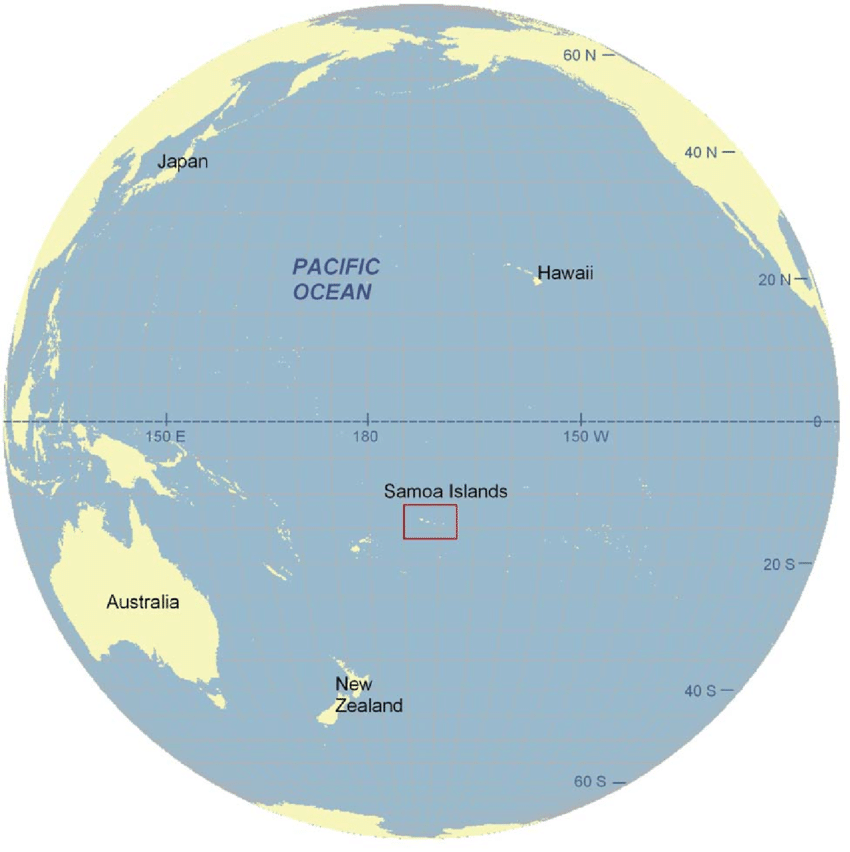
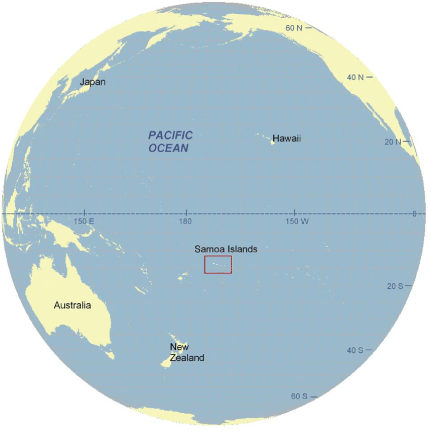
In March 2023 I headed out to Samoa for a weeklong family gathering in Upolu, the country’s main island. Then once much of the family returned home, myself and my parents visited Samoa’s other main island, Savai’i. For me it was to explore a place I’d not been before, and for my parents it was to trace back some of our family heritage by finding a family cemetery.

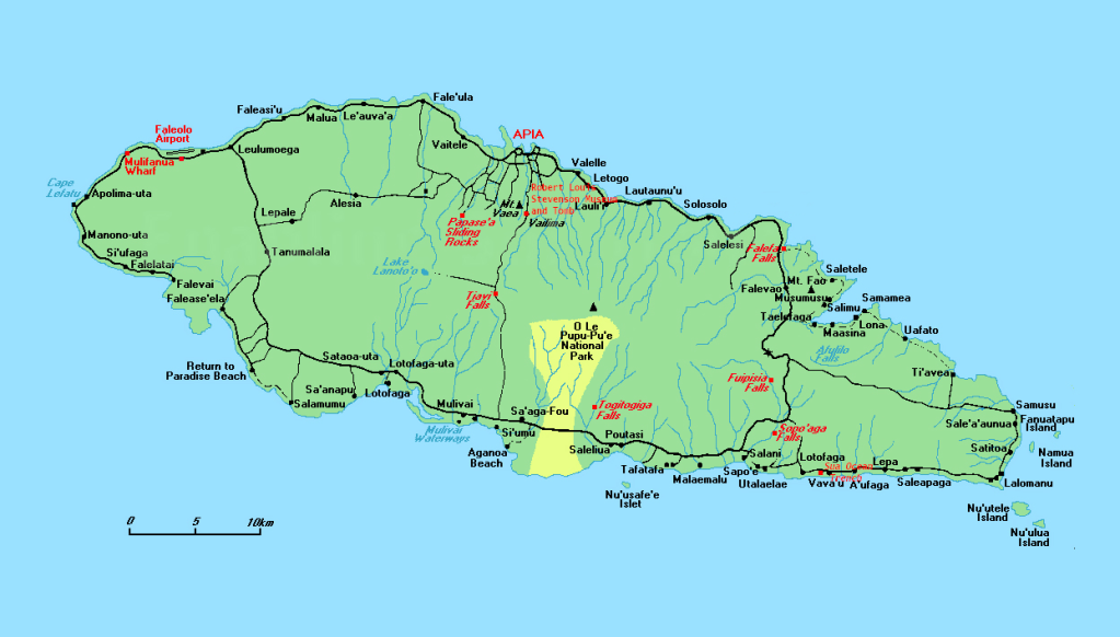
Savai’i is the largest island in the Samoan Islands chain, both in size and height, and is the sixth largest Polynesian island after the 3 New Zealand Islands and two of the Hawaiian islands. Savai’i is more traditional than Upolu with a more relaxed feel. There is also no airport on the island, so arrival must be via boat, usually the car ferry.
Ferry to Savai’i

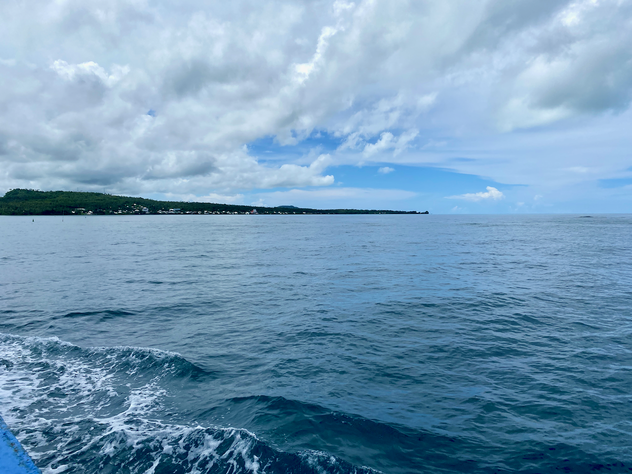
There are two ferrys to Savai’i, a small one and a larger one. On our trip over from Upolu Island, was in the small ferry. It’s the first car ferry I’ve ever had to reverse onto it, but I was guided on by helpful workers. This ferry had no sitting area, so we stayed in the car without aircon. We did find a spot at the edge of the deck where we could feel the wind. On the way back, we were on the larger ferry and locked up the car and went to sit in the airconditioned passenger seating area.
img_1147-2023-03-25-18-43.png

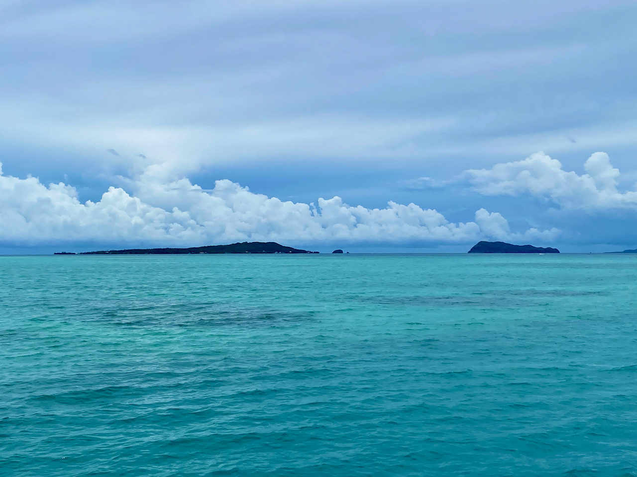
On the slow chug of the ferry, we passed the small islands of Manono and Apolima. The trip over on the small ferry took 90 minutes, while the larger one took about an hour.
img_1140-2023-03-25-18-43.png

Beach Fale

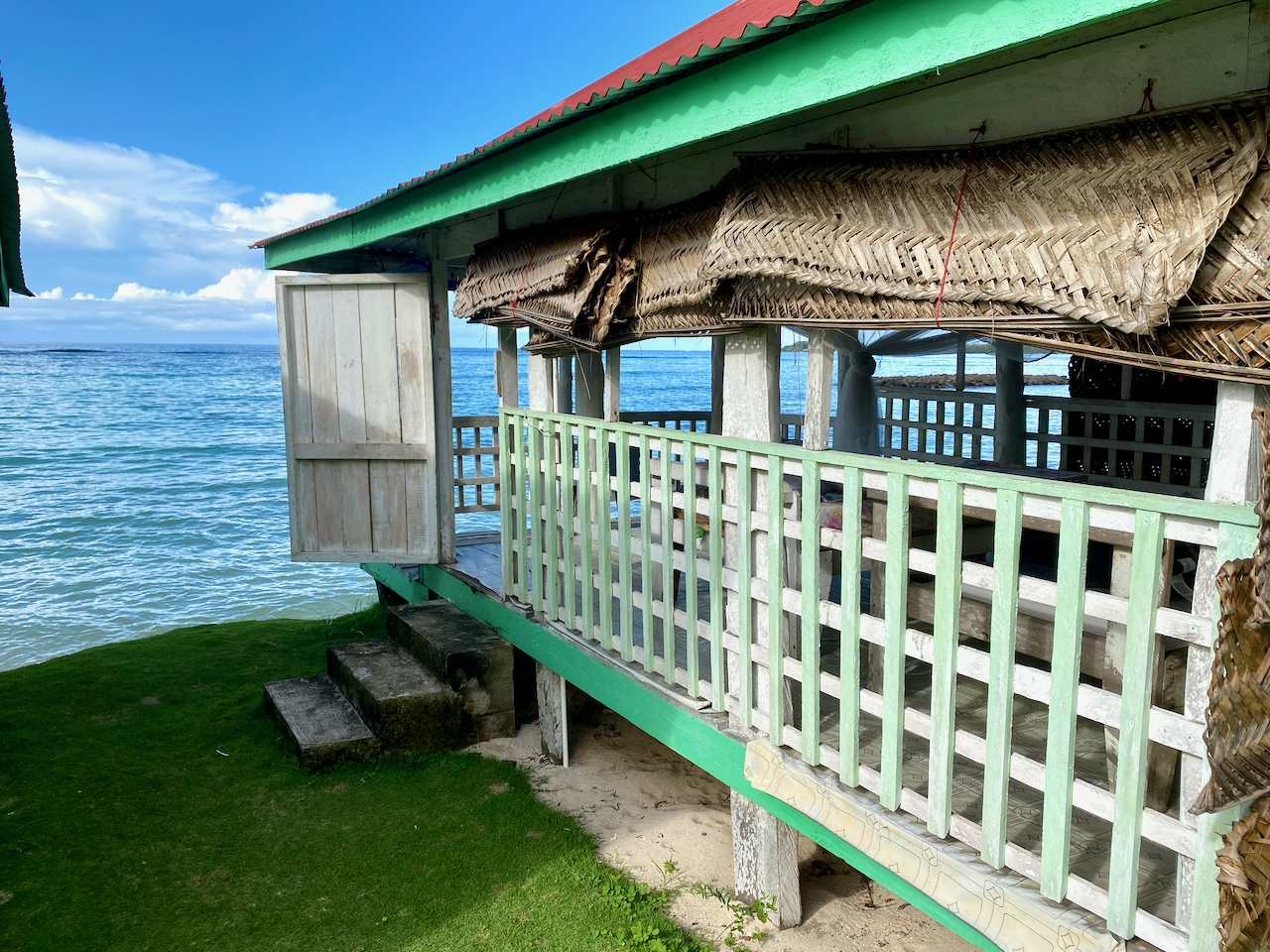
Fale in Samoan means ‘building’, and they are very common on the islands. The original fales were simple structures made from posts and a thatched roof. These days they’ve been modernised with concrete floors and corrugated iron roofs. Beach Fales are common ways for families to make extra money by renting them out to visitors. Mine had woven shields on the back half and tarpaulin sheets on the ocean facing half. While these provide some privacy, they can block the elements, especially during heavy winds or storms. The woven panels when partially drawn are good for allowing air flow on the usually steamy island nights.
img_1148-2023-03-25-18-43.png

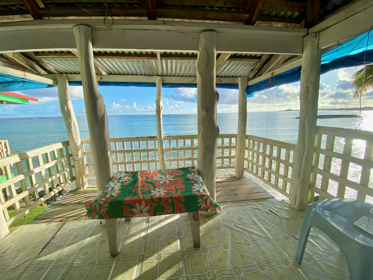
Inside mine were two beds, one with a mattress to sleep on, the other to put my bags on, plus a small table, a chair and most importantly, a mosquito net. For convenience, mine also had a light and a power plug. While not for some – my parents stayed in a resort up the road – I like trying new things, and on most days the views out the front at high tide were amazing. From time to time, I’d even see a turtle popping it’s head out of the water.
img_1150-2023-03-25-18-43.png

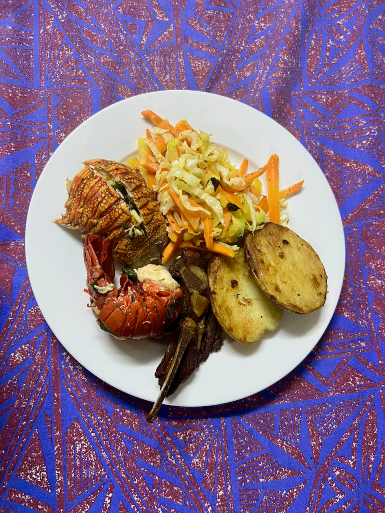
Breakfast and dinner are both included in accommodation, all traditional fare, and on the last night, there were lobster tails, local BBQ, a cooked salad with fried taro and potato.

Saleaula Lava Fields

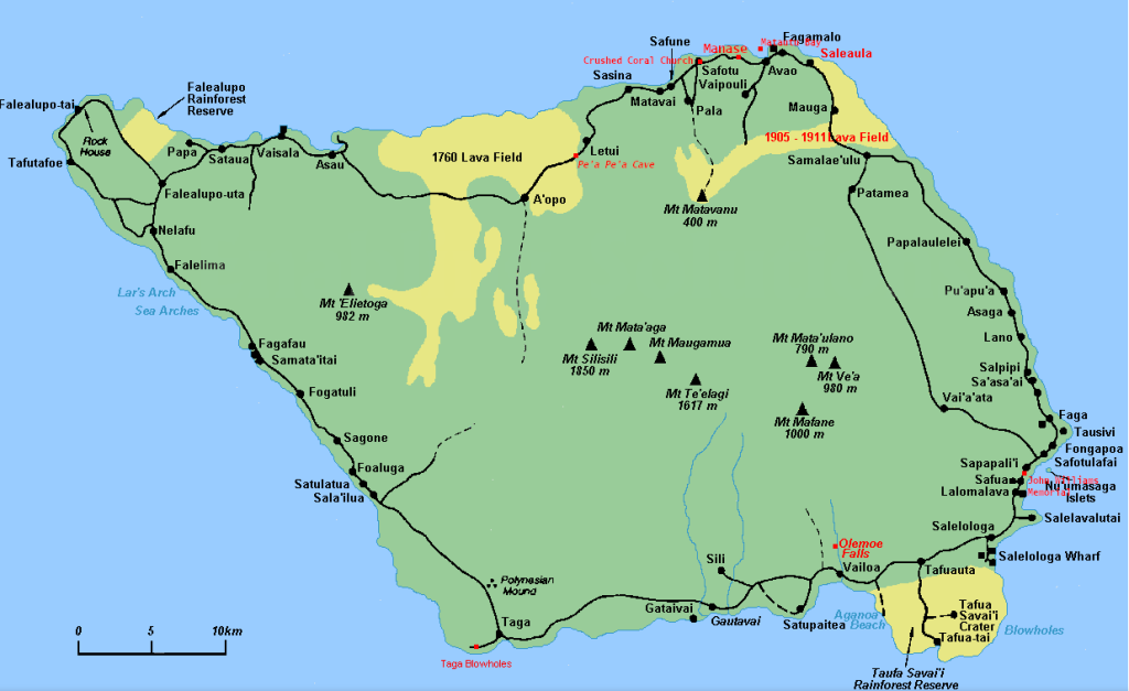
On the 3rd of August, 1905, molten lava began blowing from the ground from Mt Matavanu. It spilled over the crater’s rim filling a deep river valley leading to the flat Saleaula coastal plain, overwhelming part of Saleaula Village. A year later and much of the coastal plain had been covered, the lagoon had been filled, a vertical basalt cliff had built up over the coral reef, and five villages with their adjacent farming land had been buried. The eruption continued for a total of 6 years.
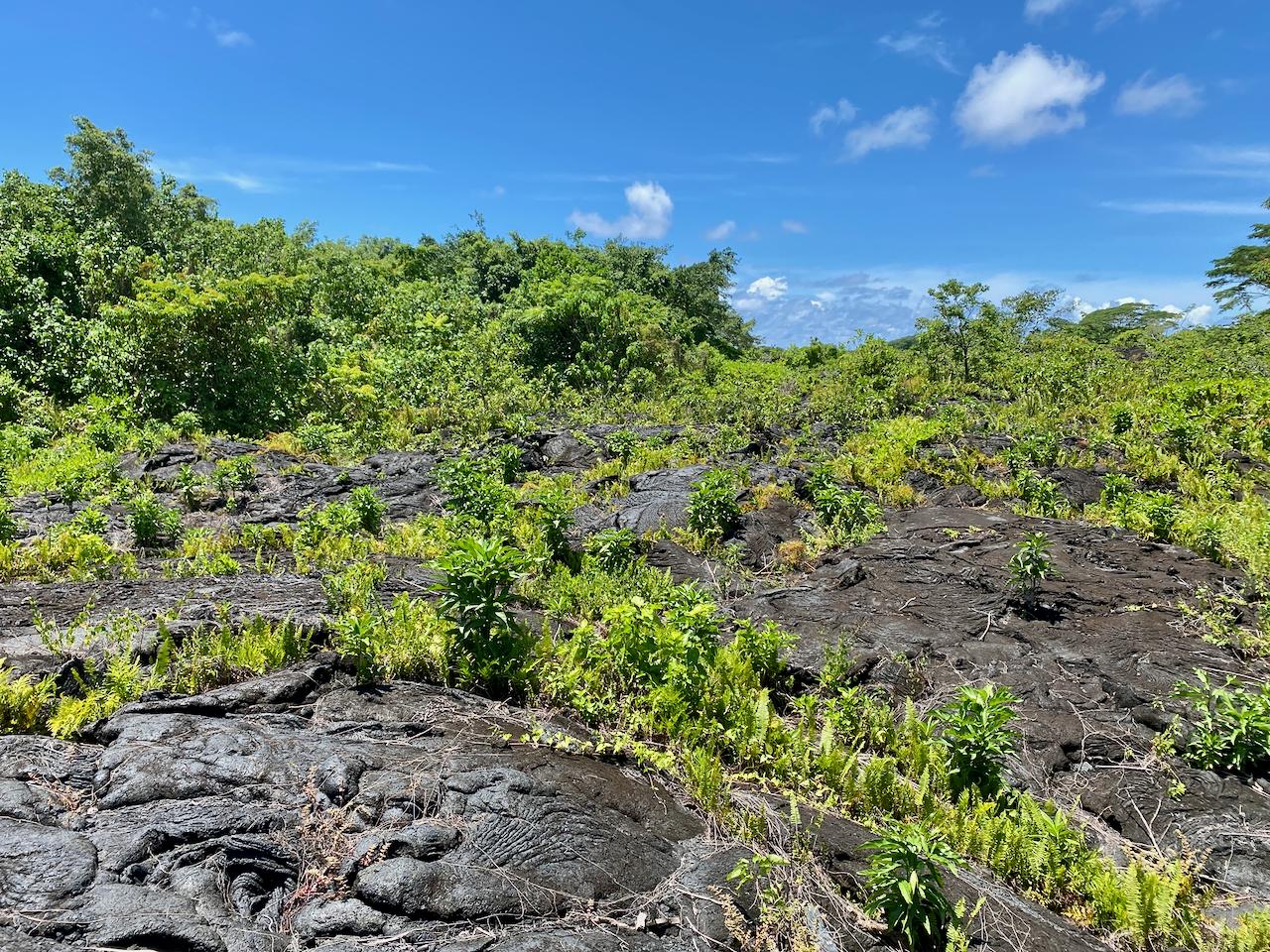
img_1155-2023-03-25-18-43.png

One of the buildings that was hit by the lava was the London Missionary Church, the remains still standing.
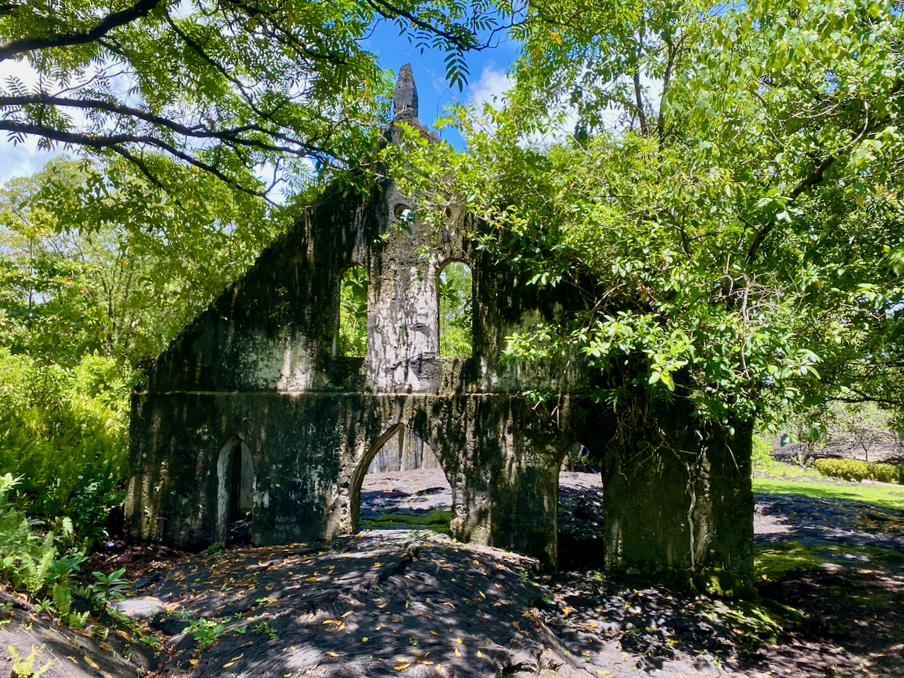
img_1154-2023-03-25-18-43.png

Some things didn’t succumb to the lava, like the Virgin’s Grave. Some say it belonged to a virgin daughter of a high chieftain, while others say it belonged to a virgin nun. In either case, the reasoning why the lava went around the grave instead of over was because the girl was so pure.
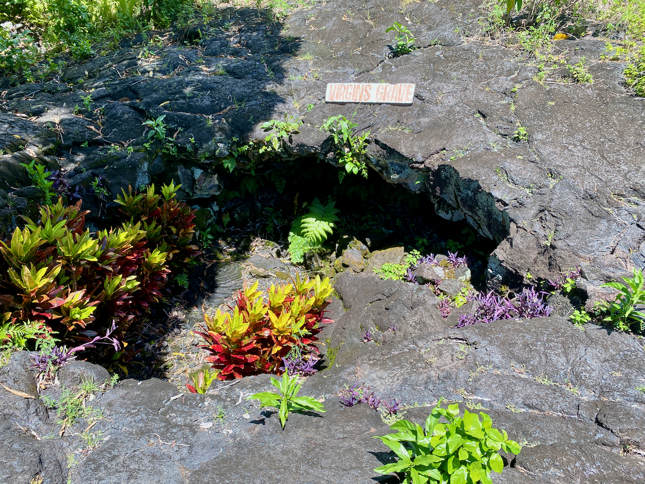
img_1156-2023-03-25-18-43.png

Safotu Congregational Christian Church of Samoa

This church, in the north western corner of Savai’i, is known for being the last church built from crushed coral. Coral was used to build many things in Samoa, from roads to buildings. Crushed to a fine sand, it was mixed with limestone to make a concrete. It’s been painted within the last few years to look almost new.
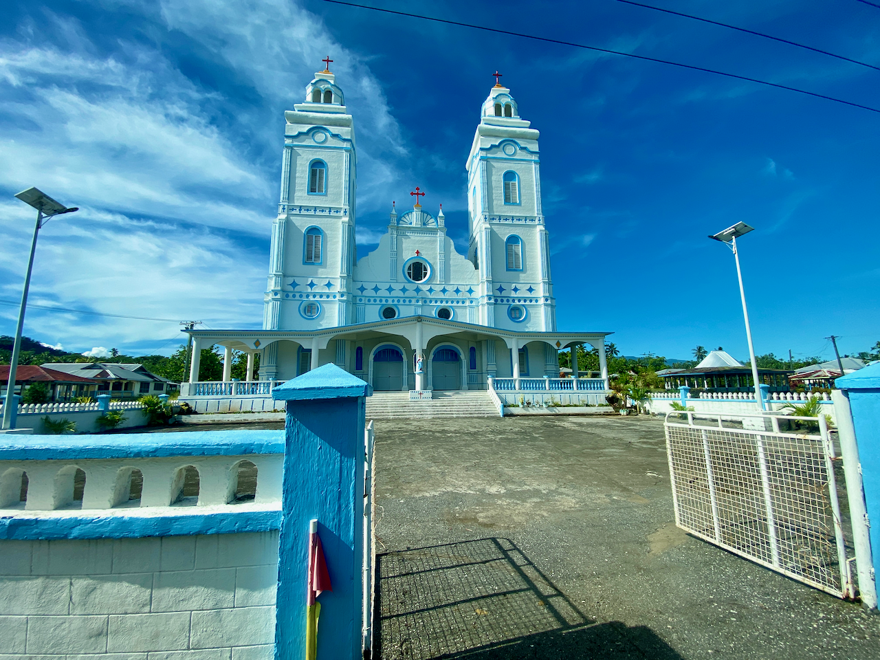
img_1159-2023-03-25-18-43.png

Flying Foxes

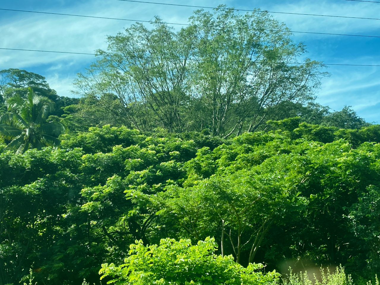
There is a species of flying fox in Samoa known as the Pe’a, which can also be found on Fiji and American Samoa. They are a hunted species, often eaten on special occasions by the locals.
img_1163-2023-03-25-18-43.png

Pe’a Pe’a Cave

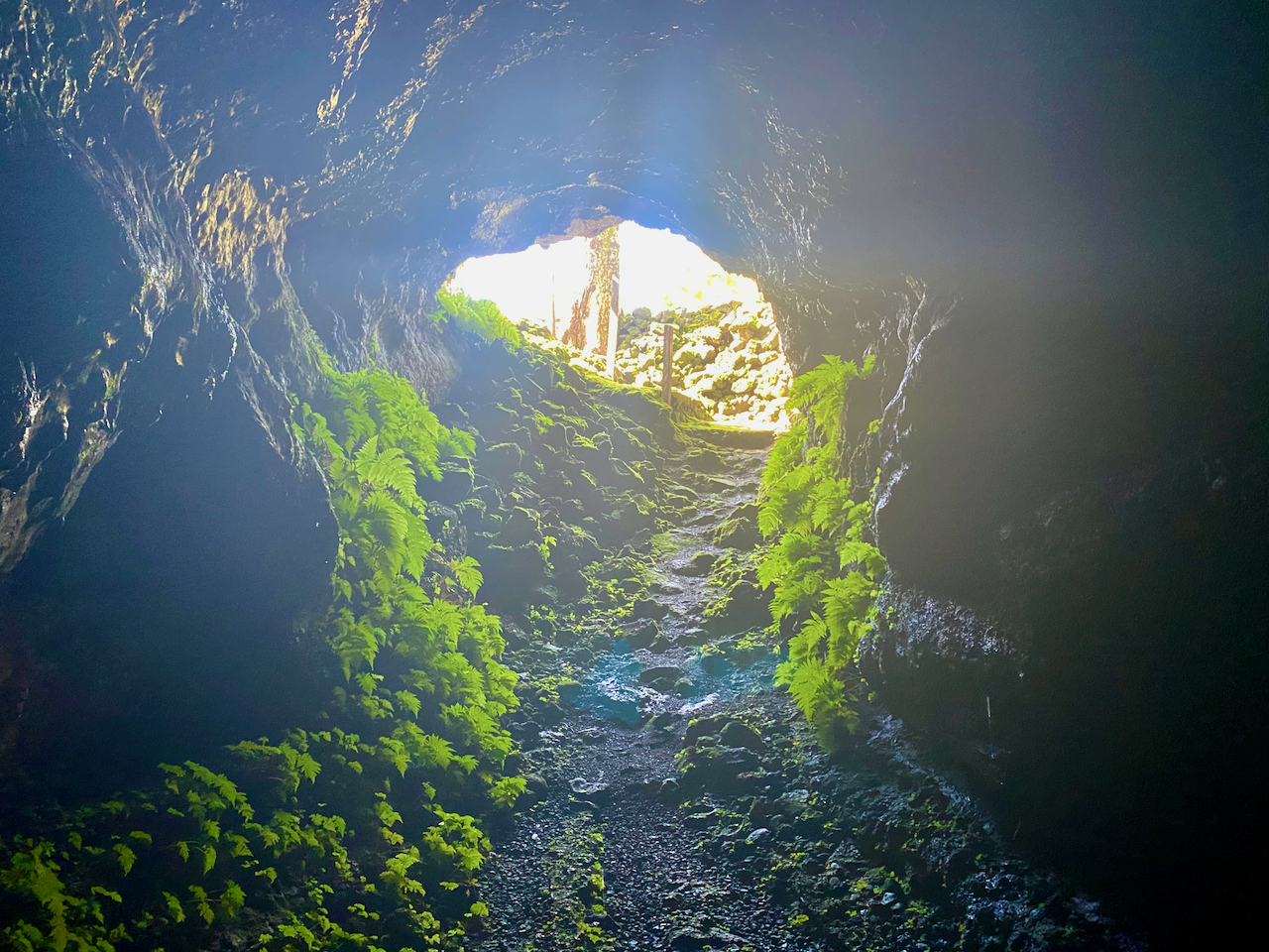
The cave is a lava tube from around the time of the First World War, when lava rushed through the area burning through whatever was here then hardening into a long tunnel. Steps lead down into the cave which then widens, running for 50m or so before the roof drops to low to walk under. I stopped there, but apparently the cave goes for a kilometre to the ocean, but can be too narrow to get through in places. The name of the cave is from the Pe’a Pe’a bird which nests in and around the cave. We saw one flying circles around the end of the cave.
img_1171-2023-03-25-18-43.png

Alofa’aga Blowholes

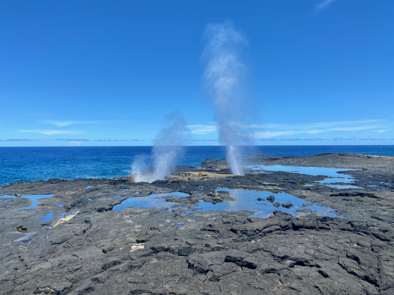
These are also known as the Taga Blowholes you must pass Taga villageto get to the blowholes and pay WST5 to use the land. Here, lava flows have created a series of tubes connecting a flat clifftop of lava rock with the ocean below. Waves breaking against the lower end of the lava tubes push water at high pressure up through the tubes, sending spray followed by fountains into the air every few seconds. There are many of these along this area near the ancient village of Fagaloa.
img_1179-2023-03-25-18-43.png

Afu Aau Waterfall

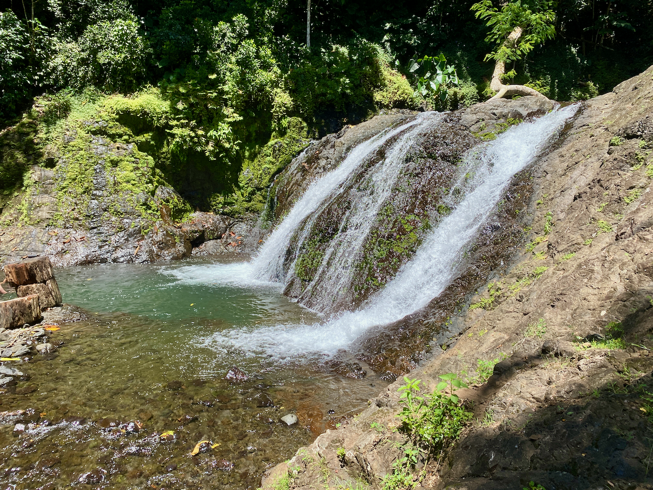
The waterfall was WST10 to go into as it is on Palauli land. There are three parts to the falls, the two minor falls along the track, and the main one at the end. There is a legend that a giant named Mafane lived near the Palauli village. Over time he turned into a mountain that erupted forming a crater for water. Twenty-five streams run from the crater – the 25 warriors of Mafane’s battalion – feeding 7 rivers, one of which runs down the Afu Aau waterfalls. The pool was large and two of us from the tour swam in it, climbing up the rocks behind the waterfall and jumping in the pool. Note, there are rocks in the pool, so it’s suggested to be careful when jumping. The pool was cool and crisp, great in the heat of the day, although the steps to get out were slippery. Some girls in the next fale from me went a few days after we did, and the waterfall wasn’t flowing. The could still swim in the pool though.

img_1201-2023-03-25-18-43.png

John Williams Memorial

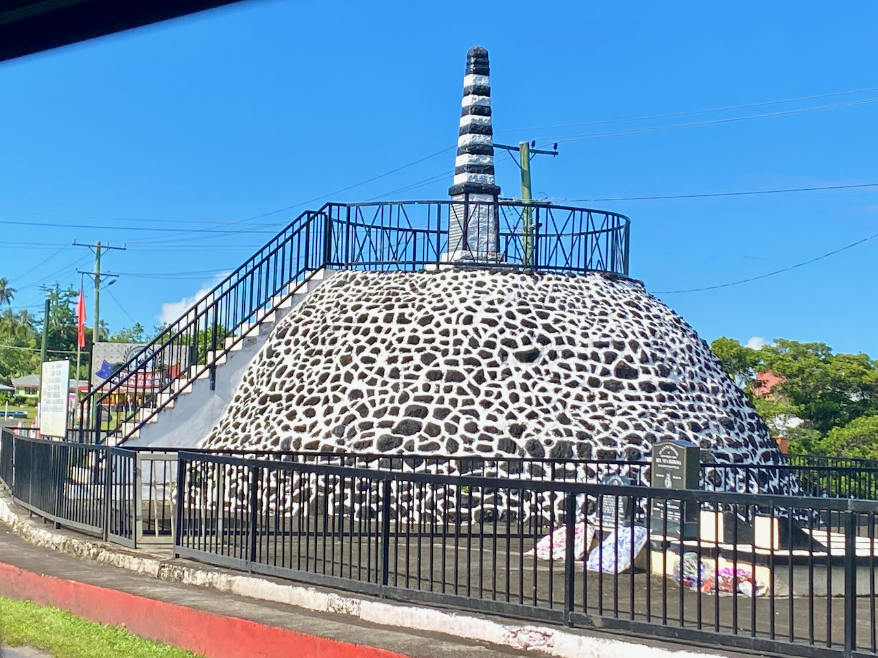
Samoa is a christian society with over 100 churches on the islands and strict holy day views with church services important. John Williams was a British missionary who visited many of the island chains throughout the Pacific bringing the word of christianity. The first was one of the islands of French Polynesia, before he moved on to the Cook Islands and many others. He arrived in Samoa in 1830 to meet with the then high chief who accepted christianity immediately. Then, with the aid of local translators he created the first bibles for the Pacific Islands. Unfortunately, on arriving in the New Hebrides, now known as Vanuatu, he was killed and eaten by cannibals. This monument was built in his honour and stands on the eastern shore of Savai’i.
img_1202-2023-03-25-18-43.png

Matautu Bay Snorkelling

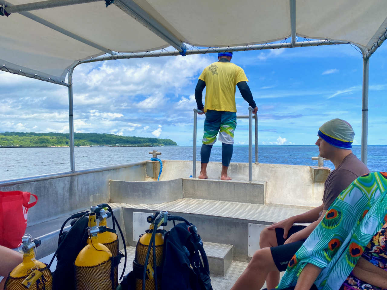
I’d brought my own snorkelling gear so I wanted to get in amongst the coral at some point on my Samoan explorations. I found the only Dive company on the island – Dive Savai’i Samoa – and booked a trip. Because of the small numbers, there were three separate groups on the boat, snorkelers, divers training for their accreditation and an accredited diver. Each of the three groups had a guide/instructor. They took us out to three separate locations around Matautu Bay. The one thing I was missing was an underwater camera, as mine had died in Rarotonga and new ones were quite expensive.
img_1206-2023-03-25-18-43.png

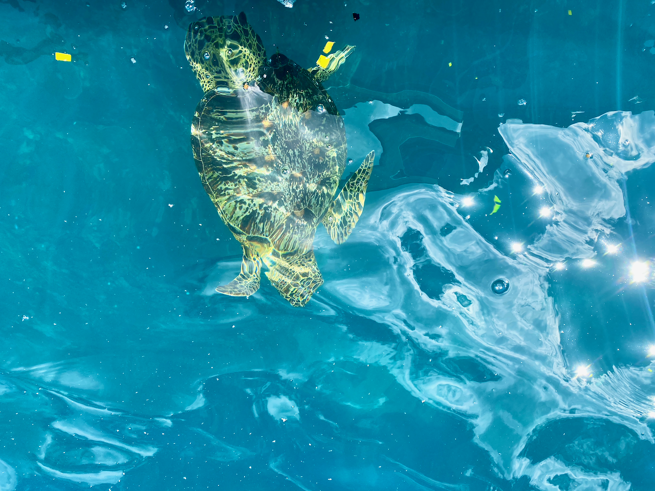
At our first stop, we swum behind the guide along the length of a coral reef with many fish, and to my surprise many turtles, some sleeping around the coral, others just out for an afternoon swim. The second spot was near an old ship wreak, the John Williams 5 apparently, but I was unable to find any information online about it. And while we were there, a turtle came to visit, eating little squares of Papaya skin we threw to it. Last stop was the coral garden, but we had to be careful, as some areas were quite shallow. Overall, a great day out on and in the water.
img_1211-2023-03-25-18-43.png

Cemetery of Distant Relatives

One of the main reasons to come to Savai’i was to track down our family’s burial ground so dad could continue his work crafting the family history. We were shown the family houses in the Manase village close to where we were staying, and found that the cemetery was up on the hill. Unfortunately, with dad’s health he’s unable to climb a hill in the heat, but I was able to talk to the woman who owns my fale and tell her our story. In true Samoan style, she was off next door to organise a 4 x 4 vehicle to take us up there. An hour later we were being driven up a crazy 4 x 4 track, bobbing madly back and forth as it went. Before long we came out at the cemetery where they were preparing a grave for a funeral at the end of our stay. There were only headstones there, but they dated back more than 100 years to Dad’s adopted father’s parents and kin. Later, I was come to learn that the owner of my fale is also a distant relative.

img_1219-2023-03-25-18-43.png

Impressions

Savai’i Island is less built up than Upolu Island and there is less there to do and see. But we still managed to fill out time and enjoyed the more relaxing week of our stay.

Then after the week, we were back to Apia on Upolu Island for a few more days.

The World Wanderer

Upolu Island, Samoa, Impressions

In March 2023, myself and 14 members of my extended family flew out to the Island of Upolu in Samoa for a family gathering and to bring the ashes of my grandfather home. We all set up our base in Apia, the capital of Samoa and the largest city on Upolu.

Upolu is the main island of the Samoa, previously known as Western Samoa to differentiate it from American Samoa which separated in 1899. While not the largest island of the chain, Upolu has the highest population.

Apia

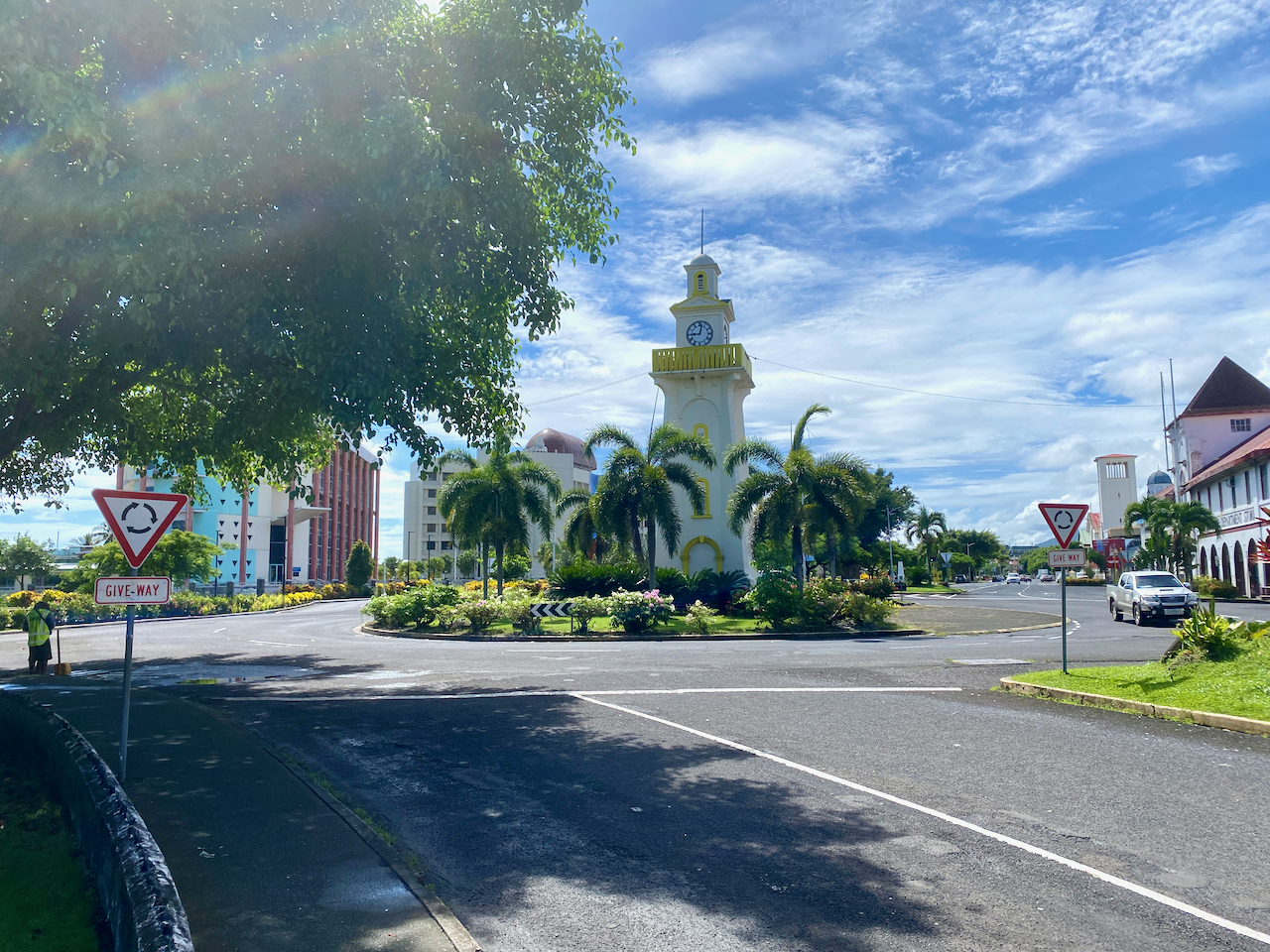
Apia is a mad mash of worlds. On one hand, there are wondrous resorts, restaurants and churches. On the other there are hovel markets, lines of shops, reminisant of south east Asia selling all manner of trinkets and knicknacks, sidewalk stalls, and so many taxis. Near the heart of the Apia is the clocktower.

img_1027-2023-03-16-13-09.png

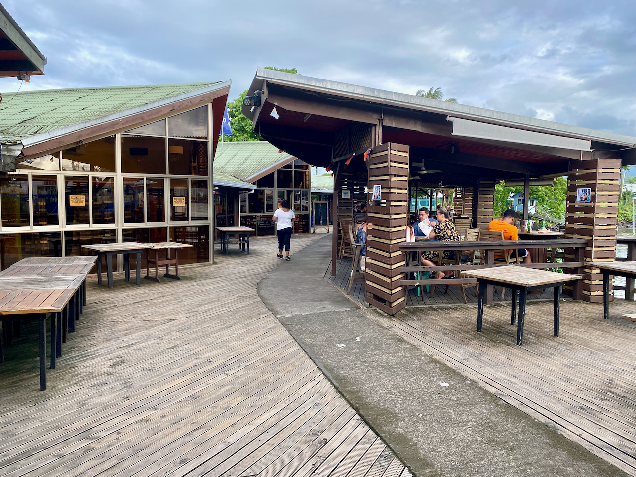
Around the bay from the resorts is the marina, with many ships and small boats docked. There’s also a more upmarket bar and restaurant area called The Edge and has views over the marina, the bay and Apia.

img_1042-2023-03-16-13-09.png

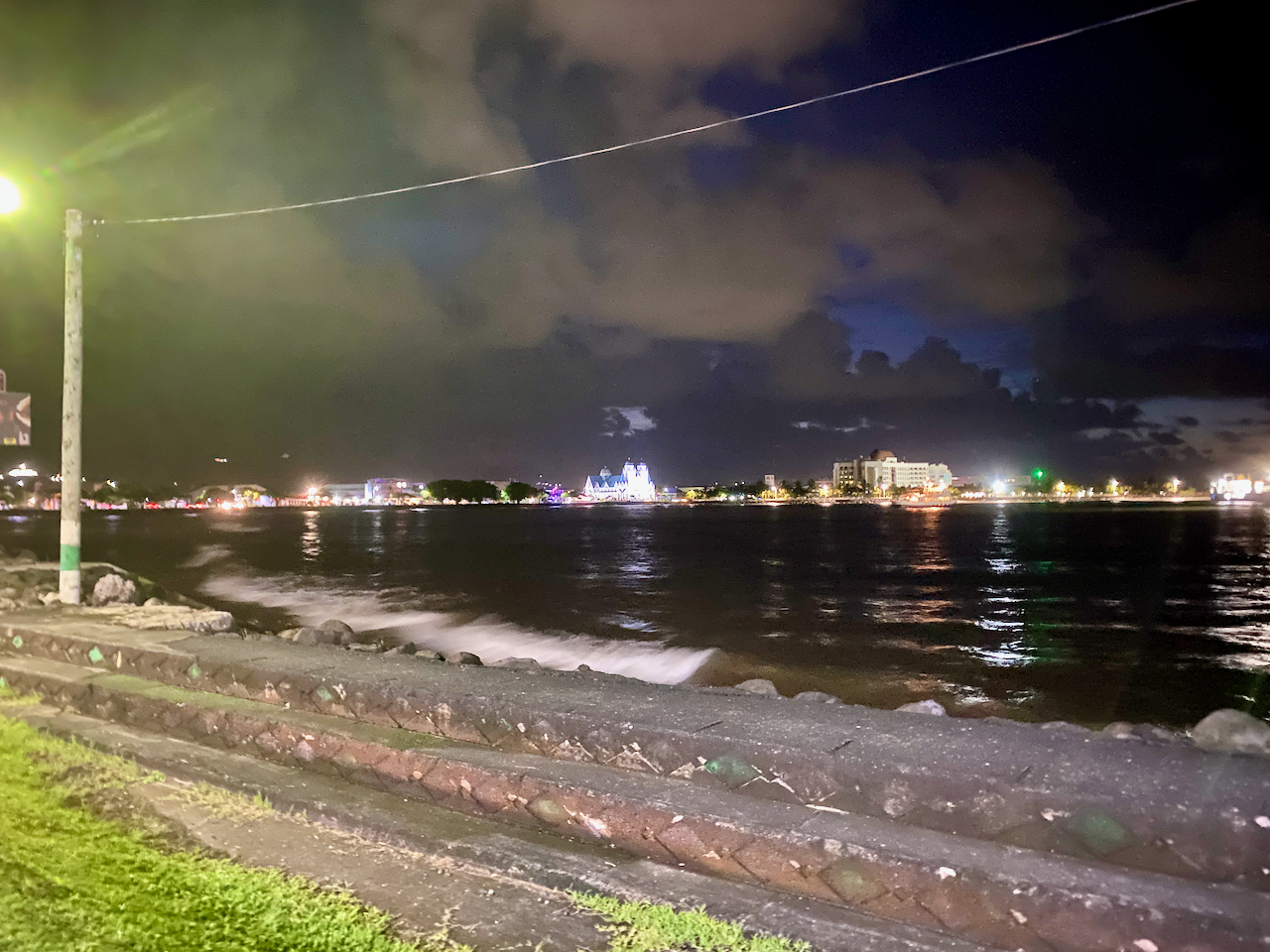
After a couple of choice cocktails during happy hour, we walked five minutes down the road to one of the best restuarants on the island, Paddles, stopping to admire the lights of Apia across the bay.

img_1048-2023-03-16-13-09.png

Garden Fale

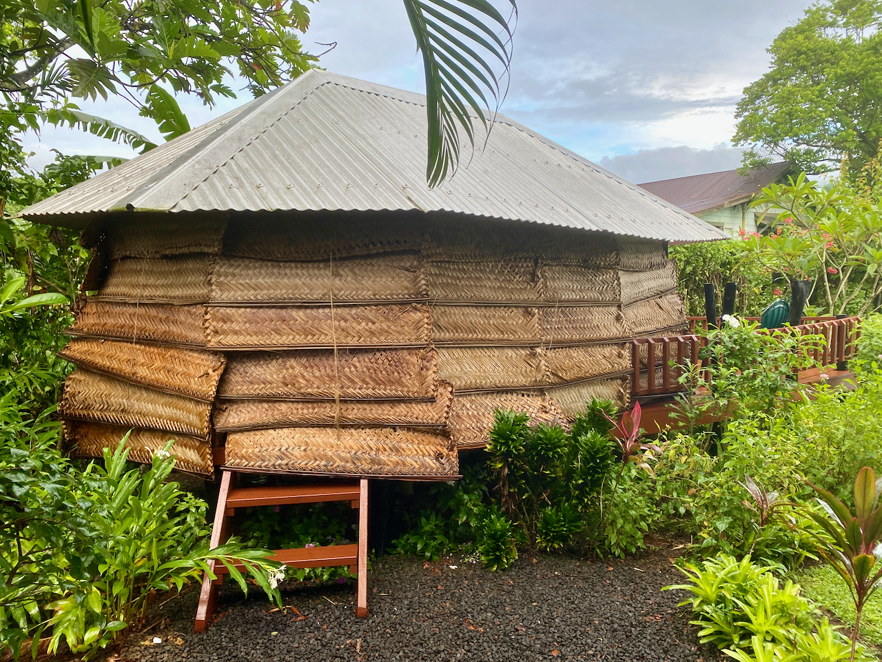
While the other 14 members of my extended family stayed at a large and somewhat expensive resort, I went for the more local style at another resort a couple of kilometres away. And instead of an air conditioned room with TV, bar fridge, toilet and shower etc, I chose a garden fale. The fale is literally just a room with a roof and woven shades on each side pulled down for privacy and protection from the elements. It’s hot inside, but by partially pulling up some of the shades, a draft can pass through. Inside there is just a pair of mattresses on the floor, mosquito netting on each, a lockable safety box, a light and a pair of power outlets. This was my first experience with a fale of the kind, but not my last. It was a fun and sweaty experience, that I enjoyed, although in this case I only stayed two nights instead of the nine I’d booked due to bed bugs.

img_1021-2023-03-16-13-09.png

Fiafia Night

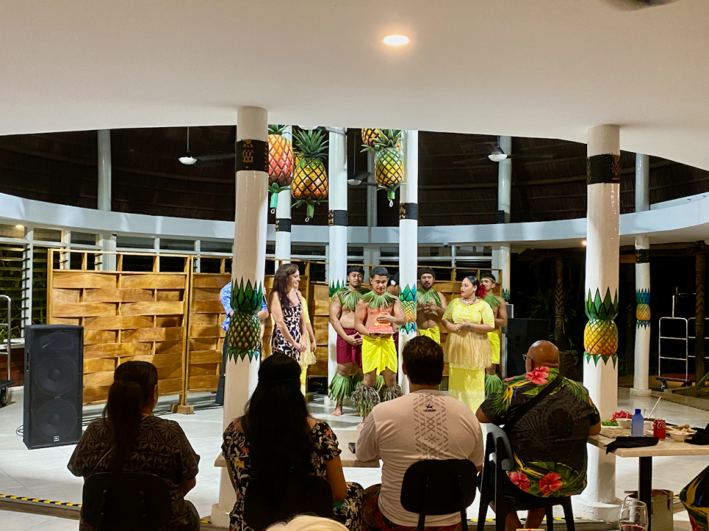
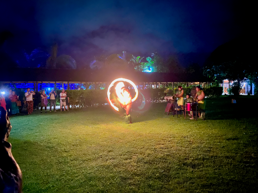
The resort where my extended family were staying hosts a Fiafia every Wednesday, so we decided to take part in this cultural event. There is much dancing and singing by our hosts, and a large buffet dinner with suckling pork on the menu. Someone even leaked to the crew that there was a birthday and they dragged my sister up to present her with a cake.

Then once the singing and dancing inside was done, we were herded outside for the fire show. An enjoyable experience.

Sua Ocean Trench

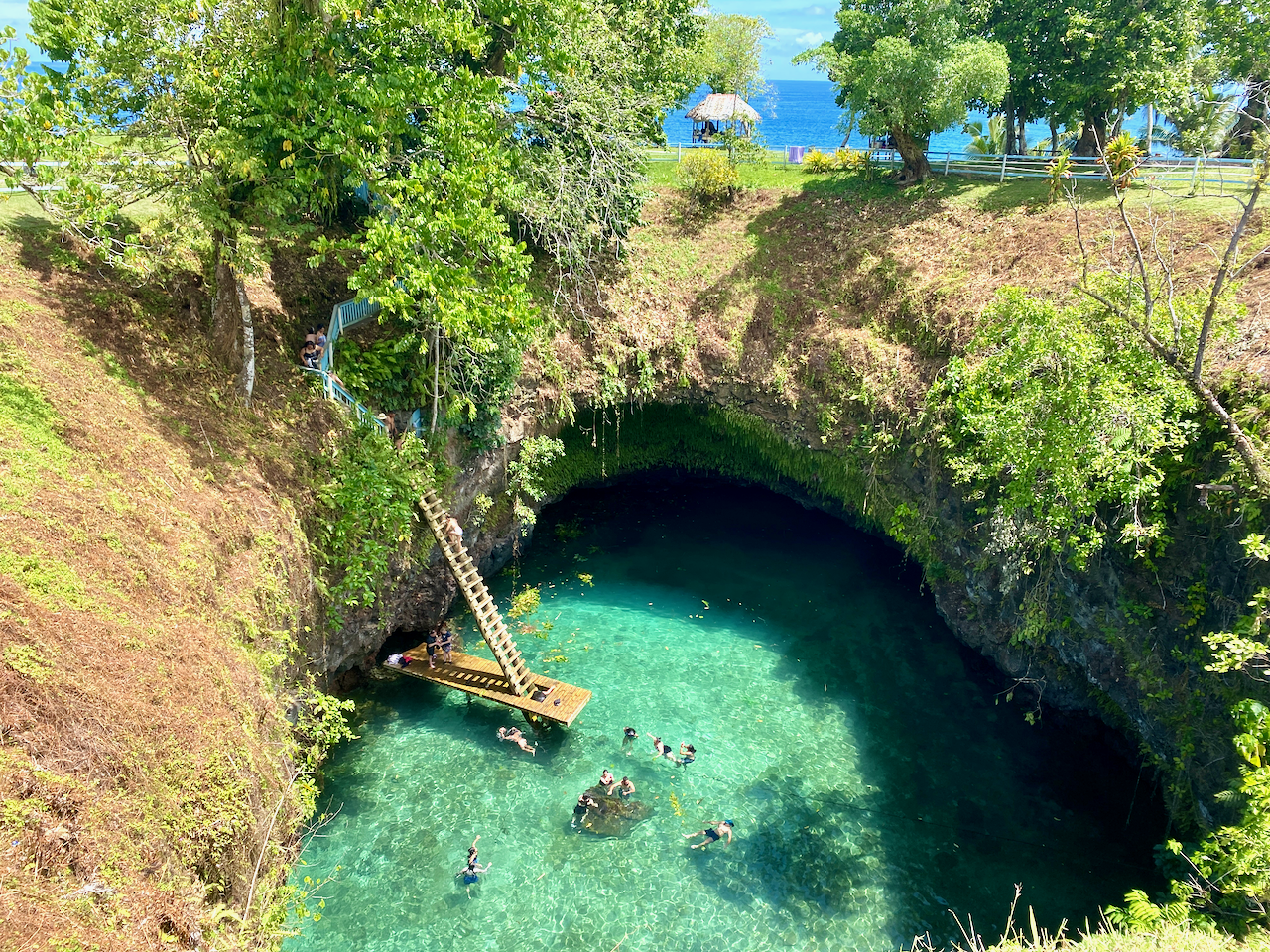
Fifteen people is a lot to transport around the island, especially if the only people mover we could rent was a 12 seater. We decided to split the group and five of us headed on a road trip across and around the island to the To-Sua, which in samoan means ‘giant swimming hole’. It has salt water flowing in from one side, and at high tide, you can climb down the crazy lader and swim in it. A great day out for the WST20 entry fee.

img_1064-2023-03-16-13-09.png

Waterfalls

On the way to and from the Sua Ocean Trench, we passed five waterfalls:

Papapapai Falls
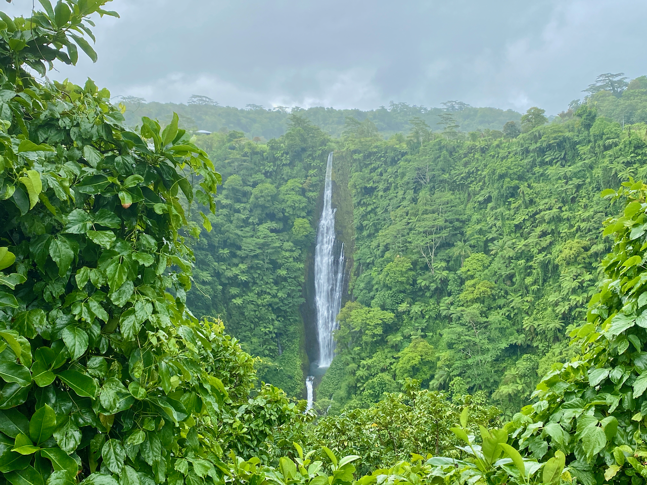
In the centre of Upolu are the tallest falls in Samoa dropping 100m into a volcanic crater. There is a carpark on the side of the road and a short 10m trail through the the grass to the best views . There was no charge for this waterfall.

img_1053-2023-03-16-13-09.png

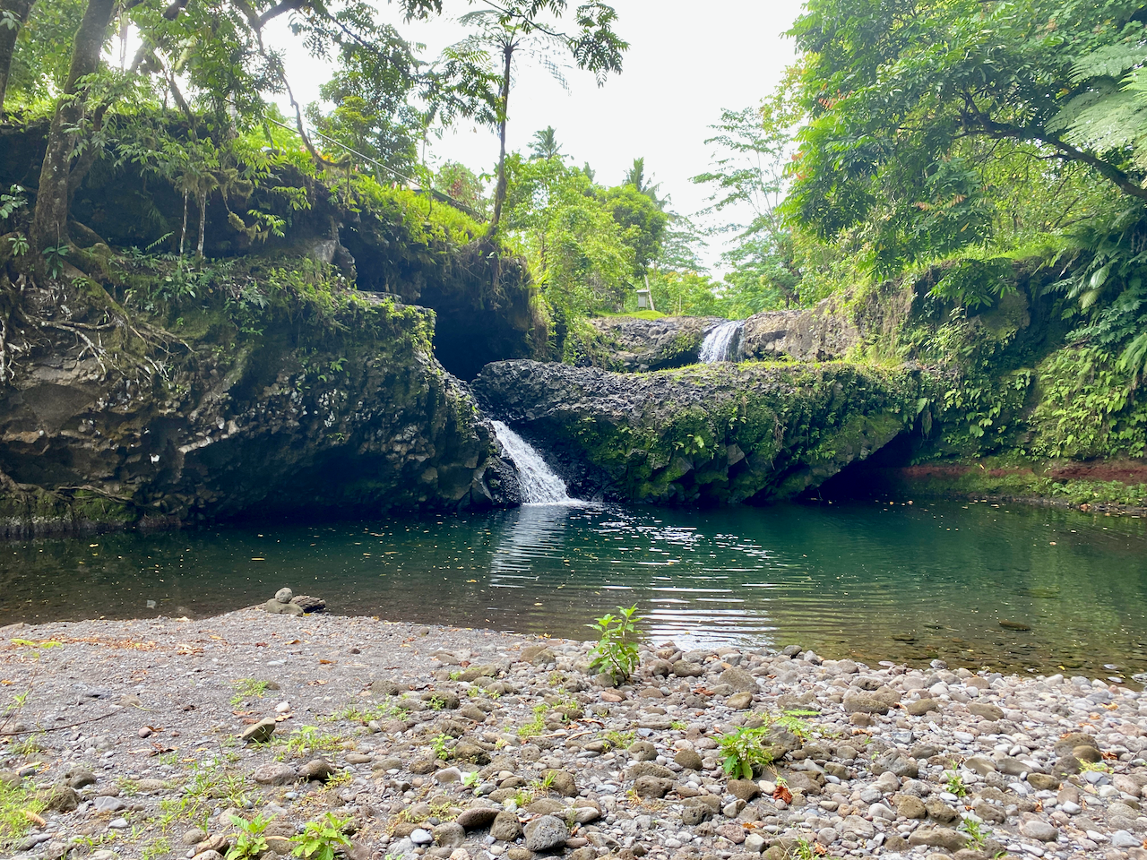
Togitogiga Waterfall
On the south side of Upolu is O le Pupu-Pue National Park, we followed a short road to a carpark. Then a short fairly flat 200m walk along a rocky track leads to a park with fales, a bbq, toilets and two pools, one above and one below the falls. The falls aren’t large, but gush down into the lower pool. It’s known to have been a place where great warriors of Samoa’s past swam. Four days later, we drove out to have another look with a different group, only to find that the falls were dry. How quickly things change. These falls are also free to visit.

img_1061-2023-03-16-13-09.png

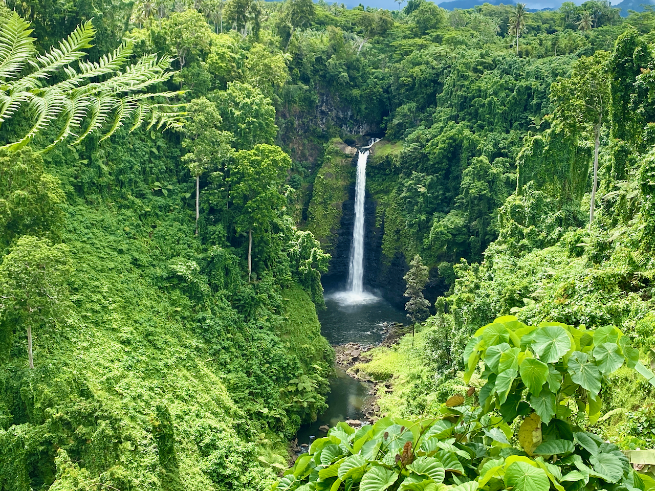
Sopoaga Falls
Near the Sua Ocean Trench, a well manicured garden surrounds a viewing platform looking across a river basin to the falls. Cost to enter this area is WST10, so only I checked it out, my family members deciding to sit this one out. While not as impressive as Papapapai Falls, the garden area is a place you could spend an hour chilling over a picnic lunch or similar. The river valley flowing away from the waterfall is also rather impressive, with great green walls disappearing into the distance.

img_1070-2023-03-16-13-09.png

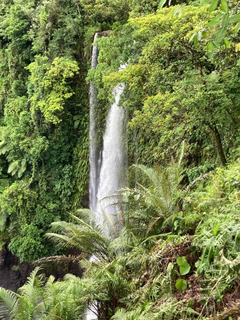
Fuipisia Falls
These 55m tall jungle falls are apparently spectacular, but at WST20 it was too rich for us to look at for a few minute viewing. This was however, the only waterfalls our other contingent stopped at, talking the land owner into dropping the price to WST10. Photo courtesy of them.

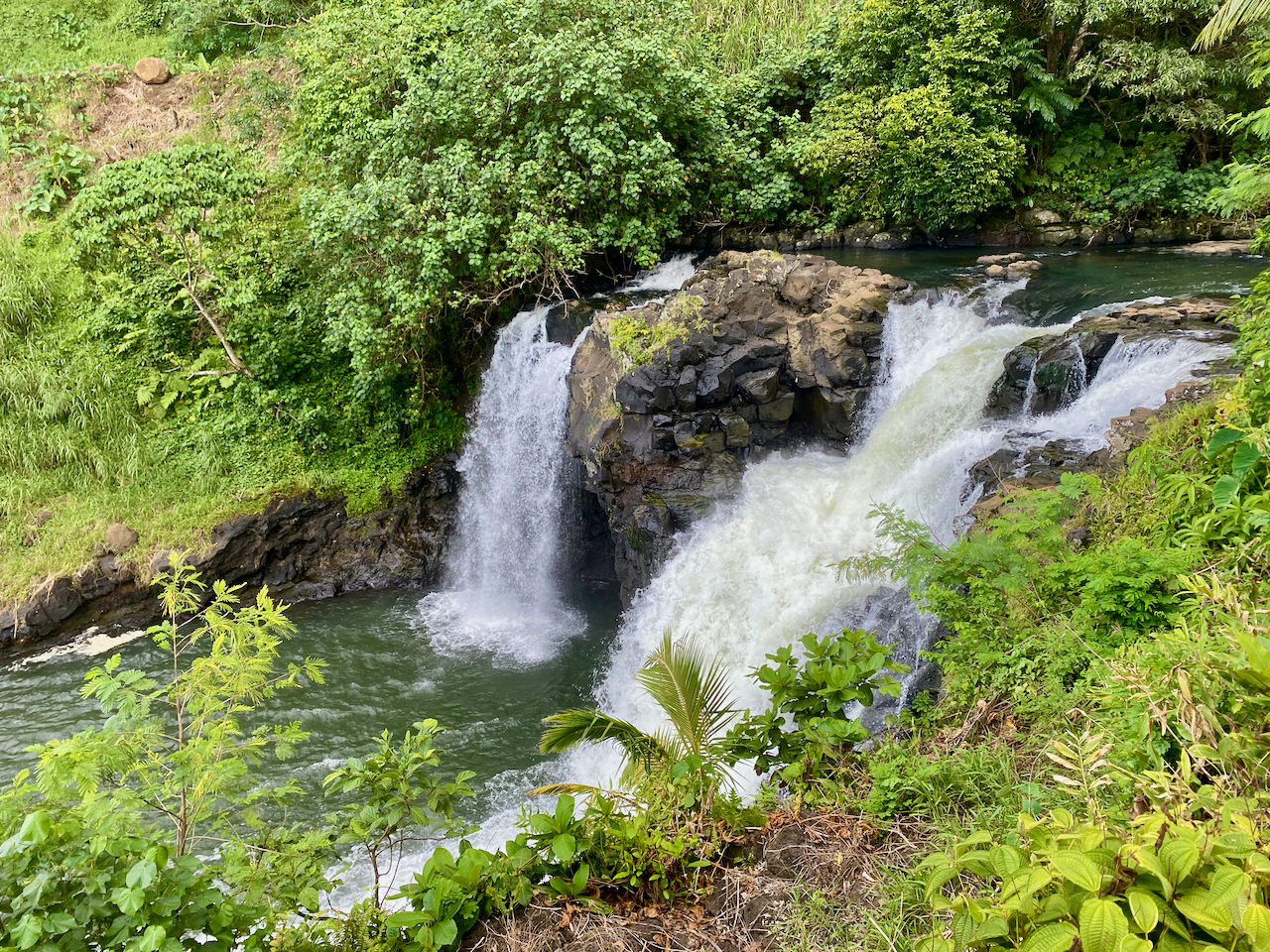
Falefa Falls
Near the north side of the island again, the final waterfall we visited was right by the road, and we stopped quickly to check it out. It’s only a short falls, with a river continuing to run out to sea, but apparently you can swim in it. We didn’t stop at the official garden entrance, but at the side looking down at it. But as we looked, a man came out of a fale 20m behind us and charged us WST5 to view it.

img_1084-2023-03-16-13-09.png

Parase’ea Sliding Rocks

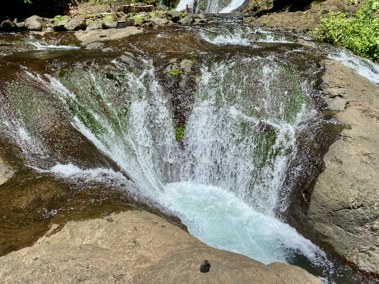
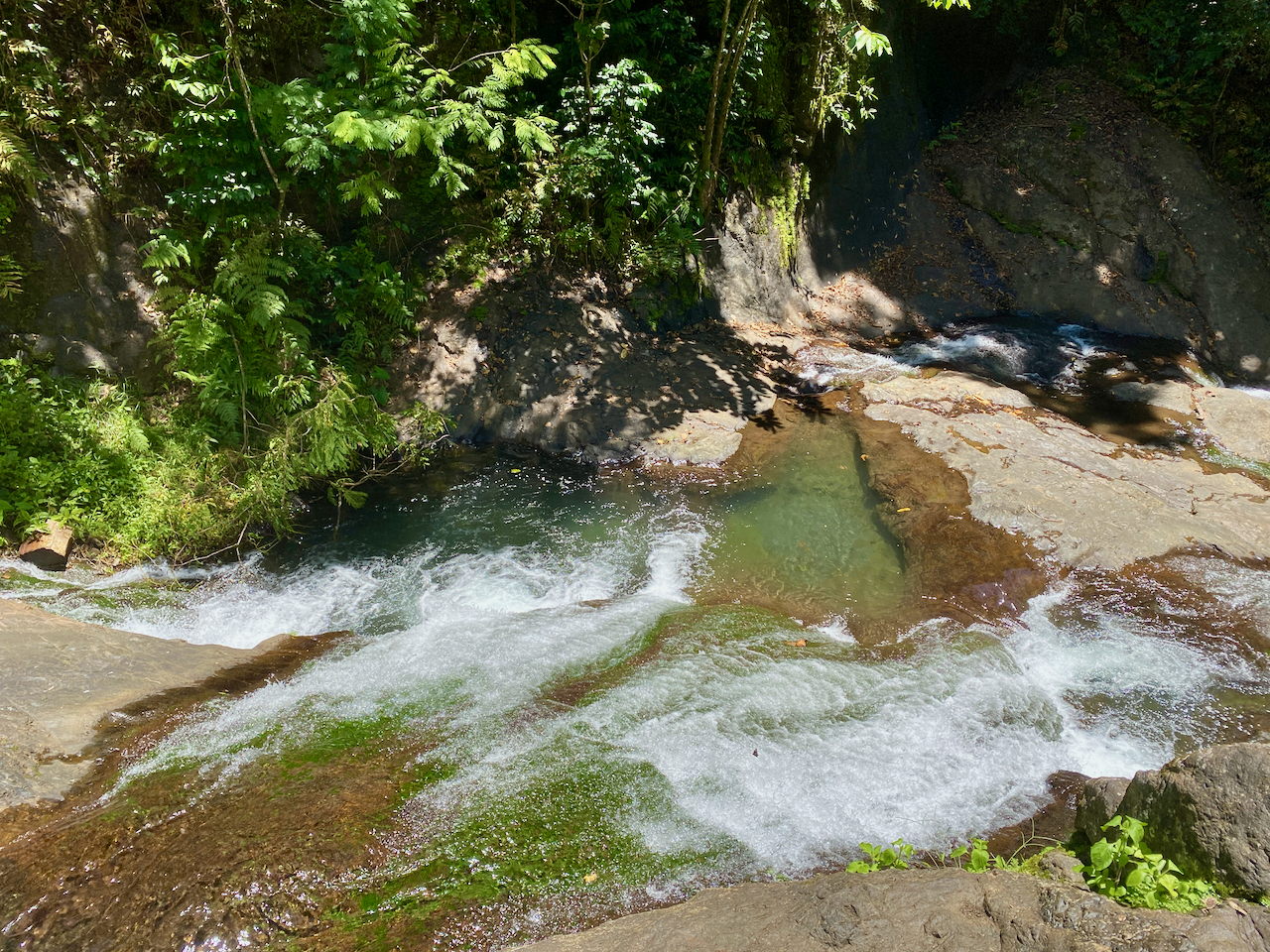
Not far out of Apia are the Parase’ea Sliding Rocks. It’s one of those redundant double names like East Timor, which in East Timorese is literally East East. Parase’ea means ‘sliding rocks’ in Samoan. There are a trio of small waterfalls, all with somewhat smooth rocks that can be slid down into a pool at the bottom. Entry fee is WST5 each.

The top falls were the shortest and easiest to slide down (photo not included). The second and main slide is more dramatic and when you come down the 100 or so steps to the sliding rocks it’s the first you come to. The far side is the correct side, due to there being a deep enough pool. It’s nerve-racking sitting at the top and pushing yourself over, but it ends quickly enough with a splash at the bottom.

img_1102-2023-03-16-13-09.png

The bottom one has two parts. I called the first part the devil’s throat as it reminded me of the Iguazu Falls in South America. Sliding down into the pool surrounded by water from three sides.

img_1104-2023-03-16-13-09.png

Then pushing up onto a lip and sliding down the next on the left side, gaining air at the end before dropping into a pool.

img_1105-2023-03-16-13-09.png

Then, once we were done, we climbed back to the carpark where there are great views down over Apia.

Robert Louis Stevenson Museum

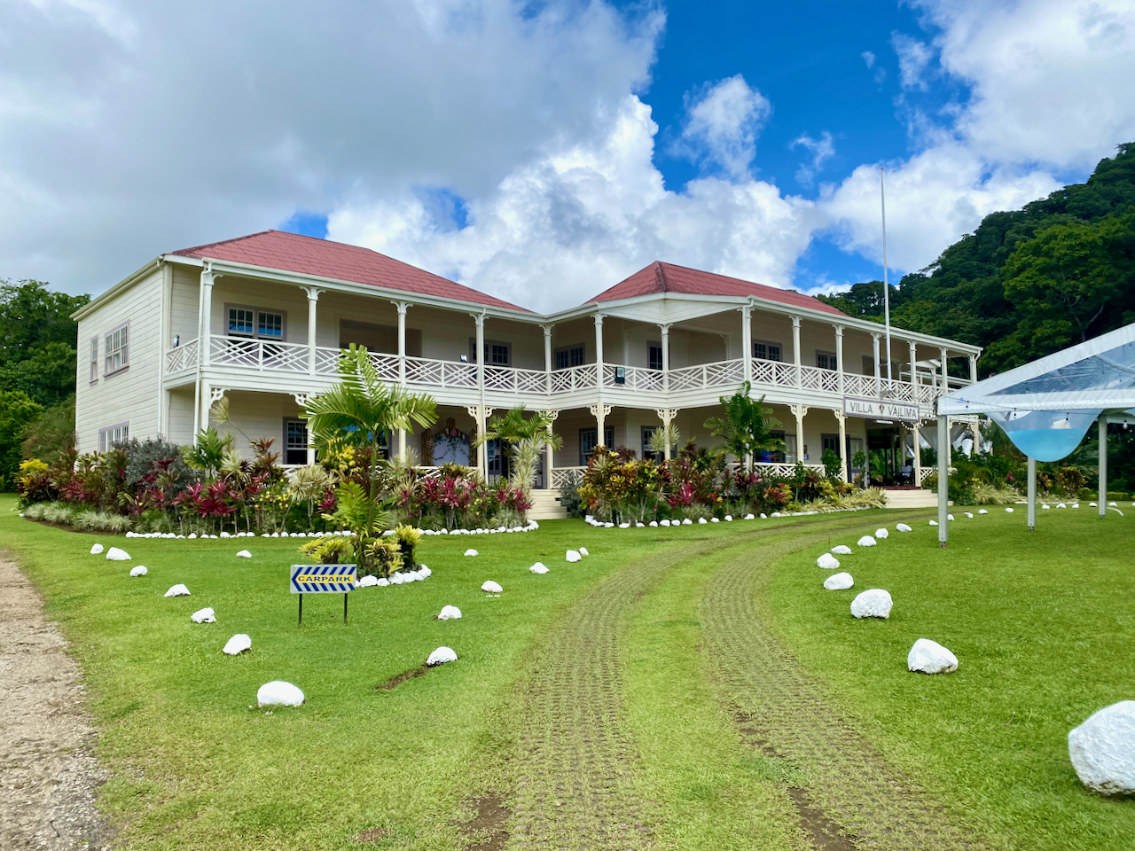
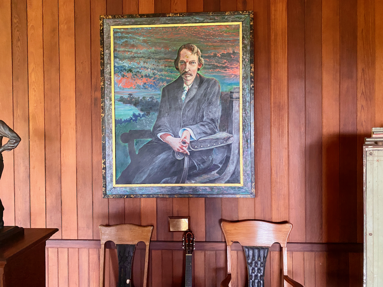
Robert Louis Stevenson was a British writer born in 1850 who wrote such classics as Treasure Island and Strange Case of Dr Jekyll and Mr Hyde. Suffering from health problems for most of his life, he decided to move to the Samoa in 1889 where the climate greatly helped his condition. In 1890 he purchased land and had a large 2-story house built, the first in the country. He would die here four years later, but not before becoming a beloved advocate of the Samoan people.

img_1224-2023-03-16-13-09.png

During the last days of my stay, I caught a taxi to his house, which has since been converted into a museum. I took the tour and heard tales of him, his wife, her 2 children from her previous marriage, and his mother.

img_1274-2023-03-16-13-09.png

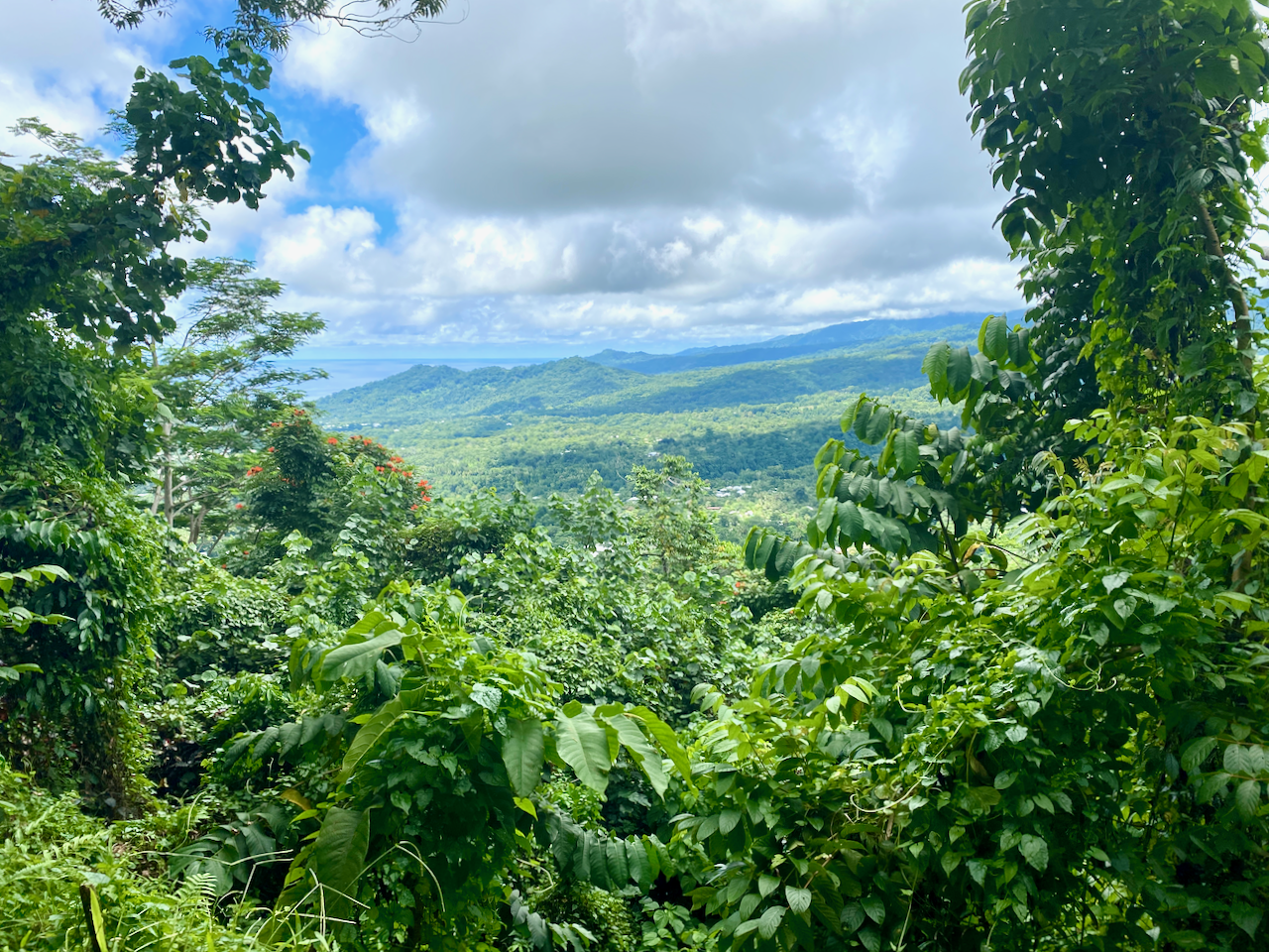
On his sudden death in 1893, Samoans stood a vigil over his body for the night, before clearing a way to the top of the hill nearby where they carried his body, and laid it to rest. After the tour, I set off up a trail to the top of that hill. There are two paths, the short steep one, and the long, not so steep one. I climbed the short one, and dripping heavily with sweat in the 32º heat, stopped several times to catch my breath and check out the view.

img_1279-2023-03-16-13-09.png

I finally reached the top where I found his resting place and a cool breeze.

img_1281-2023-03-16-13-09.png

There were excellent views back down to his house and the surrounding area. When I was done, I decided to take the longer route back down again, which was certainly a lot longer and less step, along with being fairly muddy.

img_1282-2023-03-16-13-09.png

Impressions

Upolu wasn’t what I was expecting, especially after my month in Rarotonga a year ago. The number of cars racing everywhere, dozens of taxis taking people back and forth for next to nothing, the mass of people in Apia, then the quieter areas all over the rest of the island. The sheer number of Fales and villages was all an experience, especially in the 32 degree heat. The people are generally friendly wherever you go and the atmosphere is very laid back. It was a good time to see a new country, and spend time with the extended family while we scattered the ashes in the sea outside where my grandfather grew up.

The World Wanderer

Mapping My Journey So Far

Sixteen months on the road is a long time. During that time I covered quite a distance and did many things. While I’ve been ‘resting’ in the United Kingdom, I’ve put together a step by step rundown of my trip including maps.

South East Australia

wpid-seaustralia-2014-05-8-14-57.jpg

In a van called the Pointy Brick I…

Antarctica, Chile and Argentina

wpid-southernsouthamerica-2014-05-8-14-57.jpg

From Brisbane, I flew to Auckland and spent 3 weeks with family before flying to South America where I…

Brazil, Bolivia, Peru and Ecuador

wpid-northernsouthamerica-2014-05-8-14-57.jpg

From Buenos Aires I…

Colombia, Central America and Mexico

wpid-centralamerica-2014-05-8-14-57.jpg

From Ecuador I…

The Full Map. May take some time to load.

wpid-ajtravelmap3-2014-05-8-14-57.jpg

The World Wanderer

Looking Back, Central America

While it took ten months to work my way up the massive continent of South America, three months seemed only a short time to explore the Central America sub-continent even though it’s barely larger than Colombia. But since I was in the neighbourhood…

wpid-04838a73ba16566078c9dbd7f4f662c1-2014-03-25-19-32.jpg

Panama

San Blas Islands

With no straightforward bus route from Colombia to Panama, I chose a five-day cruise through the San Blas Islands, finishing in Panama City. The San Blas Islands are a glorious chain of islands in the Caribbean Sea, but make sure you do your research as the cruises aren’t always up to standard.

wpid-dscf3016-2014-03-25-19-32.jpg

Panama City

After so long in South America Panama City feels a little like home with its massive skyscrapers, malls, cinemas and fast food chains. When travelling long-term you lose the sense of time and on arrival in Panama days before Christmas I forget that it was prime holiday season for the locals. With most of the holiday destinations booked solid and long lines to get on any buses, I decided to spend the holidays hanging around the city. While there I visited the colonial old quarter of Casco Viejo, the canal and the ruins of Panama Viejo.

wpid-dscf3062-2014-03-25-19-32.jpg

Being in Panama City feels like being in the United States. There are so many Americans and I rarely needed to use my spanish skills as most people spoke english.

wpid-p1000006-2014-03-25-19-32.jpg

Bocas del Toro

After the holiday break I headed west to Bocas del Toro, an archipelago on the border of Costa Rica. In the surf/party town I took the opportunity to spend a day on a catamaran snorkelling around the reefs and another sitting in a hammock at the hostel.

wpid-p1000110-2014-03-25-19-32.jpg

Boquete

Then taking a chicken bus, I spent three days in the cooler climes of the mountain town of Boquete. While there I climbed the tallest mountain in the country – Volcán Barú. The views were wonderful from the top, but starting the 26km hike at midnight is difficult. So to recover I spent time in some natural hot springs just outside of town.

wpid-img_1631-2014-03-25-19-32.jpg

Costa Rica

San José

Costa Rica has a reputation for being the most expensive country in Central America. From the capital, San José, I took a tour to the top of a volcano before boating along a river to see monkeys, a sloth, caimans, crocodiles and many different types of birds. It was during this tour that Iguana was served for lunch.

wpid-dscf3195-2014-03-25-19-32.jpg

Liberia

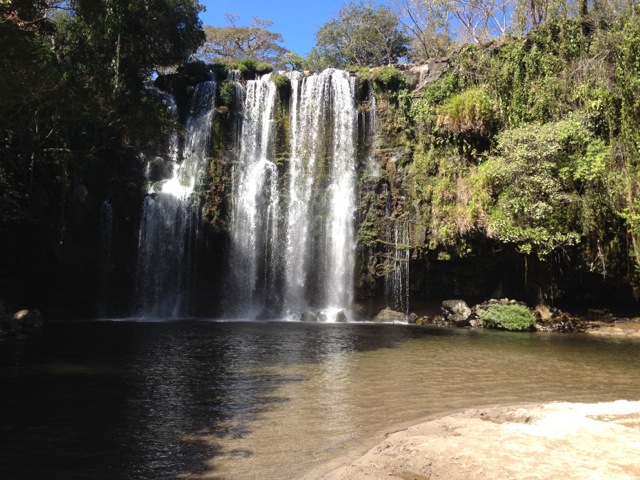
Next I headed north to the city of Liberia from where I visited the beach town of Playa del Coco and a set of waterfalls.

wpid-img_1661-2014-03-25-19-32.jpg

Nicaragua

San Juan del Sur

My first stop in Nicaragua was the surf town of San Juan del Sur. A beautiful place to spend a couple of days with bars and beach-front restaurants aplenty. The town even has a statue of Christ atop a hill at the end of the beach.

wpid-dscf3226-2014-03-25-19-32.jpg

Isla Ometepe

No trip to Nicaragua is complete without catching the ferry across Lake Nicaragua to Ometepe Island with its pair of volcanos. Cruising around the volcanos on a scooter is a lot of fun, visiting beaches, cafés and thermal pools. Both volcanos are climbable and a group of us scaled the largest of the two.

wpid-img_1677-2014-03-25-19-32.jpg

Granada

Next, I was on a bus to the touristic city of Granada at the northern end of the lake for some amazing food and a visit to yet another volcano, this one spewing smoke from the crater within its crater.

wpid-dscf3308-2014-03-25-19-32.jpg

León

Then a quick stop off on the city of Léon to go hurtling down the side of an active volcano on a volcano board.

wpid-dscf3378-2014-03-25-19-32.jpg

Honduras and El Salvador

With limited time, I set foot only briefly in both countries, mainly at customs on the borders. San Salvador, the capital of El Salvador seemed nice though for the thirty minutes we stopped there for lunch.

Guatemala

Antigua

Most travellers in Central America rave about Guatemala.  I arrived into Antigua to find another touristic city at the base of another volcano. Unlike other parts of Central America, Antigua has a lot of colonial architecture, although after numerous earthquakes over the centuries, many are in ruins.

wpid-dscf3448-2014-03-25-19-32.jpg

San Pedro la Laguna

I enjoyed a couple of days in San Pedro la Laguna on Lago Antitla with its thin streets, crazy Tuk Tuk drivers, great small restaurants and amazing lake views.

wpid-dscf3471-2014-03-25-19-32.jpg

Flores and Tikal

Then after a brief visit back in Antigua, I caught a bus to the north of the country to the island of Flores on Lago de Petén Itzá.

wpid-dscf3654-2014-03-25-19-32.jpg

Flores is a tourist destination and gateway to the great Maya ruins of Tikal, where I spent several hours exploring.

wpid-dscf3560-2014-03-25-19-32.jpg

Belize

Caye Caulker

Then on the one year anniversary of my time in Latin America I arrived in Belize, an english speaking country. Staying on the party island of Caye Caulker, I spent some time in the pristine waters snorkelling with Nurse sharks and Eagle Rays, some larger than I am.

wpid-dscf3752-2014-03-25-19-32.jpg

Mexico

While Mexico is actually in North America I included the southern portions as part of my Central American adventure. From Caye Caulker, I caught a ferry to Chetumal in Mexico and stopped for the night before heading on.

Palenque and Yaxchilán

After an eight-hour bus ride I arrived at the city of Palenque to continue The Maya Ruins Trail I began at Tikal. My first stop was the peaceful ruins of Yaxchilán and its connected site of Bonampak on the Guatemalan Border.

wpid-dscf3863-2014-03-25-19-32.jpg

Next it was to the Palenque ruins only twenty minutes out of the city.

wpid-dscf3977-2014-03-25-19-32.jpg

Merida and Uxmal

Four hours north in the Yucatán is Merida, a large and popular touristic city and the nearby ruins of Uxmal and one of its satellite cities, Kabah.

wpid-dscf4011-2014-03-25-19-32.jpg

Valladolid and Chichén Itzá

Then it was across to the city of Valladolid to see Mexico’s most visited archaeological site, Chichén Itzá, seen by more people every year than Peru’s Macchu Pichu.

wpid-dscf4176-2014-03-25-19-32.jpg

Tulum

Then it was back to the Caribbean Coastline to the town of Tulum and the Maya fortress of the same name.

wpid-dscf4233-2014-03-25-19-32.jpg

Cancún and Playa del Carmen

The final distinction in my thirteen month trip through Latin America, Cancún, where I did little more than prepare for my exit from Latin America, but managed a quick visit to the beaches at Playa del Carmen.

wpid-dscf4270-2014-03-25-19-32.jpg

Next, is a well deserved rest from travelling for six months to save and plan a year through Asia.

Adios America Latina,

The World Wanderer.

Cancún and Playa del Carmen, Mexico – Impressions

The ultra touristy Cancún at the tip of the Yucatán Peninsula is the final destination of my three-month whirlwind tour of Central America and southern Mexico.

wpid-487303-mp0404twoweeks-2014-03-19-23-30.jpg

Cancun’s main tourist area is Isla Cancún and was created in the mid 1970s by the Mexican government. The island is actually part of the second largest barrier reef in the world, stretching 1000km from the tip of the peninsula along the entire length of Belize to Honduras. Cancún is renown for being one of Mexico’s two most famous resort cities, the other being Acapulco on the Pacific Coast.

wpid-800px-cancun001-2014-03-19-23-30.jpg

As Cancún was my final destination, I didn’t spend a lot of time exploring the city, instead preparing for my imminent departure. But I did take a day out to travel an hour along the coast to the popular tourist beach, Playa del Carmen.

wpid-dscf4270-2014-03-19-23-30.jpg

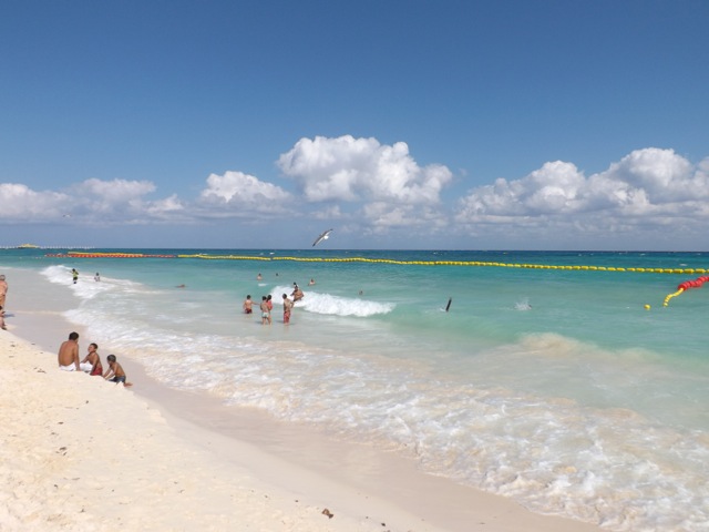
It’s easy to see why the beach town is so popular, the golden sandy beaches and clear blue waters are beautiful. And while the beachfront restaurants and resorts are numerous, they’re not as all-encompassing as those in Tulum, and hour further south.

wpid-dscf4267-2014-03-19-23-30.jpg

It’s been a long adventure through Latin America these past thirteen months but I’m ready for a well-earned rest. While the constant traveling has been both amazing and stressful at the same time, I’ll miss the diverse cultures and the beautiful places I’ve visited, not to mention the challenges of constant change that travel evokes. I do look forward to six months of stability before beginning my next set of travels.

For those few who’ve been following my travels, I hope you’ve enjoyed my posts and photos as much as I’ve enjoyed providing them.

Until my next trip,

The World Wanderer.

Tulum, Mexico – Impressions

Just a short handful of years ago Tulum Pueblo was a quiet little town near the ancient cliff top Maya fortress of Tulum. Few visitors came to the town itself, most busing in directly to the ruins from Playa del Carmen, an hour to the north, or Cancún, a further thirty minutes beyond that.

wpid-487303-mp0404twoweeks-2014-03-17-18-08.jpg

Over the past few years that quiet little town has begun to grow as a tourist destination with restaurants and resorts growing along the waterfront. The Caribbean coastline is beautiful to behold with its golden sands and clear waters.

wpid-dscf4260-2014-03-17-18-08.jpg

Unfortunately because of the growing number of resorts, which charge you to get access to the beach, finding a long stretch of beach to enjoy is difficult if you don’t have your own vehicle. And while bicycles are rentable everywhere in the town it’s still a long ride to a good beach.

wpid-dscf4195-2014-03-17-18-08.jpg

With the growing popularity of the area, the food and accommodation is of high quality and makes it worth staying a night or two. The area also has plentiful cenotes, with several hidden and smaller ones near the beach.

wpid-dscf4257-2014-03-17-18-08.jpg

But beyond the beach, the cenotes and the town, the ruins are the number one attraction in the area. The fortress was once called Zama meaning ‘City of Dawn’ as it faces the sunrise on the Caribbean Sea. It has since been renamed Tulum meaning ‘wall’ in the language of the Maya because of the great wall around the fortress city.

wpid-dscf4201-2014-03-17-18-08.jpg

Tulum was one of the last Maya cities built and unlike many in the region, it’s very compact and small. A tour of the complex will take only an hour if you dawdle. And because it’s the third most visited historical site in Mexico, after Chichén Itzá and Teotohuacan, the site is often swarming with tourists.

wpid-dscf4224-2014-03-17-18-08.jpg

There is access to the sea from the ruins and many tourists come to swim in the pristine waters beneath the 12 metre cliffs on which the ruins are situated.

wpid-dscf4226-2014-03-17-18-08.jpg

Templo del Dios Viendo – Temple of the Wind God.

wpid-dscf4233-2014-03-17-18-08.jpg

Next I travel north to Cancún, my final destination in Latin America.

The World Wanderer.

Caye Caulker, Belize – Impressions

Belize is a small country on the edge of the Yucatan peninsula. Unlike the countries that surround it, where they speak spanish, Belize’s primary language is english. After a year in spanish speaking countries where I couldn’t fully understand the everyday conversations around me, on arriving in an english speaking country it was a little overwhelming. It was like suddenly being able to read the thoughts of everyone around you.

As I’m nearing the end of my Latin American journey, I’ve chosen to spend only three days in Belize and all of that time on the island of Caye Caulker. Thirty kilometres from Belize City by water taxi, Caye Caulker was made popular by hippies travelling through the area in the 1970s. Since then the tourism industry along the coast has blossomed.

wpid-cayecaulker-2014-02-24-15-07.jpg

On first impressions, arriving in Caye Caulker feels like arriving in Jamaica. There’s a strong reggae groove, plenty of locals with dreadlocks wearing rastafarian style clothing and that familiar accent: ‘yeh mon,’ and ‘want some gunga mon.’

One end of the eight kilometre long island is criss-crossed with white sand roads while the other is still claimed by mangroves. There is an estimated 40 hotels, hostels and boarding houses on the island, with fresh fish on the menu of the many waterfront restaurants.

wpid-dscf3709-2014-02-24-15-07.jpg

One of the more popular activities in the region is diving with divers hoping to swim in the infamous Great Blue Hole, an underwater sinkhole 300 metres across and 124 metres deep.

wpid-great-blue-hole-belize-13625-2014-02-24-15-07.jpg

But as I don’t dive, I chose to snorkel along the Great Barrier Reef and in Shark Alley. So, booking a tour, I set out with a group of fellow snorkelers for a day in the sun on a boat. And what a day it was… We began in Hol Chan marine reserve where the fish knew our arrival meant feeding time. Schools of large fish swum around the boat as our guide took us on a swim around the reef, spying a lone barracuda, sea turtles and even managing to lure a Moray Eel out from its hole in the rocks.

wpid-p1000167-2014-02-24-15-07.jpg

Along shark alley the Nurse sharks came looking for food. There were probably a dozen of them, some more than three metres long. We were able to ‘pet’ one of them although their scales felt hard to the touch. Then came the Eagle Rays, allowing us to write our names upon their back.

A german girl in a bikini, I mean, a friendly three metre Nurse shark swimming past.

wpid-p1000207-2014-02-24-15-07.jpg

Back on the island, there are several ways to get around. Most people hire cycles and ride around the unsealed, potholed sandy roads but I chose to hire a golf cart, the only powered land vehicle on the island.

wpid-dscf3762-2014-02-24-15-07.jpg

With my ‘wheels’, I toured the quieter end of the island where there were only a few secluded homes and hotels among the plentiful mangroves.

wpid-dscf3752-2014-02-24-15-07.jpg

Overall, Caye Caulker is a great place to spend a few days if you like water activities, seafood, partying or just hanging around with well-tanned beach clad people.

wpid-dscf3733-2014-02-24-15-07.jpg

Next I head into Mexico, my final Latin American country as I follow the trail of the Mayan Ruins.

The World Wanderer
León, Nicaragaua – Impressions and Volcano Boarding

León Nicaragua’s second largest city and was at one point the country’s capital. However, in the 1840s and 50s the capital changed back and forth between León and Granada depending on the political regime at the time. Eventually the capital moved to the city of Managua between the two other cities.

wpid-political-map-of-nicaragua-2014-02-7-21-49.jpg

León is similar to Granada in that there’s a large tourist element. While Granada has its central park with a long road of restaurants and bar stretching down to the lake, León bars, restaurants and cafés dot the city, almost hidden among the markets and shops.

The centre point of the city is the cathedral but at present it doesn’t appear well maintained.

wpid-dscf3407-2014-02-7-21-49.jpg

The building is, however, being restored from the roof down. Tourists are able to climb to the newly refurbished rooftop to see the transformation.

wpid-dscf3390-2014-02-7-21-49.jpg

There are several other churches around the city and many are all need of restoration. From the roof of the cathedral there’s a good view across the city and along volcano alley. The shorter dark mound on the left is Nicaragua’s newest volcano and the location of León’s most popular outdoor activity.

wpid-dscf3398-2014-02-7-21-49.jpg

Volcano Boarding
Birthed in the 1850s the small volcano has caused much distress for León, but has also provided the city with a source of tourism – Volcano Boarding.

wpid-dscf3332-2014-02-7-21-49.jpg

The volcano is only 750m high and made primarily from small rocks and black sands. The summit is inaccessible by vehicle, so getting to the top means climbing though the shifting sands with the volcano board on your back and a bag containing overalls, gloves and goggles. The ascent takes only 45 minutes and climbs through the old crater where stains of sulphur surround smouldering rocks.

wpid-dscf3341-2014-02-7-21-49.jpg

From the top there are magnificent views of the surrounding area, including a view to the Pacific coast and along volcano alley.

wpid-dscf3349-2014-02-7-21-49.jpg

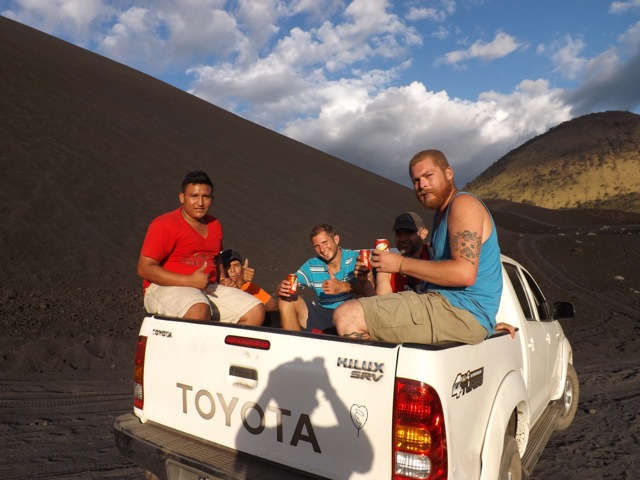
We waited for another group to go down slowly before we donned out red overalls and got our 5 minute training lesson. Then our guide waited for us half way down with camera at the ready. One at a time we pushed over the lip and began the slide down, trying not to collect stones as we went. The first part is moderately steep and allows momentum to be built…

wpid-dscf3375-2014-02-7-21-49.jpg

Then about half way down it gets steeper. The quickest time riding on boards is 93 km/h for men and 80 km/h for women. I managed a meagre 60 km/h and even that was exhilarating. The sand dust flowing behind adds a good effect.

wpid-dscf3378-2014-02-7-21-49.jpg

Then at the bottom we are back in the 4WD given a beer and driven back to town.

wpid-dscf3385-2014-02-7-21-49.jpg

Good dirty fun and even though we wore overalls, the dirt and stones get everywhere.

Next, I head north to Guatemala and the colonial city of Antigua.

The World Wanderer
Granada, Nicaragua – Impressions

Situated at the northern end of Lake Nicaragua, the city of Granada claims to be the first city in mainland America settled by Europeans. And while it’s inland and close to the Pacific Ocean it’s still considered a Caribbean port city. This is due to Lake Nicaragua being accessible from the Caribbean Sea by the San Juan river, which runs along the Costa Rican. Indeed, this was the path taken by Caribbean pirates on three separate occasions to attack the city.

wpid-political-map-of-nicaragua-2014-02-4-18-13.jpg

Like many Latin American cities, Granada has dual natures. There is the classic touristy area which sees influxes of people from the US during the northern winter months. Then only a couple of blocks from the tourist centre is the poor market quarter with ramshackle stalls lining the streets.

wpid-dscf3275-2014-02-4-18-13.jpg

The tourist area begins in the city’s central square which is a well maintained plaza area two blocks long, with cafe’s at each corner.

wpid-dscf3281-2014-02-4-18-13.jpg

Across from the square is the cathedral.

wpid-dscf3283-2014-02-4-18-13.jpg

Alongside the cathedral there is a long tourist road, with six blocks of bars and restaurants in hope of catching the tourist dollar.

wpid-dscf3289-2014-02-4-18-13.jpg

Because of the road’s length, it’s not uncommon to see a horse-drawn carriage laden with tourists traversing it…

wpid-dscf3290-2014-02-4-18-13.jpg

…past a not so well maintained church…

wpid-dscf3292-2014-02-4-18-13.jpg

…to Córdoba Plaza celebrating the city’s founder…

wpid-dscf3297-2014-02-4-18-13.jpg

…to end at the Lake Nicaragua where ferries leave for Isla de Ometepe twice a week.

wpid-dscf3300-2014-02-4-18-13.jpg

A visit to Granada wouldn’t be complete without a visit to Nicaragua’s most active volcano, Volcán Masaya. While it’s fairly short for a volcano at 600m above sea level, it’s one of 19 volcanoes that make up Nicaragua’s volcano alley. Volcán Masaya weeps acrid smoke constantly from its crater.

wpid-dscf3308-2014-02-4-18-13.jpg

The land around the volcano shows plentiful signs of the devastation it has caused over the years. Around the main crater there are four other craters that were once active, but have since closed over.

wpid-dscf3321-2014-02-4-18-13.jpg

Often a trip to the crater at night gives the sight of glowing lava in the crater, but with the lack of wind at sundown, the fumes made it too dangerous to get close enough. Nearby there is, however, a large lava tunnel over 200 metres long which is now inhabited by several varieties of bats.

wpid-dscf3324-2014-02-4-18-13.jpg

With about twenty of us walking into the caves the bats get stirred and you can see them flying about and whipping past your ears. It’s exhilarating for those of us who love bats, but terrifying for those that who don’t.

This is but a small section of things that can be done in and about Granada.

Next I’m off to the city of Léon in northern Nicaragua to slide down the black sands of a volcano on a snowboard…

The World Wanderer
Volcán Concepción, Nicaragua

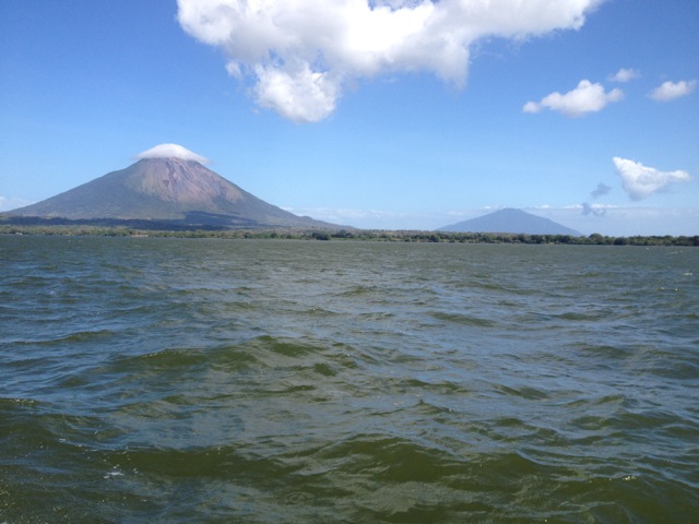
The towering cone of Volcán Concepción on Isla Ometepe looks imposing when crossing Lake Nicaragua towards it. The closer the perspective, the more intimidating the peak, which usually has a cap of cloud atop it…

wpid-img_1677-2014-02-3-13-57.jpg

But on the rare occasion when the clouds do disappear the full cone is visible in all it’s splendour. This was how it was the day before we were due to climb it.
wpid-dscf3239-2014-02-3-13-57.jpg

When looking to climb one of the two volcanos on Isla de Ometepe, I’d decided on Volcán Maderas, Volcán Concepción’s little sister. I was told that both volcanoes take the same amount of time to climb, but Volcán Maderas was muddier and less fun. So, eight of us from the hostel booked Volcán Concepción instead. We hoped for another beautifully clear day but we were to have no such luck.

wpid-ome-map700-2014-02-3-13-57.jpg

We met our guide during breakfast in the town of Moyogalpa and caught a chicken bus for 20 minutes to the trailhead where we began walking along the trail strewn with rocks and sand.

wpid-dscf3255-2014-02-3-13-57.jpg

We followed the track for 30 minutes, stopping to peer up at a group of Howler Monkey’s in the trees. It’s amazing how much noise these small monkeys actually make.

wpid-dscf3257-2014-02-3-13-57.jpg

The trail abruptly became steeper and our climb began. The trail began fairly steeply through the trees on roots and dirt steps. While the climb wasn’t overly hard, it seemed harder because of the humidity. We stopped regularly for 5-minute breaks, although there were no views available through the trees.

The only forewarning we had of coming to the tree line was the cool wind, a godsend in the humidity. When we did break the tree line we emerged into the clouds which again obscured our view. We stopped in a windy spot to decide our next course of action and managed to get a cloudy shot of the island below us.

wpid-dscf3258-2014-02-3-13-57.jpg

Then came the difficult decision: continue climbing to the top covered in cloud the entire time with no visibility or head down to a more scenic viewpoint. We decided to climb a little further but after ten minutes and being battered by cold winds in the dense clouds we turned back, deciding to take the scenic path instead. This upset two of the climbers, both of whom wanted to get to the top no matter what.

We followed a thin trail around the side of the volcano and dropped below the cloud line to a point where we could finally get some decent photographs of the island below and the lake around it.

wpid-dscf3268-2014-02-3-13-57.jpg

We continued climbing around to a large crack running down the volcano where lava had flowed years earlier. We took a break on the hardened lava.

wpid-dscf3270-2014-02-3-13-57.jpg

The lower we climbed, the more the mainland of Nicaragua could be seen on the other side of the lake and beyond that in the distance, the Pacific Ocean.

wpid-dscf3271-2014-02-3-13-57.jpg

As we neared the bottom, we looked back up the great crack in the side of the mountain.

wpid-dscf3274-2014-02-3-13-57.jpg

And because we hadn’t come back down the same way we’d climbed, we had to walk ninety minutes back across the island to Moyogalpa.

Overall, the hike was not as difficult as expected, although it may have grown more so had we pushed on through the clouds to the top. I’m not unhappy to not have made it to the top, as without pictures it would have been an empty victory.

The Lone Trail Wanderer