Tag Archives: Hiking

Volcán Concepción, Nicaragua

The towering cone of Volcán Concepción on Isla Ometepe looks imposing when crossing Lake Nicaragua towards it. The closer the perspective, the more intimidating the peak, which usually has a cap of cloud atop it…

wpid-img_1677-2014-02-3-13-57.jpg

But on the rare occasion when the clouds do disappear the full cone is visible in all it’s splendour. This was how it was the day before we were due to climb it.

wpid-dscf3239-2014-02-3-13-57.jpg

When looking to climb one of the two volcanos on Isla de Ometepe, I’d decided on Volcán Maderas, Volcán Concepción’s little sister. I was told that both volcanoes take the same amount of time to climb, but Volcán Maderas was muddier and less fun. So, eight of us from the hostel booked Volcán Concepción instead. We hoped for another beautifully clear day but we were to have no such luck.

wpid-ome-map700-2014-02-3-13-57.jpg

We met our guide during breakfast in the town of Moyogalpa and caught a chicken bus for 20 minutes to the trailhead where we began walking along the trail strewn with rocks and sand.

wpid-dscf3255-2014-02-3-13-57.jpg

We followed the track for 30 minutes, stopping to peer up at a group of Howler Monkey’s in the trees. It’s amazing how much noise these small monkeys actually make.

wpid-dscf3257-2014-02-3-13-57.jpg

The trail abruptly became steeper and our climb began. The trail began fairly steeply through the trees on roots and dirt steps. While the climb wasn’t overly hard, it seemed harder because of the humidity. We stopped regularly for 5-minute breaks, although there were no views available through the trees.

The only forewarning we had of coming to the tree line was the cool wind, a godsend in the humidity. When we did break the tree line we emerged into the clouds which again obscured our view. We stopped in a windy spot to decide our next course of action and managed to get a cloudy shot of the island below us.

wpid-dscf3258-2014-02-3-13-57.jpg

Then came the difficult decision: continue climbing to the top covered in cloud the entire time with no visibility or head down to a more scenic viewpoint. We decided to climb a little further but after ten minutes and being battered by cold winds in the dense clouds we turned back, deciding to take the scenic path instead. This upset two of the climbers, both of whom wanted to get to the top no matter what.

We followed a thin trail around the side of the volcano and dropped below the cloud line to a point where we could finally get some decent photographs of the island below and the lake around it.

wpid-dscf3268-2014-02-3-13-57.jpg

We continued climbing around to a large crack running down the volcano where lava had flowed years earlier. We took a break on the hardened lava.

wpid-dscf3270-2014-02-3-13-57.jpg

The lower we climbed, the more the mainland of Nicaragua could be seen on the other side of the lake and beyond that in the distance, the Pacific Ocean.

wpid-dscf3271-2014-02-3-13-57.jpg

As we neared the bottom, we looked back up the great crack in the side of the mountain.

wpid-dscf3274-2014-02-3-13-57.jpg

And because we hadn’t come back down the same way we’d climbed, we had to walk ninety minutes back across the island to Moyogalpa.

Overall, the hike was not as difficult as expected, although it may have grown more so had we pushed on through the clouds to the top. I’m not unhappy to not have made it to the top, as without pictures it would have been an empty victory.

The Lone Trail Wanderer

Volcán Barú, Panama

Barely 37km from the border of Costa Rica is Panama’s tallest mountain, Volcán Barú. At just under 3,500m, it’s still considered high altitude but is really just a molehill compared to 6,000m tall mountains of Andes. Volcán Barú is commonly climbed for the rare possibility of seeing both the Pacific Ocean to the south and the Caribbean sea to the north. It’s rare because the view to the Caribbean is often blocked by a layer of clouds.

wpid-101405669-idpllmbm-panama-2014-01-17-22-32.jpg

There’s two ways to the top of Volcán Barú, either taking a 4×4 vehicle tour or to hike. The hike is difficult and long at 13km from the trailhead to the peak (with a 1,750 climb in altitude) before 13km back again. What makes it a challenge is most people begin climbing at midnight, aiming to see the sunrise from the summit after walking 6 hours in the dark. Hiking 26km makes for a long day at the best of times, but beginning at midnight makes it just nasty. I even tried to nap in the afternoon, but only managed an hour, which was nowhere near enough.

wpid-dscf3124-2014-01-17-22-32.jpg

Getting to the trail head is fairly easy, with one of the hostels offering transport for US$5. Then after a very short briefing, we were pointed off along a wide track and told to just keep climbing no matter what forks in the trail we see. Except for 3 short descents, the 13km was a steady climb along the wide rocky trail. When you’re hiking at night all you have is your head torch and the ground directly ahead of you to look at.

wpid-dscf3128-2014-01-17-22-32.jpg

We were lucky to be walking under the full moon, so it wasn’t always necessary to use the head lamps. But even in daylight there would be little to see, as there are trees along both sides of the trail. We did come to several locations where we looked down upon the township of Boquete. The lights were beautiful but fleeting and too distant for good photos.

Getting to the summit for sunrise was not my aim, so I took is more slowly. When sunrise did hit, I was still half a kilometre from the summit but was able to watch it, seeing the same view as I would have from the top.

Unfortunately it was around this point where altitude sickness struck. It felt like someone had split my head in half and prodded at the insides with their fingers. As I climbed the last of the trail to the radio tower buildings at the top it grew worse and I started to feel ill.

wpid-dscf3132-2014-01-17-22-32.jpg

The last 500 metres was steeper than the rest and when I made it to the top I found the howling wind rough. I found a secluded spot and put on some warm clothing. When dressed, I looked around the buildings and took photos of the surrounds.

To the south was the city of David and the islands in the Gulf of Chiriqui beyond.

wpid-dscf3137-2014-01-17-22-32.jpg

To the west, Costa Rica.

wpid-dscf3138-2014-01-17-22-32.jpg

On the other side, I discovered the buildings were not at the absolute summit, as there was a rocky outcrop that climbed perhaps 30m higher. To get to the top was a rocky scramble, but with the state of my head and stomach I decided against it. The cross on top is the highest point in the country.

wpid-dscf3140-2014-01-17-22-32.jpg

From the northern side of the summit I was out of luck with seeing the Caribbean sea but instead clouds fading away into the distance.

wpid-dscf3136-2014-01-17-22-32.jpg

While I sat huddled out of the wind, one of the girls from my hostel found me and sat with me while I brewed a cup of tea using my hiking stove.

The walk down was very long but straightforward. The trail descends for most of its length except for three points where it climbs. Half way up the first and longest of the three climbs, my tiredness gave out and I lay down on a large rock for a power nap, letting my friend walk on alone. I woke forty minutes later slightly refreshed and no longer feeling the altitude.

The rest of the walk was more of a stagger although I did manage to catch my friend again. We discovered there were many wild flowers growing along the trail but was too exhausted to take photos beyond this one…

wpid-dscf3141-2014-01-17-22-32.jpg

We passed some of the lookouts and caught daylight glimpse of Boquete…

wpid-dscf3143-2014-01-17-22-32.jpg

We eventually made it to the end of the trail and exhausted, booked a taxi through the ranger before being whisked away back to the hostel for a shower and a well deserved sleep.

Overall, the hike up Volcán Barú was okay. I would have enjoyed it more if I hadn’t suffered altitude sickness at the end and if we’d started at a more reasonable time. While walking at night was fine – it’s cooler out of the sun and there isn’t much to see anyway – the main difficulty is the length. To make the hike more enjoyable, I would make it a two-day hike, camping just below the summit, climbing to see the sunrise early on morning two before the long walk back again.

The Lone Trail Wanderer.

Boquete, Panama – Impressions.

Nestled in the mountain plains 60km from the border of Costa Rica is the mountain town of Boquete (‘Boc-ket-e’). At 1,200 metres above sea level, the township is cooler than the rest of Panama and this makes it a popular holiday destination for both locals and travellers alike. It’s also one of the leading retirement locations for US citizens outside of the United States.

wpid-101405669-idpllmbm-panama-2014-01-18-16-43.jpg

Boquete is next to Parque Nacional Volcán Barú and is the primary starting point for those who wish to climb the volcano, the tallest mountain in Panama. The mountains around Boquete contain many short trails but the only real hike is the volcano climb, although it’s not the best of hikes as there’s little to see along its 26km length.

wpid-dscf3117-2014-01-18-16-43.jpg

Every year in mid-January Boquete hosts a flower and coffee festival that runs for ten days. It’s a very popular occasion with people coming from all over the country to party late into the night at the dance hall. Feriado Las Flores y del Cafe – literal translation: Holiday Flowers and Coffee.

wpid-dscf3119-2014-01-18-16-43.jpg

The fiesta is less crowded during the day, which allows better access to see the impressive flower displays.

wpid-dscf3118-2014-01-18-16-43.jpg

There are plenty of things to do in Boquete besides hiking and the festival, these include horse riding, visiting coffee plantations and farms, and the Aguas Calientes – hot springs.

For $2 you can spend all day on the property where several pools have been crudely set up. The crudeness gives it character, and if you get too hot there’s a river nearby to cool off in.

wpid-img_1631-2014-01-18-16-43.jpg

Overall, Boquete has a vibrant energy about it and is a great place to hide away from Panama’s year round heat.

Next, I cross the border into Costa Rica to the capital of San José.

The World Wanderer

Looking Back, Part 3 – Northern South America

Peru

As I left Bolivia I made my way around Lake Titicaca and along the Andes to Cusco, capital city of the Inca Empire more than 600 hundred years ago. Cusco was built in the image of the Puma, a holy symbol of the Incas.

wpid-dscn3270-2013-12-22-17-56.jpg

Cusco’s a popular tourist destination because of it’s closeness to Machu Picchu. To get to the ruins many people walk one of the expensive hikes in the region: the infamous Inca Trail, The Salkantay Trek or The Jungle Trek. While these hikes are said to be amazing, the expense and length of time needed to prebook put me off. Instead I caught the train to Aguas Caliente, the township at the base of Machu Picchu mountain, and climbed the near 2000 steps to the ruins. At altitude, these steps are still hard going. The ruins felt like Disneyland because of the huge number of tourists but it was still beautiful to behold…

wpid-dscn3405-2013-12-22-17-56.jpg

After Cusco, I travelled to the city of Arequipa, the southernmost city of Peru. Near Arequipa is the county’s third most popular destination, Colca Canyon. Colca Canyon is one of the largest canyon’s in the world, twice as deep as The Grand Canyon. The hiking there is very cheap and doesn’t require a guide. I explored the canyon for three days, including the final climb, a kilometre straight up.

wpid-dscn3461-2013-12-22-17-56.jpg

After Arequipa I headed down from the Andes for a time, stopping at Huacachina, a small town near the ocean renown for its massive sand dunes. I spent an afternoon sand boarding down the slopes.

wpid-huacachina21543-2013-12-22-17-56.jpg

Next was a visit to the capital, Lima. I stayed in the tourist zone of Miraflores which felt like I was in the centre of any other city in the world. I then moved to the historical centre and this was more to my liking with great architecture and a distinct lack of tourists.

wpid-dscf2137-2013-12-22-17-56.jpg

I continued north and back into the Andes to the city of Huaraz nestled between the Cordilleras Blanca and Negra. From Huaraz a group of us hiked the four-day Santa Cruz trek, with one of the hardest climbs I’ve ever completed.

wpid-dscf2065-2013-12-22-17-56.jpg

From Huaraz, I made my way to the far northern coast and the country’s second most visited destination, Mancora. Mancora is a beach town where I stayed for four days in a cabaña 20 metres from the Pacific Ocean. After the Santa Cruz hike, it was great to just sit and enjoy the beach for a few days.

wpid-dscf2147-2013-12-22-17-56.jpg

Ecuador

I left Peru and headed across the border to Ecuador’s capital, Quito, where I made plans to visit the Galapagos Islands. Two days later I was on a plane – my first since arriving in South America – and a few hours later landed on the famous archipelago. After booking a four-day cruise around the islands, I made friends with a Uruguayan guy at the hostel and spent the days prior to the cruise exploring Santa Cruz island with him, including a great swimming hole and the Giant Tortoise sanctuary.

wpid-dscf2185-2013-12-22-17-56.jpg

The cruise was amazing, I enjoyed snorkelling through the icy waters and swimming with penguins, fur seals, sea lions and sea turtles. On land there were many bird species including Blue Footed Boobies, the smaller water iguanas and the large land Iguanas.

wpid-dscf2303-2013-12-22-17-56.jpg

Back in Quito, I met some friends at the hostel and explored the city with them, including some amazing architecture, the original site of the equator and the newer more technologically accurate equatorial site. I had also prearranged with some locals to hang out with and spent a week enjoyed their company.

wpid-dscf2401-2013-12-22-17-56.jpg

With my friends from the hostel, I headed north for a weekend to the adventure town Minca buried in the rainforest, where we hung out with Hummingbirds, zip lined ourselves crazy and generally enjoyed our stay.

wpid-dscf2438-2013-12-22-17-56.jpg

Next, two of us travelled south to the city of Riobamba where we hiked to the amazing crater lake of a collapsed volcano called El Altar. Most hiking in Ecuador must be done with a guide, but the two of us enjoyed the three-day hike without one.

wpid-dscf2555-2013-12-22-17-56.jpg

Then we headed south to the southern city of Cuenca where my friend headed into Peru and I explored Ingapirca, the ruins of an Incan Fortress.

wpid-dscf2689-2013-12-22-17-56.jpg

Colombia

Then it was back to Quito for a last few days before I headed north into Colombia, to the city of Cali where I stayed for three days. I explored the city via a walking tour, learning its history, and climbed one of the hills to the local statue of Christ.

wpid-dscf2748-2013-12-22-17-56.jpg

From Cali I headed north via a very winding mountain road where the bus driver thought he was formula one driver. After the humidity in Cali, Bogota was cold. I’d prearranged to meet some people in Colombia’s capital and they were so friendly I stayed for three weeks to spend more time with them, including attending a huge Pop Culture Festival…S.O.F.A.

wpid-dscf2766-2013-12-22-17-56.jpg

Bogota is not well set up as a tourist destination but during my stay I caught a cable car up to a temple of the hill giving awesome views across the city.

wpid-dscf2780-2013-12-22-17-56.jpg

Then with general sadness at having to leave my friends in Bogota, I headed north to Medellin, a more popular city for tourists and home town of the late Pablo Escobar. I hung out at a New Zealand owned hostel and between a couple of nights partying I took a walking tour, both with a group and a separate one with a couple of guys from the hostel.

wpid-dscf2799-2013-12-22-17-56.jpg

Next I headed to Cartagena, a city on the Caribbean Sea where I hung out for a few days in the extreme humidity. Cartagena’s Old Town has a great stone wall around it that once protected it from pirate attacks 500 years ago. The entire old town is a world heritage site.

wpid-dscf2827-2013-12-22-17-56.jpg

Further along the coast is a small beach town of Taganga where I stayed for a few of days. It was a quiet little town away from the bustle of the larger Colombian cities.

wpid-dscf2844-2013-12-22-17-56.jpg

From Taganga I booked and walked the four-day jungle trek to find the Lost City, an amazing ruins of the local tribes that had been abandoned 500 years earlier. The trek was humid and sweaty, and this made the long climbs up clay trails more difficult. Swimming in the icy rivers were highlights of the sweaty days.

wpid-dscf2935-2013-12-22-17-56.jpg

After a couple of recovery days in Taganga, I headed back to Cartagena to say farewell to South America. After 9 and a half months of amazing adventure, it was sad to say farewell to the continent, although my travels were not yet at a conclusion. In Cartagena, I booked a cruise on a yacht with 11 others to make my way through the Caribbean Sea to Panama, and the beginning of my Central American adventures.

This will be an adventure I will never forget.

The World Wanderer

Looking Back, Part 2 – Central South America

After a 20 hour bus ride from Patagonia, I arrived in Mendoza, Central Argentina. Mendoza is a wine region and boasts some of the best red wines in the world. While I wasn’t the biggest fan of red wine before, after my time in the city I was a Malbec convert. One of the fun things I did while in the City of Steak and Red Wine was to spend the day enjoying some aguas calientes, a set of hot pools near the city. While this might seem strange for a desert city, it was amazing and included a huge buffet lunch.

wpid-dscn2443-2013-12-17-12-23.jpg

Around Mendoza are several wine areas and the best way to see them is via bicycle tours. The wine was delicious and cycling around the area after many glasses of wine was both crazy and fun at the same time.

Beyond the vineyards, the tallest mountain of the Andes, Aconcagua.

wpid-dscn2467-2013-12-17-12-23.jpg

Next I caught a bus across Argentina to Cordoba, the country’s second largest city. While staying in the city I got out-of-town to Parque Nacional Quebrada del Condorito – Condor Gorge National Park – for a long day walk in the heat.

wpid-dscn2517-2013-12-17-12-23.jpg

Next I headed to the Buenos Aires and stayed in a different area of the capital from the beginning of my trip. As I knew I was heading back to the city, I made contact with a friend of a friend and organised to hang out with him and his friends while I was in the city. They were very friendly and I stayed in the city over two weeks to spend time with them.

wpid-dscn2559-2013-12-17-12-23.jpg

During my stay in Buenos Aires, I caught a ferry across the river to the Uruguayan city of Colonia. While I could have stayed in Uruguay longer I was happy to see the more expensive country for the day and get the stamp in my passport. I enjoyed learning about the city and the country in a guided tour.

wpid-dscn2524-2013-12-17-12-23.jpg

I then bused headed north for my final Argentinian destination, Puerto Iguazú. While the township was very touristy, it had good reason, Iguazú Falls is one of the more popularly visited places in the region. While it had been raining the day I visited the Argentinean side of the falls they were still like nothing I’d seen before. I even took a boat to get right up close to the spraying water.

wpid-dscn2634-2013-12-17-12-23.jpg

The following day, I took a bus across the border to the Brazilian side – Iguaçu Falls. While it’s the same set of falls, it’s a totally different sight and you get closer to the Devil’s Throat, a formation of rock that water pours into from three sides. Both Argentinian and Brazilian sides are a must see if travelling to this end of the world. It was then back across the border to Argentina for a final night before booking a bus to Rio de Janiero.

wpid-dscn2677-2013-12-17-12-23.jpg

After a 24 hour bus ride to Rio de Janeiro – the longest trip in a bus I would take – I found the city to be dirtier than expected. It also gave me a sense of danger I hadn’t experienced in either Argentina or Chile. I’d booked a cheap hostel near the location of Carnival and it turned out to be the smallest hostel I’ve ever stayed in, squeezing 18 people into the space most hostels would fit 6. It also only had one bathroom.

wpid-dscn2746-2013-12-17-12-23.jpg

The hostel aside, the natural wonders of Rio were amazing. I visited Christ the Redeemer, Sugarloaf Mountain and took a bicycle ride along both Ipanema and Copacobana beaches.

wpid-dscn2820-2013-12-17-12-23.jpg

I then took my second 24 hour bus ride to a city called Campo Grande in western Brazil for an overnight tour through Brazil’s Pantanal. The Pantanal is a vast swampy area south of the Amazon. It’s similar to the jungle in many ways, just without the trees. We spent the night on the border of Brazil and Paraguay (the closest I would get to the landlocked country). On arrival we ate Piranha, the mean looking faces leering up at us from the pot. The next morning, we took a boat trip along the river to fish for more Piranha…

wpid-dscn2845-2013-12-17-12-23.jpg

…and to see Caimans, smaller cousins of Alligators.

wpid-dscn2861-2013-12-17-12-23.jpg

Then it was over the border and into Bolivia. As soon as you enter it’s obvious that Bolivia is the poorest country on the continent. The roads are bad, the towns are dirty and the buses are owner operated family affairs and include the kids running up and down the aisles while badly dubbed Steven Segal movies are blasted very loudly. My first stop was the city of Santa Cruz, where I stayed at a brand new hostel for a couple of days before heading on to La Paz.

La Paz is a bustling city high in the Andes and when I arrived my head was exploding from the altitude. It only took a good night’s sleep to recover, thankfully. While the entirety of La Paz is terracotta in colour it grows on you as you explore the city centre and beyond. The lights at night are amazing up the walls of the bowl the city is built in.

wpid-dscn2896-2013-12-17-12-23.jpg

Using La Paz as a base, I had many adventures in Bolivia. For a start, you can’t come to the city without hearing about or doing Death Road. Death Road is a crazy stretch of dirt road 65km long and famous for the cliffs on one side with no barriers. It gets its name from the people who have plummeted to their deaths from it. Riding down it on a bike is one of the most thrilling and fun things I’ve done on this trip.

wpid-dsc01629-2013-12-17-12-23.jpg

Next I hiked along an alternative route to Death Road called El Choro, through cloud forests and past my first Incan ruins. During the hike I climbed to the highest I have ever hiked, 4900m, and at that altitude the climb was intense and difficult. It was a great hike and also my first with a guide. Not something I relish, preferring to carry all of my own gear and cook my own meals.

wpid-dscn2967-2013-12-17-12-23.jpg

Then I caught a bus to Uyuni for a 3 day tour around the Salt Flats and along the Andean High Plains to the three-way border of Bolivia, Argentina and Chile. The Salt Flats are like an inland sea without the water.

wpid-dscn3077-2013-12-17-12-23.jpg

There were so many different terrains on the high plains and many stunning views. We visited some very interesting places, like the lodge made entirely from blocks of salt where we stayed on the first night. Views across Lago Roja – Red Lake.

wpid-dscn3174-2013-12-17-12-23.jpg

Then it was back to La Paz where I managed to suffer from food poisoning, an illness everyone seems to get in Bolivia. Don’t trust the street food! For my final days in Bolivia, I caught the bus up to Lake Titicaca, the highest navigable lake in the world. After a day tour to Isla del Sol, I booked a bus into Peru…

wpid-dscn3258-2013-12-17-12-23.jpg

Next, Part 3 of my Look Back Series where I complete my time in South America by working my way to Colombia.

The World Wanderer

The Lost City – Ciudad Perdida, Sierra Nevada National Park, Colombia

In the jungles of northern Colombia there’s a magical city known as Ciudad Perdida – ‘Lost City’ in spanish. Believed to be built around 800AD (650 years before Machu Picchu in Peru) the site is said to be the central city of the Tairona people, connecting the many small villages around it. Originally home to between 2,000 and 8,000 people the city is said to be four times as large as Machu Picchu and far more spread out.  Abandoned around the time of the Spanish conquests and the city was only rediscovered in 1972.

There are now regular jungle hikes to the site taking between 4 and 6 days. It’s considered a moderately difficult hike and since I was in the area I decided to do it.

Day 1
I was picked up from my hostel at 9am with just my little pack. I’m not used to carrying so little and I almost felt like I didn’t have enough with me. But then I usually don’t go on guided treks, preferring to walk alone with all my own equipment.

After a ten minute minivan ride from Taganga – the beach town where I’m staying – I was dropped off to the tour company’s office in Santa Marta where I was to meet the others in the group. I’d figured I wouldn’t be alone on this fairly popular trek but I didn’t expect to be one of 19 plus guides. With so many others hikers it was difficult to find the serenity of nature I enjoy when hiking alone. But I did my best.

wpid-dscf2848-2013-12-9-13-02.jpg

By 11am, we were off in a pair of 4x4s heading towards El Mamey, the village that serves as the hike’s trailhead. An hour later, we left the sealed highway and headed along a rough dirt road suitable only for 4x4s, motorcycles and horses. A further hour later and we arrived at El Mamey where we were provided with lunch.

After lunch and once we were all ready we headed out along a dirt road, crossing a pair of rivers as we went.

wpid-dscf2853-2013-12-9-13-02.jpg

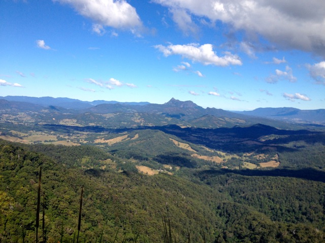
It wasn’t long before we began to climb in the muggy heat. While the steep climb was not at altitude like my previous few hikes, where lack of oxygen slowed me down, the somewhat oppressive heat stripped me of my energy, having a similar effect. As we worked our way slowly up the tree covered hill, the clay of the trail seemed to capture the heat and send it at us from all directions. Sweat ran from everywhere and I was soon soaked completely, a state I was to be in for the entire four days of the hike.

We had reached the top of the hill and were walking along a ridge line when the afternoon rains finally arrived to cool us down.

wpid-dscf2866-2013-12-9-13-02.jpg

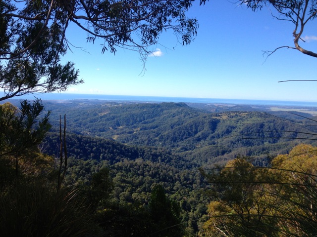
We took shelter at a small cabaña until the shower passed but it was not to be the end of the rain for the day. As we continued, low clouds began to move in around the hills, bringing a much appreciated cool breeze.

wpid-dscf2864-2013-12-9-13-02.jpg

We continued along the cloudy ridge until it dove down a long steep clay and mud trail before crossing the river to another village. Finally, we climbed a smaller hill to the cabaña where we’d be staying the night.

Under a wall-less tin roofed building there were line upon line of hammocks covered with mosquito netting.

wpid-dscf2870-2013-12-9-13-02.jpg

One section of the wall-less hut was a massive kitchen where the guides prepared our dinner of chicken, potatoes and rice. As we ate the rain returned, this time very heavily and accompanied by long peels of thunder and brilliant flashes of lightning. After dinner and a couple of beers – no South American hike would be complete without beer at the camps – I headed to bed in preparation for the next day.

Day 2
It rained heavily for a large portion of the night, well past the time I’d gone to sleep. Sleeping in a hammock was a first and quite comfortable using a blanket as a pillow. I used a second blanket briefly early in the morning when it grew a little cooler and I was thankful for the protection of the mosquito nets.

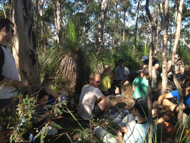
At 5am we were up and given breakfast. It was an early start to avoid the oppressive humidity later in the day. It was still hot, a wet heat that made it difficult to regulate my own temperature. But this was only a problem when I was climbing, which was much of the morning following the dirt trail through the endless trees of the jungle. During the climb we paused from time to time in various villages to get our breaths back and to take photos.

wpid-dscf2880-2013-12-9-13-02.jpg

The trail dove down hill again for a long period and at the bottom we were forced to remove our boots to cross a river. Wading across, the water came up to our thighs in all its cold and gloriousness.

With only 30 minutes to our evening’s cabaña, most of us stripped down to our shorts (or to bikinis for the girls) and went for a swim. It was difficult for us to leave the river, but we eventually tore ourselves away, dressed and walked the 30 minutes along one bank to the cabaña.

After lunch it was shower and relax time as we waited for the afternoon rains. We are only 1km away from the steps leading up to the Lost City. So close we could hear the buzzing of mosquitos.

Day 3
Many of us were woken by the breakfast crew at 3.30am, not because we had to get up but because they were being noisy. I managed to get back to sleep and at 5.30 was up and having breakfast. Then we were off along the bank for the 1km to another river crossing where we again had to remove our boots. Even first thing in the morning the cold of the river was refreshing. On the other side we found the 1,200 or so steps that lead up to Ciudad Perdida.

wpid-dscf2905-2013-12-9-13-02.jpg

The ancient tribes must have had small feet as the steps are tiny. Still, it didn’t take us long to get to the top where we emerged into the city’s market area covered in sweat. After reapplying insect repellant, I zipped on my leggings and rolled down my sleeves as defence against the mobs of ravenous insects.

We spent three hours walking around Ciudad Perdida…

wpid-dscf2915-2013-12-9-13-02.jpg

From the market, we headed up the hill by steps…

wpid-dscf2926-2013-12-9-13-02.jpg

…that led to the rich quarter of the city where the best views could be had.

wpid-dscf2935-2013-12-9-13-02.jpg

There aren’t any buildings left from the day of the city builders, as unlike the Incas, the Tairona built houses from bamboo, wood and mud. A few natives do live here but their buildings are recent.

In places around the city are gun toting soldiers, protecting visitors to the city for the last decade. The last kidnapping in the area was ten years ago in 2003. Next we headed down a long flight of steps to the poorer quarters.

wpid-dscf2939-2013-12-9-13-02.jpg

After some history lessons we climbed back down the main steps, very slowly and eventually made it to the river where the boots were off again as we crossed. 30 minutes later and we were back at our last nights accommodation for lunch.

Next was a long ten kilometre hike back along the trail to our final night’s cabaña at the bottom of a very long downhill. In the heat of the afternoon, and still drenched with sweat, we were thankful to arrive at the camp. It didn’t take us long to get out of our wet clothes and into the cool river. On the far bank a waterfall feeds into a grotto behind a huge rock. There’s an elaborate technique for getting across, the last of which is to power swim through the strongest current. A couple of us made a chain to catch some of the less strong swimmers as they were being swept past.

wpid-dscf2946-2013-12-9-13-02.jpg

That evening we relaxed under the beady eyes of many Cane Toads enjoying the rain.

Day 4
The final day was simply returning along the trail we’d walked on our first day – up a steep long climb, back along the ridge line and down a very long climb. 15 minutes before we arrived back at El Mamey, we stopped at the river for a final swim – they couldn’t have stopped us if they tried! Then after 30 minutes in the water, we were back on the trail for the final short walk to the village, where we stopped for lunch before being transported to Santa Marta and the end of the adventure.

wpid-dscf2876-2013-12-9-13-02.jpg

Overall, the 4 day jungle trek was a great adventure, and while the constant sweating and dripping wet clothes left me covered in a heat rash, it was worth it to get to the Lost City and my final adventure in South America.

The Lone Trail Wanderer.

‘Eua – Day 2 – ‘Eua National Park again

While I walked in the National Park yesterday, hiking was the major reason I came to ‘Eua (ay-oh-a). So today I asked to do a guided hike. Which one? I was asked…The hardest one, of course!

So, after breakfast, the owner of the resort set me up with the guide that was to lead me on a harder trek across the Island. And along with me were two other walkers… An English chap and his pre-teen son.

wpid-img_0444-2012-07-9-18-37.jpg

We were dropped off further into the National Park than I was yesterday and headed through bush and forest similar to yesterday. About a km in, our first stop was the Lookout at the end of yesterday’s hike with the same great views over the ocean and beach below.

The second stop was the Rats Cave. I chose not to go down the hole today. I got covered in dirt enough yesterday… We continued along the path and instead heading back along the one that had brought me to these sights yesterday, we took a different path. Our guide told us of some leaves not to touch that causes rashes similar to nettles. The path led us to the edge of the cliff and our way down. Now this is what I was looking for, a semi difficult climb down a steep earthy hill covered in trees.

wpid-img_0445-2012-07-9-18-37.jpg

At the bottom we emerged though some trees on the beach covered in shells and rocks. There was even some sand, just a little mind you.
wpid-img_0449-2012-07-9-18-37.jpg

We stopped for lunch under the cliffs.

wpid-img_0457-2012-07-9-18-37.jpg

After lunch, our guide – who had been wearing thongs this entire time – climbed a coconut palm tree and dropped a bunch of green coconuts down for us. He then spent some time skinning then by smashing them against some rocks. We drank and feasted on the coconuts until we’d had our fill.

wpid-img_0451-2012-07-9-18-37.jpg

We set off along the beach, climbing the rocks until we found an entrance up the cliff face. Climbing through a small gap in some large rocks, we made our way up the via sometimes slippery earthy slopes and some rock scaling.

wpid-img_0462-2012-07-9-18-37.jpg

We came to a short plateau and ended up walking in circles as our guide managed to get lost. We did find out way to the right path eventually, up some very steep banks and more rock scaling.

wpid-img_0468-2012-07-9-18-37.jpg

We reached the top and continued through the bush. My guide and I were rearing to go while the English chap and his son were exhausted. After a couple of kilometres through the bush we reached the road and were picked up another kilometre along.

A good day’s hiking. Tomorrow I fly back to Tongatapu for the night, then fly north to the Ha’apai islands for the next stage of my holiday adventure in the Kingdom of Tonga!

The Trail Wanderer.

‘Eua – Day 1 – ‘Eua National Park

Of all the islands in the Kingdom of Tonga, ‘Eua is the one with the big national park you can walk around. This was one of the main reasons for coming here, so today I arranged to go on one of the unguided walks through this natural paradise.

Everything is closed on Sunday in Tonga, so this is the perfect day for a hike. There are several hikes on the island, some guided and some unguided. While I am pretty confident with hiking unguided, after several incidents of travellers getting lost and falling into sink holes, the resort prefers that the guided tours are guided. Also, since the guides do not work on Sunday, I arranged to be dropped off for one of the unguided ones.

wpid-img_0391-2012-07-8-18-39.jpg

I was driven to the edge of ‘Eua National Park and Forest plantation and given a roughly hand drawn map. My driver – the owner of the accommodation – highlighted the path I should take, and some of the points. I then headed off on my way.

wpid-img_0393-2012-07-8-18-39.jpg

The initial part of the walk is along a gravel road to and old forest nursery. It’s a disused house, but it’s hard to tell as many of the homes on the island look in worse condition. The path splits off and heads to a place called the Hafu Pool. Hafu Pool is a mini dam made with a concrete wall. A small stream runs down the hill in the pool and then beyond via a couple of channels. This would be a good place for swimming.

wpid-img_0394-2012-07-8-18-39.jpg

Beyond the pool the trail continues for a hundred metres to Big ‘Ovava – a giant Banya tree. The tree grows out of sink hole and you can follow a path down to the bottom where there is a cave. The cave is fairly large with a hole in the ceiling.

wpid-img_0402-2012-07-8-18-39.jpg

There is a crack in the wall at the base where you can follow the cave in further, but I decided not to follow it, as it was rather slippery and I had a while to go. To exit the cave, you can climb up the Bunya tree and out.

wpid-img_0407-2012-07-8-18-39.jpg

I was told the path to the west from the Banya tree was overgrown, but I went that way anyway and yes, it’s overgrown, about half way up, I turned back. No point getting lost. I headed back to the old forest nursery and along a 4×4 track that lead up a steady climb into the forest. I followed the designated ribbons and cut through some over grown but obvious paths until I came to the cliff tops at a place called the rats cave. It’s a small, waist high hole in the rock.

wpid-img_0427-2012-07-8-18-39.jpg

I crawled in and it goes for ten metres before dropping down into a cave. The cave is small, but it opens out onto the cliff face and the views out into the Pacific. Climbing out of the cave is not the cleanest. It’s more of a scramble on your stomach. I emerged covered in dirt.

wpid-img_0431-2012-07-8-18-39.jpg

Walking through the forest again, I quickly came to the Lokupo lookout, a wooden platform looking out to see. Brilliant views of the Pacific, the beaches and the forest at the base of the cliffs. I walked along to the Louua lookout, a similar platform looking out more to the north. I hung out here for lunch and a rest in the sun.

wpid-img_0437-2012-07-8-18-39.jpg

I walked back to the start point, mostly downhill, and instead of ringing for a lift back to the resort, I decided to walk – it’s only an extra 3-4km and I’ve been walking anyway, so what’s another 45 minutes?

Dinner at the resort is a Umu – like a Hangi but more Tongan. I was joined by a couple of girls I’d met at Toni’s Guest house for dinner and beers.

Tomorrow, a guided tour.

The Trail Wanderer.

The Cougals – Cougals National Park

The Cougals National Park is a section of the Springbrook National Park on the border of Queensland and New South Wales. It’s a pair of peaks that rise out of the rainforest, rocky and beautiful.  Note, this is different to the Mount Cougal Cascades, which is not connected to the peaks hike.

The East Peak is the most commonly climbed and is a 8.5km return trip with a moderate grade. The West Peak has a hard grade and is a further 750m across a saddle, giving the total hike of both peaks 10km return.

There is no formal trailhead for the Cougals walk. To get to the beginning of the trail from the Gold Coast cross the border into NSW and then back again along a dirt road named Garden Of Eden Road to a gate where there is room for several cars to park. There are local’s driveways nearby, along with a handmade sign announcing the beginning of the walk and demanding hikers to stay on the track.

IMG_0291

The trail heads west along the fence line between QLD and NSW. The fence has barbed wire along it, but whether it is designed to keep the New South Welsh out of Queensland is unknown. The trail climbs uphill through brush with low branches.

IMG_0292

It had rained this last week, so the dirt here was a little slippery. The brush gave way to tall grasses along the trail, which in turn gave way to thin bamboo growths. The grass overhanging the trail sometimes contained thorny branches. I probably should have worn long pants as I sustained many small scratches by the end of the day.

IMG_0293

The grassy path explodes into rainforest with tall trees and the typical Strangler Figs everywhere. The trail follows the fence line, climbing and descending gentle hills. It’s fairly obvious when you reach the first of the Cougals, the trail climbs steeply with dirt and tree root steps making it slippery after the recent rains. While slipping is the ever-present danger, being snagged on the barbed wire makes climbing even more dangerous.  Caution is suggested.

Atop the steep climb, rocky outcrops stand tall above you with dark brooding caves along its face. We walked along the base of the major outcrop until we found our way to a path that climbed through it. The trail up the rocks was obvious as someone had tied a rope to aid with handholds.

IMG_0311

Once above the rope line, it was an easy climb to the top of the East Cougal and fantastic views of Mt Warning to the South,

IMG_0300

…the rocky face of West Cougal to the West, out to the coast towards the city of Tweed Heads out to the East and Springbrook National Park to the North. On this sunny day, the climb was well worth the effort.

IMG_0299

My companion and I did not stay long, however, deciding to push on before lunch. We climbed down to the saddle between the peaks with only one steep troublesome and slightly precarious climb. The trail crossed the saddle, but unable to find a suitable place to stop we proceeded around the great rocky outcrop known as the West peak, looking for an easy path up.

IMG_0303

The West peak looks to be a hard climb with its many rocky faces. We skirted around it passing a couple of rocky climbing places marked with pink ribbons until we found a dirt path through the undergrowth. It was a little slippery but surrounded by plants that gave plentiful handholds. While finding the route up was not the easiest, climbing up it was fairly straight forward.

Unlike the summit of the East peak, which is small, the West Peak has a large area with meandering pathways and what appeared to be a camp site. We stopped for lunch at the fire pit.


IMG_0308

The descent passed quickly, as it always seems to, and before we knew it we were slogging our way through the tall grasses and back to the car.

The Cougals is an awesome hike and I would recommend it to any fit and capable walker. It’s going down as one of my favourites in this region.

The Trail Wanderer.

Mount Tunbubudla East

Glass House Mountains National Park – again.

After spending 3 days wandering the trail of the Glass House Mountains, I’m back to climb one that doesn’t have one.  This time I’m walking with my hiking group and the mountain is Mount Tunbubudla East, a 300m tall, off track climb and is rated hard, mainly due to it being trackless.

Getting to the mountain is a mission in of itself. The old ‘major road’ that it’s off is actually a boggy dirt road and is untraversable without an off-road vehicle.  We parked at the entrance and as a group walked about a kilometre to the muddy starting point. We waited for others to arrive and find us before we headed off into the untracked grass at the base of the mountain.

I led the way, pushing a path through the long grass for the others to follow.  At the beginning there was a vague track, but this soon disappeared. The initial portion of the climb was up tree laden, broken ground. With no track, I had to evaluate each step and find suitable gaps between tree branches.

The climb became steeper before flattening out the higher we got, but because of the thick tree cover we were unable to see the views. As we approached the top we came to a large rocky area which did allow us a better view, north across the other Glass House Mountains.

IMG_0257

We reached the top and sat for lunch at the rocky cairn. I surveyed the route leading towards the West peak but found it too steep to descend. Alone it would have been fine, but with a large group in tow I made the call to return the way we’d come. This disappointed some, as the climbing down in that direction would have led to the climbing of the smaller,  steeper twin.

IMG_0256

The climb down held the same issues as the climb up – a lack of trail – and it’s also harder to see where you’re putting your feet. I again led, picking our way down the side of the mountain. We arrived at the base in short order and walked across the needle covered grass until we reached the muddy road. We could have climbed the other peak, but the mutual decision was not to. A kilometre later we were at the cars and headed off for a well-deserved beer at the Beerwah Hotel.

Trail Wanderer