Tag Archives: Mountains

Aguas Caliente and Machupicchu

After nearly six months travelling around South America, I’ve finally arrived at the most popular tourist destination on the continent, Machu Picchu. But there’s more here than just the ancient ruined city at the top of a mountain.

Located deep in the mountains, a 3.5 hour train ride from Cusco or 4 days via the Inca Trail, is a town called Aguas Calientes, meaning hot waters, or hot pools in Spanish. With no road leading into the town, there’s no other way to get than walk or catch the train.

wpid-dscn3288-2013-08-14-15-41.jpg

Aguas Calientes is a beautiful little town set on the side of the Rio Urubamba and nestled among the mountains. It’s purely set up for tourists visiting Machu Picchu, meaning if the ruins didn’t exist, neither would the town. There are a vast number of restaurants, hotels, hostels and massage places all for the pleasure of the tourist and the tourist dollar. With so many restaurants, the owners fight to get just a few customers in each night.

wpid-dscn3299-2013-08-14-15-41.jpg

I arrived by train at midday and set about investigating the town. With a plan to hike up the 2000 steps to Machu Picchu early the following morning, I headed out towards a nearby set of waterfalls only 45 minutes walk from the town. The trail leads you along the side of the train tracks that wind through the valley.
wpid-dscn3307-2013-08-14-15-41.jpg

When I got to the house with an arrow pointing at it and the word cataratas (waterfalls in spanish) on a sign I was sceptical as I couldn’t hear the waterfalls. So, I decided to just keep walking along the trail instead.
wpid-dscn3292-2013-08-14-15-41.jpg

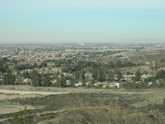
It was a pleasant walk with no hills, so I just kept going and going until I came to a place called Santa Teresa and decided to start back. The scenery was absolutely beautiful…

wpid-dscn3314-2013-08-14-15-41.jpg

What had begun as a 45 minute walk turned into a 5-hour hike. On the way back, I was able to see a single building from the ruins at the top of the mountain.

wpid-dscn3324-2013-08-14-15-41.jpg

While a casual 90-minute walk wouldn’t have been a problem, I wasn’t really prepared for the length I ended up walking. I wasn’t wearing the correct socks and managed to gain a couple of blisters, something that rarely happens to my feet.

The next morning I was up at 4.30 and getting ready for the climb to the ruins. The hostel is prepared for this as breakfast begins at 4am.

The 2000 steps climbing up to the ruins were built in typical Inca style, although with the road winding up the side of the mountain for the buses, I’m sure the stairs weren’t built by the Incans.

wpid-dscn3409-2013-08-14-15-41.jpg

The stairs were strenuous on their own although I’ve climbed more difficult mountains, but add the altitude and it becomes challenging. (Add blisters and it’s even worse!) I made it just after 7 when the mass of tourists from the buses were trying to get into the city. This is what I’d expected and why I call Machu Picchu the Disneyland of South America.

wpid-dscn3326-2013-08-14-15-41.jpg

I finally got in just before the sun rose over the mountains to shine on the city, lighting it up the stone work in the pinkie yellow of first light.

wpid-dscn3340-2013-08-14-15-41.jpg

There’s a lot that can be said about the city, but much of it is speculation and not on my part. There are few signs but beyond telling you where the exit is, they don’t tell you anything about the ruins. No-one’s really sure what the full story behind the city is and I was only able to garner a small amount of information by listening in to the many guides around the different parts of the city.

These two mountains are Huayna Picchu (the shorter) and Wayna Picchu. Wayna Picchu has a temple built atop it with a precarious path leading to it. You need to pre-pay to get to these mountains and I hadn’t.

wpid-dscn3353-2013-08-14-15-41.jpg

The ruins were discovered in 1911 when a local advised a US American that there was Incan architecture atop the mountain. He scaled the mountain and discovered the overgrown city.

wpid-dscn3358-2013-08-14-15-41.jpg

Machu Picchu was thought to have been built as the winter home of an Incan emperor and is said to have been abandoned before the spanish conquests in 1534. This is one of the many speculations of its existence. The house at the top of the tiers is the highest point in the city and the peak of Machu Picchu Mountain is behind it.

wpid-dscn3363-2013-08-14-15-41.jpg

The city was thought to be the lost city of the Incas but many think the lost city is another, larger city, several days away in the jungle. Other stories say that this was an Incan Concubine city for the emperor, with 100-200 concubines living here.

wpid-dscn3370-2013-08-14-15-41.jpg

Nestled as it is on the top of a mountain, the city isn’t flat, with many terraces and stairs. Corridors were thin or closed off to protect areas of the ruins, meaning it could be slow going with all the tourists trying to get around.

wpid-dscn3390-2013-08-14-15-41.jpg

It takes about two hours to walk around the ruins, but even in the middle of winter it’s very warm during the day. There are large open grassy areas, possibly where crops were sown.

wpid-dscn3394-2013-08-14-15-41.jpg

At the end of my walk around the ruins, I decided to climb Machu Picchu Mountain. The stairs up the side were even steeper than those leading up to the city.

wpid-dscn3405-2013-08-14-15-41.jpg

I got to a spectacular viewing area about half way up (about the same height as Wayna Picchu). With the altitude, the heat and my general state of exhaustion I decided to forego the rest of the climb and headed back down again.

wpid-dscn3408-2013-08-14-15-41.jpg

I found my way to the exit and began descending back down the stairs to Aguas Caliente. At 30°C+ it was very hot going and exhausted, I finally reached the hostel and a welcoming shower.

While Machu Picchu is packed with people – 2500 are allowed there a day – that was the only downside of the ruins. The reconstruction of parts were great and the city overall is amazing. I certainly enjoyed my visit and while expensive, it’s something I had to do, unlike the Inca Trail, where the amount of people would have spoiled my enjoyment.

Next, I am off to Arequipa, a southern city in Peru in hope of hiking through Colca Canyon, a canyon twice as deep as the Grand Canyon in the US.

The Lone Trail Wanderer

Cusco, Peru – Impressions

Cusco in Southern Peru is the historic capital of the Incan Empire from its establishment in the 13th century until the Spanish invaded in 1534 and sacked the place, destroying many of the Incan buildings so they could create their own city in its place. There are still a few Incan structures left, some temples and some think stone walls. Cusco was supposed to have been built in the shame of a Puma, a sacred animal of the Incans.

Like La Paz, Cusco is build in a bowl, although it’s nowhere near as large, only one or two of the bowl walls have housing built on them. And unlike La Paz, which is totally built using clay bricks, there’s not a single clay brick house in sight.

wpid-dscn3274-2013-08-10-16-15.jpg

Cusco is high in the Andes at around 3400m above sea level and has a lot of old spanish architecture dotted around the city…

wpid-dscn3273-2013-08-10-16-15.jpg

There are also many plazas around the central city and most have fountains. There are more fountains here than any other single place I’ve been to in South America. There are also more tourists here in Cusco than I’ve seen in one place elsewhere in South America. There’s good reason for this, Cusco is 71km away from the number one tourist site in South America; Machu Picchu. When walking around the city, there are groups of tourists 20-30 thick walking everywhere.

wpid-dscn3270-2013-08-10-16-15.jpg

There are quieter places in Cusco, many of the roads around the city central are cobbled and rather quaint.

wpid-dscn3277-2013-08-10-16-15.jpg

Then, while in Peru, one must try one of the delicacies, deep fried Guinea Pig. I compare it to dark duck meat, and while it was nice, it’s not something I’ll be eating all the time.

wpid-dscn3279-2013-08-10-16-15.jpg

On the streets of Cusco, around the central plazas, are lots of hawkers trying to sell different tours and the like. they go along with the many, many tour operators stores everywhere. But tours aren’t the only thing they’re hawking, they also push massages, suggesting you’ll need one after climbing to Machu Picchu.

My next stop is a small town called Aguas Caliente, literally ‘hot waters’ or hot pools. It’s only 4km from Machu Picchu and other than the Inca Trail is the only way to get there. My aim is to be up at 4am to make the climb to the hidden city to be there at sunrise and to miss most of the tourists. And while I love to hike, I plan to not do the Inca Trail as I call it Disneyland, there are just so many people walking it that it goes against why I like to hike, the serenity and quiet of nature. There are plenty of other places in Peru to hike and I have a couple planned.

The Lone Trail Wanderer

Lake Titicaca, Copacabana and Isla del Sol, Bolivia

At 3800m above sea level, the massive Lake Titicaca is the highest navigable lake in the world. Stretching 190km in length, the blue watered lake just disappeared off into the horizon.

wpid-dscn3216-2013-08-7-12-23.jpg

From the Bolivian side, Copacabana is the city on the lake and the only way to get there from La Paz is by bus, also meaning a 15 minutes ferry ride, as the direct road actually crosses into Peru and back again. Copacabana as taken from a ferry…

wpid-dscn3266-2013-08-7-12-23.jpg

There are several small islands near the southern end of the lake…

wpid-dscn3226-2013-08-7-12-23.jpg

With the major island on the Bolivian side is Isla del Sol, the Island of the Sun, a place where the Incas believed the sun lived. There are more than 80 ruins on the island, this one being the Temple of the Sun…

wpid-dscn3229-2013-08-7-12-23.jpg

The most common thing to do from Copacabana is to catch a ferry to Isla del Sol. Landing on the Southern pier there is a daunting set of steps leading up. It’s more daunting knowing that at altitude it’s going to be a difficult climb.

wpid-dscn3234-2013-08-7-12-23.jpg

At the highest point of the island is a small castle which is being built for tourist purposes. On the island there are numerous hostels and restaurants for the Gringo visitors, of which there are about 250 a day, some choosing to stay overnight, while others return to Copacabana.

wpid-dscn3245-2013-08-7-12-23.jpg

Small communities are dotted all over the island, with 800 families living here…

wpid-dscn3253-2013-08-7-12-23.jpg

Off to the east is Isla del Luna, Island of the Moon.

wpid-dscn3258-2013-08-7-12-23.jpg

When you’re this high in the mountains, you don’t expect to see such a massive lake, but it’s a thing of beauty. While Copacabana is a typical Bolivian small city with plentiful brick buildings, there’s also a large tourist base and plentiful hostels and hotels. With many of the hotels offering similar prices to the hostels, it’s often a better choice to treat yourself.

Unfortunately while I was here, it was Bolivian Independence week and there were markets everywhere. The unfortunate part is that all accommodations are more expensive at this time of year.

Next, I head off to Cusco, capital of Peru.

The Lone Trail Wanderer

Andean High Plains and Salt Flats, Bolivia

High in the Andes is the Altiplano Plateau at an average altitude of 3750m above sea level. There are many attractions on the Altiplano, the most popular of which is the Salar de Uyuni, a massive salt flat where an inland salt lake drained leaving only salt. While some people just come here for the salt flats, many do the longer tour along the length of the plateau with the Salar as the first day.

I decided to do a 3 day tour, not including the overnight bus to and from Uyuni…

Day 1
The bus from La Paz to Uyuni was comfortable, but the road wasn’t. The ride is 10 hours, the last 7 being over a rocky dirt road. This was an overnight bus, so the last 7 hours were when we were trying to sleep. Strangely enough, plentiful sleep was had by all.

Once the bus arrived in the town of Uyuni, there was over an hour before the tour started, so a quick look around town and half an hour later I’d seen most of it.

There were six of us on the tour and we were packed into a Land Cruiser and taken to our first stop, the train graveyard.

wpid-dscn3053-2013-08-1-18-57.jpg

Trains were used for many years as a major goods transport means around this area of South America and Bolivia, but most stopped over 40 years ago. There is still a line running from Bolivia to Chile, however. The graveyard is not that large and is definitely a tourist stop around the old rusting trains. In the car park I counted 30 4WD vehicles. If each had 6 tourists then that’s 180 people starting tours today, plus drivers. This was not counting the 4WDs we saw leaving as we arrived or the ones arriving as we left. It’s the middle of the high season, after all…

wpid-dscn3069-2013-08-1-18-57.jpg

Next was a quick stop off at Colchani for some markets, selling things made out of hardened salt and Llama wool. Colchani is right on the edge of the salt flats and is a major refining town.

Then we were onto the Salar themselves, stopping just inside where workers from Colchani were scraping patches of unrefined salt into piles. There are plentiful piles there already and they’re not as sandy as they look but very hard. I stood on one and it was solid. We even tasted the salt but it only had a faint salty taste.

wpid-dscn3071-2013-08-1-18-57.jpg

Another 30 minutes away, we stopped at a hotel made completely from blocks of salt. We then drove 80km across the flats to Incahuasi Island, a large rocky outcrop in the middle of the flats. From different places on the island you can see where water would lap at the beaches during wet season when it’s surrounded by several centimetres of water.
wpid-dscn3077-2013-08-1-18-57.jpg

We stopped for lunch before exploring the rocky structure of the island with its huge old cacti, some of which have been dated as being more than 900 years old.

wpid-dscn3103-2013-08-1-18-57.jpg

Leaving the island, we drove for a couple of hours across the flats, stopping briefly for some photos of the open salt flats…

wpid-dscn3108-2013-08-1-18-57.jpg

…before leaving the flats and coming to our overnight destination, Hostel Samarikuna in the town of Villa Candelaria, another building made from salt bricks. Llama chops for dinner!

wpid-dscn3117-2013-08-1-18-57.jpg

Day 2
We left Salar de Uyuni early in the morning and drove across the vasty smaller Salar de Chinguana which is less white than the Uyuni salt flats. We stopped under a series of volcanos along the Chilean border on a patch of very white and very strong tasting salt.

wpid-dscn3121-2013-08-1-18-57.jpg

Next we drove to the lava fields under Volcan Ollague to look at various rock structures made by dried lava.

wpid-dscn3134-2013-08-1-18-57.jpg

The road became rockier as we made out way past several lagoons most of them with their own flocks of Flamingos, some pink and others not so pink.

wpid-dscn3152-2013-08-1-18-57.jpg

We stopped at a vantage point over one of the lagunas for lunch.

wpid-dscn3151-2013-08-1-18-57.jpg

After lunch, we drove for a couple of hours through the Siloli Desert where no vegetation grew.
wpid-dscn3158-2013-08-1-18-57.jpg

The barren landscape is nothing but rocks and sand under the ever present volcanoes, of which there are more than 50 along the plateau. We travelled along the Andes Ranges wall for some time, stopping only to climb a rocky embarkment where I spied an Andean rock rabbit, but it was too quick to get on camera.

wpid-dscn3161-2013-08-1-18-57.jpg

Next, we stopped at a large stone forest with the famous Stone Tree. It’s very much like the Remarkable Rocks in Australia, formed by a lava bubble that came up through the surface, hardened and eroded over time.

wpid-dscn3166-2013-08-1-18-57.jpg

Lastly for the day, our trip took us cross country another hour to Laguna Colorado, a lake where sediment has turned it a milky red, with patches of floating snow.

wpid-dscn3174-2013-08-1-18-57.jpg

Flamingos stand in its waters sifting for food. We were dropped off at a mirador on the lake and walked around it to our accommodations for the night.

Day 3
The temperature dropped to -15°C overnight. We were up at 4.45am and getting ready for the day. After breakfast we were off into the icy darkness along a road which looked to have been plowed. The road itself was clear but on either side a wall of snow sometimes up to two metres tall.

We drove through the icy mountains landscape as the sun began to rise, stopping at a man-made geyser…
wpid-dscn3180-2013-08-1-18-57.jpg

…then to a field of natural geysers.
wpid-dscn3185-2013-08-1-18-57.jpg

It was so icy we only got out long enough to take a photo before getting back into the warmth of the vehicle.

We then drove to an aguas caliente – a hot pool fed by a natural spring at nearly 5000m above sea level. Three of us stripped down in the icy weather and threw ourselves in. Most people refrained from getting in, but the heat of the water in the cool air was amazing! We finally got out after about 30 minutes when some of the other vehicles had arrived and other travellers had braved the water. Getting out was not as cold as expected, the hot water having lifted our core temperatures enough that the skin chill was not enough to cool us.

wpid-dscn3187-2013-08-1-18-57.jpg

Once dressed, we were off again and an hour later was at Laguna Verde – Green Lake. We didn’t stay long in the freezing winds before heading to the tri-border of Chile, Argentina and Bolivia. It was here I said goodbye to my five travelling companions who were heading into Chile, me alone with our driver who didn’t speak any english, for an 8 hour trip back to Uyuni.

wpid-dscn3195-2013-08-1-18-57.jpg

We took an alternative route back to the Laguna Colorado through a frozen wilderness and a rugged but more direct route towards Uyuni. About ten minutes before we were due to stop for lunch the passenger steering stabilising hinge snapped leaving the wheel hanging at an odd angle. The driver began taking it apart and after an hour had it in pieces. It was going to take him a lot longer to fix so I was squeezed into another 4WD that had stopped and was off again.

The next stop with my new crew was a place called Valle de Rocas with some impressive rocky outcrops and spires.

wpid-dscn3201-2013-08-1-18-57.jpg

On our way again, we were 20 minutes from Uyuni when the 4WD got a flat tire on the same wheel as the previous vehicle!! Argh! They didn’t have a spare either, having already had a flat tire on their adventure. We flagged down another vehicle and borrowed one.

We eventually made it back to the Uyuni ready for the overnight bus back to La Paz.

Overall, it was another great experience along an amazing mountainous landscape. Next, after a brief stop off in La Paz, I’m off to Lake Titicaca.

The Trail Wanderer

La Paz, Bolivia – Impressions

Nuestra Señora de La Paz (Our Lady of Peace) is Bolivia’s second largest city – after Santa Cruz de la Sierra – and is set high in the Andes mountains on the Altiplano (high plains in spanish). The city is built in a bowl, almost like a crater, with the rich and middle class living towards the lower areas in the centre. When the city began to expand the only way it could go was up, so in all directions the houses were built up the sides of the bowl. The poorer people of La Paz live in the brick buildings that span all visible walls. At night, the lights of the city are a marvel to see, both from the centre looking up and from the rim looking down.

wpid-dscn2896-2013-07-26-15-23.jpg

On the southern horizon of La Paz is Bolivia’s 2nd tallest mountain, Illimani, at just over 6,400m. Illimani is only the 18th tallest mountain in the Andes.

wpid-dscn3042-2013-07-26-15-23.jpg

As you arrive in La Paz by bus, you will no doubt travel around the top of the bowl and be amazed when you look down at the sprawling city below. However, for the first couple of days, the central city – no doubt where you’ll be staying – seems a little dirty and run down, with the calls of Bolivians trying to sell you whatever they can or the beggars silently holding their hands out to you. As you slowly explore the city over the first couple of days, it grows on you very quickly. There’s a certain charm about La Paz.

wpid-dscn3048-2013-07-26-15-23.jpg

La Paz has plentiful markets and shopping areas, but there’s a strange thing that I’ve found about Bolivia in general is that they don’t have just one store selling something, they have an entire block of small stores selling the same thing. As an example, I spent 2 days in the city of Santa Cruz before coming to La Paz and found a three story mall with about 100 shops in it, 95 of them selling mobile phones. Most of the stores were selling exactly the same models too. This is the same in La Paz, I walked through the hardware sales section of the central city and there were shop after shop selling exactly the same thing, with even smaller booth shops set up in front of the other shops selling the same thing also. It did make it easier when I was looking for a new sleeping bag, all the adventure stores were grouped together as well.

wpid-dscn3049-2013-07-26-15-23.jpg

The location of La Paz enables it to be a hub for many different activities, with plentiful hikes across the altiplano, the Death Road, and busses leaving for the jungle to the north or the salt flats to the south. In the city there are a couple of parks and miradors, but most things are just outside the city. When walking around the city, you will note a plentiful small plazas and the occasional piece of architecture. On one day, I caught a taxi to The Megacentre, a multi level mall with large movie theatre. When you enter the centre, you wander if you’ve left Bolivia.

wpid-dscn3051-2013-07-26-15-23.jpg

Lastly, unless you have come from the high areas of Peru or the salt flats, you are going to have to deal with the altitude. The lowest point of La Paz is 3,500m while the highest is 4,200m. So, for the first day in the city, you might have a serious headache and it will be hard work climbing the numerous hills or stairs, as the lack of air will have you gasping like crazy. There are plentiful ways to deal with altitude sickness, pre dosing with altitude pills, chewing on coca leaves, buying special coca powder (no, not cocaine, although that is derived from the leaves) or similar. After a few days it gets easier, although you may still have issues climbing steps.

My time in La Paz has been most enjoyable and I would recommend a visit if you are in the region.

The Lone Trail Wanderer

El Choro, Bolivia

The El Choro Trek is a three day trek that’s easily accessible from La Paz in Bolivia. I wanted to do different trek here in Bolivia, but without my own transport, many of the treks are difficult to get to. And while I tend to like hiking alone, the easiest means to do this trek is via a tour. This means I wouldn’t be carrying any food or a tent, as there will be a porter along with us to do that. This is the first time not having to carry all of my own equipment and it doesn’t feel quite right.

DAY 1 – La Paz to  Challapampa

The agency I booked through picked me up at 9.30 and I met the two other people I’d be hiking with, a french guy who spoke spanish well and some english, and an argentinian born girl who had been living in New Zealand most of her life. She spoke english and spanish perfectly. The guide with us only spoke spanish and his porter english and spanish. So, spanish became the spoken language of the trek and with my meagre understanding I decided hike alone for the most part.

The trek begins very near the start of the Death Road in a snowy mountainous area at a altitude of 4,800m. It was freezing that high up with an icy wind, so we couldn’t wait get started.

wpid-dscn2904-2013-07-26-15-23.jpg

The first 100 metres of the trek climbed to the highest point of the trail, 4,900 metres. This was the hardest 100m I’ve ever climbed in my life. With such thin air, I barely got 10 steps before having to stop and get my breath back, and I was only carrying half my usual weight! Eventually, we crossed over the ridge and the cold winds ceased. Ahead of us along the valley we could see the trail through the valley and a set of ancient Incan ruins at the base of the slope. The ruins were once a rest stop for travellers on the trail. Food and shelter was always offered for free.

wpid-dscn2910-2013-07-26-15-23.jpg

The trail weaved down the side of the mountain towards the ruins and it began to slowly get warmer, so we started shedding some of our warm weather clothes. At the ruins we stopped for a rest and watched as a Llama train came by. The Llamas and their master were returning from a delivery earlier in the day.

wpid-dscn2916-2013-07-26-15-23.jpg

We pushed on along the trail that from time to time was obscured by low cloud, through fields that housed other ancient ruined buildings and walls.

wpid-dscn2925-2013-07-26-15-23.jpg

Eventually, we came to a pair of newer buildings that were being used as farms raising Llama’s and drying several different kinds of small potatoes… We stopped for 30 minutes before pushing on.

wpid-dscn2932-2013-07-26-15-23.jpg

Much of the rest of the day was spent walking through the low cloud, so visibility was only several metres, meaning the focus went on the ‘road’ we were trekking along. We were told that it was originally built by the Tiwanaku, a race of people who would eventually become the Incans, and had been repaired by the Incans, so it was difficult to tell which was which. In the clouds, the stones get very slippery.

wpid-dscn2946-2013-07-26-15-23.jpg

Our day ended upon reached the very small settlement of Challapampa, where our guide and porter set up the tents and cooked our dinner. From the high point of 4900m, we had descended to 2400m. And while it rained during the night, it was a lot warmer.

DAY 2 – Challapampa to San Francisco
wpid-dscn2953-2013-07-26-15-23.jpg

Today we hit the Cloud Forest, a fairly untouched area of the valley which is usually covered in cloud. For only short periods of the day the clouds parted, but for most of the time, we could see the cliff edge, but beyond it only cloud.

wpid-dscn2955-2013-07-26-15-23.jpg

The trail meandered along the side of the valley for much of the day, climbing and descending small hills as we trekked along the thinner ‘Incan road.’

wpid-dscn2959-2013-07-26-15-23.jpg

The valley disappearing in cloud…

wpid-dscn2967-2013-07-26-15-23.jpg

…and opening up again.

wpid-dscn2976-2013-07-26-15-23.jpg

One wonderful part of the day was the plentiful different species of wild flowers that were growing along the sides of the trail. My super zoom camera getting great close up shots of most of them.

wpid-dscn2981-2013-07-26-15-23.jpg

We stopped for lunch at a small set of huts and rested for a while. Most importantly they served cerveza! Beer, in spanish.

wpid-dscn2998-2013-07-26-15-23.jpg

The rest of the trail was fairly straight forward, again with plentiful wild flowers. We eventually reached San Francisco, a tiny collection of huts, where the guide and porter erected our tents and cooked our dinner.

wpid-dscn3008-2013-07-26-15-23.jpg

DAY 3 – San Francisco to Chairo
We left San Francisco just after day break and headed away down the hill towards a river.
wpid-dscn3015-2013-07-26-15-23.jpg

As we slowly worked our way lower through the forest, we met a couple of wild donkeys who, after being initially fearful of us, just stood there and let us go past as if we weren’t there.

wpid-dscn3017-2013-07-26-15-23.jpg

We arrived at the river and crossed on a fairly new wooden suspension bridge. We were alerted to the carcass of a horse in the river under the bridge. We stopped on the other side and prepared ourselves for the climb to come, known as Subida del Diablo – the devil’s ascent.

The Subida del Diablo gets its name because it’s a very difficult climb up slippery Incan paving stones at a fairly steep incline that just keeps climbing.

wpid-dscn3023-2013-07-26-15-23.jpg

Once at the top, we stopped for a break at a place owned by an old Japanese man. Stories say he is a war criminal fled to South America after World War 2, but who knows. There is a camping spot at the back of his property next to the cliff line giving wondrous views along the valleys until the clouds again came rushing in.

wpid-dscn3027-2013-07-26-15-23.jpg

The trek continued for some time along the trail high up in the mountains. From time to time we could see the river below us, but clouds would race in to cover it quickly. Eventually, we started our decent until we could see the village of Chairo below us. It didn’t take us long to get down to the village where the guide ordered us lunch from the local cook house and we sat eating until our van arrived to take us to Choico, where death road finishes.

wpid-dscn3033-2013-07-26-15-23.jpg

We waited in Choico for an hour before catching a minibus back to La Paz. 3 hours later I was delivered to my hostel for a well deserved shower.

Overall, El Choro was a good hike where we spent much of our time climbing down. By the end, our calves were sore from the constant descending. While the low clouds meant that much of the view was hidden from us for parts of the hike, it was still good to get out into the wilderness and away from the city for a while.

Next, I head down to southern Bolivia to the Salar de Uyuni, one of the largest salt flats in the world.

The Lone Trail Wanderer

Death Road, Bolivia

Leading 69km across Bolivia from La Paz to the small town of Coroico is a road called North Yungas Road. North Yungas Road has another name, Death Road, and in1995 it was christened the world’s most dangerous road because of an estimated 200-300 deaths each year. Death Road runs along the side of a precarious cliff for most of its length. If you tip over the edge, it is 600 metres straight down and there aren’t any guard rails to stop you.

Because of the danger, a new road has been built over the course of 20 years ending in 2006, although there are parts that are still under construction and some impatient Bolivian drivers still tempt fate on Death Road. Since the mid 90’s when most of the traffic started using the new road, the road became a tourist attraction. People suit up and ride mountain bikes along most of the length of the rocky and dusty road. Since the road starts at about 4700m above sea level and finishes at 1200m, very little pedalling is required, you just steer, brake and try not to fall off. Since 1998 there have been at least 18 cyclists die on the road from about 25,000 cyclists who have ridden it…

So, with all that, one must be tempted by the attraction, so a small group of us from a couple of hostels decided to join the masses and ride the Death Road… We were one of about five adventure groups doing it this particular day, with a total of about 40. With 69km there was plenty of room for us.

The day started out slowly, it had rained overnight, which meant that higher up, it had snowed. We were picked up at 9.30 and waited at the bus station for about 2.5 hours before the police opened the road. Then with everyone going at once, it took us nearly 90 more minutes to get through the check point out of town. For a ride that was supposed to begin at 10.30, we finally got started at 2pm.

wpid-dsc01623-2013-07-26-15-23.jpg

At 4,650m it’s icy and we all shivered while getting into our clothing for the ride. Then after safety instructions we were off along the first 9km of road which is fully sealed. Being sealed means an easier run and for some a faster one.

wpid-dsc01645-2013-07-26-15-23.jpg

The first part on the sealed road was amidst amazing views of the snowy peaks. The sealed road can be made out on the left of the photo below… We made good time overtaking slower trucks and buses as we raced along.

wpid-dsc01629-2013-07-26-15-23.jpg

Then, we were back in the van and driven to the official main entrance to Death Road, where it actually becomes a rocky, dirt road. We had a late lunch then headed off, still dressed in out full kit as it was icy, and those without sun glasses had tears streaming down their faces. After a time we stopped to pose for photos – something we did regularly along the road.

wpid-dsc01689-2013-07-26-15-23.jpg

A couple of times during the ride, we were tailed by a truck and had to pull off to the side to let it past.

wpid-dsc01709-2013-07-26-15-23.jpg

As we got further along the road, it began to get warmer and thankfully the van we came in was following us down so from time to time we could strip off some of the layers. On one of the more famous corners of the road, we took photos on the edge of cliff. Some of the group were more cautious about being close to the edge while others of us were less worried. That’s me on one leg…

wpid-dsc01714-2013-07-26-15-23.jpg

Again as we got lower, the temperature grew warmer, and even passing under the occasional waterfall sprinkling the road was not enough to cool us down. Then we were forced to pull to the side as a series of trucks went past…

wpid-dsc01723-2013-07-26-15-23.jpg

About three quarters of the way down, some of the locals were having a celebration on the side of the road and we stopped for photos.

wpid-dsc01730-2013-07-26-15-23.jpg

By the bottom of the road, some of us had stripped down to singlets in the heat.

wpid-dsc01734-2013-07-26-15-23.jpg

At the end of the road, we were back in the van and taken to a resort where we spent only an hour (if it hadn’t been for the wait earlier in the day, we would have stayed longer). We did get to have a dip in the pool, some food and a couple of beers before getting back into the van and the 3 hour trip back to La Paz.

wpid-dsc01736-2013-07-26-15-23.jpg

Overall, it was a very fun day with a fun group of people. The road was nowhere as dangerous as imagined and was exhilarating enough that I have considered doing it again.

Next, I’m off for a three day hike through the Bolivian mountains.

The Lone Trail Maniac Cyclist.

Rio de Janeiro, Brazil – Adventures

Rio de Janeiro is Brazil’s second largest city. There’s so much going on in Rio that it’s one of the more interesting and entertaining cities I’ve been to in South America. Rio is nestled among some monolithic hills on the edge of the bay similar to the Glasshouse Mountains on the Sunshine Coast in Queensland, Australia.

wpid-dscn2820-2013-07-8-15-35.jpg

The city is rather spread out with a pair of small national parks nestled within the city. And, unlike elsewhere in South America, there’s a decided lack of dogs in Rio. Which means there’s a lot less dog crap on the streets and that cats reign supreme in the city.

My 24 hour trip to Rio was my longest bus ride to date. Most buses I’ve travelled in have been semi-cama (half bed) – similar to many air line seats – while there have been a handful of full-cama – almost full bed. The bus to Rio was all full-cama and quite comfortable but it didn’t have a food service. This turned out well though as for al meals the bus stopped at buffet restaurants that charge by the kilogram .

When I arrived in Rio, I found it to be the dirtiest city that I’ve been in so far, with graffiti covering the majority of the buildings. It didn’t give me the safest feeling. I quickly caught a taxi to my hostel, which turned out to be a very small place with people jammed into 3 small rooms and very little else. One bathroom for 18 people is just not enough. The hostel was also in a central area of town and not in the more famous beach areas. It was very cheap, so I guess you get what you pay for.

A couple of days later, I did a walking tour around the city to some of the more prominent sites in the central city and Lapa, the famous samba party suburb next to it. The city has many well designed buildings, churches, museums and municipal theatres.

wpid-dscn2709-2013-07-8-15-35.jpg

The cathedral is like no other cathedral I’ve seen.

wpid-dscn2705-2013-07-8-15-35.jpg

It holds 10 thousand and has amazing acoustics. Looking up from the inside…

wpid-dscn2708-2013-07-8-15-35.jpg

Then, from the central city you can look out across the bay to the suburbs on the eastern shore.

wpid-dscn2713-2013-07-8-15-35.jpg

Next, I booked a full city tour, to do some more of the touristy things. It took me to the Lapa Steps built by a Chilean artist…

wpid-dscn2758-2013-07-8-15-35.jpg

… to the Lapa arches, Maracanã stadium before up the mountain to see the most famous of attractions in Rio, Cristo Redentor – Christ the Redeemer.

wpid-dscn2736-2013-07-8-15-35.jpg

The hill it stands on gives great views over one part of the city and the peninsula that ends with Sugarloaf Mountain.

wpid-dscn2746-2013-07-8-15-35.jpg

Lasty, we were delivered to the end of the peninsula and took cable cars up to Sugar Loaf mountain. The views from both mountains are amazing.

wpid-dscn2767-2013-07-8-15-35.jpg

Getting to the top of the monolithic Sugar Loaf is a two step journey, the first up to Morro da RCA then up via the cable car another 1500m to Pão de Açúcar (Sugar Loaf Mountain).

wpid-dscn2784-2013-07-8-15-35.jpg

We stayed up there until sunset and watched the lights of the city appear below us. Definitely a spectacle to be seen.

wpid-dscn2807-2013-07-8-15-35.jpg

After a week in a tiny hostel in the city, it was time to move to the beach, so I booked three nights at a Copacabana beach hostel. On the second day, I hired a bike and rode the length of the busy Copacabana and Ipanema beachs.

wpid-dscn2809-2013-07-8-15-35.jpg

While it’s the middle of winter, it’s a beautiful 27ºC here and the beach has plentiful sun bakers, kite surfers and beach sports. The classic brazilian bikini is everywhere…

Rio de Janeiro has been an awesome experience. It feels more like a group of very different cities all merged in together.

Next I head towards Bolivia, stopping off in the Pantanal, the worlds largest wetlands…

The Lone Trail Wanderer

Mendoza, Argentina – Adventures

My bus trip from Bariloche took 19 hours. For such a long trip there are two different seat types on the bus: semi-cama, similar to airplane seats, and cama, which means ‘bed’ in spanish. For the overnight trip I went for the more comfortable cama seats, although while better than the semi-cama was nothing like a bed.  Comfortable as it was, I only got half a night’s sleep I arrived in the desert city famous for its wine.

Mendoza is a city of 850,000 people and my hostel, Hostel Lao, was a few blocks from the bustling city centre. After spending so much time in Patagonia, with its small towns and cities, to come to a big city bustling with people was a shock to the system. But once I got used to it, the jewel that was Mendoza began to sparkle.

DSCN2460

Still exhausted from my bus trip, I went out clubbing with a group from the hostel until 6am. The night life of Mendoza on a Friday night was certainly good, although beyond the smelly fact that smoking is allowed in their clubs, there were few issues for our little group of ‘gringos’ and an awesome night was had.

After spending Saturday quietly recovering, on the Sunday a small group of us headed out to Auga Termas. 45 minutes from the centre of town, the thermal hot pools were set in a beautiful location, hidden in a gorge between rocky ridges…

wpid-dscn2443-2013-06-9-18-32.jpg

There were many different pools of varying temperatures. Inside, there was a mud pool where you cover yourself, let yourself dry before washing it off in the blast showers. Included in our visit was a huge buffet lunch, Argentinian style. We ate and ate then enjoyed a couple of bottles of fine Mendoza wine outside in the sun, before heading back to the pools. Before we left, three of us had full body massages. A fantastic day.

A couple of days later I moved to Hostel Mora, a cheaper hostel just around the corner. While Hostel Lao was supposed to be the best hostel in Mendoza if not the continent, in my opinion, Hostel Mora did it better. Pretty much all hostels in Mendoza offer a free glass of wine each night, while Hostel Lao offered it five nights a week, on arrival Hostel Mora opened this 4.75 litre bottle of Malbec…

wpid-dscn2450-2013-06-9-18-32.jpg

The weather in Mendoza was brilliantly sunny. It is the desert after all and after 3 months in the colder south, it was nice to feel warm again.

DSCN2448

On the western side of the city is the massive Parque General San Martin and on the far side, another 45 minutes walk, is Cerro de la Gloria.  After a rough ten minute climb I made it to the top for good if not a little hazy views across the city. All trees in Mendoza are hand planted and watered using an irrigation system based on the snow melts of the Andes.

DSCN2456

You can’t come to Mendoza without going on a wine tour. Some choose to be driven around but for the keen, bikes can be hired for next to nothing and a self-guided tour done.

DSCN2462

I’ve been particularly enjoying the Malbec, a type of red wine that is very popular in Argentina. Riding bikes around the roads of the wineries after many glasses sounds dangerous, but it was actually rather refreshing. So too was sitting at the bodegas drinking wine and enjoying the view…

DSCN2467

After eight days in Mendoza it was hard to say goodbye. I had such a fun time, drank an awful lot of wine and met some great people from all over the world.

Things to do in Mendoza:

  • Walk through Parque General San Martin
  • Climb the towering Aconcagua, highest mountain in The Americas
  • Cycle a wine tour around Maipu wine region
  • Cycle a wine tour around Luján de Cujo region
  • Visit one of the other 12 wine regions
  • Explore Witches Cave
  • Have a steak dinner in the city

Next I bused to Córdoba, the city at the centre of Argentina.

The Wine Cycling Trail Wanderer.

El Bolsón, Argentina – Impressions

For my final stop in Patagonia I caught a bus 100km south of Bariloche to the small town of El Bolsón.

El Bolsón is known in Argentina for the typical Patagonian trekking and mountaineering experience, fly fishing, art, its regular markets, micro-breweries and for being a hippie town. The label of hippie town was what caught my attention and is the tag line that draws most other travellers to the town.

wpid-dscn2439-2013-05-21-15-401.jpg

I only spent a couple of days in El Bolsón and while it did seem like a nice small community in a great location, I didn’t find a lot to actually make it a hippy town. The sculptures in and around the town centre were pretty cool, but the markets were fairly typical selling many of the usuals: home-made jewellery, carved wooden things, sewn items and a myriad of different semi precious stones.

wpid-dscn2432-2013-05-21-15-401.jpg

El Bolsón sits between two great rocky ridges, a 2km tall range that got a powdering of snow on my second day…

wpid-dscn2438-2013-05-21-15-401.jpg

…and one 1,600m tall range. The trekking did look amazing but El Bolsón is in Patagonia. But since my visit was during a rainy last week of autumn, I hadn’t planned to go hiking.

wpid-dscn2434-2013-05-21-15-401.jpg

While my visit to El Bolsón was inexpensive and relaxing, with winter arriving, it was time to head to warmer climates.  After a brief stop off back in Bariloche, I headed north into the desert to the wine region of Mendoza.

Some things to do in El Bolsón:

  • Kayak Lago Puelo
  • Hike Cerro Piltriquitrón
  • Walk up to Cabezo del Indio – Indian Head Rock

The Lone Trail Wanderer