Tag Archives: Island

Looking Back, Part 2 – Central South America

After a 20 hour bus ride from Patagonia, I arrived in Mendoza, Central Argentina. Mendoza is a wine region and boasts some of the best red wines in the world. While I wasn’t the biggest fan of red wine before, after my time in the city I was a Malbec convert. One of the fun things I did while in the City of Steak and Red Wine was to spend the day enjoying some aguas calientes, a set of hot pools near the city. While this might seem strange for a desert city, it was amazing and included a huge buffet lunch.

wpid-dscn2443-2013-12-17-12-23.jpg

Around Mendoza are several wine areas and the best way to see them is via bicycle tours. The wine was delicious and cycling around the area after many glasses of wine was both crazy and fun at the same time.

Beyond the vineyards, the tallest mountain of the Andes, Aconcagua.

wpid-dscn2467-2013-12-17-12-23.jpg

Next I caught a bus across Argentina to Cordoba, the country’s second largest city. While staying in the city I got out-of-town to Parque Nacional Quebrada del Condorito – Condor Gorge National Park – for a long day walk in the heat.

wpid-dscn2517-2013-12-17-12-23.jpg

Next I headed to the Buenos Aires and stayed in a different area of the capital from the beginning of my trip. As I knew I was heading back to the city, I made contact with a friend of a friend and organised to hang out with him and his friends while I was in the city. They were very friendly and I stayed in the city over two weeks to spend time with them.

wpid-dscn2559-2013-12-17-12-23.jpg

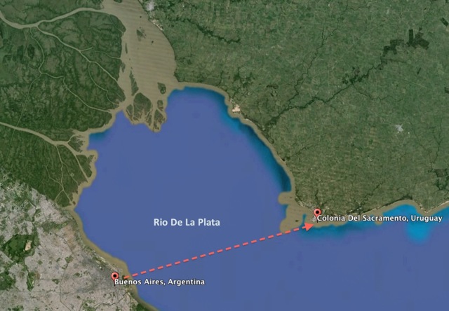
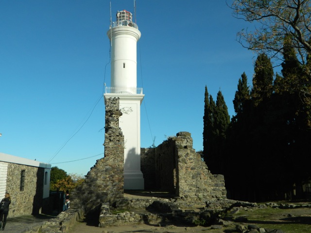
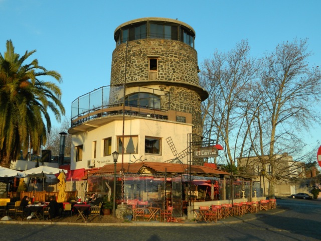
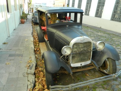
During my stay in Buenos Aires, I caught a ferry across the river to the Uruguayan city of Colonia. While I could have stayed in Uruguay longer I was happy to see the more expensive country for the day and get the stamp in my passport. I enjoyed learning about the city and the country in a guided tour.

wpid-dscn2524-2013-12-17-12-23.jpg

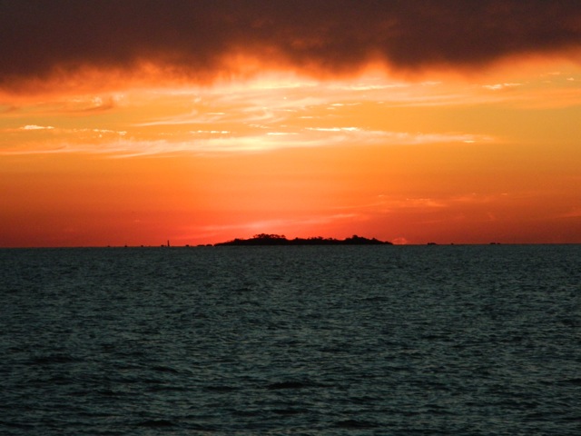
I then bused headed north for my final Argentinian destination, Puerto Iguazú. While the township was very touristy, it had good reason, Iguazú Falls is one of the more popularly visited places in the region. While it had been raining the day I visited the Argentinean side of the falls they were still like nothing I’d seen before. I even took a boat to get right up close to the spraying water.

wpid-dscn2634-2013-12-17-12-23.jpg

The following day, I took a bus across the border to the Brazilian side – Iguaçu Falls. While it’s the same set of falls, it’s a totally different sight and you get closer to the Devil’s Throat, a formation of rock that water pours into from three sides. Both Argentinian and Brazilian sides are a must see if travelling to this end of the world. It was then back across the border to Argentina for a final night before booking a bus to Rio de Janiero.

wpid-dscn2677-2013-12-17-12-23.jpg

After a 24 hour bus ride to Rio de Janeiro – the longest trip in a bus I would take – I found the city to be dirtier than expected. It also gave me a sense of danger I hadn’t experienced in either Argentina or Chile. I’d booked a cheap hostel near the location of Carnival and it turned out to be the smallest hostel I’ve ever stayed in, squeezing 18 people into the space most hostels would fit 6. It also only had one bathroom.

wpid-dscn2746-2013-12-17-12-23.jpg

The hostel aside, the natural wonders of Rio were amazing. I visited Christ the Redeemer, Sugarloaf Mountain and took a bicycle ride along both Ipanema and Copacobana beaches.

wpid-dscn2820-2013-12-17-12-23.jpg

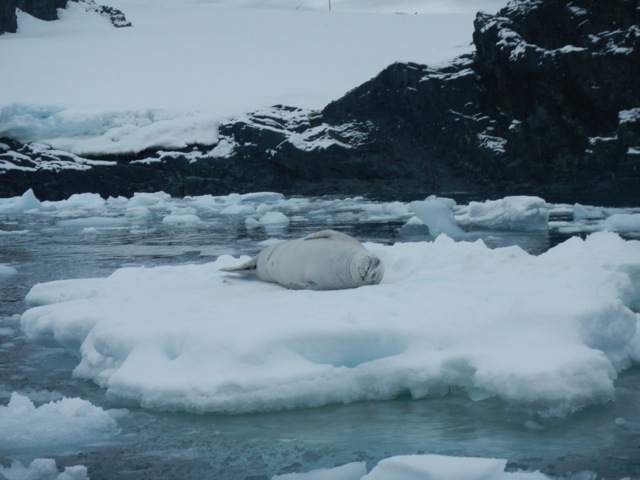
I then took my second 24 hour bus ride to a city called Campo Grande in western Brazil for an overnight tour through Brazil’s Pantanal. The Pantanal is a vast swampy area south of the Amazon. It’s similar to the jungle in many ways, just without the trees. We spent the night on the border of Brazil and Paraguay (the closest I would get to the landlocked country). On arrival we ate Piranha, the mean looking faces leering up at us from the pot. The next morning, we took a boat trip along the river to fish for more Piranha…

wpid-dscn2845-2013-12-17-12-23.jpg

…and to see Caimans, smaller cousins of Alligators.

wpid-dscn2861-2013-12-17-12-23.jpg

Then it was over the border and into Bolivia. As soon as you enter it’s obvious that Bolivia is the poorest country on the continent. The roads are bad, the towns are dirty and the buses are owner operated family affairs and include the kids running up and down the aisles while badly dubbed Steven Segal movies are blasted very loudly. My first stop was the city of Santa Cruz, where I stayed at a brand new hostel for a couple of days before heading on to La Paz.

La Paz is a bustling city high in the Andes and when I arrived my head was exploding from the altitude. It only took a good night’s sleep to recover, thankfully. While the entirety of La Paz is terracotta in colour it grows on you as you explore the city centre and beyond. The lights at night are amazing up the walls of the bowl the city is built in.

wpid-dscn2896-2013-12-17-12-23.jpg

Using La Paz as a base, I had many adventures in Bolivia. For a start, you can’t come to the city without hearing about or doing Death Road. Death Road is a crazy stretch of dirt road 65km long and famous for the cliffs on one side with no barriers. It gets its name from the people who have plummeted to their deaths from it. Riding down it on a bike is one of the most thrilling and fun things I’ve done on this trip.

wpid-dsc01629-2013-12-17-12-23.jpg

Next I hiked along an alternative route to Death Road called El Choro, through cloud forests and past my first Incan ruins. During the hike I climbed to the highest I have ever hiked, 4900m, and at that altitude the climb was intense and difficult. It was a great hike and also my first with a guide. Not something I relish, preferring to carry all of my own gear and cook my own meals.

wpid-dscn2967-2013-12-17-12-23.jpg

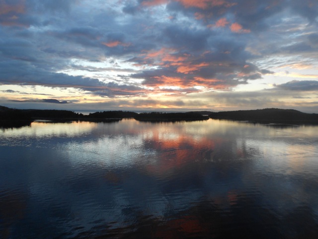
Then I caught a bus to Uyuni for a 3 day tour around the Salt Flats and along the Andean High Plains to the three-way border of Bolivia, Argentina and Chile. The Salt Flats are like an inland sea without the water.

wpid-dscn3077-2013-12-17-12-23.jpg

There were so many different terrains on the high plains and many stunning views. We visited some very interesting places, like the lodge made entirely from blocks of salt where we stayed on the first night. Views across Lago Roja – Red Lake.

wpid-dscn3174-2013-12-17-12-23.jpg

Then it was back to La Paz where I managed to suffer from food poisoning, an illness everyone seems to get in Bolivia. Don’t trust the street food! For my final days in Bolivia, I caught the bus up to Lake Titicaca, the highest navigable lake in the world. After a day tour to Isla del Sol, I booked a bus into Peru…

wpid-dscn3258-2013-12-17-12-23.jpg

Next, Part 3 of my Look Back Series where I complete my time in South America by working my way to Colombia.

The World Wanderer

Looking Back, Part 1 – Patagonia, South America

Patagonia is at the southern end of South America and is an area that is jointly owned by both Chile and Argentina. Patagonia contains the tail end of the Andes mountains, the second largest ice field in the world and is predominantly set up for tourism with is brilliant mountains, amazing lakes and so many hikes you could walk around it forever. Thankfully, that was the primary reason I came to Patagonia.

wpid-dscn2358-2013-06-9-18-24.jpg

I arrived in Usuhaia, Argentina in the last days of summer and was stunned by the beauty of the mountains and the seas near the most southern city in the world.

wpid-dscn1489-2013-06-9-18-24.jpg

With Autumn came low season and a slowing down of the tourism industry. This didn’t mean there was a lack of people, just not as many. And, if anything, it was a good thing because the numbers in high season can be overbearing. In Ushuaia, as I waited for a boat to Antarctica I did several hikes in and around the Martial Mountains.

wpid-dscn1598-2013-06-9-18-24.jpg

After a 12 day trip to the White Continent…

wpid-dscn1771-2013-06-9-18-24.jpg

I left Ushuaia for a 12 hour bus trip to Punta Arena, the southern most city in Chile, for a two day stop of before heading to Puerto Natales, another 5 hour bus ride north.

Puerto Natales has a large tourism industry set around two places, the southern fiords of Chile and Parque Nacional Torres del Paine, Chile’s most popular and most expensive national park. I spent a couple of days in Puerto Natales preparing for my hike before heading to the national park where I spent 9 days hiking around the Torres del Paine Massif. A fantastic hike.

wpid-dscn1815-2013-06-9-18-24.jpg

Back in Puerto Natales, I made the decision to catch the Navimag Ferry though the patagonian fiords, but I also wanted to head into Argentina to hike around Mt Fitz Roy. So I decided to do both. I booked the five day ferry trip and with several days before it departed, I caught a 5 hour bus across the border to El Calafate in Argentina.

wpid-dscn2189-2013-06-9-18-24.jpg

There is a famous glacier near El Calafate in Parque Nacional Los Glaciares called Perito Merino. But after coming back from 9 days hiking, and having seen plentiful glaciers in Antarctica, I decided to just rest in El Calafate for 3 days before heading north to El Chaltén. In El Calafate I had, perhaps, the best Asado – BBQ – I’ve had in South America.

El Chaltén is 3 hours by bus from El Calafate and is set at the north end of Parque Nacional Los Glaciares. The town principally supports hiking around Mt Fitz Roy, which is another name for Chaltén. For three days, I walked what I call the Fitz Roy Triangle around the mountains to see some wondrous peaks and lakes.

wpid-dscn2140-2013-06-9-18-24.jpg

Then I was back on a bus to El Calafate for the night before then heading back to Puerto Natales once more.

The following night I was on the Navimag Ferry and was preparing for the trip. The ferry left Puerto Natales at 4am the following morning and wended its way south west to pass through a thin gap before heading north. That was when the rain started and it stayed with us for the rest of the trip. It was a shame because we missed a lot of the mountain views due to the low clouds. So the only thing to do was to stay inside and get to know some of the travellers.

wpid-dscn2217-2013-06-9-18-24.jpg

I arrived in Puerto Montt at the end of the journey and made my way to my Hospedaje, a home stay style hostel. Compared to the small relaxed towns of lower Patagonia, Puerto Montt felt like a bustling atrocity set beneath a might volcano.

wpid-800px-puerto_montt_2009-2013-06-9-18-24.jpg

I guess it was just the more people all in one place. After a couple of days around town, I headed 2 hours north by bus to Osorno with the intention of hiking the Puyehue National Park and climbing a small volcano. I hitch-hiked out to the parque to find it had been closed because of a missing hiker. So I stayed the night in a cabin before flagging down a bus heading to Osorno.

wpid-dscn2271-2013-06-9-18-24.jpg

Three hours north of Osorno, again by bus, is the town of Pucón. Pucón is a beautiful little town on a lake and below a large active volcano. Every tourist seems to climb the volcano, so instead I’d planned a 6 day hike around the base of both it and the one behind it. All I needed was a nice space of fine weather, but after a fortnight the break in the weather never come. The time wasn’t wasted, I spent much of the time writing. Before leaving Pucón, I caved and climbed the volcano…

wpid-dscn2281-2013-06-9-18-24.jpg

A day or so later, I said a final goodbye to Chile as I crossed the border back into Argentina to the city of Bariloche in the Lakes Region. In Bariloche, I decided to take a 2 week Spanish course,  But on the weekend prior I climbed to Refugio Lopez near the top of Cerro Lopez to look down upon the lakes that give this region its name.

wpid-dscn2305-2013-06-9-18-24.jpg

A week later, during my weekend off study, I climbed Cerro Catedral and stayed at Refugio Frey next to a frozen mountain lake.

wpid-dscn2396-2013-06-9-18-24.jpg

After my second week of study, I travelled a 100km south to the small not very hippie-like, hippie town of El Bolson. It would have been nice to have hiked in the mountains there, but due to the time of year, it turned out to be a rather uninspiring visit.

wpid-dscn2432-2013-06-9-18-24.jpg

After two nights, I was back to Bariloche for my final days in Patagonia before heading north by bus for 19.5 hours to the warmer wine regions of Argentina – Mendoza.

My trip to Patagonia was wondrous trip through the southern portion of South America, reminding me very much of the South Island of my home country, New Zealand. And being such a vast place, you just can’t see all of it. Perhaps one day I will come back and explore more of it…

Next, I head around northern Argentina and then through Central South America…

The World Wanderer

Colombia to Panama Cruise via San Blas Islands


After nine and a half months in South America it’s time to make my way north into Central America. I’ve mainly travelled by bus around the continent, but as the border between Colombia and Panama is said to be controlled by guerrilla groups and dangerous – whether true or not – I decided to look for other options. Because I’m carrying excess baggage I avoid flying so I decided on a 5-day cruise through the Caribbean Sea via the San Blas Islands instead.

The San Blas Islands are to the east of the Panama Canal and of the approximately 378 palm covered, golden sand islands, 49 are inhabited.

wpid-dscf2998-2013-12-15-13-50.jpg

The boat I booked was the Luka, a 56’ yacht that has been converted into a cruise vessel. For the 12 passengers and 2 crew there are few rooms and most are crammed. Because I’m a solo traveller I drew the short straw of sleeping in the saloon. While it’s not ideal, the couch like seats are longer than the berths in the rooms, and as I’m 189cm (6’3”) a longer bed is better.

Day 0
We all arrived at the dock at 8pm and were ferried out to the yacht where we waited in the calm of the harbour. We were due to leave at 10pm but it was closer to midnight before we set off. Eventually we set sail under motor which caused many of the rooms to be rather hot overnight, even with their built-in fans.

Cartagena Harbour at night…

wpid-dscf2951-2013-12-15-13-50.jpg

Day 1
No-one slept well and two of our number suffered major seasickness overnight, spending the night on the deck throwing up. I woke very hot and tired after 9 hours sleep. With the motion of the sea and the heat of the cabin, I couldn’t stomach breakfast. Standing up also caused me to feel sick, so I went back to sleep until the early afternoon. When I awoke I also couldn’t stomach lunch so went on deck where the cool wind made me feel a lot better. There wasn’t much to see though, no sea birds or land, only the waters of the Caribbean sea and the very occasional dolphin – too quick for the cameras.

wpid-dscf3022-2013-12-15-13-50.jpg

I stayed on the deck for much of the rest of the day enjoying the sun and the cool of the wind. While it’s winter in the northern hemisphere and I’m told it’s snowing in parts of the US, I’m spending most of my time in just shorts, even late into the evening. And though I slept for most of the day, without anything else to do I was ready for bed at 10pm. With the flashes of lightning on the horizon we prepared for a rainy night.

Day 2
It did rain overnight, while not heavy it meant we had to close the hatches which increased the heat of the rooms below deck. I woke early, not surprisingly, and just hung out in the galley until breakfast was served. After breakfast I went on the deck and enjoyed the breeze on the overcast day. Along one side we could make out the mainland as the San Blas islands came into view.

wpid-dscf2966-2013-12-15-13-50.jpg

The smaller San Blas islands reminded me of the islands of the Pacific – beautiful golden beaches, palm trees and not much else, all surrounded by reefs that keep out the heavy seas. We were ferried across to one of the islands, known as Turtle Island because sea turtles are known to lay eggs here in September.

wpid-dscf2983-2013-12-15-13-50.jpg

The day was spent hanging out in hammocks on the beach, swimming, eating and drinking. What else is there to do on a virtually deserted island in the Caribbean sea?

wpid-dscf2987-2013-12-15-13-50.jpg

In the evening, we cooked beef skewers over an open fire as we continued to take in the surroundings. After dinner, the weather turned against us and it began to rain. After the first shower, several of us headed back to the yacht. We’d only just made it when the clouds opened and it poured, drenching those still on the island.

Day 3
In the morning, the captain went to pick up the three passengers that had chosen to stay on the island for the night. While there was a hut where the locals lived, it was not the best in rain, so the three slept little as they shivered in the cold and wet.

After breakfast, we set sail for the next group of islands. While we were told it was only 45 minutes away, it took us nearly 2 and a half hours to get there in the heavy cross winds. When we arrived, most of us couldn’t wait to get over the side and into the clear warm water.
wpid-dscf3016-2013-12-15-13-50.jpg

Then after lunch, we were dropped off at one of the islands and left to our own devices. While it had been gorgeous weather when we’d arrived, it turned sour after an hour or so, so we headed back to the boat where we hung out for the afternoon swimming between showers.

While we were on the island, the captain had brought a bucket of Lobsters to the boat that was to be our dinner. This was to be our only taste of seafood on the trip.

Day 4
In the morning we sailed for another set of islands. These islands were actually only 45 minutes from where we had anchored the previous day. We were ferried to one of the larger islands and hung out on the beach drinking beer in the sun while a bronzed blonde girl kite-surfed back and forth along the beach.

wpid-dscf3029-2013-12-15-13-50.jpg

After midday we were ferried back to the boat for lunch before many of us swum out to a small desert island not far from the boat. I made it to the island without issue, but because of an old sports injury, on the return trip my shoulder locked up and I had to be collected by the crew. A little embarrassing, but you get that.

wpid-dscf3027-2013-12-15-13-50.jpg

In the afternoon the captain changed his plan and instead of sailing overnight for Portobelo harbour, our end point, we set sail at 3pm instead. Most of us slept through the rocky 8-hour journey as it was difficult to sit on deck. We were woken for an early dinner, then it was back to sleep again until morning.

Day 5
We woke on our last day to the dirty brown waters of Portobelo harbour and waited while the captain took our passports to immigration.

wpid-dscf3035-2013-12-15-13-50.jpg

Panama has recently passed a law requiring travellers to show proof of onward travel out of Panama or suffer a US$105 tax. Onward travel must be in the form of airline tickets. This has resulted in most travellers creating false flight tickets to avoid this absurd tax. While the rest of my boat mates had copies of real or fake tickets, I did not. As it turns out it didn’t matter and we finally got to land without any further fees.

A Not So Good Cruise
While I’ve painted a fairly positive picture of this cruise, it wasn’t all happy travels. Beyond the rough seas, rainy afternoons and the chap who was sea sick for the entire 5 days – none of which could be helped – the cruise was particularly badly organised. The Owner didn’t come with us on this cruise, so the two Panamanian crew had free rein. The captain spoke english well but the chef did not. Briefings were non-existent, so for the most part we had no idea what we were doing each day unless we pestered the captain, who gave us information that changed regularly. Sure, trying to estimate travel times when winds go against you is hit and miss, but the different between 45 minutes and 2.5 hours is vast even for an experienced captain in the region. Then dumping us on an island and disappearing while the locals on the island hound us for the US$2 per person entry fee is poor form.

The cruise was not cheap, but having hot dogs for meals 4 times was not acceptable. In fact, beyond the BBQ Crayfish and the beef skewers on the beach (which we made ourselves), most of the meals were sub par, including stale breakfast cereals, stale bread and potato slush.

Overall, the trip was an experience and while the location was great with the beautiful islands, pristine beaches and seas, the cruise itself was a great let down.

Next I explore Panama City…

The World Wanderer

Galapagos Islands Cruise

The Galapagos Islands are an amazing set of volcanic islands just under 1000km from mainland Ecuador. There are several ways to see the islands each with benefits and drawbacks:

  • Pre-booked cruises are the most popular means to see the Islands and are commonly booked from the mainland. They are perfect for those with only a short vacation time but can also be the most expensive.
  • Booking a Last Minute cruise when you arrive on the islands is more suitable for long term travellers or those with plenty of available time. The cruises are up to half the price of a pre-booked cruise but there may be some wait before departure day.
  • Island hopping is possibly the cheapest means of seeing the islands and can be tailored to however long you have available. They take more work to organise and you can’t get to some of the more distant islands the cruises can take you to.

For my trip to the Galapagos, I simply flew to the Islands and booked a Last Minute 4-day cruise. The cruise started several days after I booked it, giving me time to explore parts of Isla Santa Cruz and Puerto Ayora.

Day 1
The day began early with myself and my Uraguayan friend leaving the hostel at 7a.m., having a quick breakfast in town before catching a taxi to the bus terminal. After a 90-minute mixed bus and ferry ride we arrived at the airport where we met our tour guide and some of the other passengers. We were taken to the boat, the Estrella del Mar – Star of the Sea. The boat’s passenger capacity was 16 and my friend and I were the oldest of the group.

wpid-dscf2273-2013-09-27-20-42.jpg

Onboard the Estrella del Mar we were given a delicious lunch and as we sailed to our first destination, Isla Bartolomé, had a chance to get to know the other passengers. As we travelled the choppy seas and the rocking of the small boat caused me to feel a little sick, so I took some sea sickness pills I had left over from my Antarctic cruise.

We arrived into the calm waters of Bartolome Island in the early afternoon and donned our wetsuits. We were dropped off on the shore and snorkelled for an hour around the pinnacle – a large piece of weathered rock sticking up at the edge of the beach.

wpid-dscf2240-2013-09-27-20-42.jpg

While there wasn’t any coral, there were plenty of fish. As we swam we located several Galapagos Penguins hanging out on the rocks and the occasional Galapagos sea lion doing the same.

wpid-dscf2252-2013-09-27-20-42.jpg

There were also plenty of small colourful crabs climbing the rocks so I swum in for a closer look. As I got nearer to the shore, I went underwater and came face to face with a White Tip Reef shark sleeping in a small cave under the rocks. While they aren’t usually aggressive, I was still cautious for the few minutes I watched it. I did eventually get a shot of the colourful rock crab.

wpid-dscf2249-2013-09-27-20-42.jpg

After returning to the beach, we were taxied to the boat where we changed before being delivered to another part of the island, to hike to the top of a volcanic hill. There were great views and our guide was very knowledgable about the formation of the islands.

wpid-dscf2266-2013-09-27-20-42.jpg

After the hike, we returned to the boat for dinner while it headed north. At about 11p.m. we cross the equator.

Day 2
Our cabin was on the lower level at the front of the boat. So, while we were in motioned overnight, the cabin was very hot even with the air conditioning on.

In the early hours of the morning we arrived at Isla Genovesa, an extinct volcano where a massive sinkhole had filled with water to form a natural harbour. After a large breakfast, we were taken in the zodiacs to the beach, where we went for a short walk around the beach and a small patch of mangroves. This allowed us to see several nesting species of birds, black Marine Iguanas and fur seals, including this cub.

wpid-dscf2281-2013-09-27-20-42.jpg

We then changed into our wetsuits on the beach before heading into the water. We snorkelled for about an hour in the fairly murky water. We saw plenty of fish similar to yesterday, but little else. We were taken back to the boat briefly before being taken across the bay for more snorkelling. This is the only spot on our cruise where Hammerhead sharks are commonly seen but after an hour in the water we had no luck. I had fun swimming a little way down the shelf that drops off to a depth deeper than the ships sonar can see, making it more than 350m deep.

wpid-dscf2303-2013-09-27-20-42.jpg

Back on the boat, we had lunch and relaxed for a couple of hours. Many of us napped after a long morning of swimming. When we were ready, a small group of us were taken to third spot in the bay for yet more snorkelling. It was calmer and warmer in the water as the sun had broken through the clouds during lunch. We swam along the wall of the bay, the rocks climbing up about 20 metres. We were joined by a couple of sea lions, but they only played for a few minutes before heading back to their rocks. We snorkelled on, but saw little more.

Lastly, after heading back to the boat for a shower, we climbed to the top of the rocky wall and walked through the hardy trees to see more wildlife. We spied the Blue Footed Boobie, a Petrel, a rare sighting of a Galapagos Owl – which actually hunts during the day – and a lovely pair of boobies, Nazca Boobies that is…

wpid-dscf2298-2013-09-27-20-42.jpg

After the hike, we were taken back to the boat for dinner and an early night following a very busy day. During the night we headed back across the equator and it was again very rocky aboard.

wpid-dscf2304-2013-09-27-20-42.jpg

Day 3
Overnight the rocking of the boat caused me to feel very sick, but only in my cabin, so I forwent my usual evening movie and just went to sleep. And this was after having taken seasickness pills. I awoke in the morning to calm seas and felt much better.

After a hearty breakfast, we set about getting ready for our first activity, a short hike across South Plaza Island to see some wildlife.

We started on the beach where many fur seals were sleeping.

wpid-dscf2308-2013-09-27-20-42.jpg

We then walked along the rocky trail stopping for photo opportunities and discussions about the flora and fauna. Among the various species of birds we spied a land Iguana. This one is a metre long.

wpid-dscf2309-2013-09-27-20-42.jpg

Then it was back to the boat and off across the strait to Isla Santa Fé where we had lunch and prepared for another walk. We landed on the beach amidst plentiful napping sea lions…

wpid-dscf2324-2013-09-27-20-42.jpg

We walked along a rocky path seeing two species of lizard, the metre long yellow land Iguana…

wpid-dscf2334-2013-09-27-20-42.jpg

…and the 10cm long gecko.

wpid-dscf2332-2013-09-27-20-42.jpg

Then, it was back to the boat to change into our wetsuits in preparation for our final snorkelling session of the cruise. Swimming in the bay at Isla Santa Fé makes me want to buy an underwater camera. Firstly, there were playful sea lions and I finally found my first coral in the waters. It wasn’t very colourful, but some coral is better than no coral. Then, as we snorkelled across the small bay, we were joined by sea turtles and stingrays sucking at the sand on the bottom. All in all, an excellent snorkelling session for our final day.

wpid-dscf2336-2013-09-27-20-42.jpg

Back on the boat, we set sail for Puerto Ayora harbour where we dropped anchor for the evening.

Day 4
The final day on the cruise was a little disappointing. When booking the cruise, we enquired if they would be going to either the Giant Tortoise colony or to Charles Darwin Research Station, where they look after the young animals. We were told the cruise would finish at the Research station, so prior to the cruise, my Uraguayan friend and I headed up to see the Giant Tortoises. As it turned out, the group was taken to see the Giant Tortoises. But instead of seeing them again, we called an end to our trip and headed back to the hostel.

Summary
Overall, the cruise around the Galapagos Islands was great. While the islands don’t feel as tropical as other Pacific Islands, the diverse species of animals, especially the ones that are native to these islands were amazing. A most enjoyable cruise.

After a couple more days in the Galapagos Islands, I fly back to Quito.

The Trail Wanderer

Galapagos Islands, Equador – Adventures

The Galapagos Islands is an archipelago of volcanic islands about 1,000 kilometres off the coast of Ecuador. While they’re technically Pacific Islands, they don’t have the same tropical islands feel like that of Tonga or Fiji. There are no palm trees here, for example.

Most people travelling to the Galapagos come for a cruise to see the diverse animal species. Most cruises are organised from the mainland before arriving and can be expensive. So, I decided to book a flight to the islands and to look for a ‘last minute’ deal when I got there, like I had for Antarctica 7 months ago. If you have time to spare, this is the cheaper way to go.

After an hour in a taxi from the hostel to the airport, a 30 minute stop off in the port city of Guayaquil and a 90 minute flight, I finally arrived on the islands. The airport is situated on a desert island, not the sandy romantic type, but a more rough dry vegetation type. What they don’t advertise is the US$100 entry fee into the National Marine Park – which covers all of the islands. Luckily, I had just enough on me, otherwise they would have taken my passport and I would have had to pay and collect it somewhere in town.

wpid-dscf2162-2013-09-22-22-081.jpg

I caught a bus to the ferry pier, caught a ferry to Santa Cruz Island, and another bus to Puerto Ayora. After my early flight I napped for the hour and a half it took to cross the island. I woke as I arrived in the port town…

wpid-dscf2170-2013-09-22-22-08.jpg

At the hostel I met a Uraguayan guy, Ernesto, who I ended up hanging out with for the rest of my time on the islands. We were greeted by the owner Kevin, from the US. Kevin took us on a free tour of the town introducing many of the aspects that were useful to know. At the end of the tour, Ernesto and I booked a 4-day cruise at a fairly good price. It was a couple of days away, so we explored some parts of the island.

Giant Tortoises
At the top of the island is a sanctuary for the massive giant tortoises that can only be found on these islands. They wallow in mud, chew grass and take very leisurely strolls down the side of the main cross island road. While fencing is used to separate properties on the islands, the tortoises are allowed to go anywhere they want, albeit slowly.

A taxi to anywhere in town is US$1 by law, but to get to the Giant Tortoise sanctuary it costs US$30 and the driver who takes you up there becomes your impromptu tour guide – thankfully Ernesto could translate. At the end of the tour, the driver takes you to several other places before dropping you back at your hostel.

wpid-dscf2201-2013-09-22-22-08.jpg

The reserve on Santa Cruz Island isn’t large but we met many of the tortoises who were just sitting around munching grass or drinking muddy water. The very large ones are the males (some 1.5m long) while females are smaller. There were several young aged 3-5 years, which were about the size of normal turtles. You’re not allow to approach to within 2 metres of the animals, but even at 5 metres some of them pull in their heads and hiss. They could no doubt give a nasty bite, so we kept our distance.

wpid-dscf2185-2013-09-22-22-08.jpg

Lava Tube
After visiting the tortoises, the driver took us to a large lava tunnel and dropped us at the start before going to wait for us at the exit. Stairs descend into the tube, which was slightly taller and wider than a train tunnel. The tube is nearly 500m long and is lit by sporadic lights.

wpid-dscf2207-2013-09-22-22-08.jpg

Near the end the tunnel roof descends, giving only a crawl space for about 2 metres. After crawling through on our bellies we met the taxi and were taken back to town.

Swimming Hole
While it’s not steaming hot in the islands, it can be a little muggy first thing in the morning. The day before the cruise was cloudy but warm, so we decided to find the swimming hole we’d been told about. Just prior to leaving, an English couple arrived at the hostel and we invited them to join us.

From the pier at the centre of town a water taxi takes us across the small harbour for 60 cents, zig-zagging through the yachts.
wpid-dscf2229-2013-09-22-22-08.jpg

We then walked across volcanic rock for 20 minutes to a natural fissure in the rock about 40 metres deep. The bottom 10 metres is filled with water.

wpid-dscf2217-2013-09-22-22-08.jpg

A pair of bikini clad girls from Florida at the edge of the swimming hole told us the water was cold. Of course the best way to get into cold water is to dive. But, the water wasn’t as cold as expected and the four of us ended up swimming for an hour, occasionally climbing up the sides and jumping from the rocks.

Eating
Puerto Ayroa has plentiful restaurants and being in the Pacific, seafood is common. For the three nights we stayed we ate in three different places. Firstly, at the pier where the boats bring daily fresh catches. In the morning they sell their catches of fish and crayfish, then in the evening they have a cheap seafood fry up. Very tasty.

wpid-dscf2358-2013-09-22-22-08.jpg

On night two, we discovered a street where all the small restaurants block the road by setting up plastic tables down the middle. At one particular restaurant, I ate a local fish dish – Caviche – where they slowly cook raw fish in a lime throughout the day. Yum!

wpid-dscf2361-2013-09-22-22-08.jpg

Day three, with our new English friends, we ate at a normal restaurant. Boring, but still tasty.

Tortuga Bay Beach
Lastly, on returning from the cruise, we decided to head to Tortuga Bay beach, a 30 minute walk along a 2.5km path. The day we went was warm but very cloudy and when we arrived at the beach it was beautiful but rather cold.

wpid-dscf2349-2013-09-22-22-08.jpg

As we walked we spotted several black Marine Iguanas wandering down the beach. Middle right in the above picture. When necessary, he uses his long tail to swim through the surf. Then, at one end of the beach, we also found an Iguana pile…

wpid-dscf2356-2013-09-22-22-08.jpg

As evening approaches, the Iguanas head a special location and pile on top of each other to conserve heat during the night. The Marine Iguanas are the only species of in the world that do this, and at a half a metre long each, that’s a big pile.

Next, the 4-day cruise around the islands.

The Trail Wanderer

Lake Titicaca, Copacabana and Isla del Sol, Bolivia

At 3800m above sea level, the massive Lake Titicaca is the highest navigable lake in the world. Stretching 190km in length, the blue watered lake just disappeared off into the horizon.

wpid-dscn3216-2013-08-7-12-23.jpg

From the Bolivian side, Copacabana is the city on the lake and the only way to get there from La Paz is by bus, also meaning a 15 minutes ferry ride, as the direct road actually crosses into Peru and back again. Copacabana as taken from a ferry…

wpid-dscn3266-2013-08-7-12-23.jpg

There are several small islands near the southern end of the lake…

wpid-dscn3226-2013-08-7-12-23.jpg

With the major island on the Bolivian side is Isla del Sol, the Island of the Sun, a place where the Incas believed the sun lived. There are more than 80 ruins on the island, this one being the Temple of the Sun…

wpid-dscn3229-2013-08-7-12-23.jpg

The most common thing to do from Copacabana is to catch a ferry to Isla del Sol. Landing on the Southern pier there is a daunting set of steps leading up. It’s more daunting knowing that at altitude it’s going to be a difficult climb.

wpid-dscn3234-2013-08-7-12-23.jpg

At the highest point of the island is a small castle which is being built for tourist purposes. On the island there are numerous hostels and restaurants for the Gringo visitors, of which there are about 250 a day, some choosing to stay overnight, while others return to Copacabana.

wpid-dscn3245-2013-08-7-12-23.jpg

Small communities are dotted all over the island, with 800 families living here…

wpid-dscn3253-2013-08-7-12-23.jpg

Off to the east is Isla del Luna, Island of the Moon.

wpid-dscn3258-2013-08-7-12-23.jpg

When you’re this high in the mountains, you don’t expect to see such a massive lake, but it’s a thing of beauty. While Copacabana is a typical Bolivian small city with plentiful brick buildings, there’s also a large tourist base and plentiful hostels and hotels. With many of the hotels offering similar prices to the hostels, it’s often a better choice to treat yourself.

Unfortunately while I was here, it was Bolivian Independence week and there were markets everywhere. The unfortunate part is that all accommodations are more expensive at this time of year.

Next, I head off to Cusco, capital of Peru.

The Lone Trail Wanderer

Colonia, Uruguay – Impressions

Uruguay’s full name is ‘The Oriental Republic of Uruguay’, an english translated perversion of the name which actually means ‘The republic east of the Uruguay (river)’.

From Buenos Aires the ferry takes just over an hour to get to the small town of Colonia del Sacramento. It’s a must visit if you’re in Argentina’s capital for a few days. Although the trip can be a little expensive, about US$75 return, half of that for border taxes.

ferry-ride-buenos-aires-colonia

After a mad dash across Buenos Aires in a taxi, I made the ferry with about 30 minutes to spare and once through customs and onboard the catamaran, I promptly went for a nap for the hour and ten minutes it took to cross.

Compared to the madly bustling metropolis that is Buenos Aires, Colonia is small, quaint and tranquil. Much of the 500-year-old original town is still there with its original cobblestone roads and buildings.

wpid-dscn2528-2013-06-21-19-04.jpg

As part of the ferry booking there was a walking tour around the original township, nestled at the end of the peninsula. We walked to what was left of the wall that had separated the town during the War of Independence. The wall is now only about 30 metres long with a single gate and drawbridge, the rest having been removed. As a welcome there was a white-faced mime standing on a boulder just on the inside of the gate.

wpid-dscn2524-2013-06-21-19-04.jpg

Many of the old buildings have survived through the years and are protected by the government. Some of the buildings weren’t so lucky and have had new buildings built within their old structures…

DSCN2530

Other buildings have been refurbished and converted to other uses, in this case a restaurant…

DSCN2541

After the tour, I went to find something to eat and found a restaurant where a singer could be heard inside. Outside, there were three old cars that had been converted to other uses… this one into a two-seater table for the restaurant. The other behind has a garden growing in it.

DSCN2536

The restaurant was lovely as was the entertainment and they gave the prices for the meal in US dollars, Argentinian pesos and Uruguayan pesos, but it was expensive unless you’re actually paying in US dollars.

After lunch, I walked around the township enjoying the quiet. I stopped at an ATM in hope of getting some US dollars but it had run out.  Many people come to Uruguay from Argentina to get US dollars to sell on the black market, sometimes for twice its value. I was unlucky, they’d run out by the time I’d got there. Later I headed to the bay to watch the sunset. Just to the left of the island, the buildings of downtown Buenos Aires can just be made out.

DSCN2553

The trip back across the bay was uneventful and at approximately 10pm local time, I arrived back in Buenos Aires.

This was my only trip into Uruguay. After a couple of more days in Buenos Aires, I traveled north by bus to my final destination in Argentina, Puerto Iguazú – one of the 4 largest waterfalls in the world and home of the Devil’s Throat, Iguazú Falls.

The Lone Country Hopping Trail Wanderer

Navimag Ferry – Puerto Natales to Puerto Montt

wpid-ferry-evangelistas-02-2013-04-18-16-07.jpeg

The Navimag is a large ferry that travels a regular route through the fiords of Patagonia from Puerto Natales to Puerto Montt, and back again. The trip takes four nights and five days, although the first afternoon and night are spent in Puerto Natales Harbour, waiting to set sail in the early hours of Day 2.

wpid-mapa-pnatales-pmontt_en1-2013-04-18-16-07.jpg

While it was not the cheapest or quickest mode of transport in Patagonia, for the price we got many amenities, time through some amazing landscapes and food included. Alcohol was also available for purchase at the bar. The Navimag has been a transport for many years, but only in the last decade has been allowed to transport people.

The ferry was larger than the ship that took me to Antarctica, but there was about the same number of passengers. Much of the boat consisted of cargo bays, carrying vehicles and other cargo for the local market, including live cattle that could be heard mooing at the most unusual times.  Once we were onboard, the cargo bays were of limits to us.

The ship contained three levels we passengers were allowed onto during the voyage. At the top was the bar, a fairly large area where we spent most of their time when not eating, sleeping or doing some of the other activities on board.

DSCN2233

Level two contained the more expensive cabins and the dining hall. This large room was used for, well, dining, but also for lectures, which they gave twice, once in spanish and once in english. These lectures were about Patagonia, birds, whales, our destination and the like. In the afternoons/evenings they showed movies or documentaries here also. While we were sailing, they showed: The March of the Penguins, Ice Age 4, James Bond – Skyfall, The Vow and several others.

wpid-dscn2238-2013-04-18-16-07.jpg

Lastly, on the lowest level were the main sleeping quarters. There were several different levels of cabins, from ones with windows and toilets to ones without. Also in the sleeping quarters was The Dorm, a figure eight corridor with a series of 22 bunks set into the walls. Each bunk had a curtain, a light, a power socket and at the end a locker. There were several bathrooms scattered around the corridor. This lowest level of accommodation was adequate, but the noise of people going past or having conversations  kept you awake unless you have a good set of ear plugs.

DSCN2236

I boarded the ferry on Monday night and hung out in the bar with a friend before heading off to bed. The ferry left port at 8am on Day 2 and meandered its way along the fiords towards the southernmost part of the route, a place called the White Narrows, before it again heading north along a series of channels. The weather grew steadily worse as we went, but we did get a few pictures in the morning.

DSCN2204

While I was expecting landscapes similar to Antarctica because of our proximity to the South Patagonian Ice Field, the low cloud ensured we saw little of the ice field. The views were mainly of rocky islands with the occasional bird.

wpid-dscn2217-2013-04-18-16-07.jpg

There were apparent sightings of dolphins and a seal, but not while I was out looking for them. The White Narrow was the only place in the fiords the ship can pass through to head north without heading into the Pacific Ocean and while it was particularly narrow, it wasn’t white.

DSCN2219

For the rest of the day and night we worked our way through channels with the aim of coming out through the English Narrow into the Golfo de Penas. We were warned that the sea might get a little rough and many of us medicated with seasickness pills just in case. From the gulf we headed out into the Pacific Ocean to round Region Alsen del General Carlos Ibanez del Campo.

wpid-dscn2209-2013-04-18-16-07.jpg

The rain started before we headed through the English Narrow on Day 3 and continued for most of the rest of the journey. Strong winds hit us in the gulf as did the swell. While my group of companions and I held out fine, that evening the dining room was only half full and many people hovered in their rooms/bunks or threw up in the bathrooms. After my trip to Antarctica, I actually rather enjoyed the roughness of the sea, finding it fun fighting against the listing of the boat to get from one area to the next.

DSCN2227
An old shipwreck sitting on a bank.

In the afternoon of Day 4, we crossed back into the fiords and reached Canal Moraldes.  Overnight we sailed north through Golfo Corcovado, passing Isla del Chiloe before eventually arriving at Puerto Montt in the early afternoon of Friday. We’d been due to arrive earlier that morning, but the winds in the Pacific caused us to run 7 hours late. While cruising slowly into Puerto Montt harbour we were escorted by a Southern Right Whale, a pair of dolphins and a seal. And yes, I saw them this time.

While the weather wasn’t the best for the trip and the views weren’t always great, the cruise itself was still most enjoyable. I made friends and hung with them in the bar, playing my board games (Carcasonne and Coloretto). They were very popular as they were different to the standards: the chess, checkers, dominos and the like that was available at the bar.

From here, I spent two nights in Puerto Montt planning my trip north and getting supplies ready for hiking in the Lakes Regions, a slightly warmer region of Northern Patagonia.

The Boat Wanderer

Antarctic Voyage – The Journey Back to Civilisation.

Find Days 1 – 3 here: We’re Going South Baby, WAY South!
Days 4 – 5 here: Along The Great White Peninsula
Days 6 – 7 here: Next Stop, The Polar Circle

Day 8 – Returning Along The Peninsula

Last night the swell rocked the boat so madly many people were unable to sleep. While the seas weren’t often bad and many of us no longer show signs of sea sickness, some can barely get out of bed to attend meals.

On the morning of Day 8 we anchored off Verdnasky Island and were invited by the Ukrainian science team there to visit Verdnasky station.

wpid-dscn1932-2013-03-21-16-10.jpg

We broke into three groups: a third visited the station first, another third visited the abandoned Wordie station on the other side of the same island, and the remaining third were the kayakers and divers.  Each group eventually got a turn to visit the main research station.

wpid-dscn1931-2013-03-21-16-10.jpg

Wordie Station was the original research station and must have been built for short, thin people as it’s pretty cramped.  When researchers moved to the newly built Vernadsky station, Wordie station was converted into a museum.  To get between the two stations we had to cruise through sets of pure blue icebergs with amazing natural textures on them.

DSCN1922

Verdnasky Station is huge in comparison to Wordie with a pair of long sprawling corridors leading to many different science labs. Outside there are other rooms and silos for storage, additional labs and fuel. Upstairs there’s a relaxation room which holds the southernmost gift shop and the southernmost Post Office in the world, where we got our passports stamped and sent postcards (most took more than a year to arrive). Through an archway was the world’s southernmost bar where we could buy large shots of vodka for US$3.

After exiting the station and waiting for the Zodiacs to collect us, we gathered on the pier to watch a leopard seal torment a penguin. When it noticed it had an audience, it made a display of tearing its lunch to pieces before consuming it.  While macabre, it’s part of nature and we couldn’t take our eyes from it. Back on the ship we headed further north to Petermann Island for another short hike. The island itself has different colours of snow – green from algae and pink from penguin poo.

wpid-dscn1939-2013-03-21-16-10.jpg

The hike was a walk up a slippery mound to a cairn and down the other side. This island had some beautiful views, but was the smelliest island I’ve ever been to. While the old saying: ‘Don’t eat the yellow snow’ still stands, a new one came from this trip: Definitely don’t eat the pink snow.

wpid-dscn1942-2013-03-21-16-10.jpg

As we made our way back to the ship we spied another leopard seal enjoying a penguin. Penguins are considered the rabbits of the south, they breed like crazy and provide good food sources for the seals and larger sea birds.

Across the bay, we could see the base of several majestic looking spires their tops hidden behind the cover of clouds.  Thankfully the clouds began moving as we were leaving, giving us a partially better view.

wpid-dscn1953-2013-03-21-16-10.jpg

Day 9 – Final Landfall – Deception Island

The plan for the day was to make landfall in the morning and begin the journey back across the Drake Passage in the afternoon. This was not to be, however, as the wind and seas were too harsh. Instead we sailed back to the South Shetland Islands to attempt Deception Island again. When we arrived the wind was still strong, but thankfully in the right direction allowing us to enter the volcano via a stretch of water known as Neptune’s Bellows.

wpid-dscn1972-2013-03-21-16-10.jpg

We sailed through and even with the low clouds it was picturesque. The bay inside was huge and we anchored in a smaller bay just inside called Whalers Bay. On reaching land, we set foot on black volcanic pebbles and sand. There were a number of old broken down buildings which we were warned not to enter because they were unstable.

wpid-dscn1976-2013-03-21-16-10.jpg

Deception Island erupts every 40 years, the last time being 40 years earlier. We were prepared should it go up but it didn’t, obviously. On land there were few penguins and many fur seals. We walked along the beach for a while and climbed the semi-collapsed wall to Neptune’s window…

wpid-dscn1979-2013-03-21-16-10.jpg

…which provided great views both inside and out.

wpid-dscn1987-2013-03-21-16-10.jpg

We then followed a stream up the side of the volcano…

DSCN1991

…to a higher perch. With the clouds and the blue-green of the sea, the sight looked like a mystical world that photos just don’t do justice to.

DSCN1992

Back on board, we set sail for the Drake passage and as expected the seas were a little rough.

Day 10 and 11 – Back across the Drake Passage

For two days we sailed across the open and slightly choppy seas. It wasn’t as crazy as we’d expected, but after making landfall twice each day in the Antarctic, hanging about the ship sent many of us a little stir crazy. There were lectures to bide the time but I dove into a book and managed to finish the second of two novels I’d begun on the journey.

We arrived into the shelter of the Beagle Channel in the late afternoon of Day 11 and docked in the early morning at Ushuaia. We disembarked after breakfast.

Overall

My Antarctic trip will always be one of the most memorable experiences of my life and worth far more than I paid for it. The many places where we made landfall and the multitude of wildlife were unreal. People on board were friendly, although with 37 different nationalities it was sometimes difficult to communicate well. There were many new experiences and I’m glad I chose the Plansius from Oceanwide Expeditions, as I’ve heard some of the other cruises were not as well organised or the crews were not as interested in giving passengers the best experience.

Next, after a couple of days in Ushuaia, I began my long journey north along the Andes starting with Patagonia.

The Ocean Cruising Trail Wanderer

Antarctic Voyage – Next Stop, the Polar Circle

Find Days 1 – 3 here: We’re Going South Baby, WAY South!
Find Days 4 – 5 here: Along The Great White Peninsula

Day 6 – Antarctic Peninsula

Overnight the weather had changed and on awakening we found it had begun to snow. While we’d loved the clear days, it just hadn’t felt like Antarctic until now.

wpid-dscn1815-2013-03-21-16-08.jpg

We set out across the bay to an Argentinian base called Almirante Brown where some of us docked and the others cruised around the harbour in Zodiacs looking at the scenery and the natural colours in the rocks…

wpid-DSCN1823-2013-03-21-16-08.jpg

As we moved through the water we could see the snow slowing beginning to freeze the water. We were told the process starts with a type of ice called ‘grease ice’, which gives the ocean a strange greasy look, then moves on through several more stages before the bay freezes over.

DSCN1849

It would have taken hours, so no chance of us being iced in. After 45 minutes of cruising through the icebergs we were dropped off at the jetty.

DSCN1833

We walked across the new snow to the base, stepping carefully so as not to slip into the sea…

DSCN1835

…and up the hill behind it where a pinnacle of rock provided a great, albeit foggy view.

wpid-dscn1842-2013-03-21-16-08.jpg

There’s only one real way down from the pinnacle: on your backside skidding down a previously rendered track. I shot down the first part but there was an older guy in front of me who was struggling to get going. I couldn’t stop in time and careened off the side of him to slide sideways down the rest of the hill. Awesome! If there had been more time, many of us would have climbed up and gone again.

Then we were back on the ship and heading out along the beautiful Lemaire channel, with great icy mountains and glaciers along both sides. Whales have now become a common sight and penguins are just everywhere. Icebergs larger than previously seen dot the waters, the very occasional one having a leopard seal napping on it. We came out into a bay known as The Iceberg Graveyard, full of huge icebergs some twice the size of the ship or larger.

DSCN1856

Our next stop was Booth Island. We land and see our fourth variety of penguin, the Adelie along with their tracks in the fresh snow.

DSCN1859

We then climbed a hill to get awesome views in all directions, but because of the low clouds only the base of several rocky spires could be seen.

DSCN1866

We couldn’t resist sliding down the hill before being whisked back to the ship. That evening the boat made its way down the peninsula in hope of crossing the polar circle. According to the captain, it depended on the weather and sea conditions if we were to cross.  We all went to bed hoping the conditions would be right.

Day 7 – Antarctic Polar Circle

The polar circles are defined by the sun. In winter, Antarctica is a sunless icy land, while in summer there is 24-hour sunshine.

Today the battery of my fairly new camera refused to charge, evidently affected by the atmospheric cold.  Thankfully one of my shipmates had a spare he could lend me. So, while I wasn’t using my own camera, all of the shots are my own.

DSCN1889

It was snowing when we were roused for breakfast and the seas were rather rough. At breakfast we watched the largest iceberg we’ve seen float past. It was massive, the part we could see above water was the size of a city block and perhaps 100m tall. Under the water, we’re told it’s 7 times larger.

Then just after breakfast, we gathered in the observation lounge and with a glass of champagne to celebrate the crossing of the polar circle. We had only a single landfall below the circle. Two hours later we entered a bay where the water was significantly calmer. After another 30 minutes we boarded the Zodiacs and make our way around icebergs to land at Detaille Island, site of a former English research base.

The snow was thick on the ground and there were two different kinds of seals just languishing on icebergs – the Crabeater Seal and the Weddell Seal. They peer up as we go by but we don’t interest them so they go back to their napping. On the island is the hut where the researchers lived and we were able to go inside. It’s fairly roomy and once housed 8 scientists comfortably.

DSCN1893

After our time on the island we were taken on a cruise through the icebergs to get a little closer to the napping seals.

DSCN1907

Then back onboard the Plansius we set off again, beginning the long journey back along the peninsula.

DSCN1909

Mid afternoon, after we cross the polar circle again, we came across a large pod of Orca hunting. We circled them for about an hour, trying to determine what they were doing. The pod was about 10 animals strong and had a huge male with them. We were told they were killing an Arnoux Beaked Whale by trying to drown it  They did this by lying on top of it to prevent it getting to the surface. Once they considered it dead, they began tearing into it. It’s nasty, but it’s nature. This kind of action takes documentary makers 10 years to find, and we were lucky to chance upon it. Pictures don’t give it justice, however.

Next, The Journey Back To Civilisation.

The Antarctic Wanderer