Category Archives: Pacific

Travers Sabine Angelus Circuit, Nelson Lakes – New Zealand – Part 1

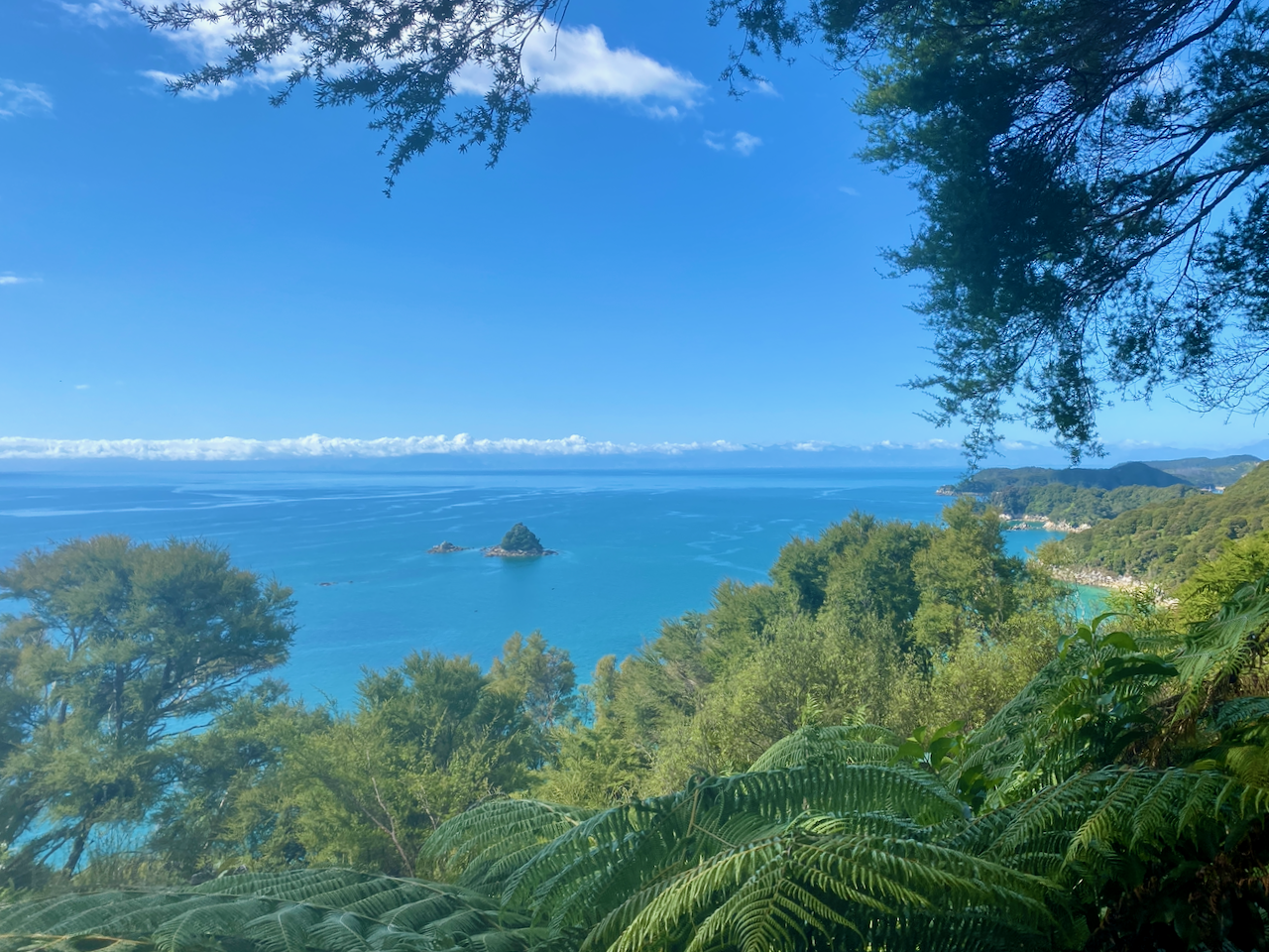
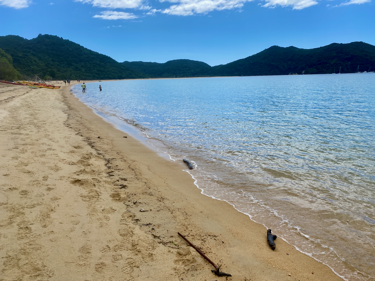
After walking the 4-day Abel Tasman Coastal Great Walk, I took a break and caught a transport 86km south of Nelson to the Nelson Lakes Region looking for more of an alpine hike.

Initially, I was due to arrive late afternoon and camp the night in St Arnaud. But due to a change in timing for the transport, I would be in the region several hours early, so chose to start the hike immediately with a short first day.

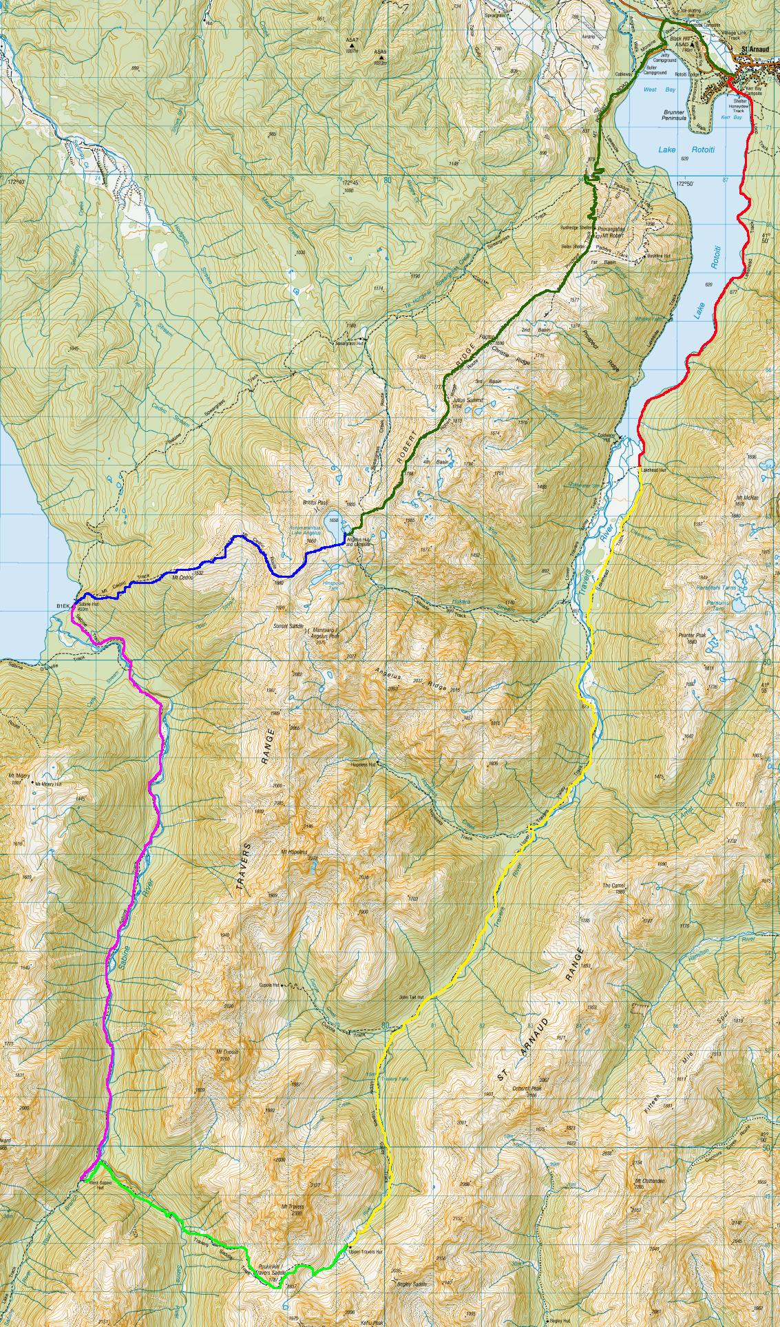
Day 1 – St Arnaud to Lakehead Hut – 3hr – 10 km

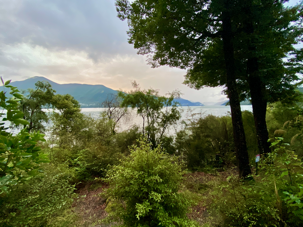
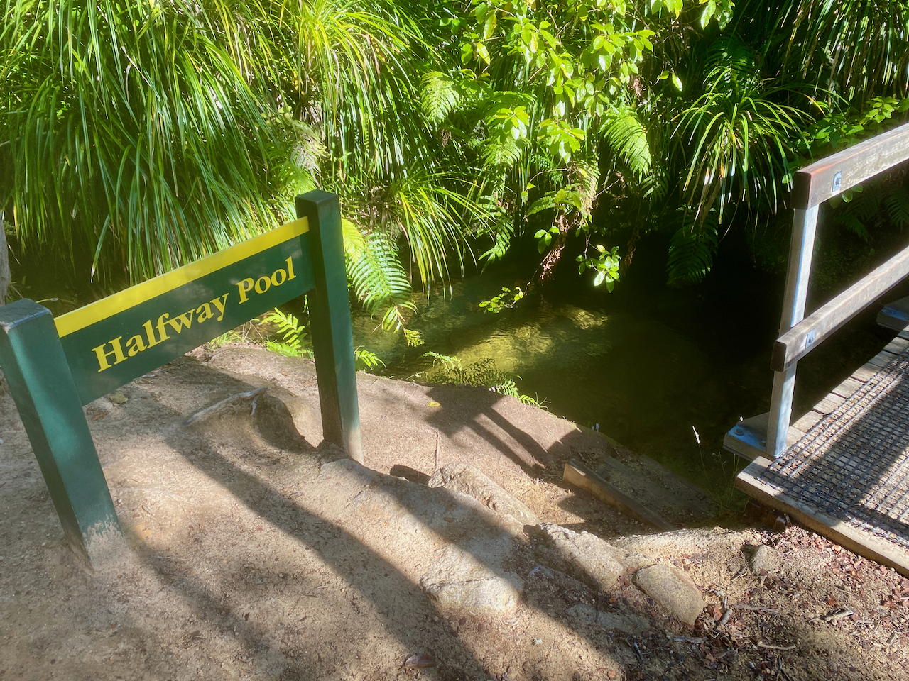
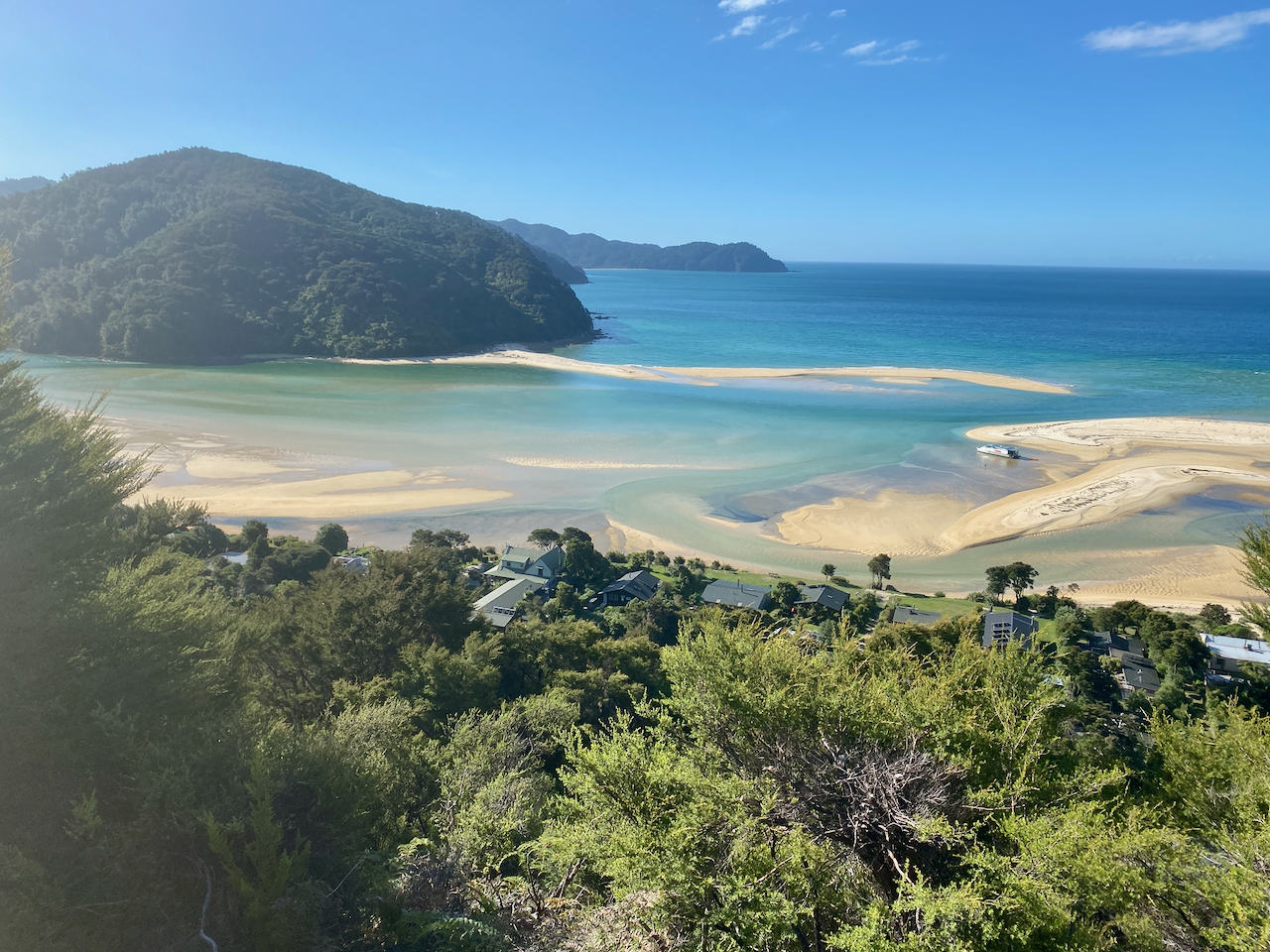
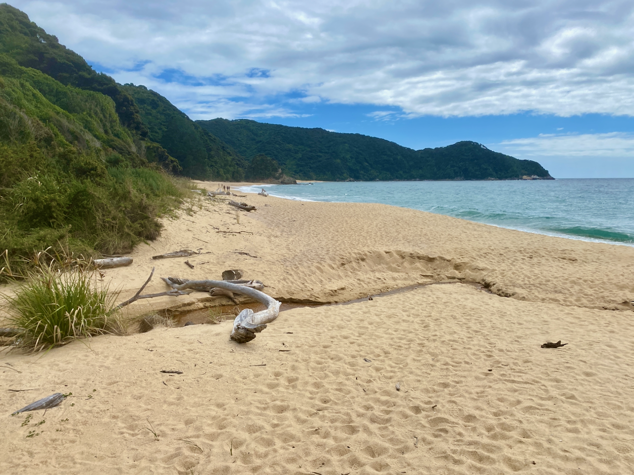
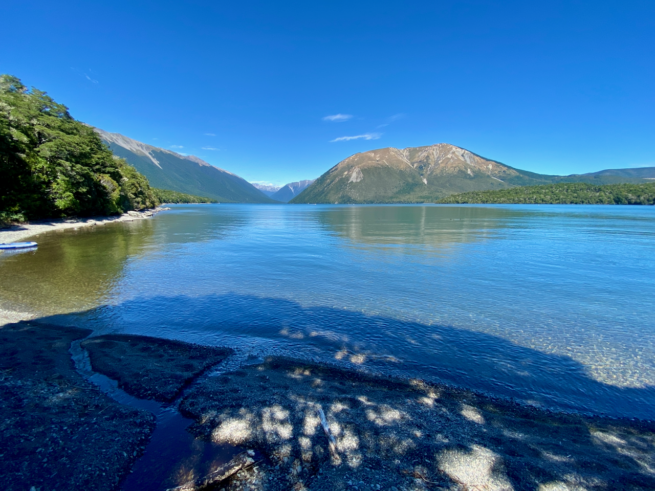
I arrived in St Arnaud, bought a coke from the Petrol Station/General Store, and with the lunch I’d brought with me, sat on the beach of Lake Rotoiti to enjoy them.

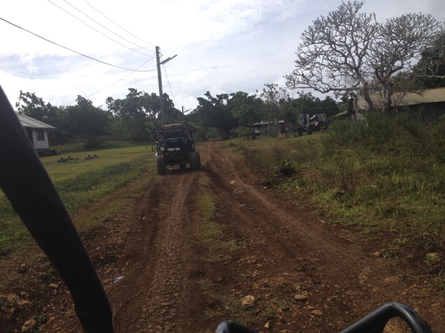
My big mistake was not to not know there aren’t any rubbish bins in St Arnaud. I’d have to carry an empty coke bottle for the entire hike. You live and you learn. After lunch, and a bit of harassment by a duck, I headed off around the edge of the lake climbing a little as I went on a thin non-manicured trail.

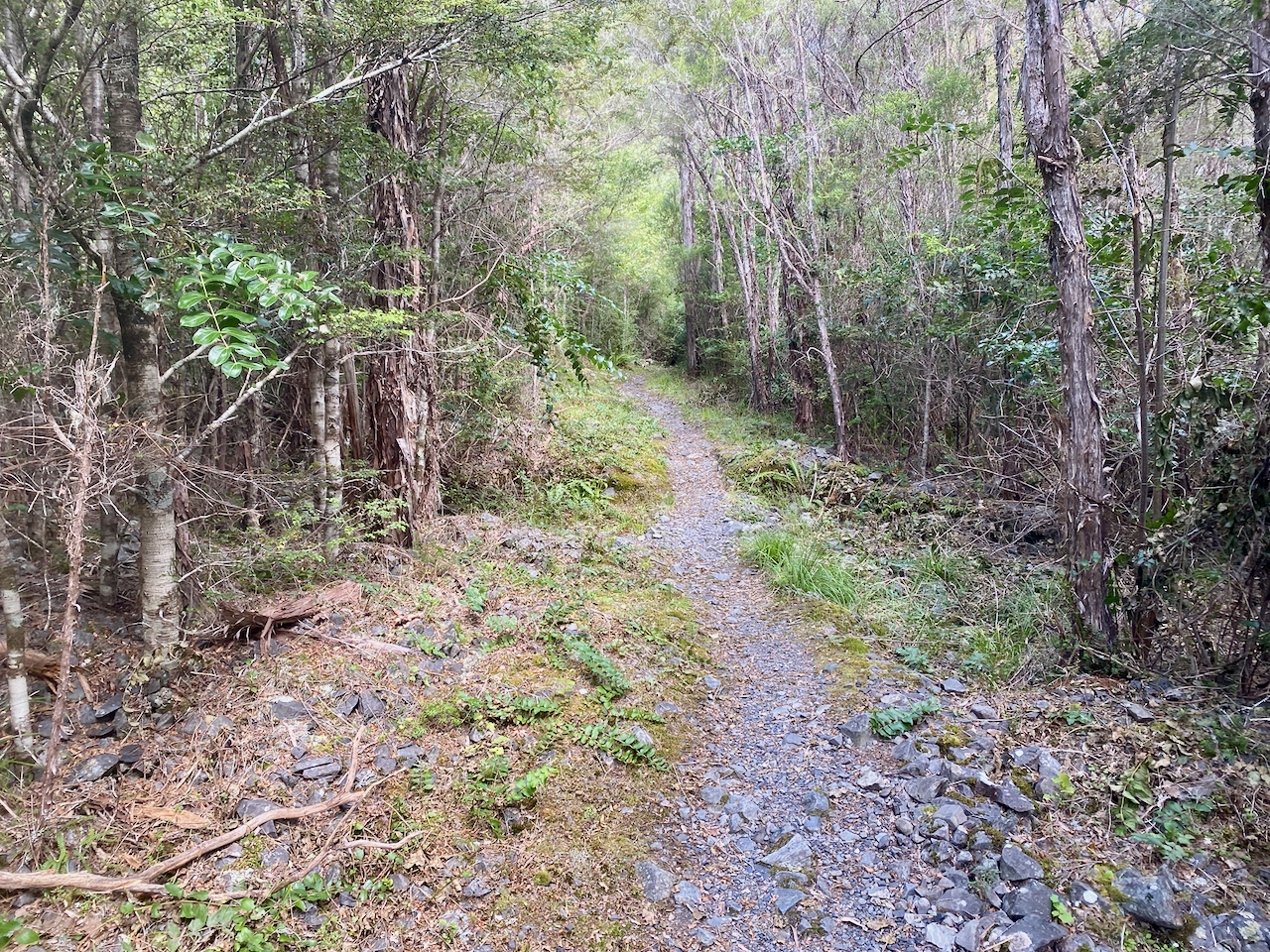
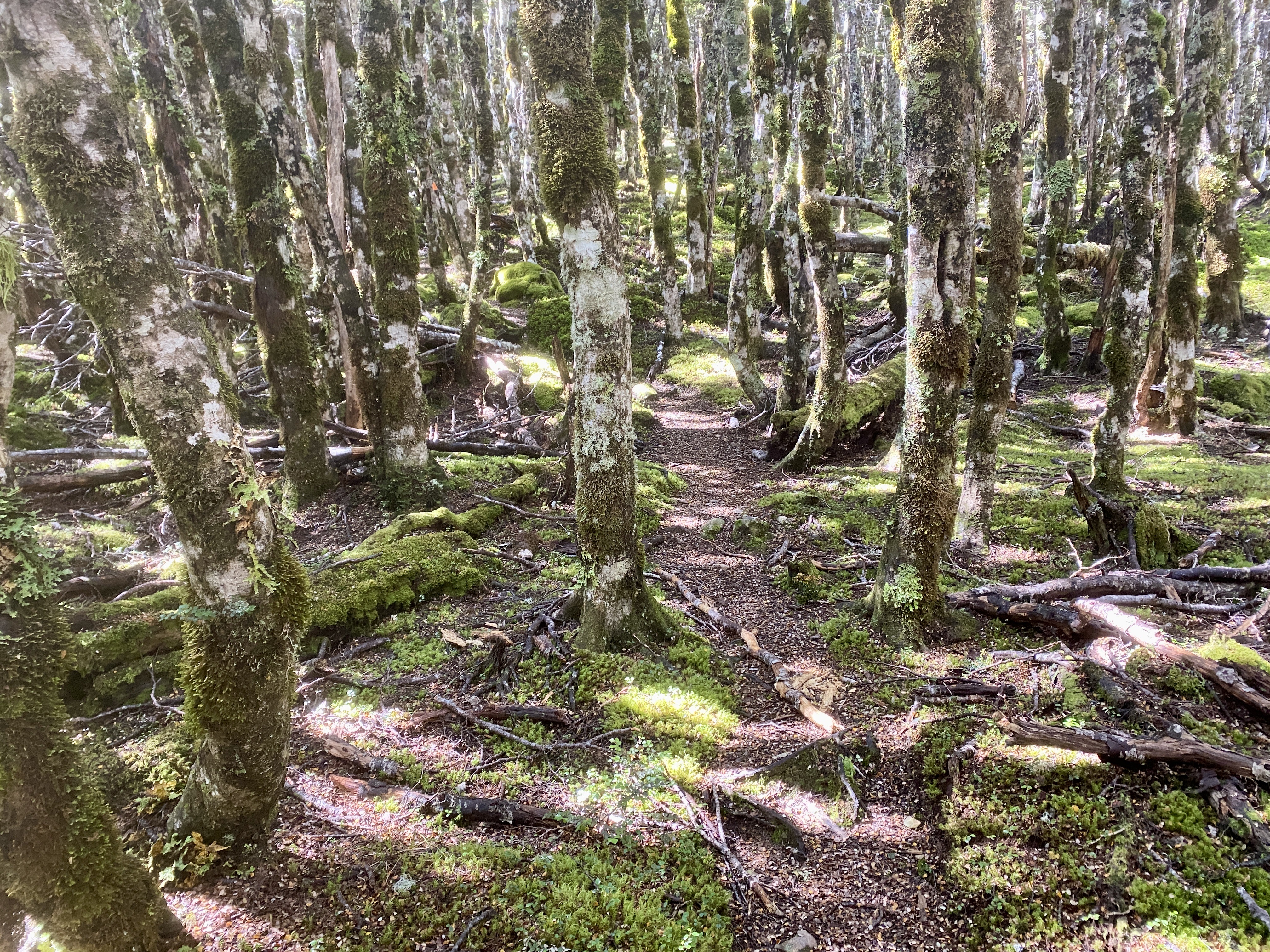
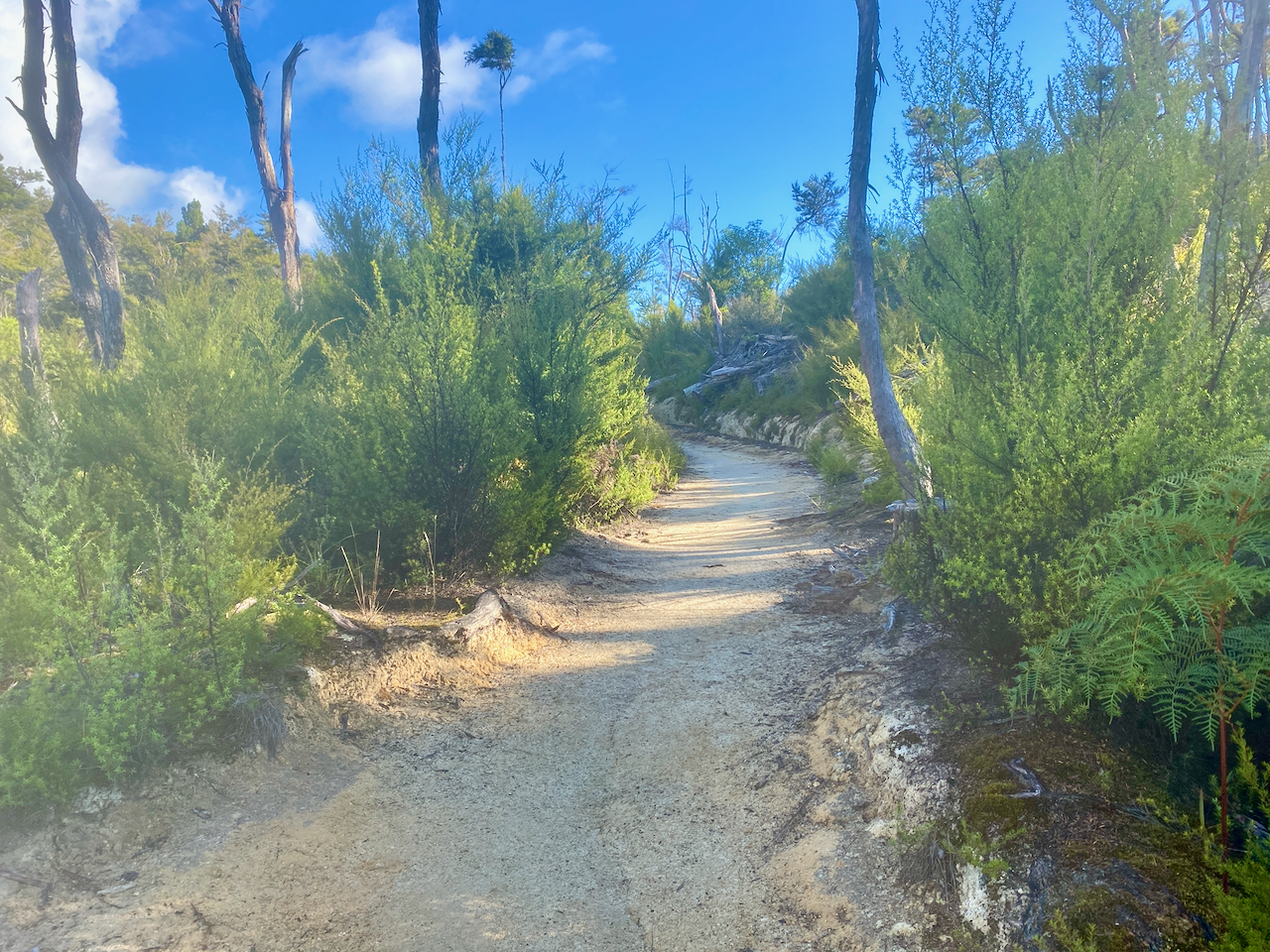
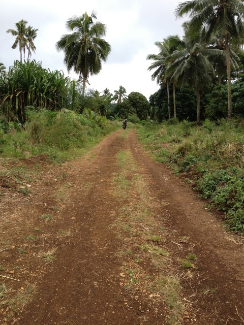
The 10km of today was entirely in the forest, and it would not sink in until later in day two that the vast majority of the hike would be this way.
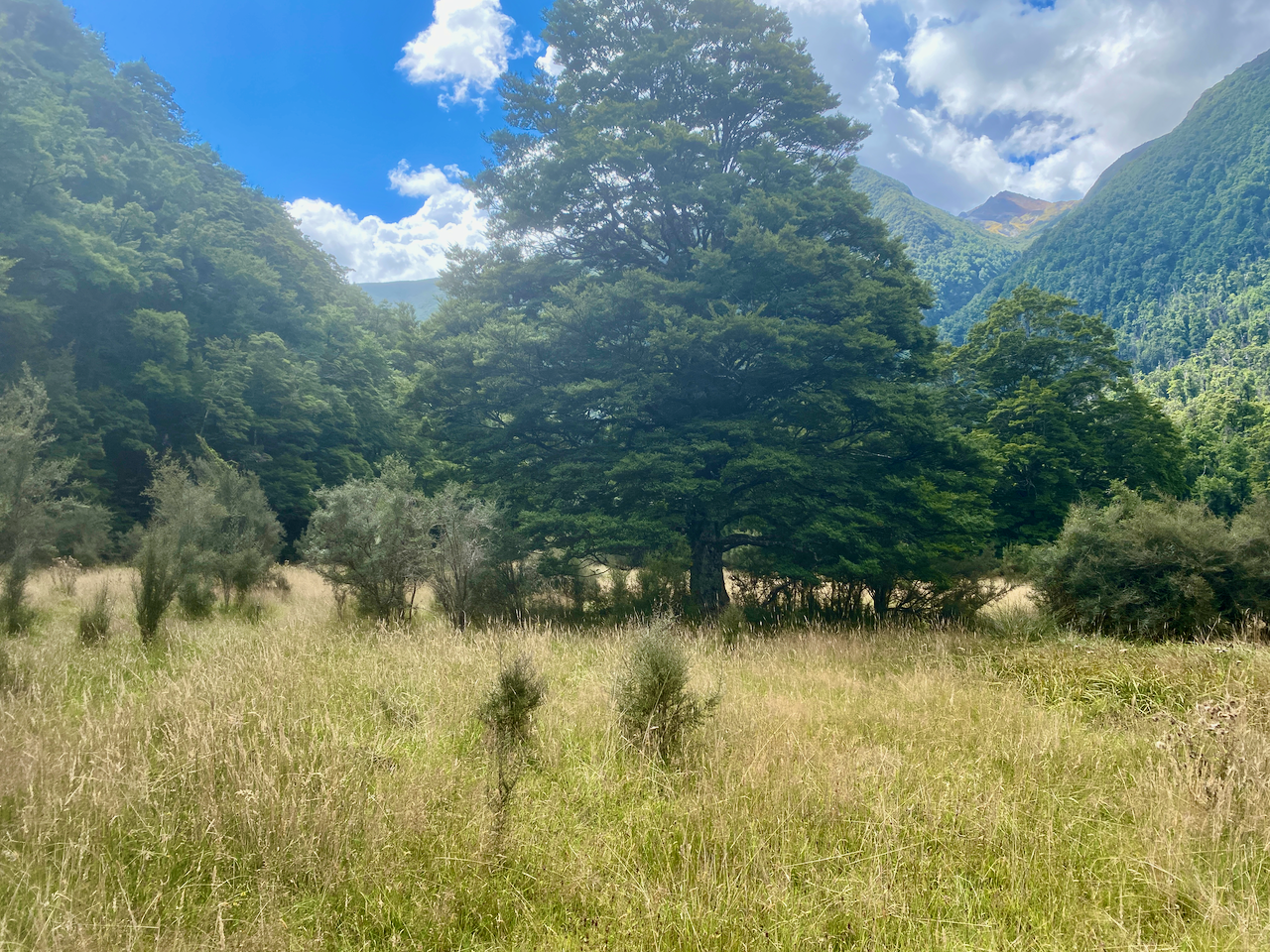
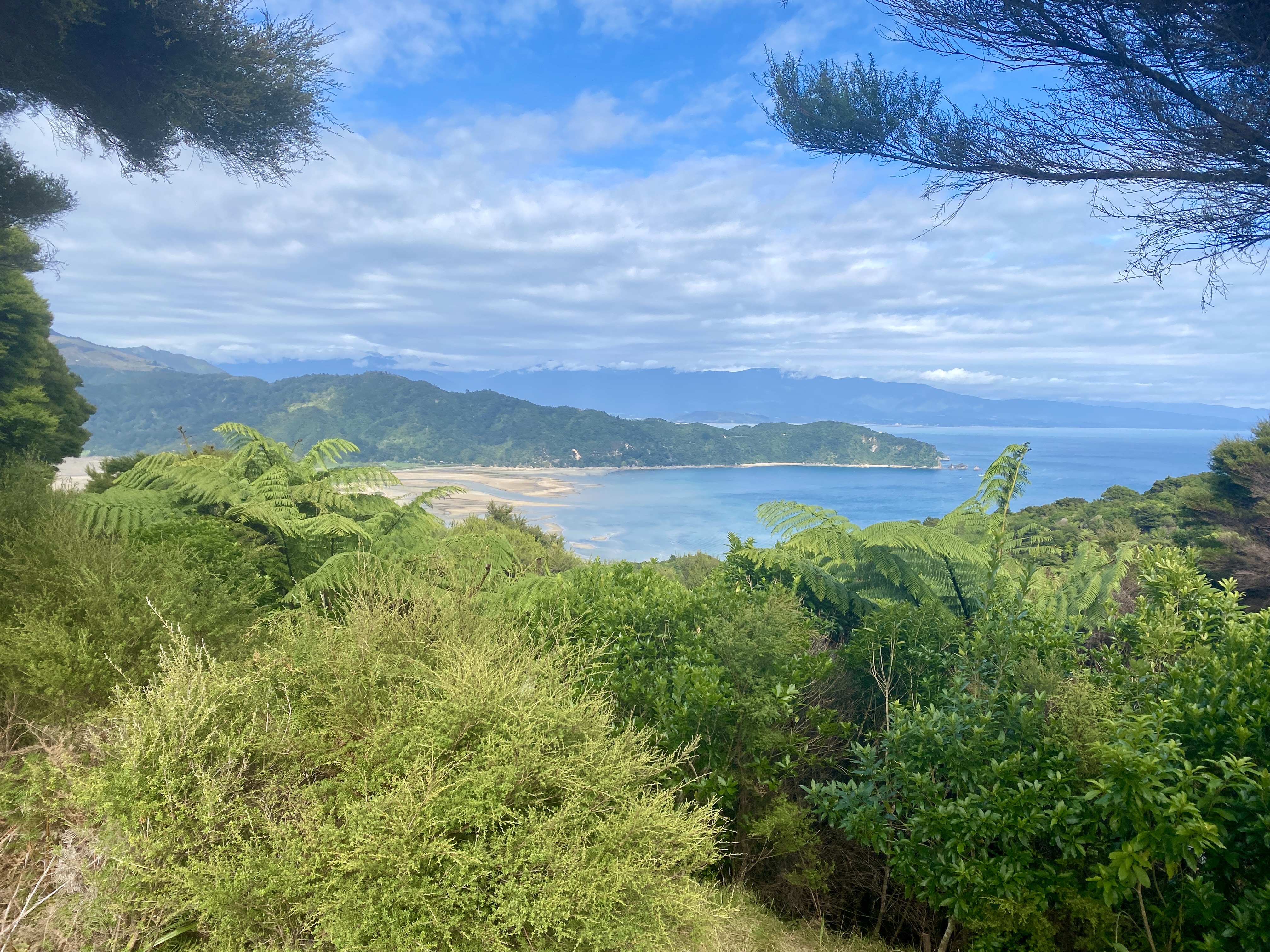
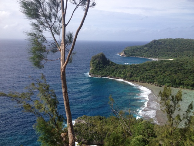
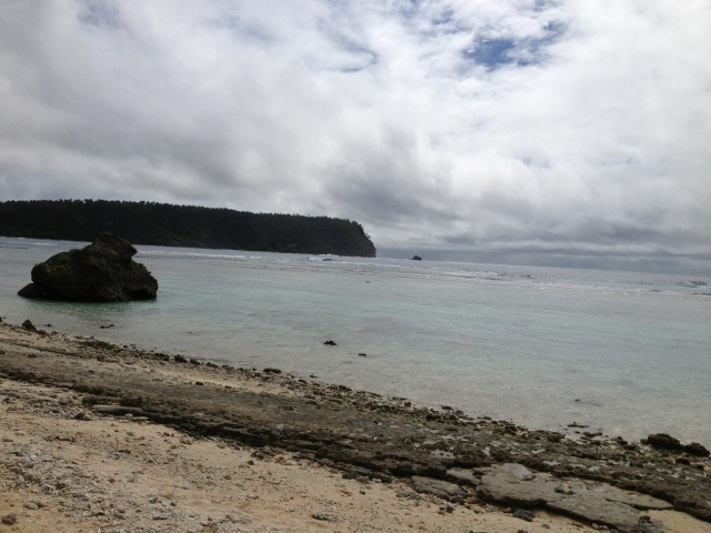
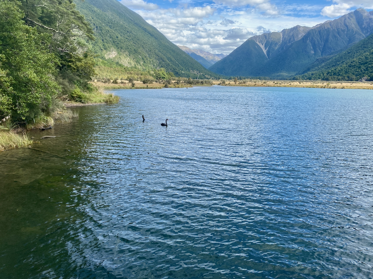
Lake Rotoiti looks somewhat like an angry sperm, with two large nobs at one end and and a thin tail at the other. Near this table end, I stopped and boots off, dunked my feet in the water. Around me wasps crawled everywhere, attracted to the Beech trees most of the forests in this region contain. None bothered me, and neither did the sandflies, as for this hike I had bought some DEET insect repellant.

It didn’t take me long to reach the hut and I settled into hut life, chatting to the people who were already there including some Te Awaroa walkers and a girl who had arrived via water taxi. I talked to her into the evening and once everyone else had gone bed, we too decided to slip off to our respective sleeping bags.

Day 2 – Lakehead Hut to Upper Travers Hut – 19.6km – 7.5 hours

The first part of today was walking through the long grass at the end of the lake, before I disappeared into the forest once more.

I left last from the hut, but within 30 minutes I ran into the girl I’d been talking to the night before, who was reorganising her bags, of which she had brought too much.

Once she was ready to move on, I walked with her through the forest for the first half of the day, talking about everything and anything. Even as the sole of her boot fell apart before me, we continued walking and talking, and before we knew it, we arrived at the John Tait Hut, where we stopped for a coffee and lunch.

After our coffee break, my new friend and I continued on, beginning the climb towards the Upper Travers hut. About 30 minutes in, she took a break, but told me to push on. I bid her farewell, that I would see her at the hut, and set off up the trail. Not long after, I came to the Travers Falls. I dropped my pack and climbed down the steep bank to get a better look.

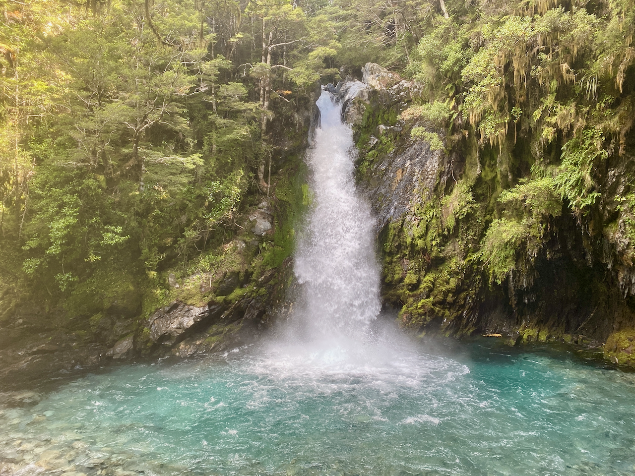
I ran into my friend again while I was putting on my pack. She seemed to like the idea of not carrying her pack for a while, so I left her to enjoy the waterfall. The climb continued at a fair pace, although within the trees I really couldn’t tell how far I was climbing except when I came out to cross the occasional stream. I’d been alerted to one of the bridges in this area having been washed out, and I located it, or what was left of it, as I crossed the rocky stream.

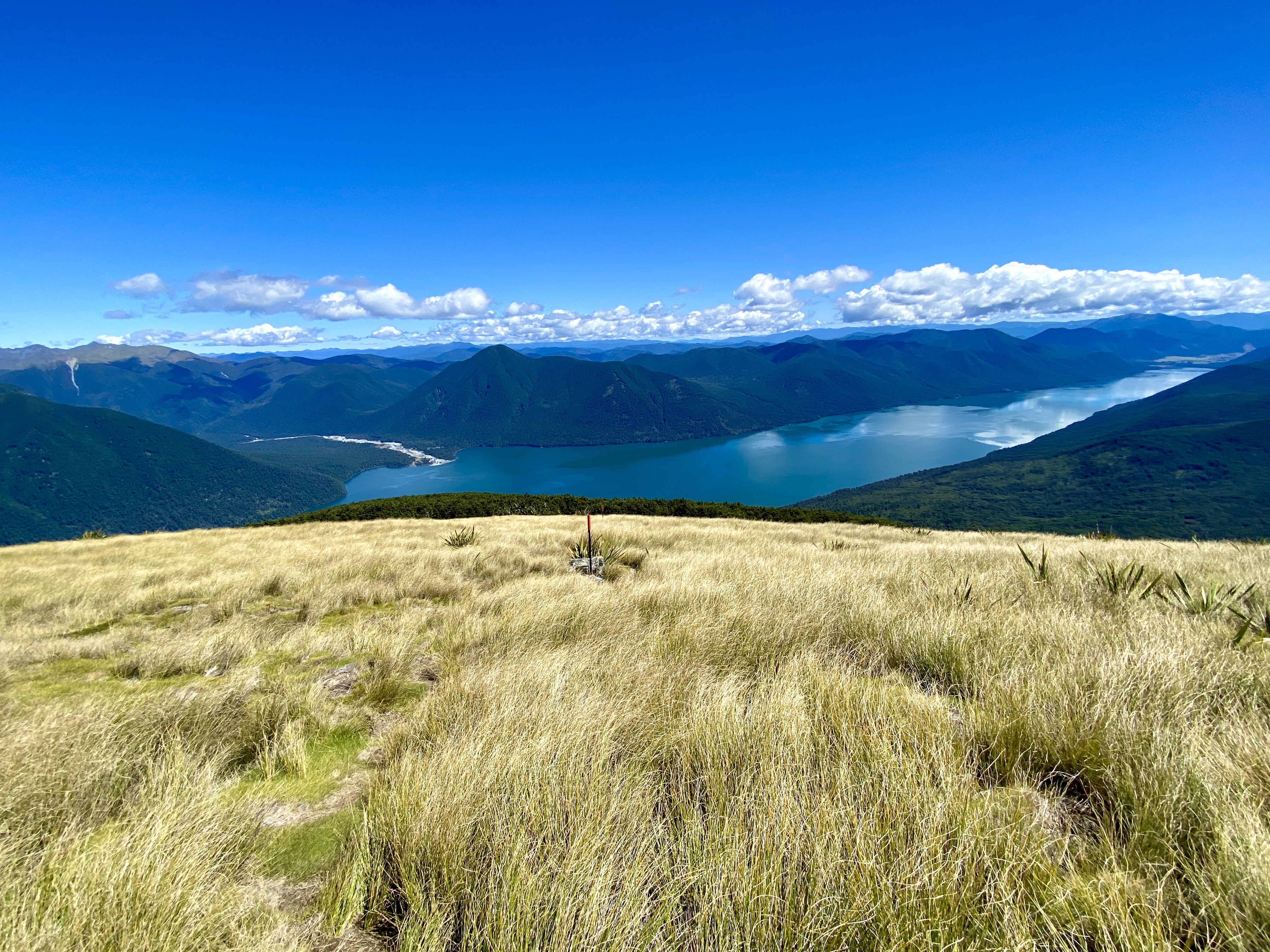
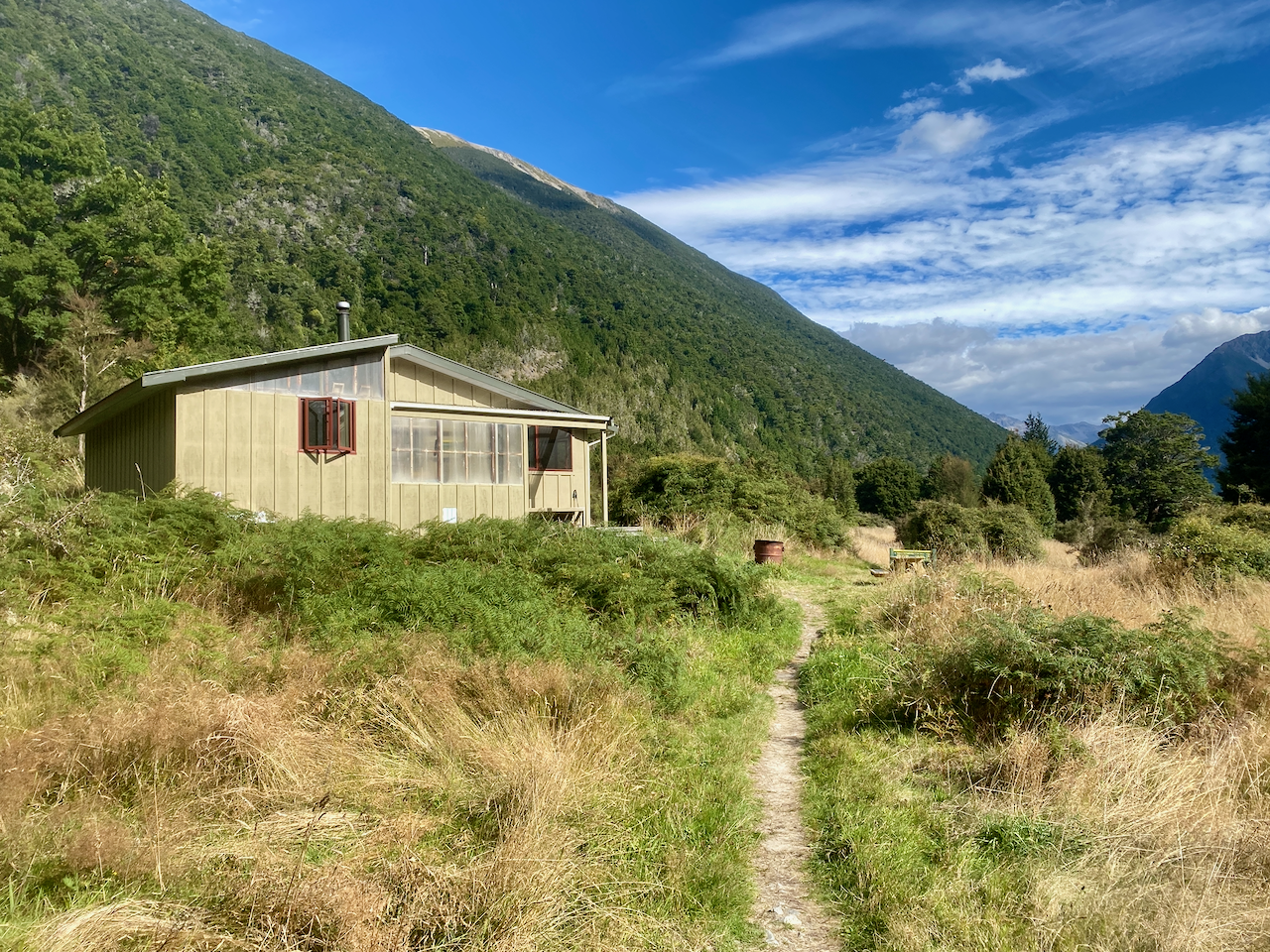
Then after three hours of climbing since the John Tait hut, I came over a rise to a tussocky field with great mountain views and the hut nestled in a small copse of trees. I crossed the field and set my pack down, preparing for the evening. For the next couple of hours I kept an eye out for my friend, who did eventually arrive, having left one of her bags behind. That evening I discovered much of the rest of the hike would be through trees, except for 2 hours crossing the saddle the next day.

Day 3 – Upper Travers Hut to West Sabine Hut – 8km – 6 hours

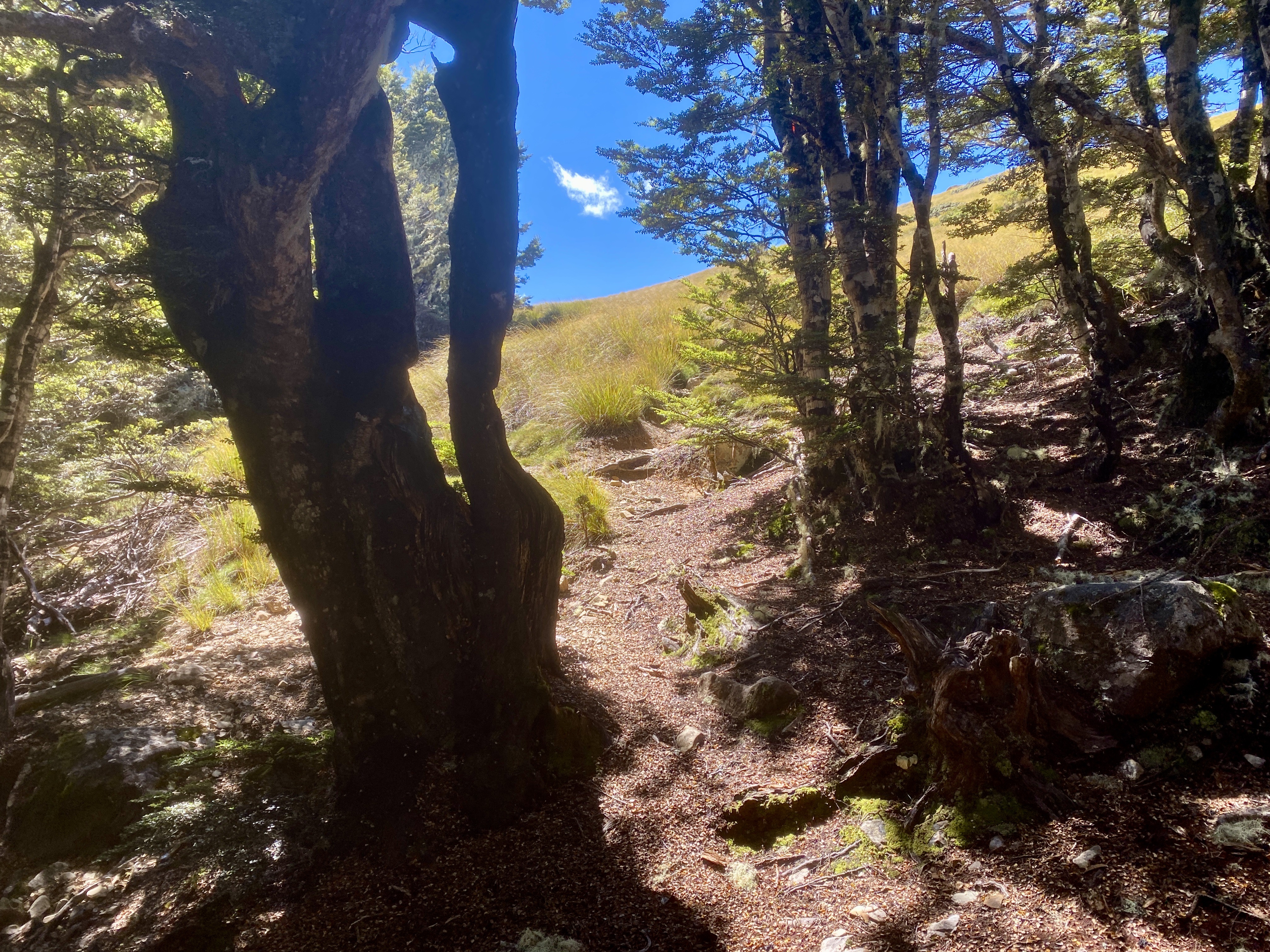
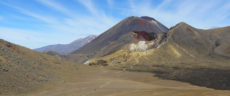
My walking friend from the day before made the choice to stay another night in the hut and return down the same track we’d climbed the previous day. While chatting over breakfast, she suggested a more alpine route, which I decided to ponder on the way to the next hut. I bid farewell and began climbing straight into forest, but only for 10 minutes before it opened out into an alpine landscape including a crown of mountains.

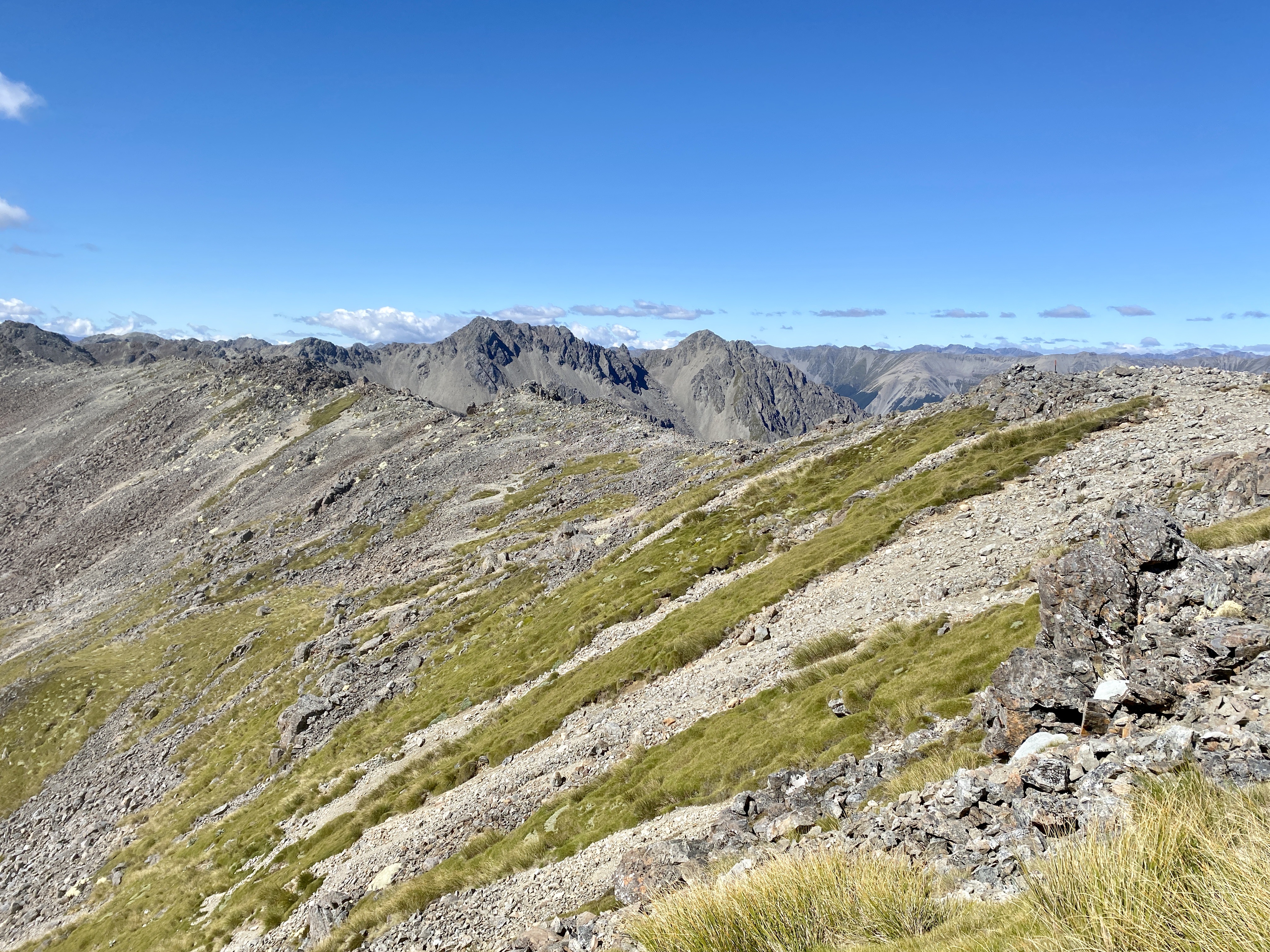
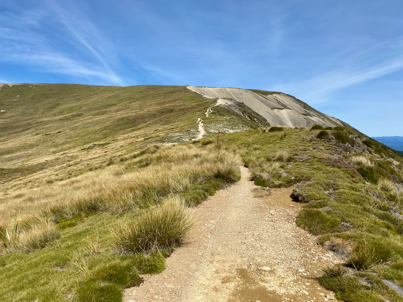
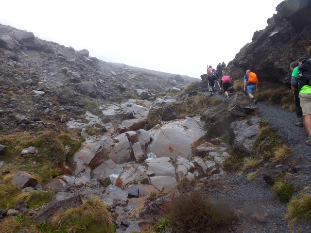
The trail plodded up towards the crown for several hundred metres before beginning a steep climb up the side of Mt Travers before slowly rounding out to the saddle, a 90 minute climb total.

I dropped pack and took a break with the view of Mt Travers behind me.

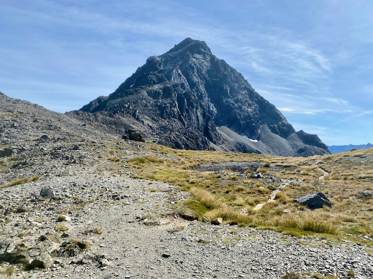
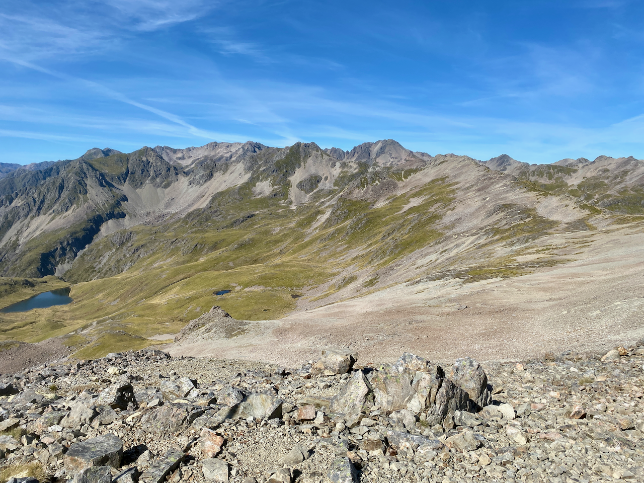
At the advice of another walker, I climbed to see small tarn a little further up, and also got a great view back down the valley I’d climbed from.

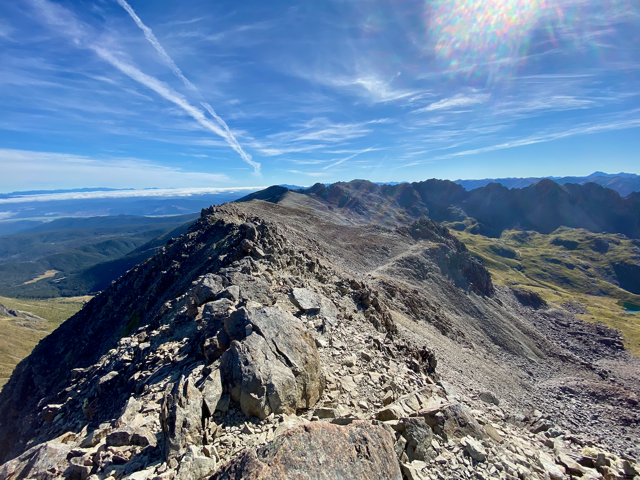
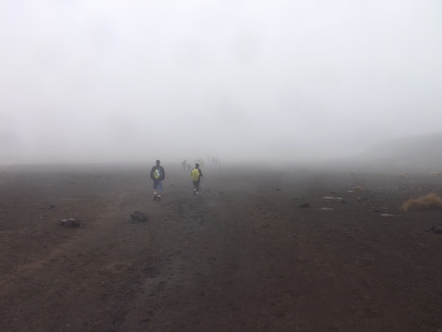
On the other side of the saddle, I got a view of where I would be going. With no sight of other walkers, I took up my pack again, and began the climb down. Half an hour later, and near where the trail dove back into the forest, I stopped for lunch in the sun.

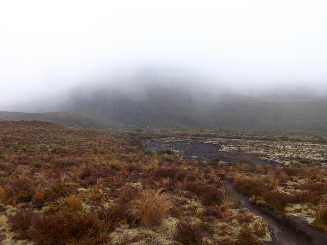
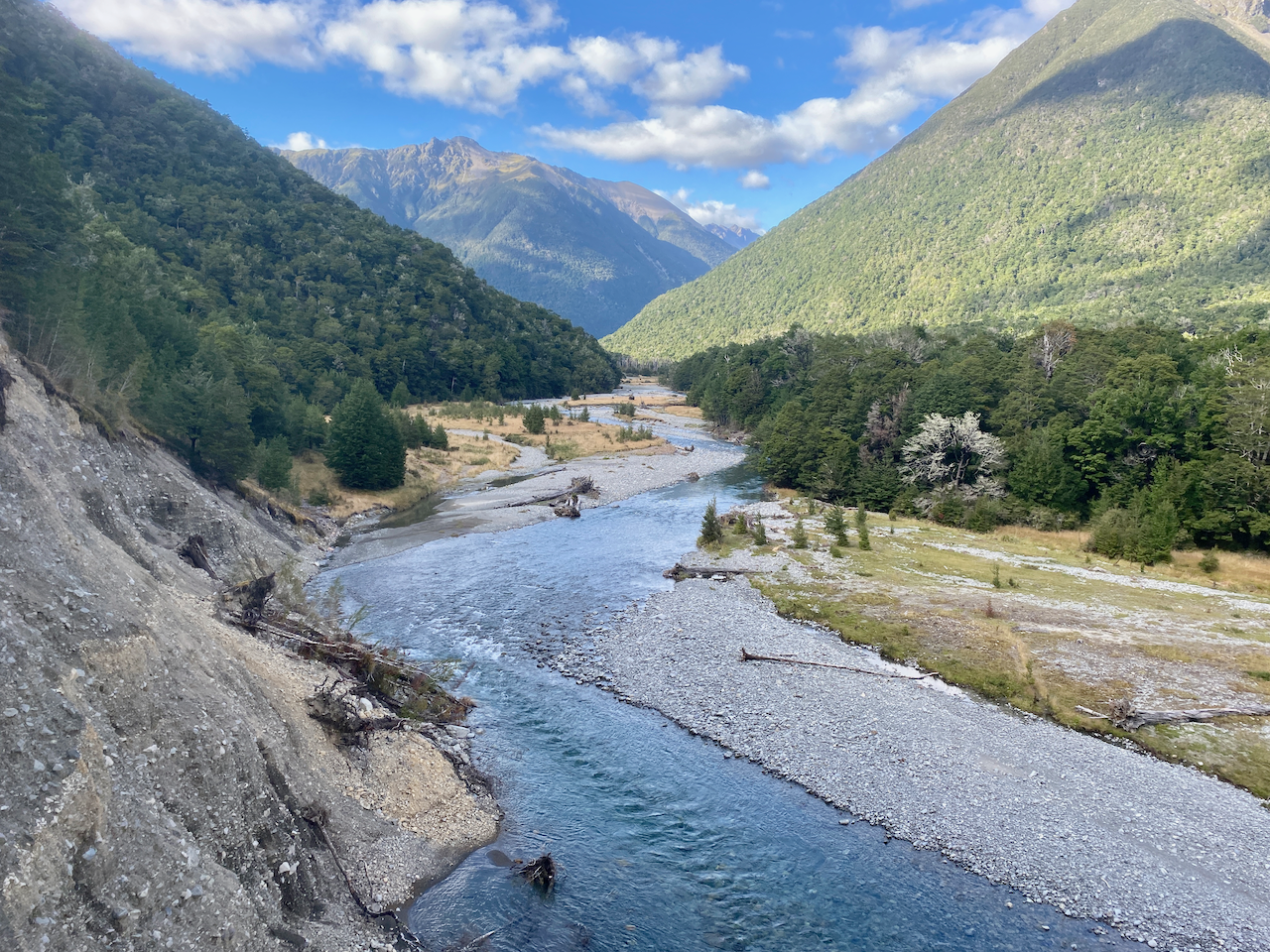
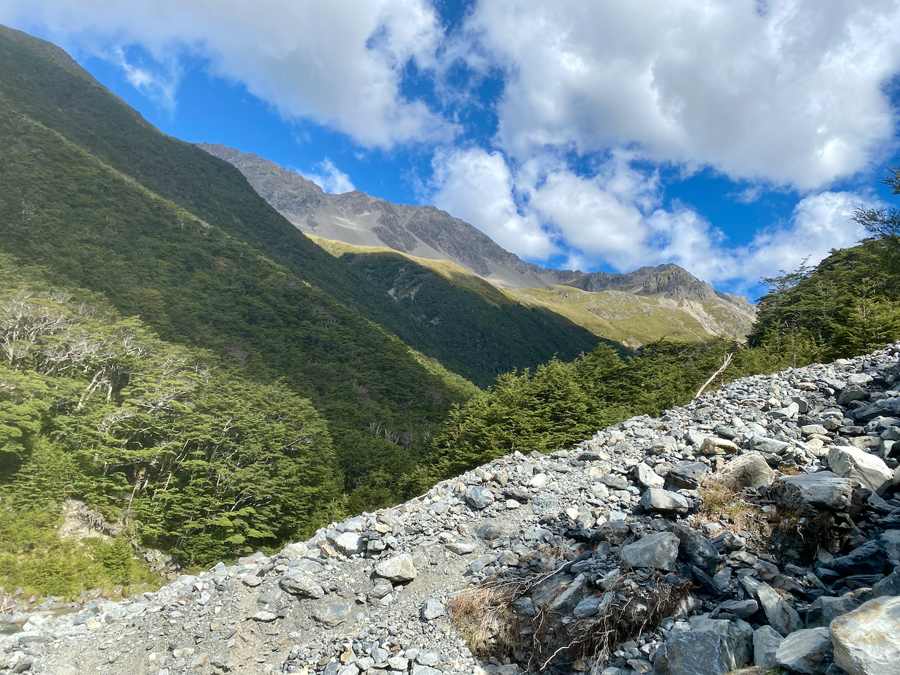
Back in the forest, the trail led steeply down and seemed endless. Very occasionally, I could see the mountains around to judge how far I’d descended. But again, it felt never-ending and my knees didn’t thank me for the effort. Finally, after what seemed like hours, I began to hear a river ahead and followed the noise along a gully until I came out at the bottom where a stream met the raging East Branch Sabine River.

Thankful for the break, I took off my books and dipped my feet in the water. Afterwards, I headed along what I thought was a flat rest of the trail, but I was wrong. It was for the first several hundred metres before it crossed a bridge where deep below, the wide river raged even harder through a thin channel. The trail climbed around the side of Mount Franklin, still deep in the forest, with often muddy areas, until after a handful of kilometres, began yet another steep decent leading down to where the east and west branch of the rivers met. Then it was a 500m flat walk to the hut where I found two ladies from the previous hut, and no-one else. That night, I did some research on my way forward.

I’d originally planned to do a return day walk to the Blue Lake, then on to Sabine hut, the following day, with a long day out to St Arnaud for my last day. But this would see me walking predominantly in the forest, which I was honestly sick of at this point. The other option was to skip Blue Lake, head straight to Sabine Hut and then climb into the alpine region to Lake Angelus Hut instead. This sounded much more my style.

Next, part 2 of my Travers Sabine Angelus Circuit.
The Lone Trail Wanderer

Travers Sabine Angelus Circuit, Nelson Lakes – New Zealand – Part 2

Eighty-six kilometres south of Nelson in the Nelson Lakes regions, I walked the Travers Sabine Angelus Circuit. Click for Travers Sabine Angelus Circuit, Nelson Lakes – New Zealand – Part 1

Day 4 – West Sabine Hut to Sabine Hut – 14.2km – 6 hours

After making the decision to skip the day walk to Blue Lake, I headed out this morning and made for Lake Rotoroa and the Sabine Hut. A hundred metres from the West Sabine hut I cross the wide river on a suspension bridge and followed it into the mossy forest.

Today’s walk is six or so hours through the forest, but thankfully, unlike the previous day, there is no major climbs or descents, just a gentle downhill for most of the day.

And yes, with the exception of the 2 hours I spent crossing the saddle yesterday, this is my fourth full day in the forest. But even the forest itself seemed to feel my frustration and came out to remind me all was fine.

There were plenty of opportunity views back along the river…

And the occasional open grassy areas to cross, to break up the constant forest. This one led onto the only real climb of the day, passing over a knoll to get the heart pumping a little. At the end of the knoll, I met an exhausted looking couple who were carrying far too much. They’d only started an hour earlier after getting a water taxi across the lake.

With only a couple of kilometres left, I crossed the river and made my way through the flat forest waiting for the lake to appear. Then, for the first time this hike, the weather turned and a very light rain began. It continued until I finally arrived at the lake and then shortly after to the hut. On arrival, the sky opened up and bucketed down with lighting and thunder for much of the evening. About midway, a rather wet walker arrived, no doubt thankful to be out of the rain.

Day 5 – Sabine Hut to Angelus Hut 7.2km – 6 hours

After the rain of the previous evening, I was concerned that the steep first route that left from beside the hut would be overly wet and slippery, but I went anyway. The initial climb was very steep and foot placement was pertinent, carefully placed on dirt with a slight covering, no rocks or roots unless I could get a good foot holding.

It was slow work, and I used the trees where I could. After the first hour, the steepness eased with easier paths, but I remained fastidious, ever watching my steps. The climb grew easier, but the forest must have held a fairly low temperature, as I neither felt tired nor even broke a sweat as I climbed. This is odd, as I am an easy sweater while walking under weight. The trail grew steeper in hour three, only to round off and become flatter once again.

The Sabine hut is at 467m and at 1335m I emerged into a sunny Tussock covered rolling hilltop. I stopped just inside the forest to prepare for the open trail.

I climbed a further 200m in the glorious open sky to the summit of Mount Cedric and stopped for lunch. Below me lake Rotoroa stretched away while to the side mountains stood tall. Out of the shade of the trees the wind at this height was icy, so I put on my wind breaker.

A crown of mountains headed off to the right, and I saw that the Mount Cedric Track followed it, so after eating, I continued walking.

My climb, now in the open air, was glorious, and under the direct sunlight I began to sweat. The climb grew higher as I skirted around the rocky top of the crown and followed the ridge line off to the left, climbing even higher.

After being in the forest for four days, just being atop an open mountain ridge gave me a sense of enjoyment. The direct sun, the slight breeze, the rocky bliss and the sense of smallness among giants…

While there was a defined path, there was some rock hopping and thin somewhat precarious paths, but I always walk with caution on these paths. I got past and rounded the ridge line to look down onto the valley where Lake Angelus was supposed to be, but there was another smaller ridge in the way. Below me I could see the Hinapouri tarns instead.

I descended towards their smaller ridge with much rock hopping, which took some time, before I finally climbed down the slope to stand before Lake Angelus.

I climbed down to a flat tussock path, then around the lake to the Hut where, in the blissful sunshine, dropped my pack and chatted to some ladies on the front deck. Angelus hut turned out to be a very social hut with more people arriving through the afternoon.

Day 6 – Angelus Hut to St Arnaud – 18km – 5 hours

After my usual breakfast and packing regime, I set out across the tussock towards the ridge line behind the smaller two lakes in the basin, to the trail called the Robert Ridge Route. The climb affording good views back down the Lake Angelus basin as I climbed. The lake soon disappeared as I walked along the top of the ridge away from the hut.

As I climbed towards the Mt Julius Summit at near 1800m, I got a view down the valley to where I had crossed on the 2nd day of this adventure.

At Mt Julius Summit, I found a wide area where I could stop – wide in this case being 1.5 – 2m. I also found good 4G reception, so thought I would video call my parents at home in Auckland, to show them the view.

Afterwards, the trail cut across the side of the rocky ridges as it continued, before changing to the rounded hilltops with wide paths. There were some climbs, but nothing major, but all the time glorious views in all directions with the weather warm and minimally cloudy.

The route continued and I began to see walkers coming towards me, I climbed the last of the large round hilltops and stopped on some flat rocks for lunch.

After chatting with a couple of passersby, I headed off again along the ridge, this time slowly descending. The route continued down past a rest shelter likely build for day walkers, to the summit of Mount Robert, the final peak before my big descent out of the National Park.

I took a break at the top to chat to another climber and admire the view down on Lake Rotoiti.

The descent to the carpark was partially through the forest, but mostly in the open, growing steadily warmer as I got closer to the bottom. There are more than 22 switchbacks on the way down, and I find it handy to count then down. In my mind it helps as fast descents are not my knee’s favourites.

At the bottom, I set out along the road towards St Arnaud, a further 90 minutes along a dirt road which turned to a major highway. I had intended to camp 45 minutes from the end of the hike, but it was still early with plenty of daylight left, so I decided to crack out onto the road and thumb a lift back to Nelson, some 86km away. I made it getting two lifts and not having to walk too much.

Overall,
I should have taken more care in selecting a hike, as I found this circuit to be particularly frustrating. If I had walked the entire length as planned, but added the side trip to Blue Lake, it would have been six days in the forest, with only 2 hours in the alpine region crossing the Travers Sabine saddle. As I particularly dislike walking in the forest for anything longer than a day, I was thankful for the girl I walked partially with on day 2 and her suggestion to go to Lake Angelus instead. As these are my first long hikes in the NZ mountains, I will be more careful with my planning in the future.

Next, after a week or so giving my legs a break, I have a couple of walks in the North Island.
Until then,
The Lone Trail Wanderer

Abel Tasman Coastal Trail – Nelson – New Zealand

For my second hike in as many weeks, I flew to Nelson at the top of the South Island. From here I will be doing a pair of hikes, but the first is a coastal and listed as one of New Zealand’s most popular hikes. Thankfully the school holidays are over and as I start on a Monday the trail is expected to be quiet.

The Abel Tasman Coastal Track Great Walk! is a 60 kilometre, 3-5 day walk which I did over four days, the last of which was a short day due to having an early pick up from my transport company. In addition, there are several inlet crossings on the trail, one of which doesn’t have an alternative high route, so tide times are important to ensure there are no delays.

Day 1 – Marahau to Torrent Bay Village Campsite – 17 km – 5.5 hours + Side trip to Cleopatra Pool

It was an early start from the hostel this morning to get to the pick up location, and I wasn’t able to find a coffee. I was collected with six others, most of whom were being dropped off like me at the southern start point.

As we pulled up I noted a cafe right next to the trailhead, but when I got there, I found it was closed on Monday and Tuesdays. I guess I’ll have to find time to make my own coffee. I started out along a boardwalk to where to the stony trail began and headed into the bush that I would annoyingly be spending much of the hike in. From time to time as I walked I got views along the golden sands of Porters Beach.

A couple of kilometres into the walk, I stopped at Tinline Campsite, the first of many, where I made a coffee.
As I drank, I had my first meeting with a Weka. It seemed friendly, but I would soon learn not to trust these thieving little beasties, thankfully not because they took any of my stuff.

After coffee, the trail climbed a little, making the views just that little bit better. I climbed down a steep thin path to Coquille Bay Campsite before continuing on. A couple of kilometres later, I did the same at Apple Tree Bay Campsite, but learned that climbing down to every beach campsite meant climbing back up to the trail again, usually on a steep path.

I was looking for a lunch spot another couple of kilometres later as I rounded Stilwell Bay. A sign sent me to Yellow Point Lookout in hope of finding a nice spot, but after a short walk, I discovered to my disappointment, there was very little to see at said lookout. I also had my first encounter with the wasps in the National Park, which were everywhere. They paid me little attention, and I learned later that this entire region was rife with them due to the plentiful beech forests. Next to the Yellow Point Lookout path was the path down to Akersten Bay Camp where I dropped my pack and took lunch, but not before visiting the small cave at the end of the beach.

My camp for the night was to be on the other side of a bay usually crossed at low tide. But as I knew this ahead of time, and with low tide several hours away, I took the high tide route around and was able to walk 10 minutes on a side trail to Cleopatra Pool, part of the Torrent Bay River.

The river runs down a slide into the Cleopatra Pool, and as I dipped my feet in the cold water, I watched a couple of women slide down.

After my break, I walked the hour around the bay and when I got to the campsite, I found a nice spot, pitched my tent and went for a walk. The Torrent Bay Village is a village of baches (beach houses, to non-Kiwis) with numerous private property signs. I wandered around a bit and enjoyed the golden sand, swam in the bay and waited for more people to arrive, but even at low tide came, no-one crossed. Tonight, it would appear, I would be the ruler of the camping ground, with my sole subjects the mozzies.

Day 2 – Torrent Bay Village Campsite to Awaroa Campsite – 18.5km – 7 hours + Side trip to Awaroa Lodge

It was low tide on my waking and people were beginning to stream across the dry bay. As I got ready and had breakfast I watched more and more begin the soggy crossing. I bumped into some later and they told me they were all coming from the Anchorage Hut or Campsite.

When ready, I walked through the village and along the beach a little before beginning the climb up the hill on the far side. It was not a tall climb, and I soon came to the Torrent Bay View point.

I headed on, winding through the forest on a curving path that stayed fairly level. These paths/tracks are very wide, as are all Great Walk! Paths.

I crossed a stream and climbed a little until I came to the Halfway Pool, formed by a stream coming through the area. Compared to Cleopatra Pool, Halfway Pool isn’t even a half sized pool.

I continued on, crossed the Falls River Suspension Bridge and began a slow descent to the turn off to Medlands Beach. I had a quick look at the carving there before continuing on. I rounded the bay and came down onto the Bark Bay spit, where I dropped my pack, took off my boots and had some lunch.

When I headed out again I noted that the bay behind the spit was dry, so decided to cross instead of going the long way around. At the far side, the water was just coming in and was too deep to cross without taking off my boots. On the other side, I put my boots back on and climbed the short steep path to the trail.

It descended slowly down to Tonga Quarry where stones were extracted for the Nelson Cathedral. The quarry was once a Campsite, but was permanently closed after storm damage in 2018. Another short climb led around to Onetahuti Bay where there had been a warning of a deep stream crossing the beach. It wasn’t deep and I crossed with little issue.

I sand walked to the end of the beach, which is not the most fun, and dropped my pack and boots for a break. I then crossed a bridge and headed back into the hills before coming to a T-junction, one way heading down to the Awaroa Lodge, the other continuing the trail. A group of girls were deciding if they should go to the lodge, but decided not to, so I tailed them a little way before they stopped and I continued on. Just over a kilometre later was another shorter route to the lodge, and with the thought of a cider creeping into my mind, I decided to take it.

The Awaroa Lodge did indeed serve cider along with hot chips, so I had a couple of drinks and relaxed. After an hour, I pushed on, following a flat path that would lead to a bay crossing. The bay still had water in it and I had to decide to wait possibly hours for the tide to go down, or to go around. I decided to go around, although I hear I could have easily crossed as the water was only waist deep. I cut through the Awaroa Glamping site instead and ended up bushwhacking a little to get back to the path. The rest of the trail was hard work, especially as I had relaxed so long (nothing to do with the cider, nope). An hour later I finally arrived at the campsite, set up my tent and to get away from the sandflies and Weka, got in. Just before dark a noisy group arrived, but thankfully stayed at the other end of the campsite.

Day 3 – Awaroa Campsite to Mutton Cove Campsite – 14km – 5 hours

In the morning, everyone was up early to get the low tide crossing of the bay, all except the noisy crowd who were barely rising when everyone else was heading out.

Halfway across I noted there was still water higher than ankle deep, so I removed my boots and put on my flip flops. The rest of the crossing was slow and muddy, but I got there, cleaned up my feet as I looked back across the bay, put my boots on and headed off.

With a minimal climb, I crossed the peninsula to Waiharakeke Bay and walked along the bay until I came out on Goat Bay Beach.

There was a steep climb over the hill at Skinner Point, but I noted the tide was still out enough that I could try to rock hop around instead. I deemed there would be plenty of time to come back if I got stuck, but there weren’t any issues.

I jumped down onto Totaranui Beach and walked along to the campsite where there were plenty of RVs and people on holiday. I stopped and made a coffee before pushing on again, heading past the Totarani Education Centre on a grassy path…

…before climbing a small hill over to Anapai Bay Campsite, a small beach camp.

I stopped for a rest before pushing on over a pair of short ridges.

I came down into Mutton Cove Campsite where I would be staying for the night. The camp was a large grassy area, but there was a lot of wind coming off the sea. I found a tucked away spot and pitched my tent. For much of the afternoon, only the occasional other walker would come by to stop for a break then head on again. Of course, I was not to have the place to myself, as late in the afternoon the noisy bunch arrived, thankfully camping at the other end.

Day 4 Mutton Cove Campsite to Wairau Bay Carpark – 8km – 2.5 hours
Today is a short day as I need to meet the trail transport in the early afternoon. I set off at my normal time, again just as the noisy crowd awoke.

I headed up the first steep climb right out of the camp as it crossed the peninsula to Wharwharangi Bay, and walked along the trail off the beach. The trail cut inland and passed the Wharwharangi Bay hut where I stopped to get some toilet paper to clean my sunglasses, then off again straight away onto the highest climb of the trail.

I powered up the sometimes steep trail and eventually came to the summit feeling strong. I took a break on a seat before beginning the slow descent around into Wainui Bay, where I was 2 hours early for the pickup.

I had hoped there might be a shop of similar nearby, but it was not to be the case. So, I found a camp table, got changed into long clothes to avoid the sandflies and just waited. The vehicle was early, and as all five of us were already there, we packed up and headed back to Nelson.

Overall,
The Abel Tasman was a nice little hike with one main issue for me, a large portion of it was spent in the forest. I’ve done plenty of forest walking in my time, but it tends to feel like I am on a treadmill with a screen showing forest displays. You climb and descend, turn left and right, but really have no idea where you’re going. I found this to be a typical case around the northern South Island. Other than this, I found the walk interesting and the various inlets a good respite from the forest. I did also note that two thirds of the people walking were woman. I noted similar on my next walk too and certainly aren’t complaining complaining.

After a day’s break in Nelson, I’m off to the Nelson Lakes Region for a more alpine walk.
Until next time,
The Lone Trail Wanderer.

Tongariro Alpine Crossing, Central Plateau, New Zealand

Mount Tongariro is one of several volcanos in the middle of New Zealand’s North Island. It’s the northernmost of the three volcanic cones just to the south of Lake Taupo, New Zealand’s largest lake.

Mount Tongariro is also the location of one of the most popular hikes in New Zealand: the Tongariro Alpine Crossing. This is a 19.4 kilometre hike that climbs over the Tongariro massif, past the summit of both Tongariro and Ngauruhoe.

tongariro-crossing-map-aug-2012-2016-04-4-15-52.gif
Map is © Copyright Tongariro Alpine Crossing Please visit that site for more information.

A group of us decided to do the Tongariro Alpine Crossing towards the end of the season. We made arrangements and drove down from Auckland on Friday night with the intentions of climbing early Saturday morning. The four-hour drive turned into five and a half as we left during Auckland’s rush hour. We arrived late in the evening and bedded down for the night with alarms set.

A Bad Start
When we awoke on Saturday Morning it was raining and didn’t look pleasant. We went for breakfast and waited to find out if the we could still do the walk. The answer came back a resounding no. The rain and strong winds meant the mountain was closed. All we could do was hang out for the day and hope for better weather on Sunday.

What Tongariro should look like, apparently…
slider4-2016-04-4-15-52.jpg

Ominous News
We were up and had breakfast early on Sunday but the weather still didn’t look great. The mountain was still not visible from our lodgings and when our driver arrived he had bad news. He believed the mountain was again closed and wouldn’t take us, leaving us a little downhearted. We asked the owner of the lodge and he was unconvinced. He rang another driver who confirmed the mountain was in fact open and would take us up.

We were driven to the trailhead in the rain with trepidation, but with the number of other vehicles heading up, it seemed others would also be braving it.

Trailhead – Mangetapopo Carpark – 1100m
We began at the Mangetapopo carpark in a slight drizzle. There were no views of the massif or much else due to the low cloud. The trail was a mix of mud, stones, wooden platforms and people. There were hundreds of others doing the track with us. If this many were doing it on a bleak day, who could guess how busy it would be on a clear one.

dscf8322-2016-04-4-15-52.jpg

The walk was easy and for the first seven or so kilometres we barely noticed the 250m climb towards Soda Springs. I walked in a quick dry sports singlet, my hiking zip-off shorts and boots. The drizzle was constant but not heavy and I was fairly warm. Others wore long pants and full Gore-tex jackets.

Soda Springs – 1350m
At Soda Springs there is a warning sign: STOP! Are you really prepared? It suggested it was going to get difficult and to turn back if you weren’t prepared. As I waited for my group, I watched several people get to the sign, stare at it for a while and then turn back. With the drizzle picking up I put on a rain poncho over my singlet and began the climb.

dscf8327-2016-04-4-15-52.jpg

It became more rugged, with a rough dirt trail and steps weaving up the side of the mountain towards South Crater. The drizzle continued and the climb became more a little more difficult, but not by much. After a while of steady climbing we began seeing people returning along with trail with warnings of how bad it was higher up.

With the constant drizzle and the warnings I was tempted to turn back. Why do a climb when you can’t see anything the entire time? You climb for the views and the experience, but the only experience would be a wet cloudy one. I put on a jumper under my rain poncho and we continued on.

South Crater – 1650m
We climbed onto the area described as South Crater and out of the wind. With visibility around 20m we walked on the flat for a while, happy for the rest from climbing.

dscf8329-2016-04-4-15-52.jpg

Red Crater – 1886m
After the mud flats of South Crater we began up the ridge and discovered the wind that had been putting everyone off. It was blowing an absolute gale and you could see the drizzle sweeping over the ridge into the cloudy nothingness. I was not surprised people had turned back but since we’d come this far it seemed silly to head back. We pushed on, dodging between rocky outcrops so as not to be blown off.

We reached the top but couldn’t see anything so just kept walking, beginning the plunge down the other side, some members of our group going arse-over-tit on the slippery silt.

Emerald Lakes – 1730m
The small Emerald Lakes would have been amazing to view from higher up but they only appeared out of the gloom when we were 10m above them. It was still good to see something other than dirt, rock and rain. By now we were completely soaked, we continued on down.

dscf8332-2016-04-4-15-52.jpg

Not far below the Emerald Lakes we came to the Blue Lake covered in the same clouds.

dscf8334-2016-04-4-15-52.jpg

Ketetahi – 1456m
After several switchbacks we finally emerged from the clouds to see the Ketetahi Hut. The drizzle let up but the wind did not. We stopped briefly for a snack before pressing on.

For the next part of the trek we were in open ground along a winding trail. Since a great many people had turned back, we only saw two other groups on the way down. Then having spent much of the day hidden in clouds we finally got some views. Lake Rotoaira appeared and we even got the occasional glimpse of Lake Taupo beyond.

dscf8343-2016-04-4-15-52.jpg

Ketetahi Car Park 800m
With 4km to the car park the trail dove into rainforest and grew warmer. We crossed a river on a wooden walkway and eventually arrived at the trail’s end after what seemed a lot longer than 45 minutes the sign had suggested.

dscf8346-2016-04-4-15-52.jpg

Overall, due to the weather, out Tongariro Alpine Crossing was disappointing mainly of the lack of views. In the rain and cold, the hike didn’t feel overly difficult. It took us only 5.5 hours of the suggested 8 hours and of the 2.5 litres of water I took with me, I came out with more than 2.

Perhaps it would have been more difficult in direct sunlight, but I’ll have to come back another time to see. Maybe the next time I’m in New Zealand.

The Trail Wanderer

The Volcanoes of Central and East Auckland

For the past few months I’ve been hibernating in New Zealand, working and resting from my travels. But next week a group of us will be doing the Tongariro Crossing so I figured I’d get in a bit of mild training by climbing six of Auckland’s volcanoes.

Auckland, New Zealand’s largest city, was built upon the Auckland Volcanic Field which contains around 53 dormant volcanoes. While many have been mined flat, some still protrude from the suburban landscape and offer great views over the city (and mild climbing experiences).

dscf8279-2016-03-26-19-37.jpg

From Mount Eden and looking east there is Mt Hobson to the left, Mount Saint John (vaguely) to the right and in the distance Mount Wellington.

Mount Eden – Maungawhau – 196m
The tallest of the six volcanoes is also the closest to the central city.

dscf8286-2016-03-26-19-37.jpg

For this reason it is a very popular mountain among tourists providing great views of the city and Auckland Harbour.

dscf8278-2016-03-26-19-37.jpg

Mount Eden has three craters and has easy access with car parks in several locations up the mountain. I began at the lowest point I could find to get the most of the climb.

Mount Saint John – Te Kopuke – 126m
My second volcano for the day is a lesser known one barely visible until you are virtually right on top of it. Compared to Mount Eden’s busy tourist vibe, I was alone on Mount Saint John except for a solitary family enjoying a picnic and a number of sheep. There is no car access to the peak and only a single crater.

dscf8291-2016-03-26-19-37.jpg

The rim of the crater gives excellent views to the east and south, with other directions blocked by trees. There is a good view over the motorway to Mount Hobson near the summit.

dscf8288-2016-03-26-19-37.jpg

Mount Hobson – Ohinerau – 143m
Directly across the motorway from Mount Saint John, Mount Hobson is perhaps one of the more human modified of all the volcanoes. It has been used for several things over the years, including an advertising medium. Due to its closeness to the motorway, signs and statements can often be mowed into the grass.

dscf8292-2016-03-26-19-37.jpg

Mount Hobson was my favourite volcano of the day with a short steep climb with few other people around. It also provided perhaps the best views from all sides but especially of Auckland Harbour and Rangitoto Island, the largest volcano in the region.

img_29711-2016-03-26-19-37.jpg

One Tree Hill – Maungakiekie – 182m
One Tree Hill is the most famous “mountain” in Auckland and was once a special Maori landmark. Over the centuries it has had a tree growing at the top, thus its name, but due to attacks on the tree at various times, it was removed.

dscf8298-2016-03-26-19-37.jpg

One Tree Hill sits near the middle of Cornwall Park and is a very popular family area on sunny weekends. Today there were many people in the park and at the viewing area at the summit.

dscf8299-2016-03-26-19-37.jpg

One Tree Hill is the southernmost volcano of the six and provides great views out to Manukau Harbour.

Mount Wellington – Maungarei – 135m
Mount Wellington is the largest volcano in East Auckland and is a popular weekend spot with a deep cone that provides ample climbing for those keen enough. It is the youngest of Auckland’s volcanoes and like most of the others it is not expected to erupt again.

dscf8306-2016-03-26-19-37.jpg

From the summit it provides excellent views over Auckland Harbour to the Bucklands Beach peninsula.

dscf8305-2016-03-26-19-37.jpg

Pigeon Mountain – Ohuiarangi – 55m
The smallest and most eastern volcano of the Auckland Volcanic Field, Pigeon Mountain sits behind the house where I grew up.

dscf8309-2016-03-26-19-37.jpg

I have spent many an afternoon climbing the small peak which gives excellent views in all directions especially along the Bucklands Beach Peninsula and south towards Manukau City.

dscf83111-2016-03-26-19-37.jpg

While the climb up Mount Tongariro next weekend will be close to twice the height of the volcanoes I climbed today put together, it has given me some training towards what should be an epic climb. See you next week.

The Lone Trail Wanderer

Vava’u – Swimming with the Whales

Today is my last day in Tonga and I must admit that I’ve rather enjoyed this little backwater Pacific Kingdom. While Vava’u has been the most commercialised of the islands groups, it’s not really that commercial at all. Tomorrow I face a flight to Tongatapu, a long wait at the international airport until my midnight flight to Auckland. I arrive at 2am and sleep in the airport until my 7am flight to Brisbane and home, well what home I have left there.

wpid-img_0636-2012-07-26-13-57.jpg

Every year as part of their breeding migration, Humpback Whales arrive in Tongan waters. This has led to a commercialised ‘swim’ with the whales all throughout the kingdom. No trip to these islands should be done without going on of the swims. I’m not sure I agree with the idea – some of nature’s creatures should be left to just get on and live, not be harassed by we humans. So, I’ve held out from going for most of my stay. But on my second to last day – yesterday – I caved and organised a trip. As I said, you can’t come to the islands without swimming with the whales.

The first objective of the captain is to find where the whales are, then get up ahead of them and send the swimmers into the water. The whales will often hang out and ‘play’ but if they move away, we get back on the boat and try again. We only try twice before ‘getting the hint’ and finding another set of whales. Because there are many operators, they often work in conjunction with each other to locate the animals and to share time with them.

wpid-img_0641-2012-07-26-13-57.jpg

We headed out to the west side of the islands and quickly located a pair of juveniles playing. We hung out around them for a while, watching them and getting the boat into position before getting into the water. In our snorkelling gear we were able to watch these animals go past. It’s magnificent to see such huge animals in their native environment. They weren’t that playful, however, and moved off. So back on the boat, we followed them and had another go. They moved away quickly again, so we left them alone.

wpid-img_0642-2012-07-26-13-57.jpg

We received a call from the other side of the islands. A crew working in conjunction had spotted a mother and her newborn. Like a tag team crew, we arrived at the specified location as other boat and it’s cargo of swimmers and they headed of – they’d been swimming with the whale for an hour – so it was our turn. We were in the water as the great juggernaut of the mother flowed past us with it’s baby – only a few days old and twice my size. The beauty of the mother just hanging there in the water was immense and we swum for a few minutes watching her interact with her baby before they swum off. Back on the boat, we followed and tried again. This time we managed only a glimpse before they give us the hint.

While I would have liked to have swum with them for longer, the mother and her calf were the last set of whales we saw for the day. We did a bit more snorkelling around the coral gardens and Swallows cave. It was a very sunny day today and the coral just shines in all its colours in the sunlight.

wpid-img_0640-2012-07-26-13-57.jpg

Not many photos of this, unfortunately, as I did not have an underwater camera today.

Back to Brisbane tomorrow and time to organise more trail walks.

The Trail Wanderer

Vava’u – Kart Safari

Today the sun came back out and the mugginess kicked in again. Having acclimatised to Queensland, I was thankful for the heat. While it hadn’t been cold, just not hot.

Today was a day I’d been looking forward to for much of my time on Vava’u… the Kart Safari day! It started in the afternoon, so I spent the morning just hanging out and relaxing in the backpackers.

wpid-img_0605-2012-07-24-15-48.jpg

I headed down to the Kart Safari place for 1pm and met with the guy who was taking me on the tour. We waited for a couple from Melbourne to arrive and then 5 of us headed out on the tour in 3 carts. I was pleased as I had one to myself.

After a very brief training session: this pedal goes forward, this pedal stops, this is how you turn it on. And that’s it, easy! We strapped in and headed off. We followed the sealed road for a while taking a road I had not been along which quickly turned to dirt…

wpid-img_0609-2012-07-24-15-48.jpg

Then to track:

wpid-img_0610-2012-07-24-15-48.jpg

We drove to one of the most northern lookouts of the island. Great, because I had not been to the north as yet. As I had expected, the lookout was amazing, vast cliffs in both directions, hidden beaches and the raging blue of the sea.

wpid-img_0614-2012-07-24-15-48.jpg

After a while at the lookout, we headed off back along the track to the dirt road to the sealed road and to the east, heading to Keitahi Beach – a place I’d been on the scooter tour. There is a steep hill leading down to the beach that was crazy on the scooter, but awesome in the buggy.

wpid-img_0622-2012-07-24-15-48.jpg

We sat for a while and chatted to the guy who had leased the entire beach front and was building a new resort. Back in the karts, we headed up the hill and took a track which headed along the cliffs to another lookout. Again with amazing views.

wpid-img_0624-2012-07-24-15-48.jpg

And the raging seas:

wpid-img_0629-2012-07-24-15-48.jpg

We watched flying foxes circle in the air – I love these beautiful creatures having worked in a bat hospital over christmas.

We headed out and drove down the dirt road to ‘Ene’io Beach again – I’d been there on my scooter tour also – for a beer. Then we returned to the backpackers.

Overall, it was a fun afternoon in the Karts although it could have been longer. Tomorrow I will climb Mt Talau again, this time with my Canadian friend, then on Wednesday – my last full day in Tonga – I’m off to swim with the humpback whales.

The Trail Wanderer.

Vava’u – Mt Talau National Park

So, it’s Sunday in Vava’u and like everywhere else in the Kingdom of Tonga, Vava’u shuts down and everyone goes to church. I decided to have a partial relaxing day and just hang out in the backpackers for most of it. There’s a nice common room, I know a few of the people, so I grabbed a book, my phone and just hung out on the couch.

By lunchtime, I felt terribly lazy and decided to get out of the place and do something a little physical. Since I’ve not hiked on Vava’u, I decided to go for a walk. At the end of the harbour, Mt Talau stands quietly in all its mountainness. I’d say splendour, but at barely 132m from the base to the top, there isn’t any. But it’s close to town, so why not. It’s actually a fair walk to get to through the sometimes steep streets of Neiafu. By the time I reached the base of the mountain, I was sweating. A good start. I located the sign along the dirt track and kept following it.

wpid-img_0598-2012-07-23-18-18.jpg

The track grew thinner and led into the bush. I kept walking until I ran out of track. Had I gone the wrong way? Instead of heading back, I chose to climb up the side of the mountain. It had mildly rained for the last few days, so the side of the mountain was a little slick and soft, but I went up anyway, hanging on to trees and roots as I went. It wasn’t difficult going and I soon spied a track when I reached the top. Heading in one direction for about 5 metres and I found another track that went to a set of steps leading down. I had obviously missed a track leading up the mountain. Nevermind.

I continued along the track and it lead around the top of the mountain to a small building with a satellite dish and then on to a lookout: a fantastic view of the harbour

wpid-img_0599-2012-07-23-18-18.jpg

I walked on and found a track leading to another path down the mountain, this one with ropes to help with the climb. I guess I missed that one too. Ignoring it, I continued on to another lookout giving a view of the town:

wpid-img_0601-2012-07-23-18-18.jpg

Then on to a third lookout at the end of the track on the north side of the mountain:

wpid-img_0602-2012-07-23-18-18.jpg

I retraced my steps back to where I had climbed up and headed back the other way. I was hoping to find a lookout to the west, but the track petered out. So I headed back. (I came back again on Tuesday and redid the climb with my Canadian female friend. We pushed on into the bush and eventually found a lookout on the west side:)
wpid-img_0634-2012-07-23-18-18.jpg

I headed back to the steps near where I had climbed up and headed down. The steps lead to a roped section of path that leads to a split in the rock that you climb through. Again the dirt was a little wet and soft, but I went down anyway.

wpid-img_0604-2012-07-23-18-18.jpg

I have to say that the climb was more difficult than I expected. There were only a few places to hold on to and many places to slip. I took my time and came out of the bottom of the split in the rock to a short rock scramble down to the ground. I walked through some trees and came to a wire fence. On the other side was the original track I’d walked along.

I was heading past the Mt Talau sign when I heard voices on the side of the mountain. This must be the other way up. I headed into the bush and found the path, it actually starts about 10 metres before the sign. The good ole start the trail before the sign trick. So I decided to climb it. It was roped the entire way to the top and took me all of 5 minutes to get up. I then climbed back down – another 5 minutes – and then back to town.

Tomorrow, I’m off on a Kart Safari!

The Trail Wanderer

Vava’u – Snorkelling Tour

There are several places around the bay that I have been interested to see, so I thought a snorkelling tour would be the best means to see them. It’s with an experienced operator who knows the islands well – Hakau Tours. As it turned out, there were six of us going on the tour, all of them from the backpackers – The canadian girl I hung out with in Ha’apai, the kiwi guy from the scooters and three british medic students.

wpid-p7210184-2012-07-21-16-46.jpg

The day started out rather shabby, with a constant drizzle, but lightened up. We met the operator at 9.30 and headed off into the harbour on his boat. The wind picked up quickly and rain threatened again. After about 15 minutes we arrived alongside an island called Kapa and around to the other side. The end of the island has short cliffs with jagged rocky areas along it that the water has worn away. Just beyond the corner are two caves. These two caves are the location of our first snorkelling swim. Swallow’s cave is the largest of the two and goes into the cliff maybe 15 metres by water, and a by the looks of it, more beyond. If I had the shoes for it, I would have gone further, but we were here to swim, so we swum around the cave where there was a large number of fish swimming in a school. We headed out and along the base of the cliffs, enjoying the small other fish and the coral until we got to the smaller unnamed cave.

wpid-p7210186-2012-07-21-16-46.jpg

Back on the boat and we headed further out into the bay to Nuapapu island, the site of another cave – Mariner’s Cave. The entrance to this cave is underwater and to get to it, you need to swim through a short underwater tunnel – about 5 metres long. This cave is where the Tonga’s used to hide during the island wars when enemy ships came into the bay, then they would swim after them, climb on board and kill all the sailors. The cave is quite spacious when you get into it. I was second into the cave and while swimming through the tunnel, lost one of my fins and almost the other. I ended up scraping my foot on the tunnel – more war wounds! One of the others brought me the fin I’d lost and I swum out again. Swimming into the cave is psychologically more difficult, as you can’t really see where you are going. Swimming out again is more fun.

The water was warmer than the air, but we got out and froze as we were taken to the next place.

wpid-img_0571-2012-07-21-16-46.jpg

At the far end of Nuapapu island and stretching over to Vaka’eitu island is a large area of coral reef known as the coral gardens. We were dropped off at one end and snorkelled our way to the other side. This took about an hour and was a lot of fun.

wpid-imga0465-2012-07-21-16-46.jpg

wpid-imga0499-2012-07-21-16-46.jpg

We were then taken to a small island called Nuku where we stopped for lunch on the sandy beach. After lunch, we were dropped of a little offshore from the island and swum along its reef line. The coral was not as plentiful as the Coral Garden, but there are other things to see. A small school of barracuda swum past at one stage and at the end of the island I found a pair of clown fish. They were very inquisitive. Unlike the other fish, when I swum down to check them out, they swum up to check me out!

wpid-img_0590-2012-07-21-16-46.jpg
wpid-img_0597-2012-07-21-16-46.jpg

The trip back only took 30 minutes, but the chilling wind and rain didn’t make it very fun. Back on dry land, we all rushed back to the backpackers for a hot shower, but were disappointed as they hadn’t changed the gas for the water heater.

Tomorrow is Sunday and the country shuts down, so it might be a good day for a hike, depending on the weather.

The Trail Wanderer

Vava’u – Scooter tour

The idea of my first day in Vava’u was to check out the township and get myself organised for my week here and to book myself some tours. Also while I was here, I hung out with a kiwi guy in the backpackers who asked if I’d like to do a scooter tour. Well, not a tour as such, we simply hire a scooter each and drive around the island. At 30 Paanga a day (A$20), why not!

wpid-img_0543-2012-07-20-19-40.jpg

So, this morning the scooters were delivered to the front of the backpackers and with only a map and several hours, we set out. I’ve never ridden a scooter before, and it took a couple of minutes and some toe scrapes to get it. We stopped to gas up our vehicles and my scooter died – the accelerator would not engage. So, we called the owner and she sent out a mechanic, who got it going. We were ten minutes down the road when it started to play up again. So, after another call to the owner and a 30 minute wait, she arrived with another bike for me. And we were off!

The weather today was not the best, while I have seen the very occasional short rain during my stay, this was the first day where it actually rained. This happened while we were waiting for the lady to arrive and finished when we set out. We decided to head out to the north-east side of Vava’u to an island connected to the main one by a causeway, and a couple of beaches. We stopped for a chat with a resort owner at ‘Ene’io beach before heading off across the causeway to the end of the island.

wpid-img_0545-2012-07-20-19-40.jpg

The people of Tonga are very friendly, and the kids just loved seeing us drive past on scooters. We then visited Keitahi Beach and my fellow biker went for a snorkel while I took some pictures of the beach and its surrounding cliffs.

wpid-img_0557-2012-07-20-19-40.jpg

We headed back towards Neiafu to refuel. Then it was off in the opposite direction, to the south-west end of the main island where there is a large lake. The ride over there were great. Unlike most of the other islands, a large proportion of Vava’u’s roads are surfaced. And the roads between the villages are the best, as with less traffic, there are less potholes. Potholes are not the best in 4 wheeled vehicles, on scooters they are hideous but a lot easier to avoid.

wpid-img_0563-2012-07-20-19-40.jpg

To ride around the lake, however, we needed to go on an unsurfaced track. This is where the fun began. Luckily it had not really rained too much in the last month, so the track was fairly dry. I say fairly, as there were some muddy spots that could not be avoided. Off road scooters! We got a little muddy and I came off a couple of times on the slippery track, but suffered only scrapes. At one stage we even had to carry the bikes over a fallen coconut palm.

wpid-img_0560-2012-07-20-19-40.jpg

We finally made it back to surfaced road and headed back to the backpackers. This was when the rain decided to visit and it poured for about 10 minutes. Yay for being wet on a scooter. Thank god we were no longer on unsurfaced tracks. Back at the Backpackers and a well needed shower.

wpid-img_0562-2012-07-20-19-40.jpg

Tomorrow I’m out on a boat doing a tour of the bay, caves, beaches and reefs.

The Trail Wanderer