Boudicca Way, Norfolk, England – Part 2

I recently walked the Boudicca Way in Norfolk, England. See here for Boudicca Way, Norfolk, England – Part 1

Day 2 – Saxlingham Green to Gissing – 28km (17.4miles)

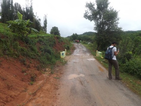
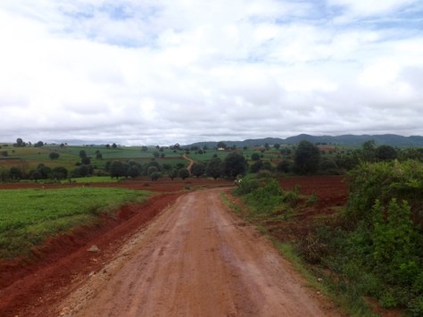
After a night in a tent and a B&B style breakfast, I packed up and headed out. I had planned for today to be the longest day of this walk, so thought it best I get started early. The trail went quickly through a field to a small lane then onto a major road for a hundred metres or so before diving back onto cropland.

dscf8498-2017-08-1-15-06.jpg

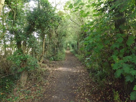
I started to see horses in paddocks as I walked and chatted to several as I went past, some coming to the fence to check me out. As I cut around a small copse of trees, I began to hear the highway ahead. I crossed another paddock and over the road where I could. I then walked between a pair of fields with horses and ponies roaming around before onto a small lane that again led to a rural road. I followed this to a small village before turning left and along for fifteen minutes to the large village of Tadburgh.

There is a pub on the far side of the township, and I was keen for a coffee, so I walked along the major road to it. It was closed. It seemed pretty standard for Norfolk not to find anywhere open that sold food. I sat on an outside seat and ate some trail mix before heading off again.

dscf8503-2017-08-1-15-06.jpg

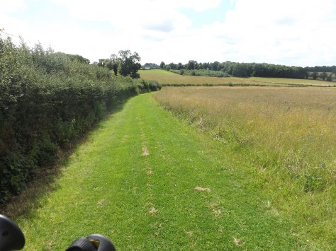
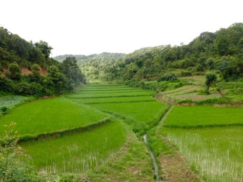
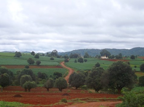
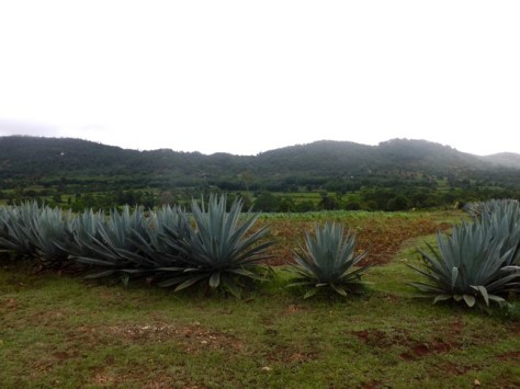
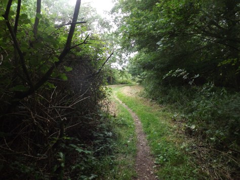
I walked on again along tight country roads for some time, standing aside for the occasional car that came by. I turned right and headed onto farmland again along permissive lands provided for my walk. I crossed more wild trails fending off nettles with my walking poles. Over a major road,  I walked into more fields, passing some trees called, ‘Devil’s Wood’ then along a path to the village of Fritton. As I walked, I wished for a seat, and when I got to the corner there was one waiting near a phone box. I sat down and ate more of my trail mix. Again, like the other villages, there was no place to stop to buy any food, not even a corner shop to grab a snack.

dscf8504-2017-08-1-15-06.jpg

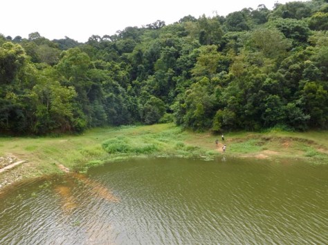
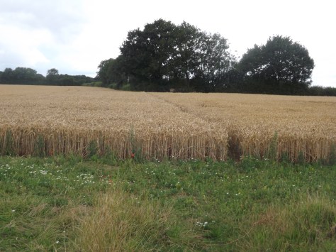
After a rest, I headed south with the threat of rain looming in the sky. It spat a little as I walked under a row of trees, but nothing more. Then it was back into farmland and across more wheat fields before heading south into Tyrell’s Wood, the first I was allowed to walk through. It seemed popular with dog walkers. When I got to the carpark, I took another rest, taking off my boots. Today my boots have been hard on my feet and ankles, and I could start to feel some strain on my Achilles’ tendons. So when I put the boots on again, I made sure to keep them loose.

Rain threatened again as I headed off again along country lanes. After ten minutes the rain finally came down. I was prepared for it and had brought a small umbrella with me. With it open, I stood under a large tree while a heavy barrage of rain came down for 30 minutes or so.

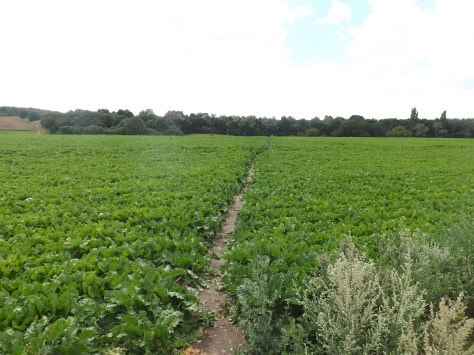
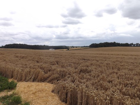
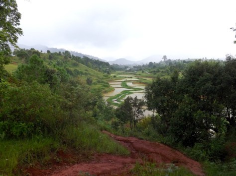
When it stopped, I headed off again and five minutes later had to cross a wheat field with a path cut through it. It was a little slippery, but the wet dirt had yet to turn to mud although my boots and legs got wet from the wet plants.

dscf8507-2017-08-1-15-06.jpg

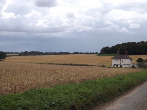
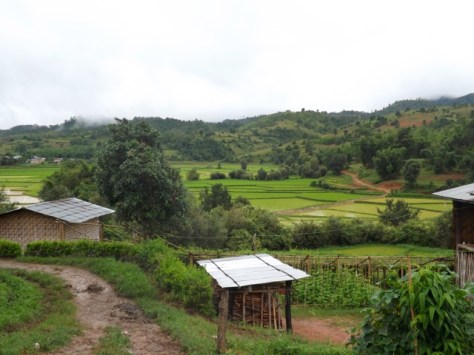
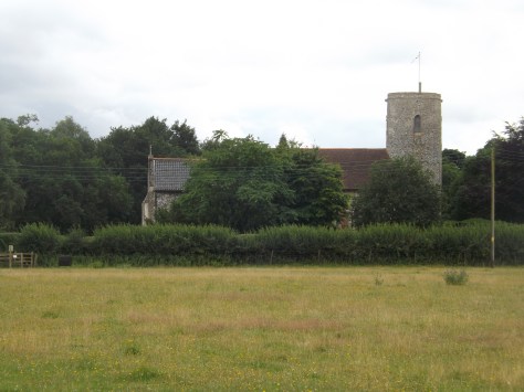
I eventually made it to Pulham Market, a larger village with a pair of pubs close together. But time was getting on, and I estimated I still had another 2 hours to walk, so I didn’t want to stop for too long. I had no idea how far I had walked since leaving camp nearly 8 hours earlier, but my legs were growing sore and seized up each time I stopped. So I pushed on. My left Achilles tendon was still sore, so I tried to go easy on it, adjusting my boots again to give some comfort.

dscf8506-2017-08-1-15-06.jpg

I pushed on south along the road and then a country road that led onto more fields. I again cut across wheat fields and along grass verges hiding nettles until I reached another major highway. It was here I was to leave the trail to get to my accommodation another 5 miles away.

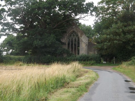
I walked through more country lanes, past houses and farms, through the village of Tivetshall St Mary to the remains of St Mary’s Church where I stopped for my final rest. I was just about to leave again when it again began to pour.

dscf8508-2017-08-1-15-06.jpg

Once it had finished, I set off but was again stiff. I crossed a railway bridge then followed a muddy trail across yet another wheat field and a grass paddock. One more road and I arrived at my B&B. My legs were sore, and I was knackered after a 10 and half hour day, nine of them walking. I looked forward to a shower and a walk to the pub for dinner.

After my shower, I could barely walk. Then because a local fete had been on that day, I discovered the pub was not serving food and delivery from Diss was going to cost me a fortune, so I resigned myself to eating trail mix again. But again, my host offered to cook me dinner. It was amazing. Afterwards, I watched some TV before collapsing into a comfortable bed.

Day 3 – Gissing to Diss – 10km (6.2miles)

Rain rain rain, all night long. It would be a short walk today to my end point where I was catching a train late in the day. My hosts told me I could stay as long as I liked, and I made a plan for when the rain stopped.

My host dropped me off back on the trail, and I waited in a pub for the rain to stop, but alas, it did not. The pub did not serve food on Mondays but could heat up a sausage roll for me. I eventually gave up waiting for the rain to stop and caught a bus to the train station in Diss where I hung out for several hours waiting for the train. Not the way I wanted to end the walk, but neither would be getting rained on and having to cross muddy fields.

dscf8469-2017-08-1-15-06.jpg

Overall
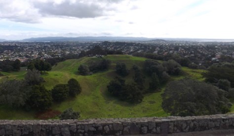
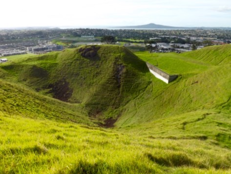
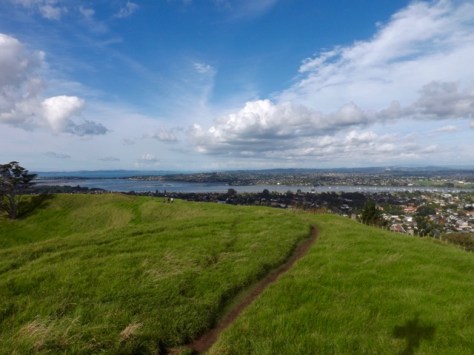
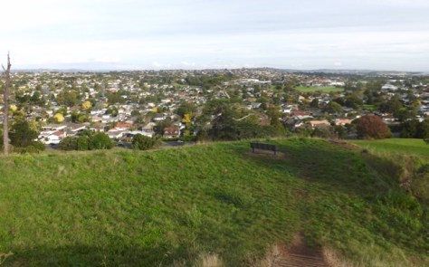
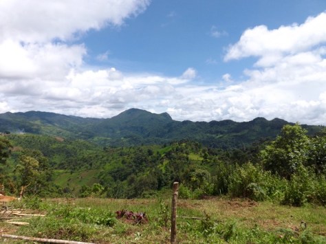
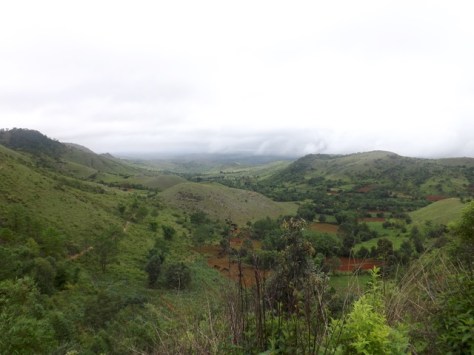
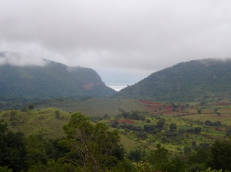
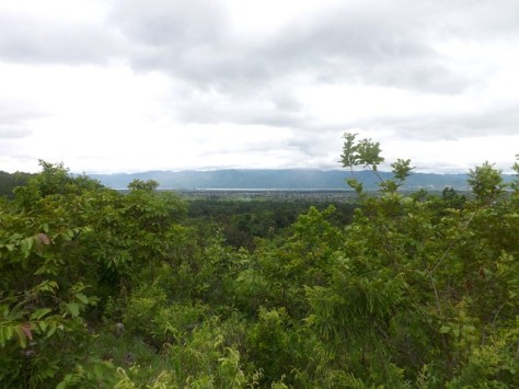
Honestly, while it was an interesting walk along roads and through paths across farms, there was not that much to the Boudicca Way. It was good exercise and got me used to a heavy pack again, but there were very few scenic views or places of interest. The difficulty finding accommodations and there being practically nowhere to eat made it a rather annoying trip. I’m glad I walked on this side of the country, but next, I will be off on what I hope will be a more decent hike, Cheshire’s Sandstone Trail.

The Lone Trail Wanderer

Boudicca Way, Norfolk, England – Part 1

In 60AD, Boudicca (bow-de-see-ya) was a warrior queen of an ancient Celtic tribe in the region now known as East Anglia. After her husband’s death, her lands were usurped by the Roman emperor Nero, she was flogged, and her daughters raped. From this, she was chosen to lead an uprising against the Roman army, which left 80 thousand Roman soldiers dead and laid waste to three cities including Londinium, which would eventually become London.

b5d9950fe8635eb3396e543cf1732480-warrior-queen-woman-warrior-2017-07-27-14-35.jpg

The Boudicca Way is a three day, 58km/36-mile hike that crosses the area where Boudicca lived, Iceni. It starts in the city of Norwich, England’s second largest city until the Industrial Revolution, to the market town of Diss.

celtmap-2017-07-27-14-35.jpg

Day 1 – Norwich to Saxlingham Green – 22.75km (14.1miles)

It was an early start in London to get ready. I’d packed the night before, so I just needed to have breakfast and get to Liverpool Street Station for my train to Norwich.

After three hours I arrived and spent some time getting water and repacking. Then I headed out along the path following the app I’d downloaded, which would prove invaluable during my trip.

pastedgraphic-2017-07-27-14-35.png

The first hour of the hike was spent getting out of the city, crossing rivers and walking streets with endless cars everywhere. Finally, I passed through Trouse Newton and along a street that grew steadily thinner as I went. Towards the end of that road, I crossed a paddock where a henge had been. It’s now empty but for a circle of cleared ground.

dscf8465-2017-07-27-14-35.jpg

I followed another road and after crossing the A47 highway the trail went rural. I followed it through cropland freshly sprinkled with rain from earlier that morning.

dscf8466-2017-07-27-14-35.jpg

On the far side of the field, my feet were soaked from the wet plants. The worst was yet to come, as the trail lead alongside wheat fields it was thickly scattered with nettles, prickles and thorn bushes. Perhaps I should rethink always wearing shorts and would recommend anyone doing this walk to wear long pants. The sting of nettles goes away fairly quickly, but the scratches from the thorn bushes don’t. Trophies of hiking I guess.

dscf8471-2017-07-27-14-35.jpg

At Armishall I headed back onto a road and then along the wide stretch of grass between fields.

dscf8474-2017-07-27-14-35.jpg

I came to a T-intersection after being on the road for a mile and followed a side path to the site of the ancient Roman town of Venta Icenorum. The site is now just an empty field that had been dug up by archaeologists. I spent some time walking around it and reading the boards explaining how the Romans of 200-300AD lived.

dscf8486-2017-07-27-14-35.jpg

I then headed back along the roads to the crossing and went the other way for four miles, passing small wooded areas and more crops.

I stopped at Shotesham for a Cider at the local pub only to find out I was too early for dinner. This was a stroke of bad luck as there had been no other food places along the way. This was also the closest food place to my accommodation, which was still three miles away. After a long day on the trail, I did not relish the idea of walking 3 miles each way to get dinner, so I resigned myself to simply dining on my trail mix in my tent.

dscf8494-2017-07-27-14-35.jpg

I walked on through fields of corn and wheat, past more woods to finally come out at my accommodation, the wild camp site. It turns out it was actually a B&B that was trialling wild camping in their extensive back field. I would get the use of a cottage’s bathroom and kitchen while only sleeping in my tent. Sheer luxury for a campsite. When my hosts discovered I’d missed dinner at the pub, they insisted on cooking me some scrambled eggs. A touch of the East Anglian hospitality I was to see more of during the walk.

dscf8495-2017-07-27-14-35.jpg

I chatted with my hosts and drank a glass of wine. They were lovely and interesting people. But after my long day walking I was looking forward to a shower, to get my tent pitched, and head to bed.

Boudicca Way, Norfolk, England – Part 2

The Lone Trail Wanderer

Lands End, England – St. Ives to Penzance, Part 2

A four-day hike around the toe of England – Land’s End, Cornwall. See the first two days – St. Ives to St. Just.

Day 3 – St. Just to Treen – 18.5km (11.5 miles)
Stage 3 overall was moderate with only a couple of difficult climbs.

As we had walked a mile past St. Just the night before to the YHA, we were already a mile ahead of schedule for the day. After breakfast, we checked out and headed along the gully to Gribba Point with a view back along the coast to Cape Cornwall. Ahead of us, the coastline stretched away as the trail cut across the cliff tops and only descended into a river gully once.

dscf8419-2017-07-10-14-35.jpg

We climbed our way back up the cliff and around to the rocky Aire Point with White Sand Bay growing ever closer.

dscf8423-2017-07-10-14-35.jpg

Beyond Aire Point, the trail grew more sandy as we came down into Whitesand Bay with Sennon Cove settlement on the far side where we aimed to find lunch. We watched surfers in the bay as you crossed a small amount of sand before climbing around the cliffs towards the town. On arrival, I found a fish and chip shop and a pub to enjoy a relax and an ice cold cider.

dscf8432-2017-07-10-14-35.jpg

After lunch, we headed up the cliff and the final kilometre to Land’s End, the westernmost point of England’s mainland. We walked briefly through Legendary Land’s End, a tourist mall, before pushing on in the heat.

The way around the coast was mainly across the tops of the cliffs with only one climb down into Mill Bay and back up the other side. From here it was rolling hills all the way around to Gwennap Head, the southernmost point of the Land’s End peninsula.

dscf8439-2017-07-10-14-35.jpg

We stopped for a break at the lookout at Hella Point before climbing down into Porthgwarra, a small village with a beach nestled in the rocks.

dscf8444-2017-07-10-14-35.jpg

Further on we were warned of a cliff slide near St. Levan, so walked cautiously but found nothing of concern. We could soon see Logan Rock ahead, our end point for day 3.

dscf8447-2017-07-10-14-35.jpg

We came to the top of the cliff over looking Porthcurno beach where there is a natural Open Air Theatre, but after a long day in the sun, neither of us felt like paying the money and lugging out bags up and down the cliff to see it.

At the top of the cliff on the other side of the beach, it was only a fifteen-minute walk to our accommodation, Treen House B&B and its host, the lovely Claire.

dscf8448-2017-07-10-14-35.jpg

Treen House B&B is only 50 metres from the local pub, but up a hill. After the day’s walk, it was perhaps the hardest walk we had to make.

Day 4 – Treen to Penzance
The initial part is ‘difficult’, going quickly to moderate, before ending on an easy walk along roads.

We left the lush comfort of the Treen B&B and walked along the road down to Penberth. As it had for the previous three days, the sun beat down with only a soft breeze to cool us as we climbed one of the few cliffs left on this coastal adventure. We descended into a gully, ascended the other side to walk along the cliff and then down towards the community of St. Loy Farm, where we finally had some shelter from the sun through a small tree reserve.

Past the community, we had to for the first time rock hop along a beach for about fifty metres before heading up Boscawen cliff on the other side.

dscf8451-2017-07-10-14-35.jpg

For the rest of the morning, we walked along the tops of the cliffs on a fairly easy route towards Lamorna where we came around the cliff to find a cosy little village nestled into an inlet. The heat was pretty sweltering, so we stopped off for lunch and a cold drink. We then continued around a rocky cliff, up Kemyel Cliff and passed alongside the Kenyel Crease Nature Reserve where we started to see more civilisation.

dscf8455-2017-07-10-14-35.jpg

We hit roads not long after at the township of Mousehole only a handful of miles around the coast from Penzance. The remainder of the walk had us following the main highway along the coast. We stopped for an ice-block to cool us down before pushing on. Many people catch a taxi or bus from Mousehole as it is all road walking, but we decided to finish on foot. The concrete under our feet was hot, and you could feel it through your boots as we pounded the pavement.

dscf8459-2017-07-10-14-35.jpg

After an hour on the road, we finally made it back to our accommodation in Penzance and dropping out bags off at the car, we headed to the local pub for a well-deserved cider.

Overall
The four-day hike from St. Ives to Penzance is an excellent and moderately difficult walk, made harder by the beating sun at this time of the year. It’s an experience and finding the little hidden away golden beaches and peacefulness of the trail, it was overall a good time. At no point would I have considered it severe difficulty as I have seen mentioned online, and only barely strenuous because of the constant heat.

The Trail Wanderer

Lands End, England – St. Ives to St. Just, Part 1

It’s been some time since I’ve put on a pack and headed out on the trail. I’m now living in London in the UK and decided to get out and see what England had to offer.
After some deliberation, my brother and I settled on a four-day hike around the toe of England in Cornwall, called Land’s End.

This is my first full coastal hike on what I’m told is the best scenic hike in England. At 66km or approximately 43.5 miles, I  split it over 4 days, plus a day to get to and from Penzance, our starting point.

Transport
Land’s End is around 300 miles from London. To get two of us down there by plane or train is very expensive, and we didn’t fancy 9 hours on a bus. This time it turned out far cheaper to hire a car.

Accommodation
There are camping grounds around Land’s End, but we decided to go ‘glamping’. So we booked backpackers and B&Bs to ensure we got a hot shower and soft bed after each day of walking. If you do this, it is best to book a fair time ahead to ensure you get a room, especially in summer when it’s most popular. Also note, most accommodations have late checkout and 5 pm check-ins, forcing hikers to walk during the hottest part of the day.

wildlandsendmap21-2017-06-23-15-04.jpg

The day before our walk, we drove down from London, a five-hour trip. We stayed the night before the hike in Penzance and would be staying at the same place at the end of the hike. This was so we could leave the car securely parked for the duration of the walk.

Day 1 – Penzance to Zennor – 11.5km (7 miles)
This first stage of the hike was the hardest but thankfully the shortest. While it is listed as ‘severe’ and ‘strenuous’, I would consider it closer to ‘difficult’, especially in mid-summer under the constant sun.

We left the car outside out accommodation and bought train tickets to St.Ives, taking only 10 minutes and delivering us to the trailhead in style.

dscf8355-2017-06-23-15-04.jpg

On arrival in St. Ives we found the small town to be set between picturesque gold sand beaches, something not normally associated with the UK. In the blue skies and hot sun of mid-summer, tourists and beach goers swarmed the small town.

dscf8362-2017-06-23-15-04.jpg

We started the walk with a tour of ‘The Island’ on St. Ives Head giving the above views out across the town and beaches. On ‘The Island’, St. Nicholas Chapel, also gave a picturesque view.

dscf8351-2017-06-23-15-04.jpg

We walked around The Island and then along Porthmeor beach on what was to be the easiest walk of the day. Then, a short climb around the cliffs as he headed towards Clodgy Point.

dscf8368-2017-06-23-15-04.jpg

The initially wide sandy trail weaved through long grasses and short bushes that did nothing to protect us from the constant sun. While there was a very light cool breeze, it did little to alleviate the heat.

dscf8369-2017-06-23-15-04.jpg

The trail crossed the top of the cliffs, ascending and descending through rocky gullies that lead down to precarious crags. As we headed towards Pen Enys Point, we left the sandy beaches long behind us.

dscf8371-2017-06-23-15-04.jpg

This section of the coast is perhaps the most desolate part of the region except for the occasional Foxglove flower dotted here and there. After two hours, we’d left the touristic day walkers behind leaving only the occasional other hikers.

dscf8373-2017-06-23-15-04.jpg

We pushed on in the heat, following the South West Coast trail around cliffs that just didn’t seem to end. As we made our way past Mussel Point, we found a lone park bench sitting in a short bend on the trail. After hours of hard climbing in the sun, we sat down for a well deserved 30-minute lunch.

dscf8374-2017-06-23-15-04.jpg

For the rest of the afternoon, we slogged on, climbing across various rocky outcrops until Zennor Head came into view. From here the climbs became longer and steeper until we came over a ridge to see a farm building on the edge of the village of Zennor.

dscf8376-2017-06-23-15-04.jpg

This announced the end of the first day. We headed along a road towards the small village where we could finally down packs and enjoy some shade. We found our way to the Tinner’s Arms, the only pub in the village, and relaxed on the grass under umbrellas enjoying cold drinks until our accommodation, Zennor Chapel B&B opened.

Day 2 – Zennor to St. Just – 18.5km (11.5 miles)
Stage 2 had some difficult parts but was overall fairly moderate.

From the window of our room, we could look out to the coast and even watch a family of rabbits play on the lawn. After a refreshing night’s sleep in comfortable beds, we went down for breakfast and picked up our prearranged packed lunch.

dscf8380-2017-06-23-15-04.jpg

We walked out of Zennor in the late morning. The weather was similar to the day before, cloudless blue skies with only the slightest breeze. Without even that slight breeze, the day would have been a lot harder.

dscf8382-2017-06-23-15-04.jpg

We set out along Carnelloe Cliff with the memories of the previous day still heavy in our minds. But unlike the end of the first day’s with its constant ascents and descents began fairly flat and skirted around the tops of the cliffs. Today we started to see more nettles on the trail and as we both wore shorts we were forced to get used to that constant stinging sensation. We could have worn long pants to avoid this, but in the heat, no thanks!

dscf8387-2017-06-23-15-04.jpg

Out first distant target was a jutting set of rocks known as Gurnard’s Head. As we walked towards it, the climbs began in the heat of the day. After an hour we walked past the rocky peninsula and climbed the Treen Cliff on the far side. We found a set of rocks on the far side with a luxurious cool breeze and stopped for a break.

dscf8390-2017-06-23-15-04.jpg

A distance marker pointed us to Pendeen Watch, a lighthouse atop Pendeen New Cliff. We set that as our lunch break point and marched on. The trail, in general, became smoother with less climbing as we followed the clifftops, but the nagging sting of nettles continued. Early in the afternoon, we crossed the Tregaminion Cliff to see the golden sands of Portheras Cove below us. On the other side, we could see Pendeen New Cliff, although no lighthouse yet.

dscf8409-2017-06-23-15-04.jpg

But as we neared the beach, Pendeen Watch did became apparent. We descended into the cove and walked briefly on the sand before climbing the other side. Near the top, a switchback trail descended the hill to a road which climbed again to the lighthouse. We stopped for a well-deserved rest and to eat the rather abundant lunch we’d been provided.

dscf8407-2017-06-23-15-04.jpg

From the lighthouse we could see chimneys further along the trail, marking the entrance of the Levant Mining area. The afternoon sun beat down on us for perhaps the hottest day of our walk. As we entered the mining area, there were far less grassy trails and more gravel. This didn’t help with the heat.

dscf8412-2017-06-23-15-04.jpg

We struggled on as the water in my pack began to grow warm. We were able to find a small shop as part of a museum in the ruins of Britain’s largest tin mine. We purchased a bottle of cold water each and drained them in seconds.

dscf8413-2017-06-23-15-04.jpg

Feeling a little more refreshed, we pushed on along the cliffs to Kenidjack Castle ruins where we got a view of Cape Cornwall and the edge of St Just, our stopping place for the end of day 2.

dscf8415-2017-06-23-15-04.jpg

With our target in sight, our strength’s began to wane, and we staggered into central St. Just, a thriving town which after a couple of days in the ‘wilderness’, had far too much traffic. On arrival, we discovered our accommodation was a mile further on from the town. We rested for ten minutes before pushing on to the YHA Land’s End and a welcome shower.

Next, the final two days of our hike, St. Just to Penzance.

The Trail Wanderer

Tongariro Alpine Crossing, Central Plateau, New Zealand

Mount Tongariro is one of several volcanos in the middle of New Zealand’s North Island. It’s the northernmost of the three volcanic cones just to the south of Lake Taupo, New Zealand’s largest lake.

Mount Tongariro is also the location of one of the most popular hikes in New Zealand: the Tongariro Alpine Crossing. This is a 19.4 kilometre hike that climbs over the Tongariro massif, past the summit of both Tongariro and Ngauruhoe.

tongariro-crossing-map-aug-2012-2016-04-4-15-52.gif
Map is © Copyright Tongariro Alpine Crossing Please visit that site for more information.

A group of us decided to do the Tongariro Alpine Crossing towards the end of the season. We made arrangements and drove down from Auckland on Friday night with the intentions of climbing early Saturday morning. The four-hour drive turned into five and a half as we left during Auckland’s rush hour. We arrived late in the evening and bedded down for the night with alarms set.

A Bad Start
When we awoke on Saturday Morning it was raining and didn’t look pleasant. We went for breakfast and waited to find out if the we could still do the walk. The answer came back a resounding no. The rain and strong winds meant the mountain was closed. All we could do was hang out for the day and hope for better weather on Sunday.

What Tongariro should look like, apparently…
slider4-2016-04-4-15-52.jpg

Ominous News
We were up and had breakfast early on Sunday but the weather still didn’t look great. The mountain was still not visible from our lodgings and when our driver arrived he had bad news. He believed the mountain was again closed and wouldn’t take us, leaving us a little downhearted. We asked the owner of the lodge and he was unconvinced. He rang another driver who confirmed the mountain was in fact open and would take us up.

We were driven to the trailhead in the rain with trepidation, but with the number of other vehicles heading up, it seemed others would also be braving it.

Trailhead – Mangetapopo Carpark – 1100m
We began at the Mangetapopo carpark in a slight drizzle. There were no views of the massif or much else due to the low cloud. The trail was a mix of mud, stones, wooden platforms and people. There were hundreds of others doing the track with us. If this many were doing it on a bleak day, who could guess how busy it would be on a clear one.

dscf8322-2016-04-4-15-52.jpg

The walk was easy and for the first seven or so kilometres we barely noticed the 250m climb towards Soda Springs. I walked in a quick dry sports singlet, my hiking zip-off shorts and boots. The drizzle was constant but not heavy and I was fairly warm. Others wore long pants and full Gore-tex jackets.

Soda Springs – 1350m
At Soda Springs there is a warning sign: STOP! Are you really prepared? It suggested it was going to get difficult and to turn back if you weren’t prepared. As I waited for my group, I watched several people get to the sign, stare at it for a while and then turn back. With the drizzle picking up I put on a rain poncho over my singlet and began the climb.

dscf8327-2016-04-4-15-52.jpg

It became more rugged, with a rough dirt trail and steps weaving up the side of the mountain towards South Crater. The drizzle continued and the climb became more a little more difficult, but not by much. After a while of steady climbing we began seeing people returning along with trail with warnings of how bad it was higher up.

With the constant drizzle and the warnings I was tempted to turn back. Why do a climb when you can’t see anything the entire time? You climb for the views and the experience, but the only experience would be a wet cloudy one. I put on a jumper under my rain poncho and we continued on.

South Crater – 1650m
We climbed onto the area described as South Crater and out of the wind. With visibility around 20m we walked on the flat for a while, happy for the rest from climbing.

dscf8329-2016-04-4-15-52.jpg

Red Crater – 1886m
After the mud flats of South Crater we began up the ridge and discovered the wind that had been putting everyone off. It was blowing an absolute gale and you could see the drizzle sweeping over the ridge into the cloudy nothingness. I was not surprised people had turned back but since we’d come this far it seemed silly to head back. We pushed on, dodging between rocky outcrops so as not to be blown off.

We reached the top but couldn’t see anything so just kept walking, beginning the plunge down the other side, some members of our group going arse-over-tit on the slippery silt.

Emerald Lakes – 1730m
The small Emerald Lakes would have been amazing to view from higher up but they only appeared out of the gloom when we were 10m above them. It was still good to see something other than dirt, rock and rain. By now we were completely soaked, we continued on down.

dscf8332-2016-04-4-15-52.jpg

Not far below the Emerald Lakes we came to the Blue Lake covered in the same clouds.

dscf8334-2016-04-4-15-52.jpg

Ketetahi – 1456m
After several switchbacks we finally emerged from the clouds to see the Ketetahi Hut. The drizzle let up but the wind did not. We stopped briefly for a snack before pressing on.

For the next part of the trek we were in open ground along a winding trail. Since a great many people had turned back, we only saw two other groups on the way down. Then having spent much of the day hidden in clouds we finally got some views. Lake Rotoaira appeared and we even got the occasional glimpse of Lake Taupo beyond.

dscf8343-2016-04-4-15-52.jpg

Ketetahi Car Park 800m
With 4km to the car park the trail dove into rainforest and grew warmer. We crossed a river on a wooden walkway and eventually arrived at the trail’s end after what seemed a lot longer than 45 minutes the sign had suggested.

dscf8346-2016-04-4-15-52.jpg

Overall, due to the weather, out Tongariro Alpine Crossing was disappointing mainly of the lack of views. In the rain and cold, the hike didn’t feel overly difficult. It took us only 5.5 hours of the suggested 8 hours and of the 2.5 litres of water I took with me, I came out with more than 2.

Perhaps it would have been more difficult in direct sunlight, but I’ll have to come back another time to see. Maybe the next time I’m in New Zealand.

The Trail Wanderer

The Volcanoes of Central and East Auckland

For the past few months I’ve been hibernating in New Zealand, working and resting from my travels. But next week a group of us will be doing the Tongariro Crossing so I figured I’d get in a bit of mild training by climbing six of Auckland’s volcanoes.

Auckland, New Zealand’s largest city, was built upon the Auckland Volcanic Field which contains around 53 dormant volcanoes. While many have been mined flat, some still protrude from the suburban landscape and offer great views over the city (and mild climbing experiences).

dscf8279-2016-03-26-19-37.jpg

From Mount Eden and looking east there is Mt Hobson to the left, Mount Saint John (vaguely) to the right and in the distance Mount Wellington.

Mount Eden – Maungawhau – 196m
The tallest of the six volcanoes is also the closest to the central city.

dscf8286-2016-03-26-19-37.jpg

For this reason it is a very popular mountain among tourists providing great views of the city and Auckland Harbour.

dscf8278-2016-03-26-19-37.jpg

Mount Eden has three craters and has easy access with car parks in several locations up the mountain. I began at the lowest point I could find to get the most of the climb.

Mount Saint John – Te Kopuke – 126m
My second volcano for the day is a lesser known one barely visible until you are virtually right on top of it. Compared to Mount Eden’s busy tourist vibe, I was alone on Mount Saint John except for a solitary family enjoying a picnic and a number of sheep. There is no car access to the peak and only a single crater.

dscf8291-2016-03-26-19-37.jpg

The rim of the crater gives excellent views to the east and south, with other directions blocked by trees. There is a good view over the motorway to Mount Hobson near the summit.

dscf8288-2016-03-26-19-37.jpg

Mount Hobson – Ohinerau – 143m
Directly across the motorway from Mount Saint John, Mount Hobson is perhaps one of the more human modified of all the volcanoes. It has been used for several things over the years, including an advertising medium. Due to its closeness to the motorway, signs and statements can often be mowed into the grass.

dscf8292-2016-03-26-19-37.jpg

Mount Hobson was my favourite volcano of the day with a short steep climb with few other people around. It also provided perhaps the best views from all sides but especially of Auckland Harbour and Rangitoto Island, the largest volcano in the region.

img_29711-2016-03-26-19-37.jpg

One Tree Hill – Maungakiekie – 182m
One Tree Hill is the most famous “mountain” in Auckland and was once a special Maori landmark. Over the centuries it has had a tree growing at the top, thus its name, but due to attacks on the tree at various times, it was removed.

dscf8298-2016-03-26-19-37.jpg

One Tree Hill sits near the middle of Cornwall Park and is a very popular family area on sunny weekends. Today there were many people in the park and at the viewing area at the summit.

dscf8299-2016-03-26-19-37.jpg

One Tree Hill is the southernmost volcano of the six and provides great views out to Manukau Harbour.

Mount Wellington – Maungarei – 135m
Mount Wellington is the largest volcano in East Auckland and is a popular weekend spot with a deep cone that provides ample climbing for those keen enough. It is the youngest of Auckland’s volcanoes and like most of the others it is not expected to erupt again.

dscf8306-2016-03-26-19-37.jpg

From the summit it provides excellent views over Auckland Harbour to the Bucklands Beach peninsula.

dscf8305-2016-03-26-19-37.jpg

Pigeon Mountain – Ohuiarangi – 55m
The smallest and most eastern volcano of the Auckland Volcanic Field, Pigeon Mountain sits behind the house where I grew up.

dscf8309-2016-03-26-19-37.jpg

I have spent many an afternoon climbing the small peak which gives excellent views in all directions especially along the Bucklands Beach Peninsula and south towards Manukau City.

dscf83111-2016-03-26-19-37.jpg

While the climb up Mount Tongariro next weekend will be close to twice the height of the volcanoes I climbed today put together, it has given me some training towards what should be an epic climb. See you next week.

The Lone Trail Wanderer

Mandalay, Myanmar

After a crazy mini-bus ride from Inle Lake, I arrived in Mandalay to discover the glass of my laptop screen cover was again cracked. It’s only the cover so no lasting damage but still annoying. Instead of taking the new wide smooth highway, the mini-bus used the old, bumpy and rocky roads. We spent half of the time bouncing out of our seats and my laptop must have jolted in my bag, coming down hard on one end. Ah well, I can live with it.

wpid-myanmar-mandalay-2015-08-1-14-00.jpg

Central Mandalay
Mandalay has a more western and modern feel than Yangon, with less street markets and more shops selling things other than mobile phones. Unfortunately, with my foot still recovering from major blistering after the Kalaw Inle Lake trek, I found it difficult to wander more than a block from the hostel. On top of that, for the first time during this Myanmar trip it rained incessantly. I guess I’ve been lucky, others have complained of constant rain in both Yangon and Bagan. So on a day with less rain and to go easy on my foot, I hired a bike and rode around the city.

Mandalay Royal Palace
The first stop for the day was the massive walled area of the royal palace, with nine separate gates and a moat wider than the Brisbane River. After going inside and paying the US$ 10 archaeological fee, I rode through the grounds of the palace, which are largely out-of-bounds to foreigners, to the central reconstructed palace area.

wpid-dscf8137-2015-08-1-14-00.jpg

Named, ‘The Famed Royal Emerald Palace’ and the ‘Great Golden Royal Palace’, the location no longer houses the original palace. Bombed to all buggery by the allies in the second world war a replica was built in its place using more modern materials — mainly corrugated iron for the rooftops. Most buildings are bare and empty although one that survived the bombing was the five-story watch tower. I got lovely views over the palace grounds although I got the impression many of the local visitors were more interested in getting photos of me than the palace.

Mandalay Hill
At one corner of the royal palace area stands the hill that gave the city its name. Covered in pagodas and temples the hill is a popular pilgrimage destination for monks with four sets of steps climbing to the summit. The steps stop at various temples along the 240 m climb although those who leave their flip-flops at the bottom are rewarded by having to dodge piles of bird and dog poop all the way up. The views from the top, however, are worth the annoyance of the climb, which is not difficult, only long.

wpid-dscf8158-2015-08-1-14-00.jpg

National Kandawgyi Gardens
A two-hour group taxi ride to the East finds us in Pyin Oo Lwin, a small town locals from Mandalay come to for holidays away from the city. One of the hotspots here is the National Kandawgyi Gardens, a spot of beauty that took myself and a kiwi girl from the hostel several hours to walk around. It was certainly a change of pace from the city. The gardens are massive with a lake and plentiful kinds of flora growing around it. A great day!

wpid-dscf8129-2015-08-1-14-00.jpg

The best way to see some of the sites of Mandalay is to book a day trip but be warned of extra charges along the way. The fee for the tour only covers the group taxi ride.

King Galan Gold Leaf Workshop
With so much gold leaf around this nation it was interesting to see how it is made. Workers pound by hand small squares of gold into sheets of gold leaf. They use 3 kg sledge hammers and belt the gold continuously for 30 minutes straight.

wpid-dscf8172-2015-08-1-14-00.jpg

Maha Mauni Pagoda
We were delivered to one of Mandalay’s major pagodas and wandered around barefoot, again careful not to stand in the poop of birds that build nests under the ceilings. In the centre of the pagoda is a great seated buddha which locals climb to plaster gold leaf across its surface.

wpid-dscf8175-2015-08-1-14-00.jpg

Mahagandhayon Monastery
Probably the most unusual part of the tour, we head to the monastery to watch lines of monks carry their bowls to be filled for the morning meal. It is unusual as at 10am every morning tourists swarm here to watch these monks (1000 of them) get rice. It must be bizarre from the monks side of things also.

wpid-dscf8189-2015-08-1-14-00.jpg

Sagaing Hill
These are in fact two hills with pagodas atop each that providing great vistas of the surrounding landscapes in addition to sprawling chambers of buddhas.

wpid-dscf8193-2015-08-1-14-00.jpg

Inwa Ava
After lunch we head to a river crossing and the more rural Inwa Ava area for two hours being driven along muddy roads in a horse-drawn carriage. At times I felt sorry for the struggling horse as it dragged two of us and the driver through difficult mud.

wpid-img_2680-2015-08-1-14-00.jpg

Bagaya Kyaung – The Teak Monastery
One of the attractions of the horse ride was the Teak Monastery built with many thick teak planks. It is a magnificent buildings except that it has suffered from fire damage and the wood has a thick black layer of soot across it. It is part of the Mandalay Archaeological zone so the card I purchased a couple of days earlier covers it. Otherwise it is a US$ 10 fee.

wpid-dscf8216-2015-08-1-14-00.jpg

Me Nu Ok Kyaung – The Brick Monastery
Our final crazy carriage visit took us to another monastery, this one the most different in Myanmar as it is not built from wood but brick. With several levels, criss-crossing passages and small rooms with connecting windows this would have made a great play castle. I could imagine playing hide and seek all day in this place.

wpid-dscf8221-2015-08-1-14-00.jpg

U Bein Bridge
Back in our group taxi and we head to the oldest and longest wooden bridge in the world. The teak wood bridge in the shape of a V is 1.2 km long and crosses the Taungthaman Lake. It is a haven of tourists, locals and monks crossing from one side to the other. But instead of walking back across, tourists can hire a boat and be rowed back, stopping midway for sunset, something that was unlikely to happen during our cloudy day.

wpid-dscf8228-2015-08-1-14-00.jpg

Overall, I enjoyed Mandalay better than Yangon as there was more to do in and around the city. There was a feeling of being a sprawling warm city than the dirty mess of cramped streets of Yangon.

Next, I head back to Yangon for my last couple of days in Myanmar before I head back to Malaysia.

The World Wanderer

3-day Trek, Kalaw to Inle Lake, Myanmar

Most hikes to Inle Lake start at Kalaw, a township about an hour west of Inle Lake. Most buses stop at Kalaw on the way through dropping off tourists to do the hike. The tour company will take your pack and arrange for it to be waiting for you at your hotel at the other end.

But, if you’re like me and don’t like the idea of handing over your Macbook and other electronics to a random stranger hoping it will all appear at the other end, then the bus continues on to Nyaung Shwe, the main tourist town of Inle Lake. Once there you can find your hotel and make arrangements to have your things put in a locker before arranging a bus back to Kalaw.

wpid-myanmar-inlelake-2015-07-24-17-58.jpg

There are plenty of trekking guides in Kalaw but for some reason I was drawn past all the others to Sam’s Family Restaurant and Trekking. They gave me the options of different lengths of trek, from 1 to 3 days and the prices depending on number of people in the group, from 1 to 6 people. Of course, the more the people, the lower the price.

You are then asked to come back the night before the trek to meet the others in your group. With group treks it’s important to get the right group. The group I was to go with seemed nice people and were from all across Europe. We were given a vague trek plan and shown our route on a map. Here is a vague approximation of the route although ours was slightly different.

wpid-kalaw-t-map2-2015-07-24-17-58.jpg

Day 1

It had rained overnight, which didn’t bode well for the trek. On top of that, as my room at the guesthouse was above the kitchen, I was awakened at 4.30am by someone messing around with pots and pans. Then, as if to ensure I had no hope of getting back to sleep, the water pump beside the kitchen started. At least the rain had stopped.

After breakfast, I headed down to Sam’s Family Restaurant at the allotted 8.30am time to get ready for the trek. But when I got there I found that I’d been put into a different group. My new group did not seem as friendly as the other and contained three Israelis and two French girls.

We began walking through the streets of Kalaw, avoiding motorbikes as we went. We then headed out onto a dirt road through houses with plentiful flower gardens.

wpid-dscf7996-2015-07-24-17-58.jpg

I stopped to take photos as the rest of the group chatted away. This was when the realisation hit me that my five hiking companions were all talkers. So, I hung out at the back to try to enjoy the sounds of nature without having to listen to the constant dribble of human voices. This is, after all, why I started hiking alone all that time ago.

wpid-dscf8004-2015-07-24-17-58.jpg

Finally, after a short time we left the sound of engines and motorbikes behind and started out along a dirt trail. The track led us through an evergreen forest for an hour with several short climbs.

wpid-dscf8008-2015-07-24-17-58.jpg

As we went we passed a couple of rice paddies hidden among the trees.

wpid-dscf8016-2015-07-24-17-58.jpg

After an hour in the forest we arrived at a reservoir where we stopped to rest and watch some locals fishing.

wpid-dscf8027-2015-07-24-17-58.jpg

After our rest and a banana, we headed back into the forest for forty-five minutes with more climbing, although nothing too strenuous. We eventually reached a view-point high on the side of the hill above a green tea plantation.

wpid-dscf8032-2015-07-24-17-58.jpg

Ten minutes further on we stopped at a Nepali Restaurant which allowed more great views while we ate our vegetarian curries. After sitting briefly with my group, I discovered they preferred to chat together in their own languages. As I was the only native english speaker I decided to sit with my original group who were more willing to talk in a common language.

wpid-dscf8041-2015-07-24-17-58.jpg

After lunch we walked further along the ridge until we met a group of local ladies from the Paung tribe of the Hin Kai Kung village who were heading to work in the tea plantation. They were more than happy to pose for some photos with us.

wpid-dscf8043-2015-07-24-17-58.jpg

We walked around the end of the valley following a dirt road and came through their village nestled high on the hilltop opposite our viewpoint lunch spot.

wpid-dscf8045-2015-07-24-17-58.jpg

Once past the village, we descended downhill on the dirt road for nearly an hour. I was enjoying being out in nature again after so long and as I had for most of the day I dropped back far enough that I could barely hear the ongoing loud chatter of my group.

wpid-dscf8048-2015-07-24-17-58.jpg

We again passed several paddy fields on the way to the railway line. We then walked along the sleepers for forty minutes, not worried about oncoming trains as they move so slowly there would have been plenty of time to get out of the way.

We then stopped for a 15-minute break in the disused railway station of the Nyin Dirk village of the Daung people, which is now a cafe type eatery. After the rest we walked on through paddy fields towards our stopping point.

wpid-dscf8050-2015-07-24-17-58.jpg

With about an hour to go the sky opened up and it poured on us. This left us with a muddy climb through hills.

wpid-dscf8054-2015-07-24-17-58.jpg

This made the last part of the day longer and harder. Soaked through we eventually made it to the Sat Sky Kong village of the Daung Tribe where we were able to put our packs down and change into dry clothing. I grabbed a beer from the local store before dinner, which was amazing, several different plates with curries and other vegetable dishes, all with rice. After dinner, we hung out in the kitchen with our guide, the cook and two of the owners, drinking the local Myanmar rum. Then we sunk into a sleep at around 9.30pm.

Day 2

The roosters began at 5.00am but only for ten minutes before falling silent again. We continued to doze until 7am when breakfast was brought into our room consisting of french toast, fruit and coffee. I learned that the french call french toast ‘toast’ although Paen Perdu better describes what we know.

After breakfast we prepared to leave, stopping for some of the group to buy fresh water at the store while the rest of us looked out over the village paddy fields.

wpid-dscf8056-2015-07-24-17-58.jpg

We headed out of the Sat Sky Kong village around 8.30am on a wide dirt road, with some puddles.

wpid-dscf8060-2015-07-24-17-58.jpg

As we walked, we noted the plentiful paddy fields were in many stages of being planted. Some were being tilled and it was from this we learned the value of buffalo to these people. They can be a cheaper, self-sustaining but much slower version of the motorbike.

wpid-dscf8058-2015-07-24-17-58.jpg

But for the most part it is the strength of the buffalo that is treasured. A single buffalo can till a field quickly and easily while would take two oxen to do the same work in slower time. Buffalos are not cheap, each costing about US$2,500, so they are well looked after and usually not eaten. Here the farmer is giving his buffalo a bath and by the sounds coming from the buffalo, it was enjoying it immensely.

wpid-dscf8061-2015-07-24-17-58.jpg

After two and a half hours of walking we stopped for a green tea break in the Kyatsu village of the Baro tribe. Then it was off again along the dirt road through more paddy fields. After talking constantly and loudly throughout the first part of the day causing me to drop back again to be able to hear nature, the Israelis seemed to run out of things to talk about and decided to listen to music instead, singing along for the rest of the day.

wpid-dscf8066-2015-07-24-17-58.jpg

While it did not rain before lunch there was a low haze over the mountains. There is a sense of mystery about a landscape cloaked in clouds.

wpid-dscf8071-2015-07-24-17-58.jpg

We arrived in the Nan Dhin village of the Daung Yo tribe for lunch at a cafe-like eatery. There were two other groups there already, the group I had almost begun with and another I had not met before. I hung out with the french girls in my group and chatted as we ate.

It poured during lunch but thankfully the store sold rain ponchos. While I have a jacket it no longer resists the rain, as I learned during the last hour of day one. The rain poncho was too long, so I cut it down to a better size. This amused the staff although they were even more amused when several other members of the groups bought and cut down their ponchos as well. But as soon as we set out after lunch the rain stopped. We followed a red dirt road across more fields, the Israelis singing away loudly to the amusement of any locals we came across.

wpid-dscf8075-2015-07-24-17-58.jpg

Beyond stopping for an occasional five-minute break here and there, we did not take an afternoon break but plodded along the red dirt road towards the low mountains in the distance, passing small settlements and people working in the fields.

wpid-dscf8076-2015-07-24-17-58.jpg

About an hour before we were due to stop for the day we finally left the road and headed across some muddy tracks through paddy fields. It was around then that it began sporadically raining which caused the mud to be, well, more muddy. This put a damper on the last part of the day and made the mud sticky and heavy on tired legs.

wpid-dscf8082-2015-07-24-17-58.jpg

By the time we reached the Partu Park village of the Daung Th tribe most of us were over the day. We just wanted to get to the room, put our packs down, take our boots off and get a beer. So that was pretty much what we did. The other group had arrived before we had, so I joked around with them a little. Then over dinner, a fish curry and vegetables, the Israelis went off into a discussion in hebrew, the french girls went off in a discussion in french and I was left to myself. So, tired after the day I went to bed.

Day 3

At breakfast the discussion again split into the three language groups. This brought me to a decision to ask to walk with the other group. With several european nationalities among them including Denmark, Holland, Spain and Belgium they predominantly spoke in the common english language.

wpid-dscf8085-2015-07-24-17-58.jpg

Hiking with a friendly and inclusive group makes a lot of difference. This and the fact that much of the day was spent walking along trails through the mountains instead of dirt roads led me to regard day three the best day of the hike.

wpid-dscf8088-2015-07-24-17-58.jpg

We stopped briefly at another Kyatsu village for the Baro tribe before starting our descent towards the plateau where Inle Lake resides.

wpid-dscf8090-2015-07-24-17-58.jpg

We passed the Inle Region checkpoint where we had to pay US$10, but as I had already got a ticket on my initial visit I did not have to pay again. We stopped for a longer green tea break at the Nan Yart village of the Baro tribe where we saw two other groups that we had not seen before.

Then after the break we headed further down the valley to the first views of the lake.

wpid-dscf80911-2015-07-24-17-58.jpg

Along the way we passed this tree, a cousin to the Bodhi tree, the enlightened tree from India the buddha would sit under. This one is over one hundred and fifty years old.

wpid-dscf8094-2015-07-24-17-58.jpg

Then we headed through the pass to the plateau with views of the Inle Lake.

wpid-dscf8095-2015-07-24-17-58.jpg

We stopped for lunch at the Donenay village of the Innthar tribe where my original group was also having lunch. I sat with the group I’d walked with on day three and rested for thirty minutes before a ten minute walk to the boats that would take us across Inle Lake to the township of Nyaung Shwe.

wpid-dscf8096-2015-07-24-17-58.jpg

During the first part of the hour-long trip across the lake we saw fishermen laying nets and steering their boats with their feet.

wpid-dscf81001-2015-07-24-17-58.jpg

With the occasional boat similar to ours racing past.

wpid-dscf81041-2015-07-24-17-58.jpg

And mountains on both sides covered in ominous rain clouds.

wpid-dscf81051-2015-07-24-17-58.jpg

During the last half of the boat ride those ominous clouds opened up and it poured with rain, so we donned our cut-down ponchos until we were delivered to the jetty.

That evening I met up with my group from day 3 for pizza, european food after days of local food. I had the Tutti Pizza, which I call the ‘Monk Pizza’… one with everything.

Overall, other than ending up with the wrong group, the trek was not bad. The last day was definitely the highlight although the surroundings for most of the trek were amazing. It was great to be out in nature again as it’s been 18 months since my last hike which was to Ciudad Perdida in the Jungles of Northern Colombia.

Then with a heavily blistered foot and a little toe with an infection, I hung out in Nyaung Shwe for a couple of days before heading north to Mandalay.

The Lone Trail Wanderer

Bagan, Myanmar

Nestled in the curve of the Ayeyarwaddy river is Bagan, a city of beauty and wonder founded in the 9th century with the name Pagan. The city only survived four centuries, however, but during the final two hundred years more than 10,000 pagodas, temples and monasteries were built, 2,200 of which are still standing today.

wpid-myanmar-bagan-2015-07-15-16-321.jpg

After a nine-hour overnight bus ride north from Yangon I arrived in Bagan, paid the US$20 archaeological park entrance fee every visitor must pay and was delivered to my hostel at 4am. Unable to get into my dorm, I hired e-bikes with an american girl I met on the bus and we headed out to see the sunrise at one of the more popular pagodas.

wpid-dscf7892-2015-07-15-16-321.jpg

Tourists could once rent scooters in this region but the taxi lobby had them banned. Locals, however, found a way around this law by introducing e-bikes, which are simply electric scooters. Most don’t go fast, barely 20km/h, and don’t have a great range although they also don’t need gas. There are quicker ones, such as the one I rented, with speeds up to 45km/h. In a land as hot as Bagan, you really do want the wind flowing past to keep you cool whenever you can.

wpid-dscf7929-2015-07-15-16-321.jpg

When we arrived at the stupa in the dark there were only a handful of people there. But as sunrise grew nearer more people arrived to climb the large and popular pagoda. The rising of the sun gives great views across the landscape, which is mostly flat and littered with short trees.

wpid-dscf7871-2015-07-15-16-32.jpg

But you don’t really notice the vegetation as there are so many pagodas and temples scattered around, some merely twice my height, while others are massive structures covered in gold leaf that shine brilliantly in the sunshine. The amazing thing about this landscape is that no matter which way you look there are scattered pagodas. The vista is absolutely stunning, like nothing I’ve seen anywhere else in the world.

wpid-dscf7884-2015-07-15-16-32.jpg

The Bagan Archaeological area is surrounded by a bitumen road. Then crisscrossing the plains and providing access to the pagodas are wide dirt tracks. It does pay to be a little careful on these dirt tracks as there is often areas of sand which can make riding sometimes a little tricky.

wpid-dscf7935-2015-07-15-16-32.jpg

There are simply too many temples and pagodas to document and it took me a good two full days of exploring to get my fill. For some, however, like my american bus companion, one day was enough and she was off the very next morning. Crazy if you ask me as this place holds so many wonders.

wpid-dscf7898-2015-07-15-16-32.jpg

Sunset is a popular time to head out with a group, find a pagoda to climb and enjoy the view. In fact, sitting on ancient stonework with new friends as darkness floods the lands, is one of the more amazing aspects of this area. It was something I did on each night of my stay.

wpid-dscf7859-2015-07-15-16-32.jpg

When the darkness comes some of the larger stupas light up. For the rest they are simply dark silhouettes in the evening. There is beauty here even in the darkness where you can just sit and drink in the tranquility of Bagan and her surroundings.

wpid-dscf7949-2015-07-15-16-32.jpg

Began doesn’t have a UNESCO site rating as it was rebuilt by the military without using the original bricks, but the feel of the original city is still here. The military built other things in the area such as a golf course and a viewing tower. While these were looked down upon by the locals, the best view can be gained from the watchtower which stands out on the plains like some dark spire reaching towards the sky.

wpid-dscf7944-2015-07-15-16-32.jpg

The other way to get great views is via one of the balloon rides. These, however, do not operate in low season and cost a small fortune. But beyond this, low season is definitely a great time to come here, while it gets a little hot during the day, there are far less crowds.

wpid-dscf79041-2015-07-15-16-321.jpg

But there is more to the region than just a field full of pagodas. A 90-minute journey away is Popa Mountain where a series of stupas was built atop a rocky mountain. There are some pretty great views from the top, but the taxi will usually stop before the mountain for views of the mountain itself. There are 777 steps to the top, which can be fairly strenuous but also involves avoiding hordes of thieving monkeys. They seemed sated of their thievery when we were there so we had little issue with them.

wpid-dscf7908-2015-07-15-16-321.jpg

One day while exploring, I stopped at one of the handy map boards scattered around the plains and was approached by a local girl asking if I would like a tour of her village.

wpid-dscf7938-2015-07-15-16-32.jpg

As it happened it was exactly what I was hoping for and was happy to be led around the village. I met her family and neighbours, and saw how they weave their cloth, lacquer their bowls and spin cotton. This is her grandmother spinning cotton while her mother rolls cigars just out of picture to the left. They visit gave me plenty of insights into tribal life in the village, which helped me to detail the villages I’ve created in the novel I recently wrote.

wpid-dscf7942-2015-07-15-16-32.jpg

Overall, Bagan was an amazing place and I even extended my stay because I was enjoying the surroundings so much. I was even sad when I decided to move on but there were other places I wanted to see. There is something deeply spiritual about Bagan that gives you a deep sense of peace. No other place I have been to on this trip have had that effect. This has to be one of my favourite places in the world.

wpid-dscf7955-2015-07-15-16-321.jpg

Next I head across Myanmar to Inle Lake and a spot of hiking.

The Lone Trail Wanderer

Yangon, Myanmar

In 1989 the Socialist Republic of the Union of Burma became the Union of Myanmar. At the time it was a military dictatorship until it ceded to a democratic government in 2010. It was around this time that the borders opened and travellers such as myself began flocking to a country mostly untouched by the modern western world.

wpid-myanmar-yangon-2015-07-10-17-06.jpg

Five years later and it’s a very popular travel destination with many coming to the country to see it before it becomes the next Thailand, of which it borders.

Between 1974 and 1988 Myanmar was known as one of the world’s most impoverished countries. So, when I arrived in Yangon, formerly known as Rangoon and the country’s largest city, I was surprised to find it bustling with some large rich houses, many newer looking cars and a smart phone in most people’s hands. It seems the western world will not stay locked out for long as there is evidence of a slow seepage already occuring… There’s a KFC in the city, but only one, and it’s very popular with the locals. No doubt more will follow.

wpid-dscf7792-2015-07-10-17-06.jpg

Yangon is a very busy city with just too many cars for the infrastructure, but unlike the rest of South East Asia there is not a scooter to be seen. Because everyone seems to own a car there are traffic jams everywhere and catching a taxi can be a very slow process although at their cheap fixed prices, it’s a better way to get around the city if you have the time.

Myanmar is still hanging on to its culture with fruit markets popping up everywhere as night rolls in. Most of the restaurants are what I call ‘plastic chair affairs’ – a stall set up with small plastic chairs scattered around short tables under the open sky. While mobile phones signs and satellite tv dishes are everywhere, it still feels very real and original. I’m sure this will change in time.

wpid-dscf7776-2015-07-10-17-06.jpg

One of the more fascinating cultural elements seen in the city is the dress. Many women wear clothing usually associated with Thailand, but that is not seen often in that country these days. They come in many colours and are very pretty. Both men and women tend to wear the Longyi, a thick fabric sarong often worn over the more western long shorts.

While there is some use of western cosmetics, most women and many men use a traditional cosmetic called the Thanaka made of a bark compound applied to the cheeks and sometimes the forehead. It has several good properties including a fragrance similar to sandalwood and it is used as a sunscreen. It certainly makes everyone stand out.

wpid-dscf7783-2015-07-10-17-06.jpg

This lovely young lady spoke excellent english as she harassed me to buy her postcards. I finally agreed after a bunch of haggling that included letting me take this photo.

During my visit, I got around the city to a few of the more popular tourist sites…

Shwedagon Pagoda
More than 2,500 years old, the pagoda enshrines strands of the buddha’s hair and several other holy relics. It is the most sacred buddhist pagoda in Myanmar, reaches 99 metres tall and is plated in gold leaf. At the top of the spire, an area known as the crown umbrella, there are 5448 diamonds and 2317 rubies. At the very top, a place called the diamond bud, there is a 75 carat diamond.

wpid-dscf7803-2015-07-10-17-06.jpg

The Shwedagon compound contain many different pagodas, stupas, shrines and statues. It is a very popular location with many groups of people in the different halls, praying and chanting. Most of the buildings are well maintained and often very shiny, like this silver one.

wpid-dscf7802-2015-07-10-17-06.jpg

Each corner of the compound has a great Bodhi tree, the so called tree of enlightenment buddha liked to sit under.

wpid-dscf7800-2015-07-10-17-06.jpg

Sule Pagoda
Said to be even older than the Shwedagon Pagoda, the smaller stupa is in the centre of the city. Standing at 45 metres tall and gilded in gold it stands out on the skyline of the city.

wpid-dscf7786-2015-07-10-17-06.jpg

Legend tells that it was once the home of a powerful spirit called a Nat and now houses a single strand of the buddha’s hair.

wpid-dscf7782-2015-07-10-17-06.jpg

Kantawgyi Gardens and Karaweik
Situated beside the Shwedagon Pagoda, the Kantawgyi gardens is a grand park area surrounding a small lake. It is a very popular place on weekends for the locals who come to enjoy the surroundings of nature in the middle of the city. There are many areas where people can hide away and just relax. It’s a beautiful place with a great view of the Shwedagon pagoda sparkling gold across the lake.

wpid-dscf7831-2015-07-10-17-06.jpg

But there’s another amazing sight in the park… Once floating, but now attached to one shore is Karaweik. It was an emperor’s palace, but is now a massive restaurant for the local elite.

wpid-dscf7851-2015-07-10-17-06.jpg

Chau Htat Gyi Pagoda
The Chau Htat Gyi Pagoda holds a much revered statue that is known as the six-story buddha because it is literally housed in a six-story warehouse. And it’s just down the road from the five-story buddha, although as the six-story is reclining, its overall length is far greater than the sitting five-story buddha.

wpid-dscf7825-2015-07-10-17-06.jpg

The site is over a century old and is even more massive than the golden reclining buddha at Wat Pho in Bangkok.

wpid-dscf7822-2015-07-10-17-06.jpg

Circle Train
At the cost of only US$1 you can board the circular train and ride it in a circle around the city returning three hours later to the central train station. It takes a long time not because Yangon is that large but because the train goes very slow.

wpid-dscf7816-2015-07-10-17-06.jpg

The train is a fairly popular tourist experience as it takes you out into the country side, through smaller townships and past some of the more impoverished parts of the city. The ride was interesting and while the views were similar to some I’ve seem from a train in Bangkok, it was watching the locals go about their daily business that was more interesting. There were even wandering fruit vendors carrying trays of fruit on their heads. Because the train goes so slow, it doesn’t usually stop at stations, people just get on as the train slowly moves past.

wpid-dscf7820-2015-07-10-17-06.jpg

After a few days in Yangon, I headed north to one of the great wonders of Myanmar, the Bagan Plains.

The World Wanderer