Tag Archives: Mountains

Aotea Track, Great Barrier Island, New Zealand

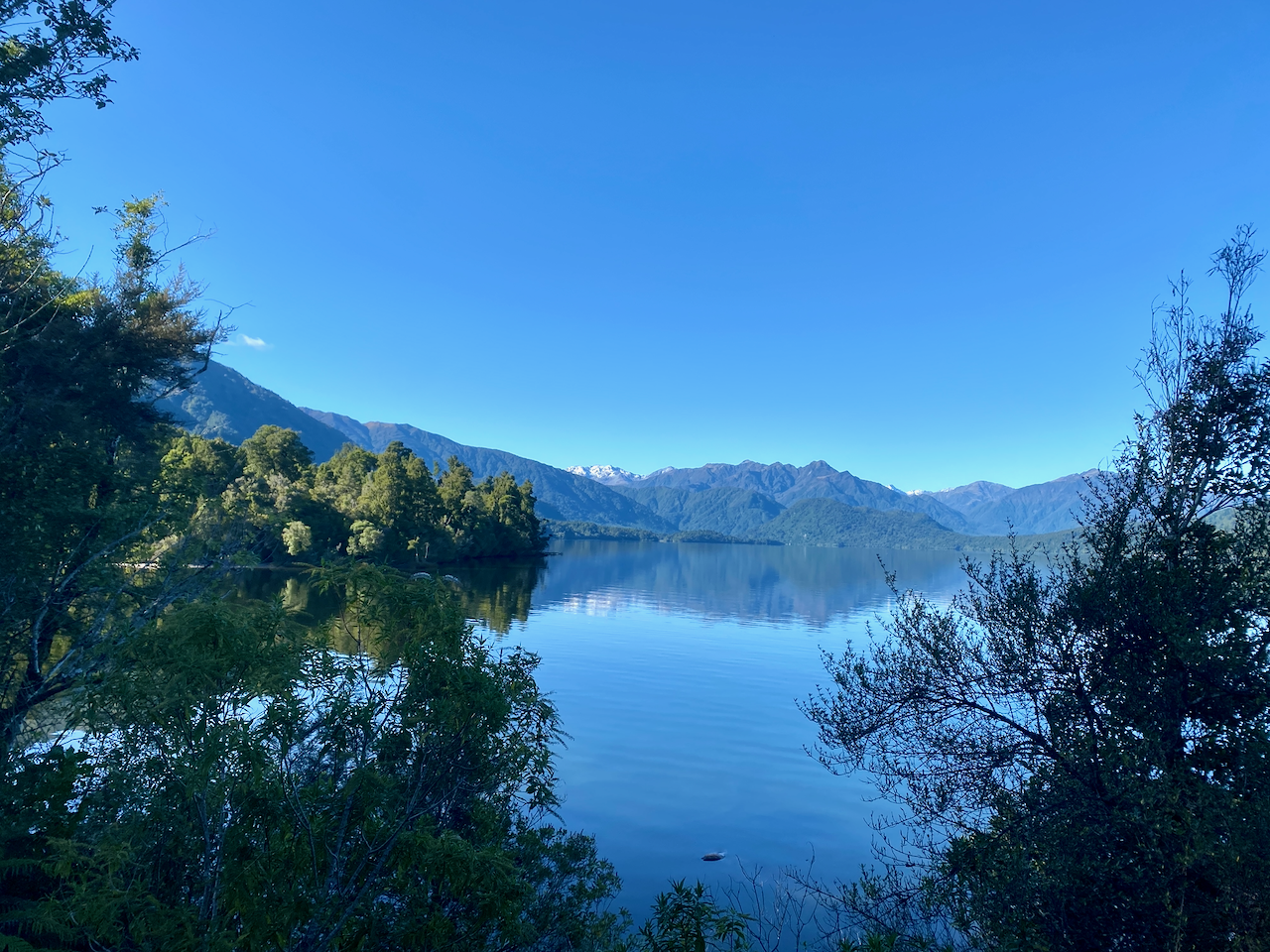
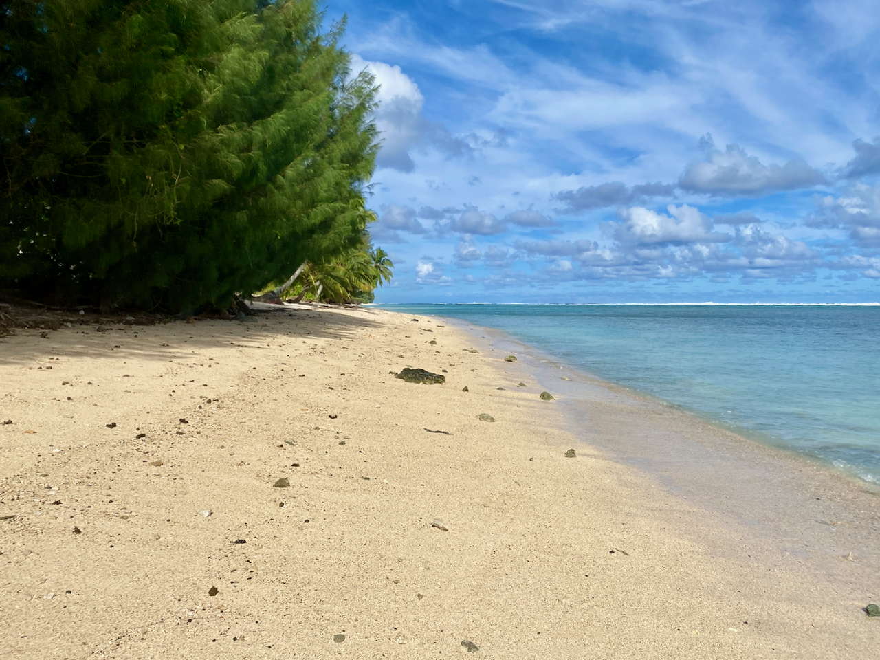
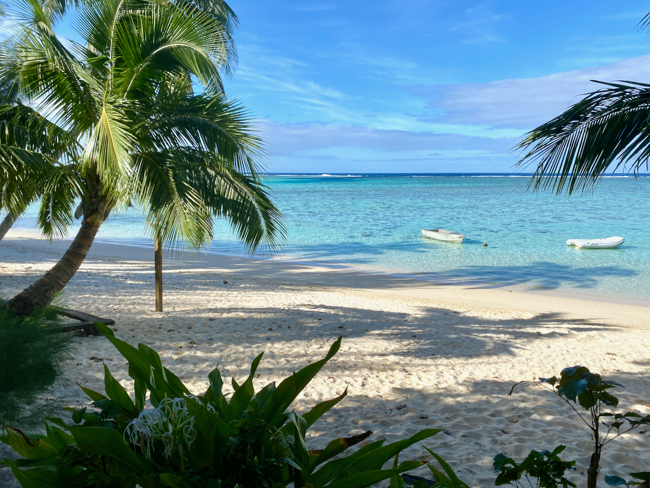
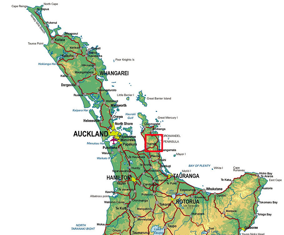
Great Barrier Island is 100km North East of Auckland Central, and sits between the Hauraki Gulf and the Pacific Ocean just to the north of the Coromandel Penninsula. More than half of the island is a nature reserve, and the 1000+ residents live off the grid.

aoteatracklocation-2023-04-5-17-27.png

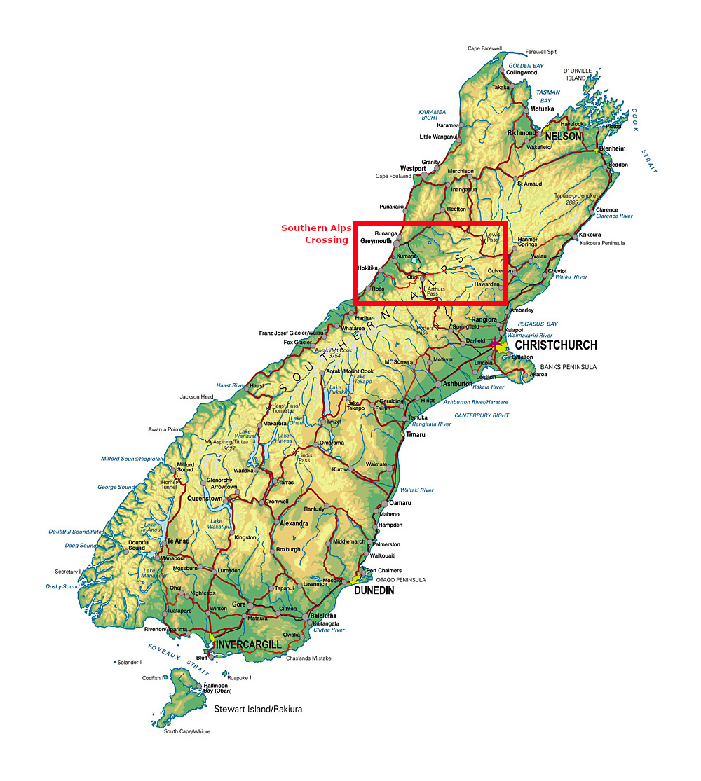
I first visited Great Barrier 25 years ago, and have been trying to get back to do a hike for months now. I’ ha’d planned it as a warm up hike before my Southern Alps crossing, but it wasn’t to be. First, a downpour flooded Auckland, including the airport, so I couldn’t fly out, then the Island was closed down due to the Cyclone Gabrielle. Now, a month after completing my Southern Alps crossing, and I finally made it.

Day 1: Whangaparapara Road to Mt Heale Hut – 8.2 km – 3.5 hours – Red Track

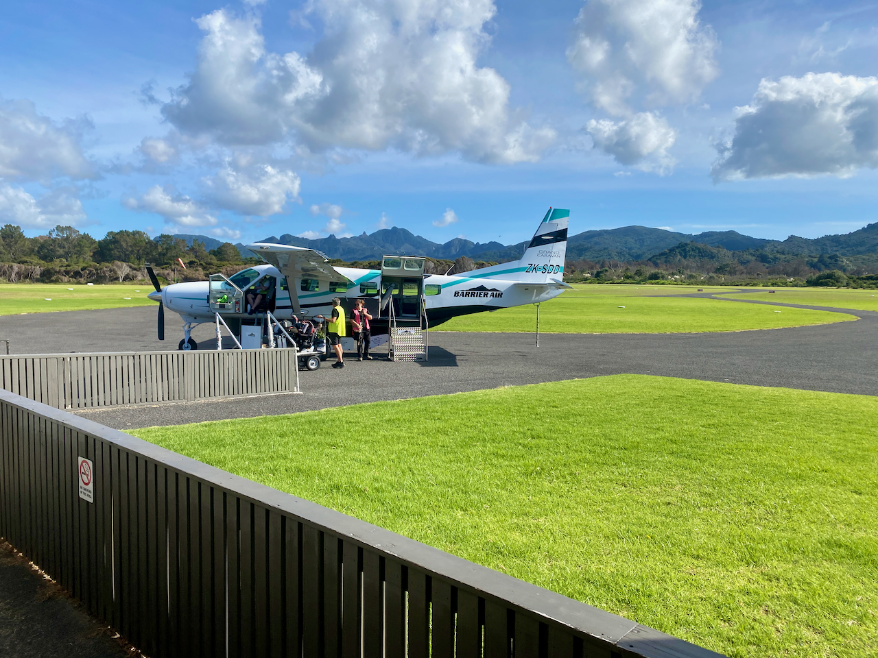
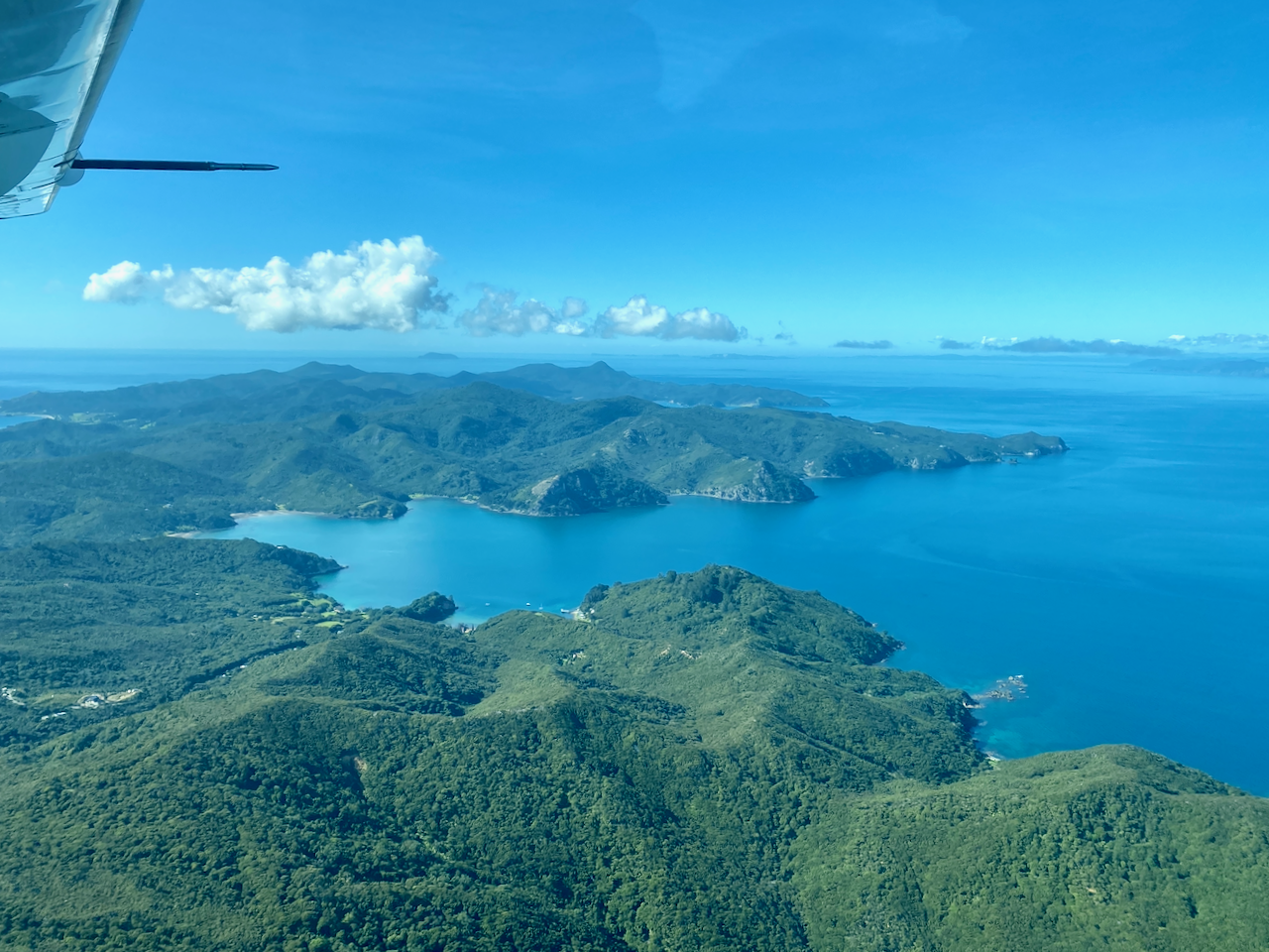
I’d tossed around catching the car ferry over, but with the extra costs associated with it, flying was only a little more expensive. So, after a quick 30 minute flight in a 12 seater Cessna aircraft, I arrived on the island.

img_1445-2023-04-5-17-27.png

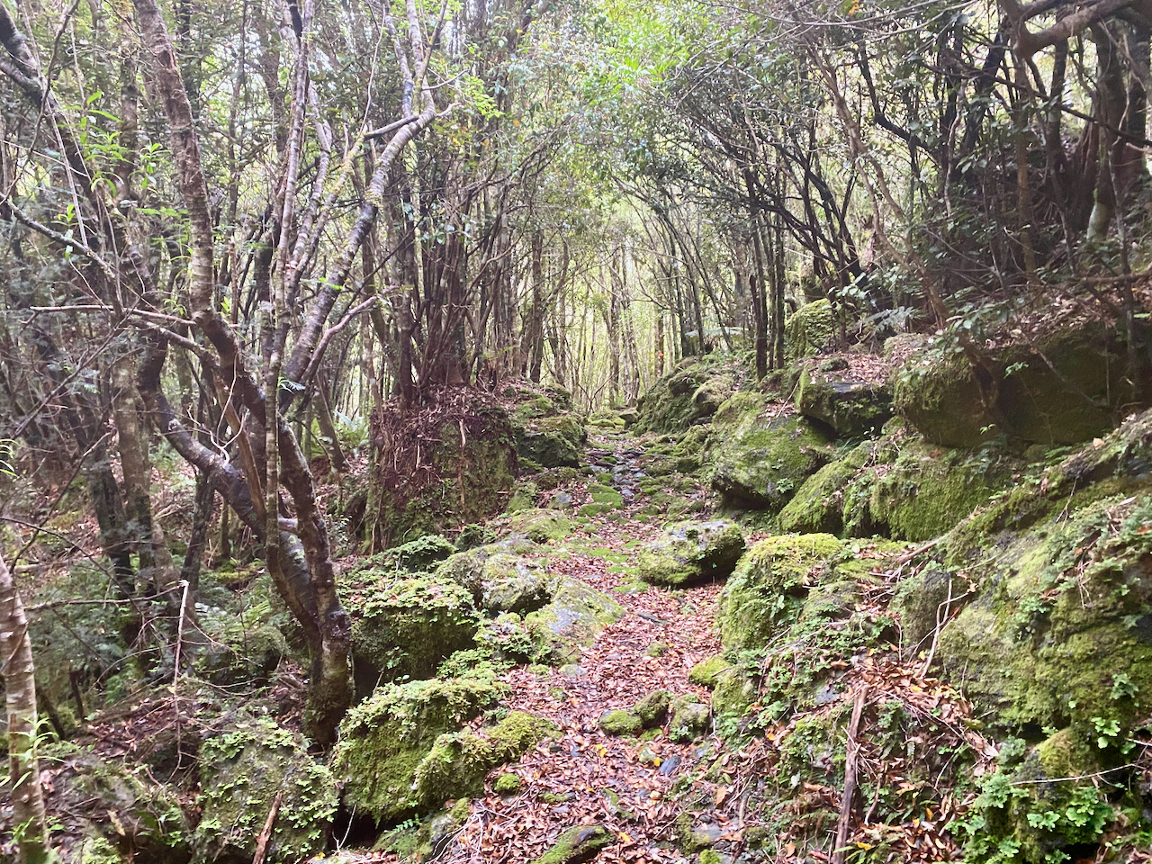
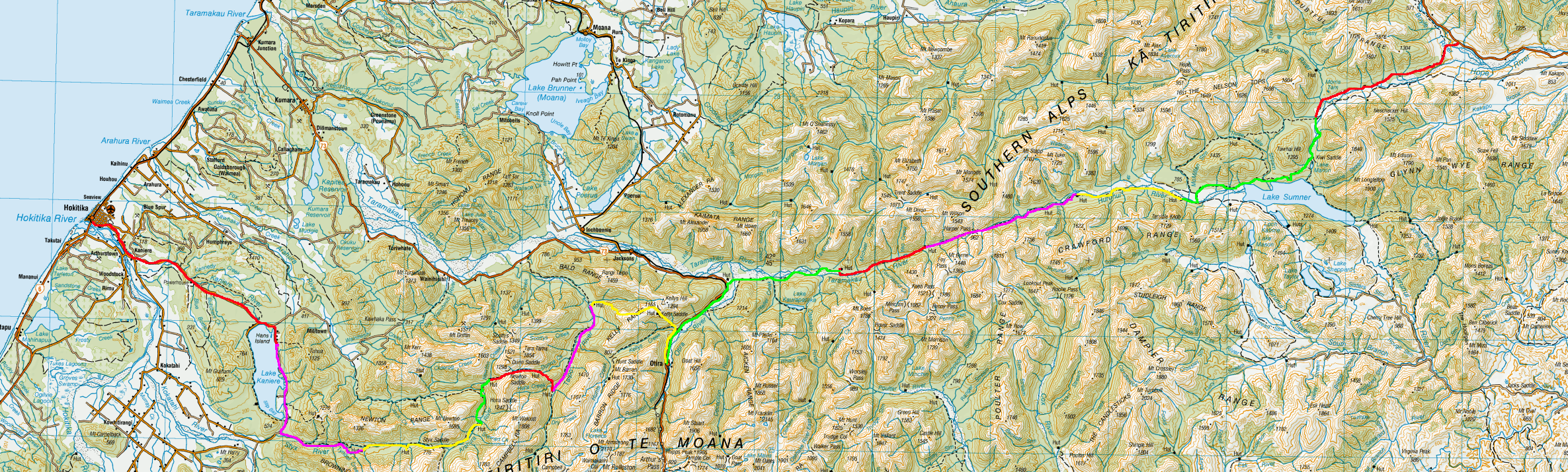
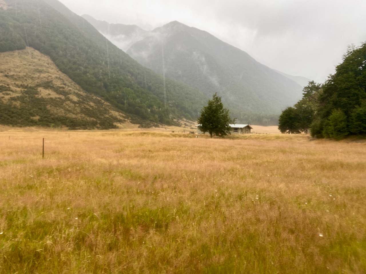
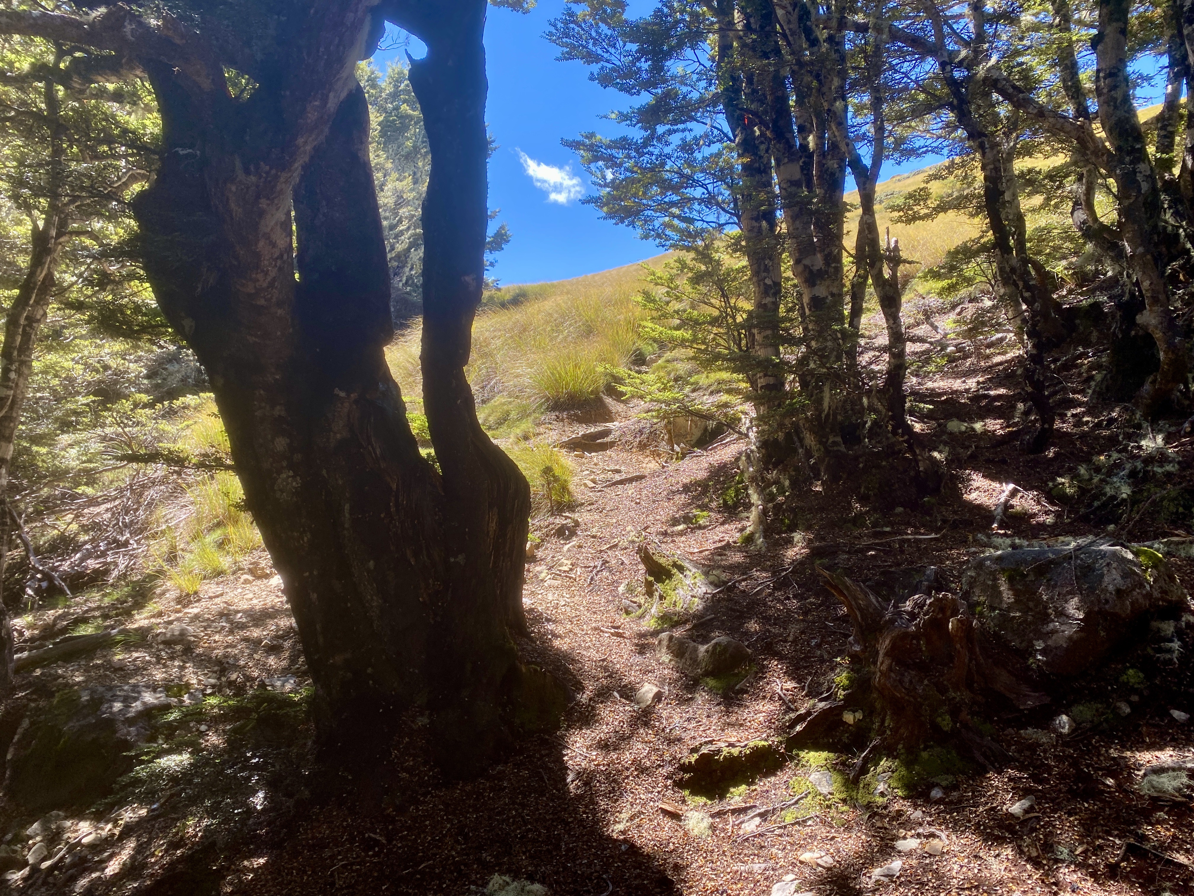
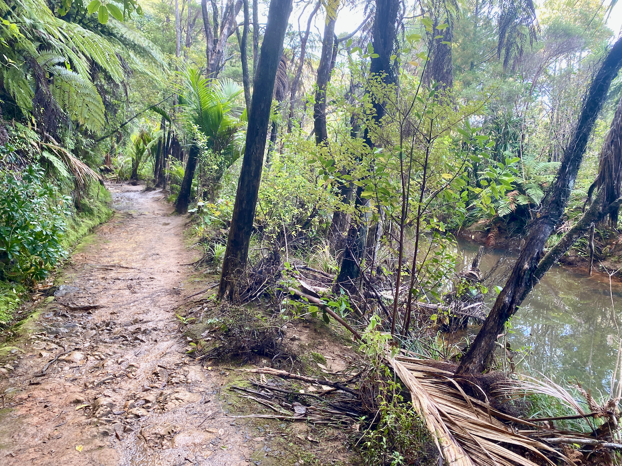
I’d arranged to be collected from the airport and delivered to the trailhead by a local transport. I arrived at 2:10 pm, and with an estimated 4 hours walk, I set out along a wide track beside a stream. As daylight savings ended last night, sunset was going to be just after 6, so I was going to be close.

img_1308-2023-04-5-17-27.png

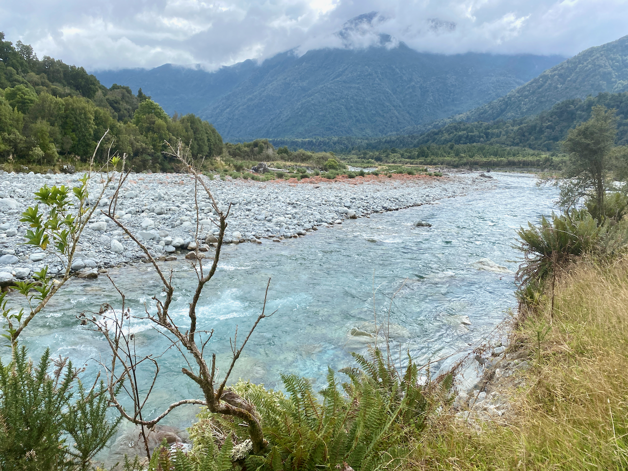
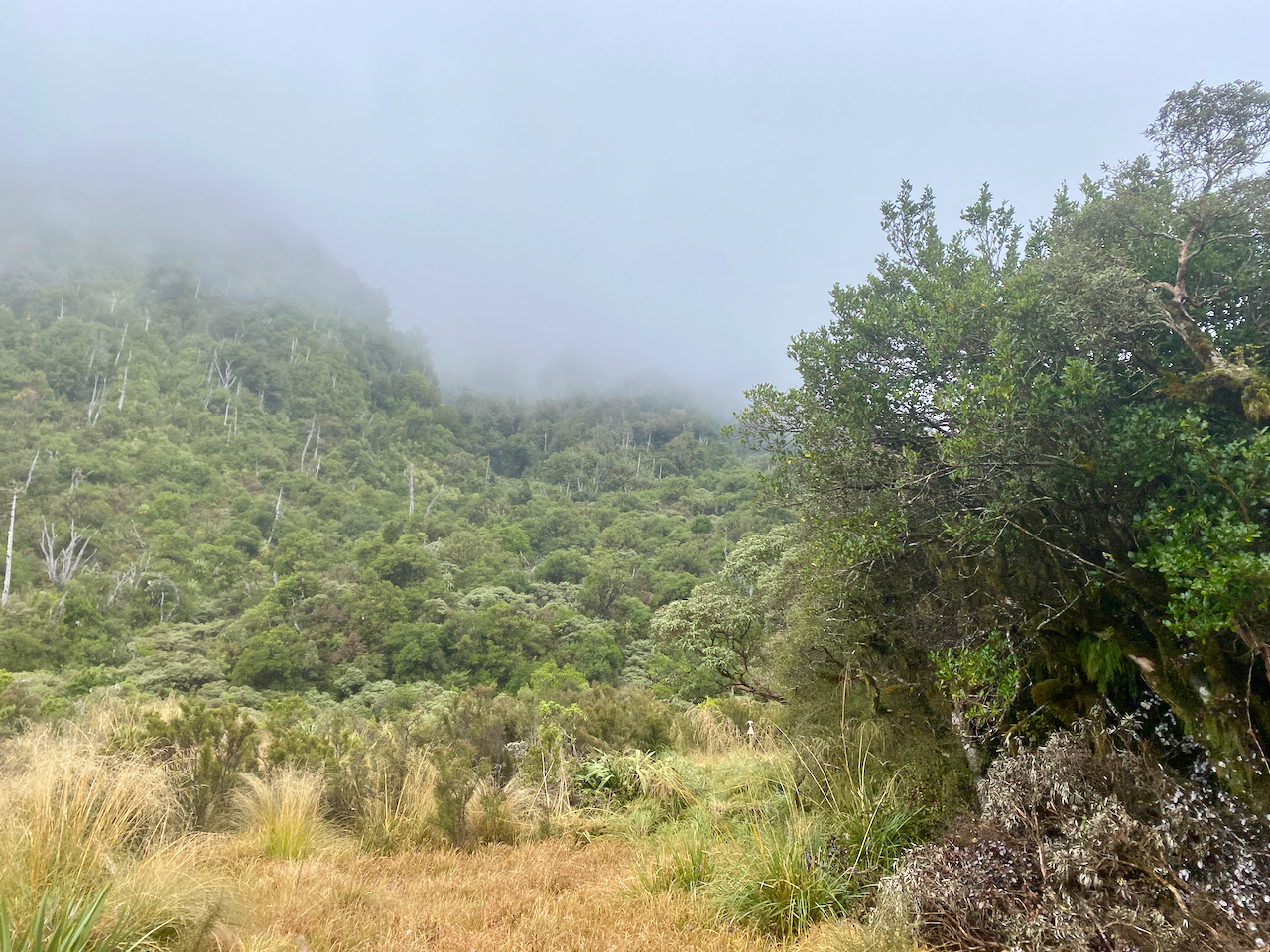
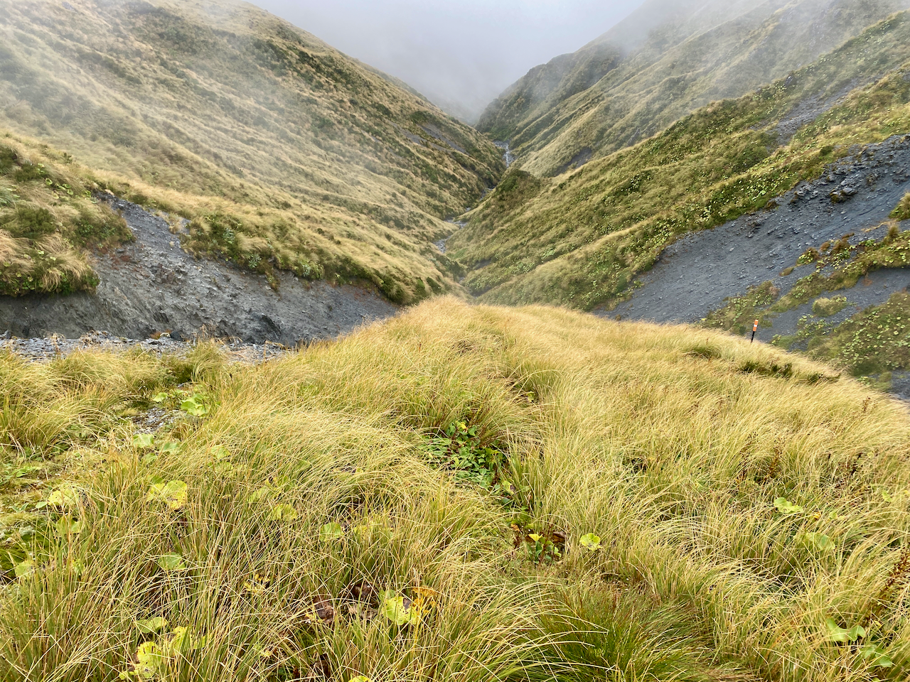
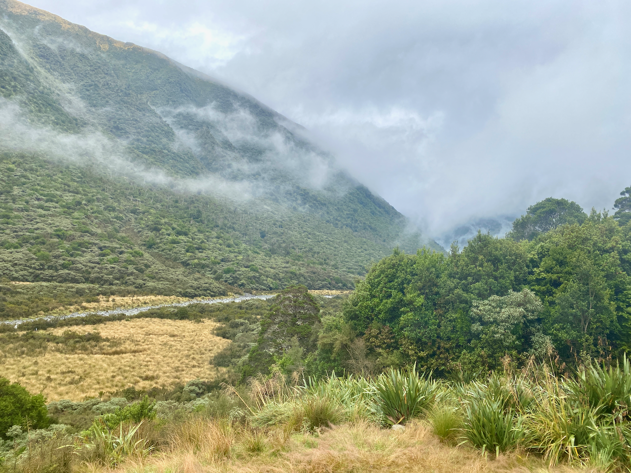
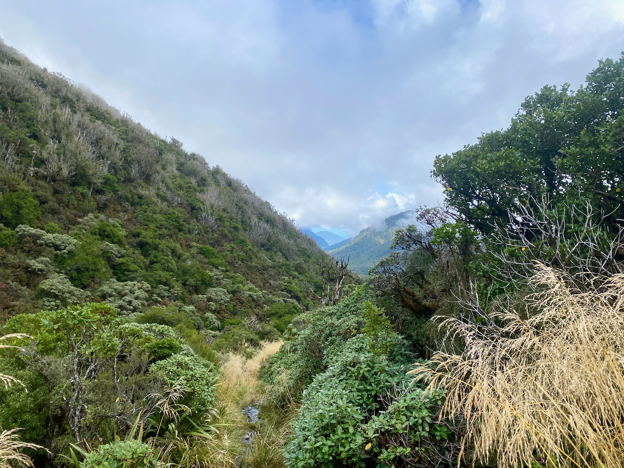
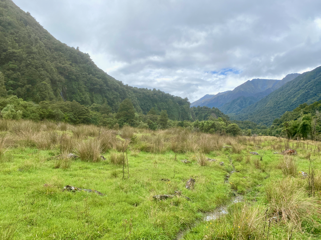
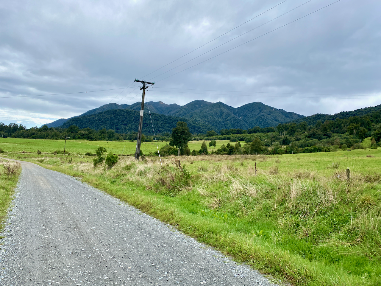
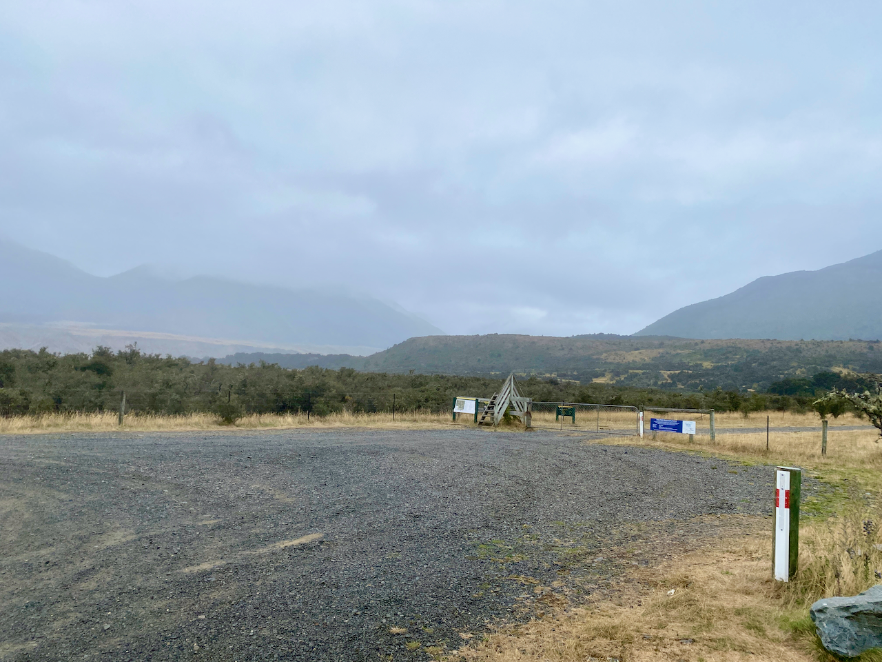
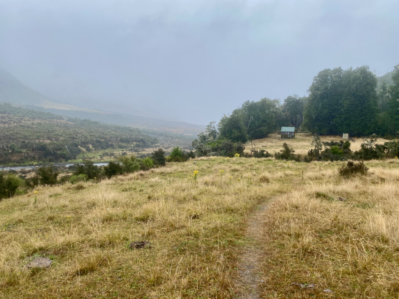
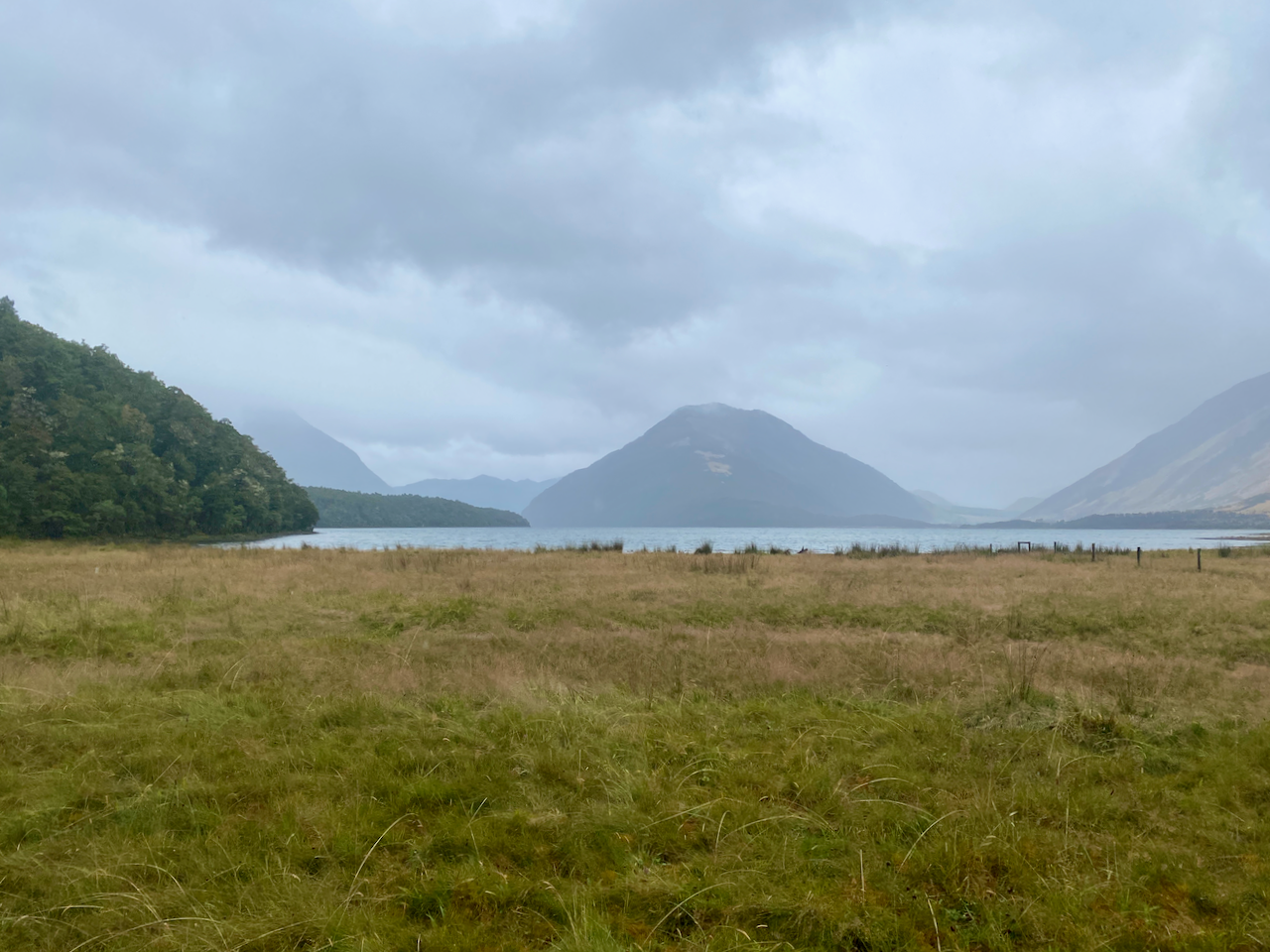
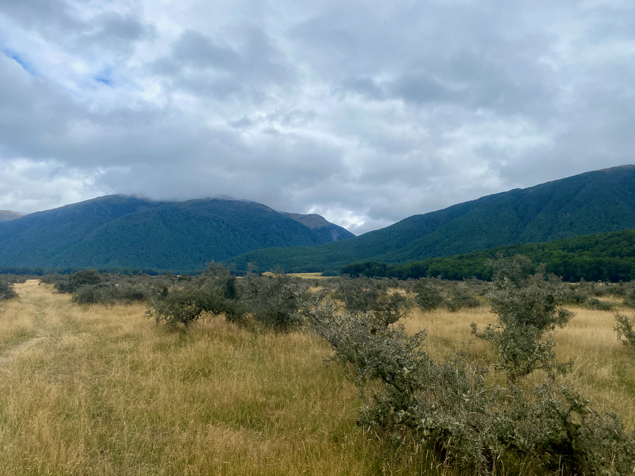
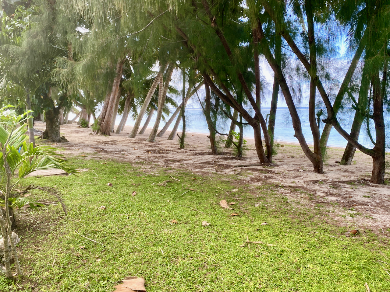
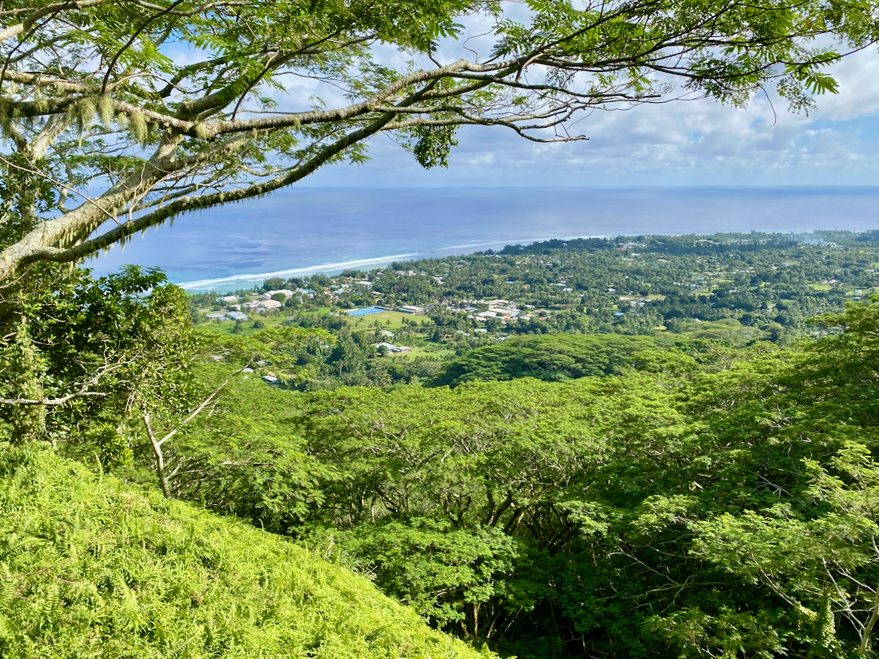
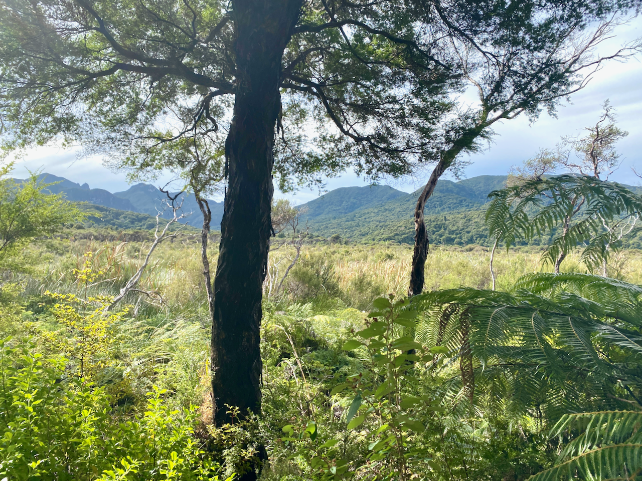
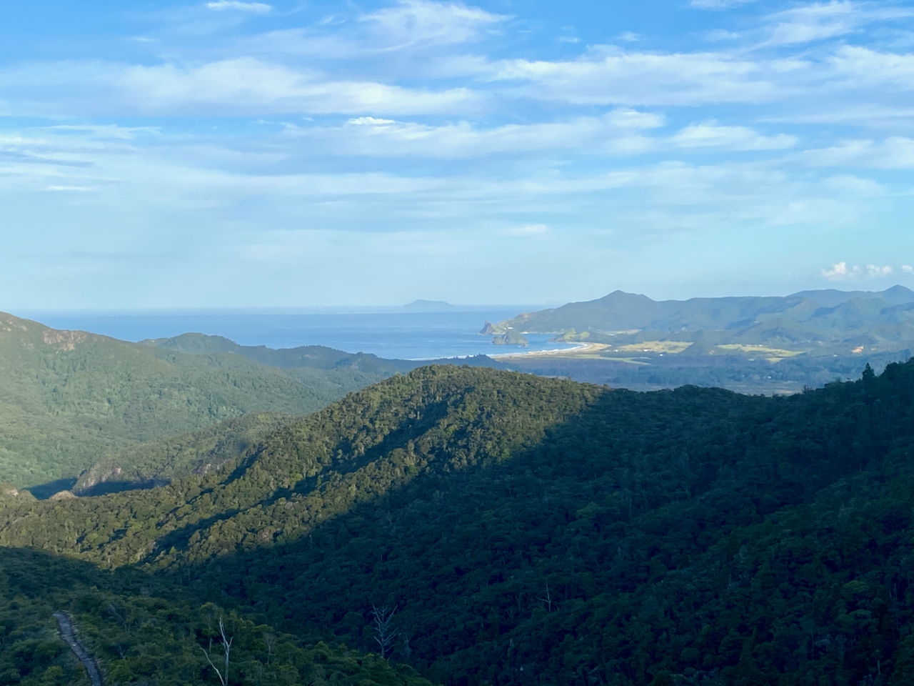
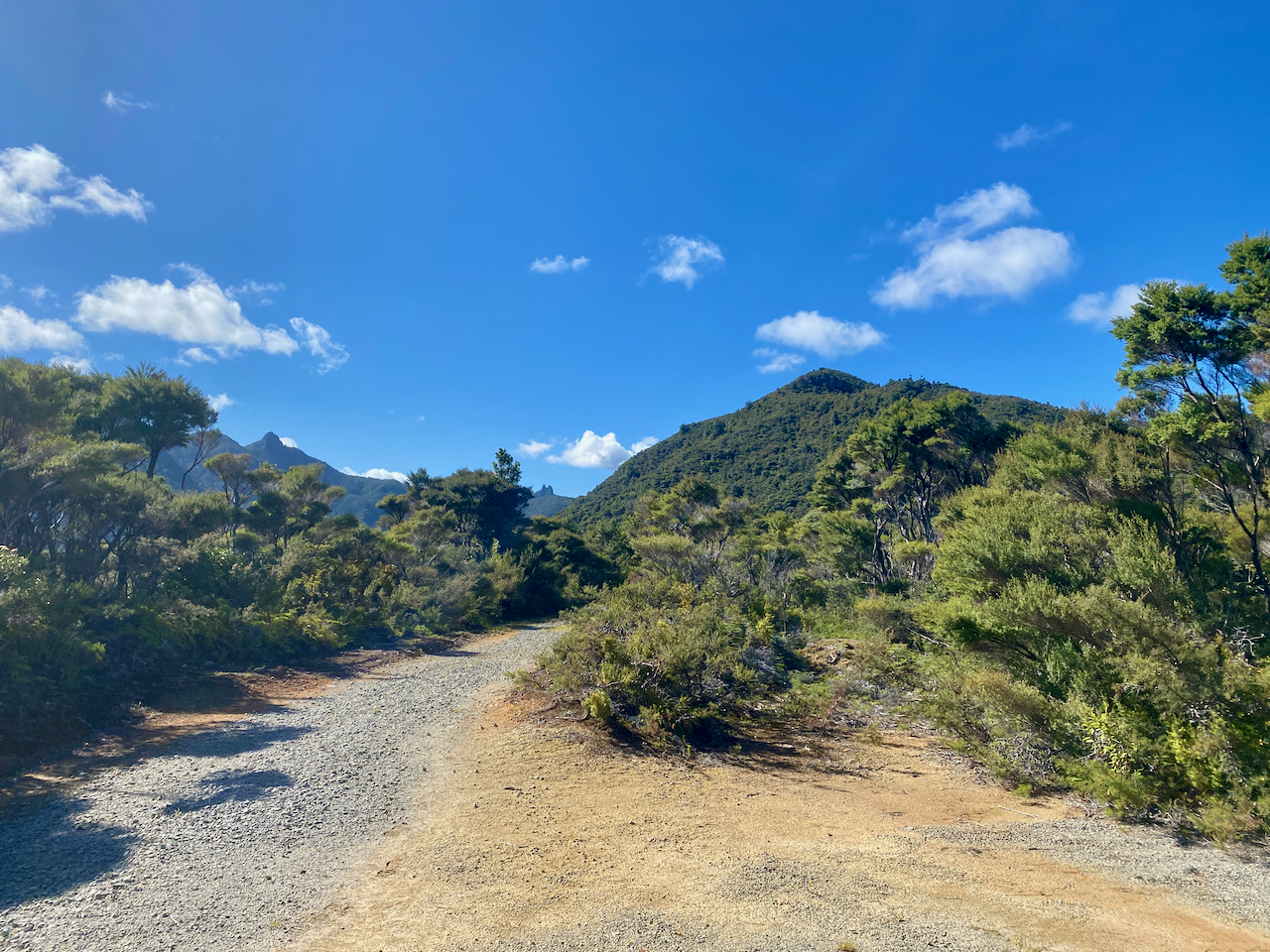
Along the trail I got my first look across the grasslands, with views of the short mountains beyond.

img_1312-2023-04-5-17-27.png

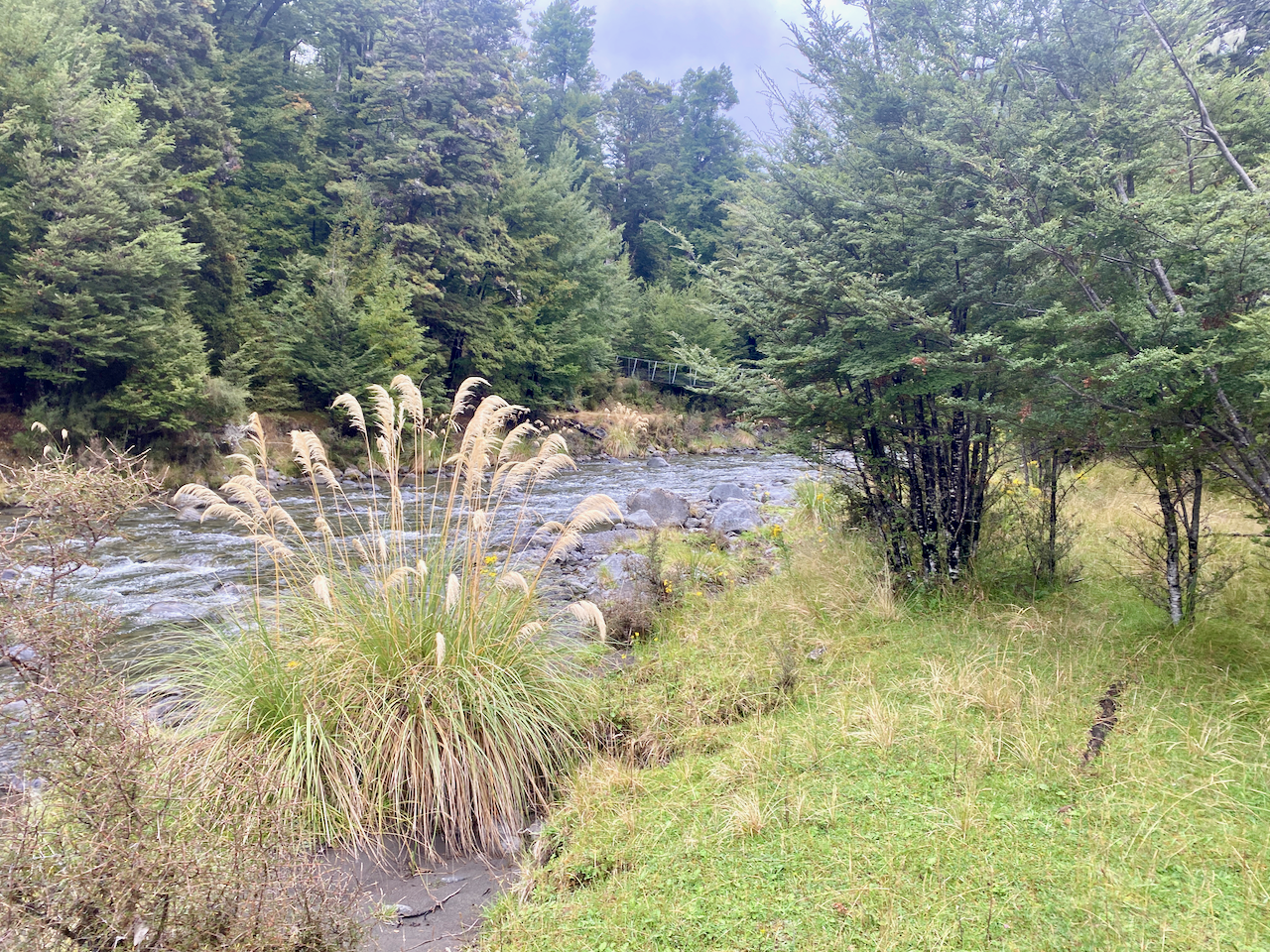
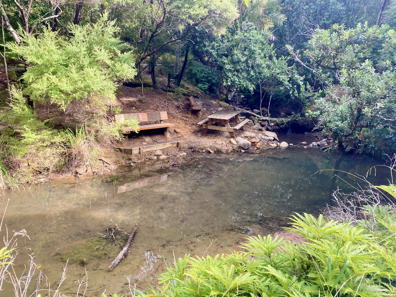
The trail was flat and the smell of sulphur in the air heralded in my arrival at the ‘hot springs’. The springs themselves were more of a luck warm stream with pools along it. I might have gone in if I hadn’t been pressed for time, although as they weren’t quite hot, they lost their appeal.

img_1318-2023-04-5-17-27.png

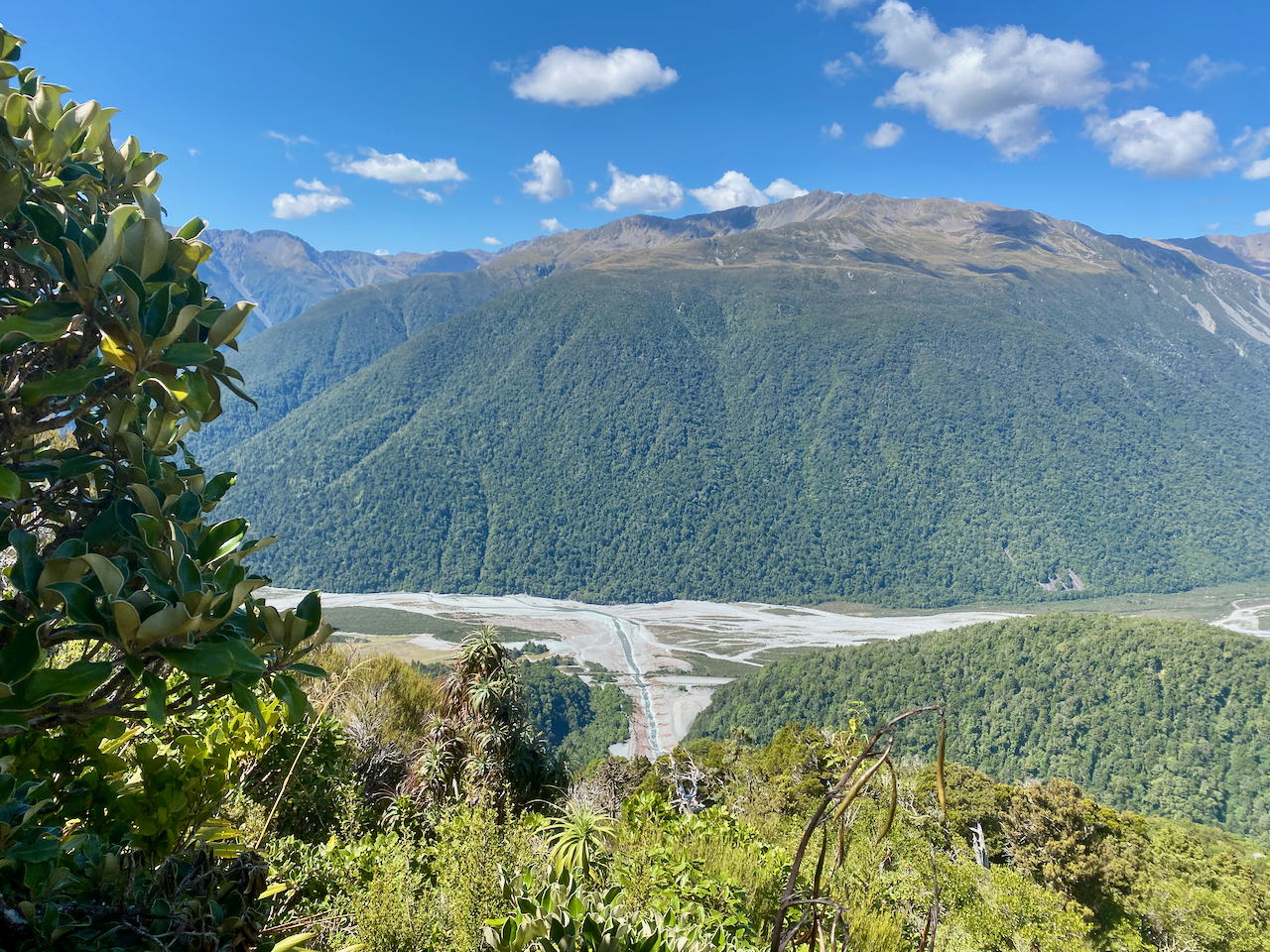
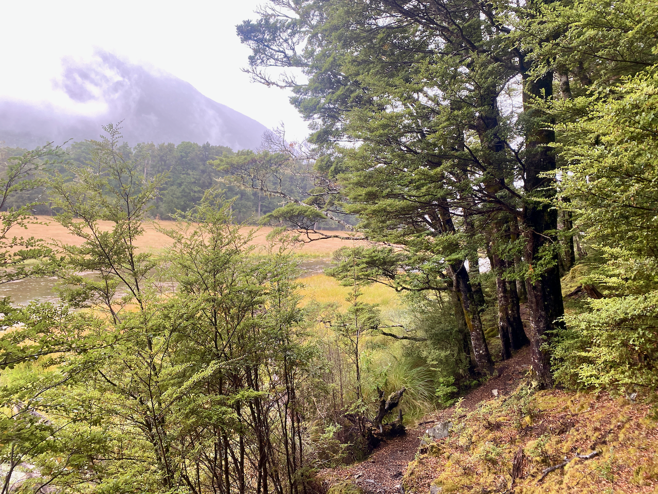
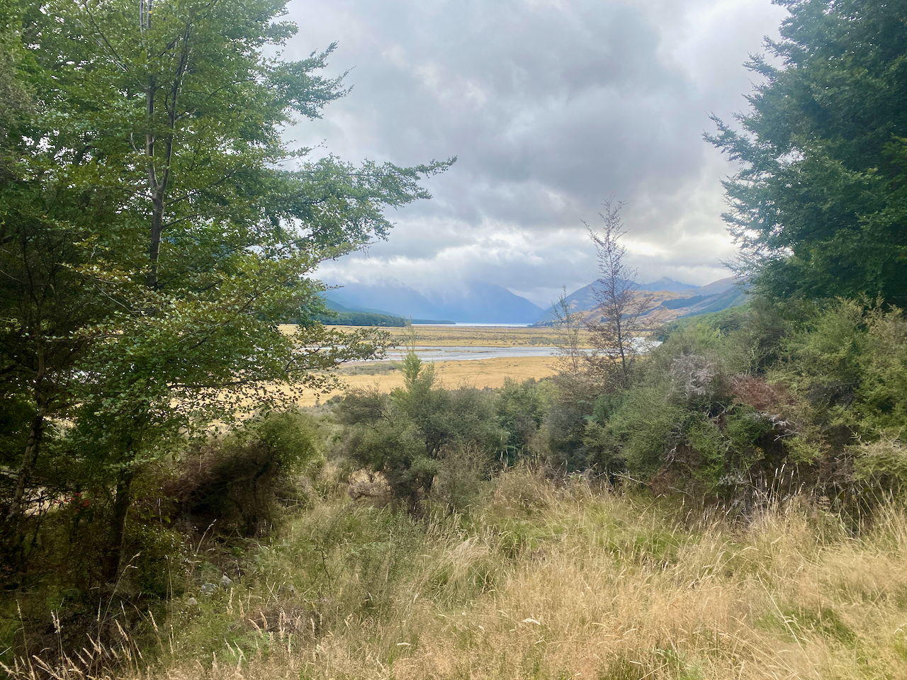
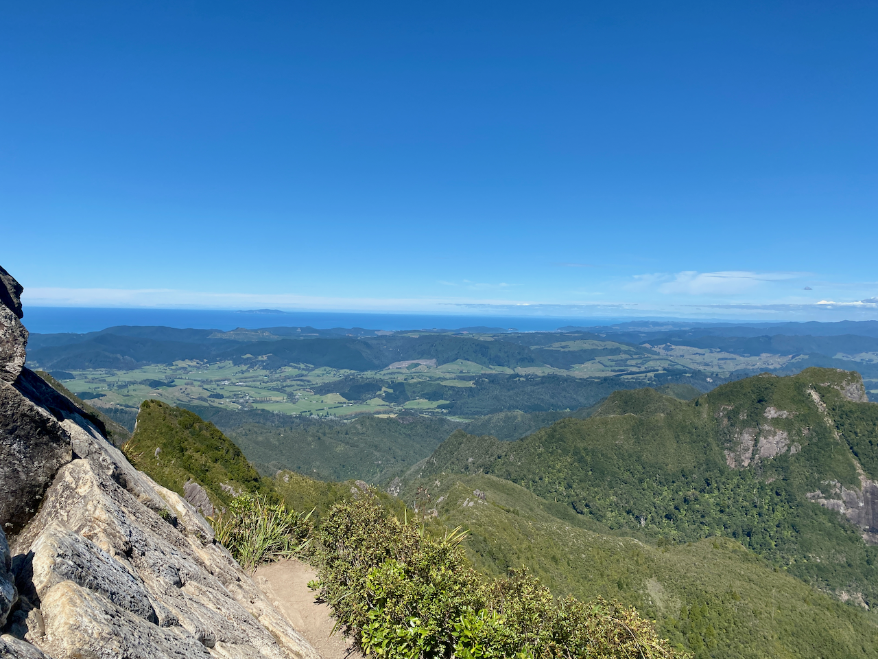
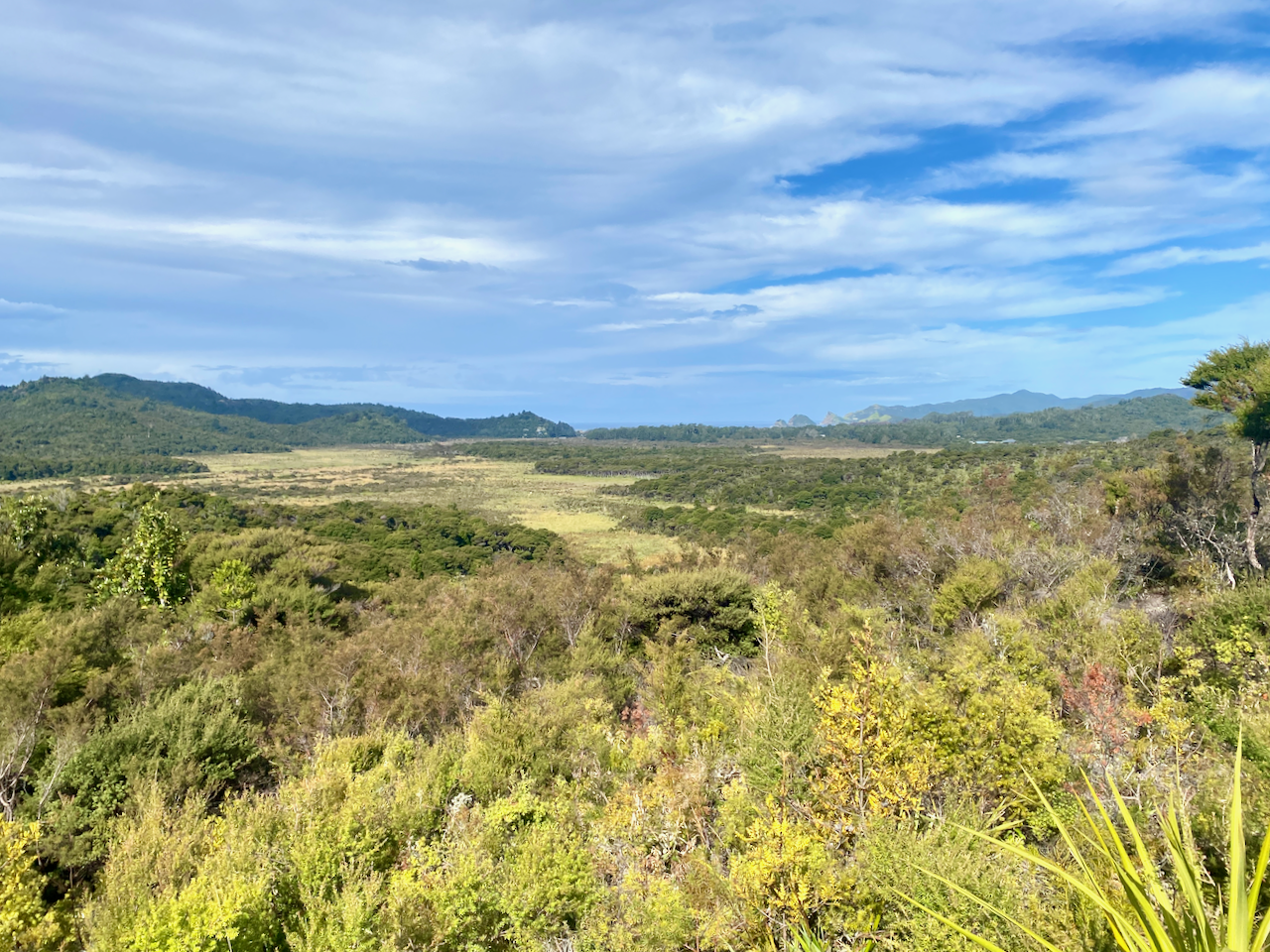
Not long after the hot springs, I arrived at the Tramline trail where Kauri Trees were logged more than 100 years ago. A view out over the grasslands to Kaitoke and Medlands Beaches.

img_1319-2023-04-5-17-27.png

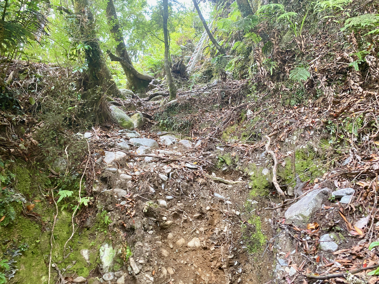
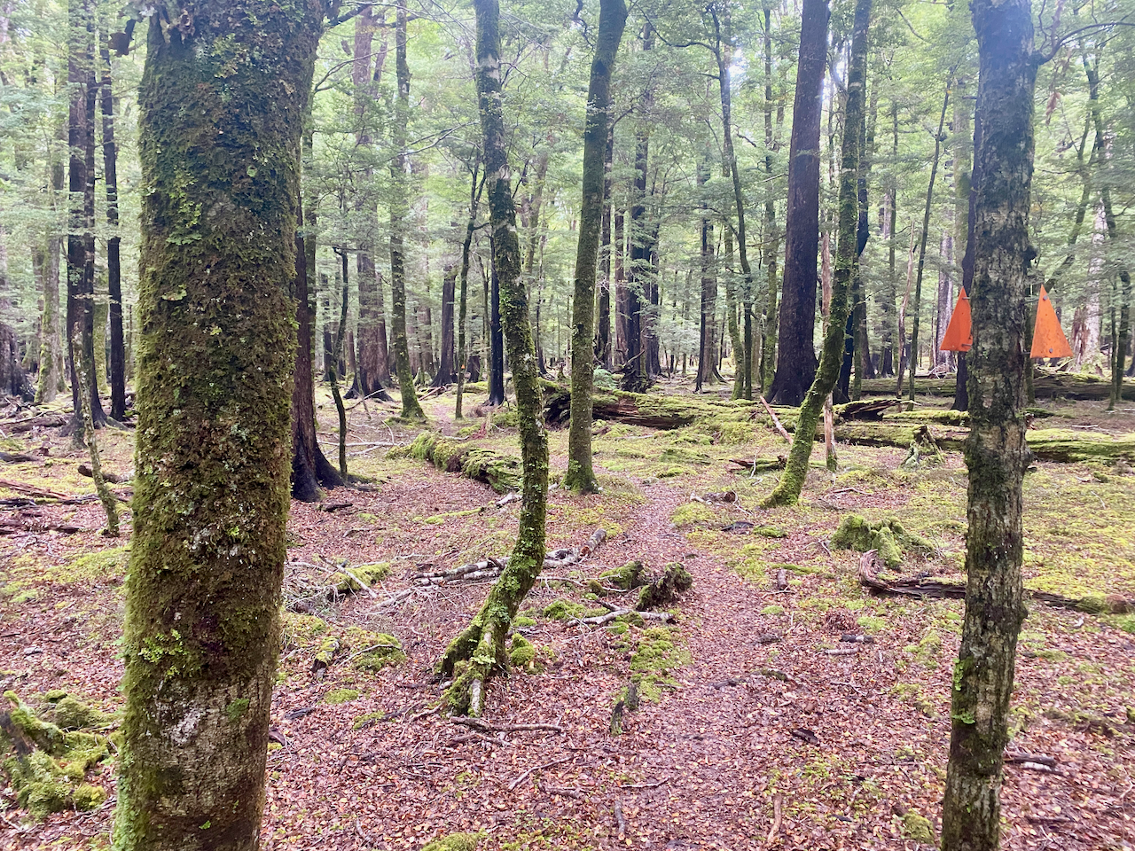
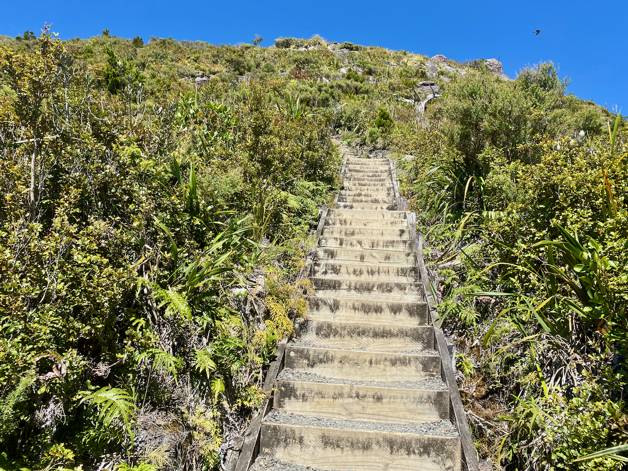
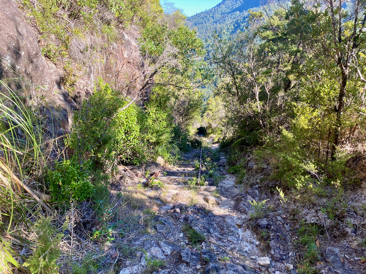
The Tramline track was also flat until it headed up Peach Tree Trail, which began a crazy amount of steps. This would be a reccuring theme on the island.

img_1334-2023-04-5-17-27.png

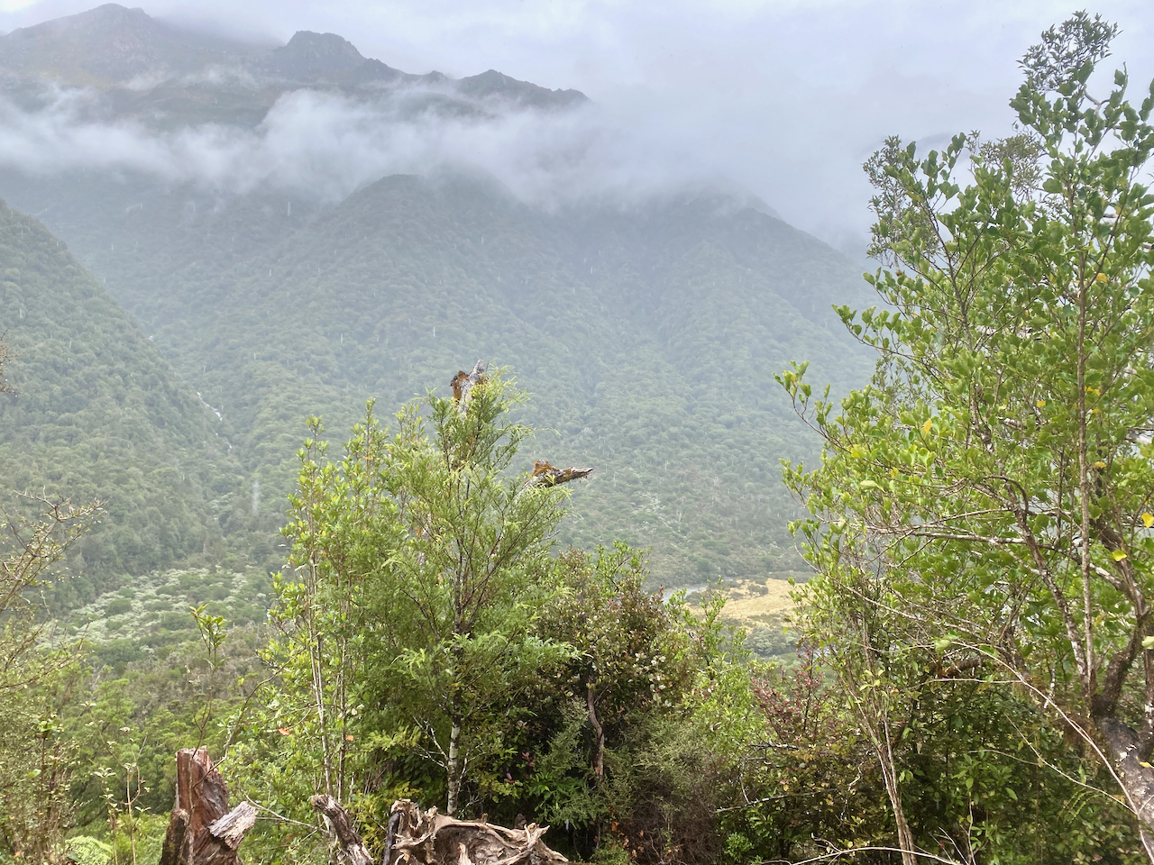
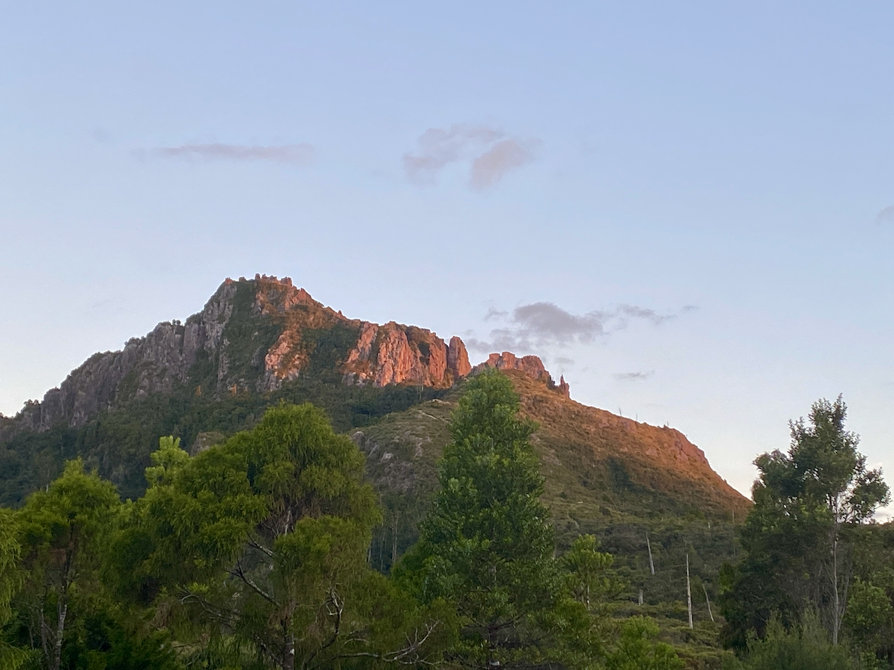
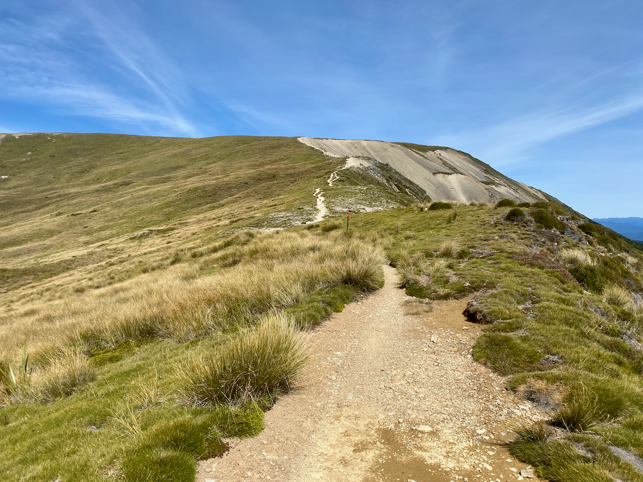
Starting near sea level, I climbed towards the the hut at 412m. The lack of breeze ensured that my climb felt more like I was swimming up the mountains in my own sweat. But the views were worth the energy.

img_1341-2023-04-5-17-27.png

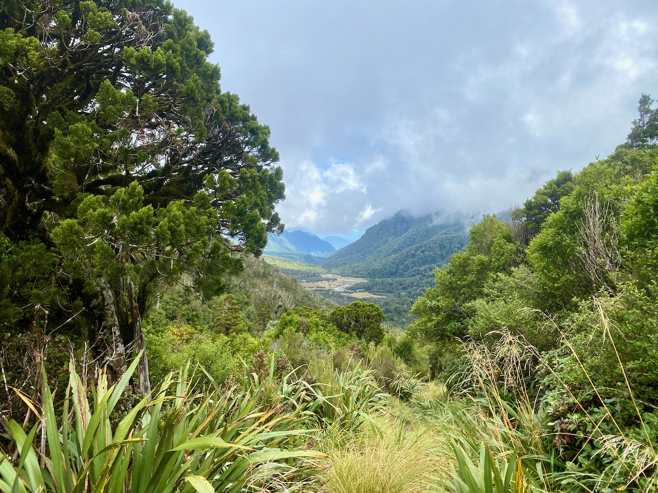
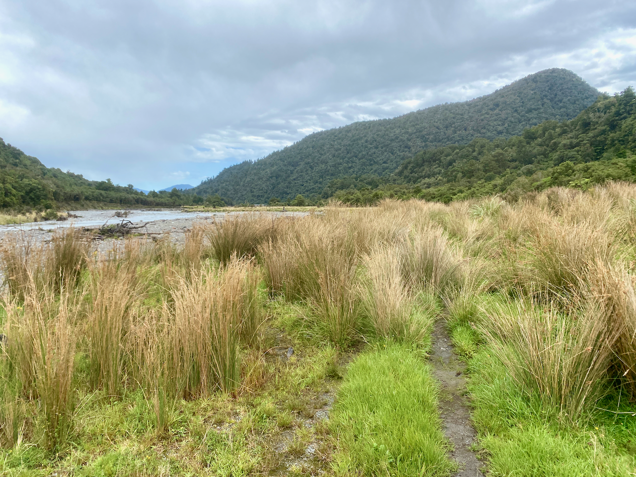
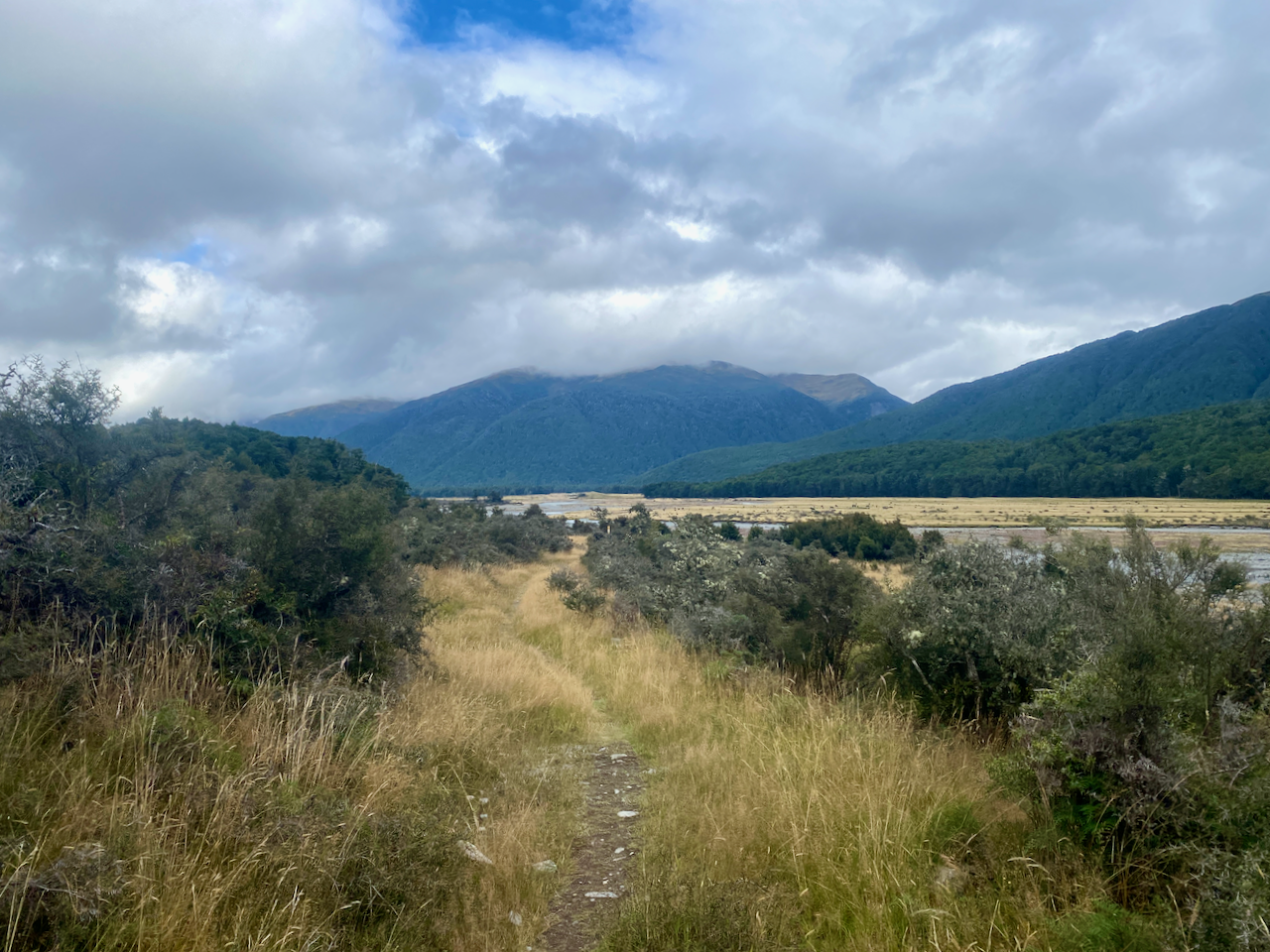
And I got a better look back to Kaitoke and Medlands Beaches as I got higher. The trees gave way to low scrub giving an almost alpine feel on a mix of dirt path and stairs.

img_1352-2023-04-5-17-27.png

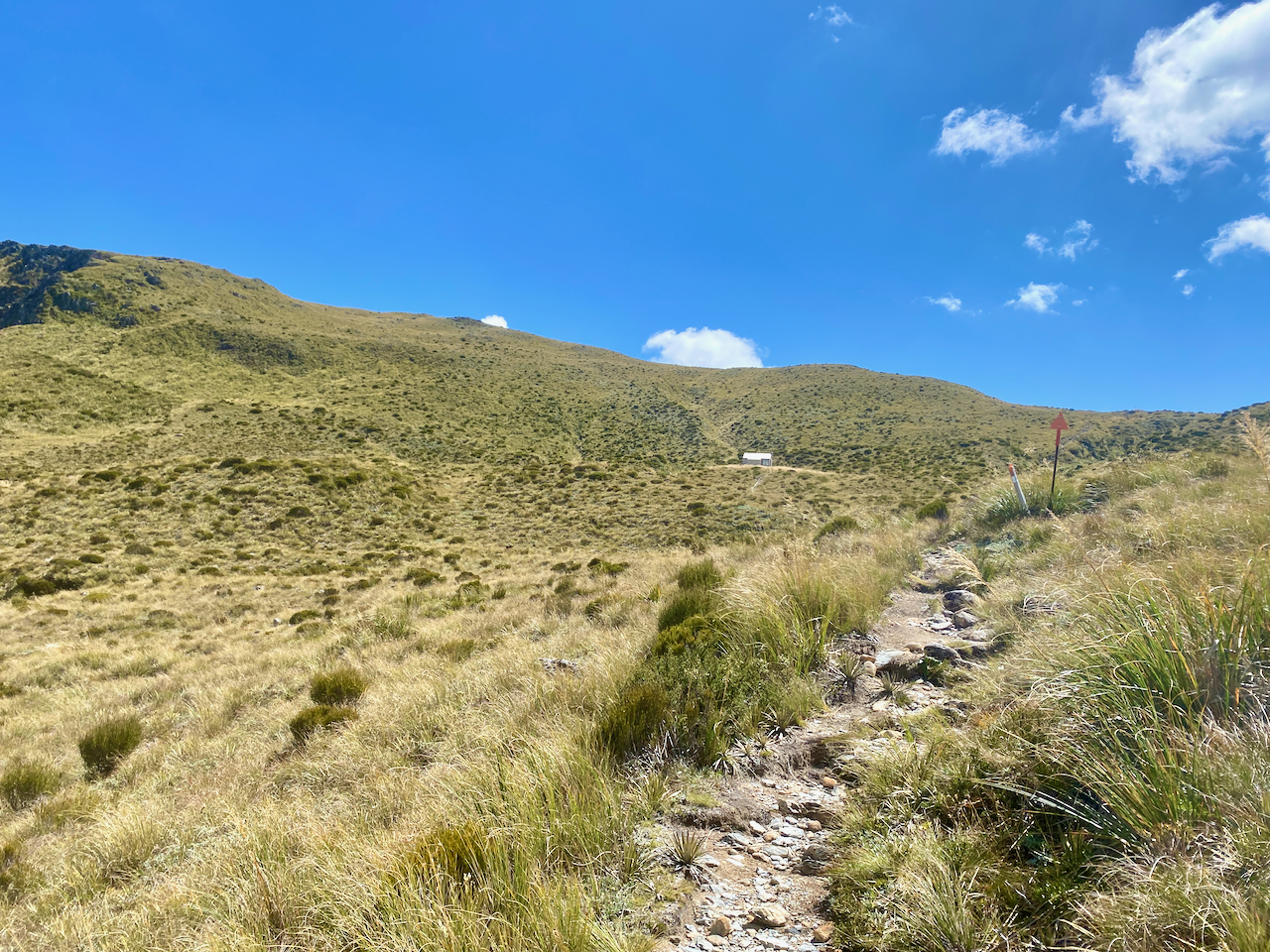
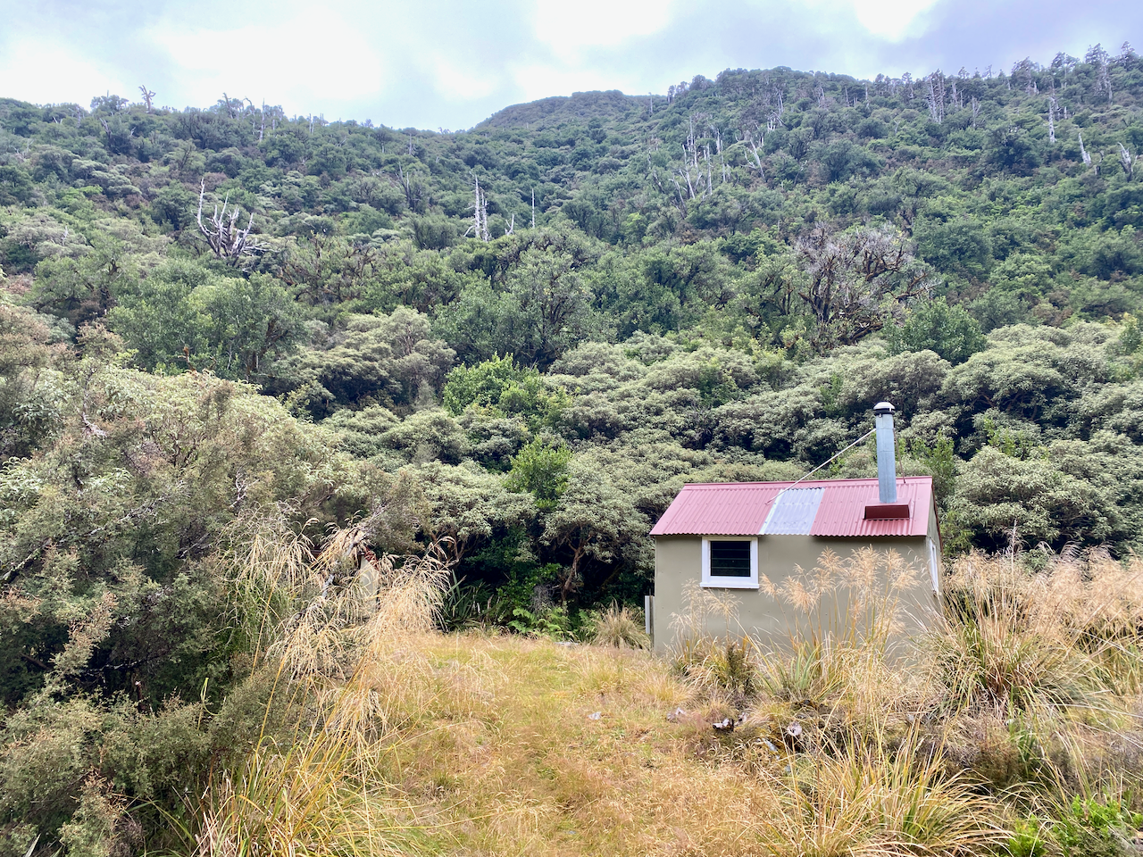
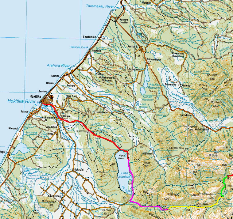
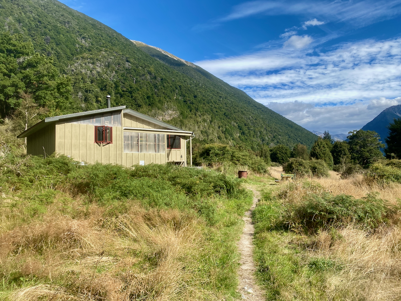
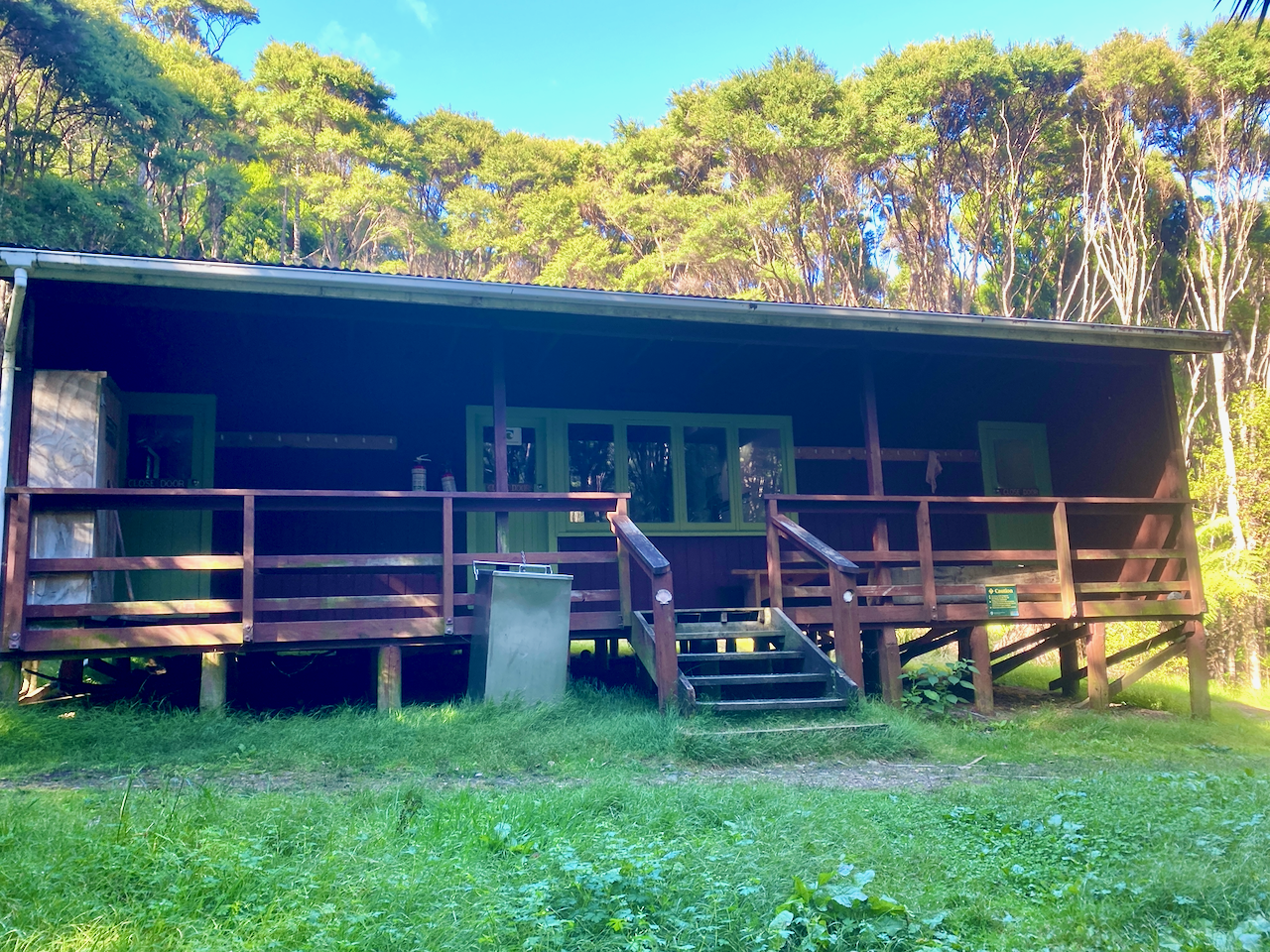
At the 400m altitude mark, I saw the sign to the Hut stating 5 min and 200 m. I arrived soon after and found a family group of 4 already there. I went in, claimed a bunk, had a quick hiker’s shower before going out to watch the sunset. Then while chatting to the family members, I cooked a Chef Corso Trail Meal, Macaroni with Bacon and Blue Cheese.

img_1357-2023-04-5-17-27.png

Day 2: Mt Heale Hut to Kaiaraara Hut via Mt Hobson Lookout and Port Fitzroy – 16.9km – 4.75 hours – Pink Track

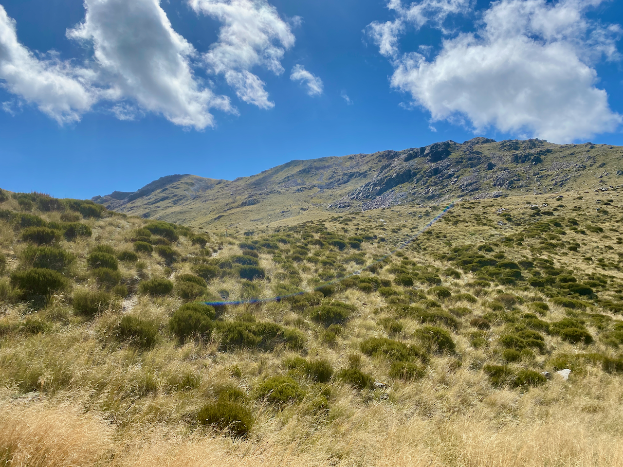
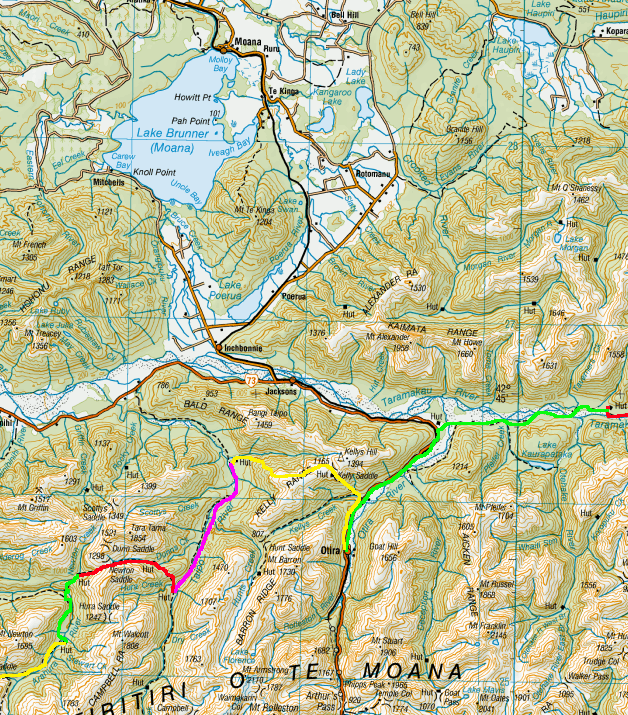
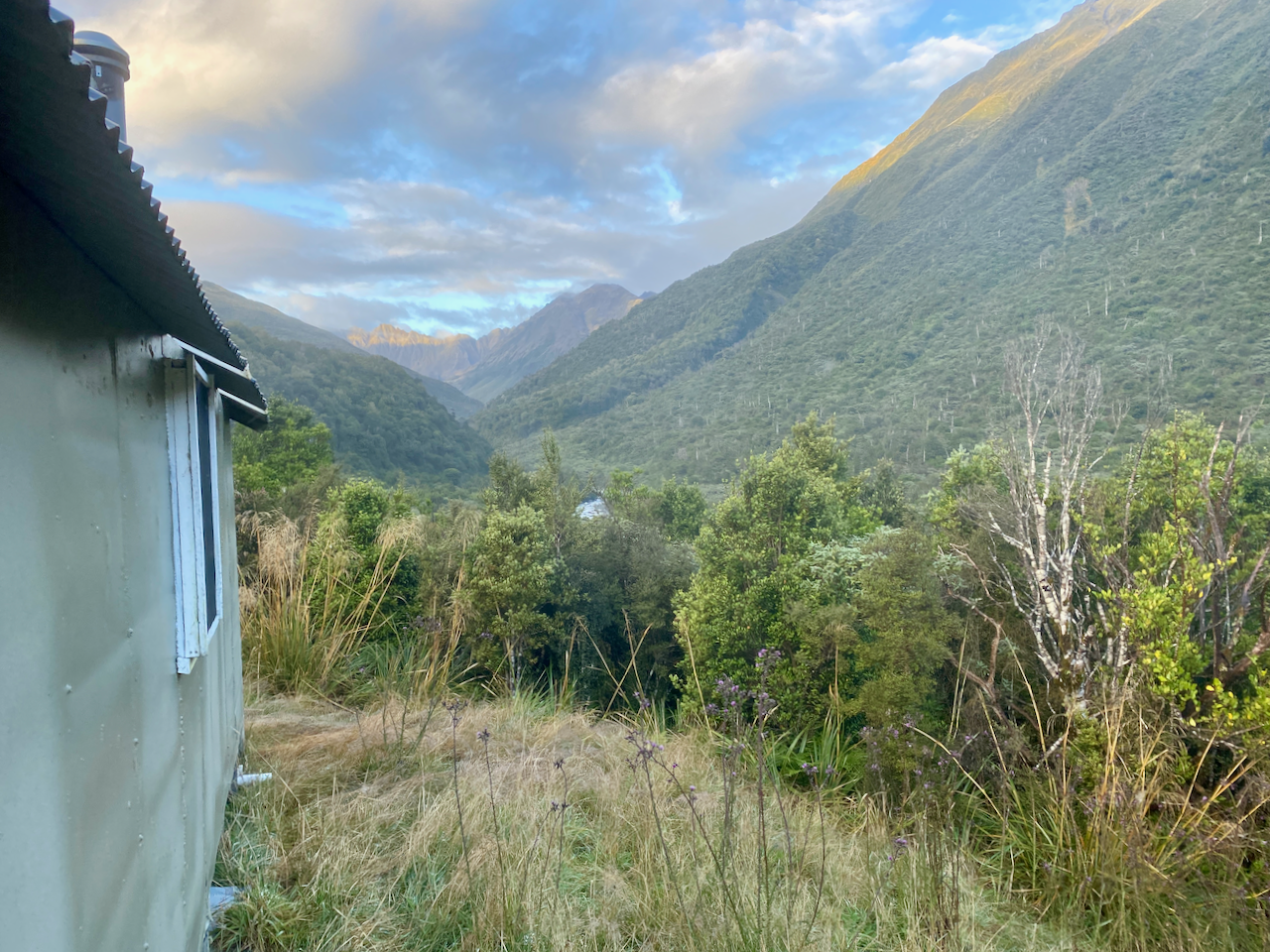
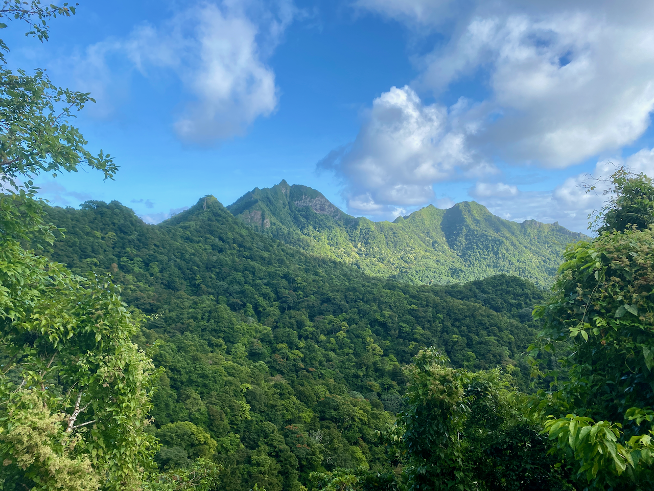
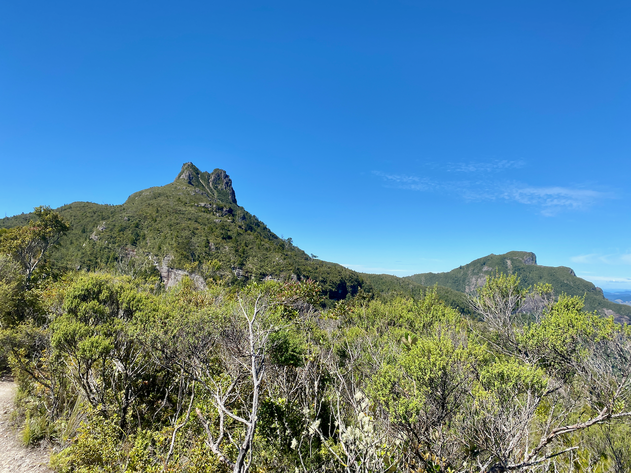
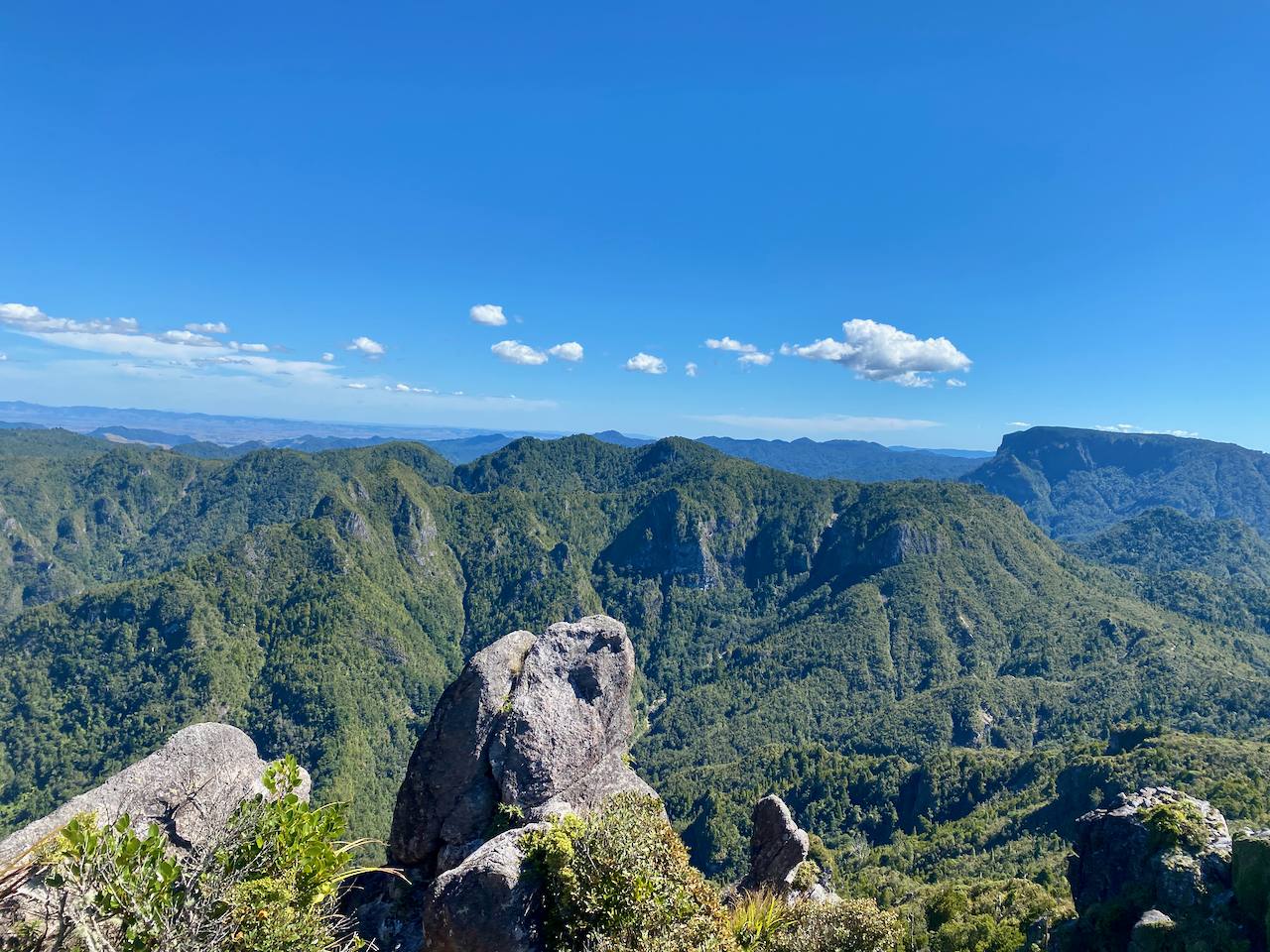
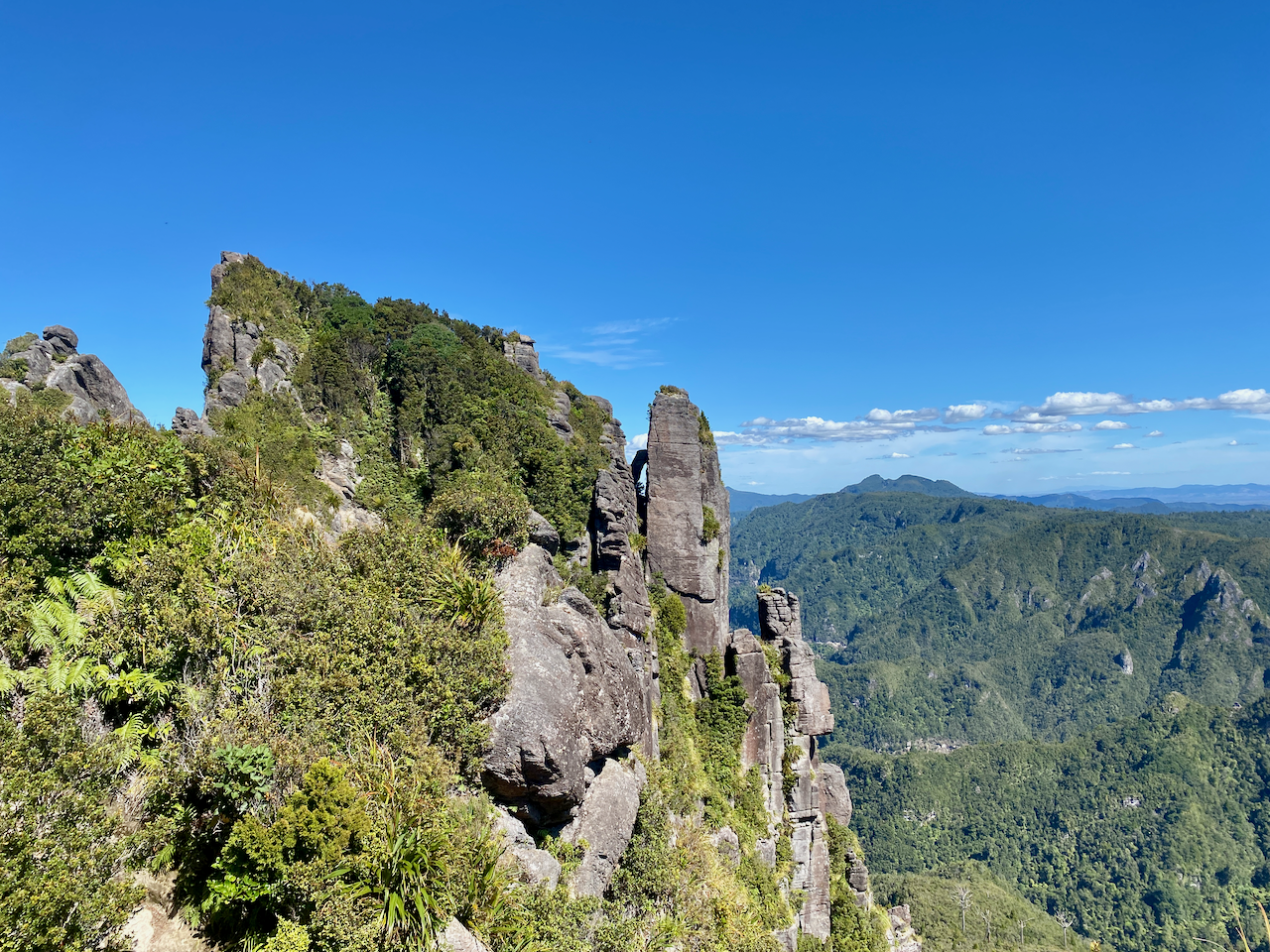
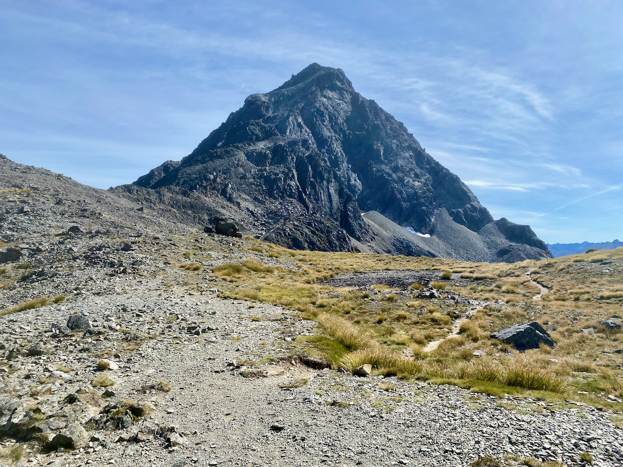
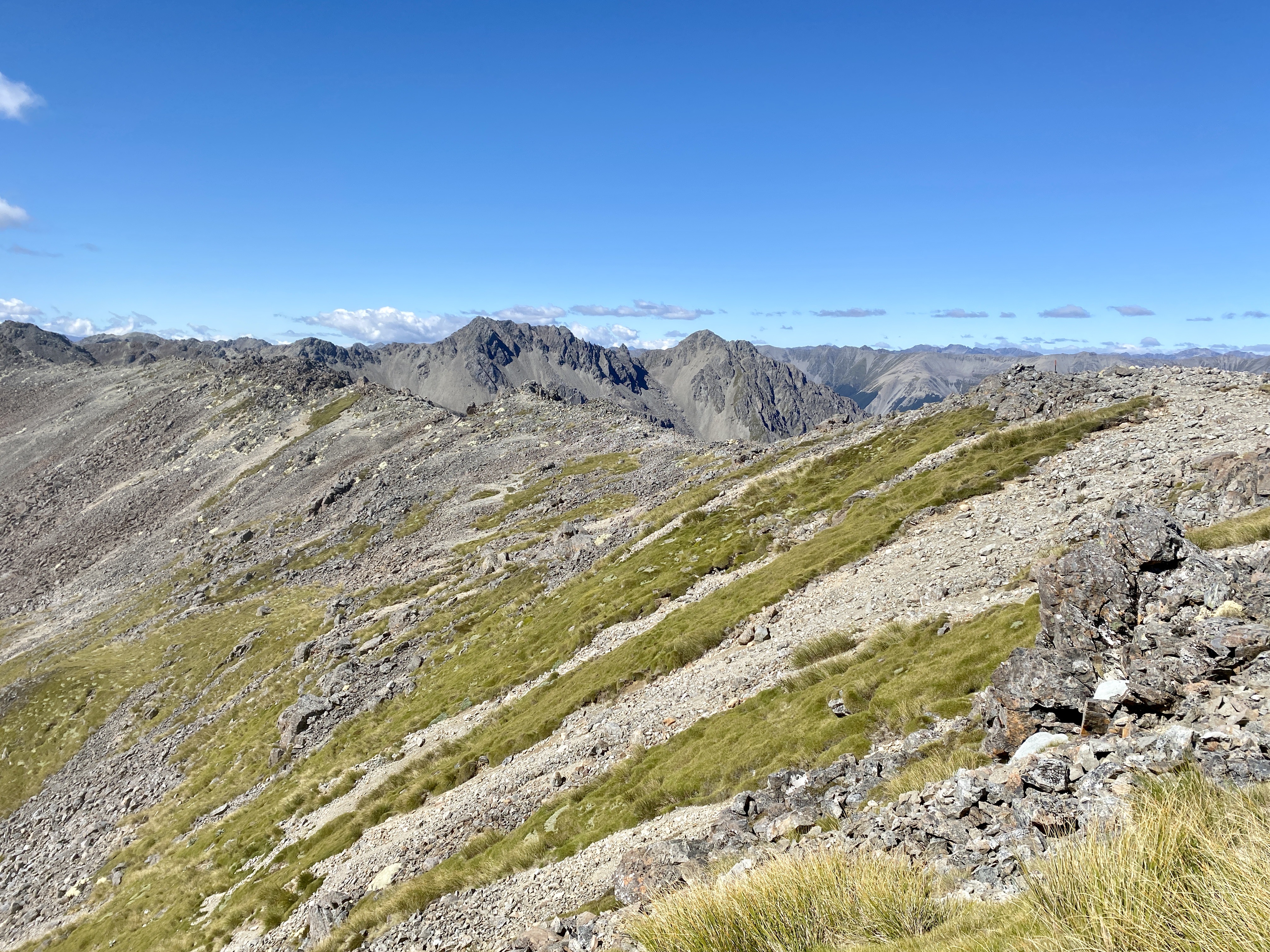
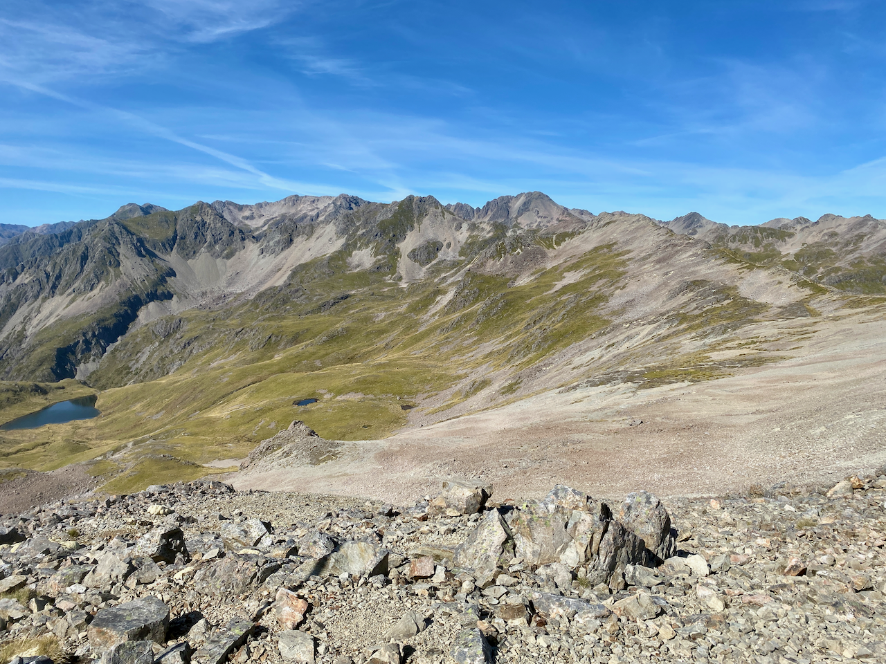
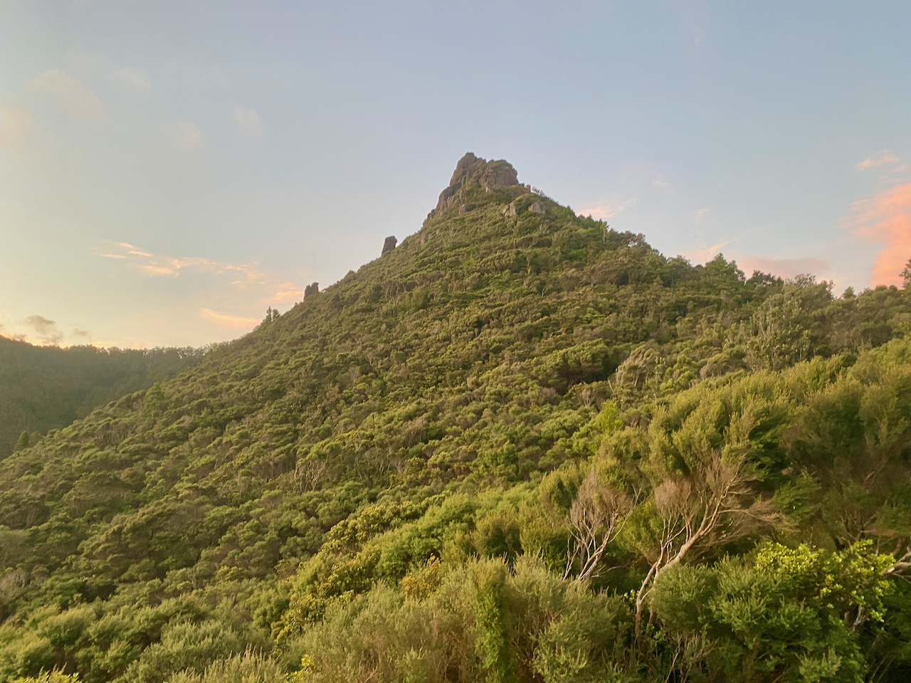
After a fitful night’s sleep, I arose and got ready for today’s walk. First, I climbed past Mt Heale to the summit of Mt Hobson, the tallest mountain on the island, at 627m. I was to have climbed past Mt Hobson and along the ridgeline to the next hut, but due to a slip the trail that was was closed. So I’d left my pack at the hut.

img_1363-2023-04-5-17-27.png

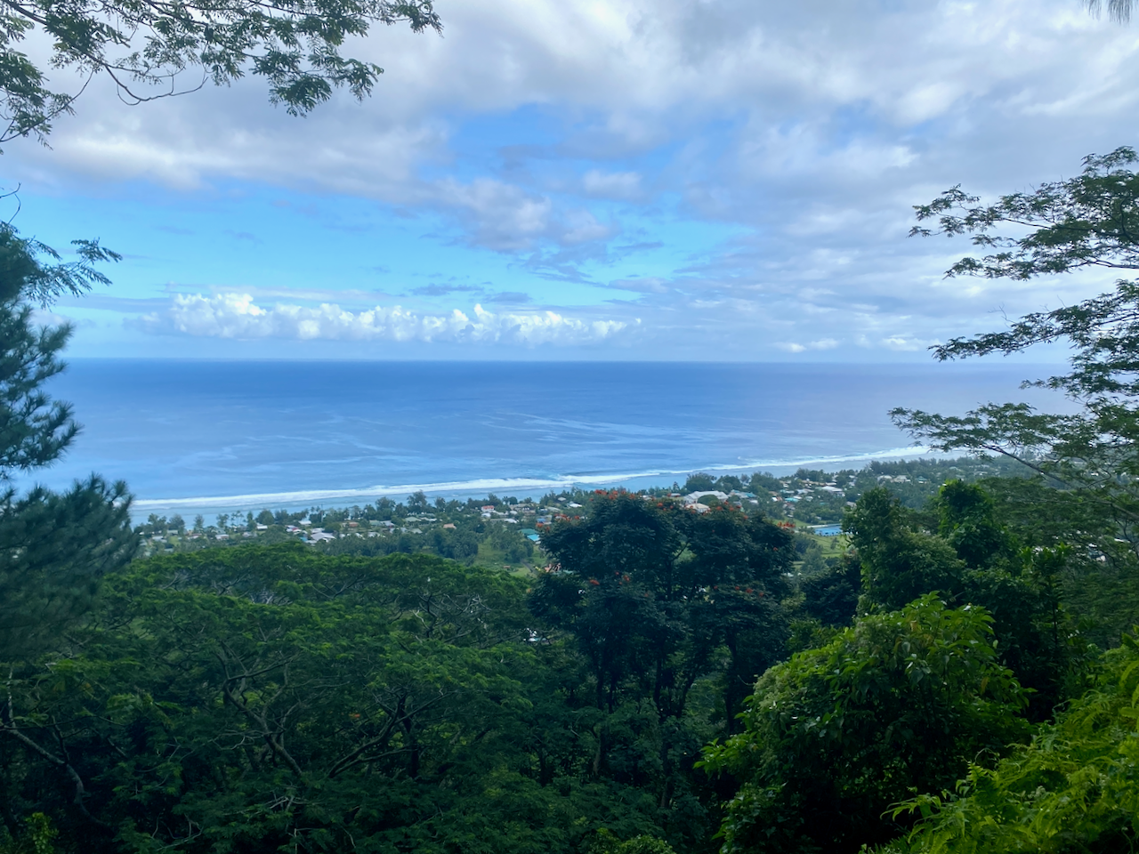
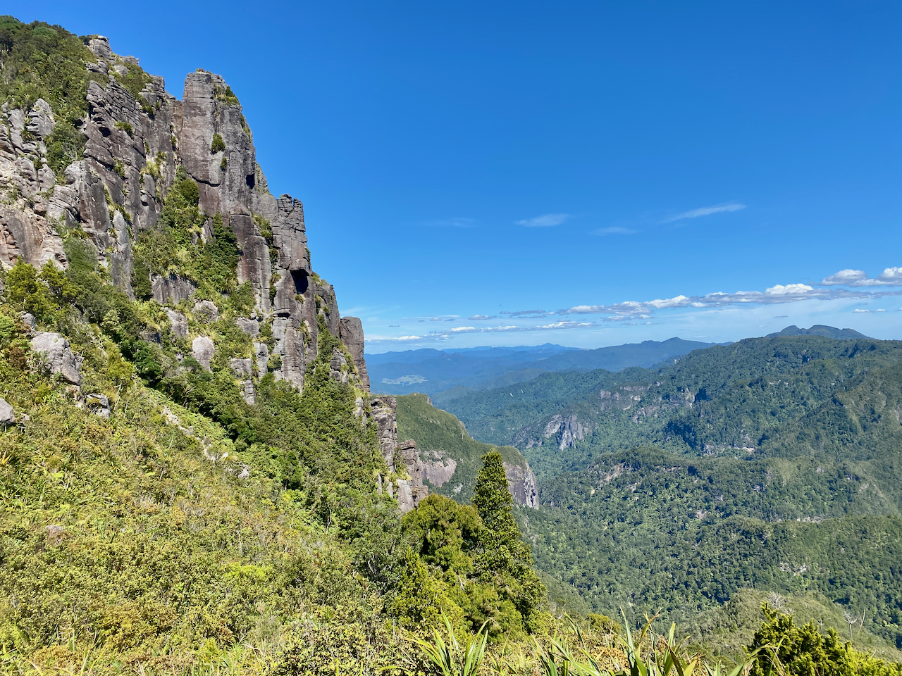
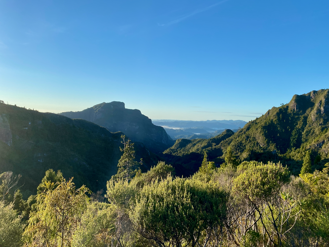
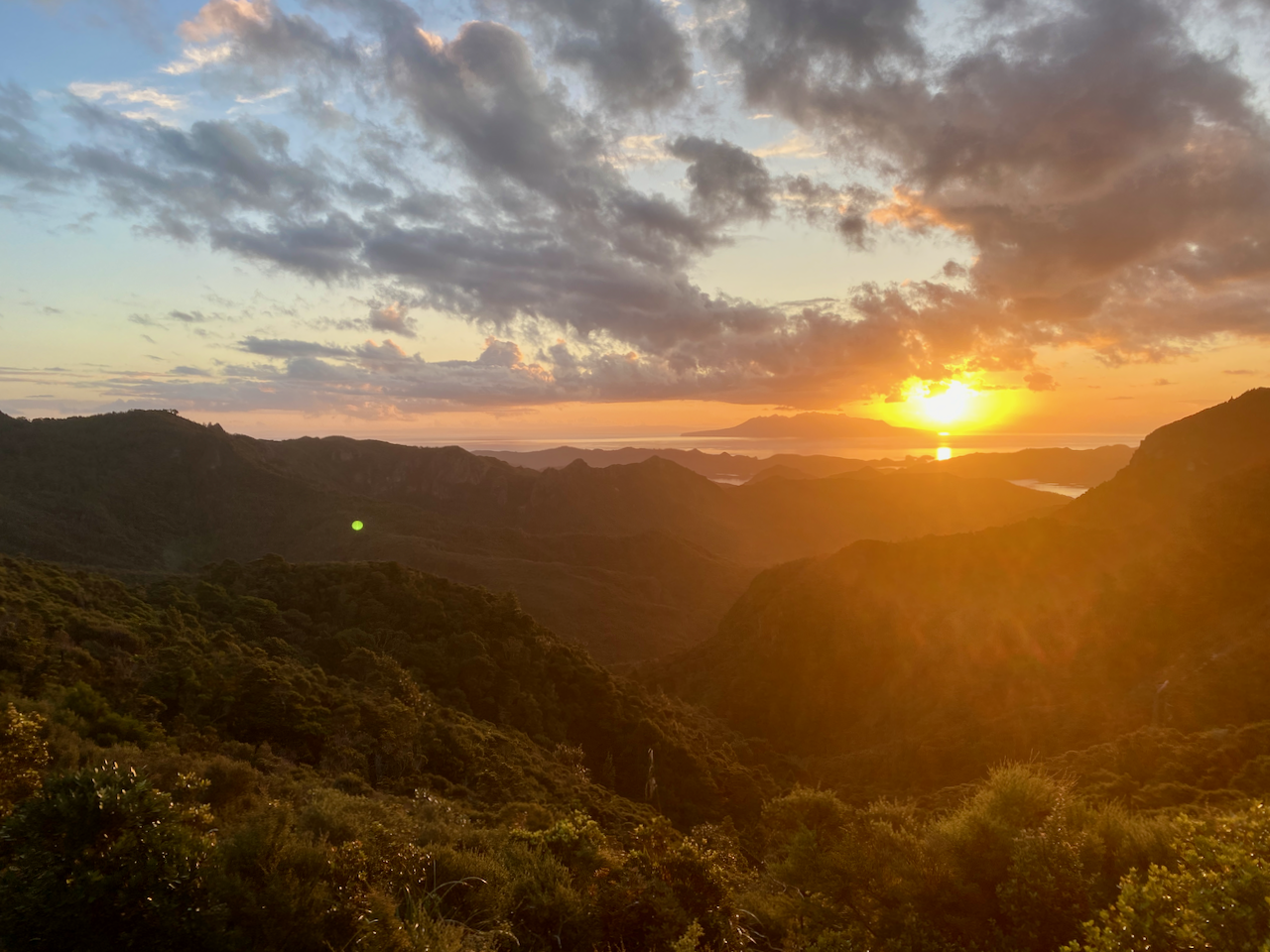
I knew there was going to be a lot of steps, as others in the hut had complained about the sheer number. I didn’t bother counting on the way up, concentrating on the climbing until I reached the summit platform with almost 360 degree views. This over Whangapoua Bay…

img_1373-2023-04-5-17-27.png

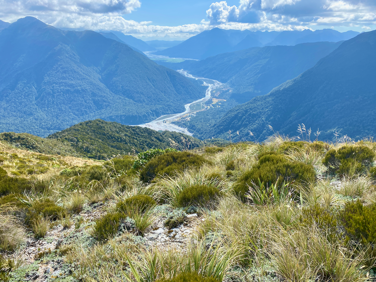
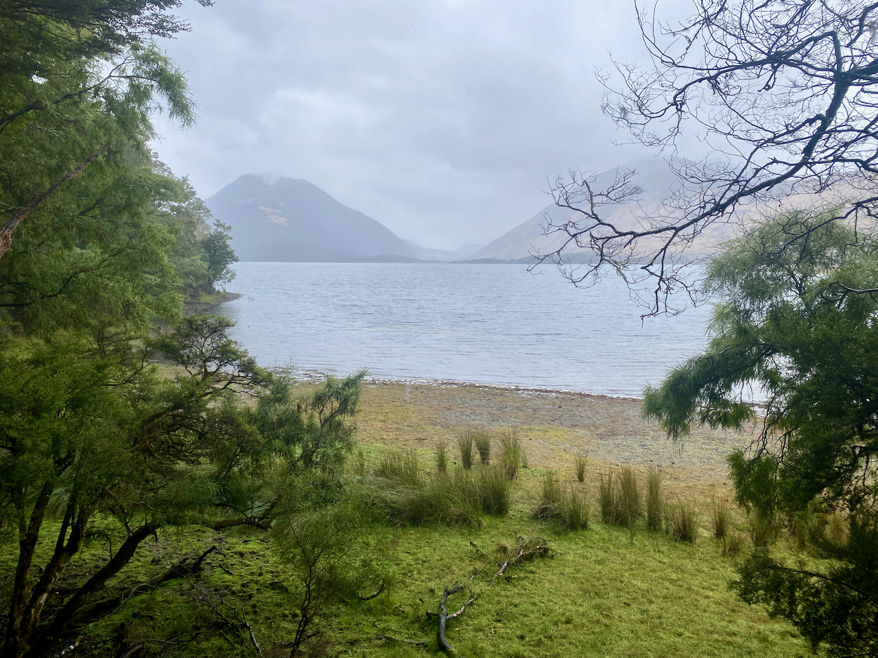
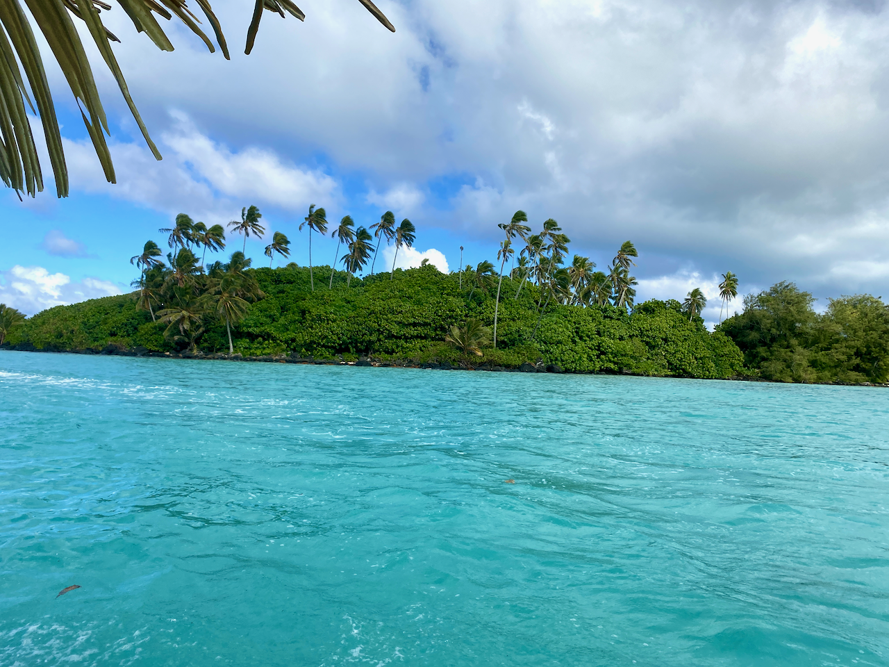
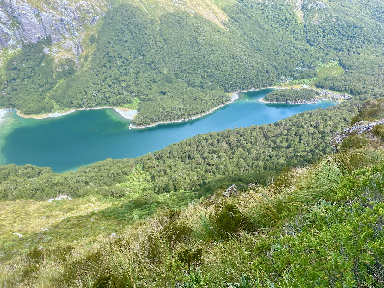
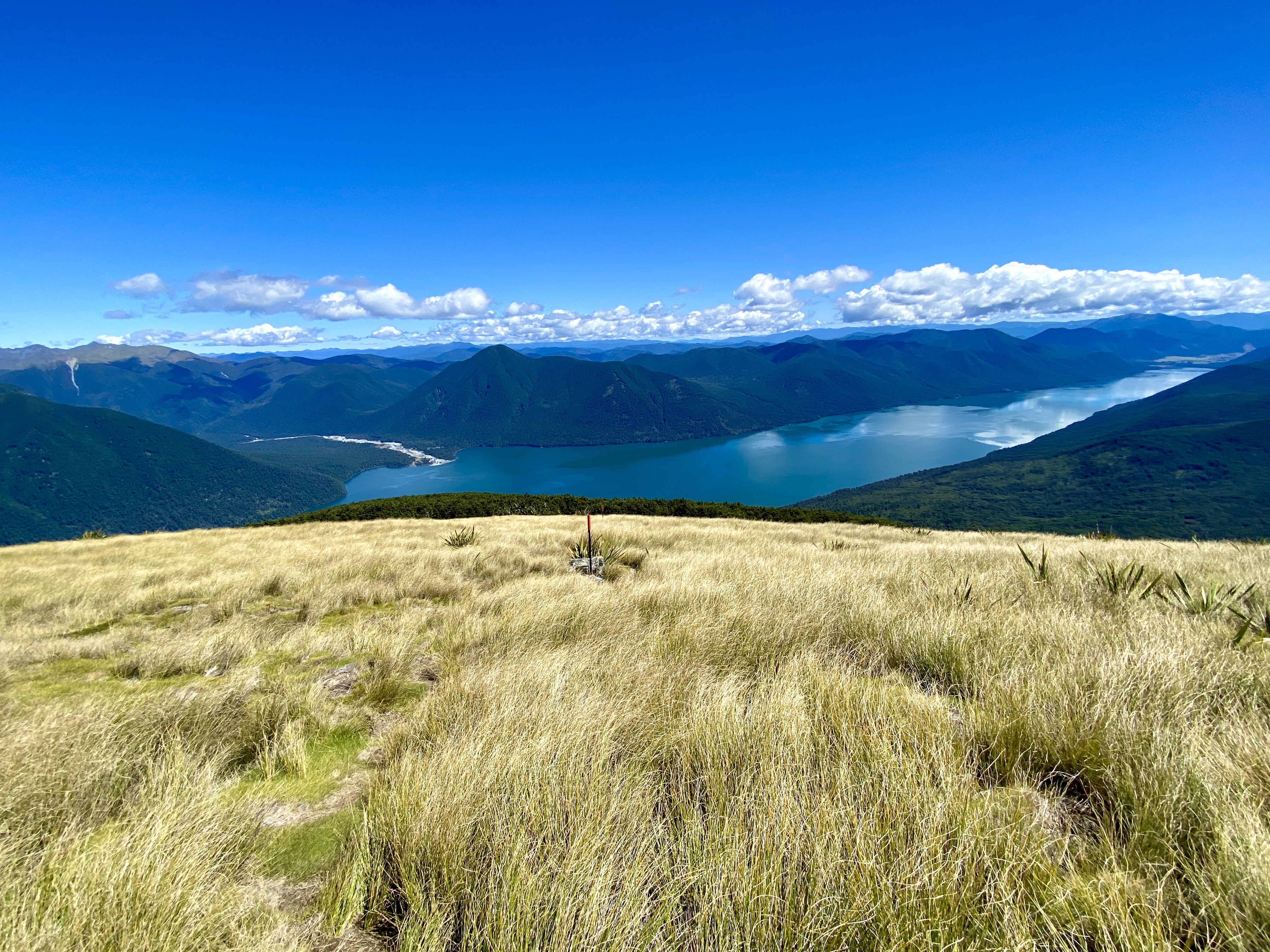
and this over Port Fitzroy with Kaikoura Island, in the centre, and Little Barrier Island, in the distance.

img_1374-2023-04-5-17-27.png

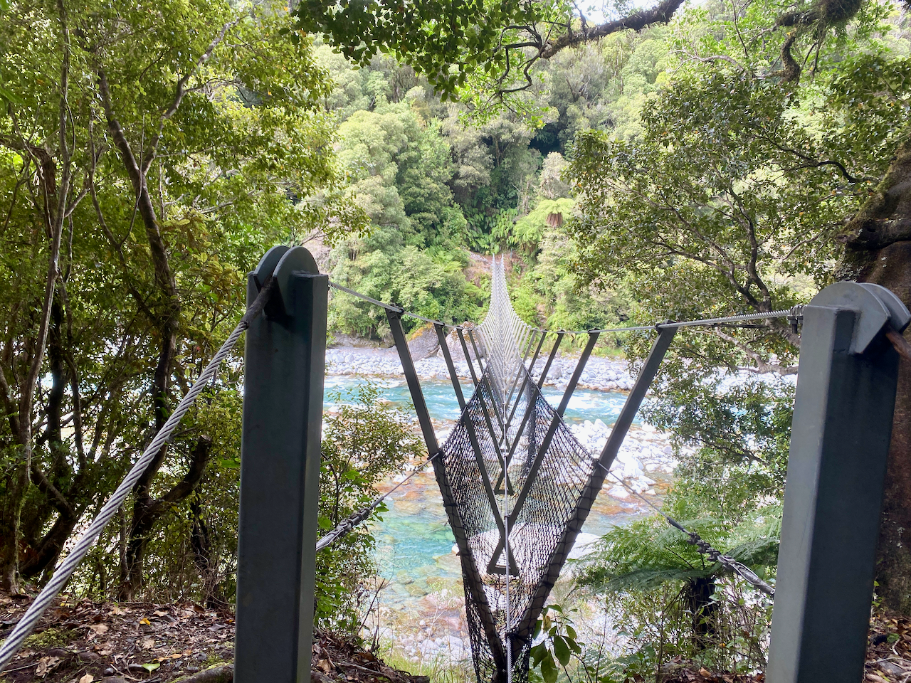
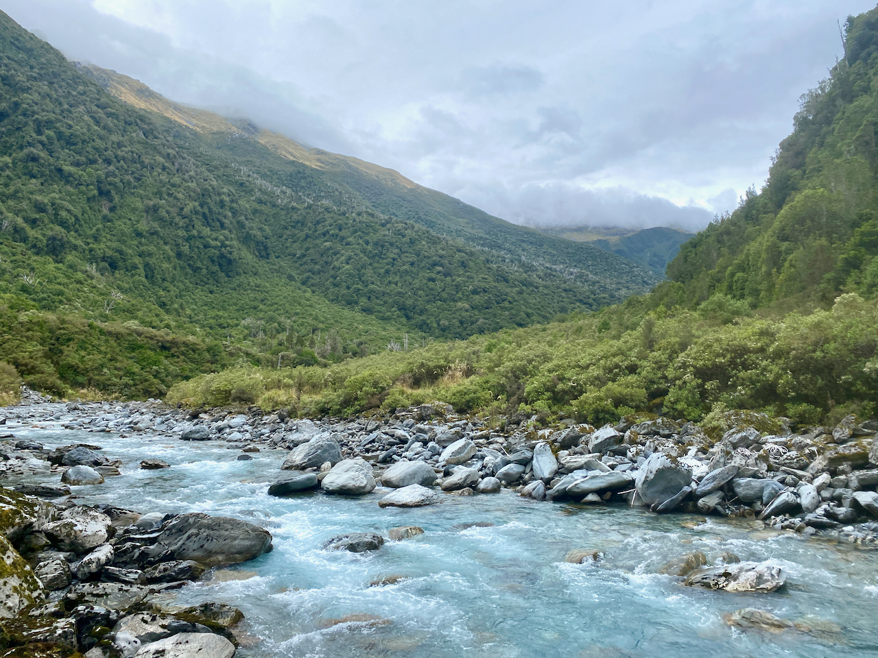
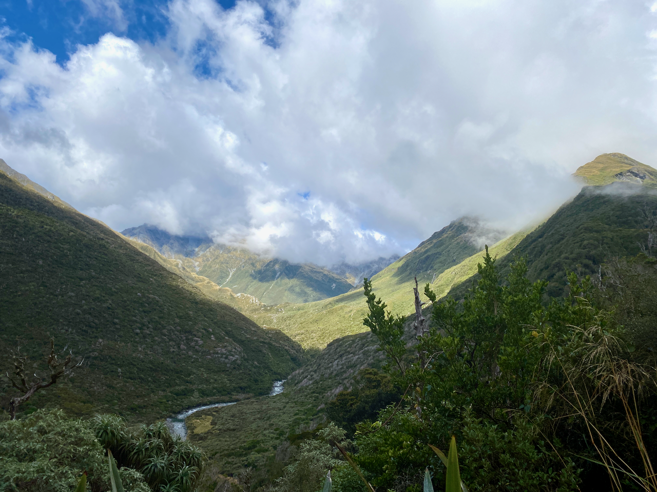
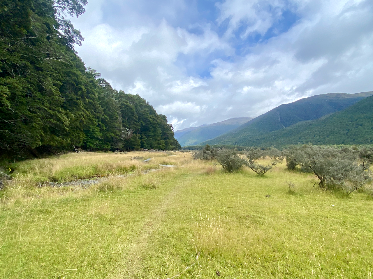
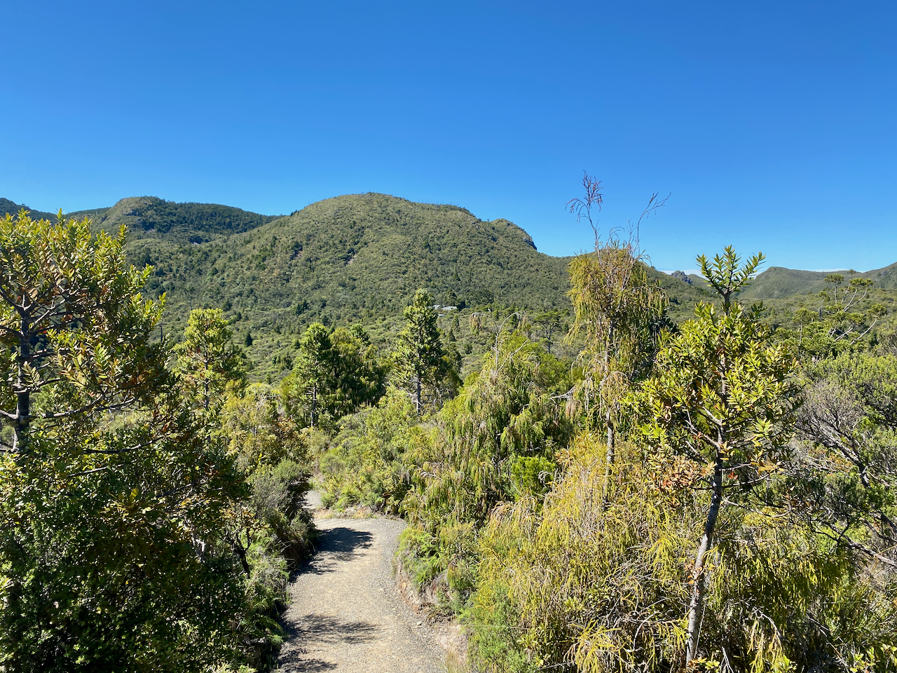
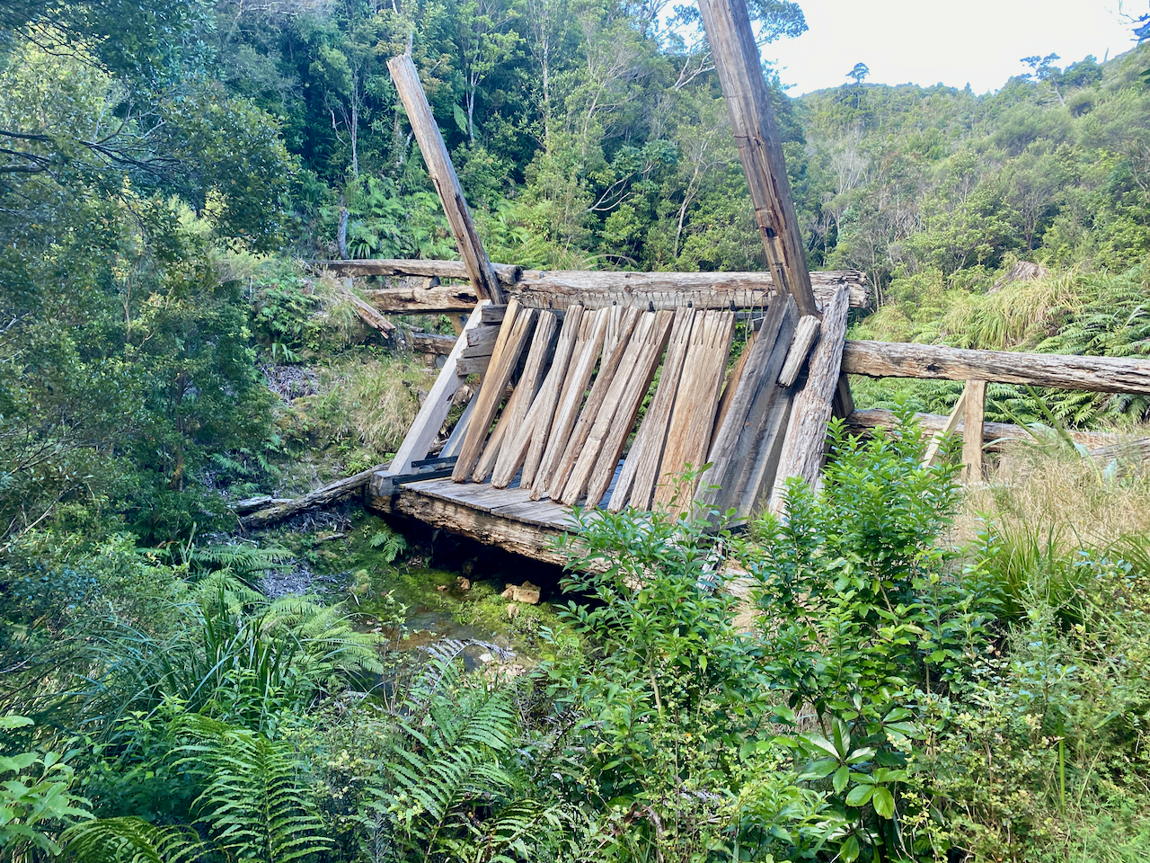
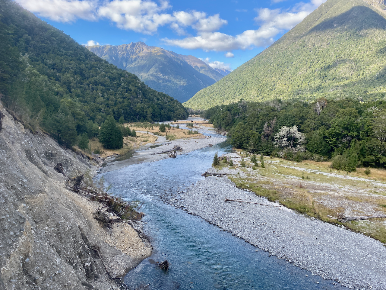
I counted 1016 stairs on the way back to the hut where I picked up my pack and headed straight off again. A sign at the top of the South Fork Track said an hour to the Forest Road, not far from the hut. So it was going to be a short day. The trail headed down slowly, crossing a wire bridge as it went.

img_1379-2023-04-5-17-27.png

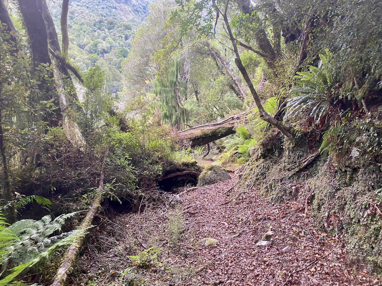
The trail was wide and an easy descent. Along the way I passed a pair of woman, the only two people I’d see on the track today.

img_1386-2023-04-5-17-27.png

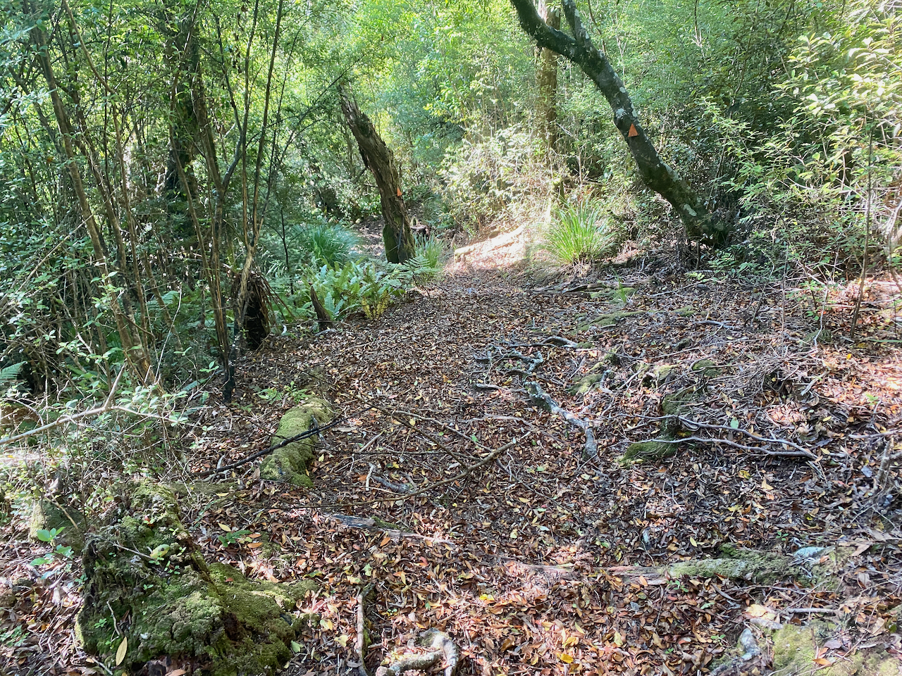
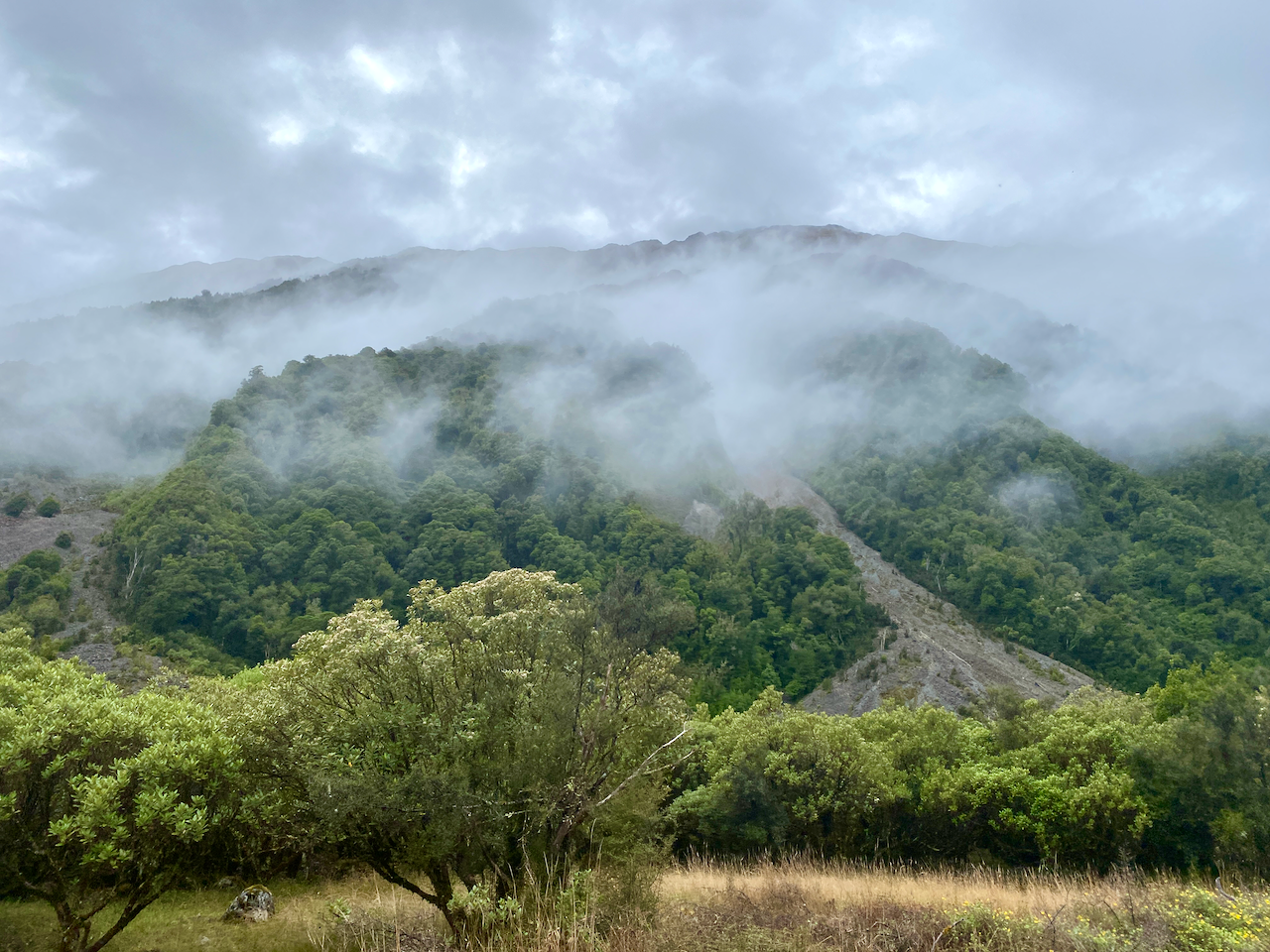
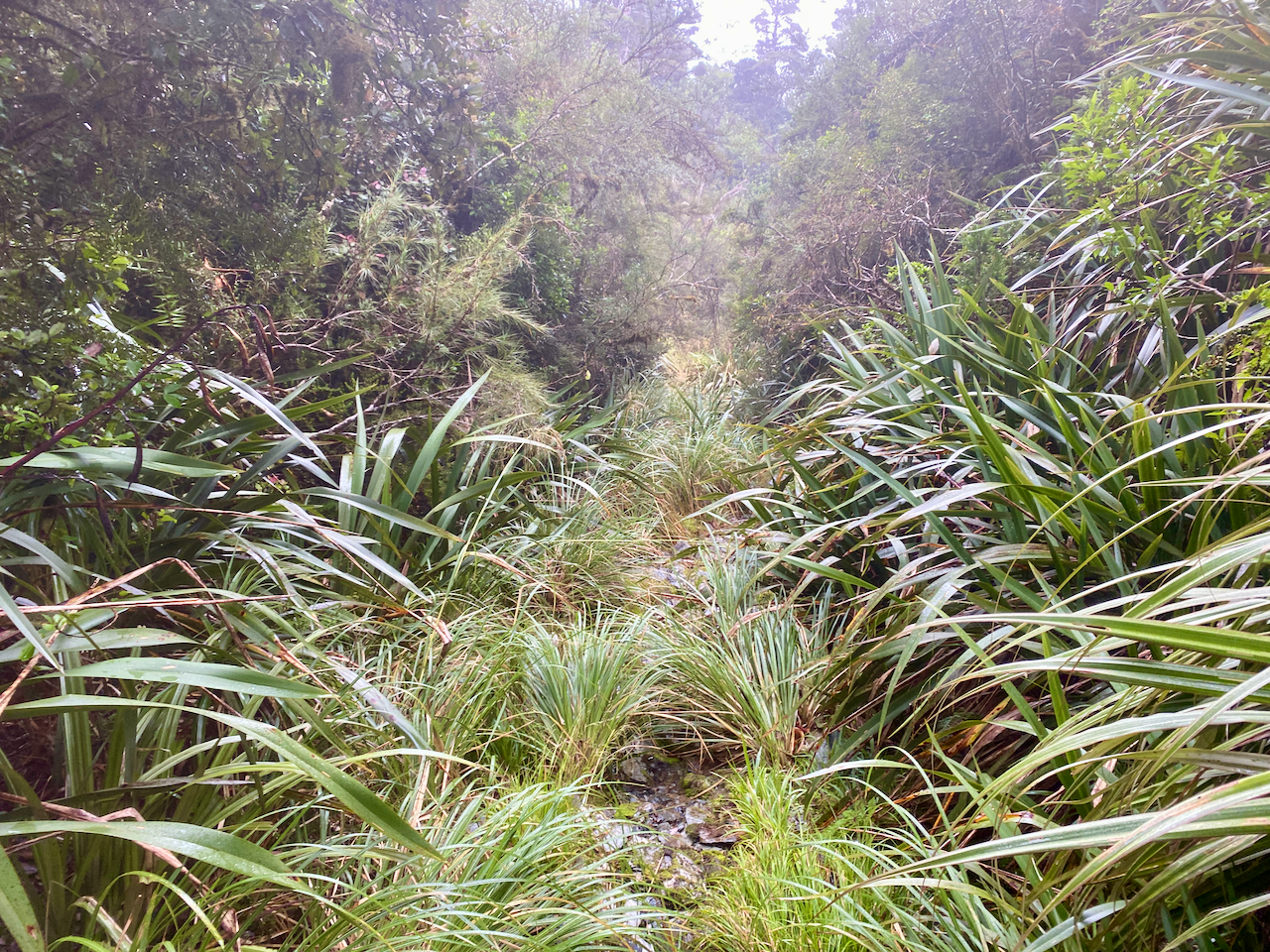
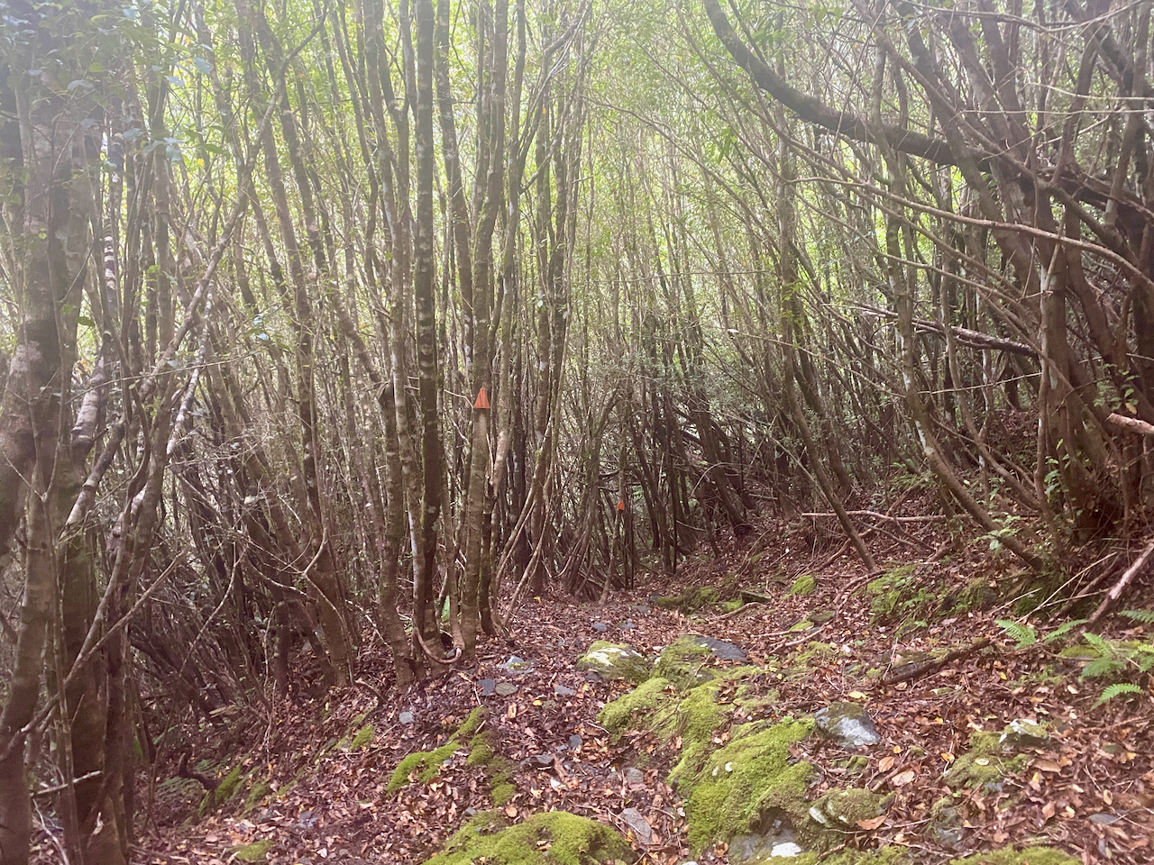
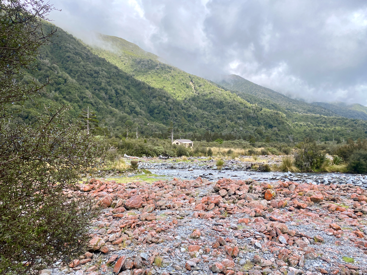
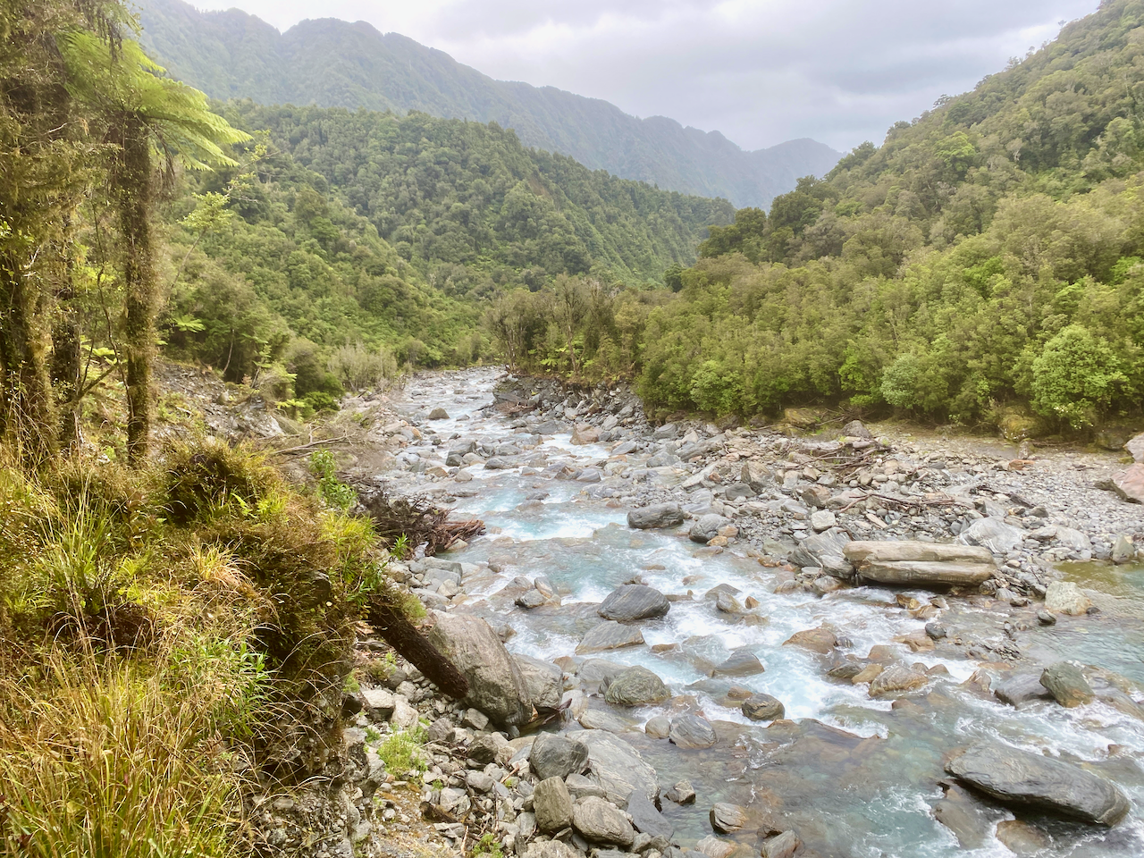
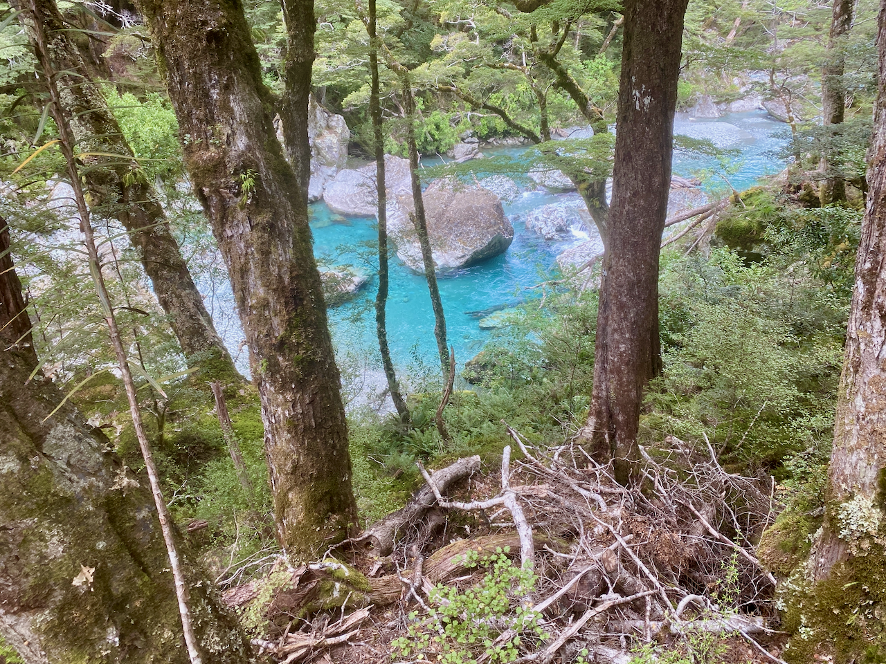
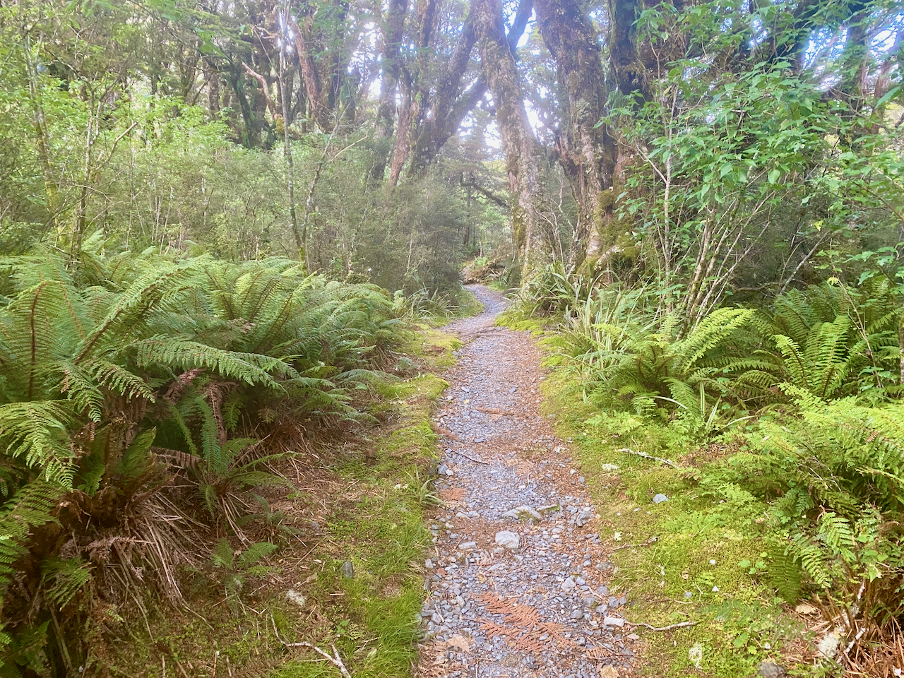
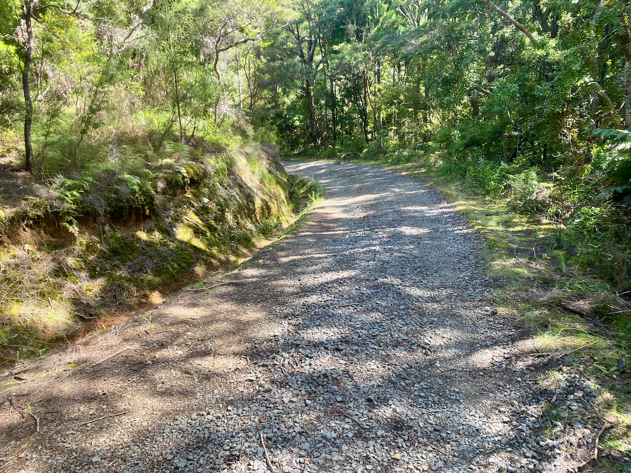
The trail crossed a stream several times, and was easy to avoid getting my boots wet, although the trail was a little muddy and slippery at times. I finally came out at the Forest Road after an hour and a half. Not sure where they got an hour from as I wasn’t walking slowly. The Forest Road is rocky road though the nature reserve, and the sign said 30 minutes to the hut, but it only took 10 minutes.

img_1390-2023-04-5-17-27.png

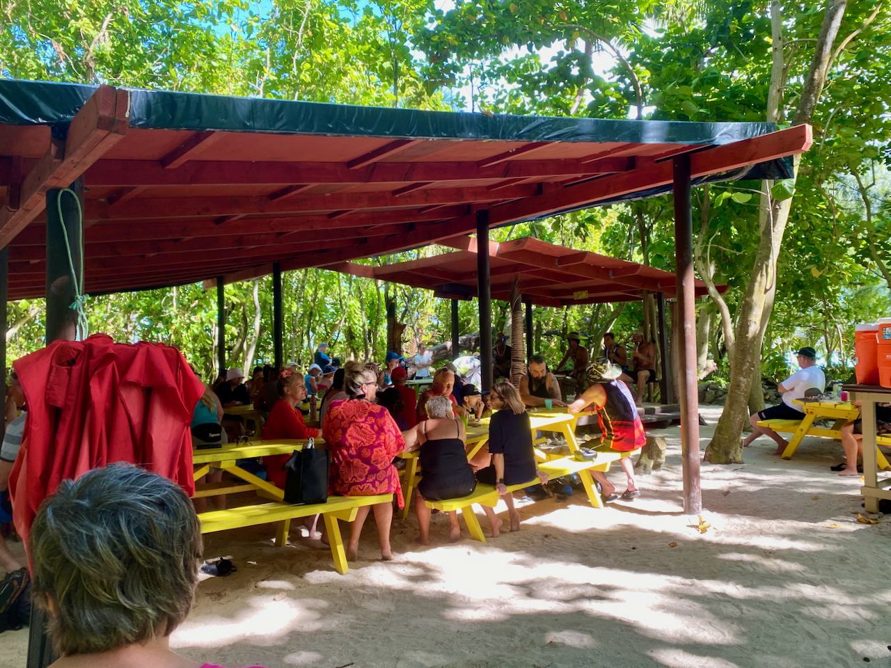
At the hut I ran into one of the ladies from the hut last night. It was early, so we decided to walk the 5km into Port Fitzroy. I’d heard there was a burger place, which turned out to be closed, so we continued walking to the Boat Club, hoping for a burger, but that was also closed. We did manage to persuade the owner to sell us a beer though. Afterwards, we stopped at the shop on the way back. That evening we discovered there were mice under the hut, as my hutmate had left a bag outside with a chocolate bar in it. The mice enjoyed that. Thankfully they couldn’t get inside.

Day 3: Kaiaraara Hut to Green Campsite via Mt Maungapiko – 17km – 4 hours – Green Track

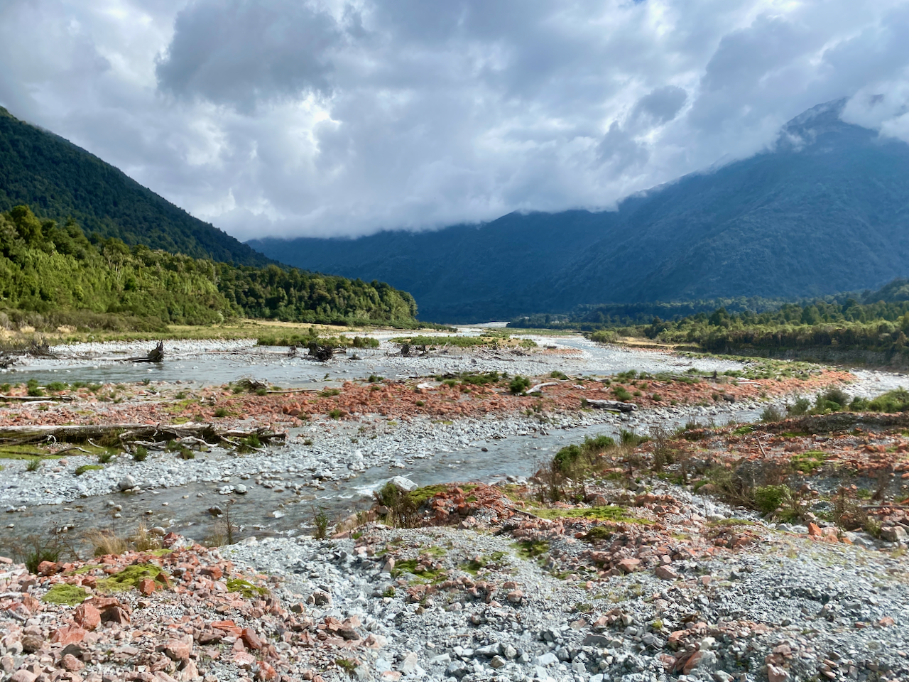
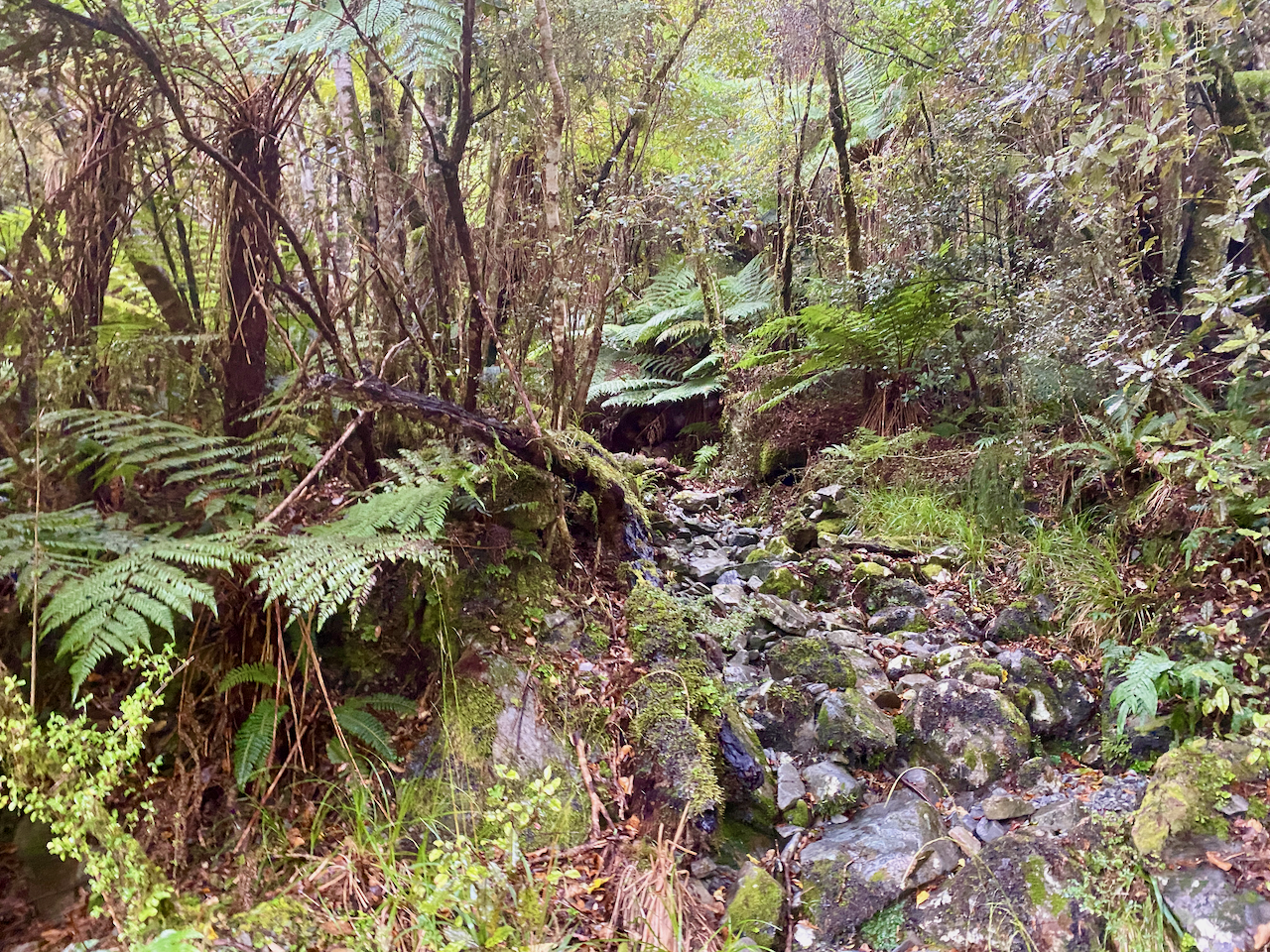
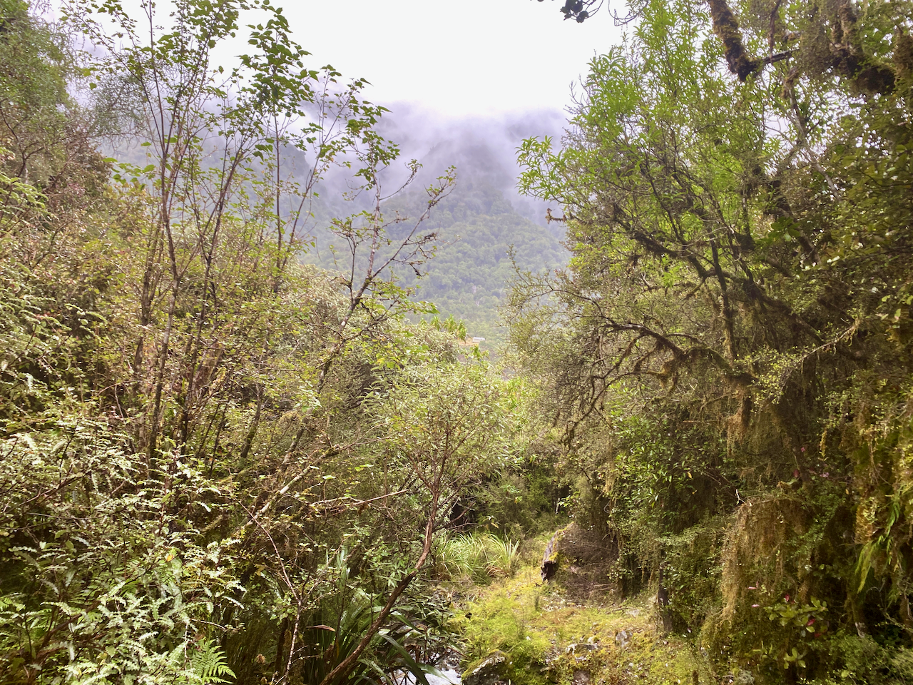
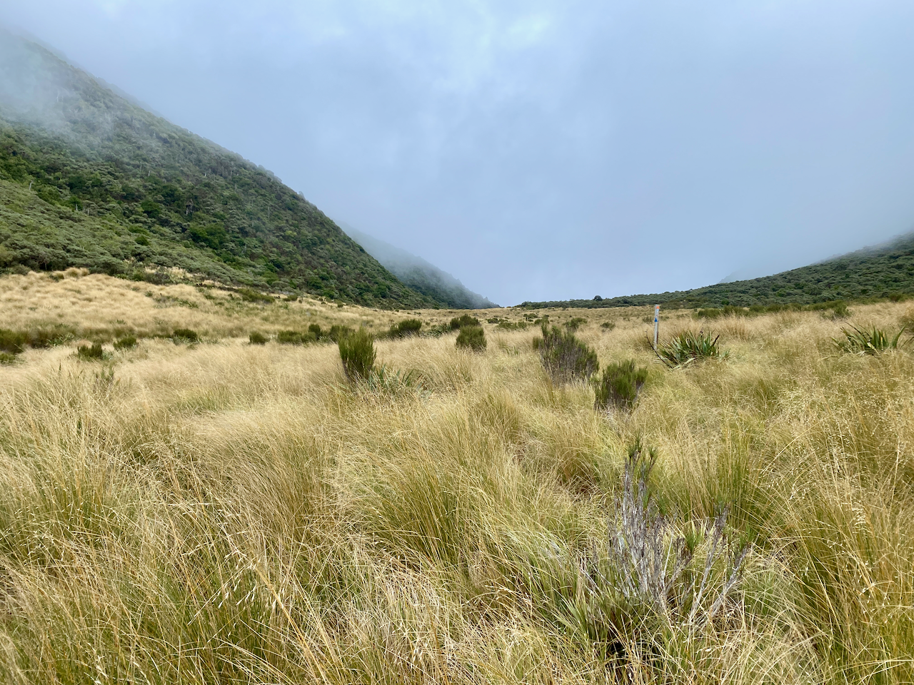
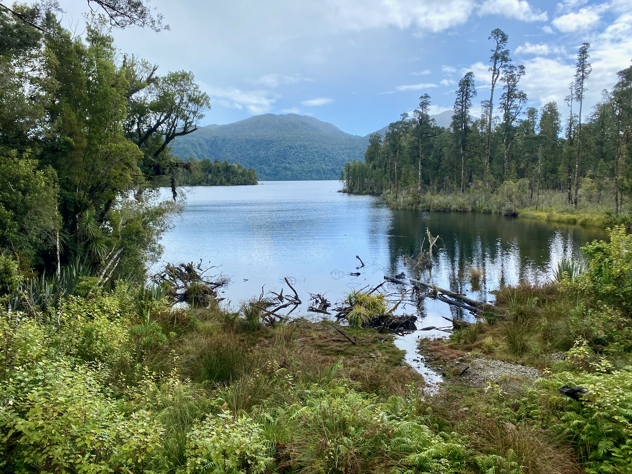
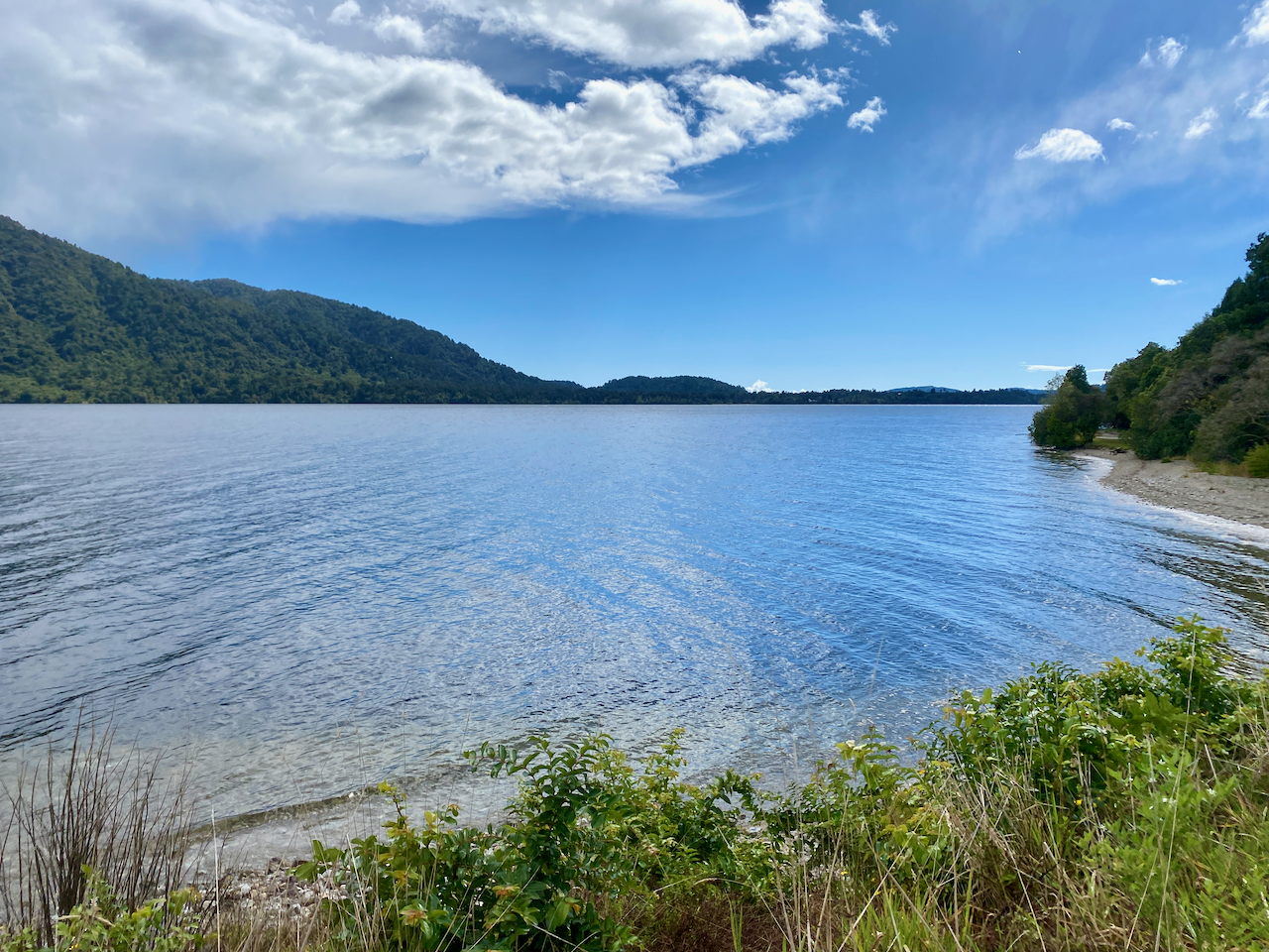
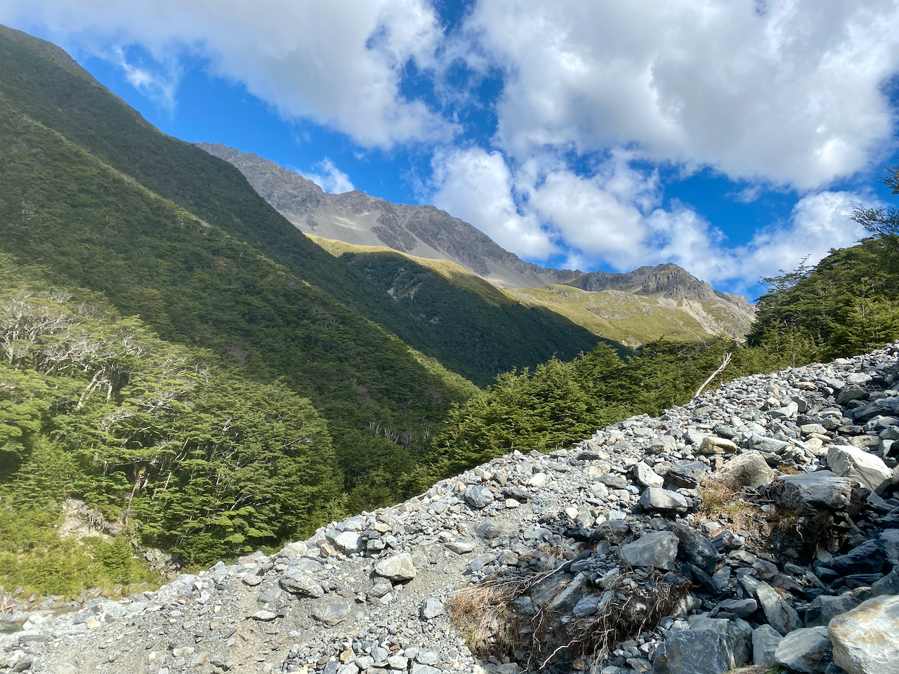
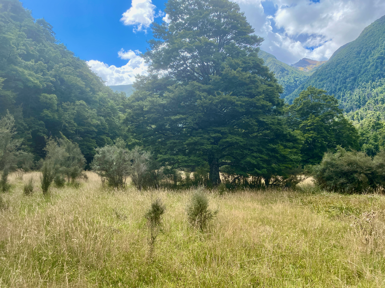
Today would be the longest day, although most of it would be spent walking along the Forest Road. Unfortunately, there wasn’t much of a view most of the time, so I took whatever photos I could.

img_1406-2023-04-5-17-27.png

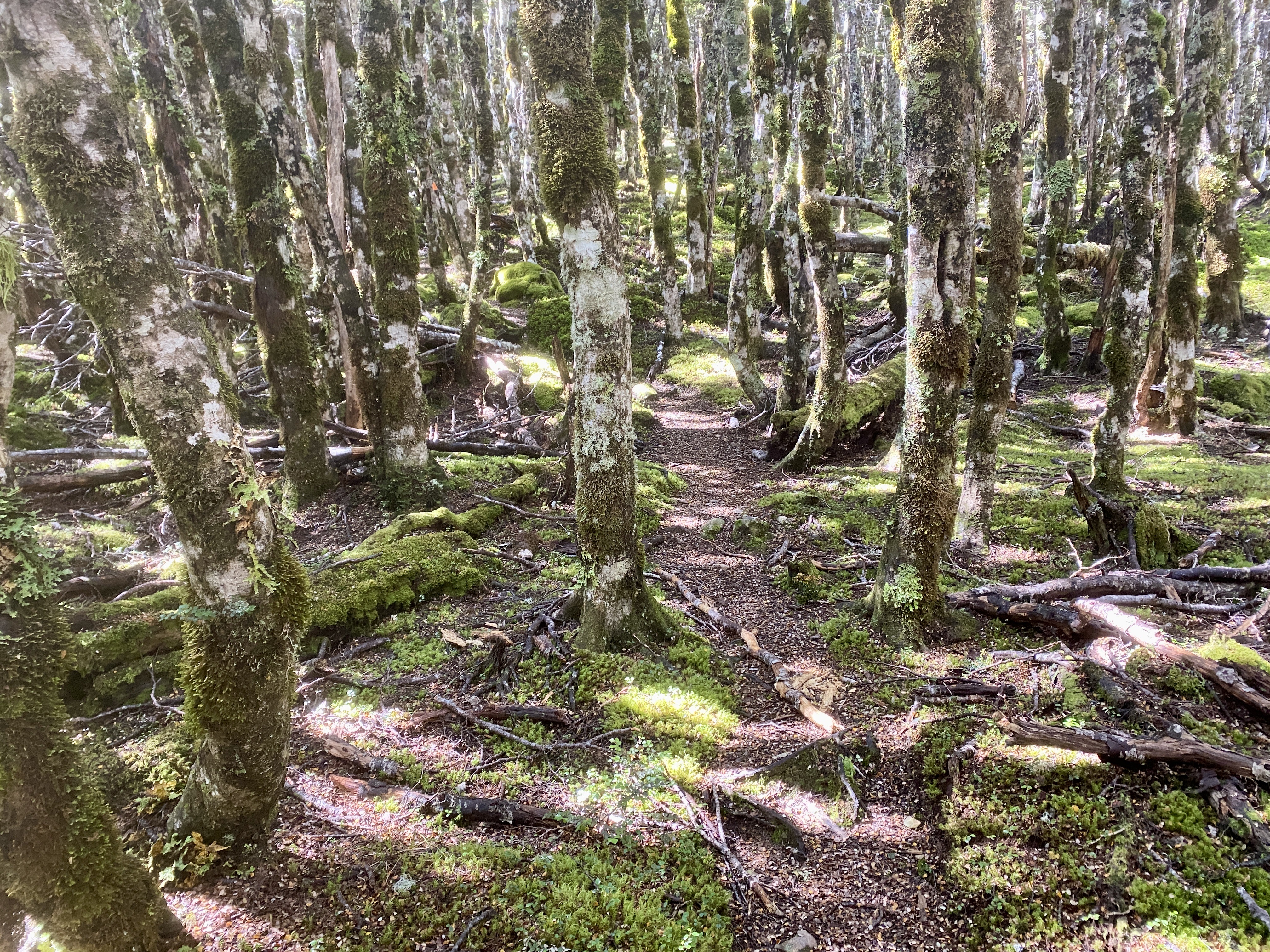
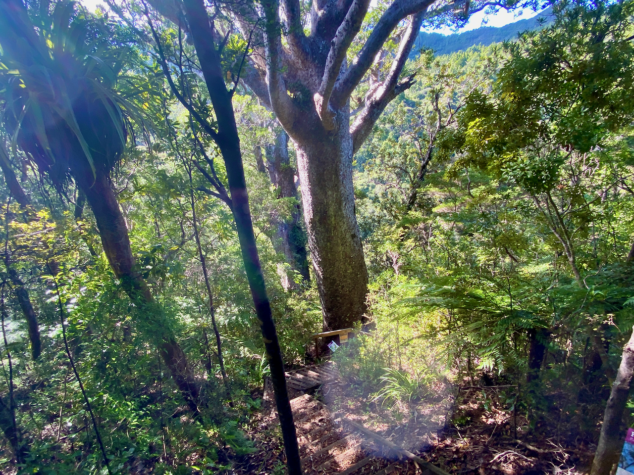
Then a short side trail with a bunch of stairs led down 50m to a pair of large Kauri Trees. After the logging a century ago, there were few of the ancient giants left, and with Kauri Dieback Disease, there are likely to be few others living to such greatness.

img_1418-2023-04-5-17-27.png

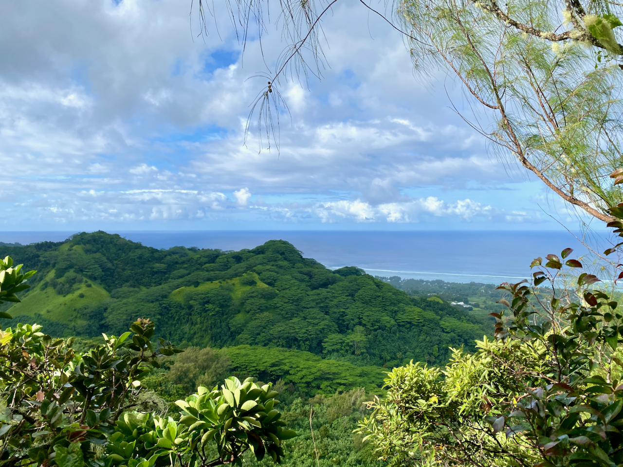
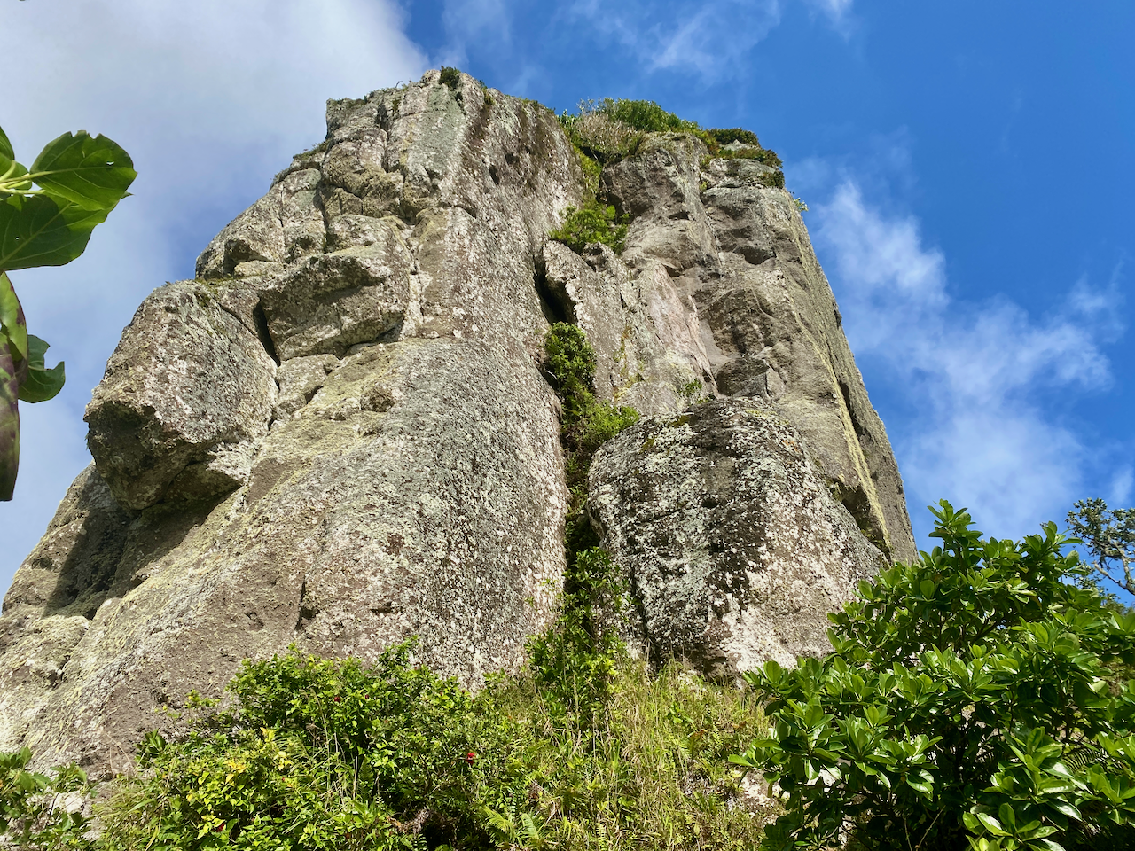
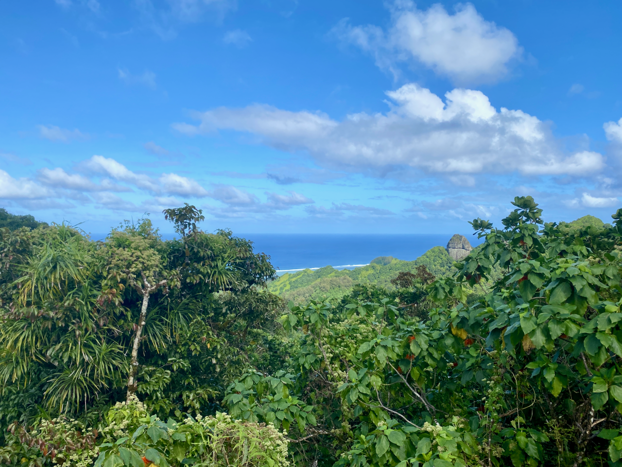
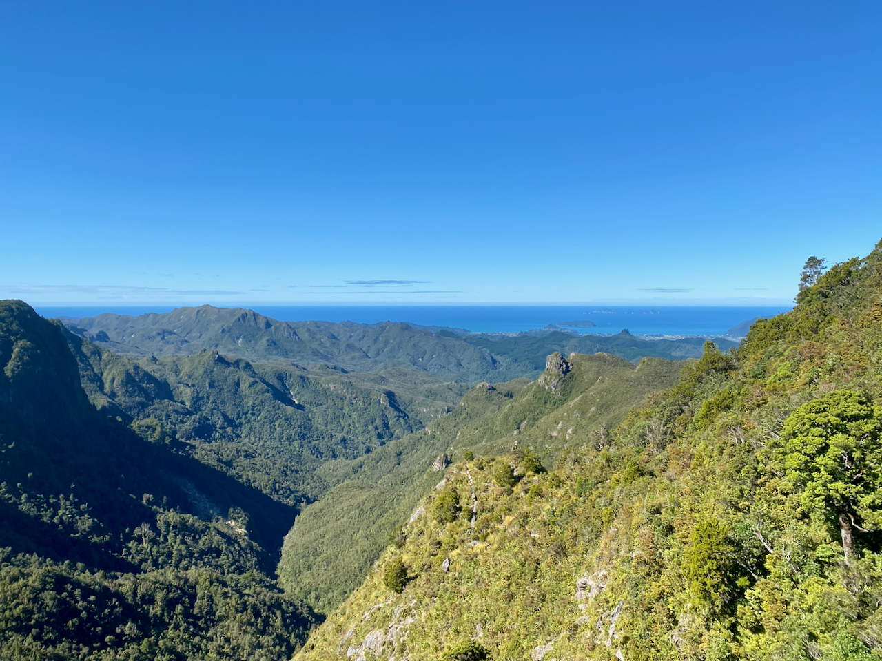
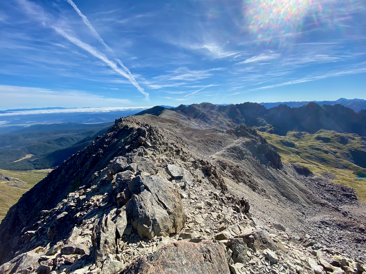
30 minutes later, I came to the turn off to Mt Maungapiko, a 280m peak with good views. It was the only climb off the Forest Road, and in time for lunch, so I took the opportunity, and climbed the rough rock to the top where there’s a wooden bench.

img_1426-2023-04-5-17-27.png

I stopped for lunch, taking photos of the near 360 degree views.

img_1421-2023-04-5-17-27.png

And back the way I’d come.

img_1425-2023-04-5-17-27.png

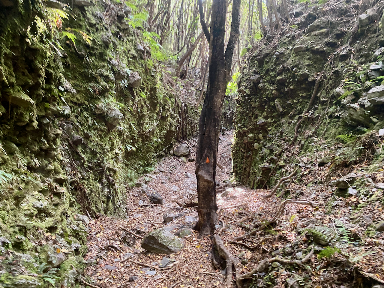
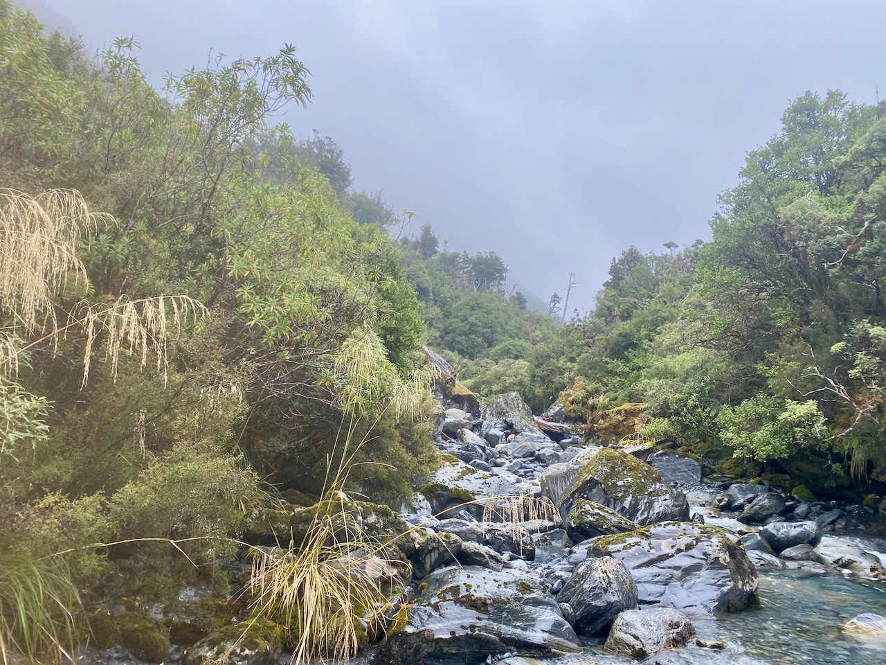
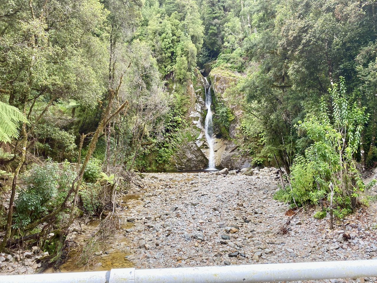
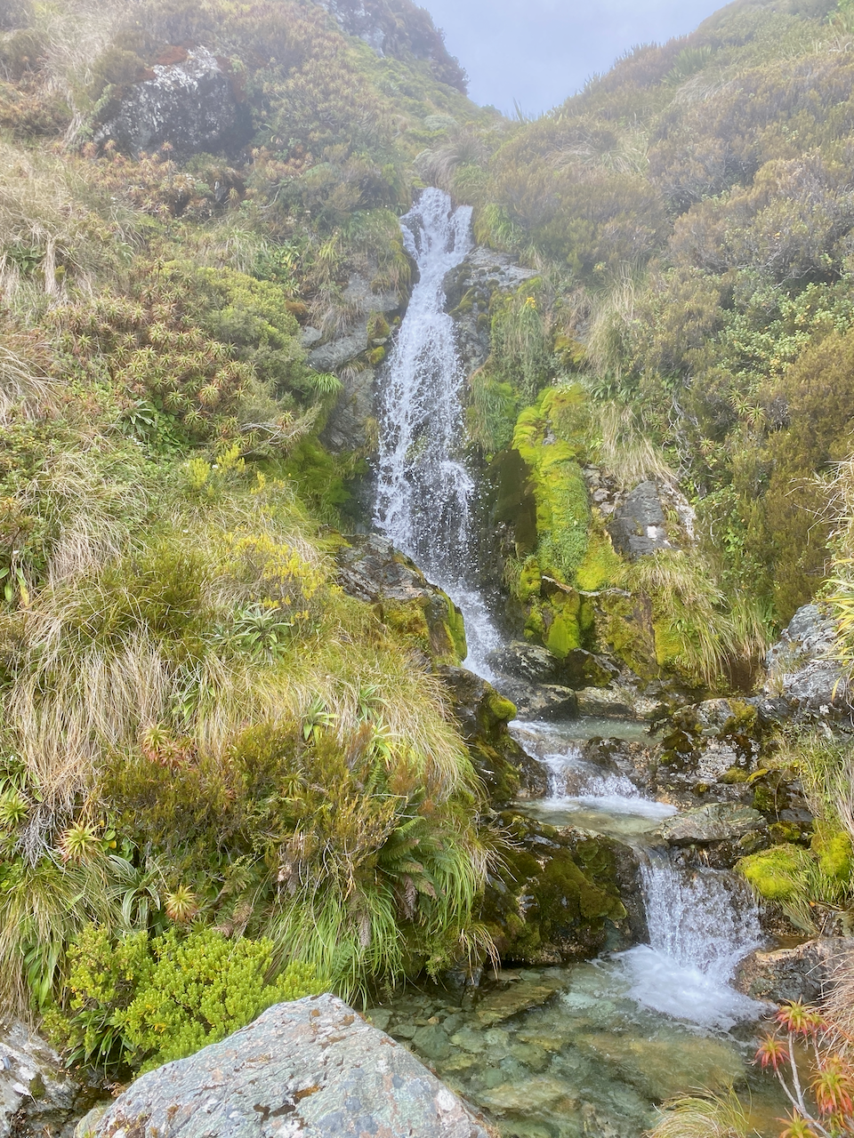
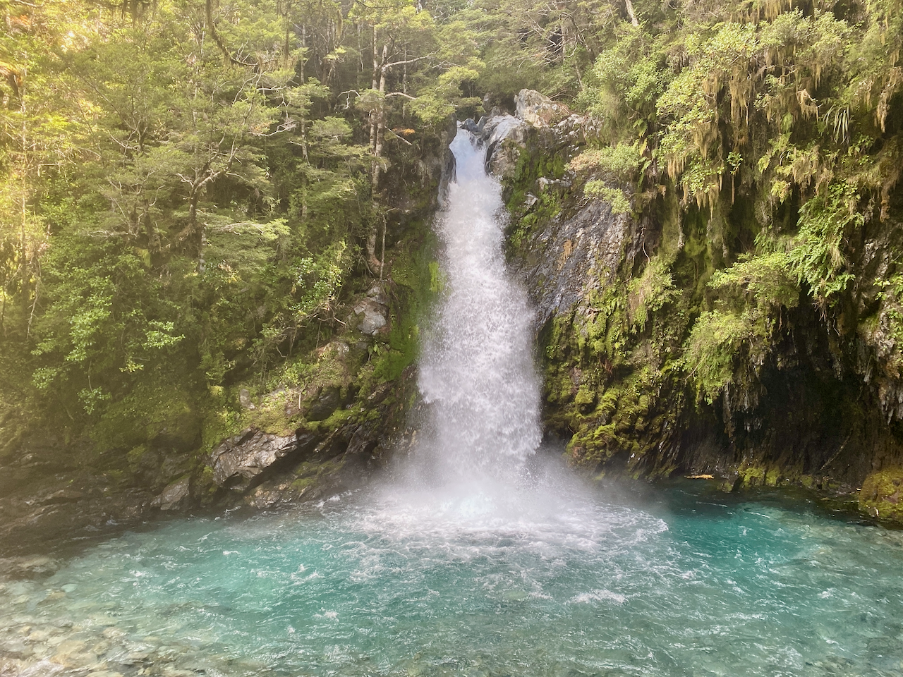
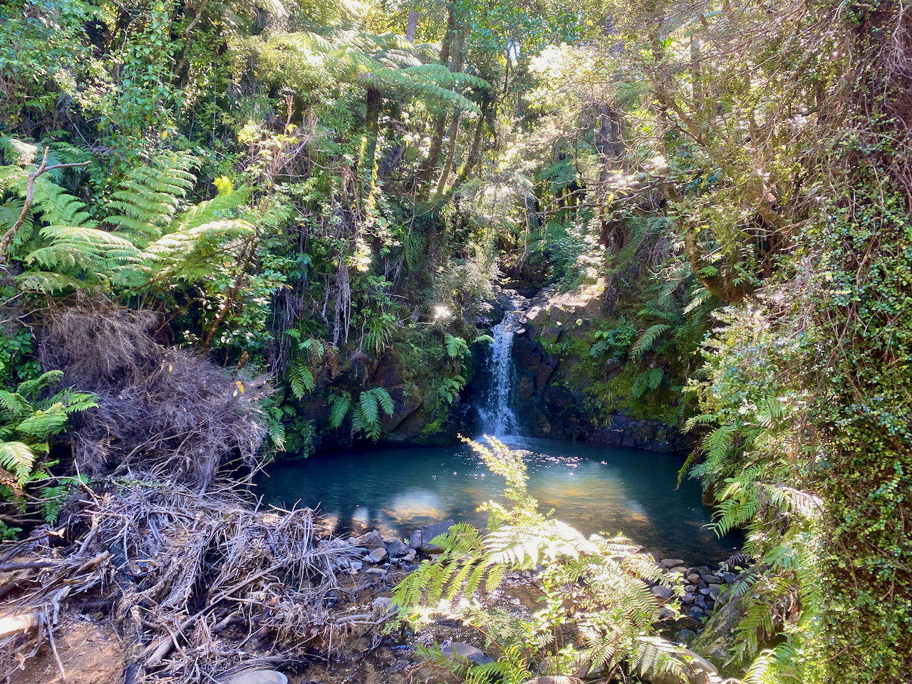
Back on the Forest Road, I headed down to a stream, the climbed for the final time before finally reaching the South Tramline Track. The actual metal tramline had been removed many years ago, leaving just a steep descent. About halfway down I came to the turnoff to the Kauri Falls, and stopped to have a look.

img_1432-2023-04-5-17-27.png

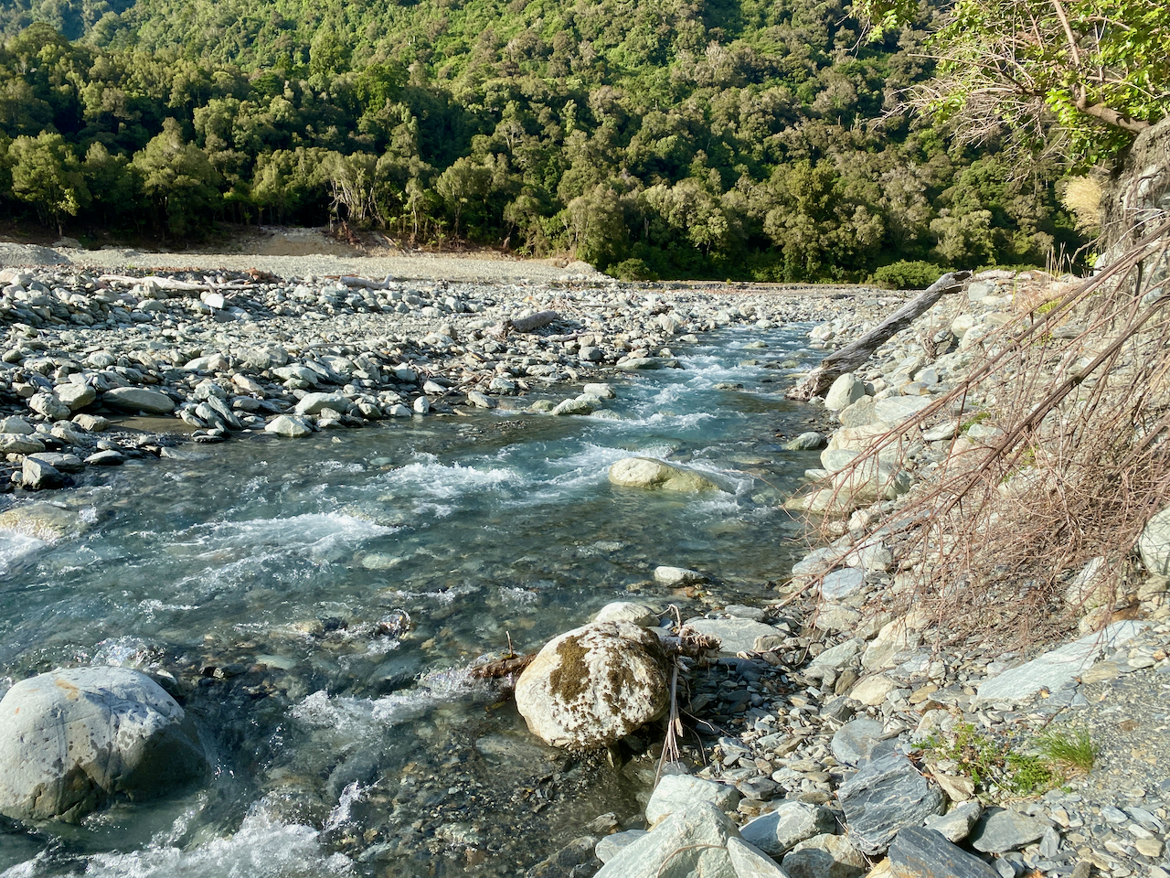
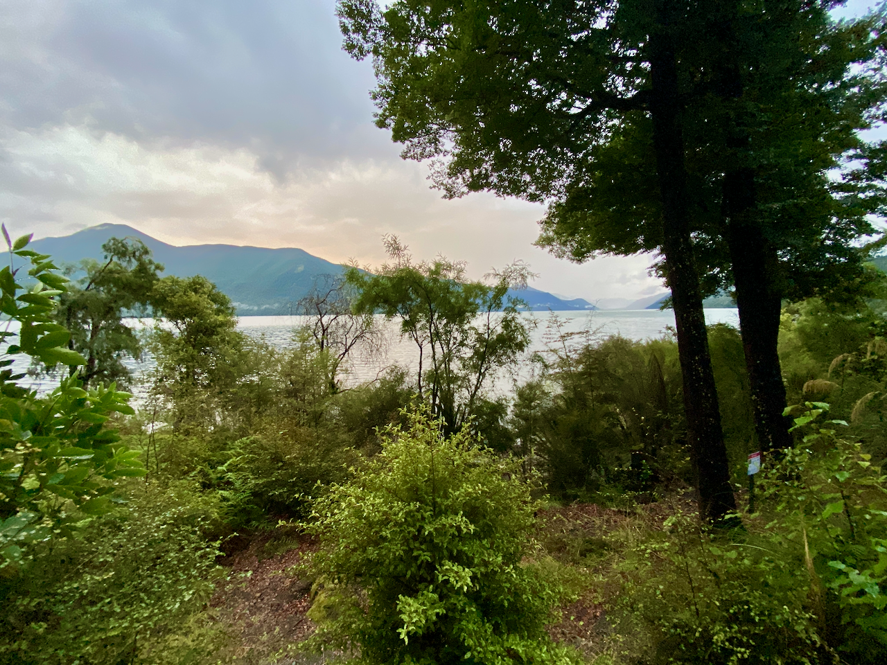
Then it was a fairly easy walk, crossing numerous streams via wooden bridges, before I came out near Whangaparapara, then a 7 minute walk to the Green Campsite, opposite the village. I set up my tent, then went for a short walk along the main road of Whangaparapara hoping to find a beer at the lodge, but it was closed. So, I just chilled, reading in the sun.

img_1437-2023-04-5-17-27.png

The next morning, I packed and had breakfast, before I met the trail transport guy who dropped me off at the airport for my 30 minute flight home.

Overall

The hike was a fairly easy walk over three days, and would have made the perfect warmup hike had it not been for the weather events. I enjoyed my time there in relative quiet.

The Lone Trail Wanderer

Southern Alps Crossing – New Zealand – Days 9 – 10

In late February 2023 I embarked on my longest walk in New Zealand, 13 days across the Southern Alps of the South Island. Go back to Days 7 – 8 or to the beginning Days 1 – 3.

Day 9 – Mid Taipo Hut to Newton Creek Hut – 6.9 km – 11 hours – Red

It had rained a little overnight and as today would be a long difficult day, I wasn’t pleased that everything would be wet. Clouds hung atop the ridges, and I hoped they’d blow over. In the hut were instructions to get to the beginning of today’s climb, so I followed them back to the turn off and easily found the trail leading up the mountain.

img_0885-2023-03-10-14-49.png

While I’d been told the trail would be steep, it wasn’t as bad as expected. I’d imagined the climb from yesterday after the three war cableway, just much longer. But it turned out to be a moderate climb, fairly constant up rocks and roots only damp from the overnight rain.

img_0888-2023-03-10-14-49.png

And, after 90 minutes I popped out at the top amidst the mist.

img_0891-2023-03-10-14-49.png

The sign at the bottom had said 2 hours to the Dunn Creek Hut, but it took another hour to make my way through wet flax and vegetation.

img_0893-2023-03-10-14-49.png

A couple of wet stream crossings and I crossed a marshy, grassy mud patch leading up to hut. It was in better shape than I’d expected, but the heating had been removed and I’m glad I’d decided not to stay there. I took my boots off, brewed a coffee and ate some lunch.

img_0894-2023-03-10-14-49.png

Half an hour later, I headed out again across the boggy grasslands following the trail markers.

img_0897-2023-03-10-14-49.png

Much of the climb to Newton Saddle was up Dunn Creek, and it was pretty lively as I went. The trail pushed up the centre of the creek over wet rocks and wasn’t very pleasant as it was slippery and slow as I tried to ensure each step was stable. Thankfully over the hours I climbed, the creek grew thinner. At one point I must have climbed up the wrong rocky gully as lost sight of the regular orange markers. My GPS confirmed I was off track and I was forced to bush whack my way across the grassy mountain slope until I saw the correct creek with the markers. Going down would have cost me extra time.

img_0899-2023-03-10-14-49.png

I was mostly dry as I walked, but the occasional gust of cold wind from across the saddle was pretty miserable. I saw the markers go up the very steep side of the grassy bank away from the creek, and I knew this was the final climb to the saddle. It was hard going. I couldn’t use my poles, so let them dangle from my wrists with the straps. Each step was finding a footing and dragging myself up by the grass, bit by bit until I got 30 metres from the top when I could again use my poles. I finally got over the top and looked down to regard where I came from…

img_0903-2023-03-10-14-49.png

The hundred or so metres across the saddle was fairly flat and it felt good to not have to climb. I stopped at the top of the descent and looked down.

img_0906-2023-03-10-14-49.png

The climb down was the opposite of the ascent. It was easy going at the top, trickles of water in the rocks, but as I went it got thicker and heavier the trail going down the centre of the Newton Creek. I descended into the mist which grew bright from the occasional ray of the sun, only to fade again. With several other water flows joining the creek it got heavier and the rocks larger. I slipped several times, catching myself on my poles, bending them slightly under the strain. Sometimes I had to let go of them and catch myself on my arms in the water. I don’t remember bashing my ribs, but perhaps coming down hard on my arms caused bruising on my left side. It didn’t affect my walking, or carrying, only turning over at night. I had scratches and bruises down much of my legs and again wished I’d brought the full length gators.

img_0907-2023-03-10-14-49.png

The day was getting on and I realised I wasn’t going to make it to the hut I’d originally planned to stay in. There was another, closer one, so I decided to walk there. But again, because I hadn’t preplanned it on my digital map, I had to guess where it was. And at 7:30 pm, I was also starting to worry that I was losing daylight. Based on where I thought the hut was, I’d likely be walking in the semi dark with my head lamp. Thankfully I train for endurance, so even though I’d been going for more than 10 hours, I still had more in me. Another large creek joined the Newton Creek, making it just too wild to be rock hoping in a raging river. Thankfully the trail finally cut along the side for the first time during this descent. Then, as I followed the trail, I came out onto a grassy patch and looked over to see a hut. I wondered about there being another hut not shown on the map, but went over to it and it turned out to be the hut I was looking for and hour earlier than I predicted. The sense of relief was unimaginable. I set about getting out of my wet gear, having a wet wipe ‘hikers’ shower and getting into warm clothing. I topped up my water for the next day from the river, set out all my gear before getting the fire going. I cooked some dinner and just stared into the fire for what felt like hours.

img_0910-2023-03-10-14-49.png

Day 10 – Newton Creek Hut to Mudflats Hut – 5.1 km – 3.5 hours – Green

After belting myself around yesterday, I woke somewhat refreshed and ready to continue my trek. I packed up and headed out into the wet morning grass. The trail continued through the woods beside the raging river and it wasn’t long before I arrived at the 200m descent I’d been expecting last night. I’m glad I didn’t have to do it in the twilight or the dark, the slippery roots and steep trail was slow going as I had to be careful of every step. Half way down there was a grove of thin trees giving me something to hang onto as I descended.

img_0911-2023-03-10-14-49.png

I finally got to the bottom after an hour and came out at the Arahura River, which I stood little chance of crossing. But, according to the map, around the corner was a triple wire crossing, so I began rock hoping along, careful on the slippery boulders. Then, it began to spit, heralding in the rain.

img_0912-2023-03-10-14-49.png

There was a small climb up to the wire bridge, but according to the map the other side was going to be a bit of a bush whack as I climbed to a trail. But, I found that the trail had changed, and straight from the end of the bridge it began to climb. It wasn’t as steep as the earlier descent, and got my blood pumping. At the top of the climb the trail went both ways and was quite wide.

img_0914-2023-03-10-14-49.png

I figured this would be a brief patch of wide trail, but was pleasantly surprised. For several kilometres, the trail stayed wide and flat. Perhaps this was part of an old settlers trail and had been around for many decades, maybe even from the 1800s, with only the occasional stream crossing that was a little rocky. It continued to rain, but there was a fair covering, so I wasn’t affected too much. I also got views of the grassy river plains below.

img_0916-2023-03-10-14-49.png

Then came the descent along a small stream heading towards the hut, and while I’d planned to walk further today, the constant rain was bugging me, so I decided after the extreme day yesterday, I’d get to the Mudflats Hut and call it a day.

img_0917-2023-03-10-14-49.png

The trail down wasn’t hard and I emerged at the base of the mountain on the wet grassy plains in the rain. I crossed a long wire bridge and crossed more grassy lands before I was forced up a steep climb where I came out at the hut. The rain was still coming down, so I ducked inside and got prepared for the night, a hiker’s shower, a change of clothes, collecting for firewood etc. I’d been there two hours in the ongoing rain when I heard footsteps outside and a slight German girl appeared at the door. She’d come along the river I was heading up tomorrow. We chatted for a couple of hours as I lit the fire before I got on with my evening.

img_0919-2023-03-10-14-49.png

Next, the final part, Days 11 – 13 of my Southern Alps Crossing.

The Lone Trail Wanderer

Southern Alps Crossing – New Zealand – Days 11 – 13

In late February 2023 I embarked on my longest walk in New Zealand, 13 days across the Southern Alps of the South Island. Go back to Days 9 – 10 or the beginning Days 1 – 3.

Day 11 – Mudflats Hut to Mid Styx Hut – 12.38 km – 6 hours – Yellow

My German hut mate for the night left in the dark to walk out along the trail I’d come in on yesterday, so when I awoke, I did my usual breakfast and pack up routine before heading out. The rain had stopped early this morning, but the grasses would no doubt be wet. The sky in the direction I was heading looked promising.

img_0922-2023-03-10-14-49.png

I crossed the river via the wire bridge and followed the trail along the grassland alongside the river. Not far along, it began to climb, but not high, perhaps 100m in elevation before levelling out in a wide flat trail similar to the one coming around the mountain yesterday. The trail continued for several kilometres, crossing many small streams, creeks and rock slides, but staying wide and flat, although edging higher as it went. The views along the river continued with Harman Hut, where the German girl had come from yesterday, somewhere down that way.

img_0931-2023-03-10-14-49.png

But I wasn’t going that far as my trail came to a T junction, the third trail heading over the Styx saddle, a low pass compared to many in the area. It wasn’t a difficult climb, more annoying as it was through tall grasses with little streams running across it, not to mention bogs here and there. I got wet as I crossed it, both boots and body due to the still wet grass, some of which were taller than me. I followed the trail markers towards the edge of the saddle hidden in mist. I passed a memorial of several people who’d died in a plane crash in the area in 1979.

img_0933-2023-03-10-14-49.png

The way down was more thick grasses and thin trees along small streams but the mist cleared and I could see the descent ahead.

img_0936-2023-03-10-14-49.png

It was fairly gentle for the most part, dropping more than 100m to the grassy river plains below.

img_0938-2023-03-10-14-49.png

It didn’t take me long, crossing the occasional wide creek before popping out on the grassy plains.

img_0943-2023-03-10-14-49.png

One more creek and I arrived at the Grassy Flat Hut. This is where I’d intended to walk to yesterday if it hadn’t been for the rain. I stopped, boots off and went inside to make a coffee and have lunch. I also checked the routes to the next hut. Over the wet winter, the heavy rains had washed away a section of the trail meaning that all walkers had to follow the trail to the Mid Styx Hut instead of just following the trail along the Styx River to the carpark. This meant I’d have to do a major river crossing at some point.

img_0945-2023-03-10-14-49.png

I headed out again after lunch, crossing some river flats, through grasses taller than myself, finding a way across a deep stream and then across the river to the far bank. From here I’d walk for an hour looking for the sign telling me where to cross the river, all the while watching the river grow deeper and wider.

img_0950-2023-03-10-14-49.png

I almost missed the sign, but headed down the bank to the river. There was no hope I was going to keep my boots dry here, so I ensured nothing was in my pockets and waded on it, using my poles to help stabilise me against the flow of the river. The water at its highest didn’t quite reach my crotch thankfully, and I made it without much of an issue. I then headed up a thin trail into the woods that climbed somewhat steeply at points, but eventually levelled out through the thin trees. I passed the point on my GPS map and kept walking to eventually come out at a little hut. This one had an old style fireplace and no toilet. So I set about getting ready for the evening, getting wood in ready for a fire. There were plenty of tools in the hut, so I got a spade and found a nice place to dig a hole away from the trail, for tomorrow morning’s business. Then I settled in, got the fire going and chilled out for the evening.

img_0952-2023-03-10-14-49.png

Day 12 – Mid Styx Hut to Hans Bay Campsite – 17.7 km – 6 hours – Pink

I awoke the next morning feeling good and ready for my final day in the wilderness, as tomorrow will be mostly a road walk from the DOC campsite to Hokitika. I was lying in bed thinking about getting up when it began to rain, so I got moving. I’d seen warnings that after heavy rain the Tyndall Creek and Styx River are dangerous to cross, and the first part of my day would be walking along Tyndall Creek. Halfway though getting ready it began to pour which disheartened me and I lay back in my bed considering staying in the hut for the day. Then I heard footsteps outside and opened the door to find two guys wet from the rain. They were just passing through and headed on along the trail. This pushed me to get moving and I packed, did my morning ablutions and headed out 30 minutes later. I weaved quickly through the forest along the trail for a kilometre until it began descending steeply, eventually coming out at Tyndall Creek.

img_0962-2023-03-10-14-49.png

After the warnings, I was nervous about following the creek as I was expecting to spend a lot of time climbing over the rocks in the raging creek as I’d done down Newton Creek. But I found much of the trail was on either side, through the trees and bushes, crossing it several times.

img_0963-2023-03-10-14-49.png

After 45 minutes, I emerged at the Styx River, crossed Tyndall Creek one last time before heading along the top of the bank on the true left side of the river – the left side in the direction it is flowing. I wandered through the forest at the top of the bank for 500m before climbing down a small creek to grassy plains.

img_0965-2023-03-10-14-49.png

I followed the plains for a kilometre and a half, occasionally diving into the forest. At the last hut there had been a map telling me where I was to cross the Styx river safely and it was near where I’d planned to begin climbing to Brown Hut. But due to the on-the-fly changes I’d made to my walk, along with the weather, I decided to skip this final climb and walk to the car park instead. I found the location the map had said and crossed the river without difficulty, again using my poles to stabilise me. On the other side I found the original trail and walked for less than 100m before the trail ended at a massive rock slide. This forced me to cross the river again. And again, it wasn’t difficult. Then another kilometre along, I saw a marker on the far side of the river so crossed a third time and found a 4 x 4 track.

img_0966-2023-03-10-14-49.png

I followed this for nearly a kilometre before finally emerging at the carpark. I knew if I stopped for any length of time the sand flies would feed, so I began the walk to my campsite hopeful that I might be randomly picked up like I had been on my road walk on day 6. The walk along Dorothy Falls Road to the campsite was about 6 km.

img_0968-2023-03-10-14-49.png

The road tracked through the forest for a bit, climbing here and there before passing the falls.

img_0976-2023-03-10-14-49.png

It rained on and off but not heavily as I passed some grazing fields with views of the mountains. I was passed by about a dozen vehicles from cars to large RVs, but no-one offered me a ride. Note, I wasn’t trying to hitch, just wondering if anyone would kindly offer me one.

img_0969-2023-03-10-14-49.png

My first sighting of the lake was half way along, a narrow gap of water with mountains on the far side.

img_0972-2023-03-10-14-49.png

The road the road weaved through more forest to emerge beside the lake. I walked the final couple kilometres as the road turned from the stones to tar seal and I knew the campsite was near when I rounded a corner to see a large cell tower.
I found the camp and walked around looking for a spot away from the RVs, of which there were plenty, and pitched my tent. This was the first I’d used it in the 12 days I’d spent walking. While it’s only light, the items I’d carried only to use on this particular night would come to 2.5 kilos more than 10% of my pack weight. When set up, I relaxed in the sun, drying clothes and boots while reading and catching up on everything I’d missed online over the past 6 days.

img_0977-2023-03-10-14-49.png

Day 13 – Hans Bay Campsite to Hokitika Central – 21 km – 1 hours – Red

I shouldn’t really include this day in my walk, as I decided not to walk the three hour trail along the ridge, instead trying to hitch a lift into Hokitika. It was a little cold over night in my tent as I’d gotten used to sleeping in huts with a fire. After having breakfast and packing, I set out along the road, putting my thumb out for the first time. I worked out it would take me 5 hours to walk the 21 km to Hokitika and was more than happy to walk if no-one picked me up. A handful of cars passed me before the end of the lake.

img_0992-2023-03-10-14-49.png

I then headed along Lake Kaniere Road – which sounds like you are saying Lake Canary – and had walked a total of 3 kilometres before a van pulled over to pick me up. A tour operator had just dropped a host of people off near the lake to ride bicycles back to Hokitika. We chatted the 20 minutes to the town, but as it was too early to book into my accommodation, he took me on a tour of the town.

img_0996-2023-03-10-14-49.png

Afterwards he dropping me off at a laundrette that he owned where I did all my washing and lay me tent out to dry in the glorious sun. When all was dry, I headed into town for lunch and then to my accommodation.

Overall

The thirteen day walk was different than I expected. I didn’t expect the first 6 days to be so flat along the Harper Pass, or that there would be so many TA walkers, but it was a good build up to being on a long term hike. In turn, I was expecting the second part to be more rugged and peaceful with big climbs and long descents, but it was more brutal than I expected. I’m glad I chose to take an emergency beacon this time just in case although thankfully I didn’t need it. I enjoyed my walk, but the overall most exhausting part was the rain, which overall made the trek less fun.

I do chalk it up as an achievement, crossing the large set of mountains in the country I grew up in, and marks the end of a year of walking in New Zealand.

Until next time,

The Lone Trail Wanderer

Southern Alps Crossing – New Zealand – Days 1 to 3

In Late Summer 2023, I set out on a mission to cross New Zealand’s Southern Alps over 13 days.

After a summer of fairly consistent rain in the North Island, and plentiful sun in the South Island, I flew to Christchurch, then caught an InterCity bus north to Hanmer Springs, a small mountain town near where I would begin my walk.

I split the 13 day walk into two parts with a stop in the middle at a village on highway 73. The first 6 days turned out to be easier and busy with walkers, while the second 6 was hard with very few walkers.

Day 1 – Windy Point to Hope Kiwi Lodge – 17km – 5 hours – Red

On a hazy morning in Hanmer Springs, I was driven the 45km to Windy Point, the trailhead of my walk. When I arrived, it began to rain, and I hovered in a nearby shelter. When ready to head out, I climbed the steps beside the gate, and walked along a road past some students from a Christian camp.

img_0552-2023-03-10-14-49.png

I skirted past the camp and up a slight hill to a wire bridge and crossed to the mound on the other side, where the trail met the Te Araroa Trail coming south from Boyle Village. I’d only met a handful of TA walkers on other routes to date, but that was about to change.

img_0558-2023-03-10-14-49.png

I followed the trail through a wood grove and over the mound as the rain came down heavier. It then stopped for a bit, so I took off my pack and jacket, but it wasn’t long before it began again.

img_0561-2023-03-10-14-49.png

The moderate rain quickly caused my feet to be soaked in my boots, I followed the trail along the upper portion of a flat area 100-150m above the river plain.

img_0566-2023-03-10-14-49.png

The sign at the trailhead had said the Hope Halfway Hut was 2 hours along, but cold and fed up with the rain, I passed the two hour mark with no sign of the Hut. Another hour along, and I finally saw it as I came over a rise. I hustled towards it and inside. It was a fairly nice small hut with no heating. I got out of my wet boots and jacket, and ate some lunch. A pair of fisherman stopped in for a few minutes, before heading off again.

img_0570-2023-03-10-14-49.png

The rain had not let up when I left and the trail headed down onto the river plain covered with yellow grass.

img_0571-2023-03-10-14-49.png

I came down near the river and crossed via another wire bridge.

img_0573-2023-03-10-14-49.png

In many places, the trail running through the grass was filled with water, so I walked along beside it.

img_0577-2023-03-10-14-49.png

Then I spied the hut at the edge of thick wood. Of course, the trail led me through the woods and when I eventually came out to the hut, I found five people already inside. Two had just chilled for the day in the hut to avoid the rain, while the other 3 had arrived earlier. Thankfully the fire was already lit so I could get out of my wet gear and get it drying. Another 9 people would arrive during the evening. While there was plenty of room, it was my first introduction to a busy hut because of TA walkers.

img_0582-2023-03-10-14-49.png

Day 2 – Hope Kiwi Lodge to Hurunui Hut – 16.1 km – 6 hours – Green

The next morning, while much of my clothes were dry, my boots weren’t entirely. It wouldn’t matter, as while the rain had toned down, it hadn’t stopped. I set out across the grassy fields which stretched into the distance, crossing a deep stream on the way.

img_0587-2023-03-10-14-49.png

After more than an hour, the trail crashed into the forest and began climbing towards the Kiwi Saddle. For the first somewhat major climb of the walk, it wasn’t intense, and thankfully, the forest blocked much of the rain.

img_0596-2023-03-10-14-49.png

If it wasn’t for a sign, I would have barely noticed the saddle deep in the forest. Near the saddle, another short trail climbed to a lookout where I got my first partial view of Lake Sumner.

img_0603-2023-03-10-14-49.png

The trail descended and I passed a half dozen people all solo walkers except one couple. The descent was gentle but again with no real view of the lake. I crossed Three Mile Stream on a wire bridge and on into the forest.

img_0609-2023-03-10-14-49.png

I finally came out close to the lake and walked along the trail with views for a brief time.

img_0614-2023-03-10-14-49.png

I crossed a grassy field to a gate, which gave me two options separated by a fence: across the field for several kilometres in the light rain, or dive into the forest for the same length to avoid it.

img_0615-2023-03-10-14-49.png

The uninhibited views across the lake were worth the momentary stop in the rain.

img_0616-2023-03-10-14-49.png

But I chose to head into the forest. I would come to regret this decision as the following 3 km pushed me through a hectic medley of downed trees, jagged roots and wet bushes on a thin trail that got me covered in water anyway.

img_0617-2023-03-10-14-49.png

Glad to be out of the trees, I again cross the fields towards a wire bridge then once across it, I turned back and took a photo.

img_0625-2023-03-10-14-49.png

Another 10 minutes or so along the trail I came to the Hurunui hut. When I arrived, no-one was there, so I set about changing and thought about lighting the fire when a trio from the Hope Kiwi Hut arrived. More and more TA walkers would arrive from the other way, including an annoying group who had been playing cards in the next hut for hours burning all the wood. Just when it was dark outside and most of us had climbed into out sleeping bags they arrived, making a bunch of noise cooking and eating.

img_0626-2023-03-10-14-49.png

Day 3 – Hurunui Hut to Hurunui No. 3 Hut – 9.91 km – 3 hours – Yellow

Checking my daily walking timeframes, I discovered my plans were wrong. Today, I had myself walking for at least 6 hours, but from talking to others it was only going to be two and a half to three. The rain had mostly stopped, but that didn’t mean that the grass was dry, so wet boots again. This was annoying as my boots were finally dry. I set out from the hut down onto the grasslands near the river.

img_0630-2023-03-10-14-49.png

Much of my day would be wandering alongside the river. Sometimes I just ignored the trail and followed the flat grassland anyway.

img_0631-2023-03-10-14-49.png

Only heading up the bank when the river got too close to this side, dropping down to the grasslands again when the river moved away.

img_0633-2023-03-10-14-49.png

I came to a sign that said 1.5 hours back to Hurunui Hut and 1.5 hours to Hurunui 3 hut. Weird, as I’d only been walking 45 minutes from Hurunui.

img_0638-2023-03-10-14-49.png

Everyone’s favourite spot on today’s section was the hot pool. Hot water flows down from the side of the mountain leaving a two tone algae on the rocks. It drops into a pool, which likely had been hollowed out for the purpose, then overflows 15 metres down to the river. I arrived just as another walker was leaving, so I stripped off and got in. It was a little dirty and a sign said not to submerge my head. Another tube had been set up to feed cold water into the pool should it get too heat, but I left that out.

img_0644-2023-03-10-14-49.png

I got ouot after 30 minutes, quickly dried and dressed to get away from the sandflies, and got on my way once more. The trio following me since Hope Kiwi Lodge said they’d spent more than 2 hours in the pool.

img_0646-2023-03-10-14-49.png

The trail stayed in the bush for a short time before emerging onto grassy plained until I eventually came out at Hurunui No 3 Hut. On arrival, I checked the wood, and wasn’t sure it would last. So I went hunting around for some. I wasn’t sure I’d find much due to the rain of the previous couple of days. But with an axe from the wood house, I located and cut a long dead branch. I dragged it back to the wood house and cut it into bits. But as I was dragging it, my leg got caught in some spiky plants and scratched it to hell. So, once I had the fire going, I bandaged my leg. Hurunui No 3 Hut has two sets of triple bunks and a pair of double bunks. Overall, a good hut again.

img_0654-2023-03-10-14-49.png

Next, Days 4 – 6 of my Southern Alps Crossing.

The Lone Trail Wanderer

Southern Alps Crossing – New Zealand – Days 7 – 8

In late February 2023 I embarked on my longest walk in New Zealand, 13 days across the Southern Alps of the South Island. Go back to Days 4 – 6 or the beginning Days 1 – 3.

Day 7 – Rata Lodge Backpackers Otira to Dillon Hut – 14 km – 8 hours – Yellow

After a breakfast down at the local cafe, I packed and was delivered to the start point by the owner of the Backpackers. I’d originally planned to stop at Carroll Hut at the top of today’s climb, but after finding there was no heating there I decided to walk further. In the carpark I took my obligatory selfies to prove I was on the walk, then set off up the trail into the forest. I was barely 10 metres when a man emerged with pack on. He would be the last person I’d see for more than 24 hours.

img_0799-2023-03-10-14-49.png

The climb was by no means difficult but no easy fair either. I pushed on step by step and was rewarded by the occasional view out across the mountains. For the first steep climb of the walk, I finally got a good sweat on.

img_0805-2023-03-10-14-49.png

The good weather continued as I climbed out of the forest, passing the short stubby trees towards the top as I always seem to. I stopped and got another good shot along the range with Otira and Authur’s Pass in the distance.

img_0806-2023-03-10-14-49.png

The top two hundred metres the trail grew more rocky, feeling more exposed and dangerous.

img_0807-2023-03-10-14-49.png

But I finally crossed onto the tussock covered top and Carroll Hut came into view. At the hut I stopped for 30 minutes for lunch and to dry my sweaty clothes.

img_0811-2023-03-10-14-49.png

From here the trail was marked with posts, but the trail was not as well defined as before. This was fine atop the range which felt more like rolling hilltops than craggy mountain peaks.

img_0813-2023-03-10-14-49.png

As long as I could see the next pole, it didn’t matter that there were a meander of little trails leading to it. I go my first views down the other side where I’d eventually be descending to the river valley below.

img_0827-2023-03-10-14-49.png

The poles continued as did the suggested routes, which were fairly obvious due to the short vegetation. However, the mapping software I’d used to plot my course only listed the huts I’d planned to stay at, but as I’d decided to stay at a different one, I was forced to guess exactly where it was. Today was fairly easy, but later in my walk it would be more of an issue.

img_0832-2023-03-10-14-49.png

As the trail disappeared beneath the longer vegetation I was forced to bush bash from post to post. This was the beginning of my scratched legs woes, and my regret at not bringing full length gators.

img_0837-2023-03-10-14-49.png

The trail grew more prominent as I crossed into the tree line, with the usual orange triangles marking the route. At the top I easily descended 200m quickly before the trail got a little more precarious, but nothing too dangerous.

img_0844-2023-03-10-14-49.png

I came out atop a slip giving good views down. Then, near the base the trail lead through a rocky passage with a lone tree in the centre then popped out onto a rocky creek.

img_0845-2023-03-10-14-49.png

The creek was raging in places, and after a long day, I wanted to find the huts less than a kilometre away and rest. I skirted along the lower bank beside the creek, but couldn’t get past. So, trying to ensure my boots remained dry, I skirted back again looking for a place to cross. I found one, and jumped over, but I think my sunglasses came off my pack here, as I didn’t see them again. I walked along the other side, and found a place to cross.

img_0848-2023-03-10-14-49.png

Then it was up the bank and along a 4 x 4 track. I quickly saw the Dillon Homestead Hut and stopped to check it out. The homestead hut has been around since 1945 and has a lot of character in it. I could have stayed here and I’m not sure why I didn’t, but I chose to push on to the nearby Dillon hut, a far newer Department of Conservation hut. I wasn’t disappointed and as I had it to myself I got set up for my first night alone on this trek. And as it had been a warm day, I didn’t bother with a fire.

img_0854-2023-03-10-14-49.png

Day 8 – Dillon Hut to Mid Taipo Hut – 8.9km – 3 hours – Pink

Because yesterday was long day, and tomorrow will be too, I chose a more chilled walk today along the Taipo River. I’d planned to climb to the Dunn Creek Hut at the end of the day, but had read that it wasn’t in the best of shape and being rebuilt. Again my map didn’t have the alternative huts marked, so I was guessing by the end of the day. I headed out from Dillon Hut in an overcast sky.

img_0861-2023-03-10-14-49.png

As the river was wide and deep in places, I stayed on the left bank waiting for a three cable crossing I knew was further along.

img_0863-2023-03-10-14-49.png

To get to the crossing, I had to climb the side of a high rocky outcrop, then follow the path and a super steep descent where a ladder had been installed to help.

img_0867-2023-03-10-14-49.png

I crossed the bridge over a raging river, and on the other side, had a hard climb almost straight up the dirt bank that seemed endlessly.

img_0868-2023-03-10-14-49.png

It eventually flattened out before an easier descent down the side to pop out near the river, which had split in two.

img_0870-2023-03-10-14-49.png

I then followed vague trails along the river bank and grassy flats.

img_0872-2023-03-10-14-49.png

…before running into two guys who’d come from a hut further up the river. From a few minute chat, one suggested that if I was going up to Dunn Creek Hut to go up the creek instead of the trail further around as it was less steep. I’d originally planned to do that, but as I was no longer going to that hut tonight, I might have to be satisfied with the more difficult route up.

img_0874-2023-03-10-14-49.png

The river gully became quite tight with no way to walk along the side, so I was forced to push up the side of the bank on a forest trail. It was by no means a easy walk, and cemented in my mind that I wouldn’t be coming back to climb Dunn Creek.

img_0875-2023-03-10-14-49.png

I finally popped out at the Mid Taipo Hut having passed the less than obvious junction to tomorrow’s climb. There were bits of sun and it was warm. I decided to wash my sweaty clothes, so I stripped down tossed my clothes in a waterproof bag with some special organic cleaner and headed out to the river to do the washing. In my naked state, I kept an eye out should someone pop out of the wilderness, but no-one did. I took my washing back to the hut and hung it up outside, then went back to the river and bathed. The water was pretty icy, but I got it done and returned to the hut to chill out as it began to rain. I lit the fire to help dry the clothes and got on with my afternoon.

img_0883-2023-03-10-14-49.png

Next, Days 9 – 10 of my Southern Alps Crossing.

The Lone Trail Wanderer

Rarotonga Island, Cook Islands – Impressions

Three and a half hours by plane north east of New Zealand is Rarotonga, the largest and capital island of the Cook Islands.

img_9608-2022-06-22-10-14.png

As COVID lockdowns ease across New Zealand, I skipped out on winter for a bit and shot off to this tropical paradise. Here are some of my explorations during my time there.

where-are-the-cook-islands-located_2899-1-1024x680-2022-06-22-10-14.png

The Island
Rarotonga is surrounded by a reef where waves crash sometimes a hundred or more metres out. The shallow lagoon it provides makes plentiful snorkelling available right from the beach, assuming clear waters on windless days. The island sits atop a 3000m volcano with 600m sticking out of the water. Thankfully, Rarotonga has been dormant for millions of years.

rarotonga-island-map-2022-06-22-10-14.jpg

The inner parts of the island are hilly, with many climbable albeit forest covered peaks. On the south east is the largest lagoon with four explorable small islands. As a tropical island, there are huge amounts of sun, sand, palm trees, coconuts and, of course, mosquitoes.

img_9609-2022-06-22-10-14.png

A road runs around the coast and is a constant buzz of motorcycles, scooters and small vehicles. Two buses run in opposite directions on an almost hourly basis, circling in about 50-75 minutes depending on number of stops. Bussing is affordable enough that you don’t have to go through the rigmarole of sitting your scooter license and its associated costs. Much of the island is on ‘Island Time’, though, so the buses don’t operate on Sundays, and businesses tend to close early.

img_9655-2022-06-22-10-14.png

Rarotonga is a dog island, with dogs everywhere. While most run loose, they are collared but aren’t wild, having their own territories around the Island. They tend to get excited when you walk along the beach, but ignore them and they lose interest quickly enough.

Round the Island Walk
With no buses running Sundays, what better day to walk the entire ring road of the Island? At about 32km, it’s a fair walk in the winter tropical heat, thankfully at around 27-28ºC with only 70% humidity. Still warm, but not hideous.

img_9618-2022-06-22-10-14.png

Thankfully in many places there is an offshore wind, and the shore is fairly close to the road. Also, thankfully, there’s a store at least every kilometre selling all manner of refreshments.

The walk took me about 6 hours with most being flat. My problem with flat walks, is that I tend to walk too fast, sustaining around 5.5km an hour with few breaks. This caused my Tibialis Anterior muscles – the front muscles below the knee – to be in pain for the next three days.

The island has plenty to see. The south has the best views out to the ocean, while the south east, around the second largest town, Muri, has the best lagoon views and its four smaller islands. The north is the site of the main township, Avarua and the North west is the airport, where tourists tend to hover waiting to watch planes fly over. The island’s peaks can be seen from all sides, although I felt the best views are the north and the east.

img_9654-2022-06-22-10-14.png

Raumaru Walk
A couple of days after my Island Circuit walk, I decided to climb one of the hills near my hostel, on the island’s western side. The start of the walk is near where I was staying, so together with one of the girls from the hostel, I headed out in the heat of the morning.

img_9672-2022-06-22-10-14.png

We cut along a road to the inland circular road and climbed an easy dirt road to the trailhead. From here we followed a dirt track skimming under branches. It wasn’t a hard walk, more of a steady gentle climb. The main issue was the heat with sweat pouring off us for much of it. It had rained overnight, and showered twice during the walk making the path slippery even in my hiking boots.

img_9673-2022-06-22-10-14.png

About a kilometre and a half into the climb, the trail came to a rock scramble, with a knotted rope and climbing struts hammered into the rock wall. I got a few metres up, and with a good ten more to go, I decided against proceeding. I could have made it, but was concerned about coming down on the slippery rock, and my companion was adamant she didn’t wish to climb. Taking advantage of what views we did have, we headed back down.

img_9679-2022-06-22-10-14.png

Captain Tama’s Lagoon Cruise
There are many cruises in the Lagoon out from Muri, I chose Captain Tama’s as they seemed very popular. And, indeed, on the day we had four boats and about 80 people, not including the ‘captains’.

img_9689-2022-06-22-10-14.png

The weather, however, was not the greatest, and we were told the snorkelling might not be the best due to the murky waters, but we were heading out to see what was possible.

img_9690-2022-06-22-10-14.png

We got out near the edge of the lagoon, but found it indeed too murky and rough to snorkel. Annoying, as this was why I came, but it is what it is. We headed back to one of the islands for lunch, a show and a bit of a swim in the shallow but still murky waters. Then it was across the bay and back to the main island and home.

img_9693-2022-06-22-10-14.png

Cross Island Walk
While the Cross Island walk can be done without a guide, I chose to go with one to hear stories of the island and its local flora and fauna. Pa was the guide I wanted to walk with, a local hero, but it wasn’t to be.

img_9700-2022-06-22-10-14.png

Pa had been crossing the island on tours barefoot for 35 years, doing more than 5000 times. However, when COVID hit, and at the ripe old age of 70, he retired, handing the reins to his niece’s husband. He was awarded the above monument for his efforts.

img_9703-2022-06-22-10-14.png

The walk was still good, and I learned a lot following Bruce, with the walk being fairly easy and the partial climb up The Needle on ropes and chains fun and the views across the island great.

One other in our small group struggled due to fitness levels, which slowed the walk, but as it was only a half day walk anyway, there was plenty of time.

img_9716-2022-06-22-10-14.png

We ended at the Papua Waterfall with lunch provided before being dropped back at the hostel.

img_9719-2022-06-22-10-14.png

Markets
There are two main markets on the island, The Punanga Nut day markets, every morning but Sunday in Avarua, and the Muri Night Markets, 3 nights a week. Both offer different experiences and were worth the visit. The Punanga Day Markets are the classic markets, selling clothes, food, drinks, and on Saturday mornings some of the island’s best selections of fruit, vegetables and local cooking. While it’s quiet most of the week, Saturday morning can get busy with tourists.

img_9696-2022-06-22-10-14.png

The Muri Night Markets is more of an outdoor food court surrounded by food shacks. While there was some local food types, there were many typical foods, such as waffles or pizza on offer. The atmosphere, however, was still great.

img_9686-2022-06-22-10-14.png

Snorkelling
As the island is surrounded by a shallow lagoon, if the weather is right, there are many good places to snorkel. I had several occasions to to get in the water, even hiring fins to make getting around a little easier.

img_9681-2022-06-22-10-14.png

I was able to spy many different varieties of fish during my sessions, some the length of my arm. I was even able to see several Moray Eels while swimming, usually just poking their heads from holes, but on one occasion, one at full swim.

p1000426-2022-06-22-10-14.png

I had brought my old waterproof camera, and used this until one day it just stopped working. After that, I had to do what I could without it.

img_9631-2022-06-22-10-14.png

Impressions
Overall, my time in Rarotonga was most enjoyable. A couple of weeks away from New Zealand’s winter on a tropical island. While it was more expensive than I was expecting but not surprising given COVID shut down the country for most of 2 years. I got to see many sights, both physically and culturally, and while the Cook Islands’ culture has its similarities in NZ’s, it was good to see the differences. A fun overall trip to what I am calling Little New Zealand.

img_9670-2022-06-22-10-14.png

Until Next Time

The World Wanderer

The Pinnacles Loop Track, Coromandel – New Zealand

After a day walk in the Karanagahake Gorge, I headed to Thames, a 115km from Auckland, to prepare for an overnight hike to the Pinnacles in the Coromandel Forest Park. While a large portion of it is in the forest, there is a good portion in the tussocks above it too, so I will let it go. The mid-March weather also continues to hold up.

The Pinnacles Loop is a 17.2km trail amalgamating three trails, The Kauaeranga Kauri Trail to the Pinnacles hut, the side trail to the top of the Pinnacles themselves and the return walk on day two along the Billygoat Walk. While 17.2km is around my average walking distance on a typical day on my multi-day hikes, I’m stretching it out over two days as I want to stay at the Pinnacles Hut.

Day 1 – Kauaeranga Valley Road End to Pinnacles Hut – 6km – 3 hours + side trail to Pinnacles Summit (2km – 1.5 hours)

I headed out from the carpark at the end of Kauaeranga Valley Road, through the boot clearing station and onto the rocky trail. There is an epidemic of Kauri Dieback disease in New Zealand, and one of the defences is to clean boots before and after walking in Kauri forests, and thus there are boot cleaning stations everywhere. A few minutes in, I followed a short side trail to view the Billygoat Falls. They are distant and small, but caused loggers in the early 1900s much trouble.

I continued along Webb Creek as the trail began to climb steady on a rock and dirt trail with steps cut into it in many locations. These steps were often build with branches or chiselled out of the stone. This was to help the the pack animals climbing the trail and hauling logs back down again.

Much of the 400m total ascent occurs during the first 3km with the trail, crossing the creek several times either by rock hopping or on small bridges. On several occasions there were flood trails for those days when the creek is unsafe to cross due to high water levels, but today it was very low. After two hours in the forest, I came out at the Hydro Camp, a flattened areas which is the junction on the trails. I paused for a break and took my boots off in the sun.

From here the tall tussock begins giving more access to the sun and the views. This entire region was created by volcanic activity over the past 20 million years, with the bluffs and pinnacles acting as rocky plugs of the long extinct volcanoes.

The path grew drier and wider and after another hour, I came over a knoll to see the hut. I proceeded to it and dropped my pack. It was only 2pm and the sign left by the warden said he’d be back at 3.30.

I took a break, had a look around, filled my water bottle, then with only my lighter daypack, headed towards the Pinnacles themselves on a manicured path. The sign says it’s a 50 minute climb to the top.

To make the climbing easier, there are a large number of stairways climbing up to the first of the pinnacles.

But the views from this lower one was still good.

After this pinnacle, permanently installed ladders replaced the stairs. And in several locations, bars of metal have been pounded into the rock to be used as steps in areas where the rock scrambling grew more difficult.

While I didn’t find the climb particularly difficult, the views in all directions were well worth it.

And from this height, the towns of Pauanui and Taurui come into view on the Bay of Plenty coast.

I spent some time alone at the top enjoying both the sunshine and the views, before I made my descent. Coming down was quicker, and when I arrived back at the hut, went straight past to the nearby Dancing Creek Dam, which has been rebuilt to show what the original dam once looked like.

The Pinnacles hut can accommodate a total of 80 people, but there were only 13 booked for the night I stayed. The kitchen area is large and has gas burners and electric lighting. Many of the people in the hut came later than me, arriving close to sunset. As it is only an overnight walk, the wine bottles appeared from packs after dinner. This also meant that people were coming to bed later and making more noise.

Day 2 – Pinnacle Hut to Kauaeranga Valley Road End via Billy Goat Walk – 7km – 2.5 hours
All of the late comers from the evening before also decided to get up early to meet the sunrise at the top of the pinnacles, so the noise began again. And once I’m awake, I find it difficult to get back to sleep again, so I got up. I moved all my stuff into the dining area in the dark, as I watched the light begin to brighten the sky. I made breakfast and began packing waiting to see the fresh pink sunlight on the Pinnacles.

Once I was ready, I made a quick march from the hut back across the trail to the the Hydro Camp where the trail split and I barrelled on down the the Billygoat Walk trail. For a handful of kilometres, the trail undulated with several dips and climbs but always seeming to come back to a similar height, until it didn’t anymore, and the main descent began. In the trees, there was little to see as I came down, with similar steps in many places cut from stone, branches or packed dirt. Eventually I came out at the Billygoat Campsite where I had a brief chat with an American girl who was packing up her tent. I continued on and the main steep descent began. I got a good view down the valley as I went, some mist still hanging on the hills in the distance.

I came past an old tramline a couple of times, the higher end once held the engine which moved very little, but using tow cables, it lowered and raised cars laden with logs and equipment.

The slope continued its steepness, and I pushed on down it for nearly a kilometre until it finally came out at the Kauaeranga River, which thankfully was not running strong at this point. I rock hopped across and came out on Kauaeranga Valley Road 300m from the carpark. Not long after, I arrived and dropped my pack.

Overall,
While a good portion of the walk was in the forest, it was short enough to not set off my annoyance and the views above the forest line were excellent. It was a short walk, and I could have easily done it in a single day, I enjoyed getting away from civilisation for the night.

With the weather packing up for the next couple of weeks, I’m back to the gym hoping to get a clear week at the beginning of April for an early autumn walk at the end of my walking season before I begin my winter hibernation.

Until next time,
The Lone Trail Wanderer.

Routeburn Track, Fiordland, New Zealand

During the COVID pandemic, I chose to take a break from Europe and head to New Zealand for a bit. In early February, I’d planned a hike in the central North Island. But due to sustained rain over the two available weekends, I put that trip on hold and instead flew to Fiordland, at the the bottom of the South Island, where it was still sunny.

The Routeburn Track is a popular 3-day hike crossing the Mount Aspiring National Park and the Fiordland National Park. As it’s considered a Great Walk run by DoC (the NZ Department of Conservation), there are 3 huts along the way where most people will stay. However, at NZ$68 a night, I chose instead to camp for only NZ$21 a night. Unfortunately, there are only two campsites on the trail, meaning the first day would be very short, and the second day, very long.

Day 1 – Routeburn Shelter to Routeburn Flats Campsite – 7.5km – 1.5hr

Having spent the night in nearby Queenstown, I caught a trail transport to the trailhead at the Routeburn Shelter where several of us were dropped off. I left the shelter feeling icy at just after midday, marching into the forest and following Route Burn. A burn is a watercourse, somewhere between a large stream and a small river.

Over the course of the day, there would be a gradual 250m climb, which was barely noticable. With only a short walk, I out marched the others from the trail transport, crossing several side streams on swing bridges and static wooden bridges. These bridges gave the only real views of the day other than trees. The water of the burn ran very clear and was a tourquoise blue in many of the pictures I took.

As I walked, I came to a purpose built toilet, just off the side of the trail. There’s nothing like the sense of being in the wilderness with random toilet blocks.

The trail itself could be described as the motorway of hiking trails, wide, flat and stony. This was purposeful, I assume, to make the hike accessible to beginning hikers. Before long, I could see the flats opening up on one side of the river and came to the Routeburn Flats Hut. Only 200m to the campsite and I was out of the trees, where I pitched my tent and hung out for the afternoon.

Day 2 – Routeburn Flats Campsite to Lake MacKenzie Campsite – 13.5km – 7hr + Side trip: Conical Hill

It had been cold overnight, but my new gear was warm. I was up early the next day, and as I packed up I watched the pink light on the tops of the mountains as the sun came up, well before it reached me and the other handful of tents. Once ready, I headed out of camp, back past the hut and up the hill. It began a fairly steady climb of 250m over the course of the 2.3km, but still in the trees. The trail became thinner and rocky as it skirted around the mountain until the hut came into view. After my first spot of hard work on this hike, I dropped my pack at the hut and took a 10 minute break, admiring the view back whence I’d come. It was around here that I first began to notice my pack didn’t feel weighted right.

After my break, I pushed on up the hill and out of the forest for the first time. Today, the weather was blissfully sunny, as I climbed another 250m over 2km and got a sight of the trail ahead crossing the small plateau. At one point I passed an older couple and their daughter having a late lunch.

Without looking at the map, I guessed a lake sat in the crater above. On climbing around the side of the peaks my guess was confirmed when Lake Harris came into view at the top of the Route Burn Left Branch.

As the path led around above the lake, I crossed the hike’s highest point (not including side trails) at just under 1300m, and rounded the peak to see the Harris Saddle Shelter. I crossed the saddle and set my pack down for lunch.

It’s here that the side trail up Conical Hill begins. I’d heard it was well worth the effort, so I donned my day pack with water bladder inside and begin the climb. I won’t lie, it was hard work, and I stopped many times for short breathers until I finally came over the top. At 1515m, the summit of Conical Hill gave me great views along the Hollyford River Valley leading to Lake McKerrow and further out to the Tasman Sea.

At the other end of the valley I could see a lake, but with so many lakes in Fiordland, I couldn’t tell which it was. I hung about for 10 minutes before heading down. As I got to the shelter, I discovered I was out of water with 3-4 hours of today’s walking still to go. I stopped for a few minutes before heading off south along the upper slopes of the Hollyford River Valley.

I’d heard much of the water in the streams, huts and campsites were good to drink without treating. So at the first stream I filled up. The taste was crisp, clean and refreshing. I continued along as the trail slowly undulated around the small peaks. I again passed the trio from before the saddle, they too had run out of water, but were more nervous about drinking from the streams.

I continued and eventually rounded a peak to see Lake Mackenzie below, the hut (the white block on the right), and the camp (near the largest of the visible beaches. After rounding the peak, it was all downhill to the lake.

The trail hit a couples of switchbacks before diving back into forest. Over the past couple of hours, I had begun to notice more and more that my pack wasn’t quite right. It was hanging to one side all the time, and the straps kept slipping. It felt more like a travel pack meant to sit on the back for an hour at a time, not a 9 hour slog over mountains. I stopped and repacked it, but while the balance felt a little better, but it still wasn’t quite right. I followed a girl down the hill and came out at the hut. Nearby people swam in the lake as I continued the the 10 minute walk to the campsite. Finding a spot, I pitched the tent, had a wetwipe ‘shower’ and zipped myself in for the evening.

Day 3 – Lake MacKenzie Campsite to The Divide 12km – 5 hours + Side Trip: Key Summit

Most of today would be in the forest, so after a late breakfast I headed out. I climbed the first of today’s two short climbs, barely noticing the 100m over the 1.5km distance. It was then fairly flat over the next few kilometres, the only views were in places where there had been slips although signs advised to hurry through and not stop.

At one point, I ran into the older lady and her daughter and stopped for a chat. Then a kilometre on I came out at the Earland Falls and met the husband with a family I’d met on the transport to the hike on the first day. It seemed we would all be on the transport out of the hike later that day. Earland Falls is a 179m tall with a large pool at the base. The water levels were low, but it can apparently flood during the winter.

From here it was a descent of 300m over 2.5km, but as it was through the forest, it was hard to tell. I passed several people going the other way in the early hours of their hikes before eventually coming out at lake Howden where I stopped for a 15 minute break. There was once a hut at this location, but it burned down a couple of years ago. After my break, I headed up the last 100m climb of the trail, still in the forest and stopped after a kilometer, when the trail led up to the Key Summit. I dropped my pack and headed up without it. The side trail climbed above the forest line giving wonderful views back north along the Hollyford River Valley from whence I’d come. At the top, it also gave a view of Lake Marian.

I stopped only briefly before heading down again. I donned my pack and continued for the last 3 kilometers of the trek, all downhill and all within the forest. I emerged at the Divide Shelter, took my pack off and rested. Not long after, others began emerging too, many of whom would be on the 4 hours bus ride back to Queenstown.

Overall
The Routeburn trail is a classic three day hike centred around crossing Harris saddle, with much time spent above the forest line. It was a busy and popular hike that I’d rate as having a moderate difficulty. I’d recommend for beginners and and those fairly new to hiking, although advanced and experienced hikers would enjoy too, although there are other more challenging hikes around.

It was good to get out on the track after 18 months away from hiking due to COVID and moving countries. I was troubled by my new pack, so set a task for myself to buy a new one on returning to Auckland.

Next week, I head to Nelson to start the Abel Tasman Coastal Great Walk.

Until then,

The Lone Trail Wanderer

Travers Sabine Angelus Circuit, Nelson Lakes – New Zealand – Part 1

After walking the 4-day Abel Tasman Coastal Great Walk, I took a break and caught a transport 86km south of Nelson to the Nelson Lakes Region looking for more of an alpine hike.

Initially, I was due to arrive late afternoon and camp the night in St Arnaud. But due to a change in timing for the transport, I would be in the region several hours early, so chose to start the hike immediately with a short first day.

Day 1 – St Arnaud to Lakehead Hut – 3hr – 10 km

I arrived in St Arnaud, bought a coke from the Petrol Station/General Store, and with the lunch I’d brought with me, sat on the beach of Lake Rotoiti to enjoy them.

My big mistake was not to not know there aren’t any rubbish bins in St Arnaud. I’d have to carry an empty coke bottle for the entire hike. You live and you learn. After lunch, and a bit of harassment by a duck, I headed off around the edge of the lake climbing a little as I went on a thin non-manicured trail.

The 10km of today was entirely in the forest, and it would not sink in until later in day two that the vast majority of the hike would be this way.
Lake Rotoiti looks somewhat like an angry sperm, with two large nobs at one end and and a thin tail at the other. Near this table end, I stopped and boots off, dunked my feet in the water. Around me wasps crawled everywhere, attracted to the Beech trees most of the forests in this region contain. None bothered me, and neither did the sandflies, as for this hike I had bought some DEET insect repellant.

It didn’t take me long to reach the hut and I settled into hut life, chatting to the people who were already there including some Te Awaroa walkers and a girl who had arrived via water taxi. I talked to her into the evening and once everyone else had gone bed, we too decided to slip off to our respective sleeping bags.

Day 2 – Lakehead Hut to Upper Travers Hut – 19.6km – 7.5 hours

The first part of today was walking through the long grass at the end of the lake, before I disappeared into the forest once more.

I left last from the hut, but within 30 minutes I ran into the girl I’d been talking to the night before, who was reorganising her bags, of which she had brought too much.

Once she was ready to move on, I walked with her through the forest for the first half of the day, talking about everything and anything. Even as the sole of her boot fell apart before me, we continued walking and talking, and before we knew it, we arrived at the John Tait Hut, where we stopped for a coffee and lunch.

After our coffee break, my new friend and I continued on, beginning the climb towards the Upper Travers hut. About 30 minutes in, she took a break, but told me to push on. I bid her farewell, that I would see her at the hut, and set off up the trail. Not long after, I came to the Travers Falls. I dropped my pack and climbed down the steep bank to get a better look.

I ran into my friend again while I was putting on my pack. She seemed to like the idea of not carrying her pack for a while, so I left her to enjoy the waterfall. The climb continued at a fair pace, although within the trees I really couldn’t tell how far I was climbing except when I came out to cross the occasional stream. I’d been alerted to one of the bridges in this area having been washed out, and I located it, or what was left of it, as I crossed the rocky stream.

Then after three hours of climbing since the John Tait hut, I came over a rise to a tussocky field with great mountain views and the hut nestled in a small copse of trees. I crossed the field and set my pack down, preparing for the evening. For the next couple of hours I kept an eye out for my friend, who did eventually arrive, having left one of her bags behind. That evening I discovered much of the rest of the hike would be through trees, except for 2 hours crossing the saddle the next day.

Day 3 – Upper Travers Hut to West Sabine Hut – 8km – 6 hours

My walking friend from the day before made the choice to stay another night in the hut and return down the same track we’d climbed the previous day. While chatting over breakfast, she suggested a more alpine route, which I decided to ponder on the way to the next hut. I bid farewell and began climbing straight into forest, but only for 10 minutes before it opened out into an alpine landscape including a crown of mountains.

The trail plodded up towards the crown for several hundred metres before beginning a steep climb up the side of Mt Travers before slowly rounding out to the saddle, a 90 minute climb total.

I dropped pack and took a break with the view of Mt Travers behind me.

At the advice of another walker, I climbed to see small tarn a little further up, and also got a great view back down the valley I’d climbed from.

On the other side of the saddle, I got a view of where I would be going. With no sight of other walkers, I took up my pack again, and began the climb down. Half an hour later, and near where the trail dove back into the forest, I stopped for lunch in the sun.

Back in the forest, the trail led steeply down and seemed endless. Very occasionally, I could see the mountains around to judge how far I’d descended. But again, it felt never-ending and my knees didn’t thank me for the effort. Finally, after what seemed like hours, I began to hear a river ahead and followed the noise along a gully until I came out at the bottom where a stream met the raging East Branch Sabine River.

Thankful for the break, I took off my books and dipped my feet in the water. Afterwards, I headed along what I thought was a flat rest of the trail, but I was wrong. It was for the first several hundred metres before it crossed a bridge where deep below, the wide river raged even harder through a thin channel. The trail climbed around the side of Mount Franklin, still deep in the forest, with often muddy areas, until after a handful of kilometres, began yet another steep decent leading down to where the east and west branch of the rivers met. Then it was a 500m flat walk to the hut where I found two ladies from the previous hut, and no-one else. That night, I did some research on my way forward.

I’d originally planned to do a return day walk to the Blue Lake, then on to Sabine hut, the following day, with a long day out to St Arnaud for my last day. But this would see me walking predominantly in the forest, which I was honestly sick of at this point. The other option was to skip Blue Lake, head straight to Sabine Hut and then climb into the alpine region to Lake Angelus Hut instead. This sounded much more my style.

Next, part 2 of my Travers Sabine Angelus Circuit.
The Lone Trail Wanderer

Travers Sabine Angelus Circuit, Nelson Lakes – New Zealand – Part 2

Eighty-six kilometres south of Nelson in the Nelson Lakes regions, I walked the Travers Sabine Angelus Circuit. Click for Travers Sabine Angelus Circuit, Nelson Lakes – New Zealand – Part 1

Day 4 – West Sabine Hut to Sabine Hut – 14.2km – 6 hours

After making the decision to skip the day walk to Blue Lake, I headed out this morning and made for Lake Rotoroa and the Sabine Hut. A hundred metres from the West Sabine hut I cross the wide river on a suspension bridge and followed it into the mossy forest.

Today’s walk is six or so hours through the forest, but thankfully, unlike the previous day, there is no major climbs or descents, just a gentle downhill for most of the day.

And yes, with the exception of the 2 hours I spent crossing the saddle yesterday, this is my fourth full day in the forest. But even the forest itself seemed to feel my frustration and came out to remind me all was fine.

There were plenty of opportunity views back along the river…

And the occasional open grassy areas to cross, to break up the constant forest. This one led onto the only real climb of the day, passing over a knoll to get the heart pumping a little. At the end of the knoll, I met an exhausted looking couple who were carrying far too much. They’d only started an hour earlier after getting a water taxi across the lake.

With only a couple of kilometres left, I crossed the river and made my way through the flat forest waiting for the lake to appear. Then, for the first time this hike, the weather turned and a very light rain began. It continued until I finally arrived at the lake and then shortly after to the hut. On arrival, the sky opened up and bucketed down with lighting and thunder for much of the evening. About midway, a rather wet walker arrived, no doubt thankful to be out of the rain.

Day 5 – Sabine Hut to Angelus Hut 7.2km – 6 hours

After the rain of the previous evening, I was concerned that the steep first route that left from beside the hut would be overly wet and slippery, but I went anyway. The initial climb was very steep and foot placement was pertinent, carefully placed on dirt with a slight covering, no rocks or roots unless I could get a good foot holding.

It was slow work, and I used the trees where I could. After the first hour, the steepness eased with easier paths, but I remained fastidious, ever watching my steps. The climb grew easier, but the forest must have held a fairly low temperature, as I neither felt tired nor even broke a sweat as I climbed. This is odd, as I am an easy sweater while walking under weight. The trail grew steeper in hour three, only to round off and become flatter once again.

The Sabine hut is at 467m and at 1335m I emerged into a sunny Tussock covered rolling hilltop. I stopped just inside the forest to prepare for the open trail.

I climbed a further 200m in the glorious open sky to the summit of Mount Cedric and stopped for lunch. Below me lake Rotoroa stretched away while to the side mountains stood tall. Out of the shade of the trees the wind at this height was icy, so I put on my wind breaker.

A crown of mountains headed off to the right, and I saw that the Mount Cedric Track followed it, so after eating, I continued walking.

My climb, now in the open air, was glorious, and under the direct sunlight I began to sweat. The climb grew higher as I skirted around the rocky top of the crown and followed the ridge line off to the left, climbing even higher.

After being in the forest for four days, just being atop an open mountain ridge gave me a sense of enjoyment. The direct sun, the slight breeze, the rocky bliss and the sense of smallness among giants…

While there was a defined path, there was some rock hopping and thin somewhat precarious paths, but I always walk with caution on these paths. I got past and rounded the ridge line to look down onto the valley where Lake Angelus was supposed to be, but there was another smaller ridge in the way. Below me I could see the Hinapouri tarns instead.

I descended towards their smaller ridge with much rock hopping, which took some time, before I finally climbed down the slope to stand before Lake Angelus.

I climbed down to a flat tussock path, then around the lake to the Hut where, in the blissful sunshine, dropped my pack and chatted to some ladies on the front deck. Angelus hut turned out to be a very social hut with more people arriving through the afternoon.

Day 6 – Angelus Hut to St Arnaud – 18km – 5 hours

After my usual breakfast and packing regime, I set out across the tussock towards the ridge line behind the smaller two lakes in the basin, to the trail called the Robert Ridge Route. The climb affording good views back down the Lake Angelus basin as I climbed. The lake soon disappeared as I walked along the top of the ridge away from the hut.

As I climbed towards the Mt Julius Summit at near 1800m, I got a view down the valley to where I had crossed on the 2nd day of this adventure.

At Mt Julius Summit, I found a wide area where I could stop – wide in this case being 1.5 – 2m. I also found good 4G reception, so thought I would video call my parents at home in Auckland, to show them the view.

Afterwards, the trail cut across the side of the rocky ridges as it continued, before changing to the rounded hilltops with wide paths. There were some climbs, but nothing major, but all the time glorious views in all directions with the weather warm and minimally cloudy.

The route continued and I began to see walkers coming towards me, I climbed the last of the large round hilltops and stopped on some flat rocks for lunch.

After chatting with a couple of passersby, I headed off again along the ridge, this time slowly descending. The route continued down past a rest shelter likely build for day walkers, to the summit of Mount Robert, the final peak before my big descent out of the National Park.

I took a break at the top to chat to another climber and admire the view down on Lake Rotoiti.

The descent to the carpark was partially through the forest, but mostly in the open, growing steadily warmer as I got closer to the bottom. There are more than 22 switchbacks on the way down, and I find it handy to count then down. In my mind it helps as fast descents are not my knee’s favourites.

At the bottom, I set out along the road towards St Arnaud, a further 90 minutes along a dirt road which turned to a major highway. I had intended to camp 45 minutes from the end of the hike, but it was still early with plenty of daylight left, so I decided to crack out onto the road and thumb a lift back to Nelson, some 86km away. I made it getting two lifts and not having to walk too much.

Overall,
I should have taken more care in selecting a hike, as I found this circuit to be particularly frustrating. If I had walked the entire length as planned, but added the side trip to Blue Lake, it would have been six days in the forest, with only 2 hours in the alpine region crossing the Travers Sabine saddle. As I particularly dislike walking in the forest for anything longer than a day, I was thankful for the girl I walked partially with on day 2 and her suggestion to go to Lake Angelus instead. As these are my first long hikes in the NZ mountains, I will be more careful with my planning in the future.

Next, after a week or so giving my legs a break, I have a couple of walks in the North Island.
Until then,
The Lone Trail Wanderer