Tag Archives: South America

Campo Grande and The Pantanal, Brazil

The Pantanal is one of the world’s largest wetlands. It’s situated in Western Brazil with a very small portion stretching over the border into both Bolivia and Paraguay. I decided to visit The Pantanal for a couple of reasons, firstly it’s known for its animal species and secondly, it was a stop off on the way to Bolivia. The bus ride from Rio de Janeiro to Campo Grande is just under 22 hours. To continue on to Santa Cruz in Boliviawould mean at least another 16 hours. 38 hours on a bus isn’t my idea of fun.

Campo Grande is a city of nearly 800,000 people, but it looks fresh and not run down like Rio. I stayed in the creatively named Hostel Campo Grande, although in all fairness there aren’t many hostels in the city. The hostel looked to be a rather large and nicely set up place, with many rooms and a swimming pool – it gets fairly warm out here in the middle of South America. I did have one major issue with the hostel, though, when I went to cook in the kitchen, I found a single pot, no pans, and nothing else but an old wooden spoon. Thankfully breakfast was absolutely amazing, with fresh rolls, many types of fresh fruit and good coffee.

The thing about Campo Grande is its access to The Pantanel. I was planning a 3 night stay in the hostel, then to make my way into The Pantanal on a tour and hope to get dropped off at the Bolivian border afterwards. At breakfast on the day after I’d arrived the owner told me of a group of English university students who were coming from Foz do Iguaçu and were planning an overnight stay in the Pantanal before being delivered to the border of Bolivia. If I went with them my night’s stay in the hostel would be free. With 90 minutes before they arrived, I raced around packing, buying strong insect repellant and cooking the last of my food.

When the English group arrived we were packed in a van with a bunch of others and driven several hours into the country with a single stop off at a Brazilian per kg buffet restaurant. We were dropped at a road crossing where we boarded an off road truck and driven along a bumpy dirt road. As we drove we could start to see the wetlands beginning around us…

wpid-dscn2832-2013-07-18-14-29.jpg

We continued on, driving over wooden bridges that creaked under our weight, until we came to this large metal bridge across the river with riverboats anchored along its side…

wpid-dscn2834-2013-07-18-14-29.jpg

A little while later the truck had a flat tire and we hung out watching chickens and dogs until it was fixed. About a kilometre later we sighted the first set of Caimans – members of the Alligator family. There are apparently more than 40 million of them in the Pantanal.

wpid-dscn2838-2013-07-18-14-29.jpg

As we travelled along the road the sun went down and the 15 of us on the back of the truck reapplied insect repellant and hunkered down as it went from hot to cool in the space of 30 minutes. In the dark we eventually arrived at a river where we could see houses lit up on the other side. We waited as several boats were sent to collect us and our luggage.

Once we arrived and were assigned rooms, we were taken to the food hall where dinner was waiting: several different salads and Piranha stew. It’s quite strange seeing the mean looking heads looking back at you from the stew… It tasted pretty good though, although it does have quite long bones.

After dinner, we were taken out on a boat in the darkness to see some of the wildlife. We saw several types of birds sleeping in the trees, many bats flying around the river and on the way back, many brief sightings of shiny Caiman eyes.

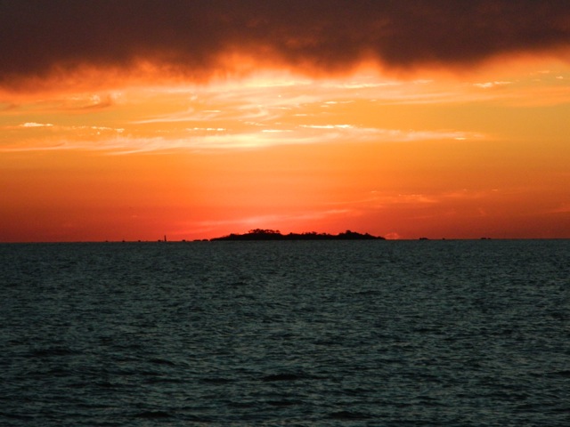
After a night’s sleep in the heat, I woke to the these views outside my room.

wpid-dscn2840-2013-07-18-14-29.jpg

Then back to the main building for breakfast…

wpid-dscn2841-2013-07-18-14-29.jpg

After breakfast we were taken back out on the water…

wpid-dscn2845-2013-07-18-14-29.jpg

To look at some of the wildlife again… I put some of the features of the camera I’d bought in Pucón, Chile to good use – the 21x zoom and close up mode. This Caiman’s head is only as long as my hand.

wpid-dscn2861-2013-07-18-14-29.jpg

We then settled in for a spot of Piranha fishing and between the six of us managed to catch four. Not as awesome as I’d hoped but some is better than none.

wpid-dscn2873-2013-07-18-14-29.jpg

We then headed back for lunch and as we’d just come ashore, we were alerted to a Yellow Anaconda that had been spotted near the shore. We were gathered around to look at it when one of the locals walked up in his bare feet and in one swift movement grabbed the snake just behind the head and dragged it onto the land. The Anaconda wasn’t happy and tried to slither back to the river but the local held it by the tail pulling it back so we could get photos.

wpid-dscn2874-2013-07-18-14-29.jpg

After a while it was released and slithered back to the water where it just sat there showing off. This snake is only 4 metres long and is as thick as my arm at its thickest. The largest Yellow Anaconda to ever be measured was just over 5 metres and just under 100kg.

wpid-dscn2876-2013-07-18-14-29.jpg

After lunch, they deep fried our mornings catch. Very tasty. The English group and I were then driven on the back of a truck further along the rocky dirt road towards the Bolivian border. Along the way we spotted a Capybara, the worlds largest rodent. For perspective this one is almost a metre in length. I’d say nose to tail but they have no tail.

wpid-dscn2887-2013-07-18-14-29.jpg

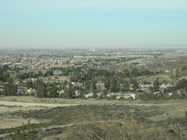
Towards the end of the journey, we drove up into the hills and I could see back towards the Pantanal.

wpid-dscn2889-2013-07-18-14-29.jpg

Overall, while my Pantanal experience was rather short, there isn’t really that much out there in the world’s largest swamp. It turned out to be rather cheap, including 2 nights accommodation, saving the cost of another bus from Campo Grande to the border and several meals. However, for every extra night the price would have skyrocketed. I was yet another adventure in my travels.

Next I’m off into the lower plains of Bolivia, to the city of Santa Cruz.

The Lone Trail Wanderer

Rio de Janeiro, Brazil – Adventures

Rio de Janeiro is Brazil’s second largest city. There’s so much going on in Rio that it’s one of the more interesting and entertaining cities I’ve been to in South America. Rio is nestled among some monolithic hills on the edge of the bay similar to the Glasshouse Mountains on the Sunshine Coast in Queensland, Australia.

wpid-dscn2820-2013-07-8-15-35.jpg

The city is rather spread out with a pair of small national parks nestled within the city. And, unlike elsewhere in South America, there’s a decided lack of dogs in Rio. Which means there’s a lot less dog crap on the streets and that cats reign supreme in the city.

My 24 hour trip to Rio was my longest bus ride to date. Most buses I’ve travelled in have been semi-cama (half bed) – similar to many air line seats – while there have been a handful of full-cama – almost full bed. The bus to Rio was all full-cama and quite comfortable but it didn’t have a food service. This turned out well though as for al meals the bus stopped at buffet restaurants that charge by the kilogram .

When I arrived in Rio, I found it to be the dirtiest city that I’ve been in so far, with graffiti covering the majority of the buildings. It didn’t give me the safest feeling. I quickly caught a taxi to my hostel, which turned out to be a very small place with people jammed into 3 small rooms and very little else. One bathroom for 18 people is just not enough. The hostel was also in a central area of town and not in the more famous beach areas. It was very cheap, so I guess you get what you pay for.

A couple of days later, I did a walking tour around the city to some of the more prominent sites in the central city and Lapa, the famous samba party suburb next to it. The city has many well designed buildings, churches, museums and municipal theatres.

wpid-dscn2709-2013-07-8-15-35.jpg

The cathedral is like no other cathedral I’ve seen.

wpid-dscn2705-2013-07-8-15-35.jpg

It holds 10 thousand and has amazing acoustics. Looking up from the inside…

wpid-dscn2708-2013-07-8-15-35.jpg

Then, from the central city you can look out across the bay to the suburbs on the eastern shore.

wpid-dscn2713-2013-07-8-15-35.jpg

Next, I booked a full city tour, to do some more of the touristy things. It took me to the Lapa Steps built by a Chilean artist…

wpid-dscn2758-2013-07-8-15-35.jpg

… to the Lapa arches, Maracanã stadium before up the mountain to see the most famous of attractions in Rio, Cristo Redentor – Christ the Redeemer.

wpid-dscn2736-2013-07-8-15-35.jpg

The hill it stands on gives great views over one part of the city and the peninsula that ends with Sugarloaf Mountain.

wpid-dscn2746-2013-07-8-15-35.jpg

Lasty, we were delivered to the end of the peninsula and took cable cars up to Sugar Loaf mountain. The views from both mountains are amazing.

wpid-dscn2767-2013-07-8-15-35.jpg

Getting to the top of the monolithic Sugar Loaf is a two step journey, the first up to Morro da RCA then up via the cable car another 1500m to Pão de Açúcar (Sugar Loaf Mountain).

wpid-dscn2784-2013-07-8-15-35.jpg

We stayed up there until sunset and watched the lights of the city appear below us. Definitely a spectacle to be seen.

wpid-dscn2807-2013-07-8-15-35.jpg

After a week in a tiny hostel in the city, it was time to move to the beach, so I booked three nights at a Copacabana beach hostel. On the second day, I hired a bike and rode the length of the busy Copacabana and Ipanema beachs.

wpid-dscn2809-2013-07-8-15-35.jpg

While it’s the middle of winter, it’s a beautiful 27ºC here and the beach has plentiful sun bakers, kite surfers and beach sports. The classic brazilian bikini is everywhere…

Rio de Janeiro has been an awesome experience. It feels more like a group of very different cities all merged in together.

Next I head towards Bolivia, stopping off in the Pantanal, the worlds largest wetlands…

The Lone Trail Wanderer

Iguazú Falls, Argentina and Brazil – Impressions

On the border of Argentina and Brazil are the mighty Iguazú Falls.  One of the seven new wonders of the world, the falls connect a national park in each country. The falls are among the seven largest waterfalls in the world, a third larger than Niagara Falls.

DSCN2572

From the Argentinian township of Puerto Iguazú it’s easy to see both sides of the falls.  The Argentinian side has many wide cascades of water at several levels while the Brazilian side has the Devil’s Throat, a U-shaped section of the falls. Here are details of both with prices correct as at June 2013:

Argentina – Cataratas del Iguazú

The trip from Puerto Iguazú by bus takes about 15 minutes. The Argentinian side is the more expensive of the two parks at $170 pesos (about US$34), but it has the larger tourist area. There are several different walks in the park and a boat tour that takes you up close to the cascades. The boat tour – the Gran Adventura – is fairly expensive at $350 pesos (US$70) but I booked it anyway. Near the booking area I came across some South American Coatí scavenging for food.

DSCN2571

It was raining on the day of my visit, so I bought a cheap rain poncho. After booking the Gran Adventura, I had an hour to kill so went for a walk around the park along a trail creatively named, ‘The Lower Trail’. Because of the rain and an excess of water going over the falls The Upper Trail was closed, which was a shame as it leads across a series of bridges to a platform above the Devil’s Throat.

The lower trail leads down the bank, past many smaller waterfalls to several lookouts with different views of the flatter side of the falls. At one point, the trail gets very close to the cascades where the spray is thick in the air.  Thankfully for the poncho I stayed mainly dry.

DSCN2598

The Gran Adventura begins with a 30 minute safari through the rainforest where a guide introduces several different native trees and I got to see my first ever monkeys in the wild.

DSCN2602

Then we were strapped into the boat and shot off at full force along the river.

DSCN2610

With so much of the thick dirty brown water coming over the falls, the water eddies like crazy and even the big jet boat was thrown around. With the amount of spray coming off the falls it was difficult to get close to the churning water coming down the Devil’s Throat…

DSCN2609

…so we spent more time getting close to and drenched by the cascades section.

DSCN2617

Then it was a crazy ride back along with the river, back into the safari trucks and out of the park.

Brazil – Cataratas do Iguaçu

The trip to the brazilian side of the falls takes about 30 minutes, including a short stop at customs. Because it’s considered a tour, no fees or visas are required.

Brazil’s park is larger overall but with a smaller tourist area. It’s cheaper at $41 Reals ($US21). To get to the viewing platforms, you need to take an internal bus which can drop you off along the way depending on what tour you want to do. They also have  boat tours similar to the Argentinian side.

The park’s main path is slightly shorter than the Argentinian side but has better views, beginning with a view across the river to the cascades section of the falls…

DSCN2634

As you get closer to the Devil’s Throat, the trail zigzags up the wall to a viewing platform right at its side, which provides awesome views of the upper river pouring right down the Devil’s Throat.

DSCN2656

While there was a section also closed because of the height of the water, the views were still amazing.

DSCN2677

With no rain today there were plentiful moths and butterflies about. They will land on everything at a moments notice.  If they weren’t so colourful, they’d be considered pests.

DSCN2687

Overall, the falls are a definite must see. While you can be happy seeing just one side, it’s not hard to see both and well worth the money spent.

Next I’m off to see the wonders of Brazil and Rio De Janeiro.

The Lone Trail Wanderer

Buenos Aires, Argentina – Take 2

After several months travelling around the southern portion of South America I returned to my starting point of Buenos Aires. On my initial visit, I’d only spent 3 days there and hadn’t seen a lot of the city. On my return visit, I stayed 10 days to hang out with a group of locals I’d arranged to meet and to see some of the sights of the city, like the main courthouse.

DSCN2558

On my second visit I staying in the central suburb of Palermo at a hostel chain called Hostel Suites Palermo, which had an above average but nothing to rave about. Palermo is described as an up and coming suburb, but with homeless people living at the end of the block perhaps ‘slowly up and eventually coming’ is closer to the mark.

Buenos Aires has 3 million people and is quite spread out. Because of its size and with the lack of national parks in the province, walking around the city was where most of my exercise came from. One afternoon, I made plans to catch up with a new friend and walked an hour along one of the main streets lined with shops. When I finally got to the meeting point, the shops continued off into the distance.

DSCN2559

The next day, I walked in the opposite direction along the same street.  An hour later I arrived in the city centre and again shops had covered the entire distance and stretched on into the distance.  On my walk I stopped in at El Ateneo Grand Splendid, the bookstore to end all bookstores, an old theatre that had been converted into a book store. It’s the most famous bookstore in Argentina but has very few books in english.

wpid-dscn2555-2013-06-29-09-34.jpg

Near the centre of town is a large group of parks and on the next sunny day I wandered around a pond full of geese and sat reading on a bench as skaters and cyclists went by.

DSCN2523

On the next day it was forecast to rain, so together with a girl I’d met at the hostel, we checked out some of the more cultural features of the city centre, several monuments which we called ‘boob monuments’, as they all contained carvings of topless women.  Then when it began to rain, we looked around several museums and galleries in the area.

DSCN2520

With Uruguay on the far side of aptly named Rio Uruguay, I caught a ferry across to Colonia on the next sunny day to tick that country off my travel list.

Overall, Buenos Aires felt different to my previous visit. But during that earlier I’d been suffering culture shock. The ever-present doggie doo was still a major problem in Buenos Aires. I did see a handful of people pick up after their mutt only to find the bags of doggie doo left in the middle of the footpath. Progress is slow…

Next I headed to my final Argentinian destination, Puerto Iguazú and the country’s other major attraction, Iguazú Falls.

The Lone Trail Wanderer

Colonia, Uruguay – Impressions

Uruguay’s full name is ‘The Oriental Republic of Uruguay’, an english translated perversion of the name which actually means ‘The republic east of the Uruguay (river)’.

From Buenos Aires the ferry takes just over an hour to get to the small town of Colonia del Sacramento. It’s a must visit if you’re in Argentina’s capital for a few days. Although the trip can be a little expensive, about US$75 return, half of that for border taxes.

ferry-ride-buenos-aires-colonia

After a mad dash across Buenos Aires in a taxi, I made the ferry with about 30 minutes to spare and once through customs and onboard the catamaran, I promptly went for a nap for the hour and ten minutes it took to cross.

Compared to the madly bustling metropolis that is Buenos Aires, Colonia is small, quaint and tranquil. Much of the 500-year-old original town is still there with its original cobblestone roads and buildings.

wpid-dscn2528-2013-06-21-19-04.jpg

As part of the ferry booking there was a walking tour around the original township, nestled at the end of the peninsula. We walked to what was left of the wall that had separated the town during the War of Independence. The wall is now only about 30 metres long with a single gate and drawbridge, the rest having been removed. As a welcome there was a white-faced mime standing on a boulder just on the inside of the gate.

wpid-dscn2524-2013-06-21-19-04.jpg

Many of the old buildings have survived through the years and are protected by the government. Some of the buildings weren’t so lucky and have had new buildings built within their old structures…

DSCN2530

Other buildings have been refurbished and converted to other uses, in this case a restaurant…

DSCN2541

After the tour, I went to find something to eat and found a restaurant where a singer could be heard inside. Outside, there were three old cars that had been converted to other uses… this one into a two-seater table for the restaurant. The other behind has a garden growing in it.

DSCN2536

The restaurant was lovely as was the entertainment and they gave the prices for the meal in US dollars, Argentinian pesos and Uruguayan pesos, but it was expensive unless you’re actually paying in US dollars.

After lunch, I walked around the township enjoying the quiet. I stopped at an ATM in hope of getting some US dollars but it had run out.  Many people come to Uruguay from Argentina to get US dollars to sell on the black market, sometimes for twice its value. I was unlucky, they’d run out by the time I’d got there. Later I headed to the bay to watch the sunset. Just to the left of the island, the buildings of downtown Buenos Aires can just be made out.

DSCN2553

The trip back across the bay was uneventful and at approximately 10pm local time, I arrived back in Buenos Aires.

This was my only trip into Uruguay. After a couple of more days in Buenos Aires, I traveled north by bus to my final destination in Argentina, Puerto Iguazú – one of the 4 largest waterfalls in the world and home of the Devil’s Throat, Iguazú Falls.

The Lone Country Hopping Trail Wanderer

Parque Nacional Quebrada del Condorito

About 2 hours by bus south-west of Córdoba is the small Condor Gorge National Park. There is no formal transport to the National Park, you simply book a ticket to the nearby town and ensure the driver drops you off on the way.

wpid-dscn2495-2013-06-20-17-24.jpg

Córdoba province is at the northern ‘dry’ end of Argentina. Most of the upper regions are desertlike pampas, not sandy like the Sahara desert, but arid dry plains much like the Australian Outback just not as red.

After my two hour bus ride, I walked beyond the national park sign and along a dirt road between two private properties until it finally opened out into rocky rolling hills. After 10 minutes I arrived at the registration building and signed the book to say I was in the park.

There’s only one main natural attraction in the small national park, the gorge. It’s about 2 hours walk (according to the admin staff) to the southern lookout. You can continue down to the river and up the other side to the northern lookout, but that’s about it.

So, I set out from the the administration building and headed up the road a little further until the sign sent me onto a rocky trail heading up a gradual hill.

wpid-dscn2498-2013-06-20-17-24.jpg

I was told there are markers every 15 minutes on the way towards the southern lookout, but it only took me 10 minutes to reach each one, so I guess the markers are for the family groups and slower walkers.

wpid-dscn2503-2013-06-20-17-24.jpg

About 30 minutes in I reached the top of a cliff and looked down across the hazy pampas to the lake and the small villages scattered below. Then, as I began walking again, a condor swept up and floated on the air currents not 2 metres above.

wpid-dscn2501-2013-06-20-17-24.jpg

10 minutes later and I came to a sign warning me about Pumas and snakes. This actually gave me the sense that I was walking in Australia again with its dangerous wildlife. It’s like living on the edge!

Half an hour later I arrived at a split in the trail, to the left it headed to the southern lookout, to the right down to the river and up the other side. I took the left track and climbed down the side of the cliff a little to where the lookout was. I stopped there for lunch looking down on the gorge below and the small river running through it.

wpid-dscn2507-2013-06-20-17-24.jpg

The walk so far hadn’t been terribly hard, although it was rather hot in the sun with no trees for shelter. After lunch, I headed back to where the trail split and took the other route, following it until it began heading fairly steeply down into the gorge. It’s about a 500 metre climb down to the river, but it didn’t take me long and eventually I came out to the bridge and crossed to the other side.

wpid-dscn2517-2013-06-20-17-24.jpg

With the hard part to go, I paused under the bridge for a few minutes before starting back up the hill. It took me a fair amount longer to get back up the side of the gorge because of the constant climbing, but after a couple of rests along the way I did eventually make it and headed back across the rolling hills to the administration. Just as I left the admin building, I saw a bus go by on the road in the distance and knowing that they only go past every hour, I slowed my pace. After waiting almost another hour and unsuccessfully flagging down 3 other buses, one did stop for me and I was whisked back off to Córdoba.

Overall, it was nice to get back out on the trail after a couple of weeks wining and dining in Mendoza. It was great walking on a hot trail again like I used to in Australia and definitely different to the last few months hiking around the cold south.

With my next stop being Buenos Aires, and with the lack of National Parks in the capital province, I will try to walk as much as I can around the city.

The Lone Trail Wanderer

Córdoba, Argentina – Impressions

Córdoba is the city in the centre of northern Argentina. It’s the capital of Córdoba province and is the second largest city in Argentina.

After a short 12-hour bus ride from Mendoza, I arrived in the late afternoon and was promptly upgraded from a dorm to a private room by the owner. Thanks to both Turning Point Hostel and quiet season! The hostel had many outdoor areas, as much of the northern Pampas region of Argentina is desert, and had several travel inspired murals on its walls.

wpid-dscn2483-2013-06-14-18-05.jpg

Córdoba is a large city and while it was more bustling than quaint Mendoza, it was quieter than hefty Buenos Aires.  A walk around the central city streets found a city full of churches and old architecture…

wpid-dscn2488-2013-06-14-18-05.jpg

And more…

wpid-dscn2482-2013-06-14-18-05.jpg

But the further afield you walk, the more interesting the buildings become…

wpid-dscn2480-2013-06-14-18-05.jpg

Every Saturday and Sunday evening in one particular set of streets is a fair, with a massive array of stalls strewn everywhere. It’s insanely popular, meaning the place was utterly crowded and has stalls selling all of the usual home-made market style goods.

Lastly, I took a bus out into the country to Parque Nacional Quebrada del Condorito for a day hike in Condor Gorge.

DSCN2517

After Córdoba, I returned to the country’s big smoke, Buenos Aires, to take another look at the city I’d begun my journey in 3 months earlier.

Things to do in Córdoba:

  • Visit Jesuit temples
  • Hang out in Sarmiento Park
  • Catch a bus out to Parque Nacional Quebrada de Condorito

The Lone Trail Wanderer

Mendoza, Argentina – Adventures

My bus trip from Bariloche took 19 hours. For such a long trip there are two different seat types on the bus: semi-cama, similar to airplane seats, and cama, which means ‘bed’ in spanish. For the overnight trip I went for the more comfortable cama seats, although while better than the semi-cama was nothing like a bed.  Comfortable as it was, I only got half a night’s sleep I arrived in the desert city famous for its wine.

Mendoza is a city of 850,000 people and my hostel, Hostel Lao, was a few blocks from the bustling city centre. After spending so much time in Patagonia, with its small towns and cities, to come to a big city bustling with people was a shock to the system. But once I got used to it, the jewel that was Mendoza began to sparkle.

DSCN2460

Still exhausted from my bus trip, I went out clubbing with a group from the hostel until 6am. The night life of Mendoza on a Friday night was certainly good, although beyond the smelly fact that smoking is allowed in their clubs, there were few issues for our little group of ‘gringos’ and an awesome night was had.

After spending Saturday quietly recovering, on the Sunday a small group of us headed out to Auga Termas. 45 minutes from the centre of town, the thermal hot pools were set in a beautiful location, hidden in a gorge between rocky ridges…

wpid-dscn2443-2013-06-9-18-32.jpg

There were many different pools of varying temperatures. Inside, there was a mud pool where you cover yourself, let yourself dry before washing it off in the blast showers. Included in our visit was a huge buffet lunch, Argentinian style. We ate and ate then enjoyed a couple of bottles of fine Mendoza wine outside in the sun, before heading back to the pools. Before we left, three of us had full body massages. A fantastic day.

A couple of days later I moved to Hostel Mora, a cheaper hostel just around the corner. While Hostel Lao was supposed to be the best hostel in Mendoza if not the continent, in my opinion, Hostel Mora did it better. Pretty much all hostels in Mendoza offer a free glass of wine each night, while Hostel Lao offered it five nights a week, on arrival Hostel Mora opened this 4.75 litre bottle of Malbec…

wpid-dscn2450-2013-06-9-18-32.jpg

The weather in Mendoza was brilliantly sunny. It is the desert after all and after 3 months in the colder south, it was nice to feel warm again.

DSCN2448

On the western side of the city is the massive Parque General San Martin and on the far side, another 45 minutes walk, is Cerro de la Gloria.  After a rough ten minute climb I made it to the top for good if not a little hazy views across the city. All trees in Mendoza are hand planted and watered using an irrigation system based on the snow melts of the Andes.

DSCN2456

You can’t come to Mendoza without going on a wine tour. Some choose to be driven around but for the keen, bikes can be hired for next to nothing and a self-guided tour done.

DSCN2462

I’ve been particularly enjoying the Malbec, a type of red wine that is very popular in Argentina. Riding bikes around the roads of the wineries after many glasses sounds dangerous, but it was actually rather refreshing. So too was sitting at the bodegas drinking wine and enjoying the view…

DSCN2467

After eight days in Mendoza it was hard to say goodbye. I had such a fun time, drank an awful lot of wine and met some great people from all over the world.

Things to do in Mendoza:

  • Walk through Parque General San Martin
  • Climb the towering Aconcagua, highest mountain in The Americas
  • Cycle a wine tour around Maipu wine region
  • Cycle a wine tour around Luján de Cujo region
  • Visit one of the other 12 wine regions
  • Explore Witches Cave
  • Have a steak dinner in the city

Next I bused to Córdoba, the city at the centre of Argentina.

The Wine Cycling Trail Wanderer.

El Bolsón, Argentina – Impressions

For my final stop in Patagonia I caught a bus 100km south of Bariloche to the small town of El Bolsón.

El Bolsón is known in Argentina for the typical Patagonian trekking and mountaineering experience, fly fishing, art, its regular markets, micro-breweries and for being a hippie town. The label of hippie town was what caught my attention and is the tag line that draws most other travellers to the town.

wpid-dscn2439-2013-05-21-15-401.jpg

I only spent a couple of days in El Bolsón and while it did seem like a nice small community in a great location, I didn’t find a lot to actually make it a hippy town. The sculptures in and around the town centre were pretty cool, but the markets were fairly typical selling many of the usuals: home-made jewellery, carved wooden things, sewn items and a myriad of different semi precious stones.

wpid-dscn2432-2013-05-21-15-401.jpg

El Bolsón sits between two great rocky ridges, a 2km tall range that got a powdering of snow on my second day…

wpid-dscn2438-2013-05-21-15-401.jpg

…and one 1,600m tall range. The trekking did look amazing but El Bolsón is in Patagonia. But since my visit was during a rainy last week of autumn, I hadn’t planned to go hiking.

wpid-dscn2434-2013-05-21-15-401.jpg

While my visit to El Bolsón was inexpensive and relaxing, with winter arriving, it was time to head to warmer climates.  After a brief stop off back in Bariloche, I headed north into the desert to the wine region of Mendoza.

Some things to do in El Bolsón:

  • Kayak Lago Puelo
  • Hike Cerro Piltriquitrón
  • Walk up to Cabezo del Indio – Indian Head Rock

The Lone Trail Wanderer

Cerro Catedral, Parque Nacional Nahuel Huapi, Argentina

After a week studying español in Bariloche it’s time to get back out on the trail. This weekend, myself and a companion from my hostel are planning to climb Cerro Catedral (yes it’s spelt correctly) to Refugio Frey, where we plan to stay the night and do some day walking around the lakes.

wpid-dscn2359-2013-05-20-15-28.jpg

Our original plan was to do a 3-day hike, walking on to the refugio after Frey, but the amount of ice on the higher trails meant the climb beyond Refugio Frey would be too dangerous.

We packed and caught the bus for the 20km trip to the township of Catedral, a town set up for the ski slopes above it. The weather was beautifully clear when we headed out and remained that way for the entire weekend. A rare weekend for this time of the year in Bariloche and perfect for the hike.

We headed out along a wide dirt road away from the huge car park for the ski fields. After a short walk, we left the road and walked up a short thin trail to the official beginning of the trail and a wooden hiker…

wpid-dscn2358-2013-05-20-15-28.jpg

The first part of the hike meandered south along the base of the rocky edifice of Catedral Norte, heading away from the chair lifts and the ski fields.

wpid-dscn2366-2013-05-20-15-28.jpg

Along some parts of the trail sat snow from an earlier snowfall, although much of it had melted leaving a thin layer of mud.

wpid-dscn2365-2013-05-20-15-28.jpg

The trail continued on its fairly flat way across the southern base of the mountains heading towards Lago Gutiérrez…

wpid-dscn2371-2013-05-20-15-28.jpg

The trail crossed many small arroyos flowing down from the mountain, many flowed beneath a layer of ice. This created some very beautiful natural icy sculptures.

wpid-dscn2364-2013-05-20-15-28.jpg

The trail rounded the base of the mountains, with a clear view of the lago as we headed west up the gully towards the refugio. The trail became icy as we walked and we had to watch our steps to ensure we didn’t slip off the path. There were sections of the trail that looked like normal dirt but you could occasionally put your foot right through it leaving a 10 cm deep hole. Ice forms in layers beneath the mud, pushing it up and making it fragile. Some places it was obvious, but other places you didn’t know it was there until your foot went through it. Beneath the ice was more dirt, so it wasn’t dangerous, just strange to walk through the icy mud. The ice itself hardens into layers of hexagonal rods about 3cm thick, and there always seemed to be three layers of the ice.

Walking through a cold forest gully, we avoided as much ice as possible. The climbing began across some muddy tracks until we came to a flattened areas where an emergency hut had been built under a massive boulder. The boulder slants down making the inside back wall of the hut. Inside there is a flat platform to sleep perhaps 3 people and a fireplace.

wpid-dscn2381-2013-05-20-15-28.jpg

With the light starting to fade, we pushed on along the gully, sighting the roofs of buildings at the top. As we walked, the top of the Cerro Catedral range could be seen off to our right with a light dashing of snow around its jagged peaks. We continued climbing up through some slippery mud until we came over the crest and crossed an icy arroyo to see the refugio ahead of us.

wpid-dscn2391-2013-05-20-15-28.jpg

Refugio Frey is expensive to stay in and provides little more than a mattress upstairs and no heating. We cook our food in a tucked away corner and settle in for the night with several other people including 3 young and rather noisy preteen boys.

It wasn’t too cold for most of the night, but as it headed towards day break it began to grow a little colder. I arose just before sunrise and headed outside with camera to catch the sun upon the mountains at the back of the valley beyond the frozen laguna. I watched the sun shine pink on the mountains opposite before lighting them up in a golden light.

wpid-dscn2396-2013-05-20-15-28.jpg

We decided to climb the wall of the valley to Laguna Schmoll. To get to the other end of the valley we decided to walk across the frozen lake. This was rather fun as it was fairly solid. The children at the refugio got out on their ice skates and stayed there for much of the day. At the far side of the laguna is the arroyo that feeds it, we walked across the ice but this wasn’t as solid and I broke through on two separate occasions. Thankfully, my trusty boots are waterproof, so it wasn’t too much of a worry.

The climb up the rocky wall of the valley was fairly easy, although there was snow in several places and some ice. This part could have been climbed with packs, but it was the next part that we weren’t supposed to do without crampons.

wpid-dscn2410-2013-05-20-15-28.jpg

Another pair of hikers had also climbed to the laguna, but they couldn’t speak english and I’m not totally confident with my spanish yet, so I left my companion to chat with them while I investigated this new valley.

wpid-dscn2411-2013-05-20-15-28.jpg

After stopping for lunch, my companion and the two other climbers decided to climb the icy wall without crampons (or packs). I scouted it a little and decided against it and let them go. On the other side of the lower valley is a ridge that leads to another set of peaks. This is sun drenched and has no snow or ice on it, so I decided to climb this instead.

I made my way back down the rocky wall and around the side of the laguna towards the short ridge, with the refugio across the lake.

wpid-dscn2420-2013-05-20-15-28.jpg

Then in the warmth of the sun, I made my way up the side of the ridge. It was an easy climb and standing atop it could see down both valleys. This is the mountain Pico Bara at the end of the ridge…

wpid-dscn2407-2013-05-20-15-28.jpg

The climb up Pico Bara was fairly easy and there were several different ways to climb it. It was a lot of fun, crossing from the back side with some snow, to the sunny side and back again. The views from the top were pretty impressive, both looking back along the valley…

wpid-dscn2429-2013-05-20-15-28.jpg

…and down upon the refugio a couple of hundred metres below.

wpid-dscn2427-2013-05-20-15-28.jpg

After a brief stop in the chilly wind, I headed down again. It didn’t take me very long to reach the bottom, where I met up with my companion and donning our packs we headed off back down the mountain.

The trip down was a lot quicker than the climb, as you can imagine. It had taken us about 4 hours under pack to climb to Refugio Frey and 2 hours and 30 minutes down again. We were really pushing it, but still missed the earlier bus by 15 minutes. We waited another hour over a couple of beers and caught the next bus back to Bariloche for a well deserved shower.

The Trail Wanderer