Southern Alps Crossing – New Zealand – Days 1 to 3

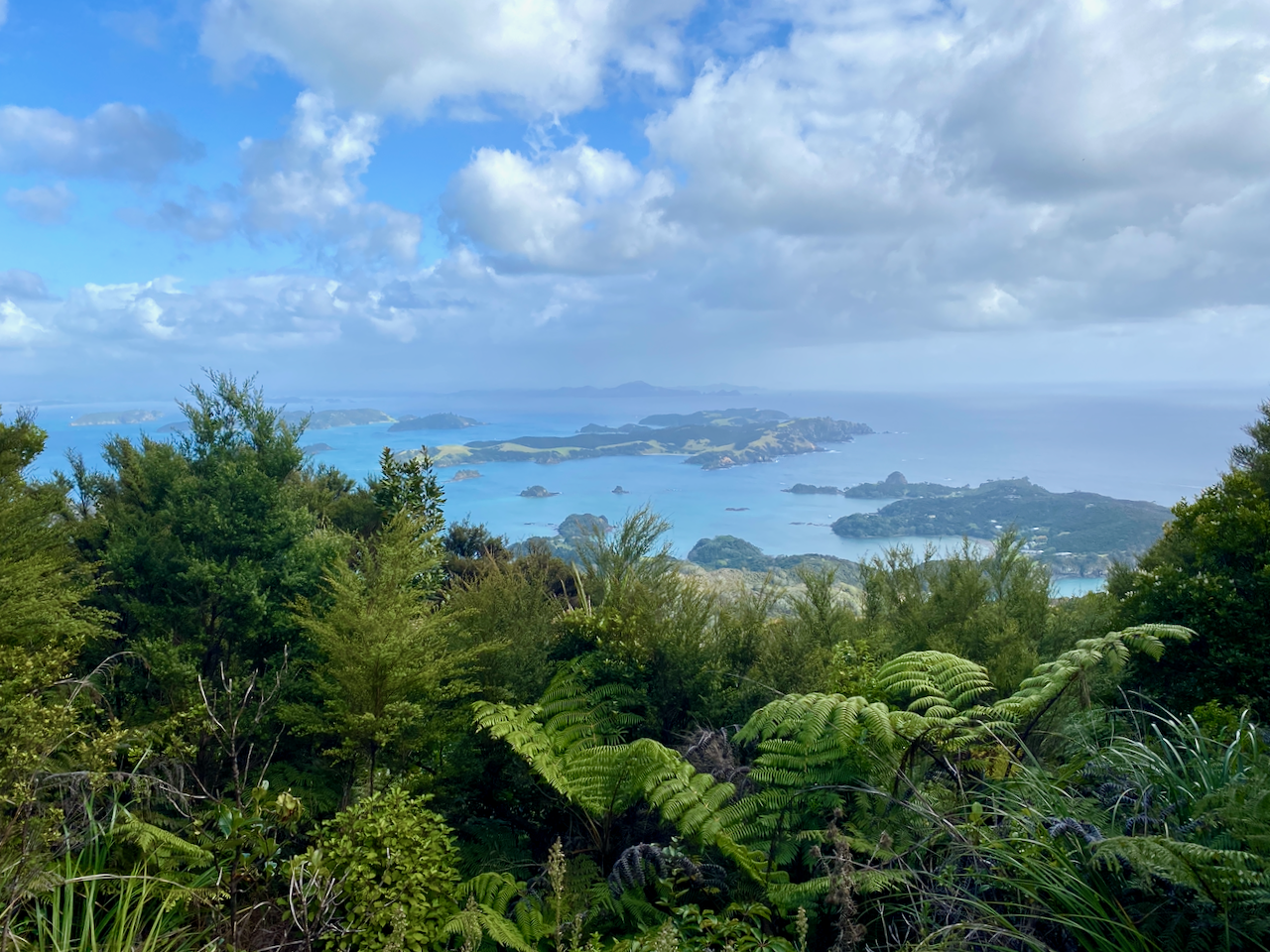
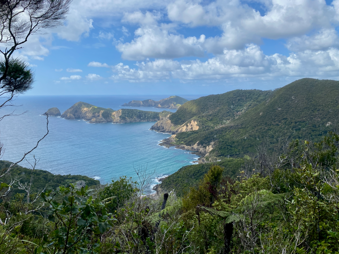
In Late Summer 2023, I set out on a mission to cross New Zealand’s Southern Alps over 13 days.

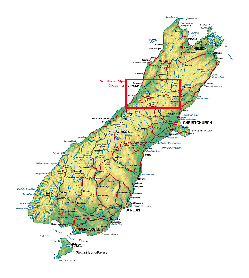
After a summer of fairly consistent rain in the North Island, and plentiful sun in the South Island, I flew to Christchurch, then caught an InterCity bus north to Hanmer Springs, a small mountain town near where I would begin my walk.

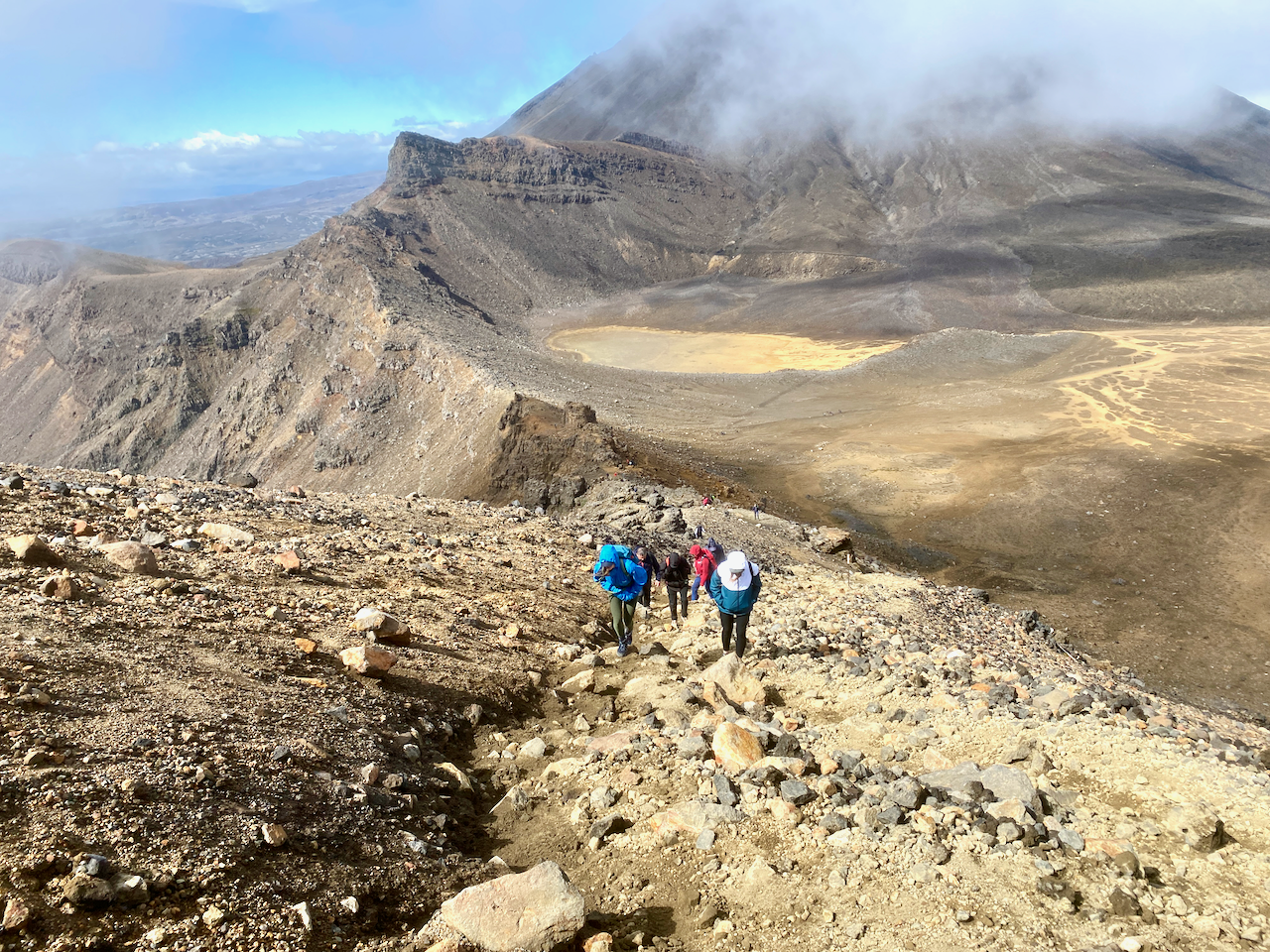
I split the 13 day walk into two parts with a stop in the middle at a village on highway 73. The first 6 days turned out to be easier and busy with walkers, while the second 6 was hard with very few walkers.

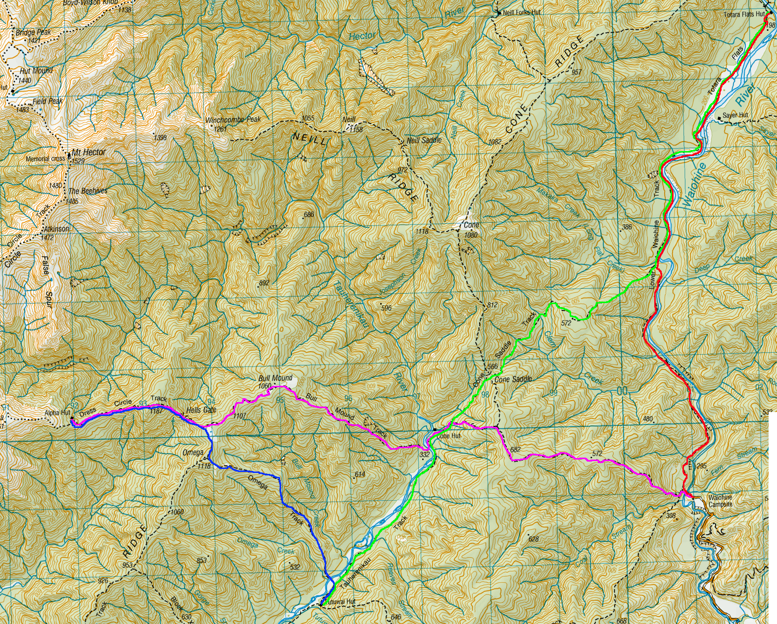
Day 1 – Windy Point to Hope Kiwi Lodge – 17km – 5 hours – Red

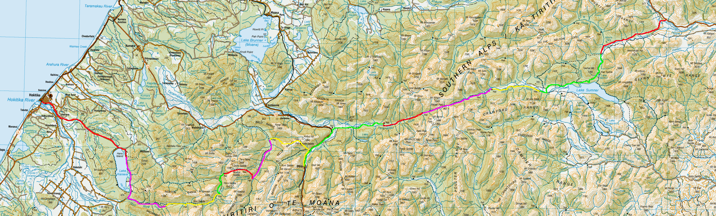
On a hazy morning in Hanmer Springs, I was driven the 45km to Windy Point, the trailhead of my walk. When I arrived, it began to rain, and I hovered in a nearby shelter. When ready to head out, I climbed the steps beside the gate, and walked along a road past some students from a Christian camp.

img_0552-2023-03-10-14-49.png

I skirted past the camp and up a slight hill to a wire bridge and crossed to the mound on the other side, where the trail met the Te Araroa Trail coming south from Boyle Village. I’d only met a handful of TA walkers on other routes to date, but that was about to change.

img_0558-2023-03-10-14-49.png

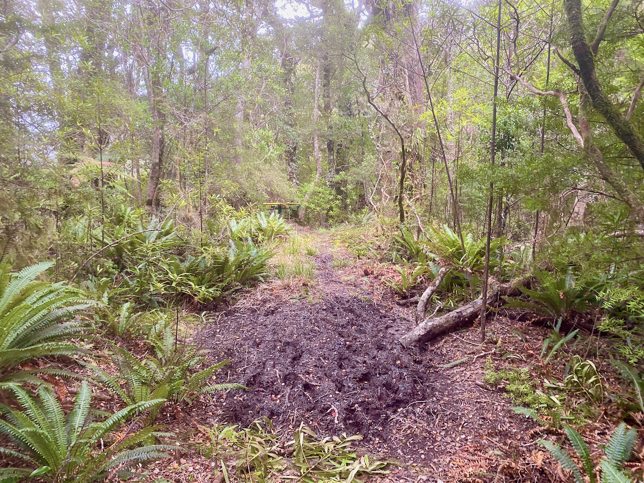
I followed the trail through a wood grove and over the mound as the rain came down heavier. It then stopped for a bit, so I took off my pack and jacket, but it wasn’t long before it began again.

img_0561-2023-03-10-14-49.png

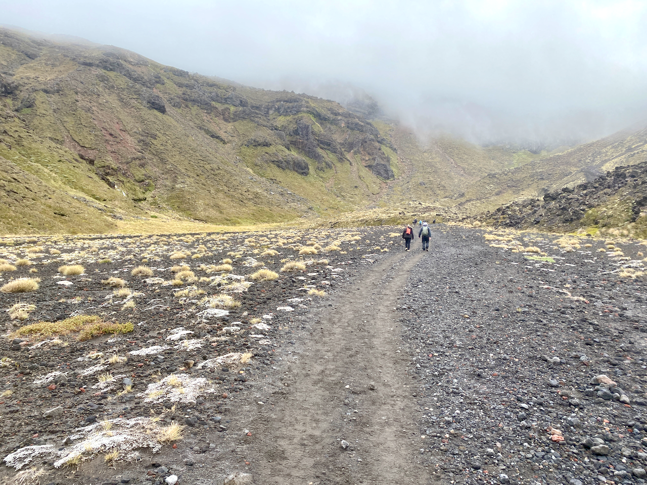
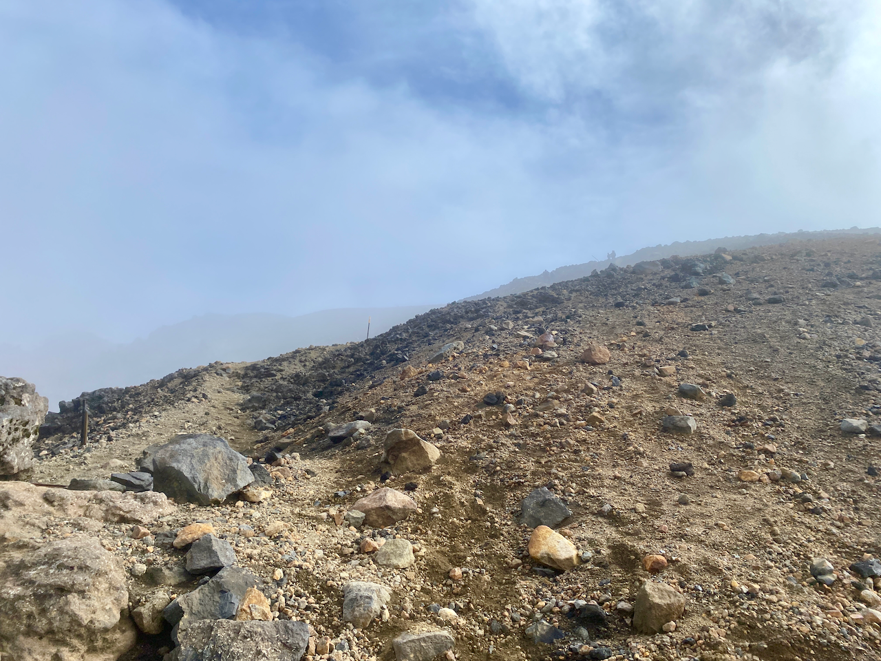
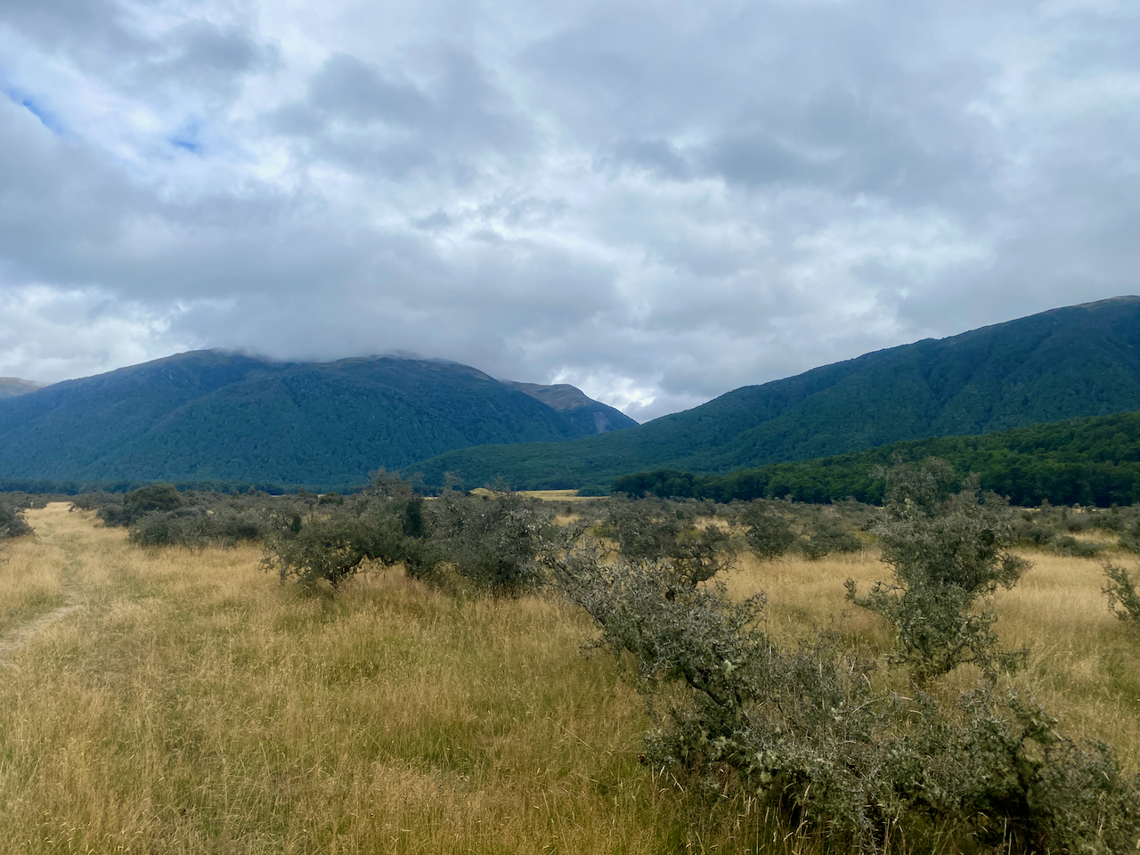
The moderate rain quickly caused my feet to be soaked in my boots, I followed the trail along the upper portion of a flat area 100-150m above the river plain.

img_0566-2023-03-10-14-49.png

The sign at the trailhead had said the Hope Halfway Hut was 2 hours along, but cold and fed up with the rain, I passed the two hour mark with no sign of the Hut. Another hour along, and I finally saw it as I came over a rise. I hustled towards it and inside. It was a fairly nice small hut with no heating. I got out of my wet boots and jacket, and ate some lunch. A pair of fisherman stopped in for a few minutes, before heading off again.

img_0570-2023-03-10-14-49.png

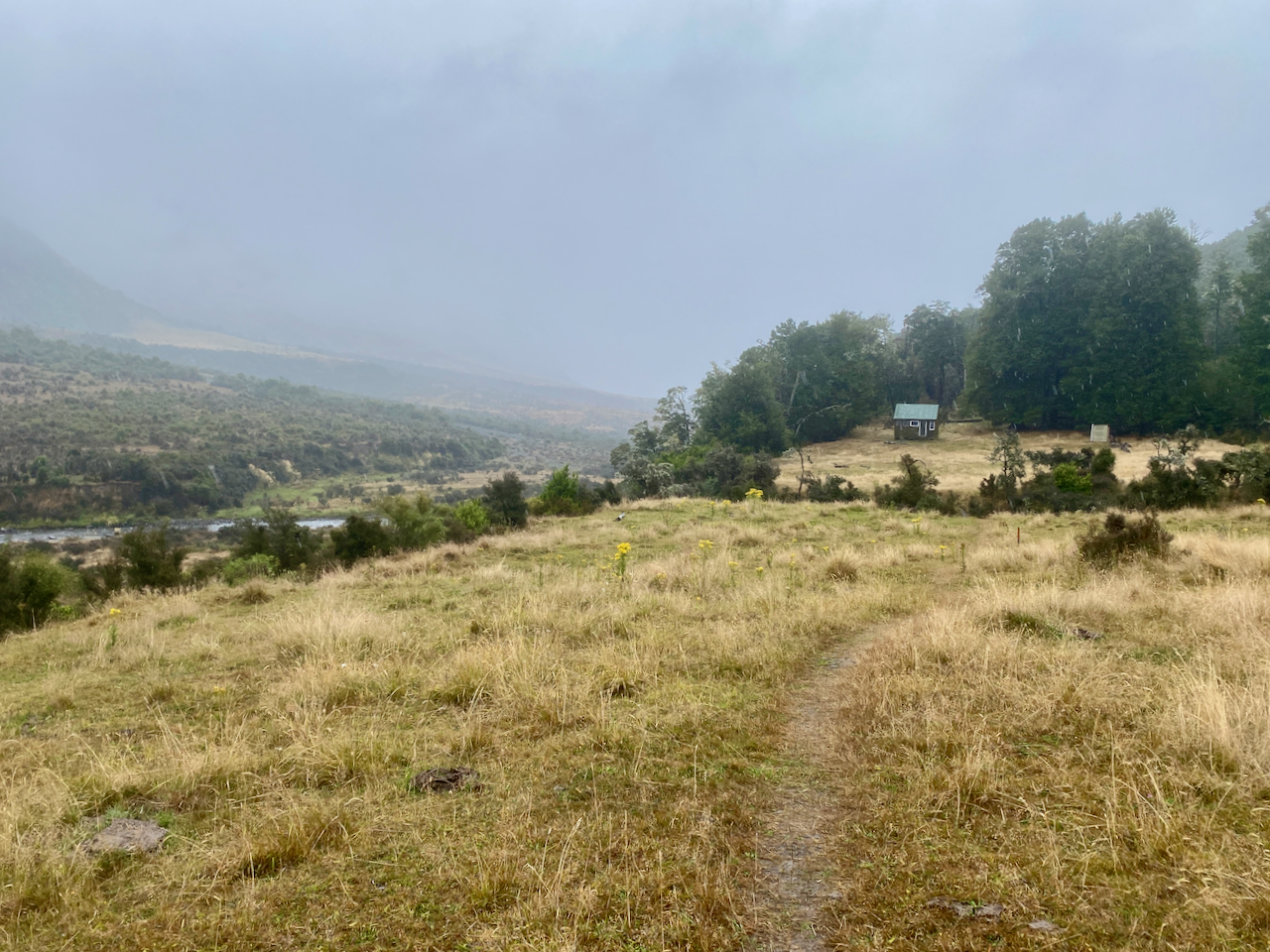
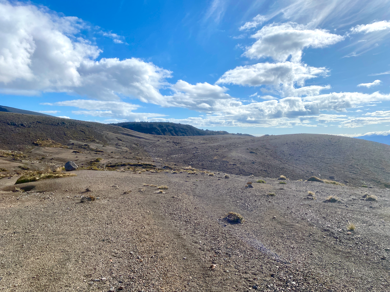
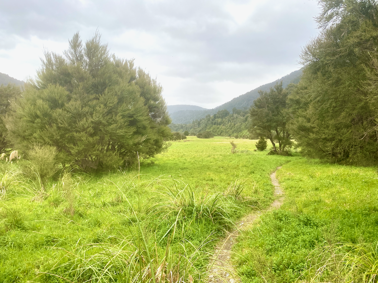
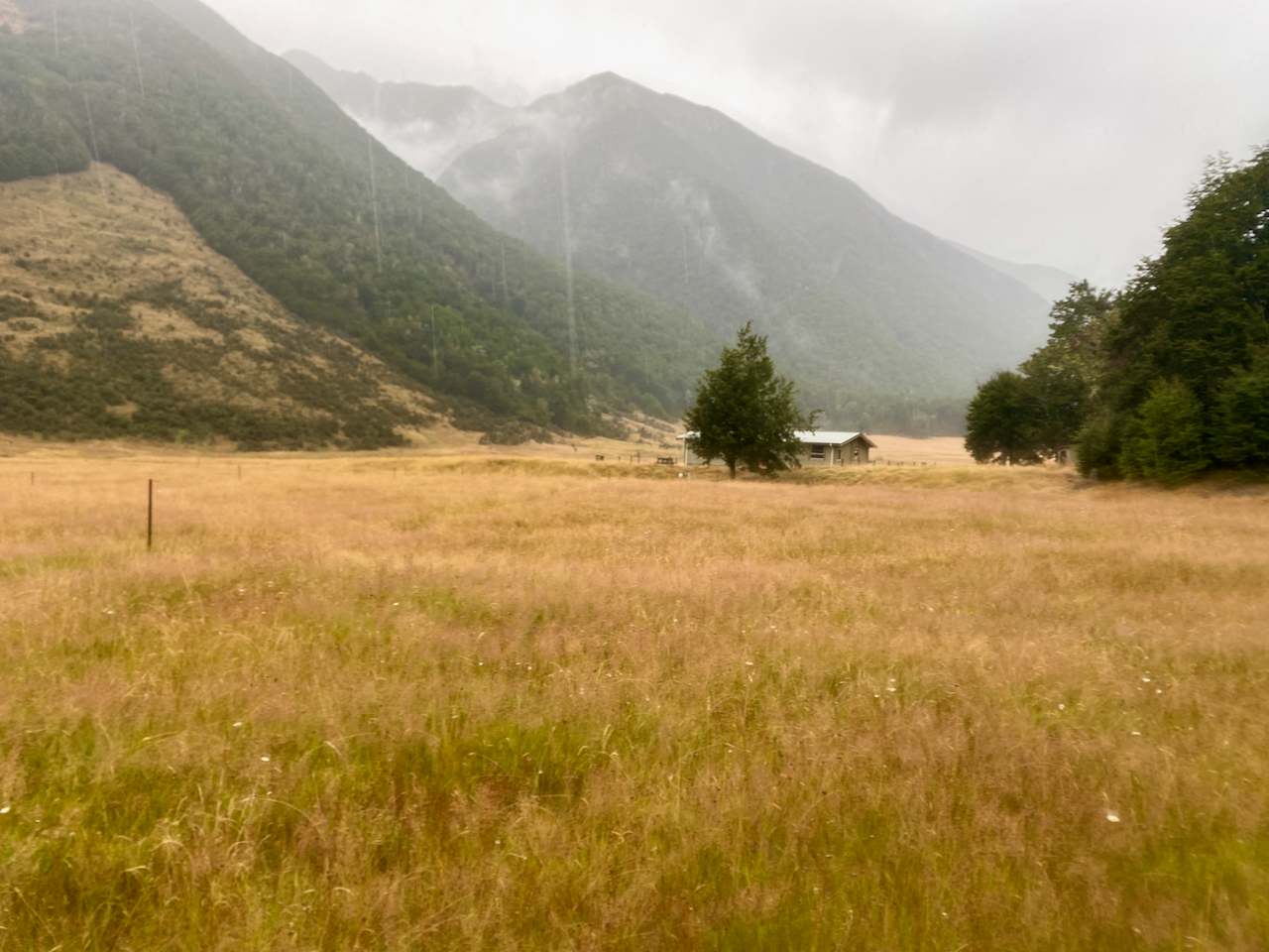
The rain had not let up when I left and the trail headed down onto the river plain covered with yellow grass.

img_0571-2023-03-10-14-49.png

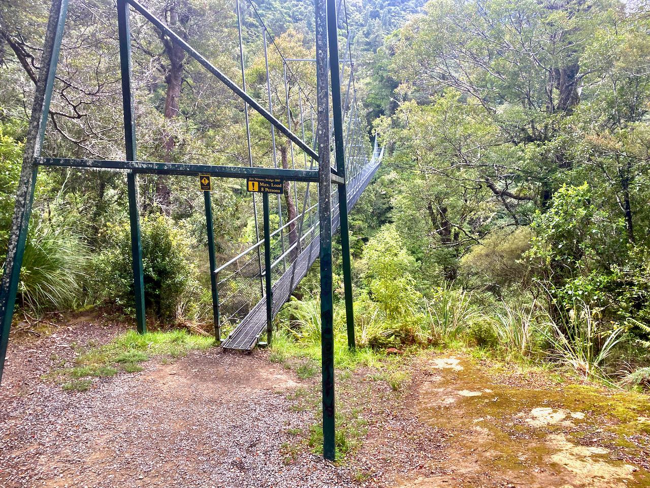
I came down near the river and crossed via another wire bridge.

img_0573-2023-03-10-14-49.png

In many places, the trail running through the grass was filled with water, so I walked along beside it.

img_0577-2023-03-10-14-49.png

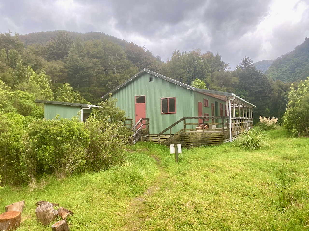
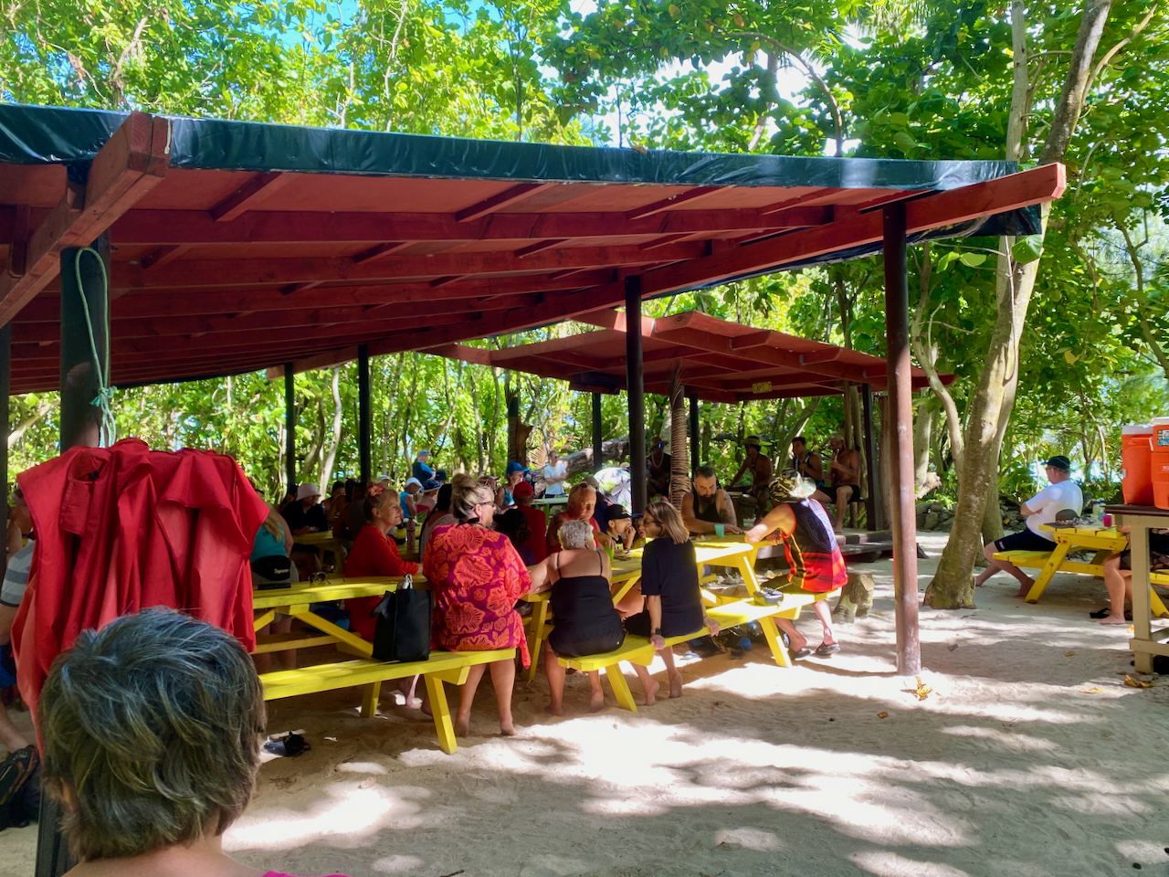
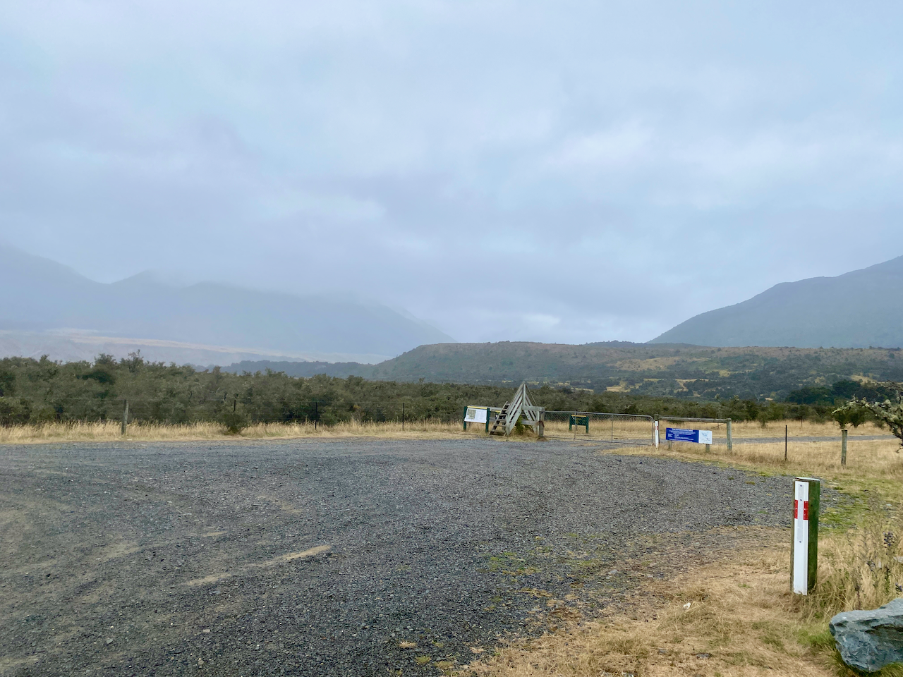
Then I spied the hut at the edge of thick wood. Of course, the trail led me through the woods and when I eventually came out to the hut, I found five people already inside. Two had just chilled for the day in the hut to avoid the rain, while the other 3 had arrived earlier. Thankfully the fire was already lit so I could get out of my wet gear and get it drying. Another 9 people would arrive during the evening. While there was plenty of room, it was my first introduction to a busy hut because of TA walkers.

img_0582-2023-03-10-14-49.png

Day 2 – Hope Kiwi Lodge to Hurunui Hut – 16.1 km – 6 hours – Green

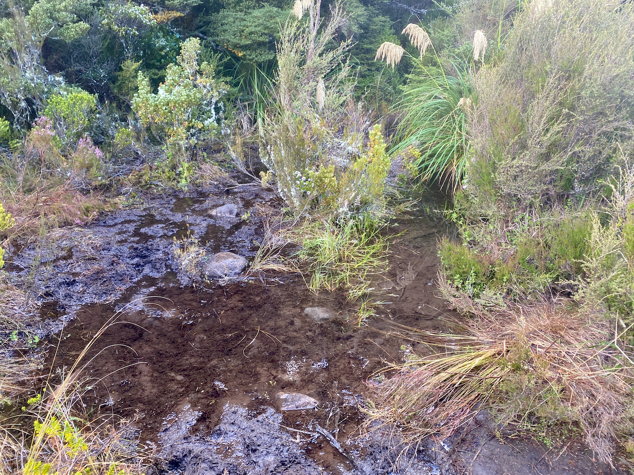
The next morning, while much of my clothes were dry, my boots weren’t entirely. It wouldn’t matter, as while the rain had toned down, it hadn’t stopped. I set out across the grassy fields which stretched into the distance, crossing a deep stream on the way.

img_0587-2023-03-10-14-49.png

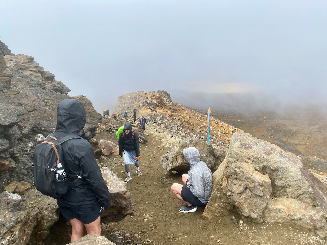
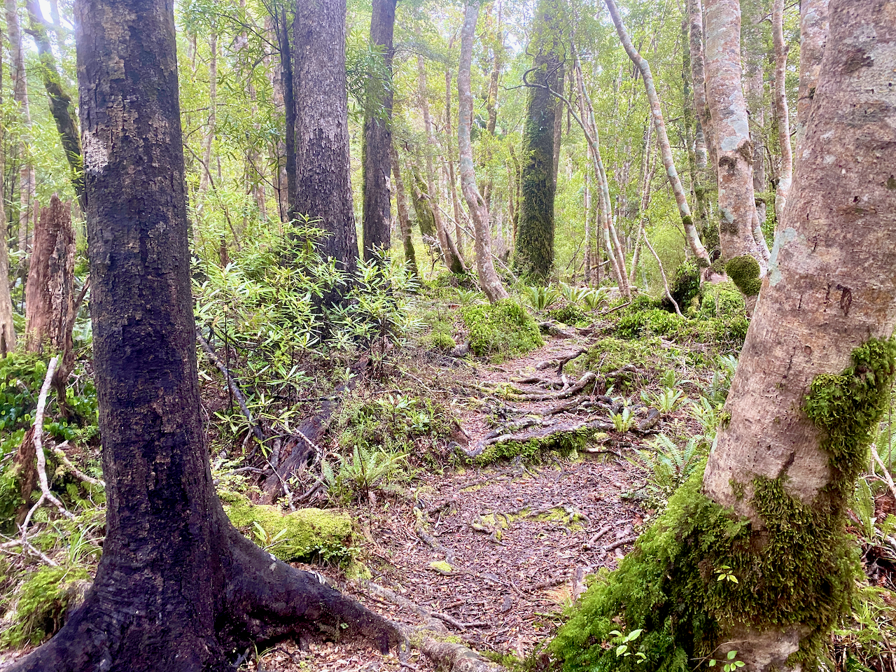
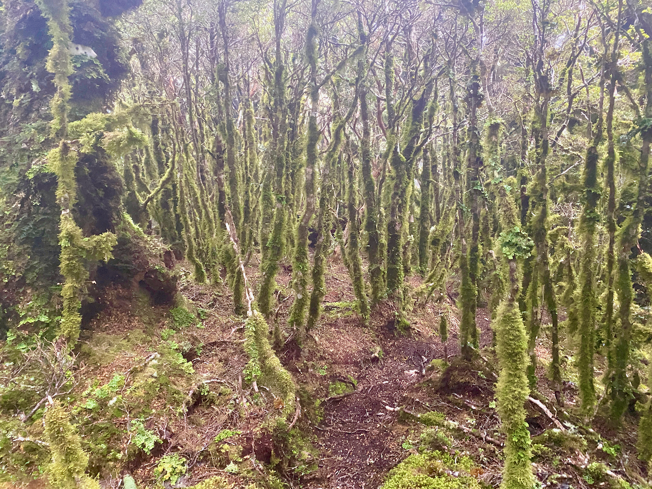
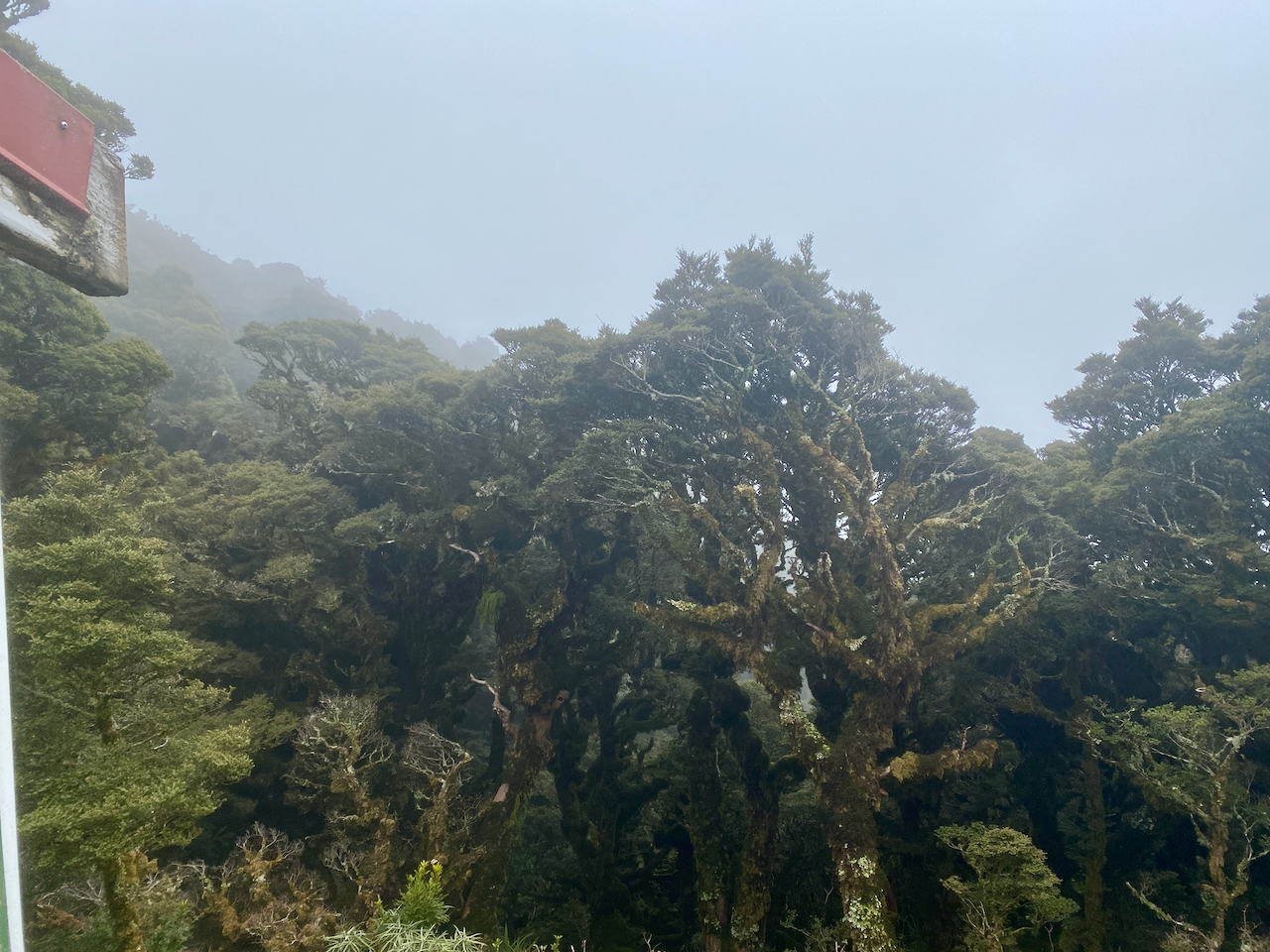
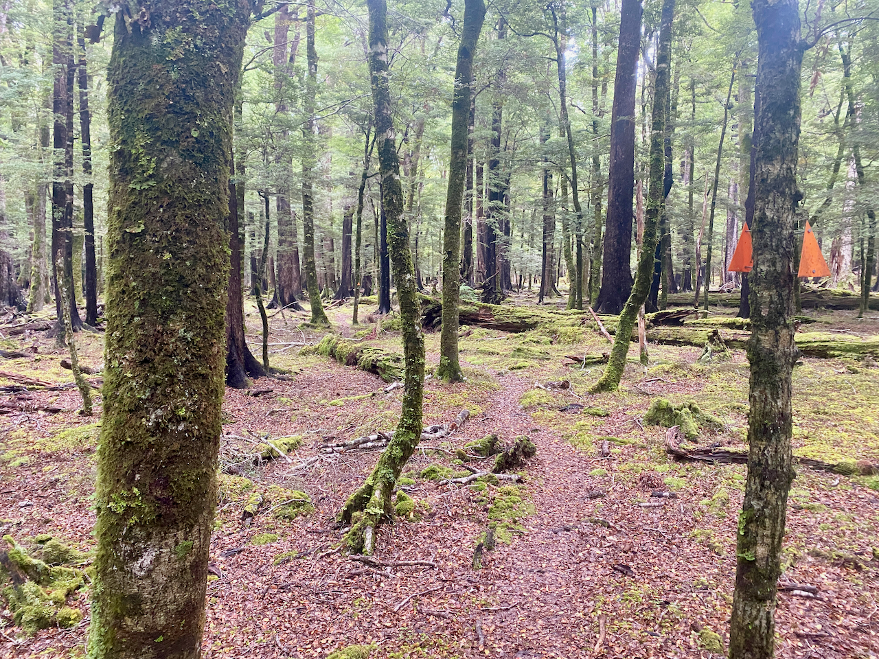
After more than an hour, the trail crashed into the forest and began climbing towards the Kiwi Saddle. For the first somewhat major climb of the walk, it wasn’t intense, and thankfully, the forest blocked much of the rain.

img_0596-2023-03-10-14-49.png

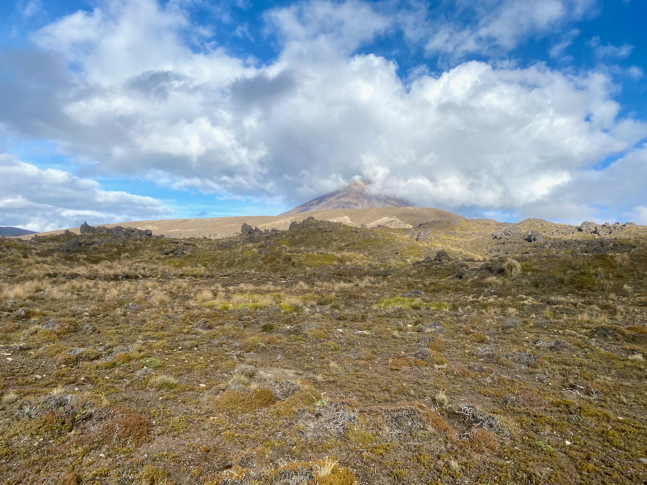
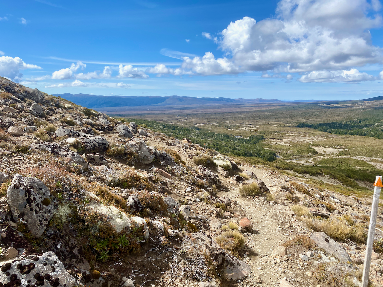
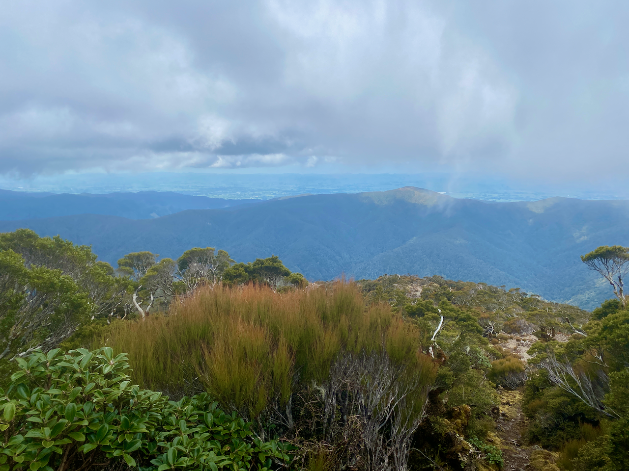
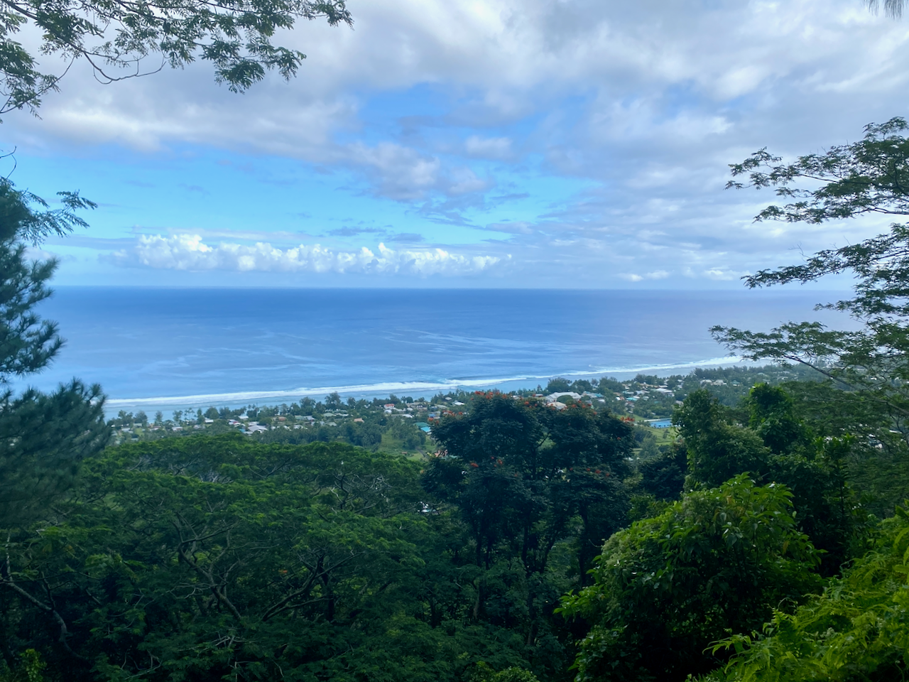
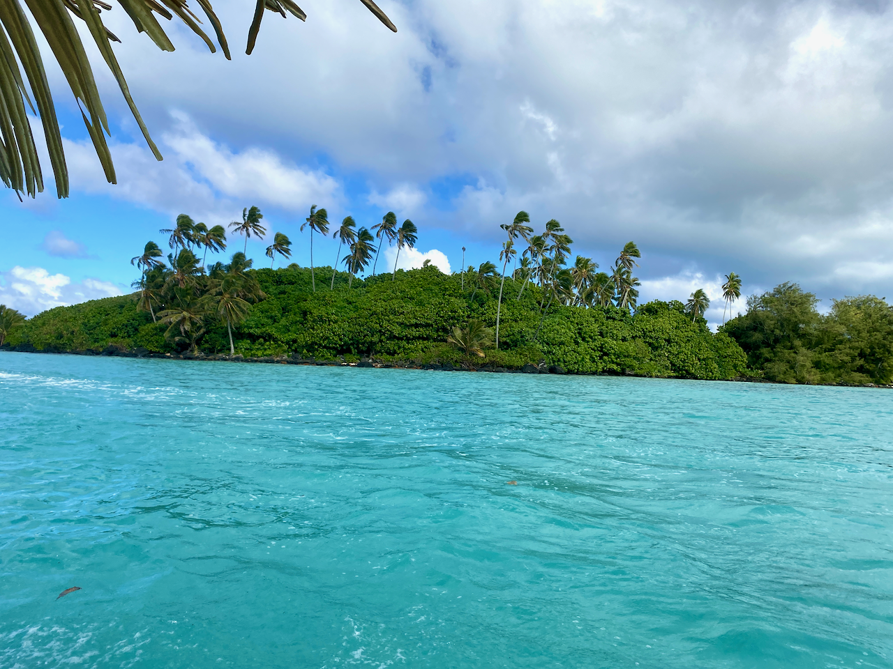
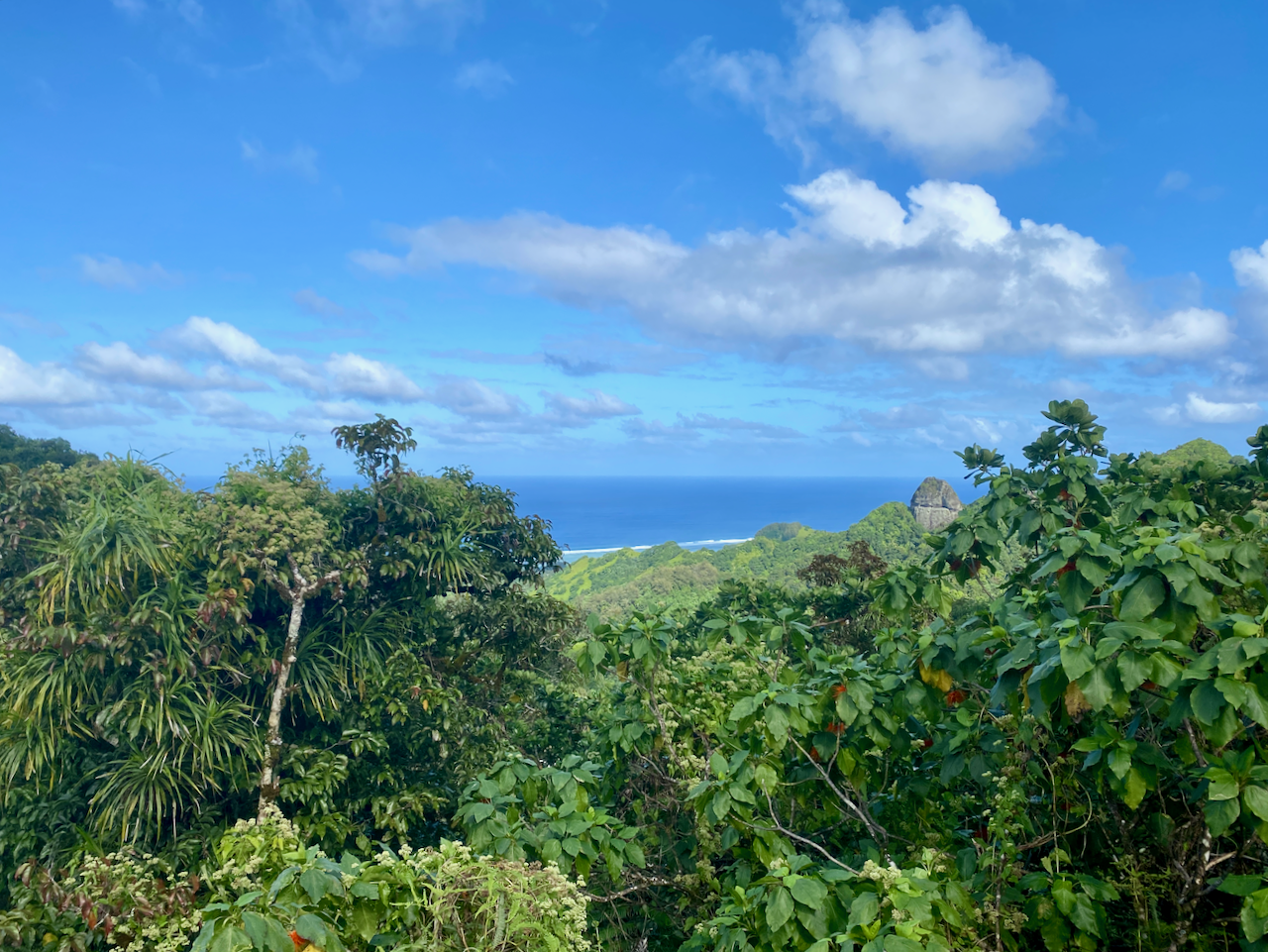
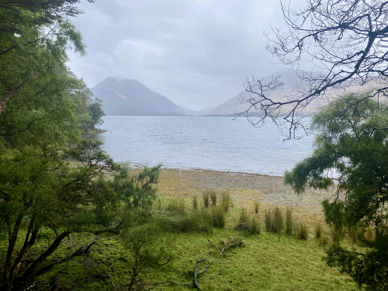
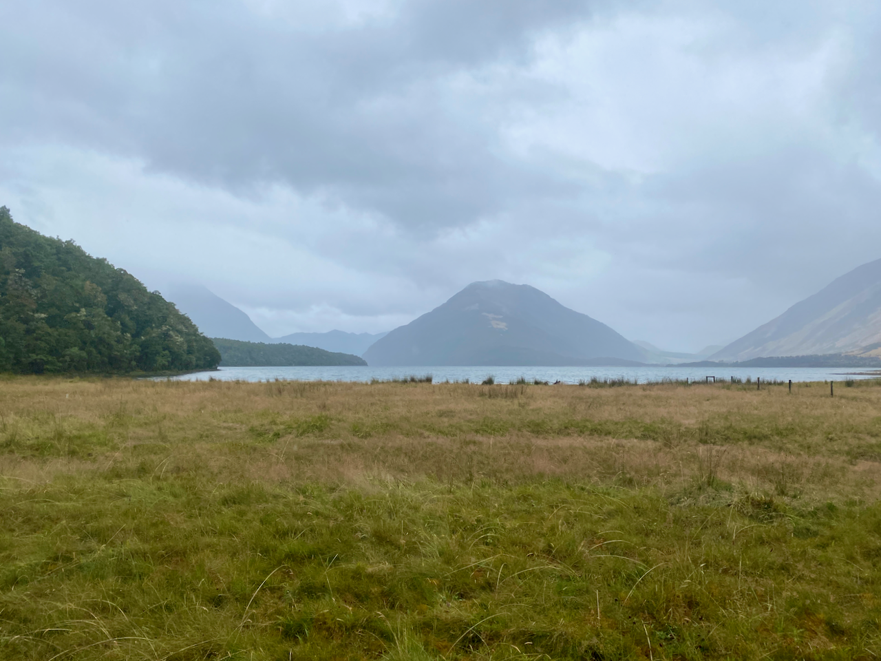
If it wasn’t for a sign, I would have barely noticed the saddle deep in the forest. Near the saddle, another short trail climbed to a lookout where I got my first partial view of Lake Sumner.

img_0603-2023-03-10-14-49.png

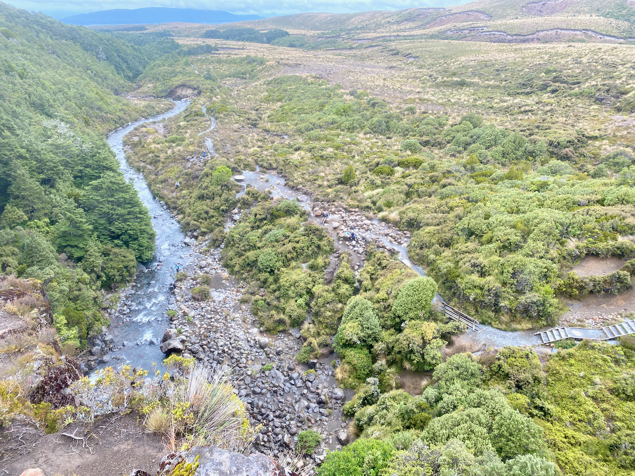
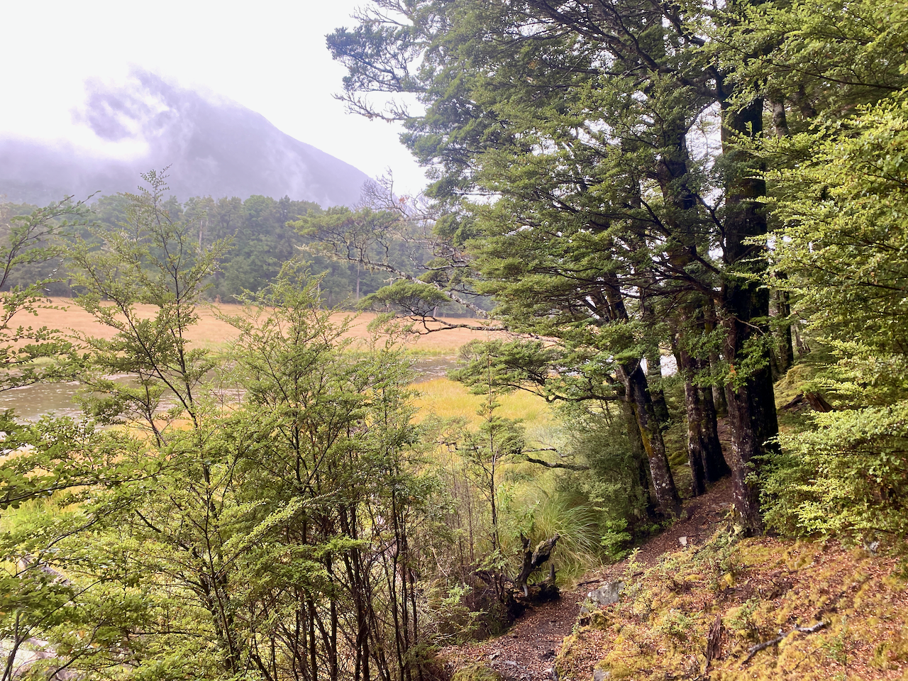
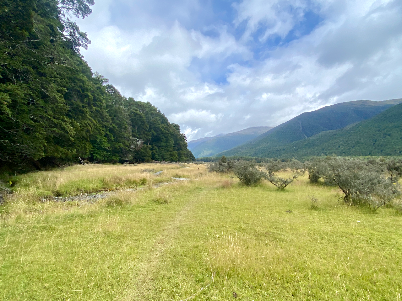
The trail descended and I passed a half dozen people all solo walkers except one couple. The descent was gentle but again with no real view of the lake. I crossed Three Mile Stream on a wire bridge and on into the forest.

img_0609-2023-03-10-14-49.png

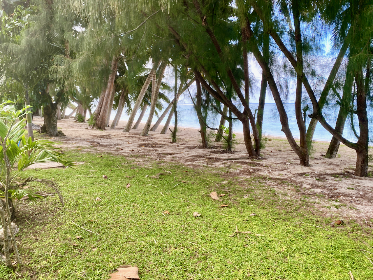
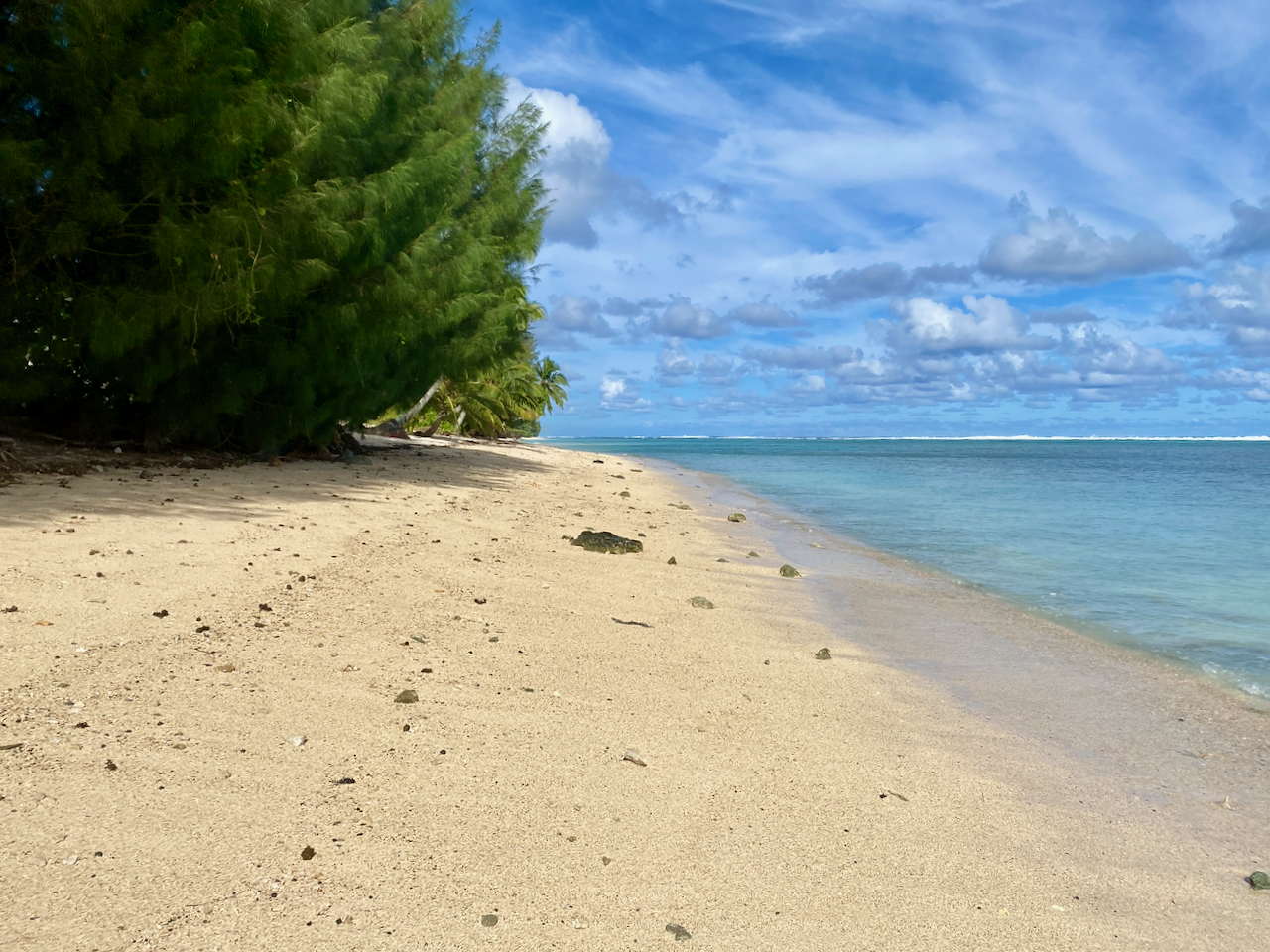
I finally came out close to the lake and walked along the trail with views for a brief time.

img_0614-2023-03-10-14-49.png

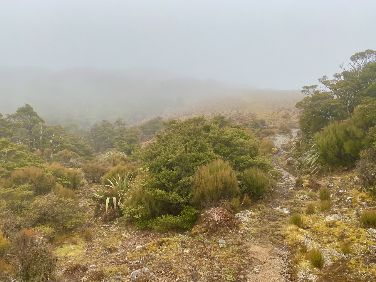
I crossed a grassy field to a gate, which gave me two options separated by a fence: across the field for several kilometres in the light rain, or dive into the forest for the same length to avoid it.

img_0615-2023-03-10-14-49.png

The uninhibited views across the lake were worth the momentary stop in the rain.

img_0616-2023-03-10-14-49.png

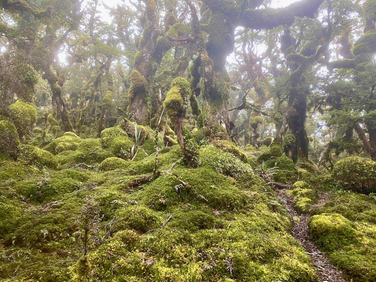
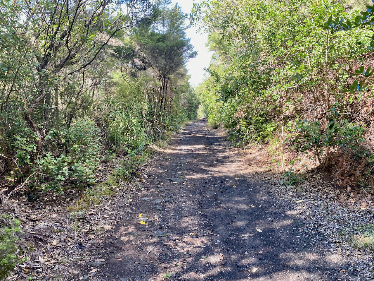
But I chose to head into the forest. I would come to regret this decision as the following 3 km pushed me through a hectic medley of downed trees, jagged roots and wet bushes on a thin trail that got me covered in water anyway.

img_0617-2023-03-10-14-49.png

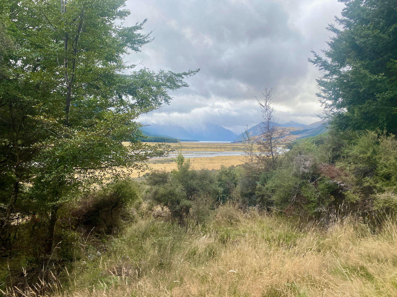
Glad to be out of the trees, I again cross the fields towards a wire bridge then once across it, I turned back and took a photo.

img_0625-2023-03-10-14-49.png

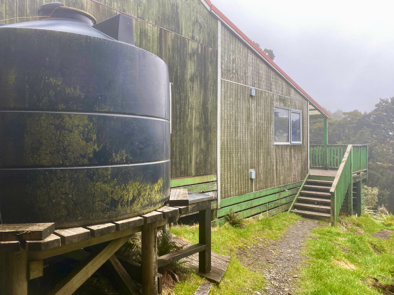
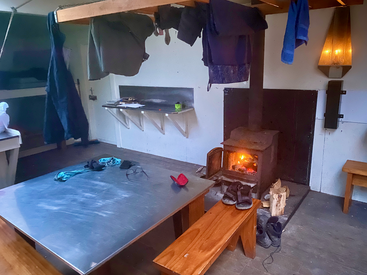
Another 10 minutes or so along the trail I came to the Hurunui hut. When I arrived, no-one was there, so I set about changing and thought about lighting the fire when a trio from the Hope Kiwi Hut arrived. More and more TA walkers would arrive from the other way, including an annoying group who had been playing cards in the next hut for hours burning all the wood. Just when it was dark outside and most of us had climbed into out sleeping bags they arrived, making a bunch of noise cooking and eating.

img_0626-2023-03-10-14-49.png

Day 3 – Hurunui Hut to Hurunui No. 3 Hut – 9.91 km – 3 hours – Yellow

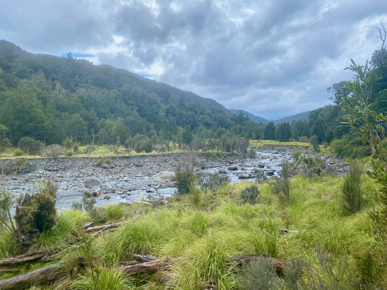
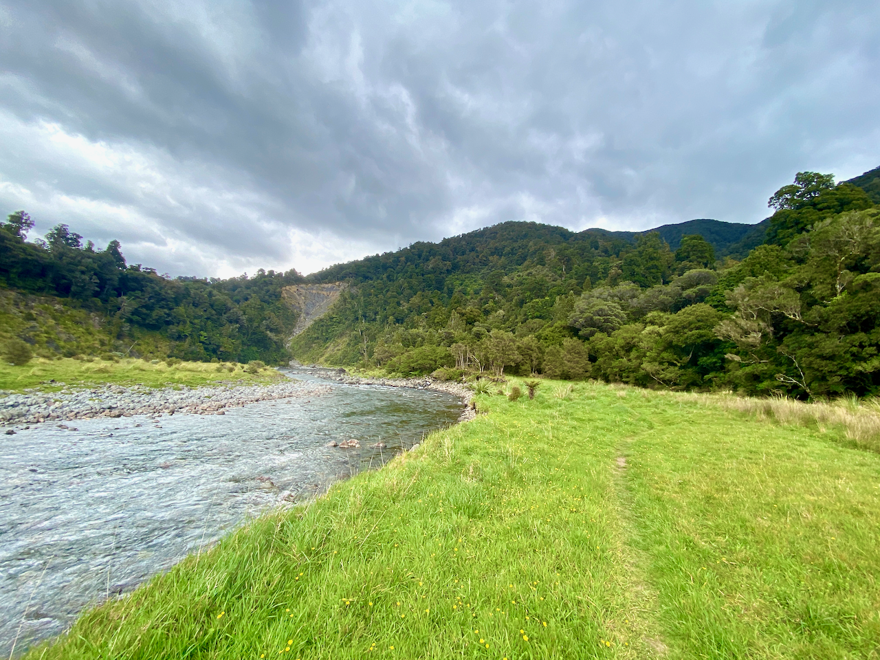
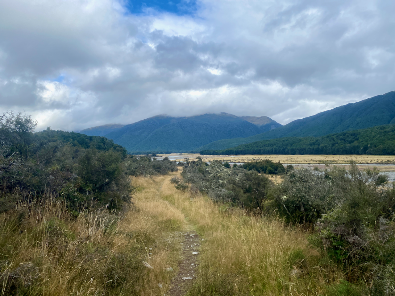
Checking my daily walking timeframes, I discovered my plans were wrong. Today, I had myself walking for at least 6 hours, but from talking to others it was only going to be two and a half to three. The rain had mostly stopped, but that didn’t mean that the grass was dry, so wet boots again. This was annoying as my boots were finally dry. I set out from the hut down onto the grasslands near the river.

img_0630-2023-03-10-14-49.png

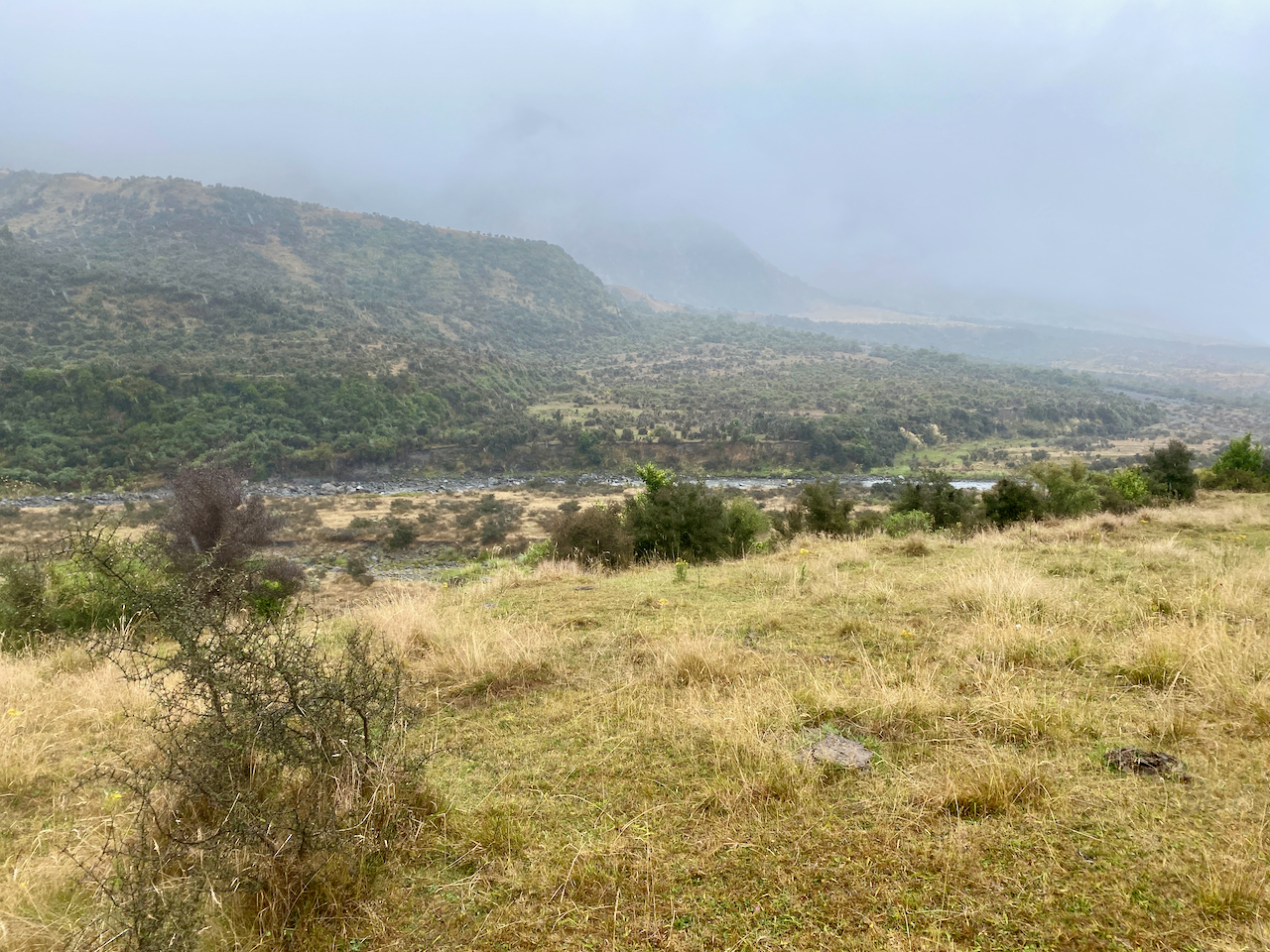
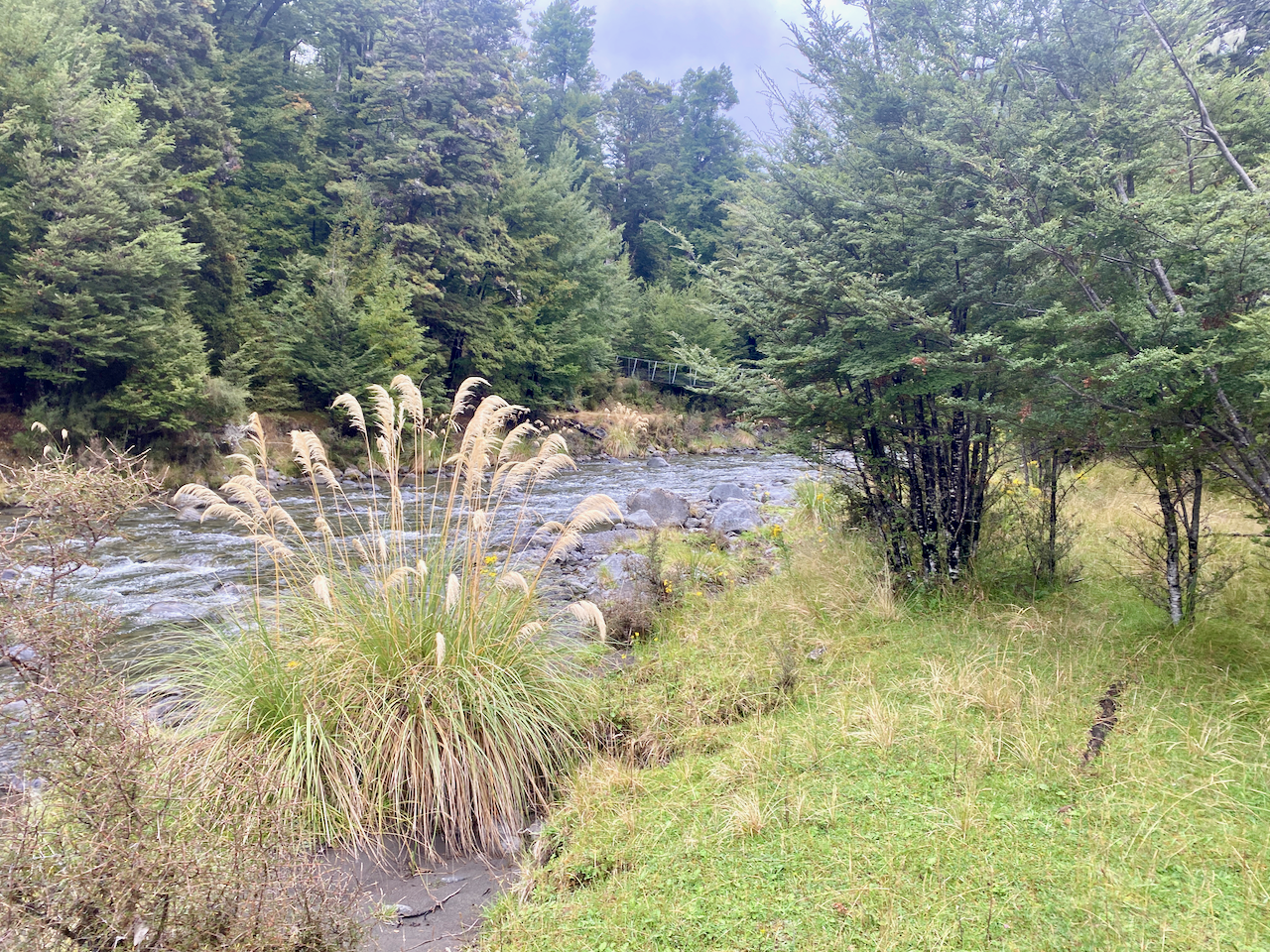
Much of my day would be wandering alongside the river. Sometimes I just ignored the trail and followed the flat grassland anyway.

img_0631-2023-03-10-14-49.png

Only heading up the bank when the river got too close to this side, dropping down to the grasslands again when the river moved away.

img_0633-2023-03-10-14-49.png

I came to a sign that said 1.5 hours back to Hurunui Hut and 1.5 hours to Hurunui 3 hut. Weird, as I’d only been walking 45 minutes from Hurunui.

img_0638-2023-03-10-14-49.png

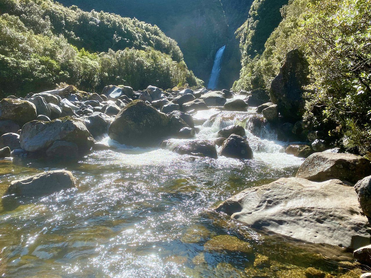
Everyone’s favourite spot on today’s section was the hot pool. Hot water flows down from the side of the mountain leaving a two tone algae on the rocks. It drops into a pool, which likely had been hollowed out for the purpose, then overflows 15 metres down to the river. I arrived just as another walker was leaving, so I stripped off and got in. It was a little dirty and a sign said not to submerge my head. Another tube had been set up to feed cold water into the pool should it get too heat, but I left that out.

img_0644-2023-03-10-14-49.png

I got ouot after 30 minutes, quickly dried and dressed to get away from the sandflies, and got on my way once more. The trio following me since Hope Kiwi Lodge said they’d spent more than 2 hours in the pool.

img_0646-2023-03-10-14-49.png

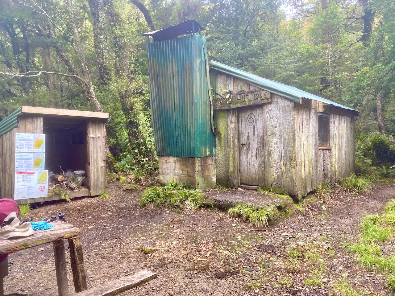
The trail stayed in the bush for a short time before emerging onto grassy plained until I eventually came out at Hurunui No 3 Hut. On arrival, I checked the wood, and wasn’t sure it would last. So I went hunting around for some. I wasn’t sure I’d find much due to the rain of the previous couple of days. But with an axe from the wood house, I located and cut a long dead branch. I dragged it back to the wood house and cut it into bits. But as I was dragging it, my leg got caught in some spiky plants and scratched it to hell. So, once I had the fire going, I bandaged my leg. Hurunui No 3 Hut has two sets of triple bunks and a pair of double bunks. Overall, a good hut again.

img_0654-2023-03-10-14-49.png

Next, Days 4 – 6 of my Southern Alps Crossing.

The Lone Trail Wanderer

Tongariro Northern Circuit Great Walk! Days 3 and 4 – The Easy Aftermath

In mid February 2023, I found a gap in the rainy summer and headed to the central North Island of New Zealand to walk the four day Tongariro Northern Circuit. See Day 2 here.

Day 3 – Oturere Hut to Waihuhuno Hut – 3 hours 45 min – 8.1 km (Green trail)

While the hut was full overnight, I’m thankful for being in one of the quieter smaller rooms, especially when people started moving around in the morning. Day three is the shortest of the hike, with a stated 3.75 hours of walking before arriving at the next hut. With Day 4 also being a shorter day some people merge the two and walk out on Day 3. I’m taking the more chilled approach and walking two short days.

I headed out from the hut in the sun and back into the sandy hellscape of the final hour of yesterday’s walk. Clouds hung quietly around Ngauruhoe as I walked.

img_0434-2023-02-12-15-59.png

I soon headed down the descent of the day, a steady but short rocky downhill towards a babbling brook running down from the mountains. In the distance I could see the Australian family.

img_0435-2023-02-12-15-59.png

On an easy path, I quick marched up the next small climb, nothing too taxing.

img_0438-2023-02-12-15-59.png

For the next hour, the trail undulated up and down rocky and sandy short hills. I flew past the Aussie family who were, in their own words, just ambling today.

img_0439-2023-02-12-15-59.png

Heading ever towards a tree covered ridge line in the distance, I spied the Italian newlyweds ahead.

img_0440-2023-02-12-15-59.png

With the tree covered ridge to one side, I sped along a sandy ridge to eventually pass the Italians on the downward climb at the end.

img_0446-2023-02-12-15-59.png

Halfway down, the trail dove into the trees.

img_0449-2023-02-12-15-59.png

At the bottom, beside a large stream the mud puddles began. Nothing too seriously thankfully.

img_0451-2023-02-12-15-59.png

Then the steepest climb of the day, up to the top of the tree-covered ridge, passing a trail runner and two groups of hikers heading the other way. I came out of the woods at the top, climbed a small hillock off the trail and sat for 10 minutes in the sun. Then heading down the other side I got the first views of the tonight’s hut.

img_0455-2023-02-12-15-59.png

Compared to the previous two huts, this one was a veritable mansion with large bedrooms and a massive indoor and outdoor seating area. Inside the main windows gave great views of the Mt Ngauruhoe. In the afternoon, the rain came in spits and spurts. Up behind the hut, to one side of tomorrow’s path, in the tussock was what I described as the 4G zone, although spottier than previous huts. At one point there were a bunch of us in the tussock 4G zone, hunting the service in what became known as 4G yoga as we stretched this way and that with our phones.

img_0459-2023-02-12-15-59.png

Overall, the walking time was supposed to be 3 hours 45 minues, but I managed it in 2 hours 20 minutes including the 10 minute sit down at the stop of the last ridge.

Day 4 – Waihuhuno Hut to Whakapapa Village – 5 hours 45 minutes – 15.4km (Pink trail)

The hut was fine overnight, with the usual issues revolving around those who want to get away early waking everyone while trying to be quiet. With a day estimated at 5 hours and 45 minutes, I planned to leave at 8am so that I’d finish at 1:45 and then arrive at my accommodation at the 2pm check in time. But as today is fairly flat, I’ll likely finish early. I set out into the overcast day, headed past the 4G tussock patch and up some stairs. After ten minutes I came past the turnoff to the old Waihuhuno historic hut. I stopped to check it out.

img_0471-2023-02-12-15-59.png

I set out again across the tussock covered plains, ever so slightly undulating, the low cloud covering the top of Mt Ngauhuhoe. As this hike circumnavigates the volcanic cone, and because it was Mt Doom in the Lord of the Rings, I think this hike should be renamed to The Mordor Circuit.

img_0480-2023-02-12-15-59.png

Today’s section has no large ascents or descents, but a very slow, almost unnoticeable, climb to the mid point, a dip down to one of the many streams on the trail, then a climb to the day’s highpoint.

img_0487-2023-02-12-15-59.png

At that highpoint, there is a T-junction, one way leading to the Tama Lakes, and the other continuing on to the the end of the trail. I stopped for a break at the junction, near the toilet that cannot be seen as it is camouflaged to look like the tussock plains. This is not the only toilet of its kind in the National Park, wherever tourists can walk, there are toilets, and as they walk out to the Tama Lakes, there’s one here.

img_0495-2023-02-12-15-59.png

There are two Tama Lakes, the Upper being 45 minutes walk from this junction and the Lower being only 10 minutes walk. I wasn’t keen to walk all the way too the Upper Tama Lake, so leaving my pack at the invisible toilet, I made my way to the Lower Tama Lake.

img_0494-2023-02-12-15-59.png

After a quick photo, I trotted back, had a snack, donned my pack and headed off again. From here on I would begin to cross paths with more and more day walkers. The trail began to undulate more but nothing overly difficult. And after an hour, I came to a rather busy location. I dropped my pack amidst many tourists, and climbed down some steep steps to view the Taranaki Falls.

img_0502-2023-02-12-15-59.png

I then climbed back to my pack, and stood at the top of the falls looking down.

img_0504-2023-02-12-15-59.png

A sign near the waterfall said 1 hour to the Whakapapa Village, twenty minutes longer than I had estimated, so I got my skates on. After 10 minutes, I saw the recently closed Tongariro Chateau in the distance, I kept my march on. I cut through some woods, and when I emerged, ten minutes before the end of the track, I stopped to take my final shot of Mt Doom.

img_0509-2023-02-12-15-59.png

When I reached the end of the trail, I walked past the chateau to the place where I had left my vehicle. It was 12:15, the time I’d estimated mid today’s walk, and even with the short side track to the Lower Tama Lake, I still came in an hour and a half early.

Overall

The Mordor Circuit, officially known as the Tongariro Northern Circuit, was a good walk although, to be honest, days 1, 3 and 4 just felt like alternative ways to get to and from the main attraction, the Tongariro Alpine Crossing. In comparison, these three days put together don’t come close to the sheer exhilaration of the Alpine Crossing in effort, beauty, and reward. In saying that, I still enjoyed my four days on the trail.

The Lone Trail Wanderer.

Tongariro Northern Circuit Great Walk! Day 2 – The Alpine Crossing

In mid February 2023, I found a gap in the rainy summer and headed to the central North Island of New Zealand to walk the four day Tongariro Northern Circuit. See Day 1 here.

Day 2 – Mangatepopo Hut to Oturere Hut via the Tongariro Alpine Crossing – 5 hours 10 minutes – 12 km (Red trail)

Morning came and the rain had stopped but it was still cool. With the carpark for the Alpine Crossing only 20 min from the hut, the first waves of people began filtering by fairly early. I got ready and headed out onto the wide gravelly trail, the ridge I’d climbed the day before up to the left.

img_0335-2023-02-12-15-58.png

The beginning of the trail is a fairly slow climb through the lower portions of Tongariro heading towards the South Crater, which is just over the lowest point of the ridge straight ahead.

img_0339-2023-02-12-15-58.png

There are boardwalks in many places along this route to protect the ground from so many marching feet on their daily attempt up the mountain. I got into a good rhythm passing many of the walkers with their tiny packs while carrying near 20kg in mine.

img_0342-2023-02-12-15-58.png

The lead up to the first climb is stony but also well worn. When I did the Alpine Crossing previously, I was already immersed in the cloud which stayed with us for most of that walk. I was hoping today would be different.

img_0347-2023-02-12-15-58.png

I began the initial climb to the toilets, some of the many emplacements along the crossing. I was approached by the two French girls I’d picked up hitch hiking to National Park village 2 days ago. I wished them well before proceeding. I was already in the low clouds at this stage, and had my thin waterproof jacket on backwards. I sweat heavy down my back, no point adding an extra layer where I don’t need it. And, when I no longer need it, I can remove it without having to take my pack off. At the toilets is the first warning sign:

img_0349-2023-02-12-15-58.png

The climb from the sign to the southern crater is only 250m in altitude gain, but in the light rain and wind it felt longer. It was here I first started hearing people coming back down warning how bad it was up top. When I got to the plateau of the Southern Crater, the wind had died down but the clouds still hung heavy.

img_0351-2023-02-12-15-58.png

The wall of the crater came into view after a five hundred metre walk across the plateau, and the wind began again tugging at my jacket and pack cover. I’ve heard some nightmare stories of people’s pack covers being torn off in the wind. Thankfully, mine has a cross strap, so was stable just a little noisy.

img_0352-2023-02-12-15-58.png

The Decision Time sign appeared out of the gloom, no doubt causing more people to head back. I marched on, my fingers starting to get cold but I was thankful for the long sleeves of my backward jacket giving a little protection. Some groups around me continued the climb, bit by bit, resting briefly where they could. My fingers got so cold they went numb and I couldn’t feel the buttons on my phone.

img_0353-2023-02-12-15-58.png

Like the first time I did the crossing, the most exposed section near the Red Crater had wind blasting visibly across it, and as per last time, I pushed on. This time I’m thankful for my hiking poles to give me a little more stability as I climbed. I marched on scurrying from rocky outcrop to outcrop across the exposed areas.

img_0355-2023-02-12-15-58.png

Then out of the mist, the final climb to the highest point at 1868m. Wind tearing at me, fingers numb and hands red, I pushed on.

img_0358-2023-02-12-15-58.png

Then in what seemed like a handful of moments, the mist swept away and looking back I got a better view of the South Crater from above.

img_0362-2023-02-12-15-58.png

And to my right, the Red Crater.

img_0367-2023-02-12-15-58.png

The wind was still cold, so I pushed on, but as I began my descent, it ceased and the sun began its warming effect. I could feel my fingers again. Below me was the Central Crater and across it, the Blue Lake. The crossing continues past the Blue Lake and down the side of the mountain for several more hours to the collection point. Last time, none of this was visible, the cloud only clearing when we were half way down, past all the main sights.

img_0374-2023-02-12-15-58.png

The Northern Circuit doesn’t go past the Blue Lake, instead cutting right after the Emerald Lakes.

img_0377-2023-02-12-15-58.png

The trail down is not rocky like the ascent, instead it’s a light dirt/ash mix where you can slide if you aren’t careful. I slithered down in my boots and took a shot back up the peak. Afterwards, it was estimated more than a third of the climbers today had turned back.

img_0381-2023-02-12-15-58.png

I dropped my pack on the trail and stopped for lunch in the sun, then left it beside a rock and walked to the Blue Lake and its fairly easy climb. I looked back across the Central Crater to the Red Crater which looked like a gaping maw of the mountain.

img_0392-2023-02-12-15-58.png

I didn’t stay long at the Blue Lake before heading back.

img_0394-2023-02-12-15-58.png

Donning my pack again, I headed down the quieter trail towards what I describe as a hellscape, the Italian couple are ahead of me.

img_0404-2023-02-12-15-58.png

The trail to the hut has a long slow rocky descent onto the hell plains, then a hot 3-4 km march across rocky landscape.

img_0417-2023-02-12-15-58.png

Oh, and did I mention the never ending sand?

img_0423-2023-02-12-15-58.png

Eventually, I came over the a rocky outcrop and saw the hut up ahead. Perhaps it was my lack of sleep the night before, but the final hour across the hellscape just seemed to drag. I was grateful to arrive. At the hut, I unpacked my tent and ground sheet, lying them out to dry in the sun and warm wind.

img_0426-2023-02-12-15-58.png

I headed inside to get myself a prime bed in one of the smaller rooms, before heading out to the ridge where I found the campsites, a good 4G zone and a waterfall.

img_0429-2023-02-12-15-58.png

The crossing was everything I remember from my previous effort, except I got to see some sights this time. It’s definitely the high point of the trail (pun not intended but accepted). Tonight I relax and prepare for the shortest day of the trail tomorrow.

Next, Days 3 and 4 of the Tongariro Northern Circuit Great Walk!

The Lone Trail Wanderer.

Tongariro Northern Circuit Great Walk! Day 1 – The Beginning

Great walks are manicured hikes for everyone, but especially tourists and locals just starting out hiking. They’re not necessarily easier, just more accessible, and often also quite busy. The Tongariro Northern Circuit was something I wanted to revisit since my Tongariro Alpine Crossing several years ago – New Zealand’s most popular tourist walk – was mired in low cloud. Lots of walking/climbing and no view. The Tongariro Northern Circuit includes the Alpine Crossing on its second day, leaving the other three days quieter. So, with wet weather prevalent throughout the beginning of the New Zealand’s summer, I’ve been dying to get out on the tracks.

The Tongariro National Park in the centre of New Zealand’s North Island, contains four massifs, the two most famous being the Ruapehu Massif and the Tongariro Massif. There are two main circuits in the National Park also, the Tongariro Northern Circuit, which circumnavigates Mt Ngauruhoe, the cone shaped volcano used as Mt Doom in the Lord of the Rings trilogy. The southern circuit is The Round the Mountain, and circumnavigates Ruapehu, the North Island’s tallest mountain.

In early February, I slowly made my way down to the village aptly named National Park, where I stayed in preparation for the hike.

Day 1 – Whakapapa Village to Mangatepopo Hut – 4 hours – 9.4 km (Yellow trail)

Today’s walk is quite short, so I left the accommodation at check out and drove the 15 minute drive to the trailhead at the Whakapapa Village. I stopped in at the village i-Site to check on parking and got an overnight permit. Locking up my vehicle, I headed past the now closed Tongariro Chateau, then along the short road behind it. From the official trailhead of the clockwise circuit, I headed along the wide gravel path created to give tourists easy access to the Taranaki Falls. I passed several such couples with day packs as I went.

img_0298-2023-02-12-13-37.png

After passing the trail to the Taranaki Falls, my trail lost its tourist appeal, becoming a thin dirt track through the tussock covered plains. I headed along the track with the cloud covered Tongariro massif ahead of me.

img_0309-2023-02-12-13-37.png

Behind me, the Mt Ruapehu massif.

img_0314-2023-02-12-13-37.png

The trail is well marked with the typical orange triangle seen all over New Zealand. The trail is also fairly mundane, undulating gently from the circuits lowest point at 1,065m above sea level to 1,165m. Occasionally there is a bit of mud which added a bit of spice to the trail.

img_0315-2023-02-12-13-37.png

After a good three hours, I came over a short ridge to see the Mangatepopo hut in the distance tucked under ridgeline. I picked my way across the plains until I came over a small hillock to see the hut and its associated campsites.

img_0320-2023-02-12-13-37.png

I pitched my tent in a suitable spot, getting my gear inside as it began to spit. I went to the hut and hung out with an older Australian woman, her two adult daughters and the boyfriend of the youngest. The rain came down briefly as more hikers came in, some walking the circuit in reverse and having done the Alpine Crossing. After my brief and rather easy walk to the hut, I needed more, so I decided to climb the ridge beside the hut, which gave me great views back along the way I’d walked.

img_0327-2023-02-12-13-37.png

And off the other side to the north…

img_0329-2023-02-12-13-37.png

Later that evening, those of us gathered at the hut came out to watch the sunset. There were a fair mix of nationalities: the aforementioned Aussies, a large group of Kiwis, a pair of Italians, a Frenchman and his daughter, a Brit girl and her Canadian friend.

img_0333-2023-02-12-13-37.png

When it got dark, I retired to my tent. There was 4G in the camping area, so I watched YouTube on my phone for a while before heading to sleep. It rained on and off during the night and was quite cold. I didn’t sleep well, tossing and turning whenever I awoke shivering.

Next, Day 2 of the Tongariro Northern Circuit, the day we go over the top on the Alpine Crossing in the rain and tearing wind.

The Lone Trail Wanderer.

Pouakai Circuit, Taranaki, New Zealand

A couple of days after my hike in the Tararua Ranges, I drove to Taranaki for another hike. Like that earlier hike, the weather got in the way, but I still got to walk on Mt Taranaki after trying several times this year.

Since being back in New Zealand, I’ve been planning the Around the Mountain hike in Taranaki. But in February, a wave of heavy rain came over the North Island on the week I was to do it, so I flew to Queenstown and did The Routeburn trek instead. In March, another wave of heavy rain took the entirety of NZ, so again I cancelled it. As the cooler months were upon us, I left it until the end of the year. The Around the Mountain track has high and low trails along most of its length to allow for people wanting different grades of difficulty. However, there are three parts where there is only one option, and during the winter of heavy rain, a slip wiped out the largest of the three, closing the hike indefinitely. So I was left with its baby sister hike, The Pouakai Circuit, which can be done over 2 days, but I decided to split it over 3.

Day 1 – North Egmont Information Centre to Holly Hut

I stayed in a hostel in New Plymouth and on the morning of the hike, watched cloud cover the entire region. I couldn’t see the mountain from the city, but the weather was due to clear up. So, in the afternoon I headed out to the North Egmont Information Centre. Even as I approached the mountain, it was enveloped in clouds. I spoke to the lady at the information centre and watched the repeating weather forecast on their TV.

At 1pm I finally set out up the manicured wooden steps following the sign that said I should be walking that way.

According to the topographic map on my phone, I had about 90 minutes climbing before I met the trail that would take me around the mountain and then another 2 and a half hours until I arrived at Holly Hut. After 30 minutes, the clouds blew off and I finally got a good look at the mountain.

The climb wasn’t difficult and the steps made it easier. After a while, as I pushed on, the steps turned into a stony trail.

The main Holly Hut Trail was muddier with fewer of the wooden steps and more raw rock to climb over. However, beside the trail were pallet sized stacks of wrapped wood dropped off by chopper. It looked like they intend to lay a kind of boardwalk along the track, which would stop the mud and would also make it easier, not to mention more accommodating for tourists. I walked on and eventually came over a ridge to see the Ahukawakawa – the Sphagnum Moss Swamp – nestled in the crown of several lesser peaks.

The muddy trail continued joining a boardwalk for the last hundred metres to the Holly Hut. In the hut were two other walkers, an American girl and a local guy. We chatted and drank Korean alcohol she’d brought with her from the Pouakai Hut the night before. Then when the hut lights came on – solar powered with a darkness sensor – we all retired to our separate sleeping rooms, of which there were three in the Hut.

Day 2 – Holly Hut to Pouakai Hut

The sky was clear overnight and plentiful stars were out and it stayed that way into the morning. The local guy had left early, and the American girl and I ate breakfast and chatted. Then after she headed off, I walked the side trek down to Bells Falls behind the hut. As today’s walk is short – 2 hours – adding an extra hour would give me something to do. I headed out down a less defined track avoiding large puddles and pushing grasses aside to get through. I even got a good view out to the sea in the west.

I followed the trail attached to the side of a large mound The Dome, dropping some two hundred metres in height until I came to the junction with the closed Around the Mountain trail. Five minutes later and I was rock hopping across the side of the river to see Bells Falls.

I climbed back along the trail back towards the hut. I had almost arrived when I heard a chopper overhead. When I came out at the hut, there were workmen there and the chopper that had delivered bags of firewood. They were also swapping out the shit crates – the large plastic crates the long drop toilets sit on that fill up with… well, shit, and toilet paper. I had to wait until they’d finished and flown away before I could continue.

I donned my pack and headed off just as two ladies with day packs arrived. I walked the 10 minutes back to the junction and took the route downhill towards the Ahukawakawa swamp. The trail is a wooden boardwalk all the way, and half way down I met a girl sitting in an information booth. We chatted before I continued on.

When I got down to the swamp itself, it was mostly tussock grass. I continued across it and over the Stony River on a footbridge – the river flows to the west where it cascades down Bells Falls. I climbed the hill on the far side on manicured wooden steps and a fair way up looked back to see the Ahukawakawa, the river, the mountain and the little green dot that was the Holly Hut at it’s base.

I pushed on, getting to the top of the ridge and around to a nice rocky outcrop beside the trail where I stopped for lunch. After eating, I continued on behind a large mound poetically named Hump. On the other side, I came to a rocky area with the trail heading down. I followed it for several minutes before arriving at the hut. I chose a bed and dropped my pack. Many groups of day walkers were coming up from the Mangorei Track. They would come across the deck to use the toilets, or go inside and have lunch on the tables. Across from the hut is another mound, this one unnamed. I chose to climb it to get away from the daywalkers and sat looking back at the Pouakai Hut.

Later, an older gentleman arrived, and we chatted for the afternoon. He’d come up from the Mangorei road end just for the night to relive his youth where he’d climbed Taranaki six times. Later an older couple arrived for the night, they’d walked the same route I had, but instead of stopping at Holly Hut had crossed the Ahukawakawa. They would be finishing the circuit the next day with me.

That afternoon I got several shots of New Plymouth when the clouds weren’t hanging low over it.

And even one in the dead of the night.

Day 3 – Pouakai Hut to Mangorei Rd

In the middle of the night, the wind picked up and the clouds swallowed us. When we awoke, visibility was at 20m or so. To finish the circuit, the three of us would have to climb over Henry Peak with the heavy wind gusts. I climbed up to the junction without my pack to check out the situation and found the winds rather strong.

We decided that climbing a mountain without any cover would be dangerous. The lone older guy offered to drive us around to the information centre when we got down, which sealed the deal for the three of us. We headed down the manicured wooden steps for the next two hours.

At the bottom, the lone man’s wife met us with their camper van and were driven to the end. This is the route we should have taken it.

Overall
Without completing the last part of The Pouakai Circuit, I would rate the walk as fairly easy due to much of it being manicured. I do like how they are making it more accessible for tourists and day walkers and I hope they fix the trail for Around the Mountain so that one day I can come back and complete.

The Lone Trail Wanderer

The Alpha and Omega Track – Tararua Forest Park, Wairarapa, New Zealand

At the beginning of Spring, I set out on a road trip around New Zealand’s North Island to see some friends and walk a couple of hikes. After several days I found my way to Masterton preparing to head into the Tararua Ranges.

As I didn’t wish to spend the entire walk in the forest, I planned a walk across the open ridges, staying in huts as I went. The weather can change quickly in the ranges, and being a cautious walker I was prepared to change plans if needed, and indeed, I did. So, this hike is different to my original plan, which is described later.

Day 1 – Waiohine Gorge Carpark to Alpha Hut

I set out from my accommodation in Masterton and drove into the Tararua ranges on a dirt road, parking at the Waiohine Gorge Carpark. I then headed out from the carpark laden with pack and across the swing bridge over the Waiohine River.

On the other side, the trail began climbing steeply immediately. The track was thin and knotted with roots, moist and slippery underfoot, with puddles of mud along the way. I began at around 170m above sea level and climbed to around 570m before it flattened out a little.

I continued on, climbing another 100m over a longer distance before the trail headed down, to come out at Cone Hut built in 1946. I stopped here for lunch. I also noted that a previous walker had marked in the hut logbook that they had left a small bag in the Alpha Hut. I would keep an eye out for it.

To continue, I had to cross the river and had bought sandals for this occasion. Before changing I spent some time looking for a way to cross, but with not luck I waded across in my sandals and up the bank. Back in my boots, I began climbing up the Bull Mound Track towards the Bull Mound, although I never did figure out why it was called that.

The first climb of the day had been rough, but this trail was worse, steeper, muddier, more tangled in roots. At one point, it was entirely blocked, forcing my to take time to find a way around. My river crossing was at around 320m, and three hours later I reached the sodden top of Bull Mound at 1060m. After 900m, the trees had begun to change, growing barely taller than myself, and almost completely covered in moss.

And, of course, the best view when climbing so long in the forest, the exit into the high alpine region.

But, I couldn’t take a rest as it was cold and wet crossing the open area, so I pushed on and into the cloud layer. Fifty metres later and I crossed the top of a small hill blanketed in sodden moss.

Stepping carefully, I marched on before beginning a descent onto a saddle known as Hells Gate. Icy wind swept up from one side to another, but thankfully there were plenty of thin trees.

On the other side, I climbed to nearly 1200m, thankfully leaving the wind behind, but my breath was coming icy and temperatures had dropped. I descended to below 1100 before climbing again. The topographic map I was following on my phone didn’t have my hut on it, so I assumed to was near the summit of Alpha, still 200-300 metres higher than I was. But not long after, I came out of the trees to find the hut.

I rushed inside, and tried to get the fire going to get some warmth, but alas, none of the wood would light as it was all wet, and not being a serviced hut, firewood wasn’t periodically dropped off. I quickly cooked some food, changed into warmer clothes and still freezing, got into my sleeping bag in hopes of getting warm. During this time I did locate the small bag left behind and squirrelled it away in my pack.

Day 2 – Alpha Hut to Tutuwai Hut

I’d gone to sleep breathing into my sleeping bag, and woke up in a cloud of warm air even though it was freezing outside. I even had to throw my sleeping bag off, and remove some of my thermal clothing as I was too hot. There had been a change in weather overnight, the icy clouds were getting a push along by some pretty heavy gusts of wind. The next couple of days were to have been spent in the open ridgetops, and as a cautious hiker, I felt that high gusts on the icy ridges was not going to be safe (or fun), so I decided to descend back to the lower huts for the rest of the hike.

After packing I headed back along my entry the trail. I descended to Hells Gate, which was again windy, but not as cold as the afternoon before, and on the other side I came to a junction and headed up towards the summit of Omega which opened out onto the rocking area. Low clouds hung over the area but I got my first views of the low lying lands of the Wairarapa. I also had reception on my phone and contacted the owner of the small bag, informing her that I would send to her when I exit the park.

The trail down was similar to the Bull Mound Track I’d climbed the day before. But I would imagine climbing it would have been more difficult. Eventually, after several hours, I came out at the Tauherenikau River I’d crossed upstream the day before. Again I studied the best place to cross, swapped into my sandals and headed across. I’d decided that I would be staying in the Tutuwai Hut that night, and as that was not far from where I’d crossed, I kept my sandals on and walked up the track. I got to an open area with a lunch table, but no hut. It took me a few minutes to locate the hut hidden up the hill – the sign had been smashed. I settled in for the afternoon, found dry wood and got a fire going. Practicing fire making skills is always a good thing!

Just as darkness fell, a pair of young guys appeared, the only other people I’d seen in the two days I’d been in the Tararuas.

Day 3 – Tutuwai Hut to Totara Flats Hut

After a warm night in the hut, I contemplated whether to exit the park or find another hut to stay in for the night. I’d set aside four days in the Tararuas so I located another hut far enough away to give me a fair walk, but also within a fair walk ofwhere I’d parked my car. I followed the river for an hour back to the Cone Hut I’d stopped at on my first day, passing three middle aged guys going to the Tutuwai Hut.

I stopped at Cone Hut for a bit as it had begun to rain lightly, but when it didn’t stop after 15 minutes I headed on. I climbed up the track I’d come in on the first day but split off towards the Cone Saddle. The sign said 30 minutes to the saddle, but I’d discovered that most of the timeframes on the signs are works of fiction, often heavily underestimating the times… it says 1 hour to the hut, 3 hours later I arrived. In many cases, other walkers had scratched off the original times and added more realistic ones. I climbed on, and arrived at the saddle 45 min later.

Perhaps I should have climbed the extra 500m to top of Cone peak and followed the ridge down, but I chose the easy path and headed down towards the Waiohone river. I crossed a small plateau and stopped for some lunch before continuing down to the river.

For the rest of the day, I followed the trails beside the river where I could. There was little climbing and I could take a rock hopping option instead of going up onto the knoll. There were plenty of flat areas, although this is also where the muddy ground is most prevalent. At one point the trail led me up a knoll and I decided to try rock hopping instead, but ran into a dead end and would have to wade into the river to get past, so I went back.

Then I came out onto the Totarani Flats, and for the next 45 minutes it felt like I was crossing a grassy paddock, but in slight drizzle. At one point I found a dry covered spot to have a rest, but was harassed by sand flies, so after five minutes continued on. The trail headed into the woods, and soon after the hut appeared.

As with the day before, I set about making a fire and got ready for the evening. An hour later, a lone runner appeared, stopped in to say hi and sign the hut book, the ran on again. She had started her ‘jog’ 12 hours earlier and still had a bit to go. Trail runners are insane.

Day 4 – Totara Flats Hut to Waiohine Gorge Carpark

The next morning, the weather was fine and once ready, I headed down to the bridge to have a look before donning my pack and leaving. I retraced my steps along yesterday’s trail through the flats, enjoying the sunshine. I crossed the long sections of flat trail and mud to eventually arrive at the the junction I’d passed coming from Cone Saddle. The sign said 2 hours, but who knows.

The trail turned out to be more difficult, with plentiful knotted roots and rocks. It felt like I was climbing over hurdles, up and down and up and down. 2 hours in and I was only half way towards the carpark. The final hour of the walk, and I noticed the trail was more manicured, with sections of boardwalk, cut steps lined with wood and long easy trails. I eventually arrived at the bridge I had crossed at the beginning and crossed over to my car, where I took a rest, changed and prepared to exit the path. After I’d left the Tararua Ranges, I stopped at Carteton and shipped the small bag back to the lady. Later that day, as I was relaxing at my friends’ farm south of Palmerston North, the clouds over the ranges where I’d just been looked ominous.

The Original Plan

The original plan had me going past Alpha hut, along the ridge lines known as the Dress Circle up to heights of 1500m plus to Kime hut, then the next day along the open ridge line to Maungahuka hut. In the cold wind and under cloud cover, the walk wouldn’t have been fun, and with no guarantee of heating at the huts I feel I made the best decision. Then from Maungahuka hut to the carpark I estimate the day would have been between 10 and 12 hours, with long steep descents and a huge climb. If I had done in mid summer it would have been more fun, and perhaps I would have split the last day.

Overall

The walk was good although as I had chosen to not go into the high open ridge tops, the majority of the hike was in the forest. The huts were pleasant, well, the ones where I could get the fire going. I felt cozy and enjoyed the warm solitude of the place. I was prepared for the possibility that I might not be able to get to the higher areas, and had alternative options. Perhaps if I’d chosen early summer, I would have had a different experience: more heat, more alpine, but then more people to contend with on the trail and in huts. Still, I give it a good rating and add it to my experience.

I think I would walk in the Tararua Ranges again.

The Lone Trail Wanderer

Aitutaki Island, Cook Islands – Impressions

While staying on Rarotonga, fellow backpackers mentioned travelling to Aitutaki, the Cook Islands’ second most popular location. So, I booked a flight and went to see what it was all about.

img_9751-2022-06-27-13-52.png

The Island
Aitutaki is 45 minutes by small plane north of Rarotonga and is the main island of an Atol of 15 islands is a loose equilateral triangle, surrounding a much more defined lagoon. Indeed, many people fly to the island for a day trip, with an hour long tour of the island, and a half day lagoon tour.

aitutaki-map-small-large-2022-06-27-13-52.jpg

The atol is vastly quieter than Rarotonga, with fewer locals also. Some tourists have said the locals live more poorly here, I think they don’t need the lavish housing of Rarotonga or NZ. The community is more friendly, not that those on Rarotonga aren’t, the Aitutaki community is just more friendly. And, if you stay more than a couple of days, you quickly become a member of said community. Unlike Rarotonga, Aitutaki has no dogs, so the cats have taken over, making it their island.

Lagoon Tour
On my first full day on the island, I was collected in the morning and taken out on the water with 16 others for a full day tour. We headed towards Honeymoon Island, stopping to snorkel on the way. Unfortunately my old waterproof camera decided not to work, but it was an enjoyable swim with some giant blue trevally and a rusted shipwreck.

img_9731-2022-06-27-13-52.png

Honeymoon island is the classic tropical island, and would be empty except for the Kite Surfing school in it’s only hut.

img_9738-2022-06-27-13-52.png

We crossed to Maina island, where we stopped for lunch, a fantastic feed of fresh tuna steaks, chicken and local salads, including the classic curried papaya.

img_9745-2022-06-27-13-52.png

It was then back onto the boat to our second snorkelling spot. We passed a 2000 year old Brain Coral as we swam along a series of bouys eventually meeting the boat in a metre of water. The bar opened and we drank beer as we floated in the warm water while a giant white trevally swam around us. Our third stop had to be cut short as the wind was picking up and the water was getting a little dangerous, but we got a quick dip to see some blue and purple coral.

img_9748-2022-06-27-13-52.png

We then stopped off at Tekopua island, also known as One Foot Island, for a walk around and another beer. There’s a post office on this little island, so I handed over my passport and got a stamp. It was then back to Aitutaki and the end of an excellent day on the bay. That night, the guys in the hostel, kite-surfers who had been there for two months, had cooked curried fish and curried papaya. As I said, community.

img_9746-2022-06-27-13-52.png

Scooter Adventure
With a day and a half to spare on the island, I called the hostel owner looking for a scooter and he brought me his personal one on loan. Unlike Rarotonga, you don’t need a licence to ride on Aitutaki, this gave me free reign of the island and I took full advantage.

img_9761-2022-06-27-13-52.png

I found some prime snorkelling sites, and got in on a couple, although it was murky in both.

I found some good cafes, the Koru Cafe at the end of the Airport Runway, and the Avatea Cafe at the other end of the Island, serving amazing fish tacos. I found my way to a Marine Research facility where they were breeding clams, both the small local ones and the giant Australian ones for repopulating the lagoon.

img_9773-2022-06-27-13-52.png

With the aide of the scooter, I climbed the two higher ‘peaks’ on the island, barely over 100m, but still providing excellent views. This is from Piraki…

img_9784-2022-06-27-13-52.png

… and the tallest at 124m, Maungapu.

img_9787-2022-06-27-13-52.png

Then as darkness fell, one of hostel mates snuck us into a local resort where some of his friends were performing after the local feast. It was nice to see the traditional dancing and music for the first time.

img_9792-2022-06-27-13-52.png

Impressions
While I was only on the island three nights, I felt that was about enough to see what the island had to offer. I liked the quietness away from the crowds in Rarotonga, but in turn, it was a little too quiet for a tourist. Still, it felt like the real Cook Islands and not the tourist centre that is the main island.

img_9777-2022-06-27-13-52.png

Until next time,
The World Wanderer.

Rarotonga Island, Cook Islands – Impressions

Three and a half hours by plane north east of New Zealand is Rarotonga, the largest and capital island of the Cook Islands.

img_9608-2022-06-22-10-14.png

As COVID lockdowns ease across New Zealand, I skipped out on winter for a bit and shot off to this tropical paradise. Here are some of my explorations during my time there.

where-are-the-cook-islands-located_2899-1-1024x680-2022-06-22-10-14.png

The Island
Rarotonga is surrounded by a reef where waves crash sometimes a hundred or more metres out. The shallow lagoon it provides makes plentiful snorkelling available right from the beach, assuming clear waters on windless days. The island sits atop a 3000m volcano with 600m sticking out of the water. Thankfully, Rarotonga has been dormant for millions of years.

rarotonga-island-map-2022-06-22-10-14.jpg

The inner parts of the island are hilly, with many climbable albeit forest covered peaks. On the south east is the largest lagoon with four explorable small islands. As a tropical island, there are huge amounts of sun, sand, palm trees, coconuts and, of course, mosquitoes.

img_9609-2022-06-22-10-14.png

A road runs around the coast and is a constant buzz of motorcycles, scooters and small vehicles. Two buses run in opposite directions on an almost hourly basis, circling in about 50-75 minutes depending on number of stops. Bussing is affordable enough that you don’t have to go through the rigmarole of sitting your scooter license and its associated costs. Much of the island is on ‘Island Time’, though, so the buses don’t operate on Sundays, and businesses tend to close early.

img_9655-2022-06-22-10-14.png

Rarotonga is a dog island, with dogs everywhere. While most run loose, they are collared but aren’t wild, having their own territories around the Island. They tend to get excited when you walk along the beach, but ignore them and they lose interest quickly enough.

Round the Island Walk
With no buses running Sundays, what better day to walk the entire ring road of the Island? At about 32km, it’s a fair walk in the winter tropical heat, thankfully at around 27-28ºC with only 70% humidity. Still warm, but not hideous.

img_9618-2022-06-22-10-14.png

Thankfully in many places there is an offshore wind, and the shore is fairly close to the road. Also, thankfully, there’s a store at least every kilometre selling all manner of refreshments.

The walk took me about 6 hours with most being flat. My problem with flat walks, is that I tend to walk too fast, sustaining around 5.5km an hour with few breaks. This caused my Tibialis Anterior muscles – the front muscles below the knee – to be in pain for the next three days.

The island has plenty to see. The south has the best views out to the ocean, while the south east, around the second largest town, Muri, has the best lagoon views and its four smaller islands. The north is the site of the main township, Avarua and the North west is the airport, where tourists tend to hover waiting to watch planes fly over. The island’s peaks can be seen from all sides, although I felt the best views are the north and the east.

img_9654-2022-06-22-10-14.png

Raumaru Walk
A couple of days after my Island Circuit walk, I decided to climb one of the hills near my hostel, on the island’s western side. The start of the walk is near where I was staying, so together with one of the girls from the hostel, I headed out in the heat of the morning.

img_9672-2022-06-22-10-14.png

We cut along a road to the inland circular road and climbed an easy dirt road to the trailhead. From here we followed a dirt track skimming under branches. It wasn’t a hard walk, more of a steady gentle climb. The main issue was the heat with sweat pouring off us for much of it. It had rained overnight, and showered twice during the walk making the path slippery even in my hiking boots.

img_9673-2022-06-22-10-14.png

About a kilometre and a half into the climb, the trail came to a rock scramble, with a knotted rope and climbing struts hammered into the rock wall. I got a few metres up, and with a good ten more to go, I decided against proceeding. I could have made it, but was concerned about coming down on the slippery rock, and my companion was adamant she didn’t wish to climb. Taking advantage of what views we did have, we headed back down.

img_9679-2022-06-22-10-14.png

Captain Tama’s Lagoon Cruise
There are many cruises in the Lagoon out from Muri, I chose Captain Tama’s as they seemed very popular. And, indeed, on the day we had four boats and about 80 people, not including the ‘captains’.

img_9689-2022-06-22-10-14.png

The weather, however, was not the greatest, and we were told the snorkelling might not be the best due to the murky waters, but we were heading out to see what was possible.

img_9690-2022-06-22-10-14.png

We got out near the edge of the lagoon, but found it indeed too murky and rough to snorkel. Annoying, as this was why I came, but it is what it is. We headed back to one of the islands for lunch, a show and a bit of a swim in the shallow but still murky waters. Then it was across the bay and back to the main island and home.

img_9693-2022-06-22-10-14.png

Cross Island Walk
While the Cross Island walk can be done without a guide, I chose to go with one to hear stories of the island and its local flora and fauna. Pa was the guide I wanted to walk with, a local hero, but it wasn’t to be.

img_9700-2022-06-22-10-14.png

Pa had been crossing the island on tours barefoot for 35 years, doing more than 5000 times. However, when COVID hit, and at the ripe old age of 70, he retired, handing the reins to his niece’s husband. He was awarded the above monument for his efforts.

img_9703-2022-06-22-10-14.png

The walk was still good, and I learned a lot following Bruce, with the walk being fairly easy and the partial climb up The Needle on ropes and chains fun and the views across the island great.

One other in our small group struggled due to fitness levels, which slowed the walk, but as it was only a half day walk anyway, there was plenty of time.

img_9716-2022-06-22-10-14.png

We ended at the Papua Waterfall with lunch provided before being dropped back at the hostel.

img_9719-2022-06-22-10-14.png

Markets
There are two main markets on the island, The Punanga Nut day markets, every morning but Sunday in Avarua, and the Muri Night Markets, 3 nights a week. Both offer different experiences and were worth the visit. The Punanga Day Markets are the classic markets, selling clothes, food, drinks, and on Saturday mornings some of the island’s best selections of fruit, vegetables and local cooking. While it’s quiet most of the week, Saturday morning can get busy with tourists.

img_9696-2022-06-22-10-14.png

The Muri Night Markets is more of an outdoor food court surrounded by food shacks. While there was some local food types, there were many typical foods, such as waffles or pizza on offer. The atmosphere, however, was still great.

img_9686-2022-06-22-10-14.png

Snorkelling
As the island is surrounded by a shallow lagoon, if the weather is right, there are many good places to snorkel. I had several occasions to to get in the water, even hiring fins to make getting around a little easier.

img_9681-2022-06-22-10-14.png

I was able to spy many different varieties of fish during my sessions, some the length of my arm. I was even able to see several Moray Eels while swimming, usually just poking their heads from holes, but on one occasion, one at full swim.

p1000426-2022-06-22-10-14.png

I had brought my old waterproof camera, and used this until one day it just stopped working. After that, I had to do what I could without it.

img_9631-2022-06-22-10-14.png

Impressions
Overall, my time in Rarotonga was most enjoyable. A couple of weeks away from New Zealand’s winter on a tropical island. While it was more expensive than I was expecting but not surprising given COVID shut down the country for most of 2 years. I got to see many sights, both physically and culturally, and while the Cook Islands’ culture has its similarities in NZ’s, it was good to see the differences. A fun overall trip to what I am calling Little New Zealand.

img_9670-2022-06-22-10-14.png

Until Next Time

The World Wanderer

Cape Brett Track – Northland, New Zealand

With winter and rain on the horizon, my hiking season is coming to an end. Nevertheless, with a short gap of sun I did find an interesting overnight walk and shot off up to the Bay of Islands in the Northland province.

The Bay of Islands houses Russell, site of the first European settlement in New Zealand. And, at the eastern edge of the bay is the Cape Brett Peninsula, a forest covered area with a lighthouse at its tip. One of the islands just out from the end of the peninsula is also home to one of the region’s better known tourists spots, a natural arch of rock called the Hole in the Rock.

After my drive north from Auckland, I stayed at a backpackers in Rawhiti, right near the beginning of the track, driving a winding road to Russell for dinner.

Day 1 – Oke Bay to Cape Brett Hut – 17.3km – 8 hours

My backpackers is a kilometre from the trailhead of the Cape Brett Track, and my parking was included in the price, otherwise places charge NZ$10-20 for the night. I walked along the road past Kaingahoa Bay, to Hauai Bay, through the waharoa and up stairs.

With Oke Bay at my left, I began the climb up the highest peak on the track, Pukehuia, although at 345m it isn’t as tall as some of my previous climbs. Most of the walk will be through forests, so I am resigned to just enjoying what I can. As the climb to the top of Pukehuia is over 2km, the track is not particularly steep. But as the day is warm, I made it to the rest stop at the top covered in sweat, but with great views of the Bay of Islands.

I stopped for a brief break, and when I was about to leave, I met one of the three other people I’d see during the walk. I set off again, and on the far side of the hill is a track leading south which is marked as closed. There’s also a good view south to another pair of rocky peninsulas.

At the base of Pukehuia is another closed track, this one also leading to the remains of Whangamumu whaling station. Soon after, I reached the predator proof fence that crosses the entire peninsula. It’s an electrified fence that keeps the possums out, although the gate was open when I arrived, I closed it once I’d gone through. For my second climb of day, smaller than Pukehuia, and the second highest of the walk, with a pair of peaks which I called the nipples. As I climbed down the first of these nipples, I passed the other two people I would see on the trail, and continued on to the far side of the 2nd nipple, where there’s a shelter. I stopped in an open grassy areas nearby for lunch with Outu Bay below.

Over the next several kilometres the trail descended to the Wait ui Stream before climbing steps to the junction of the only side trip of the walk and location where the Water Taxi collects people. As it would have added an hour to the walk, I skipped it and continued on up the hill to be regaled by views of the end of the peninsula and climbs yet to come.

As I drew closer I could make out the track climbing along the sheer cliff face on the most dangerous part of the walk. Thankfully, today the wind was calm.

After the fourth and shortest climb of the day, I came to the cliffs leading up to the entrance of the aforementioned most dangerous part of the walk, the clifftops.

At one point, on the way to the pole that marks the highest point, there’s a guard rail to protect walkers. Beyond the highest point the thin trail leads along the top of the 200m high cliff.

And from this last rise, the lighthouse came into view, along with Piercy Island, home of the Hole in the Rock.

I climbed down to the old lighthouse, which is now redundant, replaced by the smaller (a tenth of its size), stronger, electric powered one on the other side. From that vantage point, I could for the first time see the old lighthouse keeper’s hut below, which has been converted into the Cape Brett Hut by the Department of Conservation. The rest of the walk is down the hill on long switchbacks, but after a long day walking, my legs are a bit like jelly.

On arrival at the hut, I discovered there was already a dozen people there that had walked in earlier in the day. The hut also had its own cookers, pots and cutlery. I had been warned that as it’s late summer, the water may have run out, so I carred in extra water. But, I found there was still water in the tanks, although I still used my own water first. After reading for a while, I cooked my dinner and returned to my bunk for an early start the next day.

Day 2 – Cape Brett Hut to Oke Bay – 17.3km – 8 hours

More people had arrived after me the night before, and the hut was rather busy. There was also a cyclone pushing down on Northland, so most people in the hut were arranging to catch the water taxi before the seas got too rough. As I hadn’t seen a single person walking back the other way on day 1, I assumed they’d also got the water taxi too. Maybe I’m too cheap, but I came to walk, so I hikedout. When ready, and with a far lighter pack in the morning, I climbed the hill back to the lighthouse.

As I crossed the dangerous portion of the track, the wind was a little stronger , but nothing more substantial. While today was supposed to be mainly cloudy, most of the morning was sunny. The track was now familiar, and I remembered all the parts I walked over the day before. During the day, I met a family of 8 heading to stay in the hut overnight. I hope they didn’t get stuck there, as the water taxi doesn’t come in choppy water. A few hours later, I emerged from the trail, down the stairs and through the waharoa.

I walked the 1km to my car and drove to my night spot over an hour away in the city of Whangarei.

Overall,
The Cape Brett track was a nice overnight hike made more challenging by its distance, several climbs and the last section. While I usually prefer not to double backalong the same track, sometimes there isn’t other walking options. Overall, a good couple of days, although I wish less of it was in the forest.

Until next time,
The Lone Trail Wanderer

Rangitoto Motutapu Circuit – Auckland

About six hundred years ago, the volcanic cone that is Rangitoto Island erupted its way out of Auckland Harbour beside Motutapu Island. Rangitoto is the largest of the approximately 53 cones in the Auckland volcanic field, all of which are considered dormant.

I’ve not previously been to either island, and at NZ$39 return for the ferry, I decided to make the most of it and do an overnight hike. There’s no formal hike here though, only a number of day hikes on one or the other. So I made one starting and finishing at the Rangitoto Wharf and camping at Home Bay, the only public campsite on the far side of Motutapu Island.

Rangitoto Wharf to Home Bay Campsite – 12.3km – 4 hours

I booked the last ferry to the island for the day at 12:15 pm. The trip over was only 25 minutes, with a stop at Devonport. There were few people on the ferry, one other guy and his son who would be staying at Home Bay, and a day walker. The Auckland weather was sunny and warm, and there was a slight breeze on the top of the ferry as we crossed although clouds hung across both islands, stretching off into the distance.

On arrival, I marched along the wharf and through the waharoa.

Rangitoto Island has the largest forest of Pohutikawa trees in the world, although large portions of the island are covered in jagged volcanic rock. A wide path had been cleared and flattened in many places for the numerous tourists who climb the peak.

After a while, the clouds moved on leaving a hot day for the rocky climb cutting a fairly straight line up the side of the 260m cone. About 15 minutes from the summit, I came to a small camping area with a trail leading off on the side track to the lava caves.

As I had no intention of returning this way, I cut off along the side track, finding some rocky paths that led back down the slope a little before coming to the first of two main lava tubes. At the first, there were two women and their young children, so I left them to it and continued to the second lava tube. This tunnel was about 30 metres long with a nice spot in the middle with a ceiling gap. At the end I had to stoop down to get through before following a trail back to the start of the tube where I’d left my pack.

The kids were just leaving the other tube when I got back to it, but the holes were only small. I walked the 15 minutes back to the main trail and climbed to the summit where there was a large viewing platform beside an old WWII bunker.

After my brief stay at the summit, I followed a trail around the side of the cone and down an overgrown path to the summit road.

This summit road cut through trees and rock fields all the way to the causeway, which was built to connect the islands during WWII. On the road near the causeway were several baches (beach houses), remnants of the 140 built in the 1920s and 1930s before they were banned in 1937.

I stopped for a rest and at the entrance to the island.

After my break, I cut along a path although the two inch grass made it somewhat hard to walk through. The two islands are like polar opposites, and could be described as Good and Evil, or Heaven and Hell. Motutapu has rolling hills, and lots of open grassy fields, while Rangitoto is harsh, with its volcanic rocks and good covering of trees and plants.

I followed the trail across the island, with good views of the harbour, islands and the Auckland Coast until Home Bay came into view.

I climbed down the hill to the campsite and found a spot to pitch my tent. The Home Bay Campsite has 142 non-powered tent sites and during my stay there was only two tents, mine and the man I’d met on the ferry on the way over with his son.

I hung out on a seat near my tent reading until the sun went down in pinks across the sky.

Home Bay Campsite to Rangitoto Wharf – 13.5km – 5 hours

There was a fine layer of dew on everything when I woke, but instead of the forecasted cloudy day, it was full on sun.

I decided I wanted to make the 2:30pm ferry, and arranged my pickup at the other end. This gave me some time to check out other parts of Motutapu Island. I headed north up the hill and along the Rotary Centennial Walkway.

The walkway came to the junction of several roads and further up a brief hill climb to a set of gun emplacements installed during WWII.

Further down the hill was the main gun emplacement area with several underground tunnels, rooms, and large emplacements along with signs explaining various parts.

After some exploring, and checking out another set of tunnels near the junction, I followed a road along to an education camp. I was supposed to stop off at reception and announce my arrival, no exceptions, but I passed through and up the hill on the other side without talking to anyone.

I crossed Administration Bay briefly before heading back up the grassy hills and around the North Western edge of the island back to the causeway. I stopped briefly to talk with some Department of Conservation workers who were scouting for Kiwi, of which they had caught, scanned and released 23 today with a target of 50. I had no idea there were Kiwi on the island.

I stopped for a break at the causeway before beginning along the coastal trail back to Rangitoto Wharf.

At Islington Bay Wharf, I realised the coastal track would take me too long, and I would miss my ferry, so I cut back along the road, followed it up towards the summit and split off part way to race towards the Rangitoto wharf. The sun continued to beat down during the afternoon, and it was again roasting on the rocky Rangitoto. I arrived back at the wharf just prior to the ferry arriving, but was utterly drenched in sweat. As soon as I could I got into a large bathroom and changed into my dry clothes for the trip back.

Overall,
My Rangitoto Motutapu Island circuit was a success, there was plenty to see on both islands, and being a Monday, it was quiet. I enjoyed my time there.

Next, I will wait for an opening in the weather and will find another, hopefully longer, walk before winter pushes me into hibernation.

The Lone Trail Wanderer