Tag Archives: casual walkers

Montezuma Falls – West Tasmania

My trip to Tasmania has been rather interesting. I’m sure there’s an Aboriginal name for it which likely means: ‘Land where it rains, oh and some mountains’. That sure wraps it up for me so far!

After spending several days in Hobart, it’s time to move on. As I’d driven along the east coast to Freycinet then the south coast to Hobart, I figured I should go see the west coast. So, I pointed The Pointy Brick west and drove.

Strahan is a tourist port town on the west coast set on the north side of a large harbour. It and the raging sea to the west – 8000km to Argentina – is beautiful.

There are places to climb on this side of the state, but as I don’t climb in the rain, I looked for something else to do. Rain tends to make waterfalls look awesome, so I decided to go find one of the biggest in Tasmania. In the rain, I drove 50 km inland to the turnoff and then 6km further to the car park.

wpid-dscn0854-2012-12-18-18-10.jpg

The trail to the waterfall is 4.8km and is graded easy. The first thing I came to was a bridge across the river to the main trail.

wpid-dscn0856-2012-12-18-18-10.jpg

The trail was stony, although with all the rain, it was often waterlogged and muddy. Thankfully I’d decided to wear my hiking boots, so my feet remained dry.

The trail meanders through the rainforest, following the river. In places along the route there are smaller waterfalls…

wpid-dscn0859-2012-12-18-18-10.jpg

This one only as tall as I am…

wpid-dscn0860-2012-12-18-18-10.jpg

This area of the mountains used to be an old mining area and the trail itself is where the old tram line used to run.

wpid-dscn0865-2012-12-18-18-10.jpg

Towards the end you are able to enter an old mine shaft for a short distance…

wpid-dscn0869-2012-12-18-18-10.jpg

Then with the roar of water ahead, you reach a cable bridge heading out of the undergrowth.

wpid-dscn0871-2012-12-18-18-10.jpg

Halfway across the bridge is the best place to see the 104m falls that flows under the bridge and down along the valley…

wpid-dscn0873-2012-12-18-18-10.jpg

While it was a long walk to see a waterfall, it was worth the effort. A beautiful place in Tasmania worth visiting.

Tomorrow, I head to Mole’s Creek where I’ll be doing a full day Adventure Caving in the caving capital of Tasmania.

The Lone Trail Wanderer

Mt Wellington – Hobart – Tasmania

I’m in Hobart for the next couple of days. As I drove into the region I couldn’t miss the Wellington Ranges sticking up as a block above Hobart. While it doesn’t have the same jagged rocky look that grabs your attention like the Hazard Range in Freycinet National Park, it’s almost three times as tall. And of course, the moment I first lay eyes on it, I wanted to climb it.

wpid-dscn0840-2012-12-14-11-39.jpg

As it turns out I was lucky to see it at all, as it’s usually surrounded in clouds. I looked at the different walks in the ranges and wanted to do a walk known as Cathedral Rock, a 6 hour steep climb up the side of the ranges. But after checking the forecast – rain for much of my stay – I decided to get a shorter walk in before the weather turned. I chose the Organ Pipes walk instead – a 3 hour round trip.

I’m told it is generally 10 degrees colder on the range than in Hobart – it’s even forecast to snow on Sunday, in December! Yay for Summer! – so I packed for warmth.

I drove up the long winding road towards the summit and stopped at a car park called The Springs. Then I found a problem, because of the number of walking tracks on the ranges it’s easy to get confused. In most cases, the tracks are well marked, but sometimes too much information can lead you astray. I did eventually find the start of the walk and headed along the sandy trail through the trees.

wpid-dscn0810-2012-12-14-11-39.jpg

The sand didn’t last for long, turning very quickly to uneven rocky trail that continued to cut through the trees. The Springs is 700m up Mt Wellington with the highest point of my walk being The Chalet at exactly 1000m. The trail climbed from the start point up the rocky trail.

wpid-dscn0812-2012-12-14-11-39.jpg

This was perhaps the hardest part of the hike and while not steep, it was a steady climb that got the heart pumping. From time to time I could see the city, harbour and surrounding landscapes unfolding behind me thought the trees.

wpid-dscn0811-2012-12-14-11-39.jpg

The track climbed through an area of large rocks that would have been dangerous in the wet, but a good location for the photos. Hobart is a beautiful city surrounding the harbour. In the distance I could see the Tasman Peninsula where I had stayed a couple of days ago. On the other side of the harbour, the islands and the bay were amazing although would have been better on a clear day.

wpid-img_1468-2012-12-14-11-39.jpg

Looking up the mountain I could see a good view of the organ pipes – an area of vertical stone formations similar to, but not as well defined as those in the Organ Pipes National Park in Victoria.

wpid-dscn0818-2012-12-14-11-39.jpg

The wind grew harsh and the rain sprinkled briefly, so I continued walking through open rocky ground and the forest until I emerged at The Chalet – a small building on the side of the road set up as a picnic area.

wpid-dscn0828-2012-12-14-11-39.jpg

I crossed the road and headed down through the forest. There weren’t many views along this particular part of the trail, although from time to time I came to a stone cabin that had been converted to a picnic area. There was a short side track to a place called Sphinx Rock, and while I’ve no idea why it’s called that, it gave good views of the mountain.

wpid-dscn0831-2012-12-14-11-39.jpg

My walk ended as I returned to The Springs.

Since I’m likely not to get the chance to climb to the top during my visit, I decided to drive up there instead, and I’m glad I did. The temperature at the top was icy and the westerly wind scathing, even in my warmer clothing, but the views were amazing both along the range and across Hobart.

wpid-dscn0836-2012-12-14-11-39.jpg

The panorama feature of my phone is great to capture this…

wpid-img_1473-2012-12-14-11-39.jpg

In a couple of days I head to the township of Strahan on the west coast…

The Long Trail Wanderer

Organ Pipes National Park – Victoria

This evening I catch the Spirit of Tasmania to Australia’s southern most state. The Spirit of Tasmania is a cruise ship sized vehicle ferry and will take nearly 12 hours overnight to travel the 450km to Tassie. But that’s this evening… Until then I decided to kill some time and check out the Organ Pipes National Park.

wpid-dscn0678-2012-12-8-15-17.jpg

The Organ Pipes NP is 25km North West of Melbourne and is rather small. There is less than 2km of track, so yes, pretty small.

A road leads downhill to a short dirt trail which opens out on the Organ Pipes themselves – a set of vertical stone rods formed when lava flowed off the edge of cliff, hardened but doesn’t erode like the rock around it.

wpid-dscn0674-2012-12-8-15-17.jpg

Further down the trail is a rosette rock…

wpid-dscn0675-2012-12-8-15-17.jpg

… and a tesselated pavement complete with a shift couple getting busy in a hidden away spot at lunchtime on a Friday.

wpid-dscn0677-2012-12-8-15-17.jpg

But not much else.

After a brief chat to a pair of kangaroos, I was back in the van and heading off to wait for loading of the ferry.

Tomorrow, after arriving in Tasmania at 6.30am, I drive to Freycinet Peninsula.

The Short Trail Wanderer

Mornington Peninsula – Victoria

Today is a warm day in Melbourne and without any great plans, I pointed The Pointy Brick towards the Mornington Peninsula to see what I could find there. On a Great Ocean Road trip a few years back I stood on Queenscliff, on the other side of the harbour, and looked across. So, I wanted to look across from this side. It’s only 40km, so why not?

wpid-dscn0629-2012-12-8-14-551.jpg

Half way along the peninsula is a hill known as Arthur’s Seat. I drove up for a look. It gave good views down the peninsula…

wpid-dscn0632-2012-12-8-14-551.jpg

…and back the way I’d come.

wpid-dscn0633-2012-12-8-14-551.jpg

It had been a bit wet and the low cloud prevented a distant look at Melbourne across the harbour.

I drove on along the peninsula towards a little township called Portsea and the Point Nepean National Park beyond. Portsea is your typical beach township, but a cafe there makes the best Waygu beef cheese burger. I drove on to an information centre and further on to parking spot. There’s a 3.8km walk to Fort Nepean at the end of the peninsula, so I put on my walking shoes and headed out along the sandy trail.

During WWI this peninsula was fortified for war and the first actual shot of that war was fired from Fort Nepean. It said so on the information board.

The initial couple of kms cut through vegetation until I came to an old bunker.

wpid-dscn0636-2012-12-8-14-551.jpg

This was to be the first of many dotted along both inner and outer coasts.

wpid-dscn0643-2012-12-8-14-551.jpg

When I got to the first of the forts, I could walk into some of the rooms but others were closed off. Next was a set of barracks including a myriad of tunnels…

wpid-dscn0644-2012-12-8-14-551.jpg

…bunkers and gun emplacements.

wpid-dscn0645-2012-12-8-14-551.jpg

At the end of the peninsula…

wpid-dscn0666-2012-12-8-14-551.jpg

…the fort itself was complete with tunnels and gun emplacements at various different tiers.

wpid-dscn0662-2012-12-8-14-55.jpg

After checking out everything I could, I headed back to the van and back to the caravan park. Sometimes you have just got to get out there an explore, you just don’t know what you might find…

The Lone Ruins Wanderer

The Pinnacle – The Grampians

After finishing the Major Mitchell Plateau walk in the heat yesterday, I planned to do a short walk and see some of the sites of the Grampians without a pack. I headed off to Wonderland – the central portion of the Grampians where there are plentiful walks.

The car park is not far from Hall’s Gap and my intention was to walk up the Grand Canyon – a brief 100m climb through a canyon of rock.

wpid-dscn0534-2012-11-26-09-20.jpg

It was a fair struggle up the rocks in the heat – 31 degrees today – but the formations were awesome. When I came to a junction that offered The Pinnacle for just another 2km walk, I took the option (like I could have resisted!).

wpid-dscn0531-2012-11-26-09-20.jpg

The climb from there was arduous and didn’t seem to end, I passed various different rock formations and small caves…

wpid-dscn0542-2012-11-26-09-20.jpg

…resting like many other people were, in whatever shade I could find. In the end, it was not the steepness of the climb, but the heat that was the killer, sucking the energy from me as I climbed.

The Pinnacle is fenced off pinnacle of rock…

wpid-dscn0556-2012-11-26-09-20.jpg

…with brilliant reviews of the surrounding area including down into Hall’s Gap…

wpid-dscn0560-2012-11-26-09-20.jpg

…and along the ranges.

wpid-dscn0558-2012-11-26-09-20.jpg

While the walk back was all downhill and a lot easier. I’m am still thankful for the pool at the caravan park…

The Lone Trail Wanderer

Kangaroo Island – South Australia

Adelaide to Kangaroo Island to West K.I. Caravan Park

The road trip to Kangaroo Island was a mad 90 minute dash from Adelaide to Cape Jervis. Getting out of Adelaide was the hard part, it seemed like the city might not wish me to leave. A water main had stopped traffic on the Main South Road, and when I took an alternative, a car broke down right in front of me. Adelaide has a southern Expressway, but it’s one way only and time dependant as to which way. In the afternoons, you can only use to to get into the city, so I had to take the alternate route was fairly quick .

I raced towards the cape – the most southern point of mainland South Australia – passing through a town with a name I’m sure my brother would love: Myponga. I didn’t smell at all…

wpid-dscn0300-2012-11-19-19-17.jpg

As I raced towards the cape, I could see the ferry growing closer. I made it to the car park with 10 minutes to spare before we were loaded onto the ferry.

wpid-dscn0306-2012-11-19-19-17.jpg

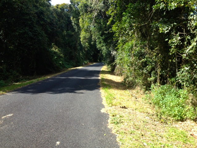
The ferry was a 45 minute ride to Kangaroo Island, and because of a pair of stock trucks on board, it smelled like cows. It arrives at the eastern end of the island and I had to get to the other end where I was staying, some 140km away. Yup, it’s a pretty big island.

wpid-dscn0313-2012-11-19-19-17.jpg

I was warned to be careful when driving at night or in the morning, as wildlife like to hang out on the road. I got to the caravan park without running anything over, but saw far more roadkill than I would have liked to.

Flinders Chase and Ravine des Casoars Wilderness Protection Area
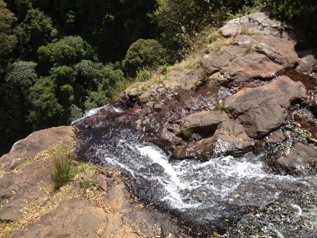
wpid-dscn0324-2012-11-19-19-17.jpg

Ravine des Casoars

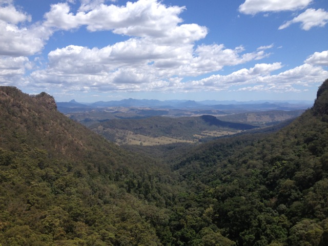
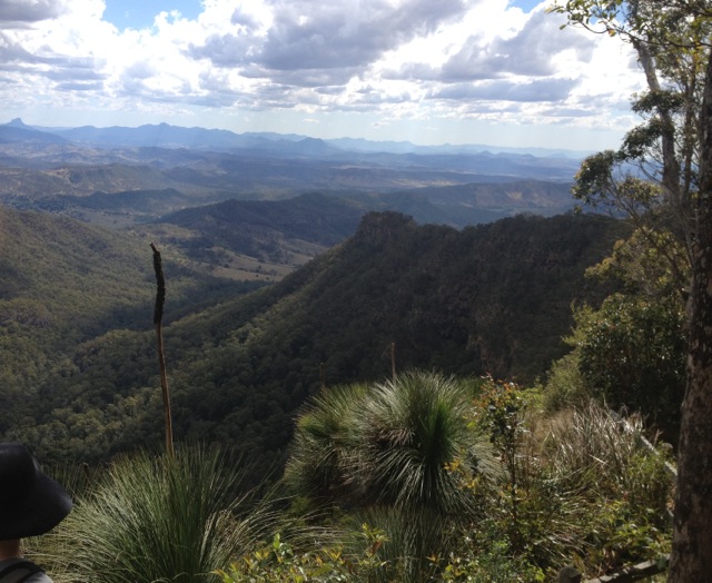
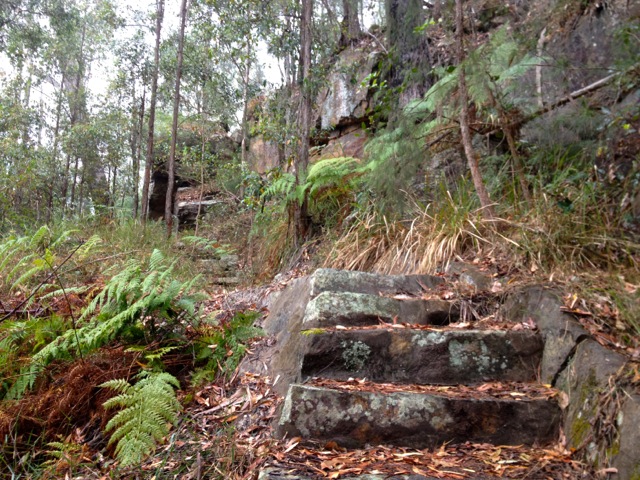
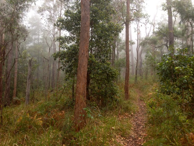
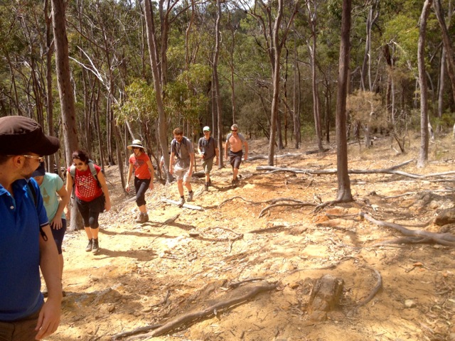
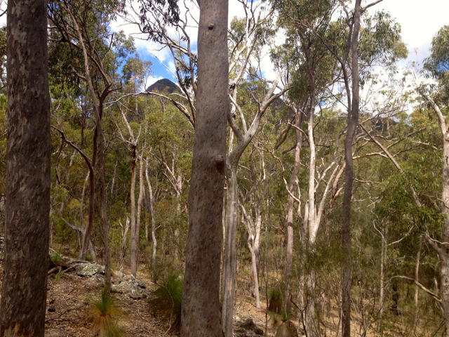
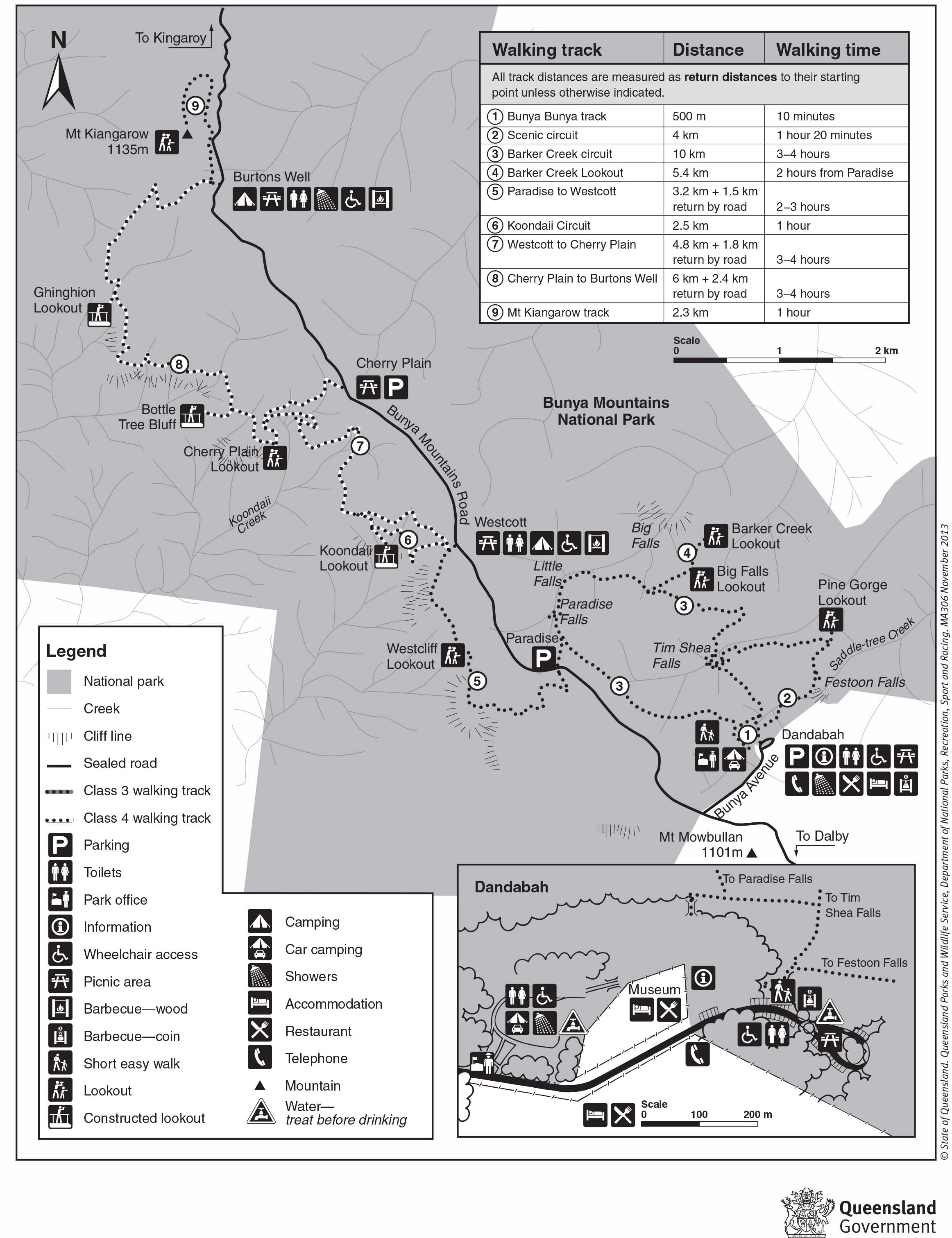
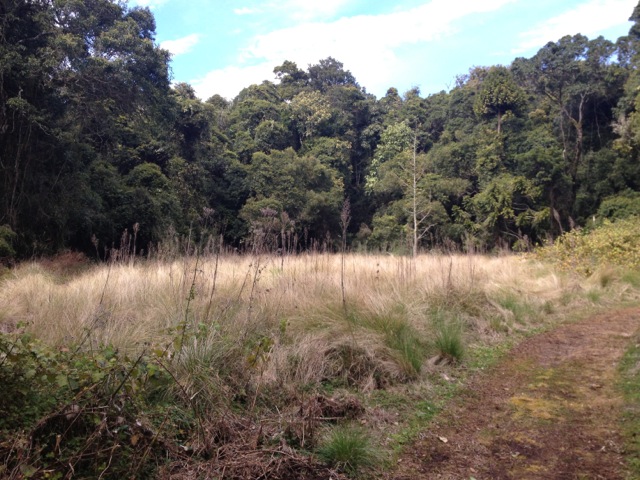
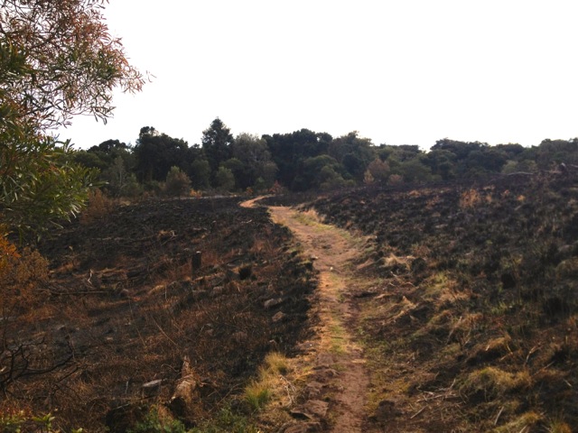
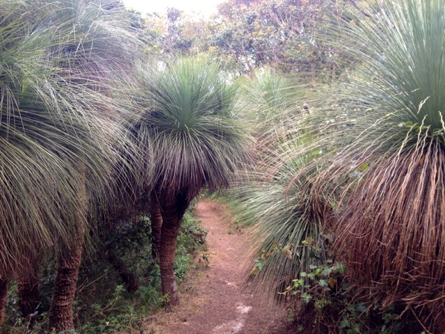
The western end of the island is a National Park and has many different walks and things to see. I chose the Ravine des Casoars hike, one of the hardest on the island. The start of the walk is about 45km from the camping ground and a two-thirds of that is over a very dusty dirt road with many areas of corrugation. This was slow going and took me over an hour to get to the site. I did stop briefly to watch a couple of Goanna’s fighting…

wpid-dscn0326-2012-11-19-19-17.jpg

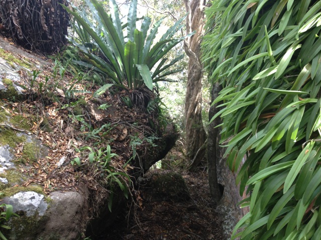
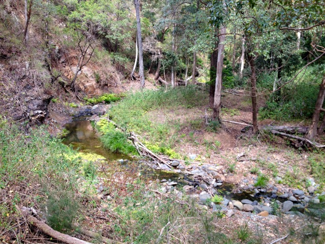
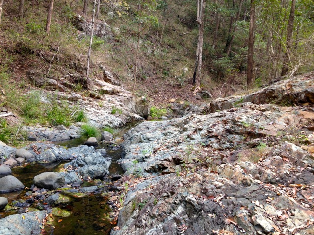
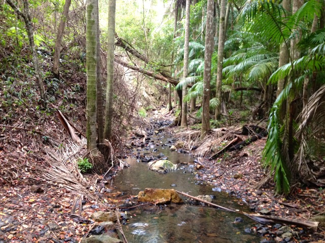
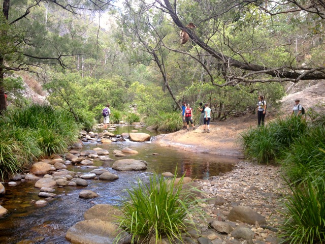
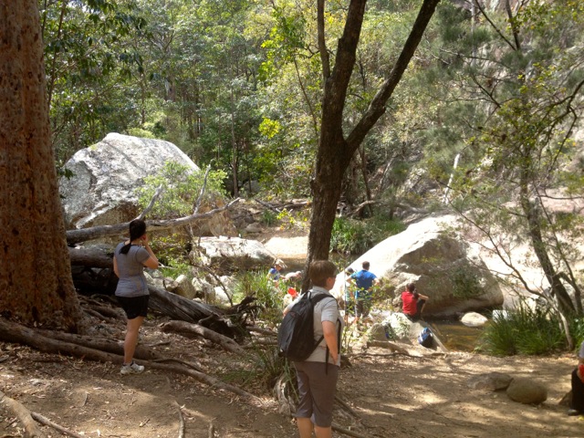
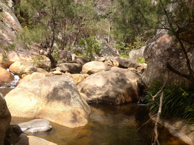
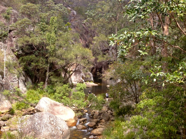
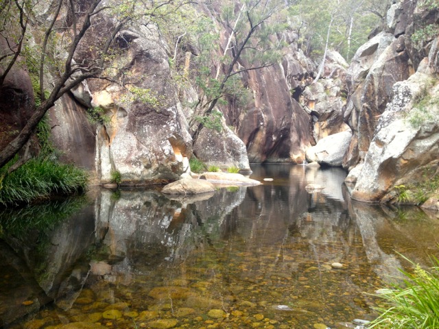
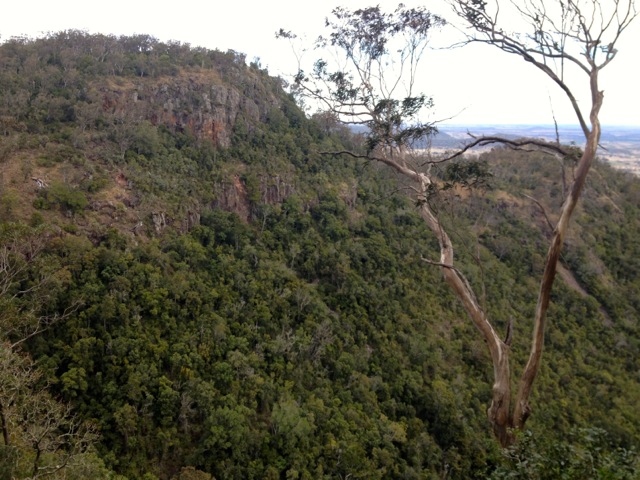
The walk itself is along the side of a ravine, then drops down into the ravine to walk out to the beach. At the beach, there is golden sand and interconnecting limestone caves.

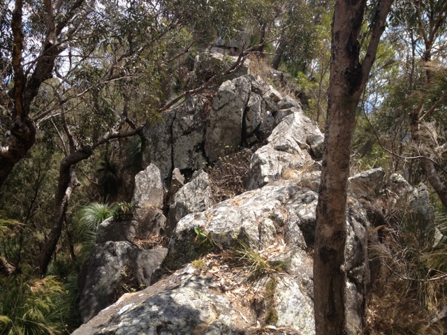
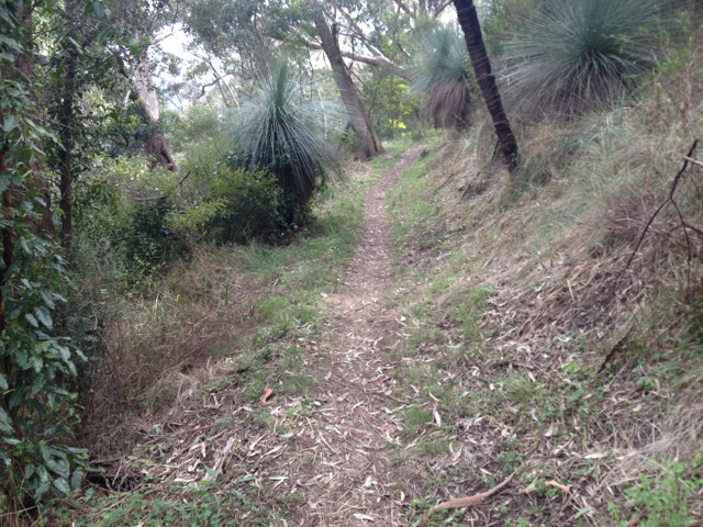
The walk itself was not difficult, but crossed several different types of terrain, rocks, stony ground, dirt and sand. The trail cut through trees for much of its way…

wpid-dscn0330-2012-11-19-19-17.jpg

…until it headed down into the ravine and then followed a stream out almost to the sea. One of the hardest parts was walking along the sand bank while trying to avoid falling in the water. There were plentiful Goannas along the trail, some more than a foot long, and far too many flies.

wpid-dscn0339-2012-11-19-19-17.jpg

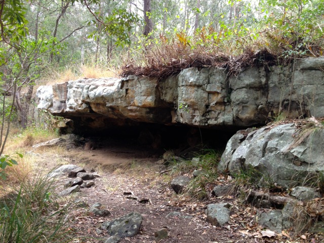
The azure blue of the sea was lovely against the golden sand. The rock formations along the side were amazing. Unfortunately, I didn’t know about the caves until I was there and hadn’t brought a torch with me – something I will remember to bring on every short hike from now on.

wpid-dscn0348-2012-11-19-19-17.jpg

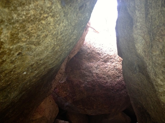
The caves were amazing, and disappeared into the darkness, some of them formed tunnels that connected with some of the other caves. If I had a torch and I would have explored further.

Admiral’s Arch

At the the southern most tip of the National Park…
wpid-dscn0368-2012-11-19-19-17.jpg

‘’’is the Admiral’s Arch. A natural arch of rock…

wpid-dscn0378-2012-11-19-19-17.jpg

Near the arch were several New Zealand Fur Seals. If I was here a couple of weeks later, many more would have been here. They are all off out at sea mating, apparently.
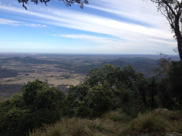
wpid-dscn0375-2012-11-19-19-17.jpg

Remarkable Rocks

Not far from the Admiral’s Arch are the remarkable rocks.

wpid-dscn0389-2012-11-19-19-17.jpg

200 million years ago, a magma boil broke the surface and cooled. Over the millions of years, the rocks have been eroded leaving the unusual collection of massive rocks. The look like an artist created them. Remarkable, really.

wpid-dscn0390-2012-11-19-19-17.jpg

Seal Bay Conservation Park

Along the south coast of Kangaroo Island is Seal Bay Conservation Park.

Walking along a long boardwalk, you can get right down near the Australian Sea Lions that have come to the shore to sleep .

wpid-dscn0409-2012-11-19-19-17.jpg

There is also the skeleton of a hump backed whale along the boardwalk also.

wpid-dscn0406-2012-11-19-19-17.jpg

Tomorrow, I head back to the mainland to Naracoorte for some Adventure Caving.

The relaxed on an island Lone Trail Wanderer

Moran Falls and Lyrebird Lookout Circuits – Lamington National Park

This week I took my hiking group into the Green Mountains section of the Lamington National Park. I’ve done several walks in the Green Mountains including the Gold Coast Hinterland Great! Walk and the West Canungra Creek Circuit.  There are many walks in this national park and I was looking for a less intense one for the group.

Lamington National Park: Green Moutains section map

Map is owned by and used with courtesy of Queensland Government.  Please visit that site for more detailed information on hiking in this region.

Getting to the start of the hike was slow along the thin winding roads where some drivers could have gone faster if they got out and pushed. Eventually, my intrepid band of 14 set out along the road heading towards Moran Falls. This particular hike mixed a couple of circuits and included a section off-track.

IMG_1348

We left the road and headed along a cemented track down the hill for 2km to the Moran Falls Lookout. At the time of writing it hadn’t rained much in Queensland for a few months, so I was hoping there would be some falls to see. But as we came to a viewpoint across from the falls, we weren’t let down. The Moran Falls drop 80m to a small pool and was a pleasant view so early in the hike.

IMG_1345

From the falls, we continued around the top of the cliffs buried in trees to a bridge across the creek flowing to the waterfall.

IMG_1349

Off-track, we followed the creek…

wpid-img_1355-2012-10-15-07-55.jpg

…to an open area of rock at the top of the falls where we could stand on the rocky ledge looking down to the base of the waterfall and along the valley.

IMG_1351

In the background is the mountainous Scenic Rim including Mt Lindsey, Mt Barney and Mt Maroon. While we hadn’t walked far, we decided to stop for lunch.

IMG_1352

After lunch, we continued along a steep dirt track up a hill. This was perhaps the most difficult part of the day and during this time the group began to break into faster and smaller groups. We continued following the path along a ridge until it opened up on one side to an unnamed lookout.

IMG_1358

The views of the next ridge were great, as was the tree-lined valley between the two. We continued along the ridge until we came to the Balancing Rock. It had been cordoned off, so we resisted getting too close.

IMG_1360

Beside Balancing Rock the track continued along a more precarious part of the ridge. The group stopped at the lookout as two of us continued along the ridge to a protruding crag at the end called Castle Crag, with views in most directions.

IMG_1362

Returning to the group and we continued up another steep dirt road to a large clearing and along a short boardwalk to Moonlight Crag – a large wooden lookout giving us again great views of the mountain ranges and Castle Crag.

IMG_1372

Again we continued on, diving into the rainforest along the thin track marked by pink ribbons. As we headed in, the group broke in two, the fast and the slow. The front group walked on to a small grotto known as the Orchid Grove…

IMG_1375

…and then on again towards Lyrebird Lookout. Unfortunately, the sign to the lookout wasn’t prominent and we went past it to an open clearing that held the foundations of several buildings from decades before.  It was unclear what these buildings had once been used for. We waited for the other group but when they didn’t arrive, headed back along the trail, making our way through the rainforest to an overgrown track and on to a well attended track. A kilometre further on we arrived back at the start point and waited for the second group to arrive. They weren’t far behind, having found Lyrebird Lookout and returned a different way through the rainforest back to the start point.

Overall, the walk wasn’t a difficult one, but it was an adventure with some great views. Next week, however, I take a group to climb Mount Barney, the most difficult hike I plan to do in Queensland. It’s the third tallest mountain in South East Queenland – the tallest being Mt Superbus from our climb last week – and has a suggested time of 10 hours, 5 hours up and 5 hours down. I’m sure my legs won’t be thanking me, but the views should be fantastic…

The Trail Wanderer

Ravensbourne National Park

IMG_1247

Ravensbourne National Park is a small park only a handful of kilometres from Crows Nest National Park.  The weekend I was here it threatened rain, but I still intended to walk as many trails as I could.

Day 1 

Cedar Block Walk
With the threat of rain I headed up to Gus Beutels Lookout.

IMG_1248

Cedar Block is a very short walk through the rain forest and served as a warm up for the day. I guess if I had to write a description, I would say… ‘there are trees and then it ends’. Warmer after the brief walk, I headed down the road to the beginning of the next walk.

Rainforest, Palm Creek and Buaraba Creek Circuits.
While these three circuits are separate hikes, the Buaraba Creek Circuit traverses both of the others before heading off track and into the forest. Off Track, that doesn’t sound like me? Never.

I headed out from the car park along the trail and into the trees. It was not long before I came to the beginning of the rain forest circuit to the right, so I climbed the steps and headed off around it. While it was a nice walk, all those tree-like things really got in the way of any kind of a view. After about 30 minutes I arrived back at the main trail and continued on.

IMG_1256

It was not long before I came to the Palm Creek Circuit. I headed along this trail and guess what? Trees. While I like walking in the forest, I do find it a little boring. I prefer rocky ridges and mountains for the challenges and the views. But often, hidden away in these forests are cool things, like waterfalls, creeks and caves. And that’s what I found at the end of the Palm Creek Circuit, a series of low caves.

IMG_1267

Beyond the caves an ungraded track continued – the Buaraba Creek Circuit. The trail soon turned into a dirt road that headed further into the National Park. The road slowly climbed towards something, although it was hard to tell exactly what. At a crossroads I turned north to another junction, where the path descended steeply towards the creek.

IMG_1271

At the bottom, I took a break.

IMG_1275

On the other side, I climbed a steep rocky hill until it too reached a junction and I headed back downhill. For most of the walk, I had seen Lantana along the side of the track, but here it started to encroach upon the trail. I fought through some of it as I followed a lesser walked track. But after a fair distance – and only a few scratches – I decided I had gone too far and decided to climb down a thin trail towards the creek. Somewhere along the other side of the creek there was a graded track leading back to the other circuits, I just had to find it.

IMG_1279

It was about then that it began to rain – only lightly at first, but slowly gaining momentum. Thankfully I’d brought my jacket and a bag cover. Off trail hiking in the rain is dangerous; rocks and dirt get slippery and I did end up on my arse a couple of times. I worked my way along the creek slowly and carefully, crossing back and forth I eventually came to a grove of palms and soon after the steps I was looking for.

At the top of the steps I found a rocky ridge line. Yay for rocks!

IMG_1282

The graded track continued ahead of me as the rain grew heavier. And what happens when it rains in the rainforest? Mist. The forest took on a whole different and very beautiful appearance.

IMG_1283

In the rain, I quick marched for about three kilometres back to the car park and dry clothing. Then I was off to the caravan park for the night and a hot shower.

Day 2

Mt Perseverance Circuit
Today it was back to the usual beautiful Queensland weather with no signs of rain.  While yesterday I did the official trails, today I am going to do a trail only found in the book: Take a walk in SE Queensland.

Because it’s not an official hike, finding the Mt Perseverance Circuit became the biggest issue of the day and the entrance is not clearly marked. After driving along gravel roads for a while, I did eventually find it.  It’s near Lot 20. Ignore the old ‘keep out’ sign which near it as it relates to the paddock next to it.

The trail for the entire hike is a wide dirt track and is an easy grade through the rainforest for 7.5km.

IMG_1289

About half way in, the dirt road climbs to Mt Perseverance. It’s not a hard climb and at the end there is a fire tower, but it’s a little anti-climactic as the tower is fenced off and the views are pretty sparse. I stopped for a break before continuing with the circuit. After another 45 minutes I returned to my van.  Over, a good stroll, but not a very exciting walk.

The Lone Trail Wanderer.

Mt Barney National Park – Lower Portals

This weekend I’m heading to Mt Barney National Park where I have arranged to walk two different hikes.  Today, I am taking a group on a the casual walk to the Lower Portals, and then tomorrow, I am taking another group to climb the more intense Mt Maroon.

I organised to meet the group at the little township of Rathdowney.  Once we had all arrived,  we convoyed to the car park at the base of Mount Barney. As we drove we passed the rocky face of Mt Maroon, which beckoned me for tomorrow’s climb.

IMG_1176

From the car park it’s 3.7km to the Lower Portals, a set of stony passages where water passes when it comes down the mountain. With Mt Barney above us to the south, we headed into the light forest on a rocky trail.

IMG_1177

We climbed over small hills on the way through the forest. To be honest, other than the occasional view of Mt Barney through the trees, the walk wasn’t very interesting.

IMG_1178

But the group made up for that and after 45 minutes we stopped at a rocky stream for a break.

IMG_1180

After our break we crossed the stream and walked south along the bank for another 10 minutes before trail ended abruptly.

IMG_1187

Massive boulders blocked our path further along the stream and we figured we had reached the Lower Portals.  It was all very anticlimactic.

IMG_1188

Until… We located a gap in one of the rocks and climbed up through it.

IMG_1196

Like a secret garden, the true beauty of the Lower Portals appeared. Beyond the boulders and perhaps a dozen metres along, the stream opened up to a pool with a gorge on the far side.  And at the far end of the small gorge, the Lower Portals.

IMG_1191

The tall rocky sides of the gorge were beautiful as a backdrop to the pool and stream.

IMG_1192

We hung around for half an hour more, taking in the views, before returning along the same trail to the car park.

Tomorrow, Mt Maroon.

The Trail Wanderer.

Bunya Mountains NP – Westcliff and Cherry Plains Circuits, and Mount Kiangarow

Today was my second day in the Bunya Mountains and after sleeping the night in my van, I was up early and preparing for two 4-hour hikes followed by a 3-hour drive home.

Today’s hikes run into each other at the Cherry Plains Lookout and could be combined, but I chose to separate them and stop for lunch in between.

Bunya Mountains National Park map

Map is owned by and used with courtesy of Queensland Government.  Please visit that site for more detailed information on hiking in this region.

Westcliff and Cherry Plain Lookouts – 11.4km
This hike begins at Paradise Carpark, an area I came close to on yesterday’s hike past Paradise Falls. Yesterday’s hike was on the northern side of the Bunya Mountains, today’s hikes are both on the southern side.

The walk began in a forest similar to yesterday’s.  I quickly came to a place called Little Pocket, a small glade in the middle of the forest.  It would make a great place to camp or for a picnic.

IMG_0861

The trail continued on the other side of the pocket with many ferns growing on either side. The trail meandered through the forest with the typical sound of the whip birds singing to each other.

IMG_0864

A slanted, tree laden cliff face dropped away on my left giving vegetation obscured views of the plains to the south heading to Toowoomba. I soon arrived at the Westcliff Lookout which gave me clearer views of the plains.

IMG_0866

I walked back into the forest and eventually came to a burned area with new green shoots. The land is hardy and while I think this was burned as part of Queensland’s back burning campaigns for the dry summers, it’s always amazing to see the new green shoots pushing up through the blackened ground. At the far side of the of the area I emerged into the Westcott Camping area where I’d spent the night.

IMG_0869

I continued along the trail and headed downhill towards the Koondali Lookout and then on to the Valley View Lookout.  Both gave the same sprawling views to the south.

IMG_0875

The trail led back into the forest, but this time the vegetation along the sides had changed. The ferns had been replaced with the sharp spiky leaves of stinging nettles and cacti. I’m glad I wore long pants today! The trail eventually winds its way back towards the road. So far much of the walk had been fairly flat or slowly heading down, not what I expected in the mountains.

IMG_0877

When I got back to the road, I followed it towards Paradise Carpark, some 3.5 km away. This turned out to be the hardest part of the hike as the road climbs steep hills directly to the carpark. The trail is suggested to take 4.5 hours, but it only took me 2.5.

IMG_0878

Mount Kiangarow and Cherry Plain Circuit – 10.7km
I drove from Paradise Carpark to Burton’s Well Carpark and stopped for lunch. I then set out along the trail which quickly came to a junction at the bottom of Mount Kiangarow, the tallest mountain in the National Park. While it didn’t take long to climb the 1.1km trail, it was actually nice to be climbing something, albeit rather gently.

IMG_0880

At the top the lookout is rather small with only a slim area to view from. A little disappointing, but you often get that.

Back at the junction I headed south and then east along the cliff line. As per the end of the last hike, the vegetation at the side of the path was mainly nettles around the trees. The path again headed downwards, this time a little more apparent than earlier today.

IMG_0883

The Ghinghoin Lookout gave the same views south as much of the other lookouts.  The trail then began to climb, not harshly, just long enough to keep the body working. While walking around the edge of the cliff, a bluff came into view and I could see a lookout platform on it.  It was not a harsh climb, but after 16km of walking today my legs were starting a quiet burn.

IMG_0895

The lookout was surprising easy to get to and I sat for a moment to give my legs some time before heading back up along the path. My last stop before the road was the Cherry Plain Lookout which was overgrown and I wasn’t sure exactly what I was looking out over.

The trail then joined the one I’d walked this morning and made its way for 1km to the road. This time I only had 2.4km of road to walk but again it was the steepest and hardest part of the hike.

I arrived back at the van ready for my trip home.

Overall, the Bunya Mountains are a beautiful place to walk with greatly varying vegetation depending on which side of the mountains you are on.

Next weekend I’m heading off to Crows Nest National Park.

The Lone Trail Wanderer