Tag Archives: Hike

Sandstone Trail, Cheshire, England – Part 1

This month I walked in Cheshire, a fairly flat county in England that runs along the border of Wales and is just south of Liverpool in the Greater Manchester area.

The Sandstone Trail runs along a central Sandstone ridge above the Cheshire Plains and is said to be one of the first middle distance walks in England. It runs a total of 55km (34mi) from Frodsham in the north to Whitchurch to the south. I planned to do it over three days, staying in B&Bs along the way as camping grounds are fairly rare. The choice of this hike was because there is a major train station at both ends of the trail, so accessibility is easy.

Section 1 – Frodsham to Clotton 23.3km (14.5mi)

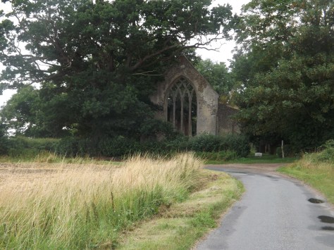
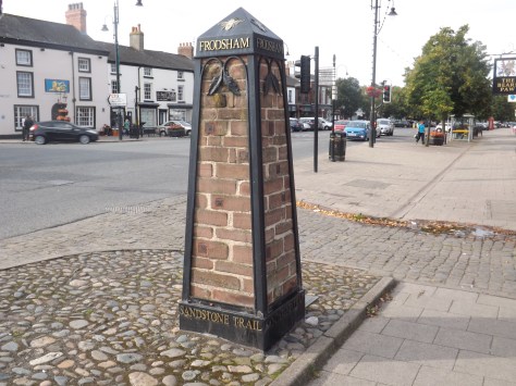
I left my B&B in Frodsham around 10AM and walked the short distance to the Bear’s Paw, the official northern Trailhead. It was once several miles to the south, but was moved to Frodsham to make it more accessible.

dscf8510-2017-08-29-14-20.jpg

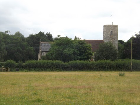
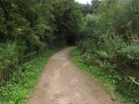
I crossed the road and headed south past the train station. Unsure if there would be anywhere on the trail to stop for food, I stopped at an Australian cafe for a coffee and to buy a sandwich. I then continued along the road to an alleyway which had a moderately steep climb along it. Within five minutes of walking, I had already climbed more than during the entire Boudicca Way hike. At the end of the alley, I came out near the Overton Church.

dscf8513-2017-08-29-14-20.jpg

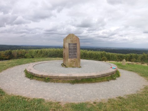
I continued up the hill passing houses until the trail led me onto the wooded slopes of Overton Hill and a steeper climb. I followed the switch back trail until I came out at a War Memorial.

dscf8520-2017-08-29-14-20.jpg

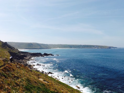
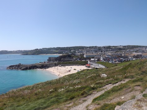
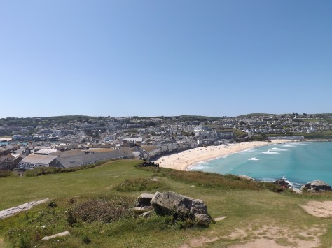
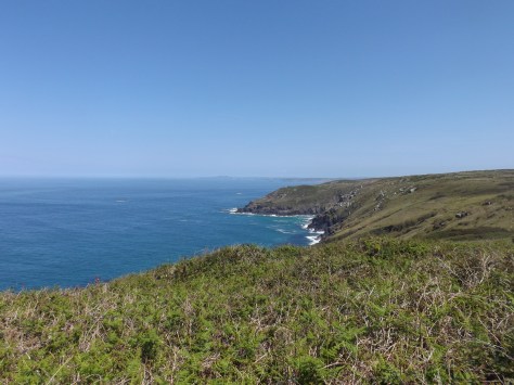
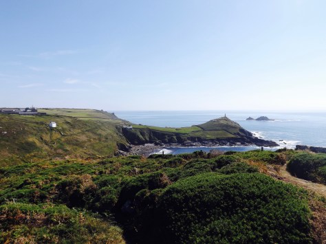
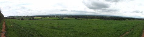
Beyond was a great view out across the Mersey Estuary with Liverpool in the distance. If the rest of the hike had similar views, I was going to enjoy this walk.

dscf8516-2017-08-29-14-20.jpg

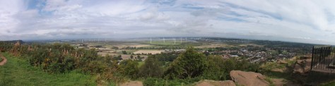
After my brief photo stop, I continued on along the trail as it cut through the woods to the south. To my left was a fenced off golf course and to my right the occasional view out to Liverpool.

dscf8532-2017-08-29-14-20.jpg

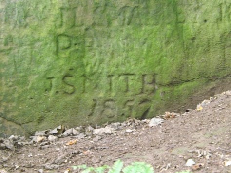
The trail followed the edge of the golf course and descended on metal and wooden steps to a lower section of the woods. The trail followed a switchback along the cliff and past Jacob’s Ladder, a series of steps cut into the cliff that was the only way down a hundred or more years ago. As I walked I noted initials and dates cut into the cliff face, some going back as far as the early 1800s.

dscf8523-2017-08-29-14-20.jpg

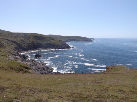
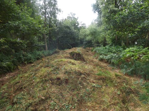
The trail climbed again to arrive at another viewpoint looking West. I followed the trail further and saw story boards relating to an old Iron Age hill fort, so I followed a smaller trail up the hill to investigate. All that was left of this 3000-year-old village is its ramparts, a line of earth mounds in which a wooden wall had once been built.

dscf8536-2017-08-29-14-20.jpg

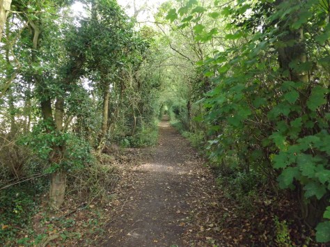
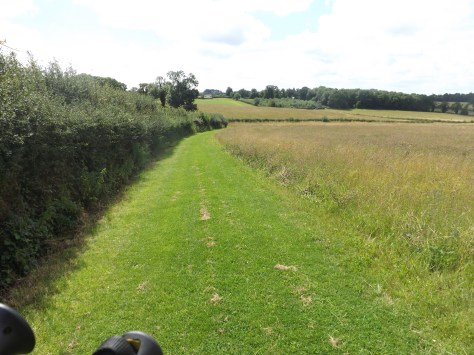
The trail continued, wending its way through the woods, up and down hills for some time through Snidley Moor Wood until it came out on a road. A hundred metres along the road the trail dove back into the woods and past a large clearing used for a scout camp.

dscf8534-2017-08-29-14-20.jpg

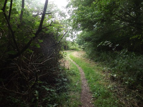
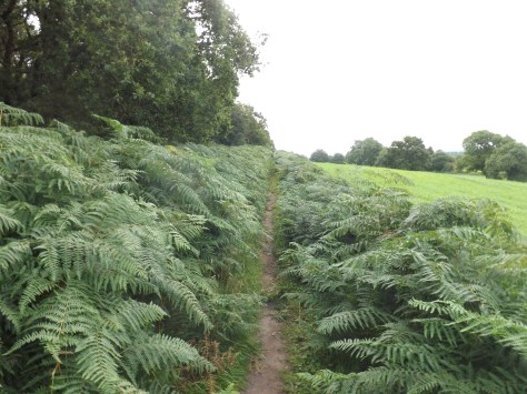
The trail then followed the base of a wooded cliff across grassy fields edged by nettles. Yes, I decided to wear my shorts again. I crossed roads and other fields, sometimes on wide grassy areas and sometimes on thick nettle covered paths. I followed a road for some time, walking along a footpath before it cut across another field to emerge near a B&B which had conveniently set up a little cafe on the grass. A great place for lunch. Then after a short walk through the village of Manley Common, I followed a path into Delaware Forest Park.

dscf8543-2017-08-29-14-20.jpg

The Forest Park is simply a forest with many dirt roads used mostly for cycling and horse riding. There are down hill cycling courses at various places and warnings to walk on the sides of the dirt roads. As it was summer holidays, there were plenty of families riding their bikes around.

dscf8545-2017-08-29-14-20.jpg

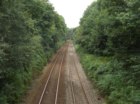
Forests aren’t my favourite places to hike as they tend to be wall to wall of trees with little else, and that is how I found Delamere Forest Park. Somewhere in the centre, there is Blackmere Moss, a flooded area like a small lake. However, there had been little rain over recent times, so it was not as flooded as I was hoping. I walked on to the south and crossed the Chester-Manchester railway line on a stonework bridge.

dscf8552-2017-08-29-14-20.jpg

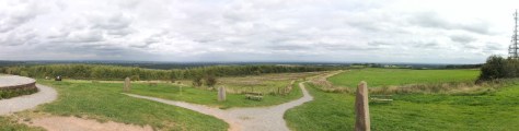
A short distance later, the trail came out of the forest park onto a grassy field with another wood off to the right. After a couple of hundred metres, there is an alternative trail that leads up to the summit of a hill called Pale Heights, with great views in most directions.
dscf8557-2017-08-29-14-20.jpg

At the top, I took several panorama photos, from the Clwydian Range to the north, the Mersey to the east and the distant Pennines.

dscf8555-2017-08-29-14-20.jpg

I then headed south again through the woods and across the A54 highway. After a brief foray across more fields, I cut into the Primrosehill Wood, then out again and up a slight hill to the south.

dscf8560-2017-08-29-14-20.jpg

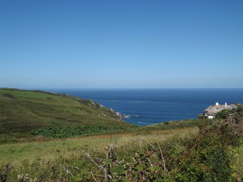
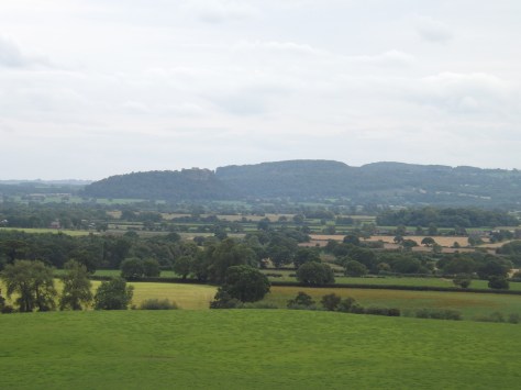
I cut along the top of the ridge and across some paddocks before coming over a stile in a field dotted with cow patties…

dscf8566-2017-08-29-14-20.jpg

…but there was a view I’d been waiting for all day for, my first sighting of the Beeston crag and the ruins of Beeston Castle.

dscf8567-2017-08-29-14-20.jpg

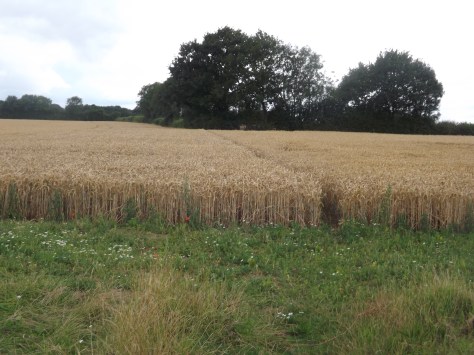
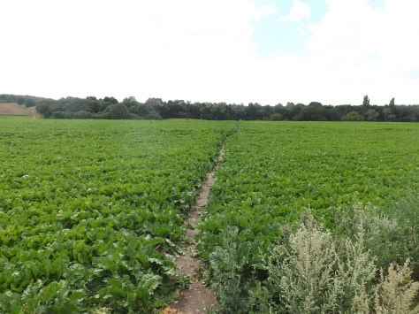
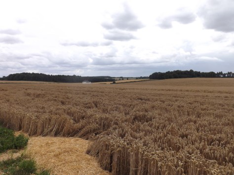
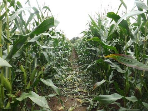
Much of the remainder of the day I crossed animal paddocks, where I avoided the ever-present cow paddies. Then, crossing a road, I was thrust into a corn field.

dscf8573-2017-08-29-14-20.jpg

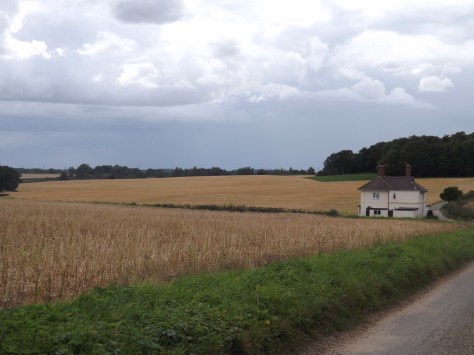
Eventually after a long day of walking, I emerged at the A51 nearly Tarporley a short distance from my B&B. When I found it I headed inside and grabbed a shower before wandering down to the local pub for dinner and a well-deserved cider.

Next, Part 2 of my three day hike On the Sandstone Trail.

The Lone Trail Wanderer

Boudicca Way, Norfolk, England – Part 2

I recently walked the Boudicca Way in Norfolk, England. See here for Boudicca Way, Norfolk, England – Part 1

Day 2 – Saxlingham Green to Gissing – 28km (17.4miles)

After a night in a tent and a B&B style breakfast, I packed up and headed out. I had planned for today to be the longest day of this walk, so thought it best I get started early. The trail went quickly through a field to a small lane then onto a major road for a hundred metres or so before diving back onto cropland.

dscf8498-2017-08-1-15-06.jpg

I started to see horses in paddocks as I walked and chatted to several as I went past, some coming to the fence to check me out. As I cut around a small copse of trees, I began to hear the highway ahead. I crossed another paddock and over the road where I could. I then walked between a pair of fields with horses and ponies roaming around before onto a small lane that again led to a rural road. I followed this to a small village before turning left and along for fifteen minutes to the large village of Tadburgh.

There is a pub on the far side of the township, and I was keen for a coffee, so I walked along the major road to it. It was closed. It seemed pretty standard for Norfolk not to find anywhere open that sold food. I sat on an outside seat and ate some trail mix before heading off again.

dscf8503-2017-08-1-15-06.jpg

I walked on again along tight country roads for some time, standing aside for the occasional car that came by. I turned right and headed onto farmland again along permissive lands provided for my walk. I crossed more wild trails fending off nettles with my walking poles. Over a major road,  I walked into more fields, passing some trees called, ‘Devil’s Wood’ then along a path to the village of Fritton. As I walked, I wished for a seat, and when I got to the corner there was one waiting near a phone box. I sat down and ate more of my trail mix. Again, like the other villages, there was no place to stop to buy any food, not even a corner shop to grab a snack.

dscf8504-2017-08-1-15-06.jpg

After a rest, I headed south with the threat of rain looming in the sky. It spat a little as I walked under a row of trees, but nothing more. Then it was back into farmland and across more wheat fields before heading south into Tyrell’s Wood, the first I was allowed to walk through. It seemed popular with dog walkers. When I got to the carpark, I took another rest, taking off my boots. Today my boots have been hard on my feet and ankles, and I could start to feel some strain on my Achilles’ tendons. So when I put the boots on again, I made sure to keep them loose.

Rain threatened again as I headed off again along country lanes. After ten minutes the rain finally came down. I was prepared for it and had brought a small umbrella with me. With it open, I stood under a large tree while a heavy barrage of rain came down for 30 minutes or so.

When it stopped, I headed off again and five minutes later had to cross a wheat field with a path cut through it. It was a little slippery, but the wet dirt had yet to turn to mud although my boots and legs got wet from the wet plants.

dscf8507-2017-08-1-15-06.jpg

I eventually made it to Pulham Market, a larger village with a pair of pubs close together. But time was getting on, and I estimated I still had another 2 hours to walk, so I didn’t want to stop for too long. I had no idea how far I had walked since leaving camp nearly 8 hours earlier, but my legs were growing sore and seized up each time I stopped. So I pushed on. My left Achilles tendon was still sore, so I tried to go easy on it, adjusting my boots again to give some comfort.

dscf8506-2017-08-1-15-06.jpg

I pushed on south along the road and then a country road that led onto more fields. I again cut across wheat fields and along grass verges hiding nettles until I reached another major highway. It was here I was to leave the trail to get to my accommodation another 5 miles away.

I walked through more country lanes, past houses and farms, through the village of Tivetshall St Mary to the remains of St Mary’s Church where I stopped for my final rest. I was just about to leave again when it again began to pour.

dscf8508-2017-08-1-15-06.jpg

Once it had finished, I set off but was again stiff. I crossed a railway bridge then followed a muddy trail across yet another wheat field and a grass paddock. One more road and I arrived at my B&B. My legs were sore, and I was knackered after a 10 and half hour day, nine of them walking. I looked forward to a shower and a walk to the pub for dinner.

After my shower, I could barely walk. Then because a local fete had been on that day, I discovered the pub was not serving food and delivery from Diss was going to cost me a fortune, so I resigned myself to eating trail mix again. But again, my host offered to cook me dinner. It was amazing. Afterwards, I watched some TV before collapsing into a comfortable bed.

Day 3 – Gissing to Diss – 10km (6.2miles)

Rain rain rain, all night long. It would be a short walk today to my end point where I was catching a train late in the day. My hosts told me I could stay as long as I liked, and I made a plan for when the rain stopped.

My host dropped me off back on the trail, and I waited in a pub for the rain to stop, but alas, it did not. The pub did not serve food on Mondays but could heat up a sausage roll for me. I eventually gave up waiting for the rain to stop and caught a bus to the train station in Diss where I hung out for several hours waiting for the train. Not the way I wanted to end the walk, but neither would be getting rained on and having to cross muddy fields.

dscf8469-2017-08-1-15-06.jpg

Overall
Honestly, while it was an interesting walk along roads and through paths across farms, there was not that much to the Boudicca Way. It was good exercise and got me used to a heavy pack again, but there were very few scenic views or places of interest. The difficulty finding accommodations and there being practically nowhere to eat made it a rather annoying trip. I’m glad I walked on this side of the country, but next, I will be off on what I hope will be a more decent hike, Cheshire’s Sandstone Trail.

The Lone Trail Wanderer

Boudicca Way, Norfolk, England – Part 1

In 60AD, Boudicca (bow-de-see-ya) was a warrior queen of an ancient Celtic tribe in the region now known as East Anglia. After her husband’s death, her lands were usurped by the Roman emperor Nero, she was flogged, and her daughters raped. From this, she was chosen to lead an uprising against the Roman army, which left 80 thousand Roman soldiers dead and laid waste to three cities including Londinium, which would eventually become London.

b5d9950fe8635eb3396e543cf1732480-warrior-queen-woman-warrior-2017-07-27-14-35.jpg

The Boudicca Way is a three day, 58km/36-mile hike that crosses the area where Boudicca lived, Iceni. It starts in the city of Norwich, England’s second largest city until the Industrial Revolution, to the market town of Diss.

celtmap-2017-07-27-14-35.jpg

Day 1 – Norwich to Saxlingham Green – 22.75km (14.1miles)

It was an early start in London to get ready. I’d packed the night before, so I just needed to have breakfast and get to Liverpool Street Station for my train to Norwich.

After three hours I arrived and spent some time getting water and repacking. Then I headed out along the path following the app I’d downloaded, which would prove invaluable during my trip.

pastedgraphic-2017-07-27-14-35.png

The first hour of the hike was spent getting out of the city, crossing rivers and walking streets with endless cars everywhere. Finally, I passed through Trouse Newton and along a street that grew steadily thinner as I went. Towards the end of that road, I crossed a paddock where a henge had been. It’s now empty but for a circle of cleared ground.

dscf8465-2017-07-27-14-35.jpg

I followed another road and after crossing the A47 highway the trail went rural. I followed it through cropland freshly sprinkled with rain from earlier that morning.

dscf8466-2017-07-27-14-35.jpg

On the far side of the field, my feet were soaked from the wet plants. The worst was yet to come, as the trail lead alongside wheat fields it was thickly scattered with nettles, prickles and thorn bushes. Perhaps I should rethink always wearing shorts and would recommend anyone doing this walk to wear long pants. The sting of nettles goes away fairly quickly, but the scratches from the thorn bushes don’t. Trophies of hiking I guess.

dscf8471-2017-07-27-14-35.jpg

At Armishall I headed back onto a road and then along the wide stretch of grass between fields.

dscf8474-2017-07-27-14-35.jpg

I came to a T-intersection after being on the road for a mile and followed a side path to the site of the ancient Roman town of Venta Icenorum. The site is now just an empty field that had been dug up by archaeologists. I spent some time walking around it and reading the boards explaining how the Romans of 200-300AD lived.

dscf8486-2017-07-27-14-35.jpg

I then headed back along the roads to the crossing and went the other way for four miles, passing small wooded areas and more crops.

I stopped at Shotesham for a Cider at the local pub only to find out I was too early for dinner. This was a stroke of bad luck as there had been no other food places along the way. This was also the closest food place to my accommodation, which was still three miles away. After a long day on the trail, I did not relish the idea of walking 3 miles each way to get dinner, so I resigned myself to simply dining on my trail mix in my tent.

dscf8494-2017-07-27-14-35.jpg

I walked on through fields of corn and wheat, past more woods to finally come out at my accommodation, the wild camp site. It turns out it was actually a B&B that was trialling wild camping in their extensive back field. I would get the use of a cottage’s bathroom and kitchen while only sleeping in my tent. Sheer luxury for a campsite. When my hosts discovered I’d missed dinner at the pub, they insisted on cooking me some scrambled eggs. A touch of the East Anglian hospitality I was to see more of during the walk.

dscf8495-2017-07-27-14-35.jpg

I chatted with my hosts and drank a glass of wine. They were lovely and interesting people. But after my long day walking I was looking forward to a shower, to get my tent pitched, and head to bed.

Boudicca Way, Norfolk, England – Part 2

The Lone Trail Wanderer

Lands End, England – St. Ives to Penzance, Part 2

A four-day hike around the toe of England – Land’s End, Cornwall. See the first two days – St. Ives to St. Just.

Day 3 – St. Just to Treen – 18.5km (11.5 miles)
Stage 3 overall was moderate with only a couple of difficult climbs.

As we had walked a mile past St. Just the night before to the YHA, we were already a mile ahead of schedule for the day. After breakfast, we checked out and headed along the gully to Gribba Point with a view back along the coast to Cape Cornwall. Ahead of us, the coastline stretched away as the trail cut across the cliff tops and only descended into a river gully once.

dscf8419-2017-07-10-14-35.jpg

We climbed our way back up the cliff and around to the rocky Aire Point with White Sand Bay growing ever closer.

dscf8423-2017-07-10-14-35.jpg

Beyond Aire Point, the trail grew more sandy as we came down into Whitesand Bay with Sennon Cove settlement on the far side where we aimed to find lunch. We watched surfers in the bay as you crossed a small amount of sand before climbing around the cliffs towards the town. On arrival, I found a fish and chip shop and a pub to enjoy a relax and an ice cold cider.

dscf8432-2017-07-10-14-35.jpg

After lunch, we headed up the cliff and the final kilometre to Land’s End, the westernmost point of England’s mainland. We walked briefly through Legendary Land’s End, a tourist mall, before pushing on in the heat.

The way around the coast was mainly across the tops of the cliffs with only one climb down into Mill Bay and back up the other side. From here it was rolling hills all the way around to Gwennap Head, the southernmost point of the Land’s End peninsula.

dscf8439-2017-07-10-14-35.jpg

We stopped for a break at the lookout at Hella Point before climbing down into Porthgwarra, a small village with a beach nestled in the rocks.

dscf8444-2017-07-10-14-35.jpg

Further on we were warned of a cliff slide near St. Levan, so walked cautiously but found nothing of concern. We could soon see Logan Rock ahead, our end point for day 3.

dscf8447-2017-07-10-14-35.jpg

We came to the top of the cliff over looking Porthcurno beach where there is a natural Open Air Theatre, but after a long day in the sun, neither of us felt like paying the money and lugging out bags up and down the cliff to see it.

At the top of the cliff on the other side of the beach, it was only a fifteen-minute walk to our accommodation, Treen House B&B and its host, the lovely Claire.

dscf8448-2017-07-10-14-35.jpg

Treen House B&B is only 50 metres from the local pub, but up a hill. After the day’s walk, it was perhaps the hardest walk we had to make.

Day 4 – Treen to Penzance
The initial part is ‘difficult’, going quickly to moderate, before ending on an easy walk along roads.

We left the lush comfort of the Treen B&B and walked along the road down to Penberth. As it had for the previous three days, the sun beat down with only a soft breeze to cool us as we climbed one of the few cliffs left on this coastal adventure. We descended into a gully, ascended the other side to walk along the cliff and then down towards the community of St. Loy Farm, where we finally had some shelter from the sun through a small tree reserve.

Past the community, we had to for the first time rock hop along a beach for about fifty metres before heading up Boscawen cliff on the other side.

dscf8451-2017-07-10-14-35.jpg

For the rest of the morning, we walked along the tops of the cliffs on a fairly easy route towards Lamorna where we came around the cliff to find a cosy little village nestled into an inlet. The heat was pretty sweltering, so we stopped off for lunch and a cold drink. We then continued around a rocky cliff, up Kemyel Cliff and passed alongside the Kenyel Crease Nature Reserve where we started to see more civilisation.

dscf8455-2017-07-10-14-35.jpg

We hit roads not long after at the township of Mousehole only a handful of miles around the coast from Penzance. The remainder of the walk had us following the main highway along the coast. We stopped for an ice-block to cool us down before pushing on. Many people catch a taxi or bus from Mousehole as it is all road walking, but we decided to finish on foot. The concrete under our feet was hot, and you could feel it through your boots as we pounded the pavement.

dscf8459-2017-07-10-14-35.jpg

After an hour on the road, we finally made it back to our accommodation in Penzance and dropping out bags off at the car, we headed to the local pub for a well-deserved cider.

Overall
The four-day hike from St. Ives to Penzance is an excellent and moderately difficult walk, made harder by the beating sun at this time of the year. It’s an experience and finding the little hidden away golden beaches and peacefulness of the trail, it was overall a good time. At no point would I have considered it severe difficulty as I have seen mentioned online, and only barely strenuous because of the constant heat.

The Trail Wanderer

Lands End, England – St. Ives to St. Just, Part 1

It’s been some time since I’ve put on a pack and headed out on the trail. I’m now living in London in the UK and decided to get out and see what England had to offer.
After some deliberation, my brother and I settled on a four-day hike around the toe of England in Cornwall, called Land’s End.

This is my first full coastal hike on what I’m told is the best scenic hike in England. At 66km or approximately 43.5 miles, I  split it over 4 days, plus a day to get to and from Penzance, our starting point.

Transport
Land’s End is around 300 miles from London. To get two of us down there by plane or train is very expensive, and we didn’t fancy 9 hours on a bus. This time it turned out far cheaper to hire a car.

Accommodation
There are camping grounds around Land’s End, but we decided to go ‘glamping’. So we booked backpackers and B&Bs to ensure we got a hot shower and soft bed after each day of walking. If you do this, it is best to book a fair time ahead to ensure you get a room, especially in summer when it’s most popular. Also note, most accommodations have late checkout and 5 pm check-ins, forcing hikers to walk during the hottest part of the day.

wildlandsendmap21-2017-06-23-15-04.jpg

The day before our walk, we drove down from London, a five-hour trip. We stayed the night before the hike in Penzance and would be staying at the same place at the end of the hike. This was so we could leave the car securely parked for the duration of the walk.

Day 1 – Penzance to Zennor – 11.5km (7 miles)
This first stage of the hike was the hardest but thankfully the shortest. While it is listed as ‘severe’ and ‘strenuous’, I would consider it closer to ‘difficult’, especially in mid-summer under the constant sun.

We left the car outside out accommodation and bought train tickets to St.Ives, taking only 10 minutes and delivering us to the trailhead in style.

dscf8355-2017-06-23-15-04.jpg

On arrival in St. Ives we found the small town to be set between picturesque gold sand beaches, something not normally associated with the UK. In the blue skies and hot sun of mid-summer, tourists and beach goers swarmed the small town.

dscf8362-2017-06-23-15-04.jpg

We started the walk with a tour of ‘The Island’ on St. Ives Head giving the above views out across the town and beaches. On ‘The Island’, St. Nicholas Chapel, also gave a picturesque view.

dscf8351-2017-06-23-15-04.jpg

We walked around The Island and then along Porthmeor beach on what was to be the easiest walk of the day. Then, a short climb around the cliffs as he headed towards Clodgy Point.

dscf8368-2017-06-23-15-04.jpg

The initially wide sandy trail weaved through long grasses and short bushes that did nothing to protect us from the constant sun. While there was a very light cool breeze, it did little to alleviate the heat.

dscf8369-2017-06-23-15-04.jpg

The trail crossed the top of the cliffs, ascending and descending through rocky gullies that lead down to precarious crags. As we headed towards Pen Enys Point, we left the sandy beaches long behind us.

dscf8371-2017-06-23-15-04.jpg

This section of the coast is perhaps the most desolate part of the region except for the occasional Foxglove flower dotted here and there. After two hours, we’d left the touristic day walkers behind leaving only the occasional other hikers.

dscf8373-2017-06-23-15-04.jpg

We pushed on in the heat, following the South West Coast trail around cliffs that just didn’t seem to end. As we made our way past Mussel Point, we found a lone park bench sitting in a short bend on the trail. After hours of hard climbing in the sun, we sat down for a well deserved 30-minute lunch.

dscf8374-2017-06-23-15-04.jpg

For the rest of the afternoon, we slogged on, climbing across various rocky outcrops until Zennor Head came into view. From here the climbs became longer and steeper until we came over a ridge to see a farm building on the edge of the village of Zennor.

dscf8376-2017-06-23-15-04.jpg

This announced the end of the first day. We headed along a road towards the small village where we could finally down packs and enjoy some shade. We found our way to the Tinner’s Arms, the only pub in the village, and relaxed on the grass under umbrellas enjoying cold drinks until our accommodation, Zennor Chapel B&B opened.

Day 2 – Zennor to St. Just – 18.5km (11.5 miles)
Stage 2 had some difficult parts but was overall fairly moderate.

From the window of our room, we could look out to the coast and even watch a family of rabbits play on the lawn. After a refreshing night’s sleep in comfortable beds, we went down for breakfast and picked up our prearranged packed lunch.

dscf8380-2017-06-23-15-04.jpg

We walked out of Zennor in the late morning. The weather was similar to the day before, cloudless blue skies with only the slightest breeze. Without even that slight breeze, the day would have been a lot harder.

dscf8382-2017-06-23-15-04.jpg

We set out along Carnelloe Cliff with the memories of the previous day still heavy in our minds. But unlike the end of the first day’s with its constant ascents and descents began fairly flat and skirted around the tops of the cliffs. Today we started to see more nettles on the trail and as we both wore shorts we were forced to get used to that constant stinging sensation. We could have worn long pants to avoid this, but in the heat, no thanks!

dscf8387-2017-06-23-15-04.jpg

Out first distant target was a jutting set of rocks known as Gurnard’s Head. As we walked towards it, the climbs began in the heat of the day. After an hour we walked past the rocky peninsula and climbed the Treen Cliff on the far side. We found a set of rocks on the far side with a luxurious cool breeze and stopped for a break.

dscf8390-2017-06-23-15-04.jpg

A distance marker pointed us to Pendeen Watch, a lighthouse atop Pendeen New Cliff. We set that as our lunch break point and marched on. The trail, in general, became smoother with less climbing as we followed the clifftops, but the nagging sting of nettles continued. Early in the afternoon, we crossed the Tregaminion Cliff to see the golden sands of Portheras Cove below us. On the other side, we could see Pendeen New Cliff, although no lighthouse yet.

dscf8409-2017-06-23-15-04.jpg

But as we neared the beach, Pendeen Watch did became apparent. We descended into the cove and walked briefly on the sand before climbing the other side. Near the top, a switchback trail descended the hill to a road which climbed again to the lighthouse. We stopped for a well-deserved rest and to eat the rather abundant lunch we’d been provided.

dscf8407-2017-06-23-15-04.jpg

From the lighthouse we could see chimneys further along the trail, marking the entrance of the Levant Mining area. The afternoon sun beat down on us for perhaps the hottest day of our walk. As we entered the mining area, there were far less grassy trails and more gravel. This didn’t help with the heat.

dscf8412-2017-06-23-15-04.jpg

We struggled on as the water in my pack began to grow warm. We were able to find a small shop as part of a museum in the ruins of Britain’s largest tin mine. We purchased a bottle of cold water each and drained them in seconds.

dscf8413-2017-06-23-15-04.jpg

Feeling a little more refreshed, we pushed on along the cliffs to Kenidjack Castle ruins where we got a view of Cape Cornwall and the edge of St Just, our stopping place for the end of day 2.

dscf8415-2017-06-23-15-04.jpg

With our target in sight, our strength’s began to wane, and we staggered into central St. Just, a thriving town which after a couple of days in the ‘wilderness’, had far too much traffic. On arrival, we discovered our accommodation was a mile further on from the town. We rested for ten minutes before pushing on to the YHA Land’s End and a welcome shower.

Next, the final two days of our hike, St. Just to Penzance.

The Trail Wanderer

Mapping My Journey So Far

Sixteen months on the road is a long time. During that time I covered quite a distance and did many things. While I’ve been ‘resting’ in the United Kingdom, I’ve put together a step by step rundown of my trip including maps.

South East Australia

wpid-seaustralia-2014-05-8-14-57.jpg

In a van called the Pointy Brick I…

Antarctica, Chile and Argentina

wpid-southernsouthamerica-2014-05-8-14-57.jpg

From Brisbane, I flew to Auckland and spent 3 weeks with family before flying to South America where I…

Brazil, Bolivia, Peru and Ecuador

wpid-northernsouthamerica-2014-05-8-14-57.jpg

From Buenos Aires I…

Colombia, Central America and Mexico

wpid-centralamerica-2014-05-8-14-57.jpg

From Ecuador I…

The Full Map. May take some time to load.

wpid-ajtravelmap3-2014-05-8-14-57.jpg

The World Wanderer

León, Nicaragaua – Impressions and Volcano Boarding

León Nicaragua’s second largest city and was at one point the country’s capital. However, in the 1840s and 50s the capital changed back and forth between León and Granada depending on the political regime at the time. Eventually the capital moved to the city of Managua between the two other cities.

wpid-political-map-of-nicaragua-2014-02-7-21-49.jpg

León is similar to Granada in that there’s a large tourist element. While Granada has its central park with a long road of restaurants and bar stretching down to the lake, León bars, restaurants and cafés dot the city, almost hidden among the markets and shops.

The centre point of the city is the cathedral but at present it doesn’t appear well maintained.

wpid-dscf3407-2014-02-7-21-49.jpg

The building is, however, being restored from the roof down. Tourists are able to climb to the newly refurbished rooftop to see the transformation.

wpid-dscf3390-2014-02-7-21-49.jpg

There are several other churches around the city and many are all need of restoration. From the roof of the cathedral there’s a good view across the city and along volcano alley. The shorter dark mound on the left is Nicaragua’s newest volcano and the location of León’s most popular outdoor activity.

wpid-dscf3398-2014-02-7-21-49.jpg

Volcano Boarding
Birthed in the 1850s the small volcano has caused much distress for León, but has also provided the city with a source of tourism – Volcano Boarding.

wpid-dscf3332-2014-02-7-21-49.jpg

The volcano is only 750m high and made primarily from small rocks and black sands. The summit is inaccessible by vehicle, so getting to the top means climbing though the shifting sands with the volcano board on your back and a bag containing overalls, gloves and goggles. The ascent takes only 45 minutes and climbs through the old crater where stains of sulphur surround smouldering rocks.

wpid-dscf3341-2014-02-7-21-49.jpg

From the top there are magnificent views of the surrounding area, including a view to the Pacific coast and along volcano alley.

wpid-dscf3349-2014-02-7-21-49.jpg

We waited for another group to go down slowly before we donned out red overalls and got our 5 minute training lesson. Then our guide waited for us half way down with camera at the ready. One at a time we pushed over the lip and began the slide down, trying not to collect stones as we went. The first part is moderately steep and allows momentum to be built…

wpid-dscf3375-2014-02-7-21-49.jpg

Then about half way down it gets steeper. The quickest time riding on boards is 93 km/h for men and 80 km/h for women. I managed a meagre 60 km/h and even that was exhilarating. The sand dust flowing behind adds a good effect.

wpid-dscf3378-2014-02-7-21-49.jpg

Then at the bottom we are back in the 4WD given a beer and driven back to town.

wpid-dscf3385-2014-02-7-21-49.jpg

Good dirty fun and even though we wore overalls, the dirt and stones get everywhere.

Next, I head north to Guatemala and the colonial city of Antigua.

The World Wanderer

Volcán Concepción, Nicaragua

The towering cone of Volcán Concepción on Isla Ometepe looks imposing when crossing Lake Nicaragua towards it. The closer the perspective, the more intimidating the peak, which usually has a cap of cloud atop it…

wpid-img_1677-2014-02-3-13-57.jpg

But on the rare occasion when the clouds do disappear the full cone is visible in all it’s splendour. This was how it was the day before we were due to climb it.

wpid-dscf3239-2014-02-3-13-57.jpg

When looking to climb one of the two volcanos on Isla de Ometepe, I’d decided on Volcán Maderas, Volcán Concepción’s little sister. I was told that both volcanoes take the same amount of time to climb, but Volcán Maderas was muddier and less fun. So, eight of us from the hostel booked Volcán Concepción instead. We hoped for another beautifully clear day but we were to have no such luck.

wpid-ome-map700-2014-02-3-13-57.jpg

We met our guide during breakfast in the town of Moyogalpa and caught a chicken bus for 20 minutes to the trailhead where we began walking along the trail strewn with rocks and sand.

wpid-dscf3255-2014-02-3-13-57.jpg

We followed the track for 30 minutes, stopping to peer up at a group of Howler Monkey’s in the trees. It’s amazing how much noise these small monkeys actually make.

wpid-dscf3257-2014-02-3-13-57.jpg

The trail abruptly became steeper and our climb began. The trail began fairly steeply through the trees on roots and dirt steps. While the climb wasn’t overly hard, it seemed harder because of the humidity. We stopped regularly for 5-minute breaks, although there were no views available through the trees.

The only forewarning we had of coming to the tree line was the cool wind, a godsend in the humidity. When we did break the tree line we emerged into the clouds which again obscured our view. We stopped in a windy spot to decide our next course of action and managed to get a cloudy shot of the island below us.

wpid-dscf3258-2014-02-3-13-57.jpg

Then came the difficult decision: continue climbing to the top covered in cloud the entire time with no visibility or head down to a more scenic viewpoint. We decided to climb a little further but after ten minutes and being battered by cold winds in the dense clouds we turned back, deciding to take the scenic path instead. This upset two of the climbers, both of whom wanted to get to the top no matter what.

We followed a thin trail around the side of the volcano and dropped below the cloud line to a point where we could finally get some decent photographs of the island below and the lake around it.

wpid-dscf3268-2014-02-3-13-57.jpg

We continued climbing around to a large crack running down the volcano where lava had flowed years earlier. We took a break on the hardened lava.

wpid-dscf3270-2014-02-3-13-57.jpg

The lower we climbed, the more the mainland of Nicaragua could be seen on the other side of the lake and beyond that in the distance, the Pacific Ocean.

wpid-dscf3271-2014-02-3-13-57.jpg

As we neared the bottom, we looked back up the great crack in the side of the mountain.

wpid-dscf3274-2014-02-3-13-57.jpg

And because we hadn’t come back down the same way we’d climbed, we had to walk ninety minutes back across the island to Moyogalpa.

Overall, the hike was not as difficult as expected, although it may have grown more so had we pushed on through the clouds to the top. I’m not unhappy to not have made it to the top, as without pictures it would have been an empty victory.

The Lone Trail Wanderer

San Juan del Sur, Nicaragua – Impressions

Thirty kilometres north of the Costa Rican border on the Pacific Coast is the beach town of San Juan del Sur (San Juan of the South). The town is known to tourists as San Juan del Surf because of its proximity to several good surf beaches.

wpid-dscf3226-2014-01-28-14-37.jpg

The oddity of the name is apparent when you realise that San Juan del Norte (San Juan of the North) – situated on the Caribbean Sea, is actually further south.

wpid-costanicaoverview-2014-01-28-14-37.jpg

For over 130 years San Juan del Sur was a little backwater town in southern Nicaragua, then in 1992 a tsunami destroyed a large portion of the town. Its recovery was helped greatly by the ‘gringo’ invasion, with many migrants arriving from the US, Britain and Canada. Scattered throughout the surrounding hills are many mansions and resorts…

wpid-dscf3218-2014-01-28-14-37.jpg

At the northern end of the cove is the statue of Jesus de la Misericordia – Christ of Mercy.

wpid-dscf3225-2014-01-28-14-37.jpg

It’s one of 17 giant statues of Christ throughout the world. The most famous being Christ the Redeemer in Rio de Janeiro, Brazil. La Paz, Bolivia has the tallest at 34m, while San Juan del Sur’s Jesus de la Misericordia is the 9th tallest at 26 metres tall.

wpid-dscf3209-2014-01-28-14-37.jpg

Climbing the hill to the statue is fairly easy, a cobbled road weaves it’s way to the top. While it’s steep at points, it’s not too strenuous and gives great views of the cove and township.

wpid-dscf3210-2014-01-28-14-37.jpg

Beyond surfing and swimming, the nightlife is the other main focus of the town as there are many beachfront restaurants and bars. As a large portion of the tourists visiting are in their 20’s, there are plenty of party hostels with raucous parties raging on until the wee hours most nights. But don’t let that put off the older traveller…

wpid-img_1674-2014-01-28-14-37.jpg

Overall, the beach town of San Juan del Sur is a great way to spend a couple of days, the surf town vibe is relaxing and fun.

Next, I head to Isla Ometepe, an island made up of twin volcanos in on Lake Nicaragua.

The World Wanderer

Costa Rica – Adventures

With an official end date to my Latin American adventures quickly approaching I’ve had to make some hard decisions. One of these was to only spend a week in Costa Rica, this being on the basis that it’s the most expensive country in Central America.

wpid-political-map-of-costa-rica-2014-01-24-16-48.jpg

From David in Panama, I caught a bus to Costa Rica’s capital, San Jose. The bus ride was around eight hours including the border crossing, which wasn’t as stressful as I was led to believe. Like Panama, when entering the country ‘proof of exit’ is required. This time I had a fake booking set up but was not asked for it.

San Jose isn’t as influenced by the US as Panama City is, and since my plan was to stay in the city only two nights I didn’t spend a lot of time exploring the city beyond finding a restaurant and a supermarket. This still took me past a municipal building.

wpid-img_1648-2014-01-24-16-48.jpg

Soon after arriving, I arranged for a full day tour to see as much as I could in the short time I was here. I confirmed the time of pick up and was prepared for the early start. The next morning the tour operator arrived 30 minutes early and when I wasn’t ready, left without me. This led me to wonder if I’d heard the wrong time. When the staff member at the hostel arrived for the morning, he confirmed that I had been correct and set about getting my money back. He booked me on another tour for the following day, a cheaper one, with the difference in price covering the cost of another night in the hostel.

The next morning the tour operator arrived at the correct time and we were off. First stop was the ruins of the Temple of the Santiago Apostle Parish. The building of the temple began in 1870 but stalled after an earthquake destroyed part of it. Building again began several years later but again stalled because of another earthquake. This happened several times over the course of 40 years until in 1910 when it was decreed that God didn’t wish the temple built and construction was abandoned.

wpid-dscf3147-2014-01-24-16-48.jpg

Our next stop was Volcán Irazú, the tallest active volcano in Costa Rica. As we drove to the top, the cone was shrouded in clouds so it was unclear if we’d be able to see much. At the top the crater was barely visible through the mist and we put on rain jackets to save getting wet. Like Volcán Barú in Panama, Volcán Irazú can sometimes give views of both the Pacific Ocean and the Caribbean Sea, but today was not one of those rare days. The clouds cleared enough after 10 minutes and we finally got to see the crater.

wpid-dscf3159-2014-01-24-16-48.jpg

After the volcano visit, the tour headed to a restaurant for breakfast then north across the continental divide to the Caribbean side of the country. After a couple of hours in the bus we stopped at Rio Puerto Veijo and got on a river boat for a 90 minute cruise along the river.

wpid-dscf3170-2014-01-24-16-48.jpg

On the trip we spied plentiful birds, including the rare Red Macaw – which are often poached and sold on the black market for US$30,000 each. We then encountered a lone Iguana sitting in the bushes on the side of the river…

wpid-dscf3177-2014-01-24-16-48.jpg

There were also sightings of a Sloth and its baby asleep in high boughs…

wpid-dscf3182-2014-01-24-16-48.jpg

Then a lone Caiman about the length of my arm. Caimans have no ridges along their backs and are much smaller than their larger cousins…

wpid-dscf3195-2014-01-24-16-48.jpg

We heard several Howler Monkeys, although only caught glimpses in the trees. Then small camouflaged micro-bats on the trunk of a tree and lastly, Crocodiles. This one is about three metres long.

wpid-dscf3198-2014-01-24-16-48.jpg

We then stopped at an animal sanctuary that houses poisonous frogs, an Asper snake and a butterfly conservatory. The poisonous frogs were the most interesting. There were two varieties, one black with luminous green spots about the size of your big toenail, and the other tiny and red about the size of your little fingernail. Their poison was used in blow guns by natives of Latin America. Lunch was a traditional Costa Rican meal but included Iguana, which like crocodile, tastes very like chicken. Then it was a 2 hour bus ride back to the hostel.

The following day, I caught a bus to the northern city of Liberia, a hub of tourism in Costa Rica. Like many Costa Rican cities, it has a more modern church…

wpid-img_1655-2014-01-24-16-48.jpg

During the couple of days I stayed, I made my way to Playa del Coco – Coco Beach, which is a touristy beach town set on the Pacific Ocean. As much of Costa Rica is tropical, even in winter, I enjoyed a swim in the cool waters of the ocean.

wpid-img_1657-2014-01-24-16-48.jpg

For my last day in the country, I visited Llanos de Cortez waterfall where myself and three women from the hostel enjoyed swimming. This is just one of the many waterfalls in the area…

wpid-img_1661-2014-01-24-16-48.jpg

Next I head to the beach town of San Juan del Sur in southern Nicaragua.

The World Wanderer